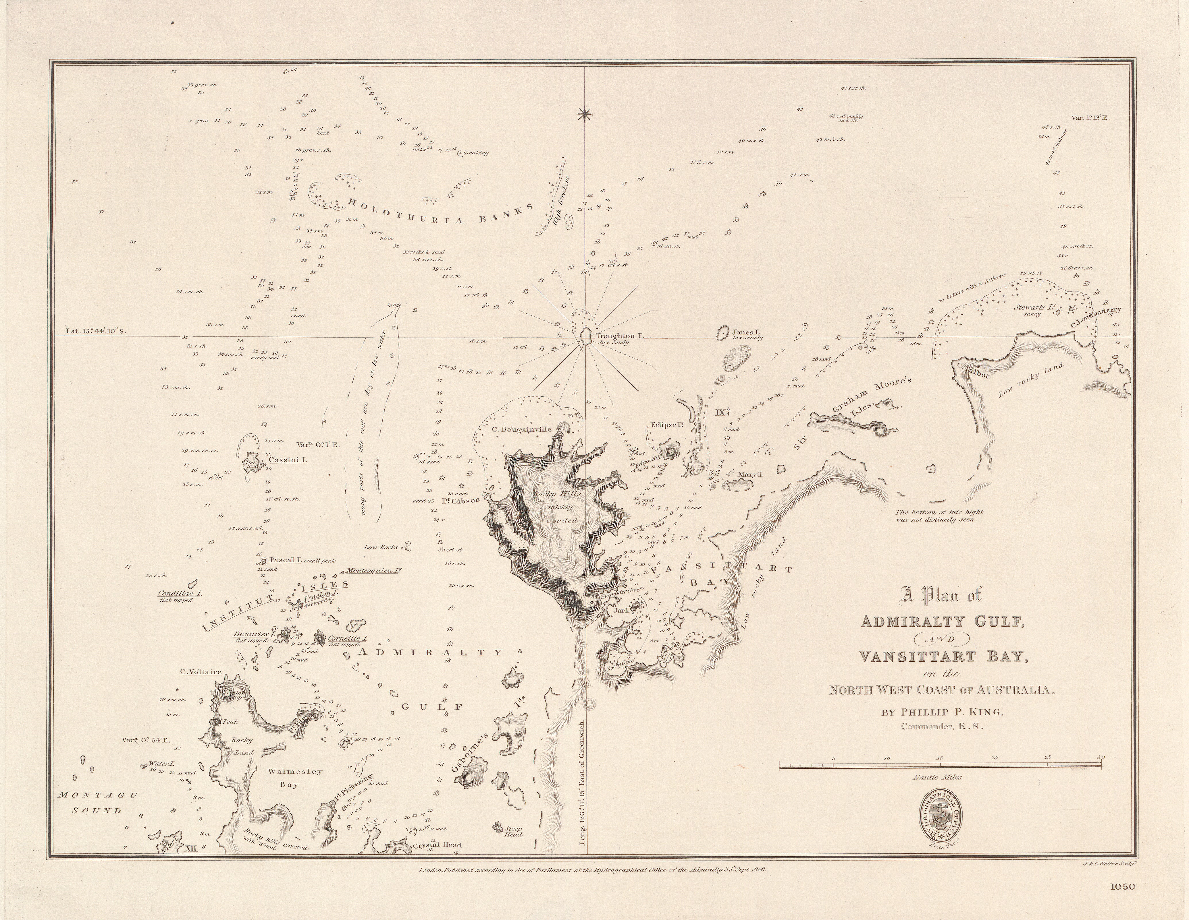
Admiralty Gulf & Vansittart Bay — North-West Coast of Australia (1818–1826)
Phillip Parker King charts the remote frontiers of Australia’s north-west
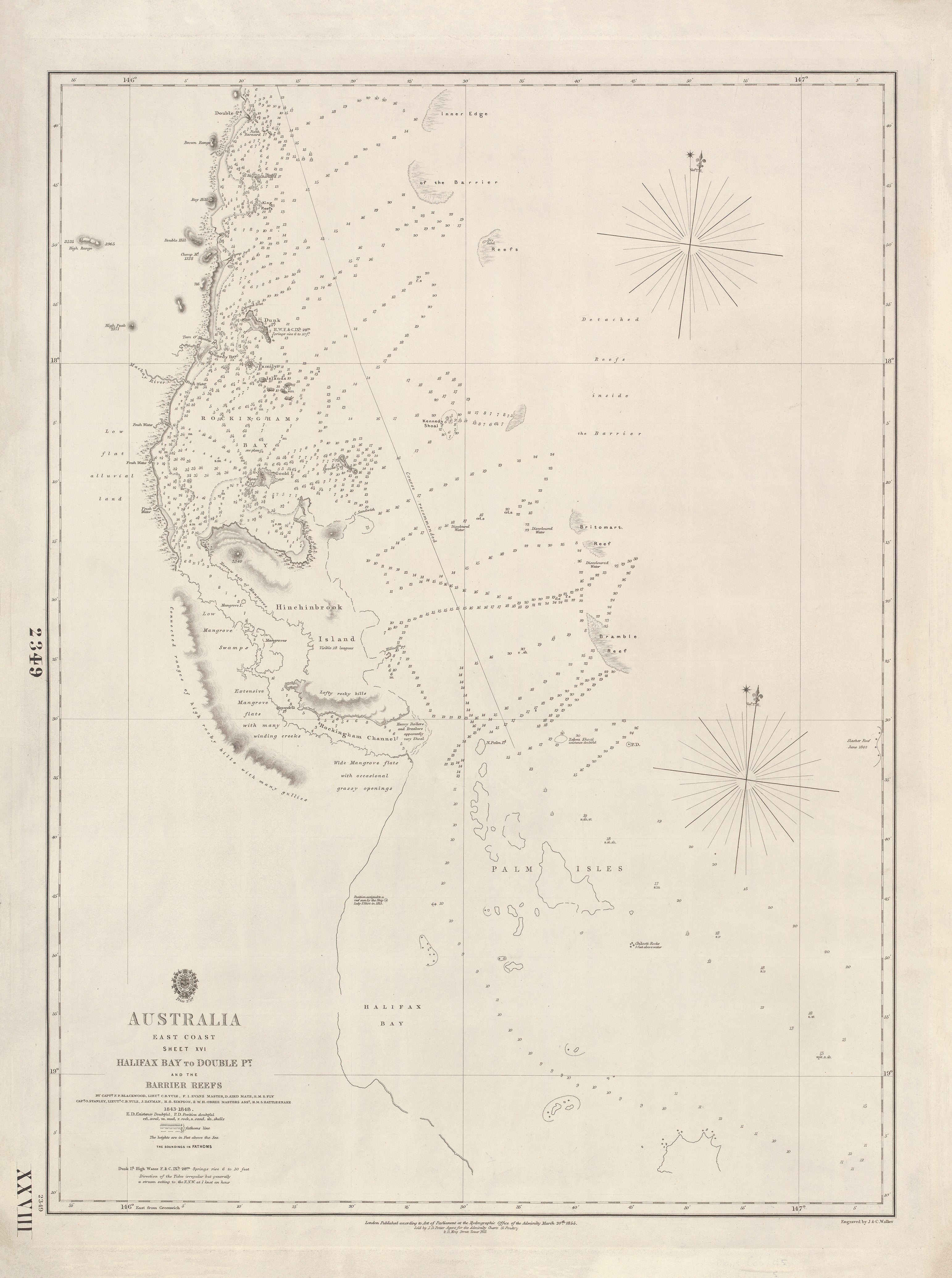
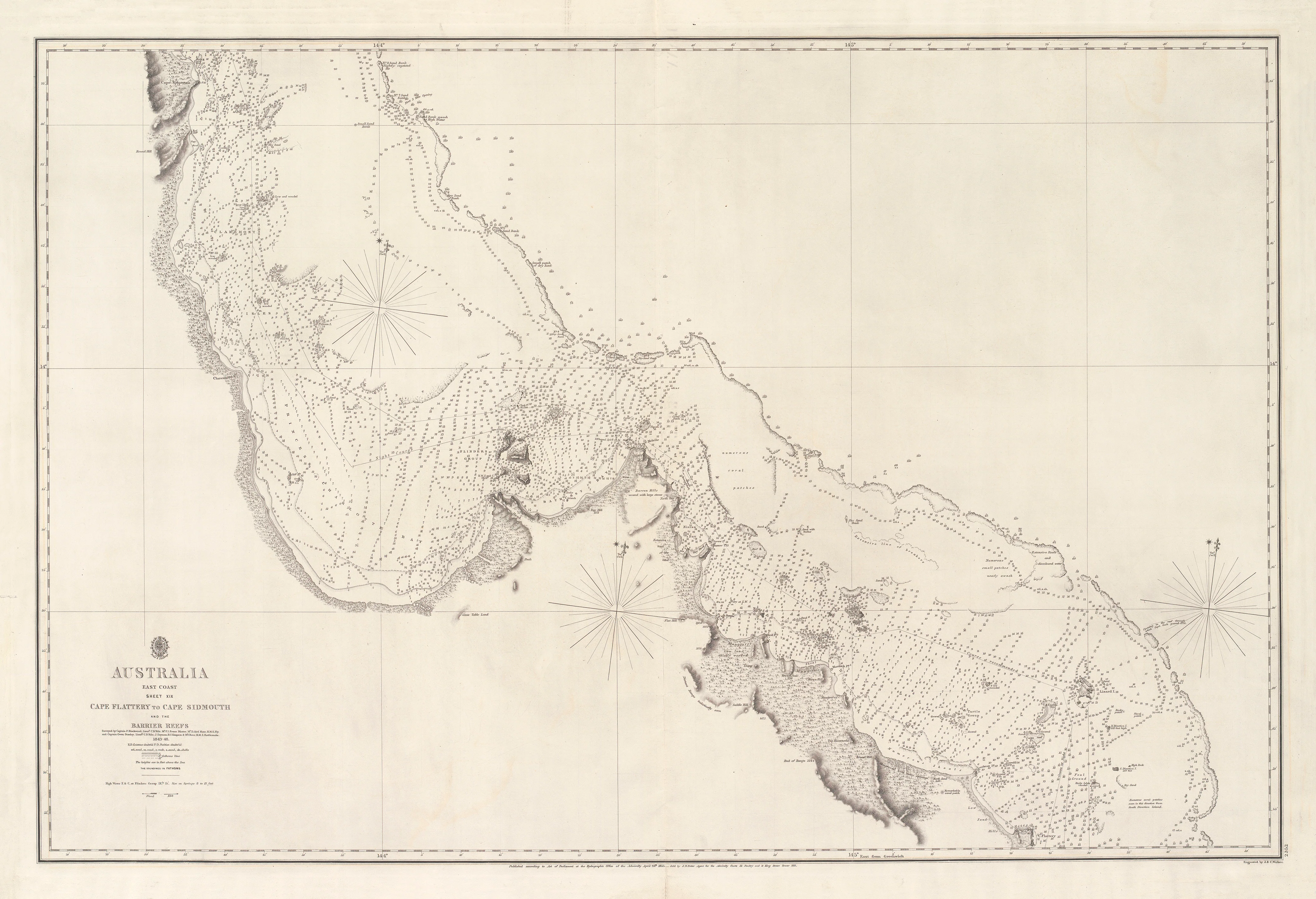
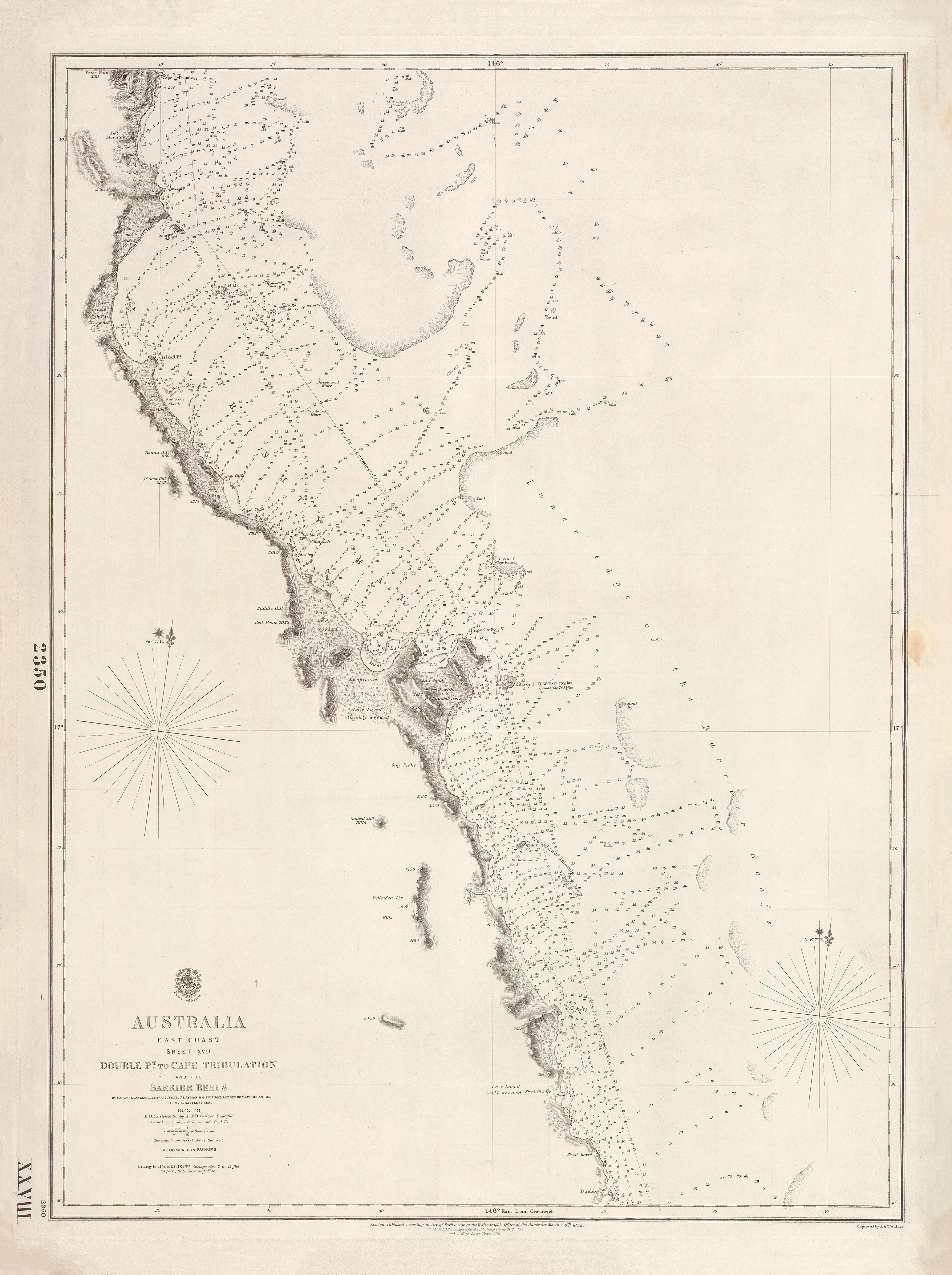
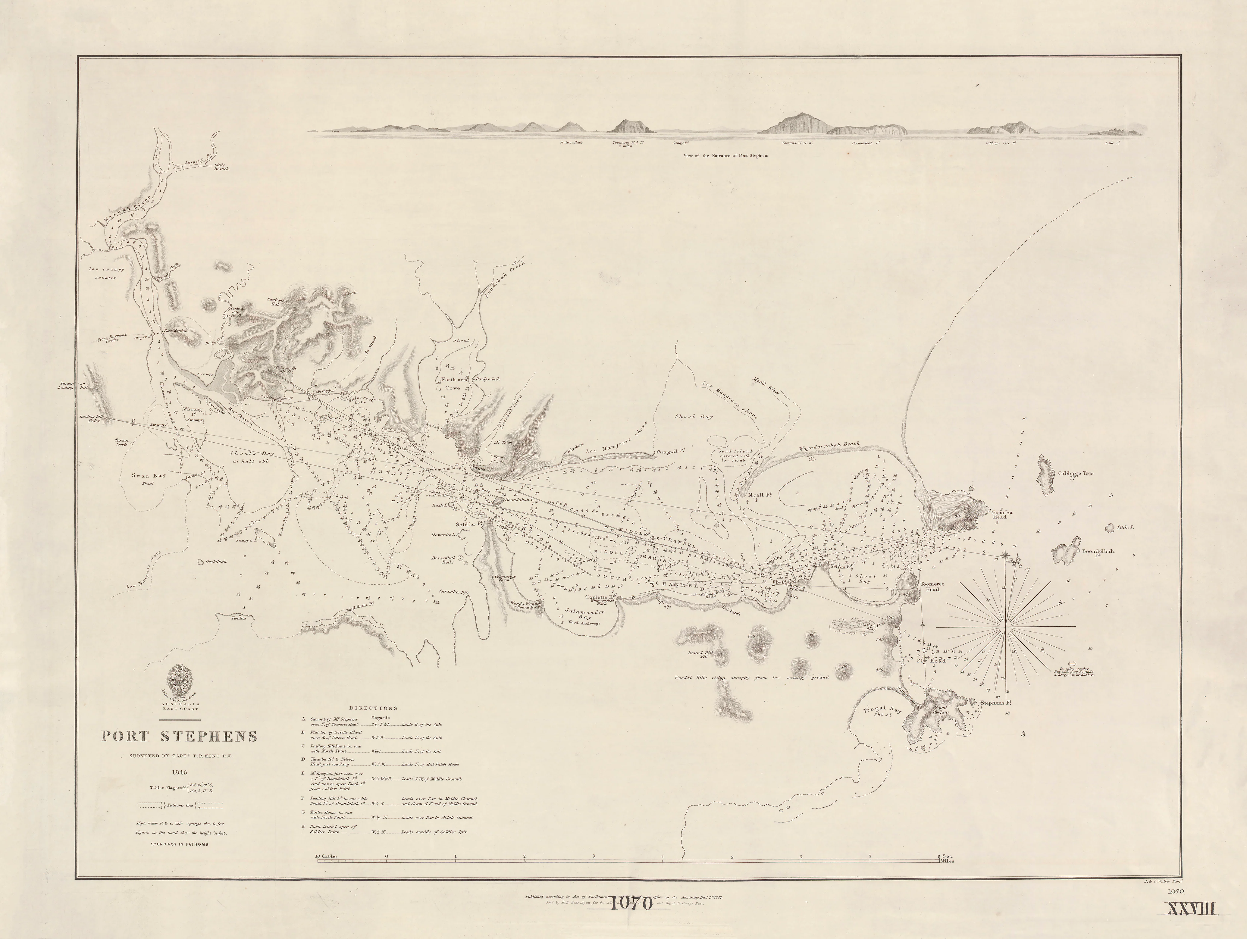
This rare British Admiralty plan presents the first authoritative survey of Admiralty Gulf and Vansittart Bay—a complex, little-known stretch of Australia’s Kimberley coast. Surveyed between 1818 and 1822 by Phillip Parker King, R.N., and engraved by J. & C. Walker, it was issued by the Admiralty in 1826 as a practical navigation chart for vessels operating far beyond settled waters.
Drawn for seamanship rather than ornament, this chart reflects the era when Australia’s north-west was still being made known—soundings by sounding, headland by headland.
This is not a decorative map.
It is a working document of exploration and navigation.
⚓ What This Chart Shows
This finely engraved Admiralty sheet renders the region with crisp hydrographic clarity.
-
Admiralty Gulf and Vansittart Bay precisely delineated
-
Headlands, bays and coastal indentations
-
Bathymetric soundings revealing depths and hazards
-
Relief shown by classic Admiralty hachures
-
Greenwich prime meridian — true naval reference standard
Every line reflects first-hand survey work in waters scarcely charted at the time.
🧭 Why This Chart Works
Most maps show places.
This shows how they were first understood at sea.
-
Surveyed by Phillip Parker King — Australia’s foundational coastal surveyor
-
True British Admiralty production — the global benchmark for accuracy
-
Focused, high-resolution gulf and bay plan ideal for study and display
-
Museum-grade engraving by J. & C. Walker
-
Direct insight into early Kimberley exploration
This chart transformed conjecture into navigable knowledge along the north-west coast.
✨ Premium Finishes
Every Admiralty Gulf & Vansittart Bay (1826) Admiralty Chart is printed in Australia using archival methods to preserve the fine linework and historic tone.
| Format | Description |
|---|---|
| 📜 Paper (160 gsm matte) | Smooth heavyweight archival paper with crisp line definition; ideal for framing under glass. |
| 🧼 Laminated (True Encapsulation) | 2 × 80-micron gloss laminate, edge-to-edge protection; tear-resistant and wipe-clean. |
| 🖼️ Canvas (395 gsm HP Professional Matte) | Pigment-based, fade-resistant inks for a warm, gallery-grade finish. |
| 🪵 Laminated + Timber Hang Rails | Natural timber rails with hanging cord; ready to hang. Allow up to 10 working days. |
| 🪵 Canvas + Timber Hang Rails | Elegant frameless presentation with lacquered natural timber rails. Allow up to 10 working days. |
📐 Size
775 mm (W) × 1000 mm (H)
A tall portrait format that gives the deep inlets and sweeping bays commanding wall presence.
🎯 Ideal For
-
Australian exploration and maritime history collectors
-
Kimberley and Western Australia heritage interiors
-
Museums, libraries and universities
-
Anyone fascinated by the charting of Australia’s remote north-west
🤝 Our Commitment
-
Printed in Australia with professional colour management
-
Archival pigment inks for long-term colour stability
-
Premium laminates and canvas for durability
-
Natural timber hang rails for refined presentation
-
Hand-checked and carefully packed before dispatch
Before ports and place names, there was the survey.
Choose your finish and bring Admiralty Gulf & Vansittart Bay’s first true map onto your wall.