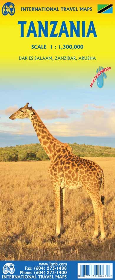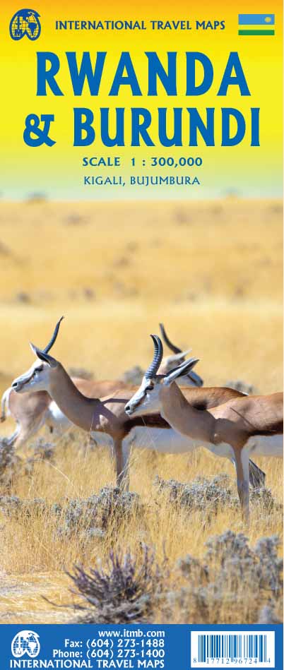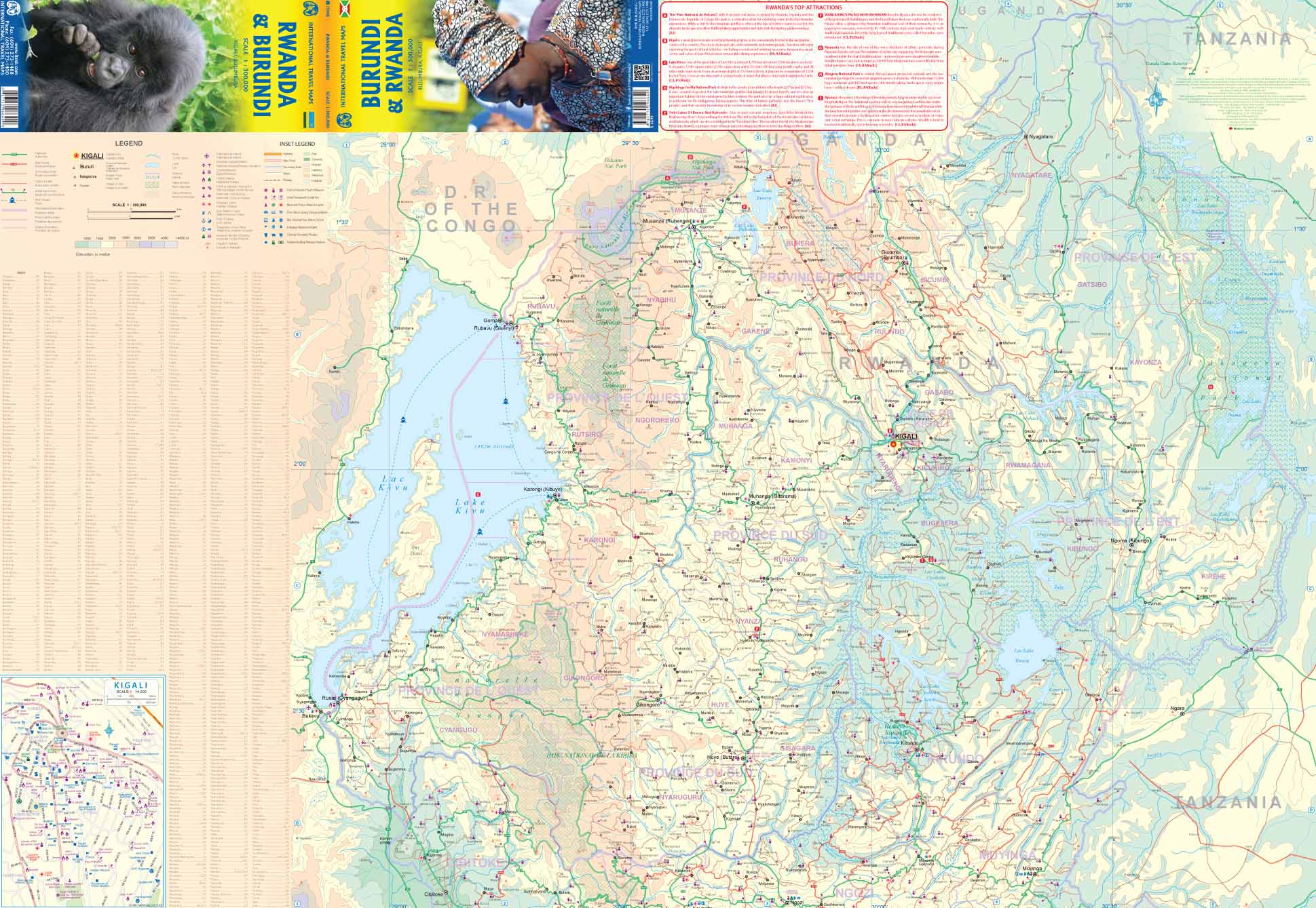
Africa National Geographic 910 x 1170mm Wall Map
🌍 Africa Classic-Style Wall Map
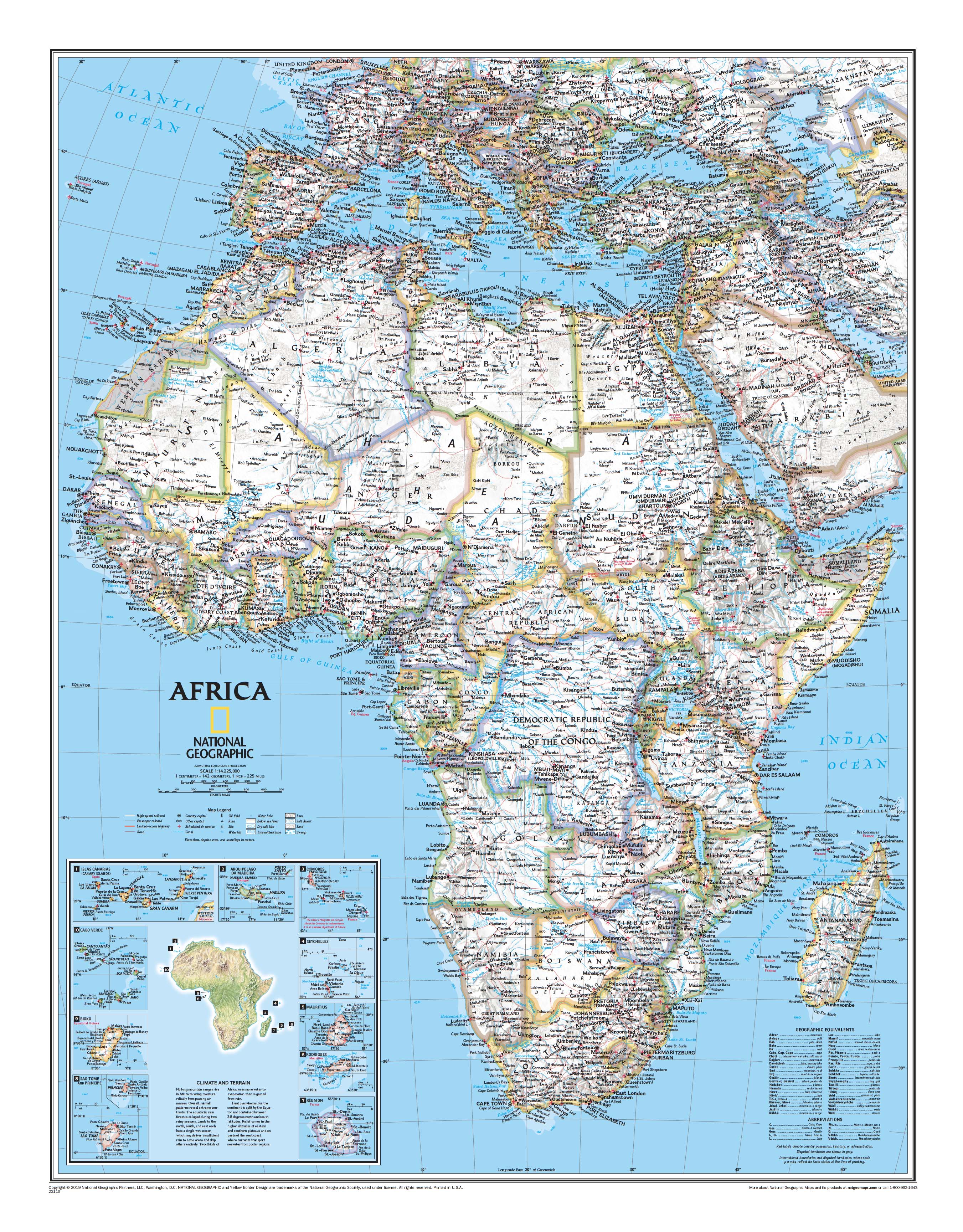
National Geographic | 910 x 1170 mm | Political & Physical | Classic Colour Palette
Bold in scale. Brilliant in detail. A true celebration of Africa’s grandeur.
Discover the African continent in all its stunning complexity with this large-format Classic-Style Wall Map by National Geographic. Measuring a generous 910 x 1170 mm, this map is as informative as it is visually striking—ideal for classrooms, boardrooms, libraries, or anyone with a deep appreciation for Africa’s diverse geography.
Designed in National Geographic’s iconic Classic style, this map features rich, full-colour rendering, clear typography, and an extraordinary level of cartographic detail.
🗺️ What You’ll See on the Map
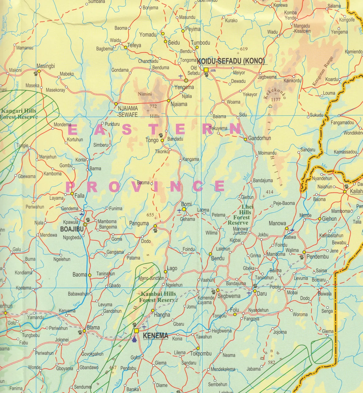
From the Atlas Mountains to the Cape of Good Hope, this map reveals Africa’s landscapes and landmarks with unmistakable clarity:
-
🟢 Clearly defined country borders in vibrant colour
-
🏔️ Shaded physical relief shows mountains, plateaus, valleys, and deserts
-
💧 Hydrological features including rivers, lakes, dry salt lakes, intermittent lakes, and wetlands
-
🏜️ Special cartographic textures highlight lava fields, swamps, deserts, and below-sea-level regions
-
🚗 Major roads, highways, and airports for geographical context
-
🌍 Inset map of climate and terrain across the African continent
-
🏝️ 10 inset maps of surrounding island nations, including Madagascar, Seychelles, Mauritius, and Cape Verde
A map designed not just to inform—but to inspire exploration.
🖼️ Available in Three Premium Formats
| Format | Material & Finish | Ideal For |
|---|---|---|
| Paper | Printed on 160gsm heavyweight matte paper | Framing under glass in home, office, or school |
| Laminated | Encapsulated in 80-micron gloss laminate (front & back) – waterproof, stain-resistant, and compatible with whiteboard markers | Classrooms, planning spaces, or durable shared use |
| Canvas | Printed on 395gsm HP Professional Matte Canvas with pigment-based inks | Long-lasting, fade-resistant, gallery-quality display |
🪵 Optional Timber Hang Rails available for laminated and canvas versions to complete your wall display.
🪚 Add Wooden Hang Rails (Optional)
Upgrade your laminated or canvas map with elegant natural timber hang rails:
-
🧵 Corded top rail for effortless wall hanging
-
🪵 Satin-lacquered timber in a neutral finish to suit any décor
-
🖐️ Hand-fitted by a professional framer for premium presentation
-
⏳ Please allow up to 10 working days for rail-mounted formats
A museum-quality finish for your wall-worthy map.
📐 Map Specifications
| Specification | Details |
|---|---|
| Map Title | Africa Classic-Style Wall Map |
| Publisher | National Geographic |
| Style | Political & Physical – Classic colour scheme |
| Scale | Approx. 1:8,000,000 |
| Dimensions | 910 mm (W) x 1170 mm (H) |
| Inset Maps | Climate & terrain overview + 10 island nations |
| Print Origin | Printed and finished in Australia |
| Optional Extras | Timber hang rails (Laminated & Canvas formats) |
💡 Why Choose This Map?
🌍 A Window into Africa – Immerse yourself in the continent’s geography, from deserts and savannas to rainforests and highlands.
🧠 Perfect for Learning & Teaching – Clear, colourful, and packed with physical and political detail.
🖼️ Striking Display Piece – Ideal for large wall spaces where it can truly shine.
🎁 Makes a Meaningful Gift – For teachers, travellers, students, and map enthusiasts alike.
🖨️ Crafted for Longevity – Professionally printed using fade-resistant pigment inks on archival-grade materials.
🇦🇺 Proudly Made in Australia – Locally printed and finished with care and precision.
Let the Africa Classic Wall Map become a centrepiece of learning, adventure, and décor—an enduring tribute to one of the world’s most extraordinary continents.
📦 Shipping Information
-
📄 Paper & Laminated maps: Usually ships within 1–2 business days
-
🖼️ Canvas & Timber Rail versions: Please allow 7–10 business days for framing and dispatch
🛒 Add to Cart – Explore Africa in Vivid Detail
Bring the beauty and complexity of Africa into your home, office, or classroom with this large-format cartographic masterpiece.
Original: $64.36
-65%$64.36
$22.53Product Information
Product Information
Shipping & Returns
Shipping & Returns
Description
🌍 Africa Classic-Style Wall Map
National Geographic | 910 x 1170 mm | Political & Physical | Classic Colour Palette
Bold in scale. Brilliant in detail. A true celebration of Africa’s grandeur.
Discover the African continent in all its stunning complexity with this large-format Classic-Style Wall Map by National Geographic. Measuring a generous 910 x 1170 mm, this map is as informative as it is visually striking—ideal for classrooms, boardrooms, libraries, or anyone with a deep appreciation for Africa’s diverse geography.
Designed in National Geographic’s iconic Classic style, this map features rich, full-colour rendering, clear typography, and an extraordinary level of cartographic detail.
🗺️ What You’ll See on the Map
From the Atlas Mountains to the Cape of Good Hope, this map reveals Africa’s landscapes and landmarks with unmistakable clarity:
-
🟢 Clearly defined country borders in vibrant colour
-
🏔️ Shaded physical relief shows mountains, plateaus, valleys, and deserts
-
💧 Hydrological features including rivers, lakes, dry salt lakes, intermittent lakes, and wetlands
-
🏜️ Special cartographic textures highlight lava fields, swamps, deserts, and below-sea-level regions
-
🚗 Major roads, highways, and airports for geographical context
-
🌍 Inset map of climate and terrain across the African continent
-
🏝️ 10 inset maps of surrounding island nations, including Madagascar, Seychelles, Mauritius, and Cape Verde
A map designed not just to inform—but to inspire exploration.
🖼️ Available in Three Premium Formats
| Format | Material & Finish | Ideal For |
|---|---|---|
| Paper | Printed on 160gsm heavyweight matte paper | Framing under glass in home, office, or school |
| Laminated | Encapsulated in 80-micron gloss laminate (front & back) – waterproof, stain-resistant, and compatible with whiteboard markers | Classrooms, planning spaces, or durable shared use |
| Canvas | Printed on 395gsm HP Professional Matte Canvas with pigment-based inks | Long-lasting, fade-resistant, gallery-quality display |
🪵 Optional Timber Hang Rails available for laminated and canvas versions to complete your wall display.
🪚 Add Wooden Hang Rails (Optional)
Upgrade your laminated or canvas map with elegant natural timber hang rails:
-
🧵 Corded top rail for effortless wall hanging
-
🪵 Satin-lacquered timber in a neutral finish to suit any décor
-
🖐️ Hand-fitted by a professional framer for premium presentation
-
⏳ Please allow up to 10 working days for rail-mounted formats
A museum-quality finish for your wall-worthy map.
📐 Map Specifications
| Specification | Details |
|---|---|
| Map Title | Africa Classic-Style Wall Map |
| Publisher | National Geographic |
| Style | Political & Physical – Classic colour scheme |
| Scale | Approx. 1:8,000,000 |
| Dimensions | 910 mm (W) x 1170 mm (H) |
| Inset Maps | Climate & terrain overview + 10 island nations |
| Print Origin | Printed and finished in Australia |
| Optional Extras | Timber hang rails (Laminated & Canvas formats) |
💡 Why Choose This Map?
🌍 A Window into Africa – Immerse yourself in the continent’s geography, from deserts and savannas to rainforests and highlands.
🧠 Perfect for Learning & Teaching – Clear, colourful, and packed with physical and political detail.
🖼️ Striking Display Piece – Ideal for large wall spaces where it can truly shine.
🎁 Makes a Meaningful Gift – For teachers, travellers, students, and map enthusiasts alike.
🖨️ Crafted for Longevity – Professionally printed using fade-resistant pigment inks on archival-grade materials.
🇦🇺 Proudly Made in Australia – Locally printed and finished with care and precision.
Let the Africa Classic Wall Map become a centrepiece of learning, adventure, and décor—an enduring tribute to one of the world’s most extraordinary continents.
📦 Shipping Information
-
📄 Paper & Laminated maps: Usually ships within 1–2 business days
-
🖼️ Canvas & Timber Rail versions: Please allow 7–10 business days for framing and dispatch
🛒 Add to Cart – Explore Africa in Vivid Detail
Bring the beauty and complexity of Africa into your home, office, or classroom with this large-format cartographic masterpiece.