Australia — Barrier Reefs, from Raine Island to Cape York (1843–1846)
A master Admiralty chart of the Great Barrier Reef’s most dangerous waters
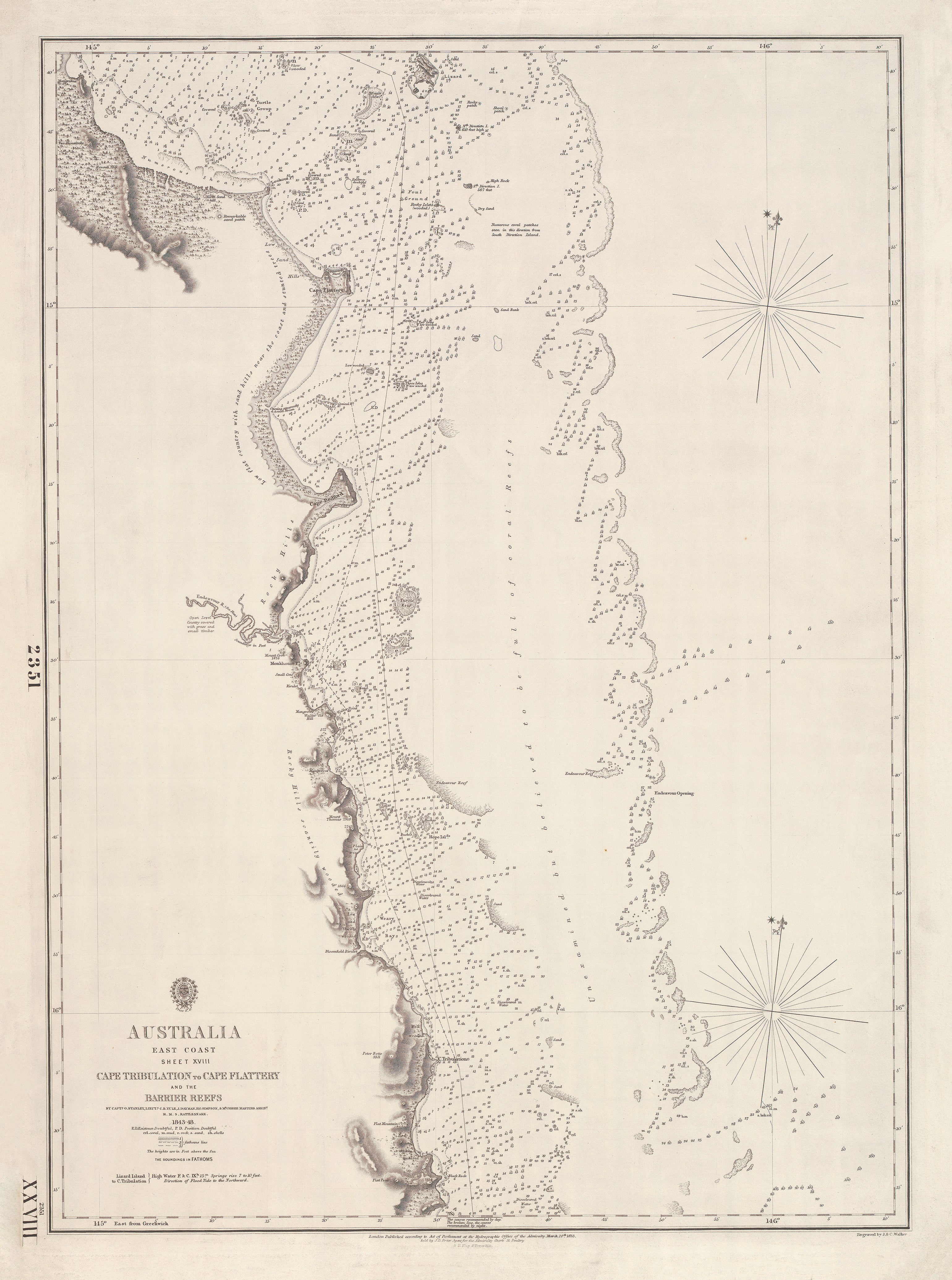
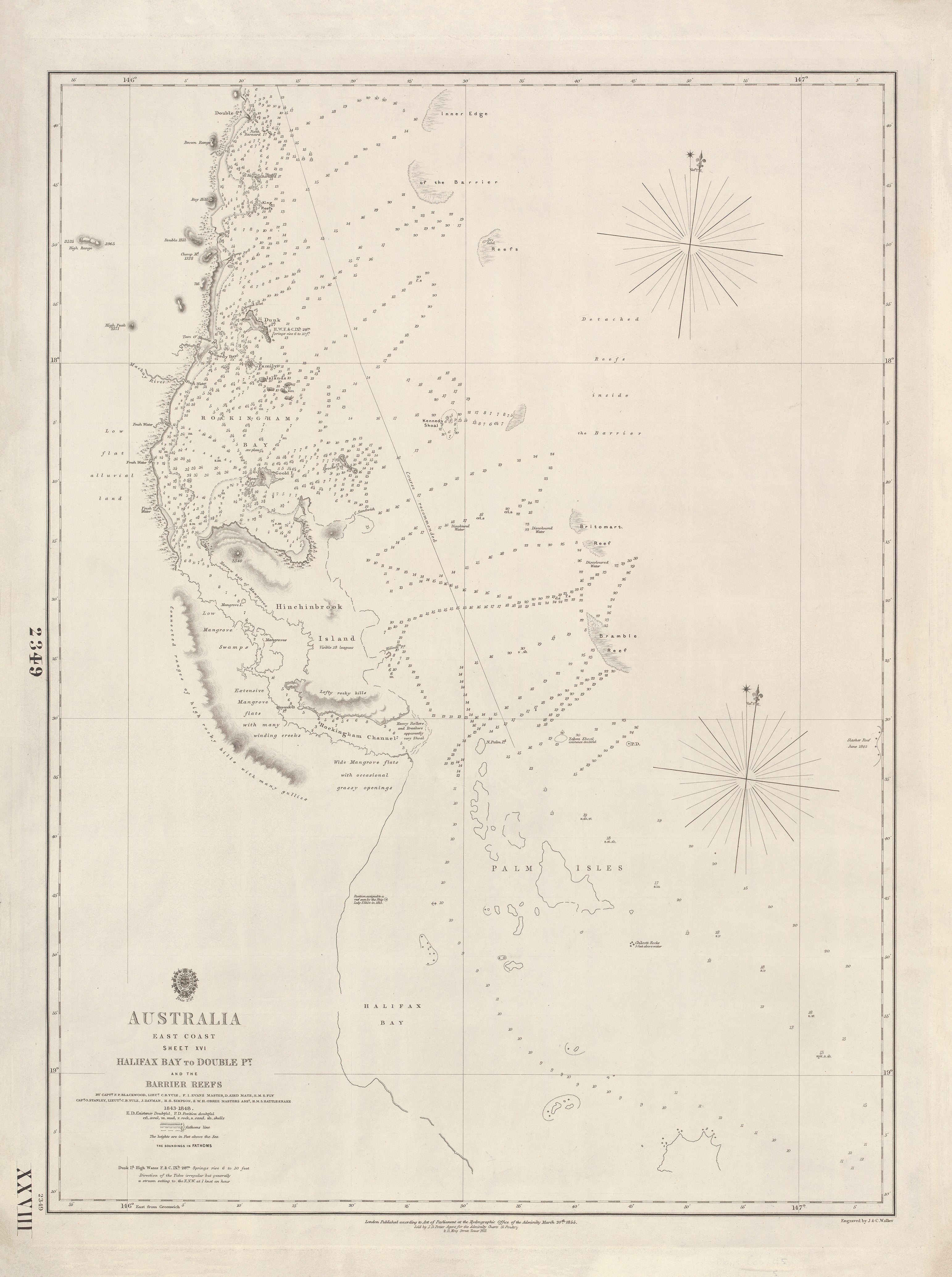
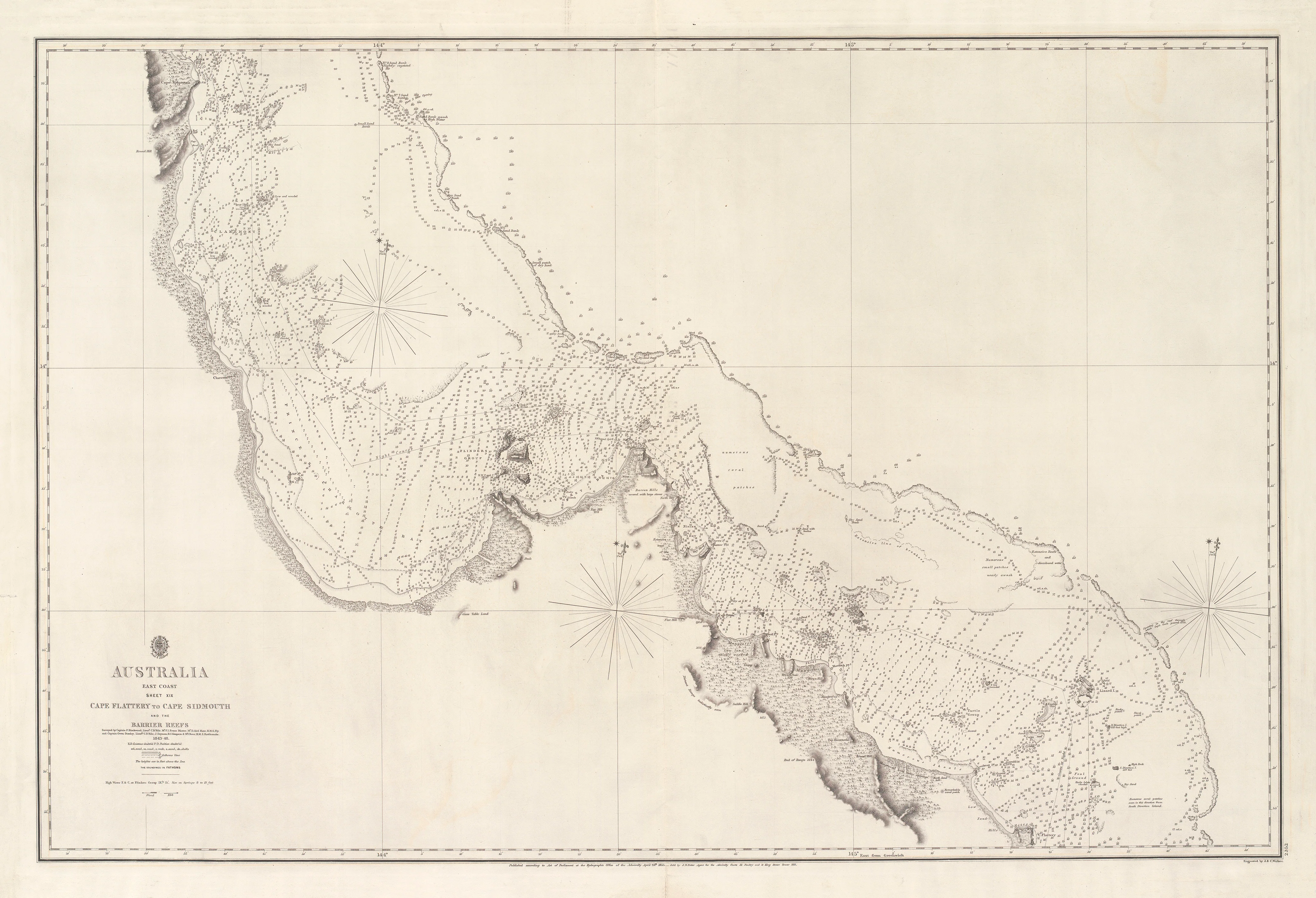
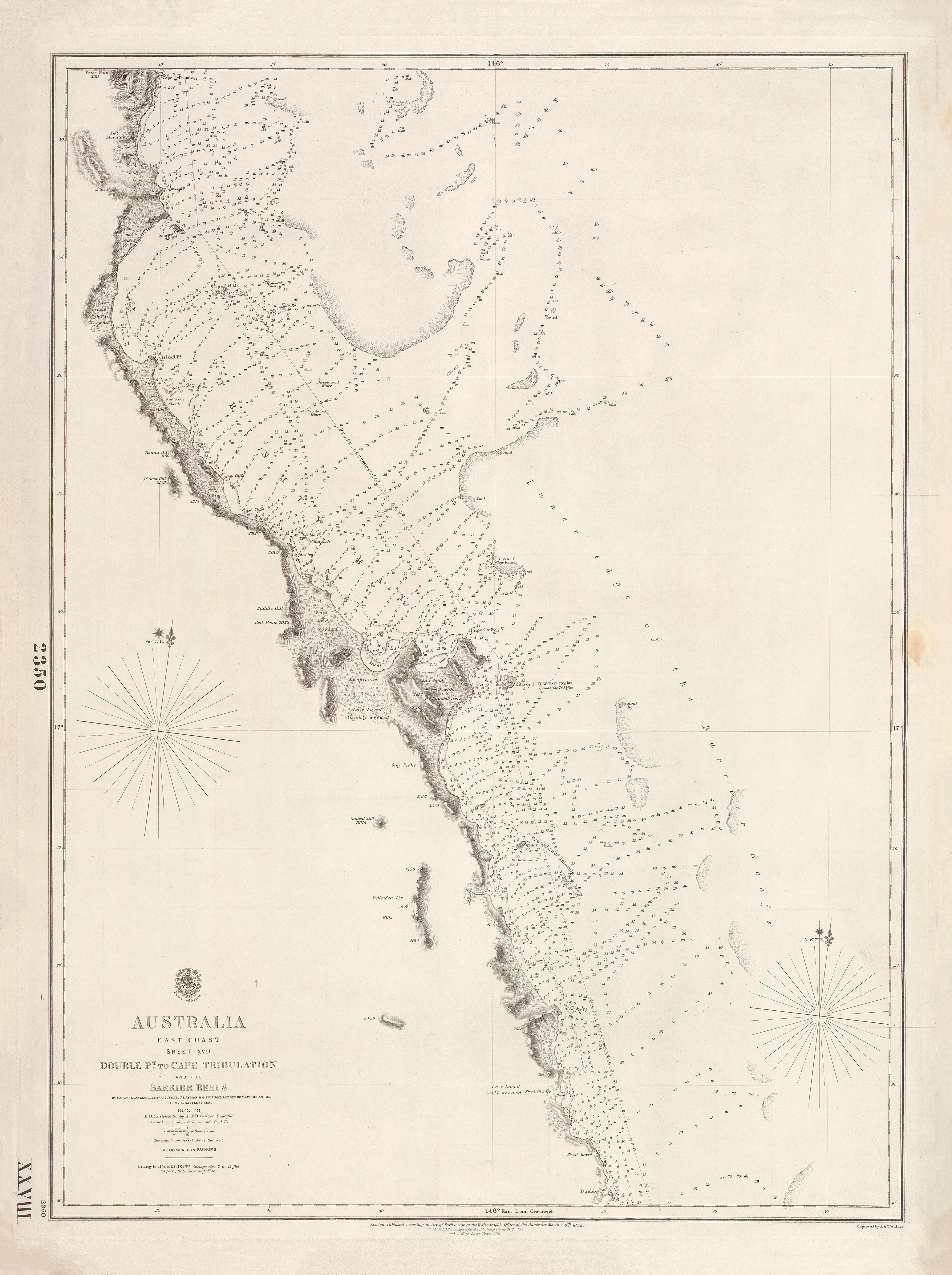
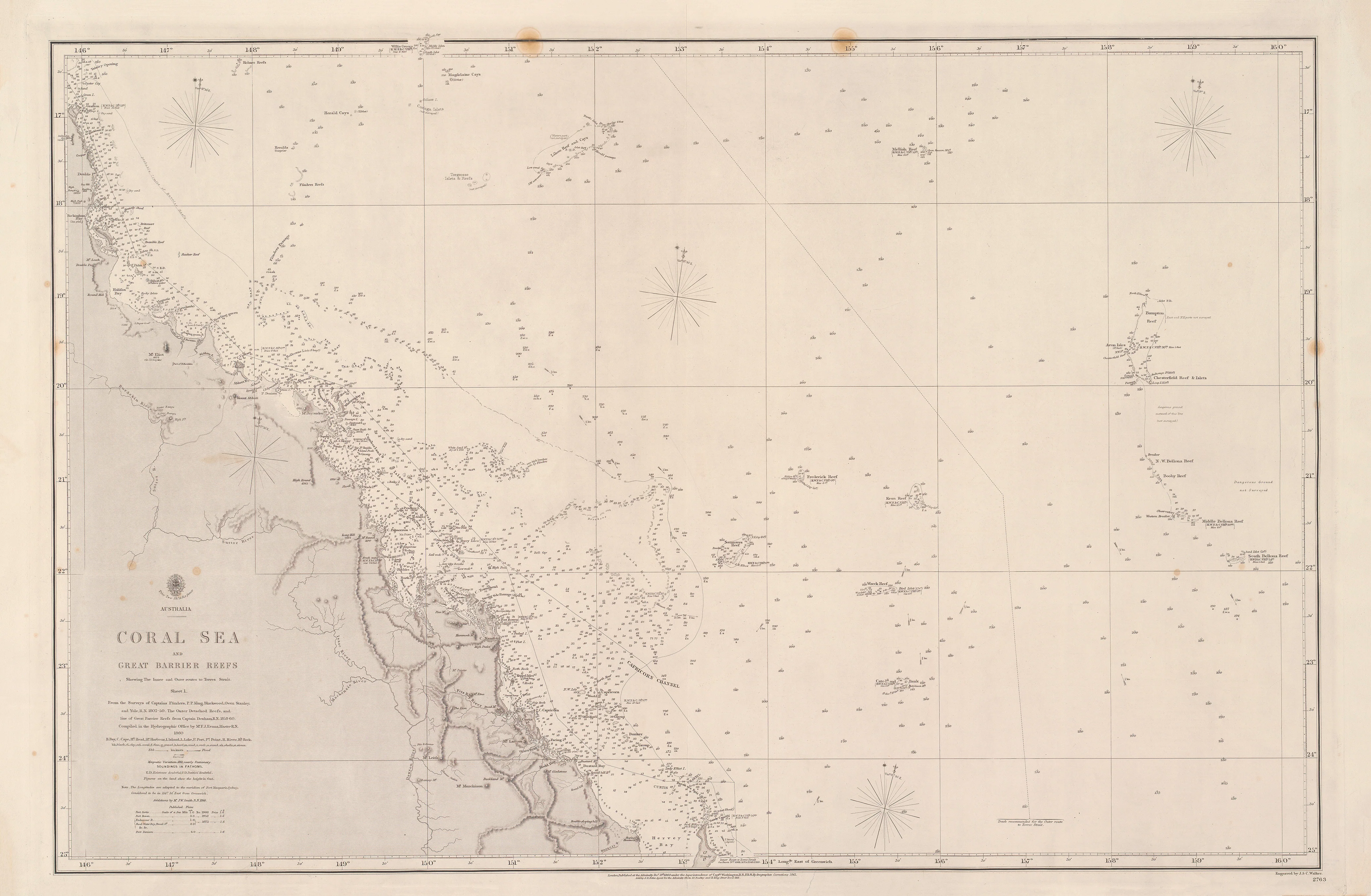
This remarkable British Admiralty nautical chart documents one of the most perilous and strategically important sections of the Great Barrier Reef—from Raine Island north to Cape York. Surveyed during 1843–1844 by Francis Price Blackwood, it records the reef passages at the threshold of Torres Strait, where accurate hydrography meant the difference between safe passage and catastrophe.
Engraved by the celebrated firm J. & C. Walker and published by the British Admiralty in 1846, this chart also traces Captain Blackwood’s survey tracks alongside Captain King’s inner route, revealing how 19th-century navigators threaded their way through reefs, shoals, and coral walls.
This is exploration-era cartography at its most exacting—
where the continent finally meets the sea-lanes of the world.
🧭 What This Chart Shows
-
The northern Great Barrier Reef, from Raine Island to Cape York
-
Complex reef systems, shoals, and coral barriers
-
Bathymetric soundings and navigational depths
-
Hachured coastal relief and reef definition
-
Survey tracks of Blackwood and King’s inner route
-
Greenwich prime meridian, Admiralty standard
⚓ Why This Chart Matters
This sheet represents the final testing ground of eastern Australian navigation:
-
Surveyed by Francis Price Blackwood, veteran hydrographer of HMS Fly
-
Critical reef corridor leading into Torres Strait
-
True Admiralty production, used aboard Royal Navy vessels
-
Exceptional clarity for reefs, channels, and soundings
-
Museum-grade engraving by J. & C. Walker
Few charts capture the navigational peril and precision of the Great Barrier Reef as vividly as this one.
✨ Premium Print & Display Options
Printed in Australia using archival methods to preserve fine linework and historic character.
| Finish | Description |
|---|---|
| 📄 Heavyweight Paper (160 gsm matte) | Archival, smooth finish with excellent engraving clarity; ideal for framing under glass. |
| 🔒 Laminated (True Encapsulation) | Sealed between 2 × 80-micron gloss laminate; tear-resistant, wipe-clean, and durable. |
| 🎨 Archival Canvas (395 gsm HP Professional Matte) | Pigment-based, fade-resistant inks for a warm, gallery-quality presentation. |
| 🪵 Laminated + Timber Hang Rails | Natural lacquered timber rails with hanging cord; ready to hang. Allow up to 10 working days. |
| 🪵 Canvas + Timber Hang Rails | Elegant, frame-free finish with natural timber rails. Allow up to 10 working days. |
📐 Size (W × H)
1000 mm × 772 mm
Orientation: Landscape
Aspect ratio: ~1.30 : 1
Framing tips: For framed displays, allow a 2–3 mm mat overlap. For contemporary interiors, consider a float-mount with a ~3 mm reveal.
Custom sizing: Available on request.
🎯 Ideal For
-
Great Barrier Reef and Queensland history enthusiasts
-
Nautical and maritime chart collectors
-
Museums, universities, and libraries
-
Coastal homes, yacht clubs, and maritime offices
🤝 Our Commitment
-
Printed locally in Australia
-
Archival pigment inks for long-term stability
-
Premium materials selected for clarity and durability
-
Hand-checked and carefully packed before dispatch
From Raine Island to Cape York, these reefs defined Australia’s northern gateway.
Select your finish and bring this landmark Admiralty chart of the Great Barrier Reef into your space.