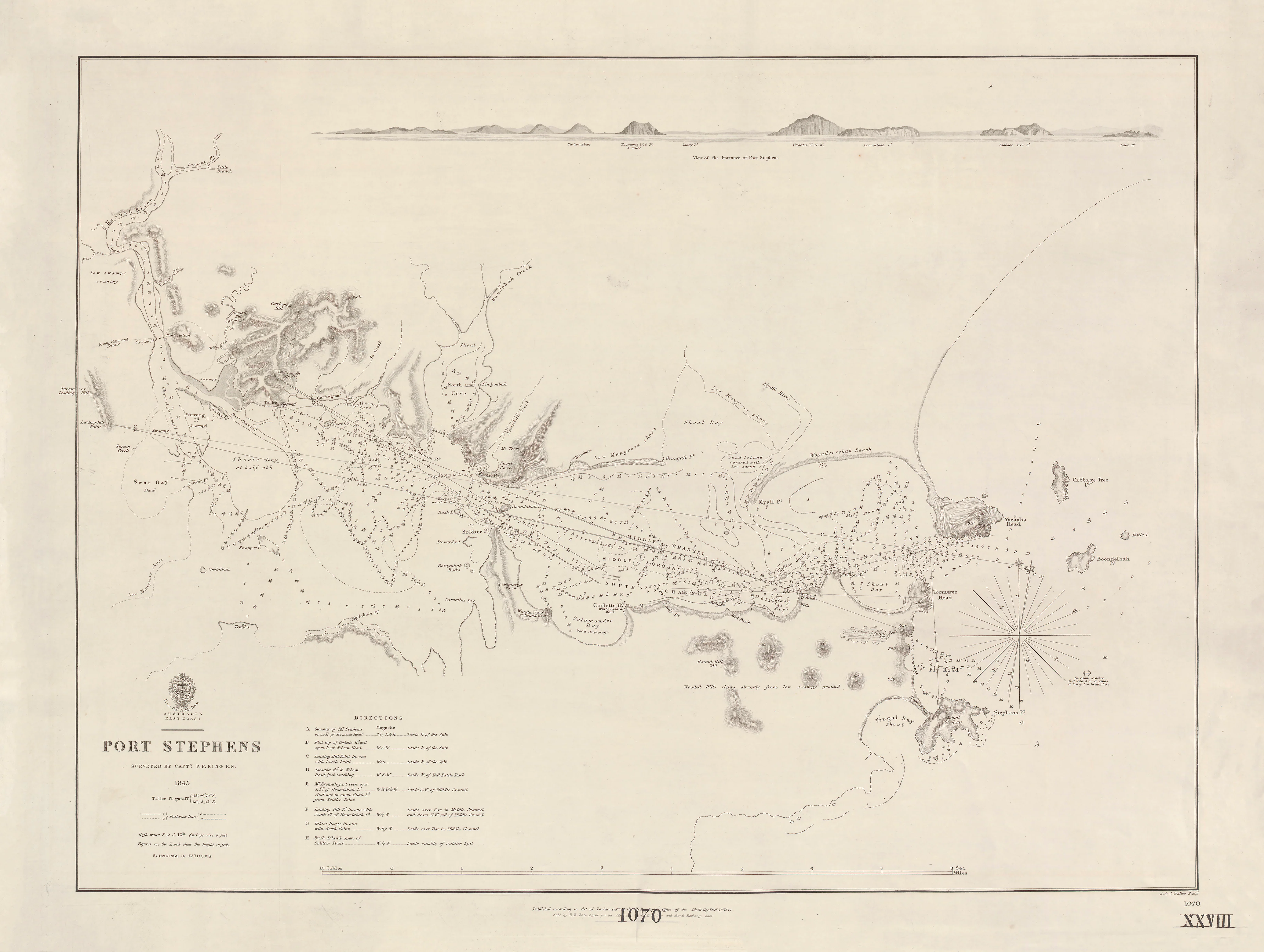
Australia — East Coast: Jervis Bay & Batemans Bay (1851–1853)
A finely engraved British Admiralty chart of New South Wales’ south coast
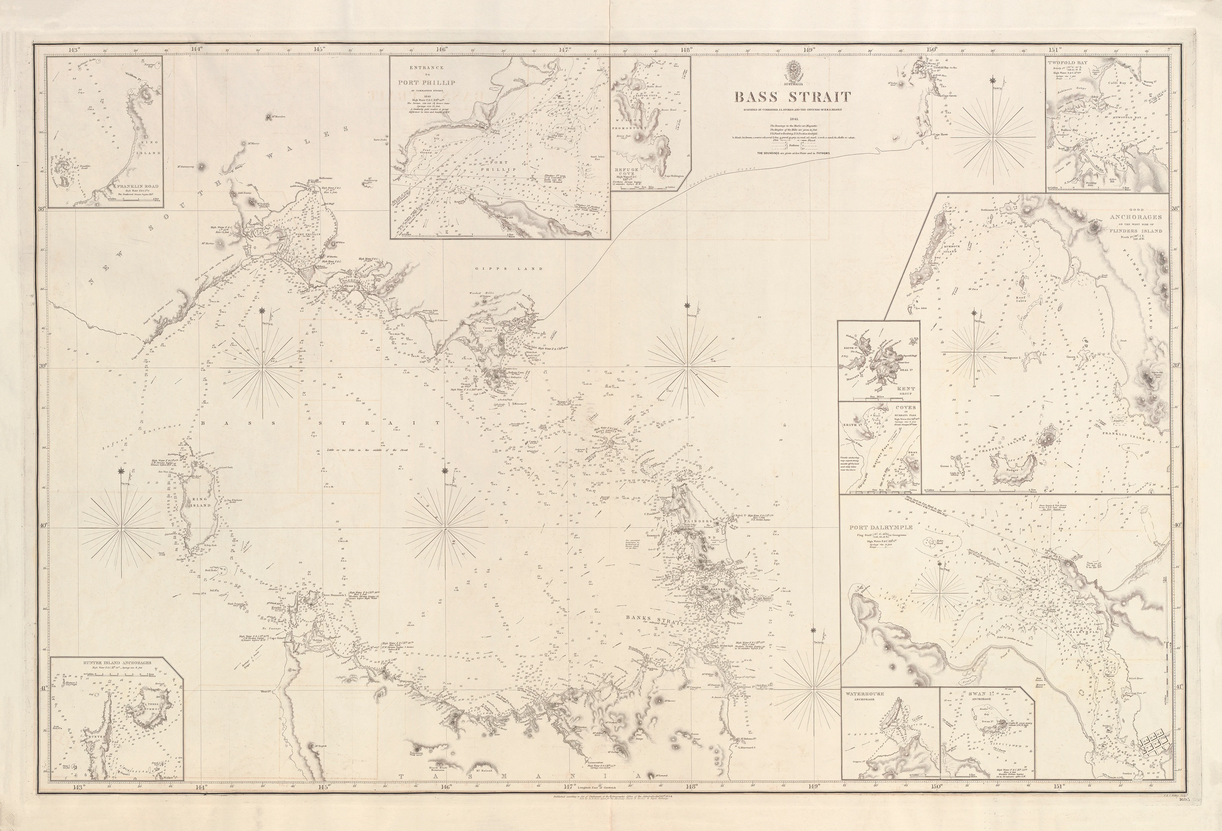
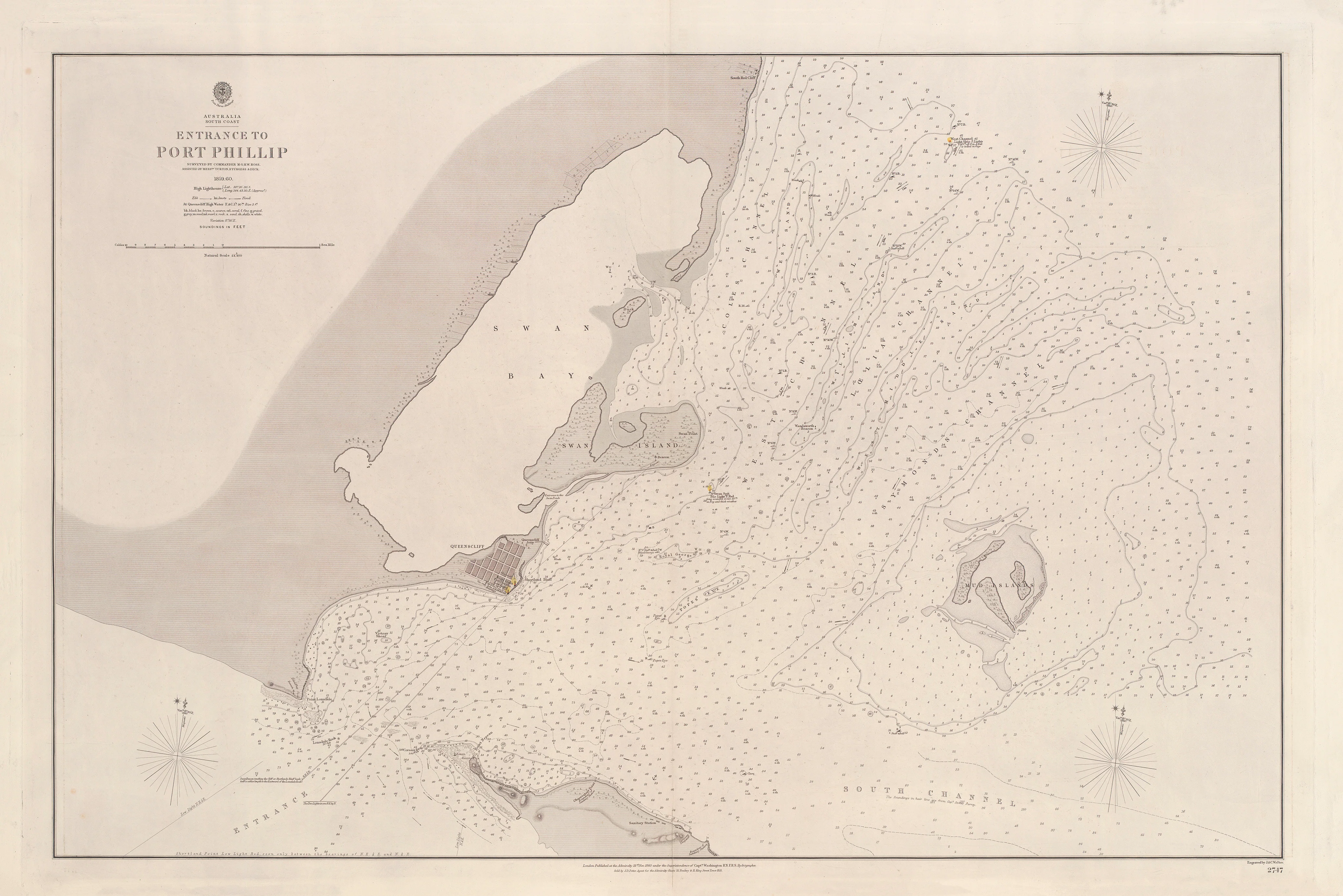
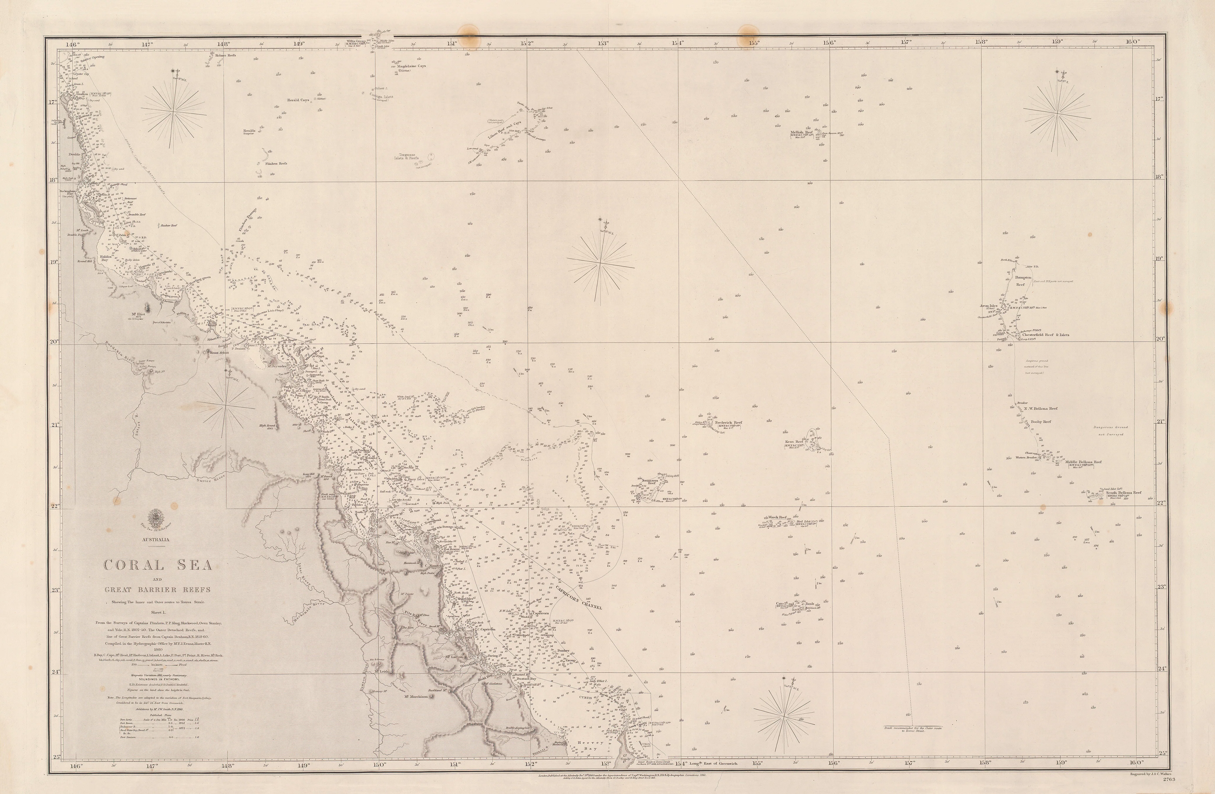
This handsome British Admiralty sheet presents two complementary charts on one plate: Jervis Bay and Batemans Bay. Surveyed in 1851 by John Lort Stokes with Robert Beecroft, and published in 1853, the chart reflects the Admiralty’s drive to accurately chart the sheltered harbours and approaches of Australia’s developing east coast.
Engraved by the renowned firm J. & C. Walker, the plate combines crisp linework with measured hydrographic detail—soundings, hachured relief, and spot heights—making it both a navigational document and a striking historical artwork.
🧭 What This Chart Shows
-
Jervis Bay — deep natural harbour with coastal relief and soundings
-
Batemans Bay — approaches, shoals, and coastal features clearly defined
-
Bathymetric soundings throughout both bays
-
Hachures & spot heights to convey shoreline and hinterland relief
-
Greenwich prime meridian; Admiralty standard symbology
⚓ Why It Matters
-
Documents mid-19th-century hydrography of NSW’s south coast
-
Associated with John Lort Stokes, a key figure in Australian coastal surveying
-
Walker engraving ensures exceptional clarity and balance
-
Dual-bay composition offers strong visual interest and context
✨ Premium Print & Display Options
Printed in Australia using archival methods to preserve fine detail and historic tone.
| Finish | Description |
|---|---|
| 📄 Heavyweight Paper (160 gsm matte) | Archival, smooth matte finish—ideal for framing under glass. |
| 🔒 Laminated (True Encapsulation) | 2 × 80-micron gloss laminate; tear-resistant and wipe-clean. |
| 🎨 Archival Canvas (395 gsm HP Professional Matte) | Pigment-based, fade-resistant inks with gallery presence. |
| 🪵 Laminated + Timber Hang Rails | Natural lacquered timber rails; ready to hang (allow up to 10 working days). |
| 🪵 Canvas + Timber Hang Rails | Elegant, frame-free presentation (allow up to 10 working days). |
📐 Size (W × H)
1000 mm × 735 mm
Orientation: Landscape
Aspect ratio: ~1.36 : 1
Framing tips: Allow a 2–3 mm mat overlap, or float-mount with a subtle ~3 mm reveal.
Custom sizing: Available on request.
🎯 Ideal For
-
Australian maritime history collectors
-
Libraries, museums, and teaching spaces
-
Coastal homes and offices with a heritage focus
-
Admiralty-chart and exploration enthusiasts
🤝 Our Commitment
Printed locally in Australia with archival pigment inks, careful colour management, and hand-checked finishing—packed with care and ready to display.
Select your finish and bring this classic Admiralty view of Jervis Bay and Batemans Bay into your collection.