Brisbane UBD 462 Map 690 x 1000mm Laminated Wall Map
A high-clarity, professionally laminated wall map of Brisbane — combining detailed urban street mapping with a broad suburban overview for real estate, business, education, and travel planning
The 2024 Brisbane Wall Map from UBD Gregory’s is an essential tool for anyone needing a clear and authoritative view of the city and its surrounding suburbs. This large-format, double-sided wall map is packed with information and printed in crisp, vibrant colour. It’s ideal for professionals, residents, planners, and educators alike.
Featuring a street-level city map on one side and a regional overview of Greater Brisbane on the other, it gives you the best of both worlds: fine-grain detail for inner-city navigation and wide-angle context for understanding the city’s growing metropolitan sprawl.
Whether you're house hunting, launching a business, planning transport routes, or simply want a beautiful and informative piece for your wall, this map delivers with precision and style.
🗺️ Two Maps in One – What Each Side Covers
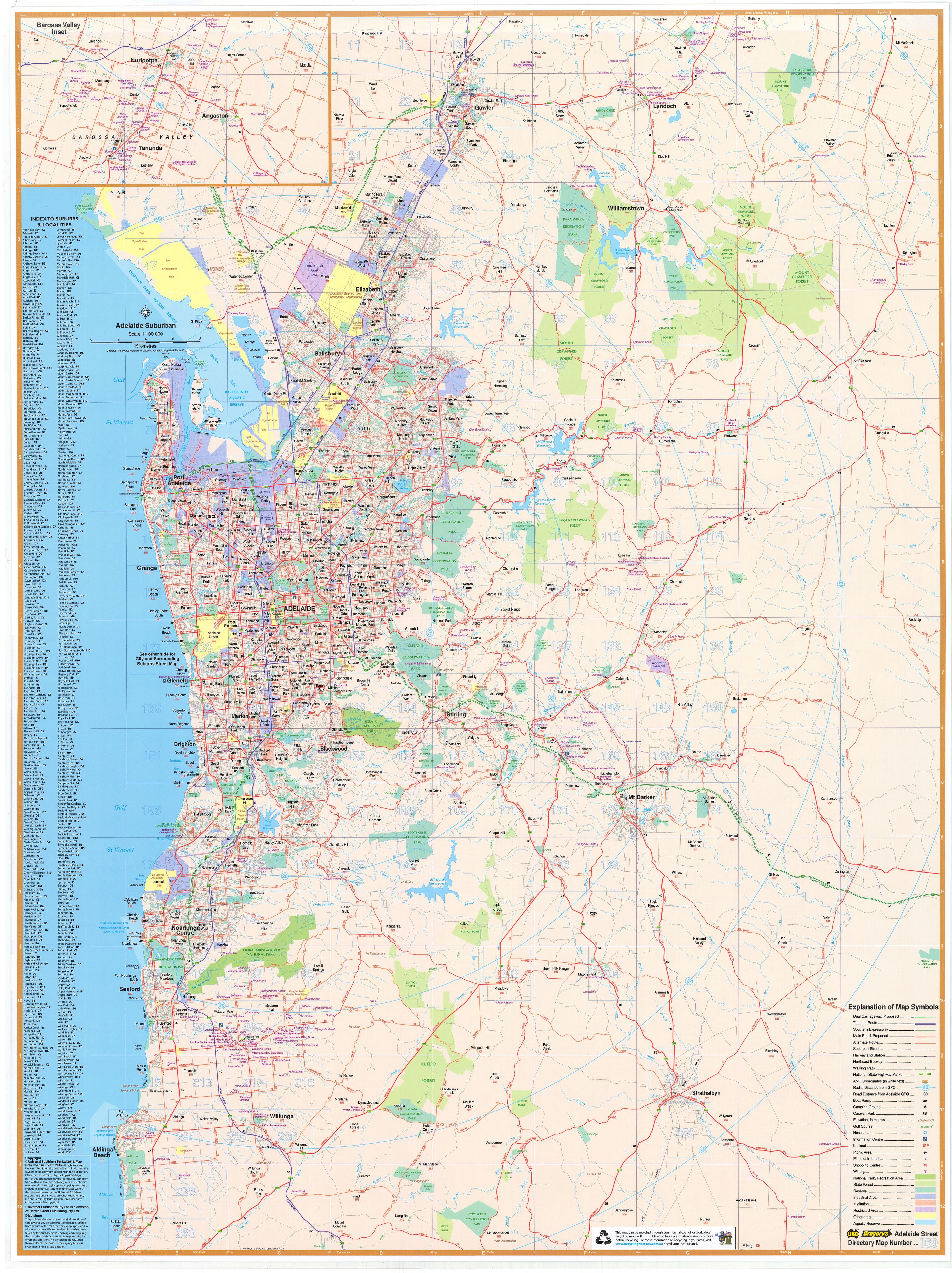
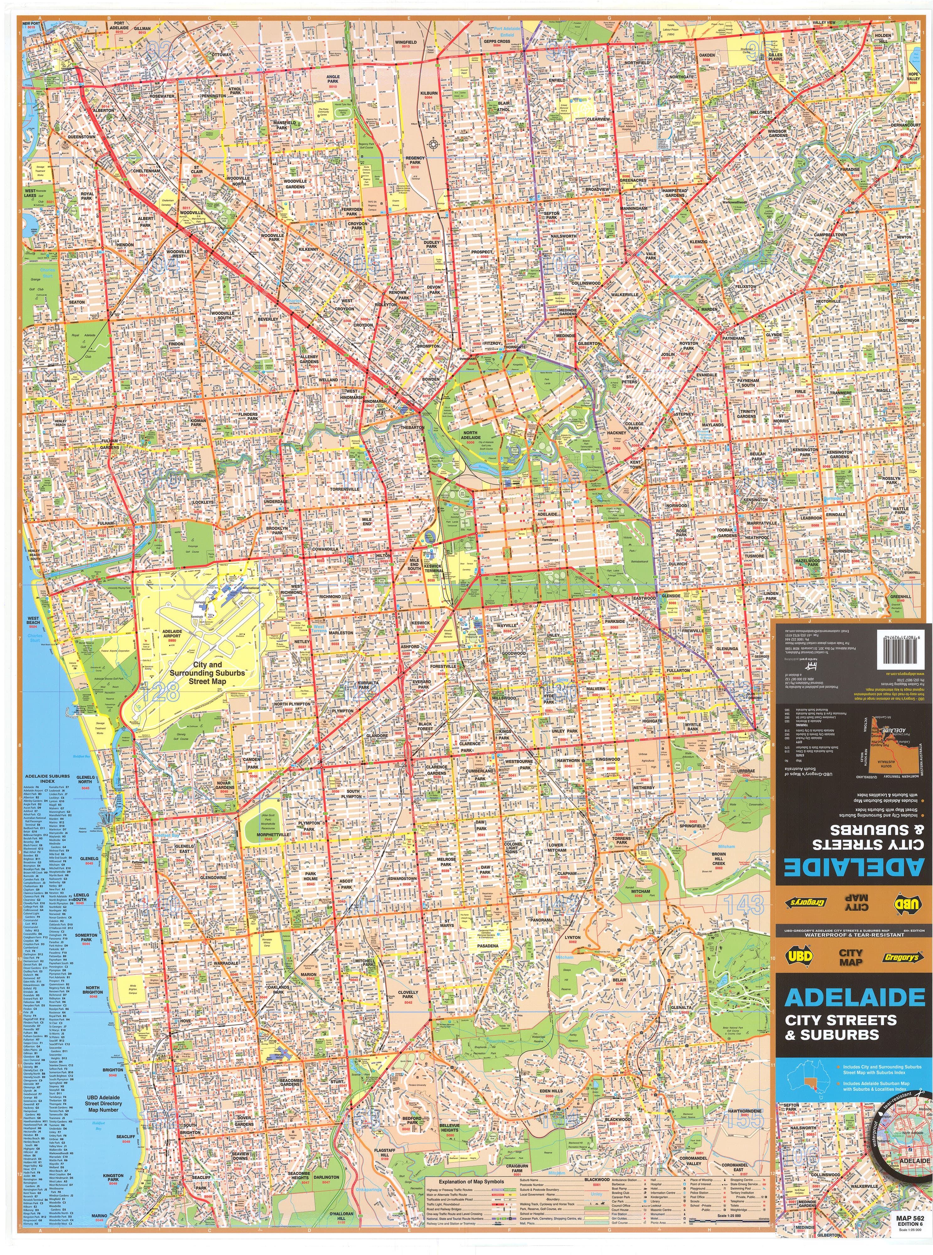
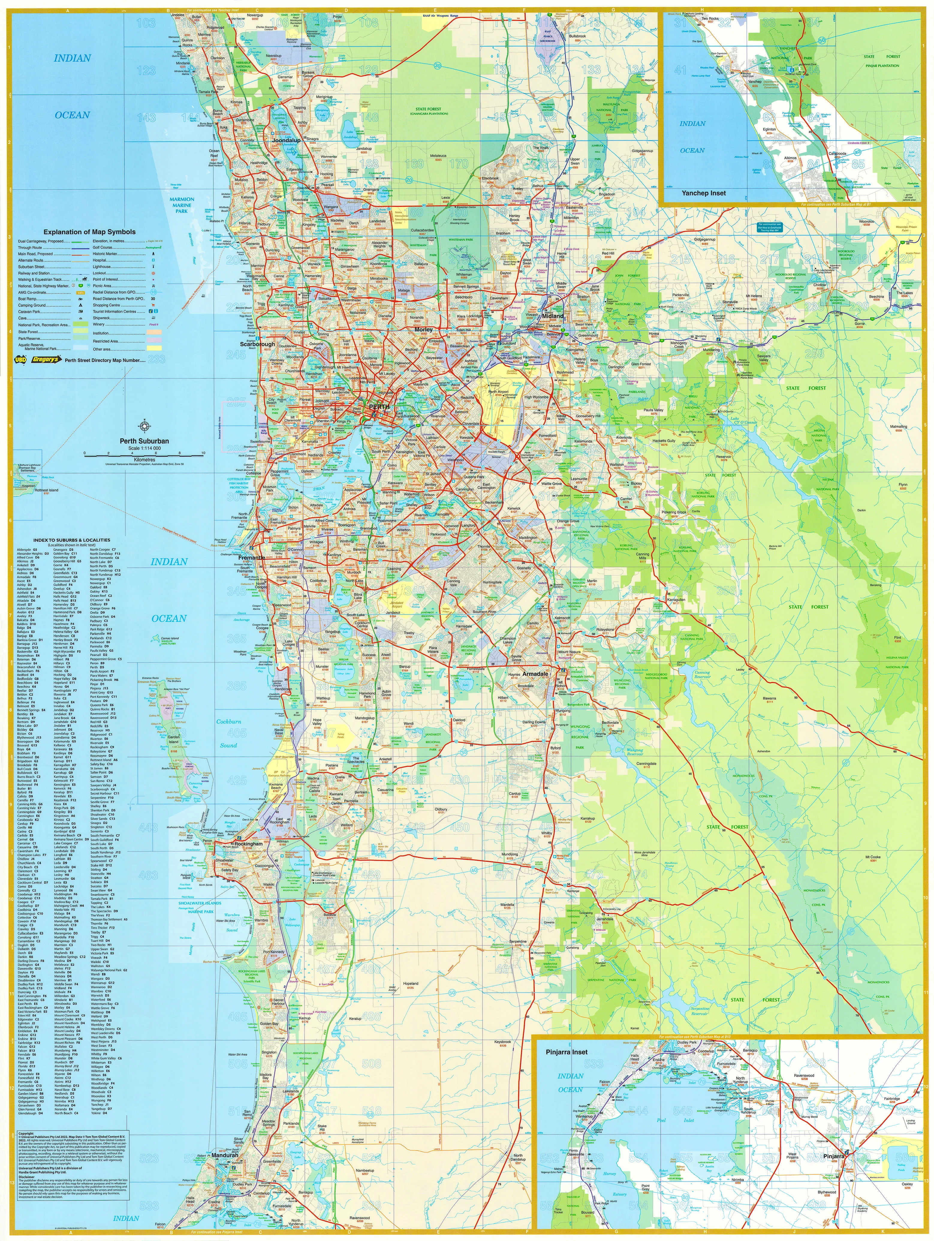
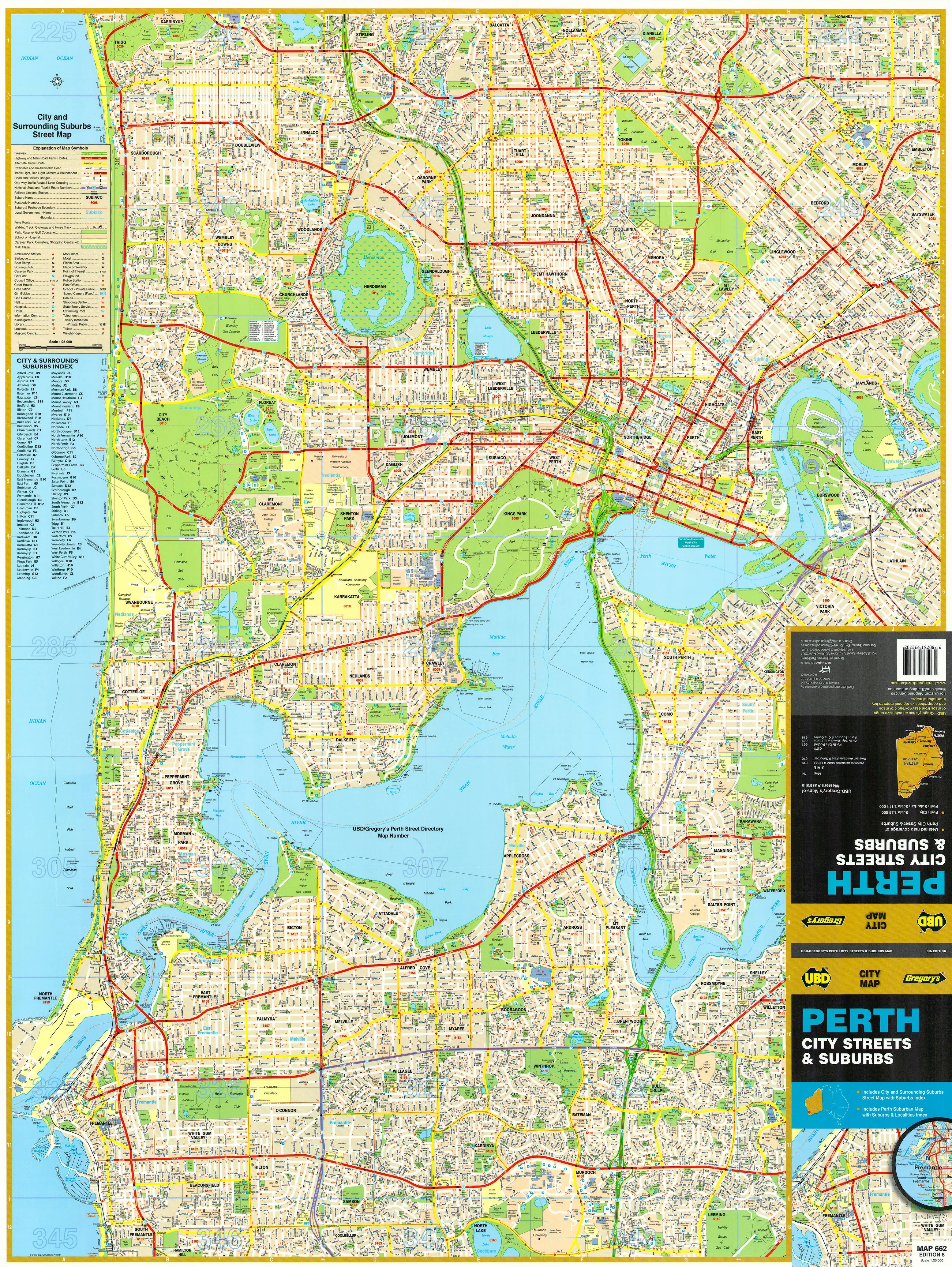
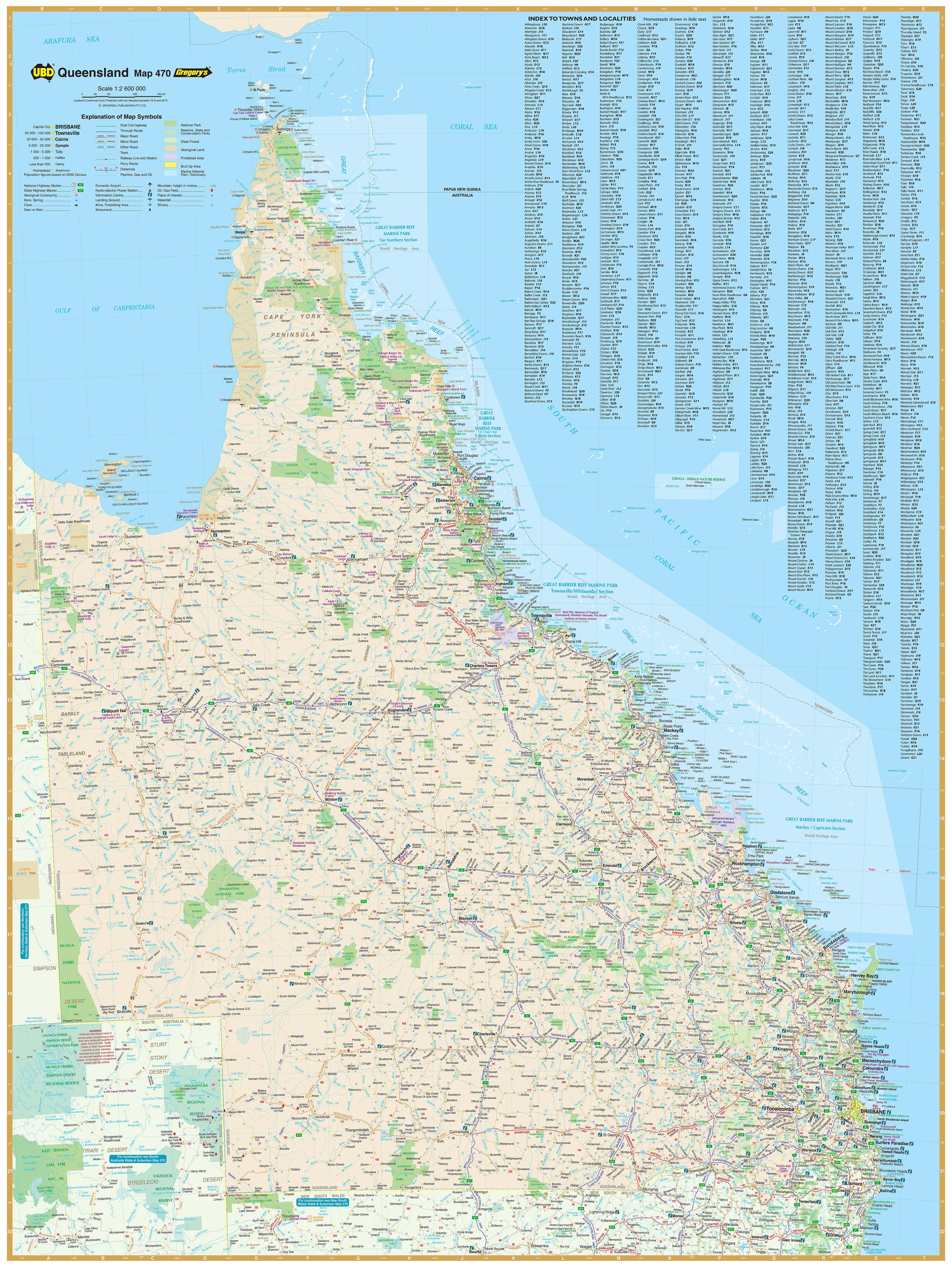
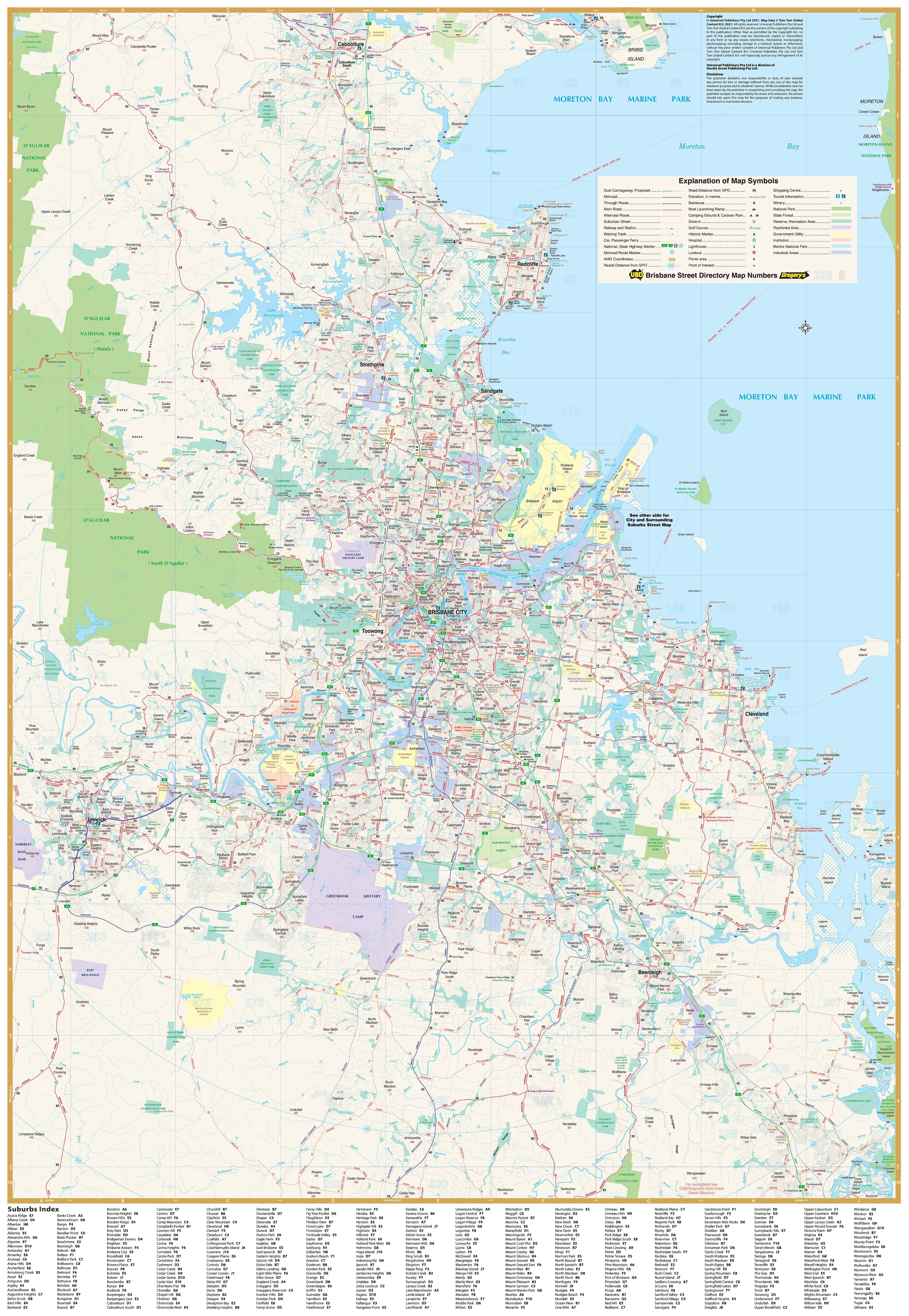
🔹 Side A – Brisbane City (Scale: 1:25,000)
This side presents high-resolution street-level detail within a 10 km radius of Brisbane’s CBD. It covers:
-
Northwest to McDowall
-
Northeast to Nudgee
-
Southwest to Willawong
-
Southeast to Eight Mile Plains
Every street is clearly labelled, with important landmarks, parks, major intersections, and public infrastructure marked. Ideal for:
-
Property professionals and buyers
-
Trades and service providers
-
Local government planning departments
-
Urban geography classrooms
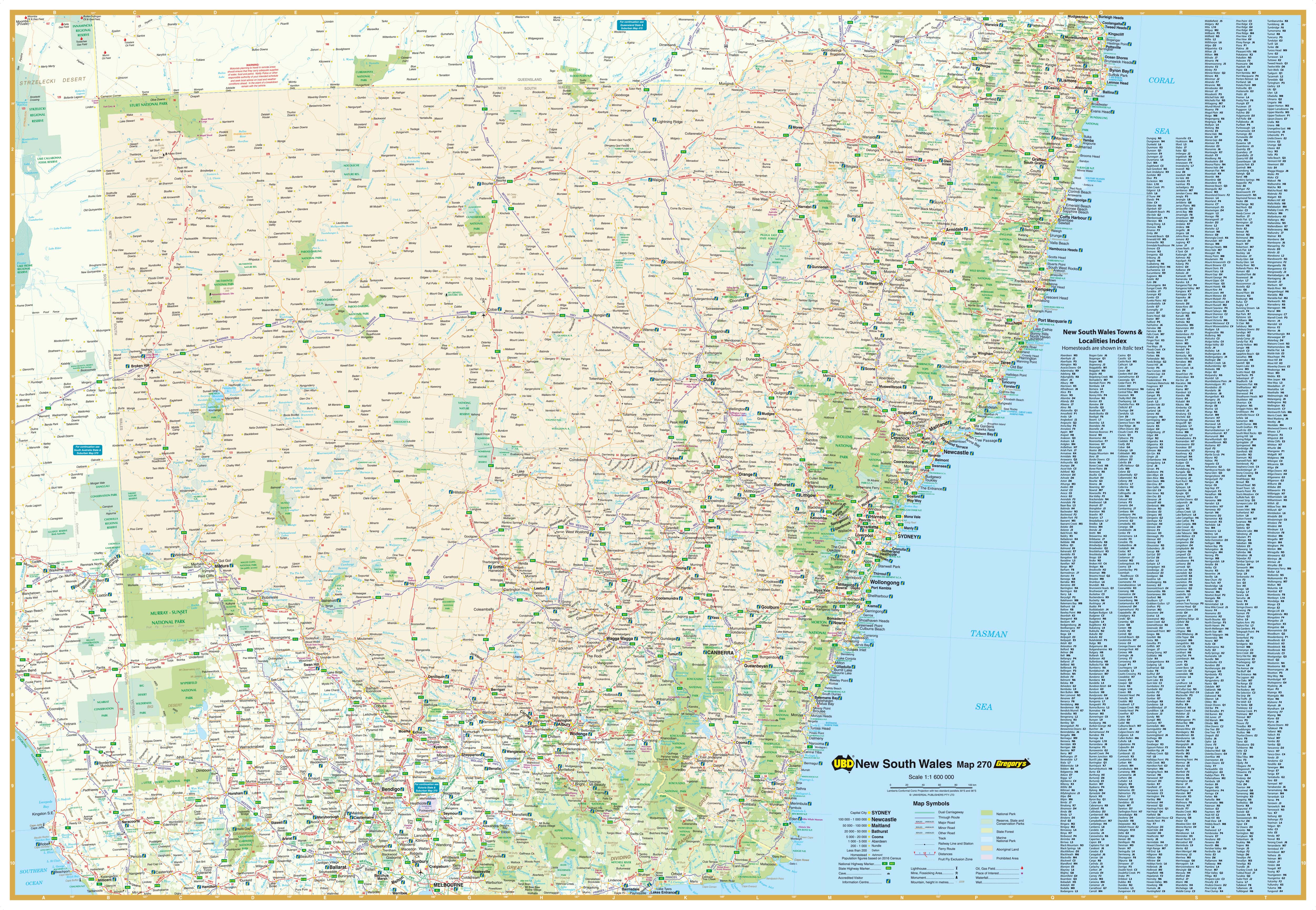
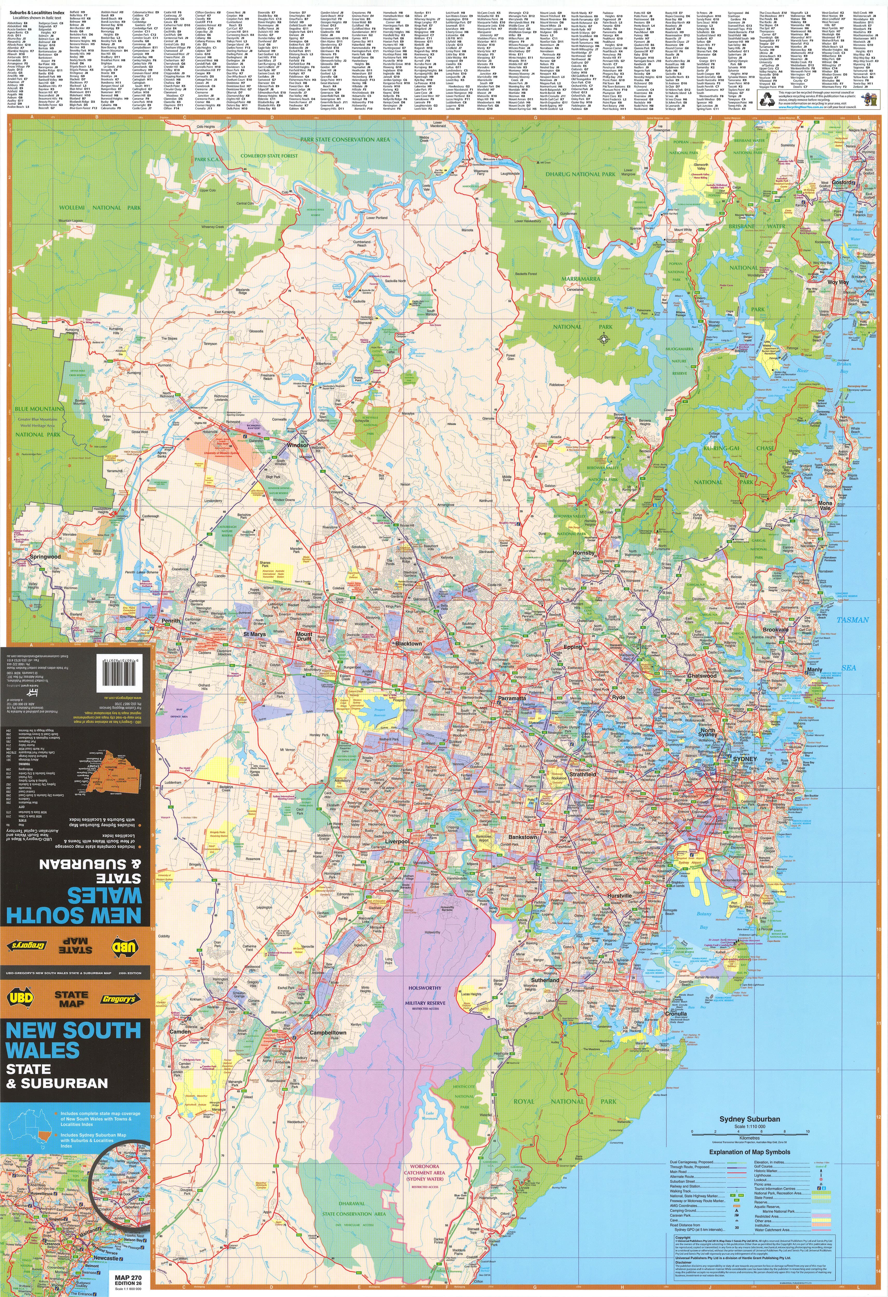
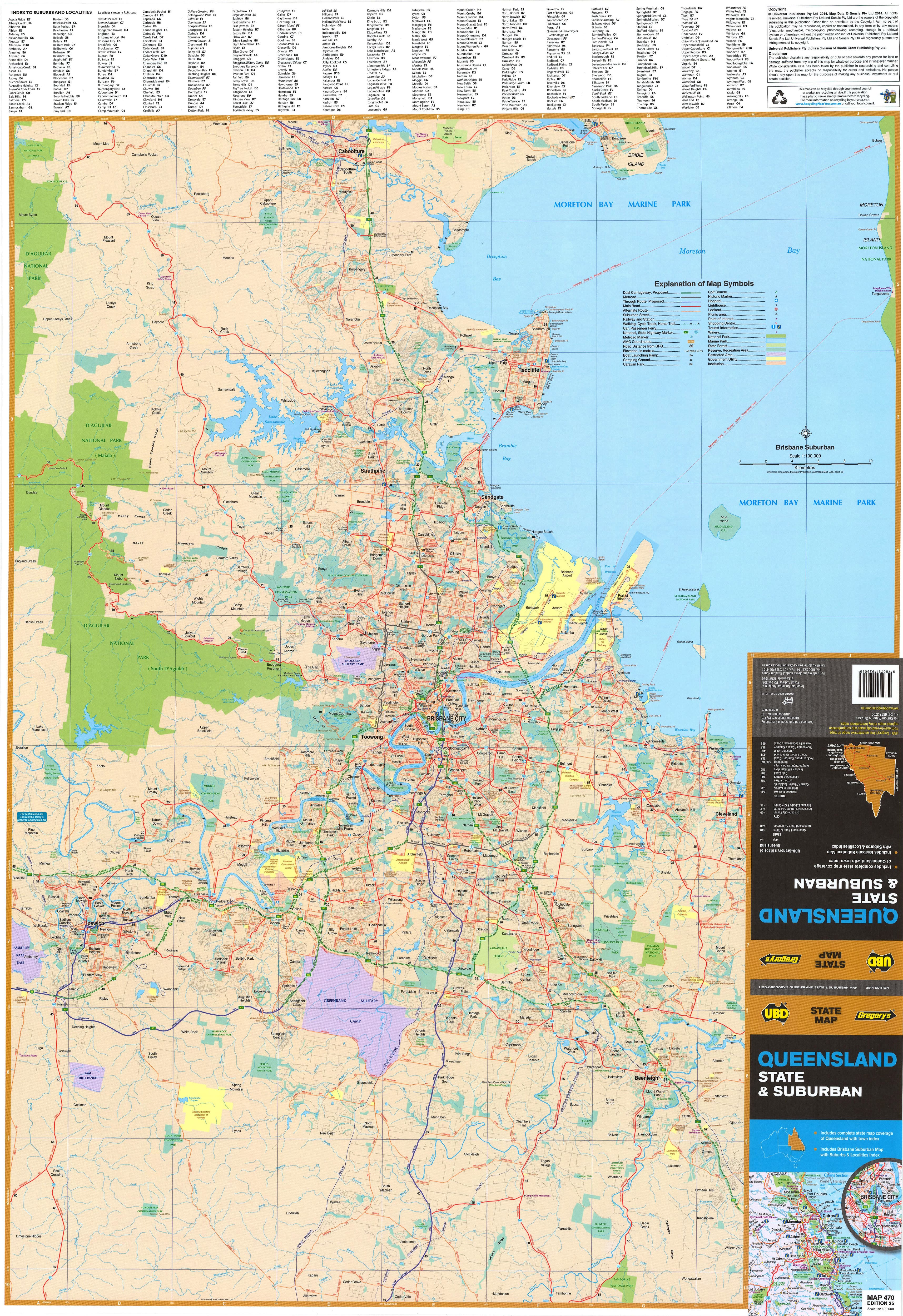
🔹 Side B – Greater Brisbane (Scale: 1:100,000)
This regional map provides a broad view of Brisbane's extended metro area, capturing a 75 km radius:
-
From Caboolture in the north
-
To Coomera on the Gold Coast fringe in the south
-
Includes Ipswich, Logan, Redlands, and surrounding regions
It features:
-
All arterial roads, motorways, and rail corridors
-
Suburban outlines and built-up areas
-
National parks and reserves
-
Industrial zones, airports, and river systems
-
Postcodes marked for each suburb, with a full indexed suburb list
🖊️ Laminated for Interactivity and Longevity
This map is fully encapsulated in gloss laminate, transforming it into a durable and reusable planning tool. It’s:
-
Waterproof and tear-resistant — perfect for high-traffic spaces
-
Writeable and wipeable — use whiteboard markers for notes and markings
-
Compatible with Map Dots — great for tracking service zones, client locations, or travel history
-
Easy to clean — ideal for display in workplaces, schools, council chambers, or home offices
📐 Map Dimensions & Specifications
-
Size: 690 mm (width) x 1000 mm (height)
-
Scales:
-
Side A: 1:25,000 (City)
-
Side B: 1:100,000 (Suburbs)
-
-
Edition: 2024
-
Publisher: UBD Gregory’s – Australia’s trusted name in cartography
🪵 Optional Hanging System – Timber Hang Rails
Add a professional touch to your display with wooden hang rails:
-
Fitted to the top and bottom of the laminated map
-
Includes a hanging cord for easy wall mounting
-
Finished in a natural lacquered timber to suit most office or interior settings
-
Please allow up to 10 business days for framed hang-railed versions, as each is assembled to order
🛒 Purchase Options
| Option | Details | Price (AUD) |
|---|---|---|
| Flat Laminated Map | Professionally laminated and supplied flat, ready to frame or hang | $99.00 |
| Folded Laminated Map | Laminated from a previously folded sheet (some minor creases may appear) | $45.00 |
Both options come fully laminated and offer the same durability and clarity.
🎯 Perfect For:
-
Real estate agencies showcasing service areas and postcodes
-
Courier and logistics companies planning delivery routes
-
Town planners and infrastructure teams assessing urban layout
-
Teachers and geography students studying Brisbane’s urban form
-
Small businesses and franchises identifying trade zones and markets
-
Homeowners and renters getting to know their neighbourhood and surrounds
✅ Why Choose the UBD Brisbane Wall Map?
-
Published by UBD Gregory’s, one of Australia’s most reliable and established mapmakers
-
Features accurate, up-to-date information for 2024
-
Combines beauty and utility — a smart addition to any workspace or home
-
A practical alternative or companion to digital maps — always visible, always accessible
-
A thoughtful gift for Brisbane residents, businesses, or geography enthusiasts
Discover Brisbane’s streets and suburbs in stunning detail.
With its rich information, crisp presentation, and long-lasting finish, the UBD Brisbane Wall Map is a smart, stylish, and essential reference for anyone with an interest in Queensland’s capital city.
Plan. Learn. Display. Navigate.
Make it Brisbane – and make it mapped.
Original: $35.74
-65%$35.74
$12.51Product Information
Product Information
Shipping & Returns
Shipping & Returns
Description
A high-clarity, professionally laminated wall map of Brisbane — combining detailed urban street mapping with a broad suburban overview for real estate, business, education, and travel planning
The 2024 Brisbane Wall Map from UBD Gregory’s is an essential tool for anyone needing a clear and authoritative view of the city and its surrounding suburbs. This large-format, double-sided wall map is packed with information and printed in crisp, vibrant colour. It’s ideal for professionals, residents, planners, and educators alike.
Featuring a street-level city map on one side and a regional overview of Greater Brisbane on the other, it gives you the best of both worlds: fine-grain detail for inner-city navigation and wide-angle context for understanding the city’s growing metropolitan sprawl.
Whether you're house hunting, launching a business, planning transport routes, or simply want a beautiful and informative piece for your wall, this map delivers with precision and style.
🗺️ Two Maps in One – What Each Side Covers
🔹 Side A – Brisbane City (Scale: 1:25,000)
This side presents high-resolution street-level detail within a 10 km radius of Brisbane’s CBD. It covers:
-
Northwest to McDowall
-
Northeast to Nudgee
-
Southwest to Willawong
-
Southeast to Eight Mile Plains
Every street is clearly labelled, with important landmarks, parks, major intersections, and public infrastructure marked. Ideal for:
-
Property professionals and buyers
-
Trades and service providers
-
Local government planning departments
-
Urban geography classrooms
🔹 Side B – Greater Brisbane (Scale: 1:100,000)
This regional map provides a broad view of Brisbane's extended metro area, capturing a 75 km radius:
-
From Caboolture in the north
-
To Coomera on the Gold Coast fringe in the south
-
Includes Ipswich, Logan, Redlands, and surrounding regions
It features:
-
All arterial roads, motorways, and rail corridors
-
Suburban outlines and built-up areas
-
National parks and reserves
-
Industrial zones, airports, and river systems
-
Postcodes marked for each suburb, with a full indexed suburb list
🖊️ Laminated for Interactivity and Longevity
This map is fully encapsulated in gloss laminate, transforming it into a durable and reusable planning tool. It’s:
-
Waterproof and tear-resistant — perfect for high-traffic spaces
-
Writeable and wipeable — use whiteboard markers for notes and markings
-
Compatible with Map Dots — great for tracking service zones, client locations, or travel history
-
Easy to clean — ideal for display in workplaces, schools, council chambers, or home offices
📐 Map Dimensions & Specifications
-
Size: 690 mm (width) x 1000 mm (height)
-
Scales:
-
Side A: 1:25,000 (City)
-
Side B: 1:100,000 (Suburbs)
-
-
Edition: 2024
-
Publisher: UBD Gregory’s – Australia’s trusted name in cartography
🪵 Optional Hanging System – Timber Hang Rails
Add a professional touch to your display with wooden hang rails:
-
Fitted to the top and bottom of the laminated map
-
Includes a hanging cord for easy wall mounting
-
Finished in a natural lacquered timber to suit most office or interior settings
-
Please allow up to 10 business days for framed hang-railed versions, as each is assembled to order
🛒 Purchase Options
| Option | Details | Price (AUD) |
|---|---|---|
| Flat Laminated Map | Professionally laminated and supplied flat, ready to frame or hang | $99.00 |
| Folded Laminated Map | Laminated from a previously folded sheet (some minor creases may appear) | $45.00 |
Both options come fully laminated and offer the same durability and clarity.
🎯 Perfect For:
-
Real estate agencies showcasing service areas and postcodes
-
Courier and logistics companies planning delivery routes
-
Town planners and infrastructure teams assessing urban layout
-
Teachers and geography students studying Brisbane’s urban form
-
Small businesses and franchises identifying trade zones and markets
-
Homeowners and renters getting to know their neighbourhood and surrounds
✅ Why Choose the UBD Brisbane Wall Map?
-
Published by UBD Gregory’s, one of Australia’s most reliable and established mapmakers
-
Features accurate, up-to-date information for 2024
-
Combines beauty and utility — a smart addition to any workspace or home
-
A practical alternative or companion to digital maps — always visible, always accessible
-
A thoughtful gift for Brisbane residents, businesses, or geography enthusiasts
Discover Brisbane’s streets and suburbs in stunning detail.
With its rich information, crisp presentation, and long-lasting finish, the UBD Brisbane Wall Map is a smart, stylish, and essential reference for anyone with an interest in Queensland’s capital city.
Plan. Learn. Display. Navigate.
Make it Brisbane – and make it mapped.