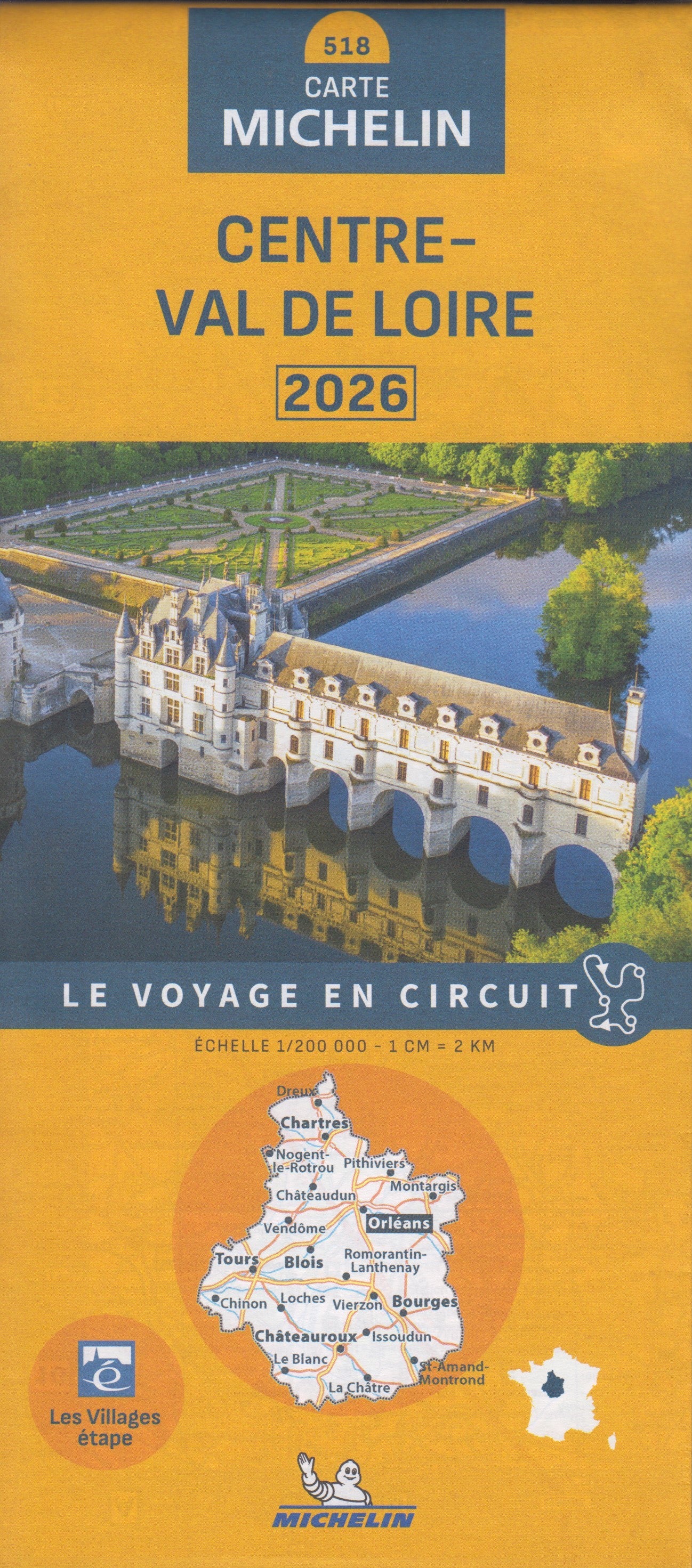
France Central France 518 Michelin Map
🇫🇷 Michelin Regional Map 518 – Central France / Centre-Val de Loire
Scale 1:200,000 | Folded Paper Map | Ideal for Scenic Road Trips & Regional Planning
🗺️ Explore the Heart of France with Michelin's Renowned Cartography
Michelin Map 518 covers the Centre-Val de Loire region — a land of rivers, rolling countryside, and Renaissance châteaux. This regional map is the perfect companion for a leisurely drive through Loire Valley vineyards, a visit to the historic cities of Tours, Orléans or Bourges, or a scenic loop through sleepy villages and river towns.
Printed at a scale of 1:200,000 (1 cm = 2 km), this fold-out map provides just the right balance of coverage and detail — ideal for both long-distance planning and navigating rural roads.
🧭 Key Features
Michelin’s regional series is trusted by travellers across Europe for its clarity, accuracy, and up-to-date information. The Central France map includes:
| Feature | ✅ |
|---|---|
| 🛣️ Detailed road network: motorways, national, regional & minor roads | ✅ |
| 🚘 Route numbers and distances in kilometres | ✅ |
| 🏞️ Scenic routes and tourist drives highlighted | ✅ |
| 🏙️ Major town plans for easy urban navigation | ✅ |
| 📍 Points of interest & tourist sites | ✅ |
| 📏 Driving distances and time chart for route planning | ✅ |
| 🔠 Full index of place names | ✅ |
| 🌍 Multilingual map legend including English, French, German, Italian & Spanish | ✅ |
📌 Area Coverage
This map includes comprehensive coverage of the Centre-Val de Loire region, including:
-
Loire Valley and its famed châteaux: Chambord, Chenonceau, Amboise
-
Historic cities: Orléans, Tours, Chartres, Bourges
-
Natural landscapes: Sologne Forest, the Brenne Regional Park, and Berry countryside
-
Wine-producing regions and river valleys of the Cher, Indre, and Loire rivers
Ideal for exploring a region that blends France’s historical richness with pastoral tranquillity.
📐 Map Specifications
| Specification | Details |
|---|---|
| Map Title | Michelin Regional Map 518 – Central France |
| Scale | 1:200,000 (1 cm = 2 km) |
| Size (Unfolded) | 1200 mm x 1000 mm |
| Format | Folded paper map with card cover |
| Language | Place names in local language |
| Legend | Multilingual (incl. English) |
| Publisher | Michelin Maps, France |
| Map Type | Touring & Route Planning |
🚗 Perfect For:
-
Independent travellers and road trippers
-
Caravan, campervan or motorbike tourers
-
Holidaymakers exploring the Loire Valley
-
Wine lovers seeking vineyard routes
-
Those planning slow travel through the French countryside
📦 Shipping & Delivery
-
✅ In stock — Ships from Australia
-
📬 Combine with other Michelin maps for regional continuity
-
🧭 Ideal pairing: Michelin Loire Valley map or Michelin Map of Brittany (512)
Michelin Map 518 – Central France
📍 Navigate with confidence and discover the beauty, history, and charm of central France — with the map trusted by travellers worldwide.
Original: $15.70
-65%$15.70
$5.49Product Information
Product Information
Shipping & Returns
Shipping & Returns
Description
🇫🇷 Michelin Regional Map 518 – Central France / Centre-Val de Loire
Scale 1:200,000 | Folded Paper Map | Ideal for Scenic Road Trips & Regional Planning
🗺️ Explore the Heart of France with Michelin's Renowned Cartography
Michelin Map 518 covers the Centre-Val de Loire region — a land of rivers, rolling countryside, and Renaissance châteaux. This regional map is the perfect companion for a leisurely drive through Loire Valley vineyards, a visit to the historic cities of Tours, Orléans or Bourges, or a scenic loop through sleepy villages and river towns.
Printed at a scale of 1:200,000 (1 cm = 2 km), this fold-out map provides just the right balance of coverage and detail — ideal for both long-distance planning and navigating rural roads.
🧭 Key Features
Michelin’s regional series is trusted by travellers across Europe for its clarity, accuracy, and up-to-date information. The Central France map includes:
| Feature | ✅ |
|---|---|
| 🛣️ Detailed road network: motorways, national, regional & minor roads | ✅ |
| 🚘 Route numbers and distances in kilometres | ✅ |
| 🏞️ Scenic routes and tourist drives highlighted | ✅ |
| 🏙️ Major town plans for easy urban navigation | ✅ |
| 📍 Points of interest & tourist sites | ✅ |
| 📏 Driving distances and time chart for route planning | ✅ |
| 🔠 Full index of place names | ✅ |
| 🌍 Multilingual map legend including English, French, German, Italian & Spanish | ✅ |
📌 Area Coverage
This map includes comprehensive coverage of the Centre-Val de Loire region, including:
-
Loire Valley and its famed châteaux: Chambord, Chenonceau, Amboise
-
Historic cities: Orléans, Tours, Chartres, Bourges
-
Natural landscapes: Sologne Forest, the Brenne Regional Park, and Berry countryside
-
Wine-producing regions and river valleys of the Cher, Indre, and Loire rivers
Ideal for exploring a region that blends France’s historical richness with pastoral tranquillity.
📐 Map Specifications
| Specification | Details |
|---|---|
| Map Title | Michelin Regional Map 518 – Central France |
| Scale | 1:200,000 (1 cm = 2 km) |
| Size (Unfolded) | 1200 mm x 1000 mm |
| Format | Folded paper map with card cover |
| Language | Place names in local language |
| Legend | Multilingual (incl. English) |
| Publisher | Michelin Maps, France |
| Map Type | Touring & Route Planning |
🚗 Perfect For:
-
Independent travellers and road trippers
-
Caravan, campervan or motorbike tourers
-
Holidaymakers exploring the Loire Valley
-
Wine lovers seeking vineyard routes
-
Those planning slow travel through the French countryside
📦 Shipping & Delivery
-
✅ In stock — Ships from Australia
-
📬 Combine with other Michelin maps for regional continuity
-
🧭 Ideal pairing: Michelin Loire Valley map or Michelin Map of Brittany (512)
Michelin Map 518 – Central France
📍 Navigate with confidence and discover the beauty, history, and charm of central France — with the map trusted by travellers worldwide.


