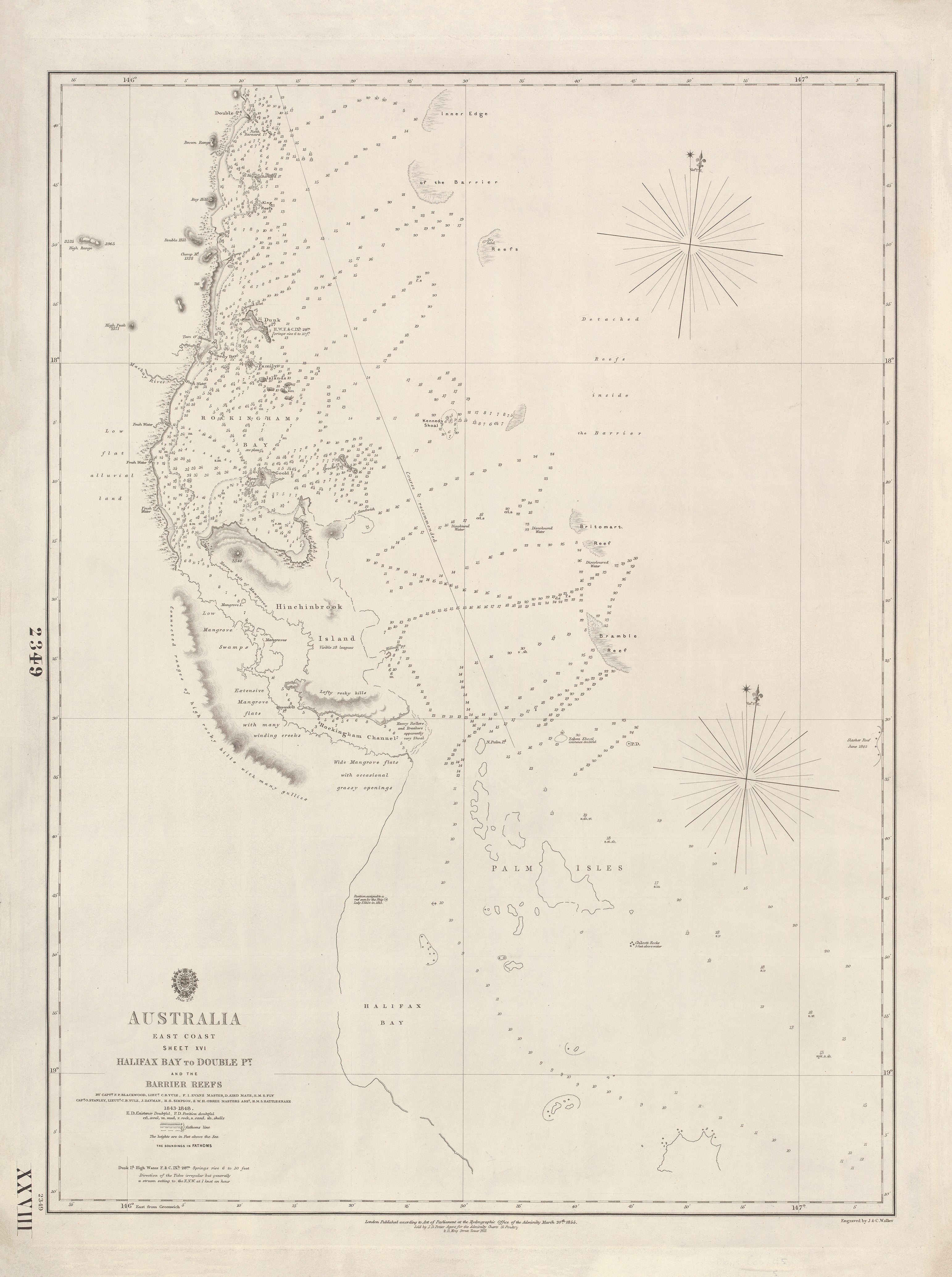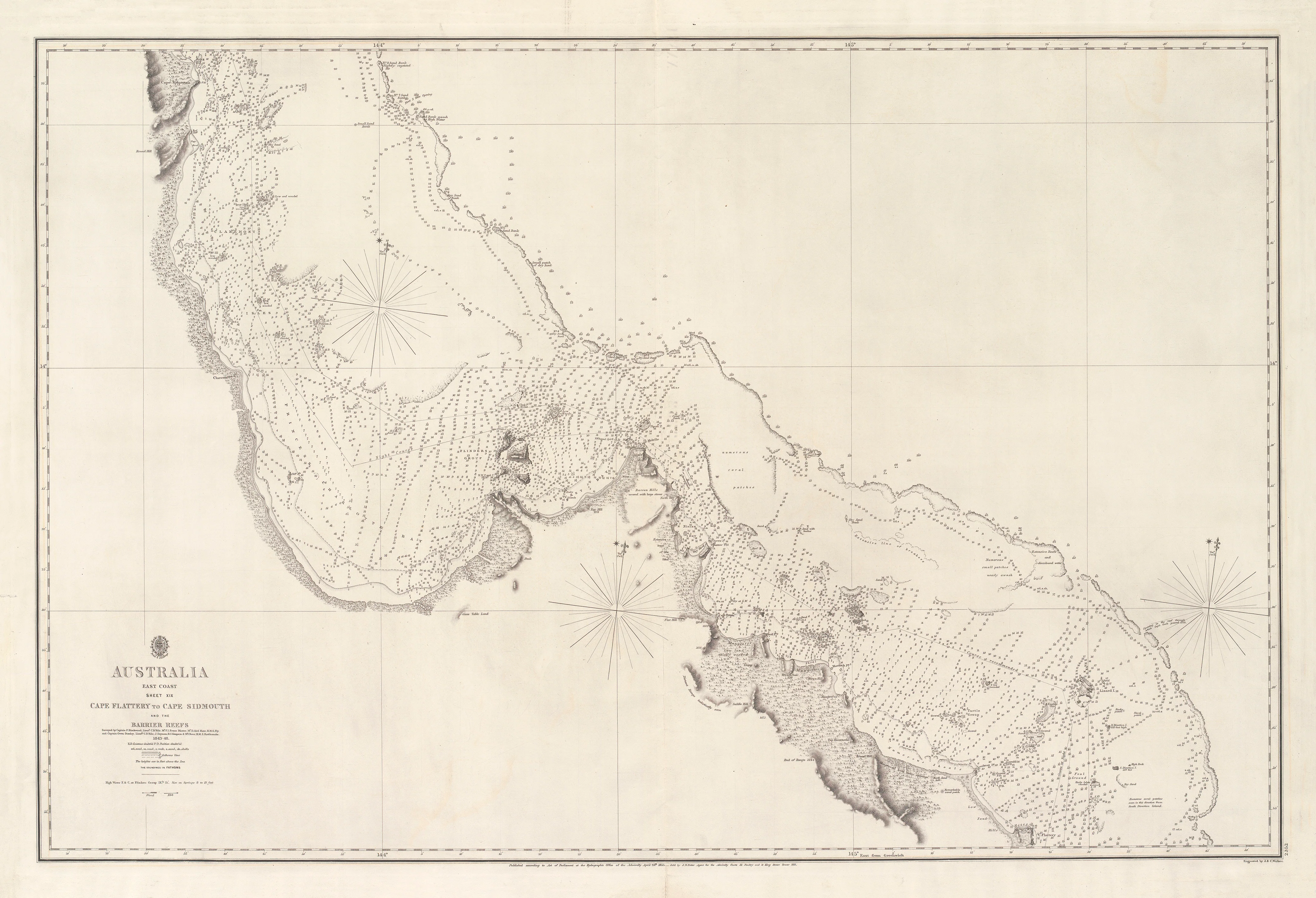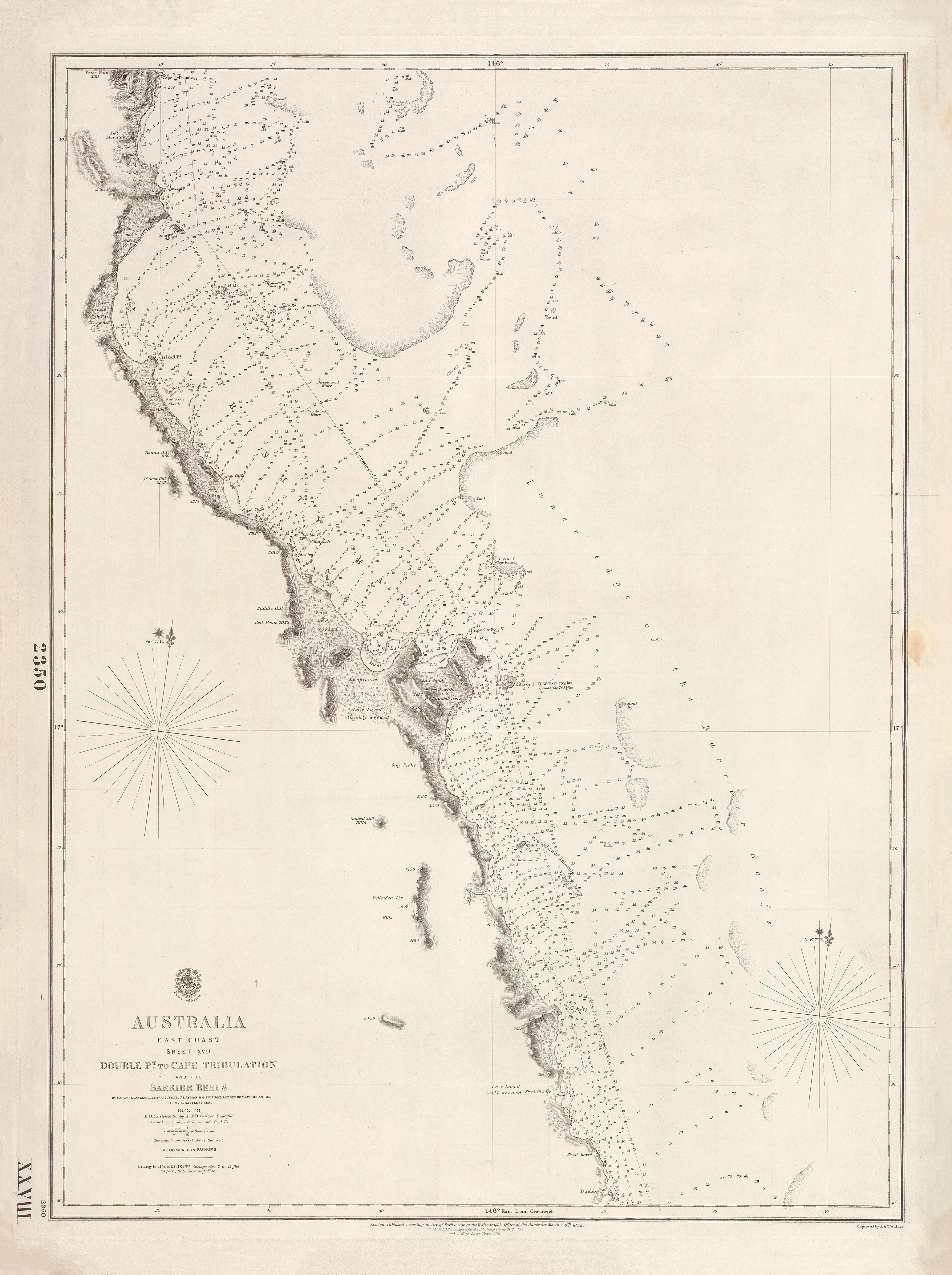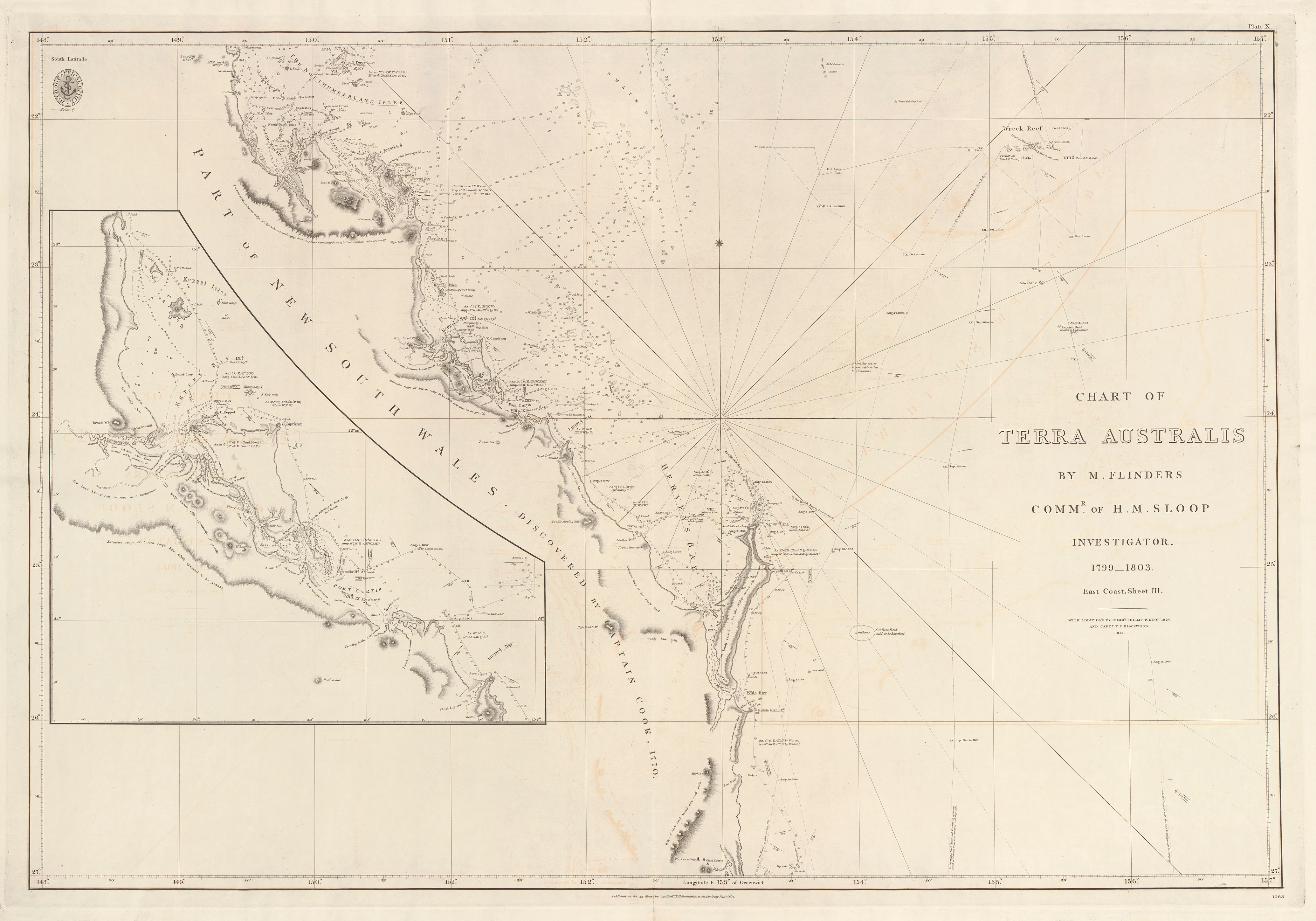
Chart of Terra Australis — Sheet III, East Coast (1802–1841)
Chart of Terra Australis — Sheet III, East Coast (1802–1844)
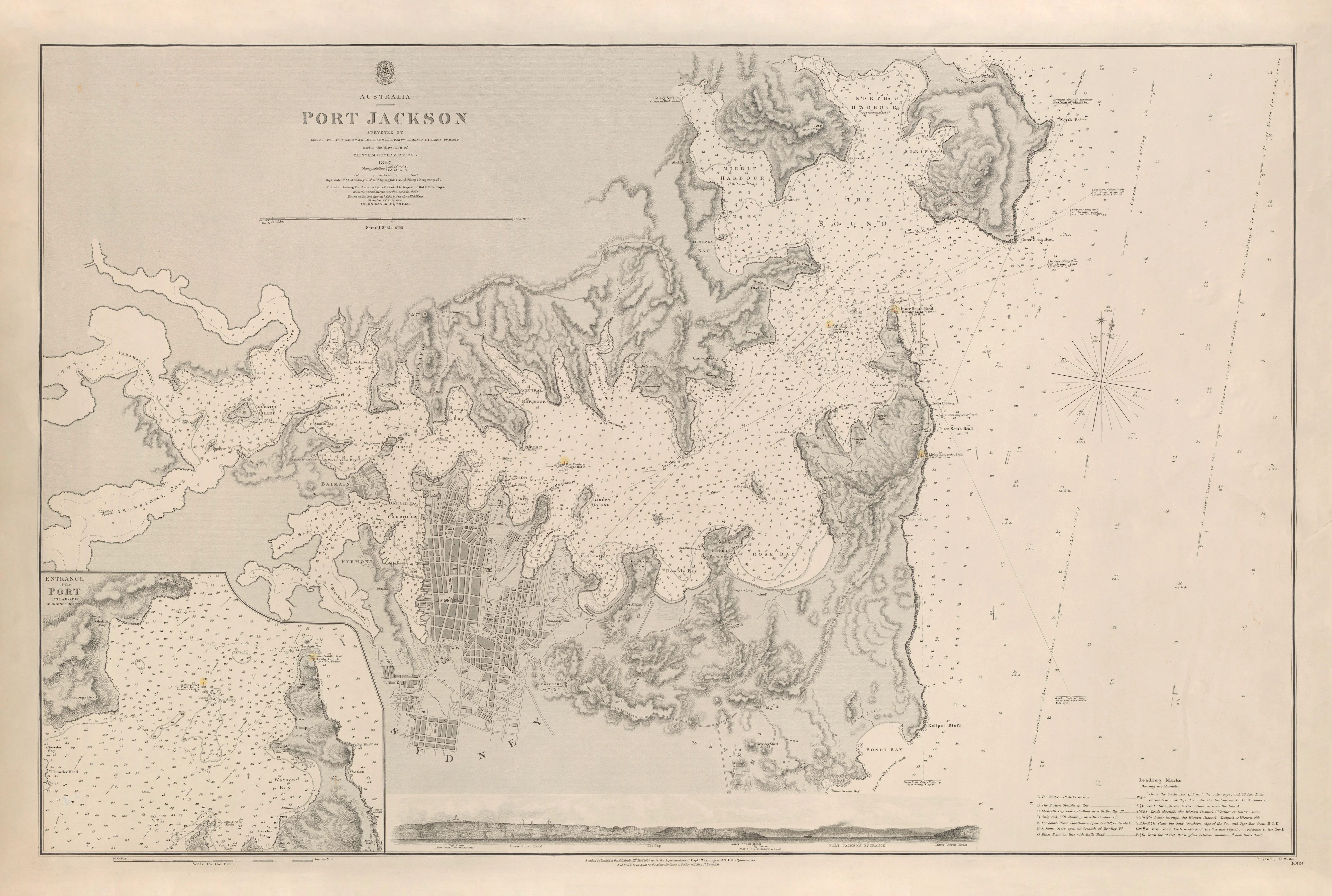
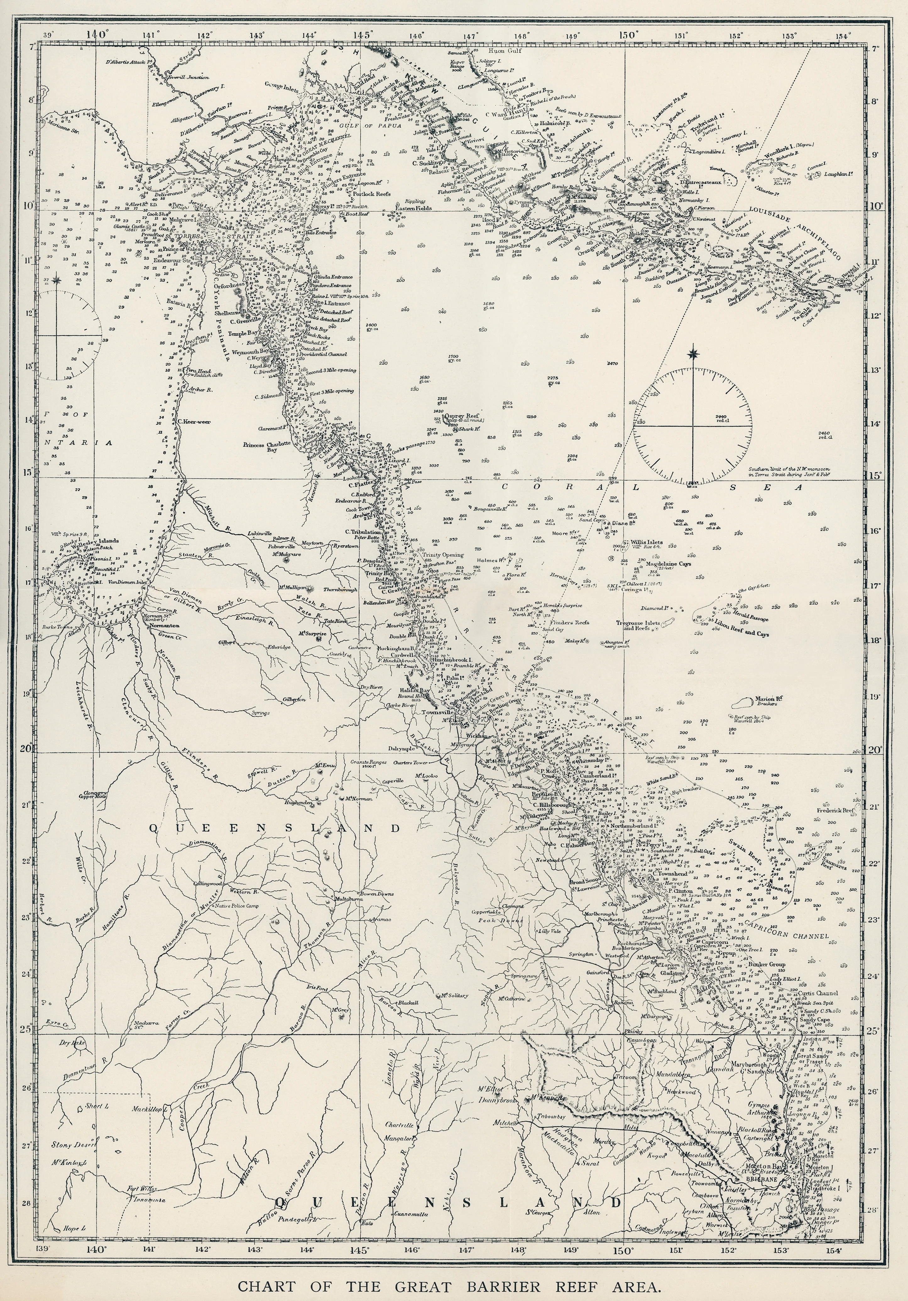
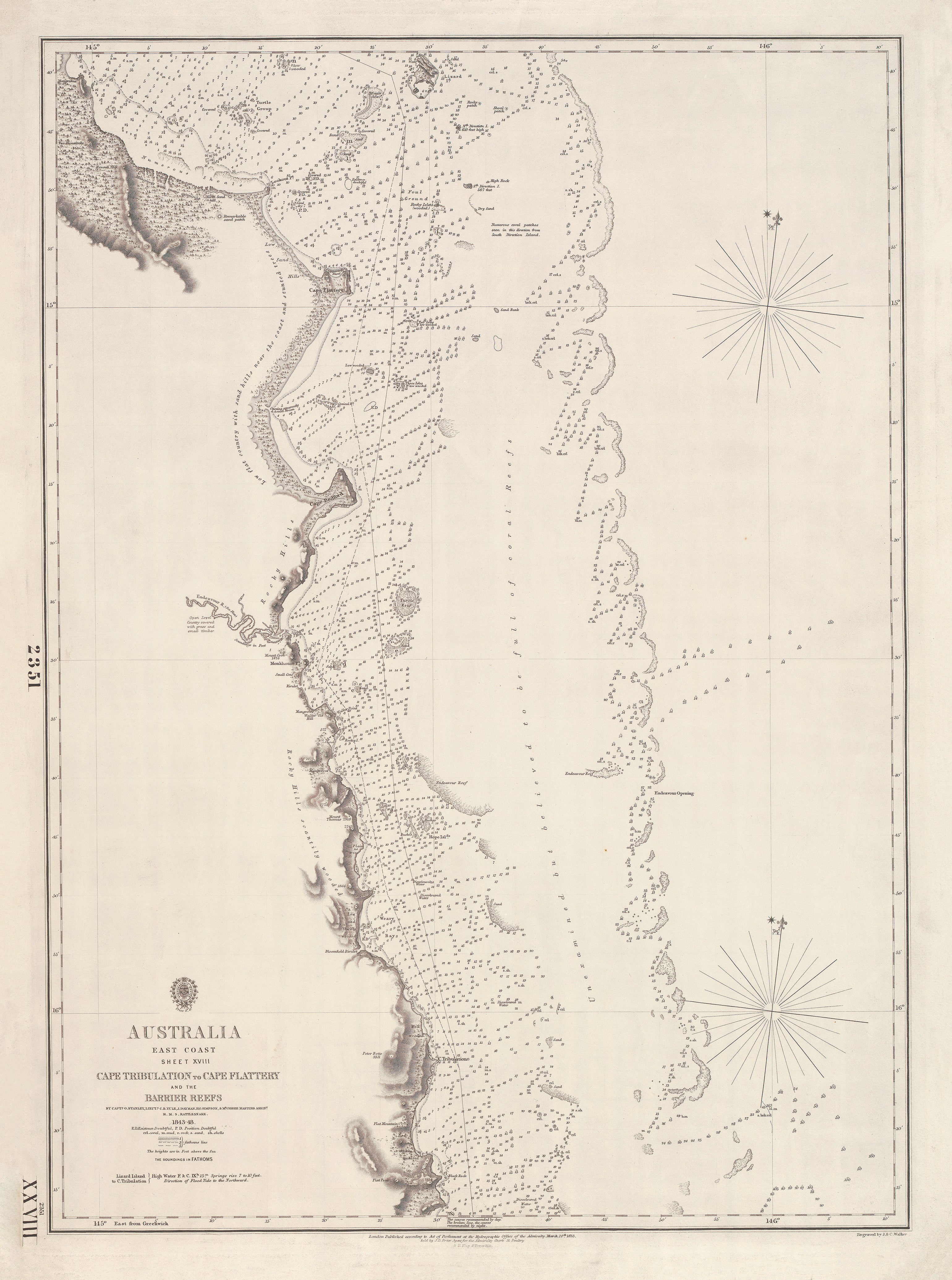
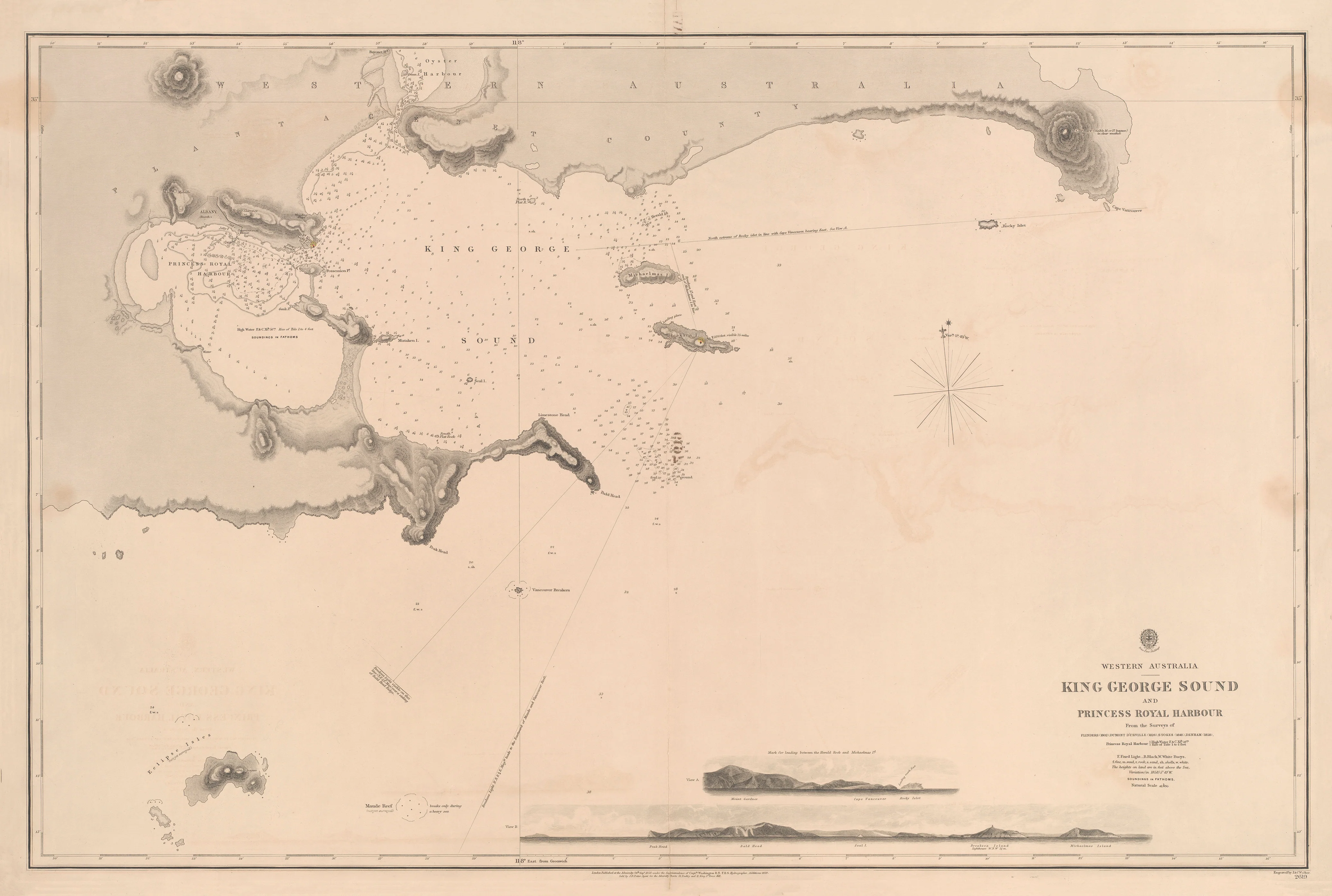
Matthew Flinders’ definitive chart of Australia’s eastern seaboard
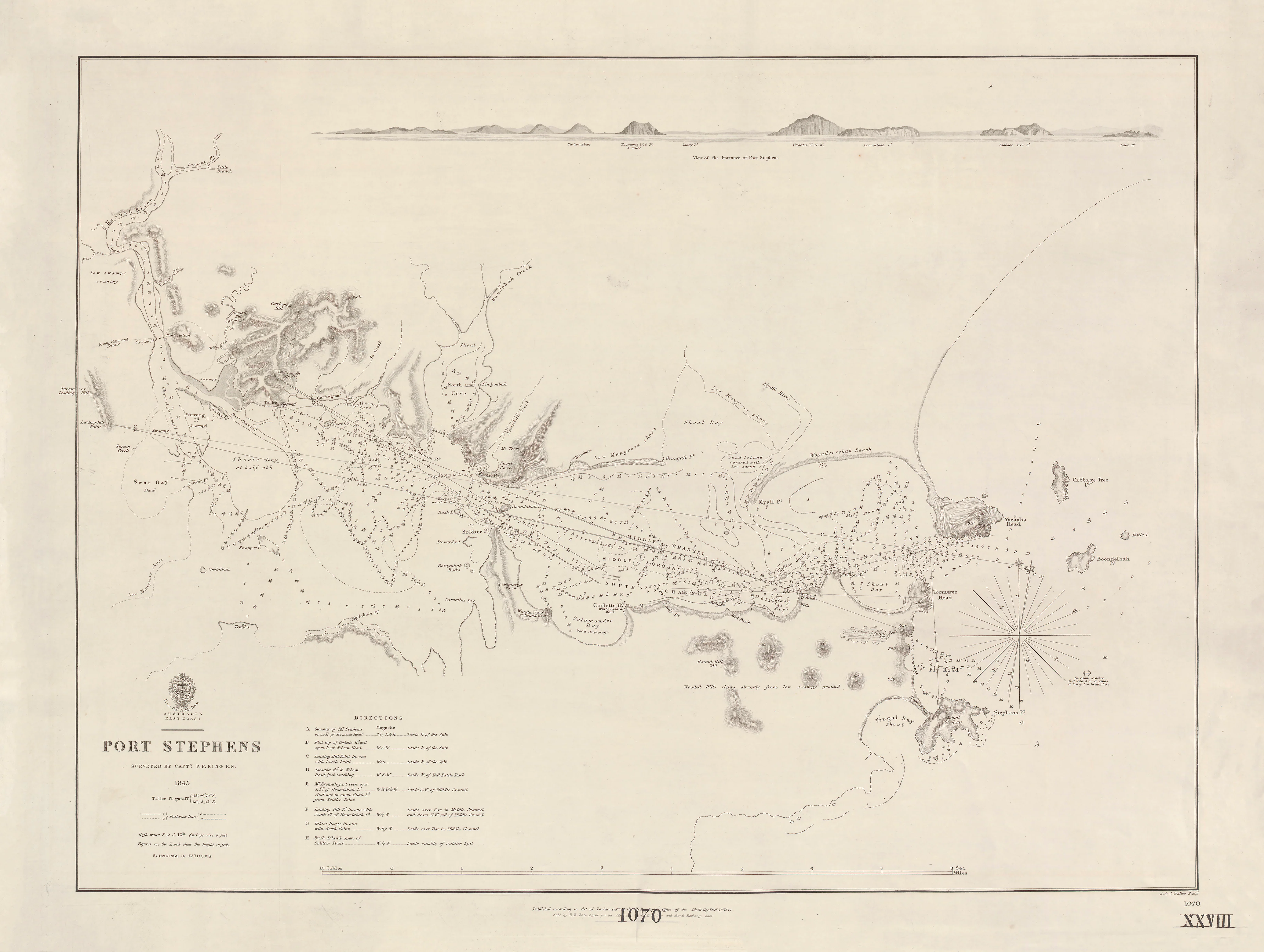
This remarkable British Admiralty chart captures the moment Australia’s vast and complex east coast was transformed from fragmented exploration into precise, navigable geography. Surveyed by Matthew Flinders between 1799 and 1803 aboard H.M.S. Investigator, and later refined by Phillip Parker King (1826) and Captain F.P. Blackwood (1844), this sheet represents the evolving mastery of Australia’s eastern waters.
Published under the authority of the Admiralty’s Hydrographic Office in London, this chart turned one of the world’s most challenging coastlines into a reliable route for navigation, trade, and settlement.
This is not a decorative map.
It is the chart that defined Australia’s eastern frontier.
⚓ What This Chart Shows
This extraordinary Admiralty sheet reveals the east coast in historic detail and navigational clarity.
• The full eastern coastline of Australia
• The intricate outline of the Great Barrier Reef system
• Flinders’ original survey tracks along the coast
• Major headlands, bays, and river entrances
• Refinements by Phillip Parker King and later hydrographic corrections
• Bathymetric soundings marking depths and navigational hazards
• Coastal relief illustrated through traditional hachures
• Greenwich prime meridian — true Admiralty navigation standard
This is the coastline as it was first understood by those who mapped it under sail.
🧭 Why This Chart Works
Most maps show Australia.
This shows how its most important coastline was revealed.
• Surveyed by Matthew Flinders — the navigator who circumnavigated Australia
• Expanded by Phillip Parker King — extending accuracy along the coast
• Further refined by Captain Blackwood as hydrography advanced
• True British Admiralty production — the global standard in maritime mapping
• A fusion of exploration, science, and precision engraving
This is the chart that made the east coast navigable.
✨ Premium Finishes
Every Terra Australis — East Coast (1802–1844) Admiralty Chart is printed in Australia using archival methods to preserve every fine engraved line and historic detail.
| Format | Description |
|---|---|
| 📜 Paper (160 gsm matte) | Smooth heavyweight archival paper with superb line clarity. Ideal for framing under glass. |
| 🧼 Laminated (True Encapsulation) | Sealed between 2 × 80-micron gloss laminate for full edge-to-edge protection. Tear-resistant and wipe-clean — perfect for libraries and institutions. |
| 🖼️ Canvas (395 gsm HP Professional Matte) | Printed on premium HP canvas using pigment-based, fade-resistant inks for a warm, gallery-grade finish. |
| 🪵 Laminated + Timber Hang Rails | Laminated chart mounted between natural timber rails with hanging cord — ready to hang. Allow up to 10 working days. |
| 🪵 Canvas + Timber Hang Rails | Canvas finished with lacquered natural timber rails for an elegant frameless maritime display. Allow up to 10 working days. |
📐 Size
1000 mm (W) × 700 mm (H)
A wide landscape-format chart that perfectly suits the sweeping expanse of Australia’s eastern coastline and reef-lined waters.
🎯 Ideal For
• Australian exploration collectors
• Maritime and naval history enthusiasts
• Museums and libraries
• Universities and research centres
• Anyone fascinated by the mapping of Australia’s east coast
🤝 Our Commitment
• Printed in Australia with professional colour management
• Archival pigment inks for long-term stability
• Premium laminates and canvas for durability
• Natural timber hang rails for elegant presentation
• Hand-checked and carefully packed before dispatch
Before the east coast was known, it was charted here.
Choose your finish and bring Flinders’ defining coastline map onto your wall.
Original: $64.36
-65%$64.36
$22.53Product Information
Product Information
Shipping & Returns
Shipping & Returns
Description
Chart of Terra Australis — Sheet III, East Coast (1802–1844)
Matthew Flinders’ definitive chart of Australia’s eastern seaboard
This remarkable British Admiralty chart captures the moment Australia’s vast and complex east coast was transformed from fragmented exploration into precise, navigable geography. Surveyed by Matthew Flinders between 1799 and 1803 aboard H.M.S. Investigator, and later refined by Phillip Parker King (1826) and Captain F.P. Blackwood (1844), this sheet represents the evolving mastery of Australia’s eastern waters.
Published under the authority of the Admiralty’s Hydrographic Office in London, this chart turned one of the world’s most challenging coastlines into a reliable route for navigation, trade, and settlement.
This is not a decorative map.
It is the chart that defined Australia’s eastern frontier.
⚓ What This Chart Shows
This extraordinary Admiralty sheet reveals the east coast in historic detail and navigational clarity.
• The full eastern coastline of Australia
• The intricate outline of the Great Barrier Reef system
• Flinders’ original survey tracks along the coast
• Major headlands, bays, and river entrances
• Refinements by Phillip Parker King and later hydrographic corrections
• Bathymetric soundings marking depths and navigational hazards
• Coastal relief illustrated through traditional hachures
• Greenwich prime meridian — true Admiralty navigation standard
This is the coastline as it was first understood by those who mapped it under sail.
🧭 Why This Chart Works
Most maps show Australia.
This shows how its most important coastline was revealed.
• Surveyed by Matthew Flinders — the navigator who circumnavigated Australia
• Expanded by Phillip Parker King — extending accuracy along the coast
• Further refined by Captain Blackwood as hydrography advanced
• True British Admiralty production — the global standard in maritime mapping
• A fusion of exploration, science, and precision engraving
This is the chart that made the east coast navigable.
✨ Premium Finishes
Every Terra Australis — East Coast (1802–1844) Admiralty Chart is printed in Australia using archival methods to preserve every fine engraved line and historic detail.
| Format | Description |
|---|---|
| 📜 Paper (160 gsm matte) | Smooth heavyweight archival paper with superb line clarity. Ideal for framing under glass. |
| 🧼 Laminated (True Encapsulation) | Sealed between 2 × 80-micron gloss laminate for full edge-to-edge protection. Tear-resistant and wipe-clean — perfect for libraries and institutions. |
| 🖼️ Canvas (395 gsm HP Professional Matte) | Printed on premium HP canvas using pigment-based, fade-resistant inks for a warm, gallery-grade finish. |
| 🪵 Laminated + Timber Hang Rails | Laminated chart mounted between natural timber rails with hanging cord — ready to hang. Allow up to 10 working days. |
| 🪵 Canvas + Timber Hang Rails | Canvas finished with lacquered natural timber rails for an elegant frameless maritime display. Allow up to 10 working days. |
📐 Size
1000 mm (W) × 700 mm (H)
A wide landscape-format chart that perfectly suits the sweeping expanse of Australia’s eastern coastline and reef-lined waters.
🎯 Ideal For
• Australian exploration collectors
• Maritime and naval history enthusiasts
• Museums and libraries
• Universities and research centres
• Anyone fascinated by the mapping of Australia’s east coast
🤝 Our Commitment
• Printed in Australia with professional colour management
• Archival pigment inks for long-term stability
• Premium laminates and canvas for durability
• Natural timber hang rails for elegant presentation
• Hand-checked and carefully packed before dispatch
Before the east coast was known, it was charted here.
Choose your finish and bring Flinders’ defining coastline map onto your wall.