Children's Africa Wall Map by Collins 492 x 760mm
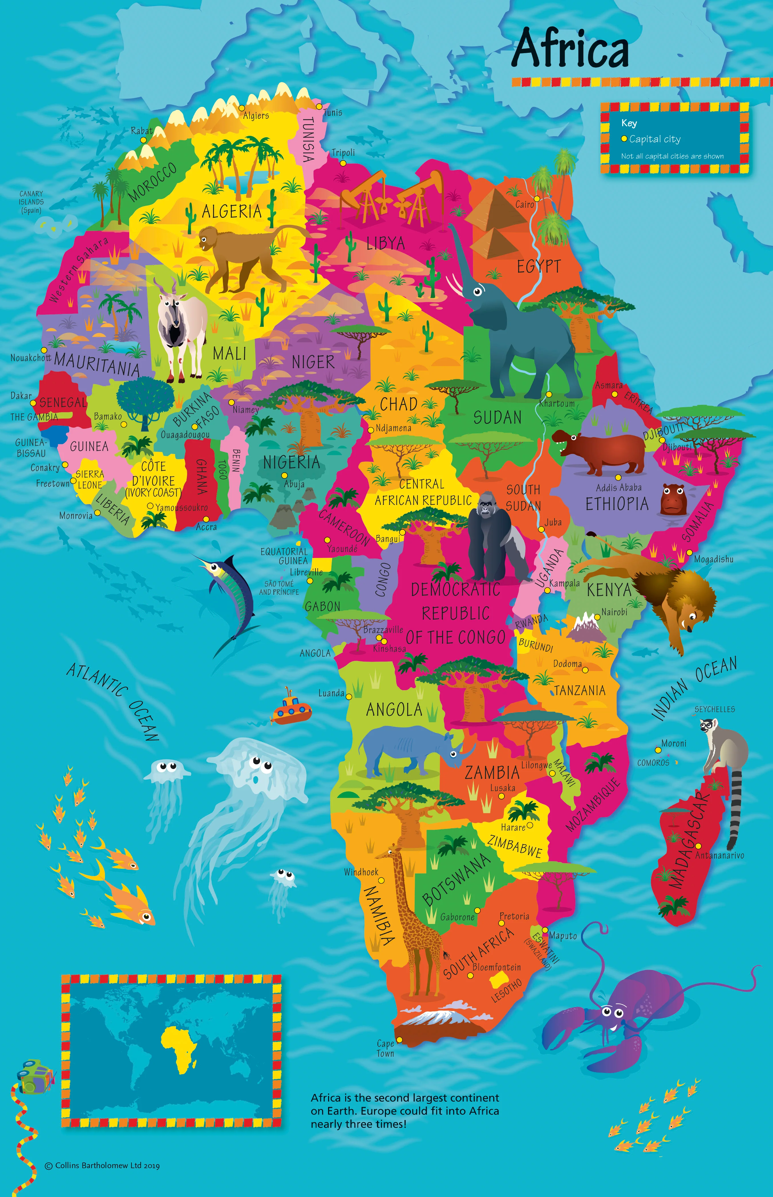
Children’s Africa Wall Map by Collins (Illustrated by Steve Evans)
492 × 760 mm • Paper / Laminated / Laminated + Hang Rails / Canvas / Canvas + Hang Rails • Made in Australia
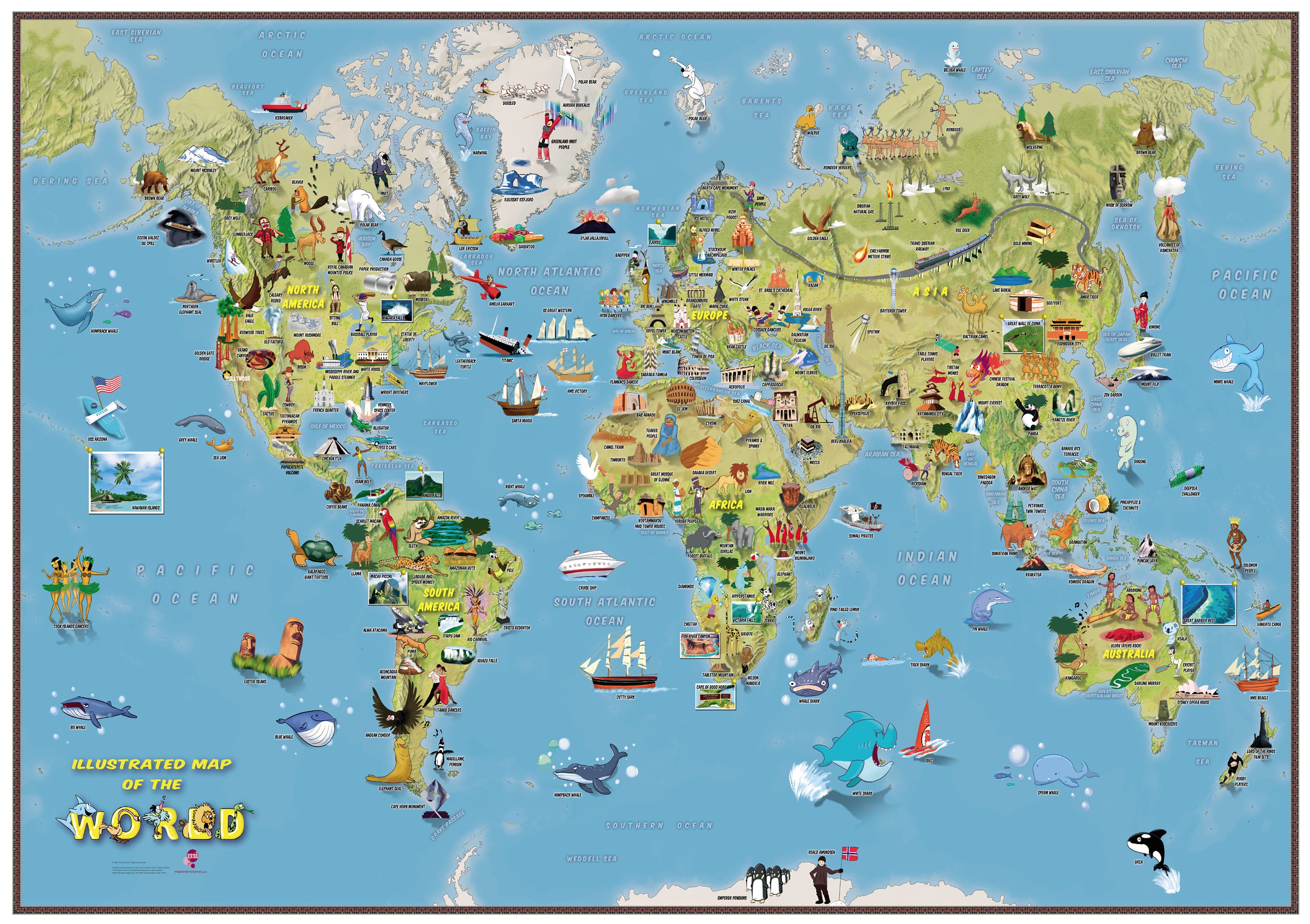
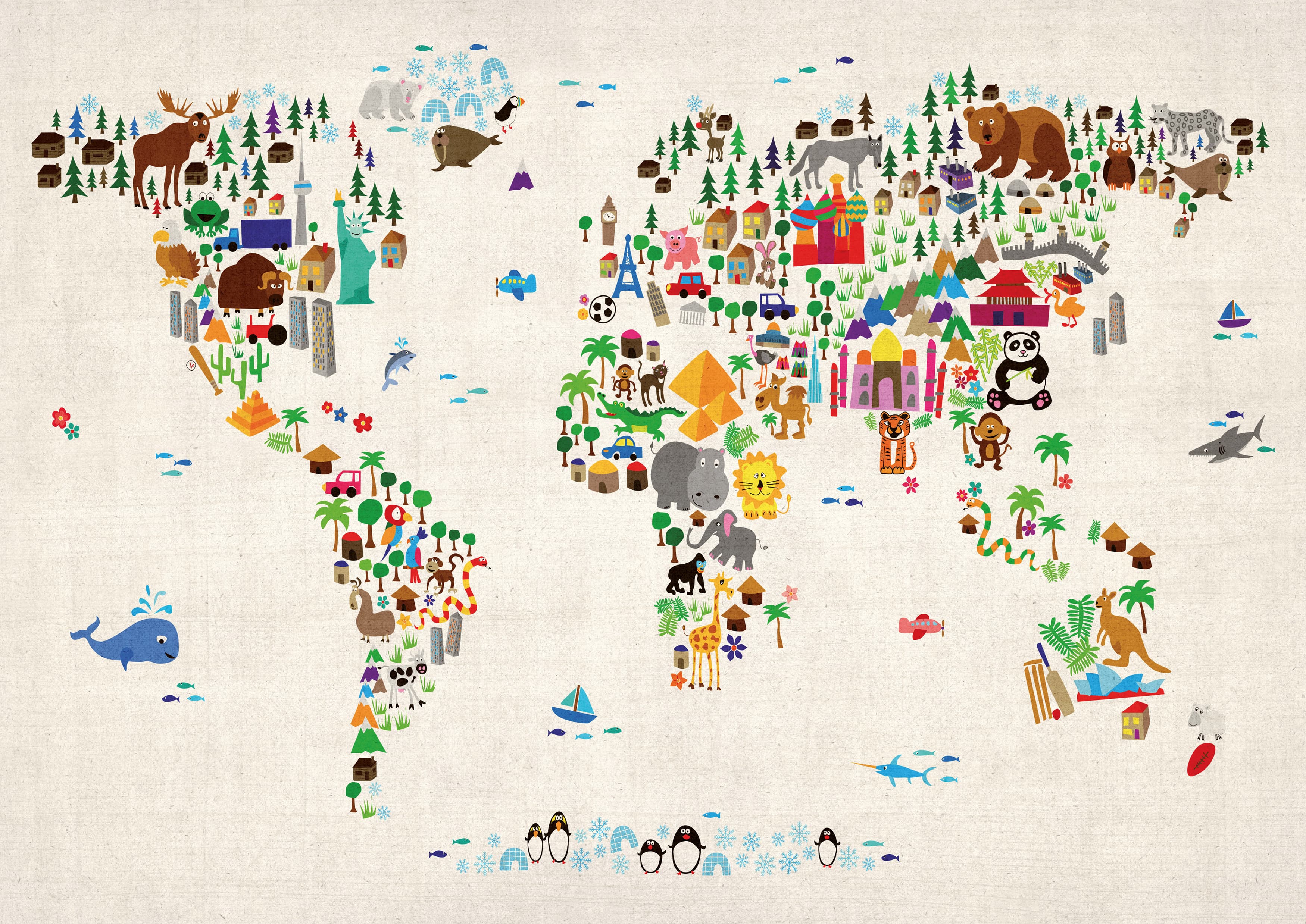
Spark curiosity about the world with this joyful, pictorial map of Africa—created especially for kids ages 4–8. Bright illustrations of animals, foods, landmarks, sports, customs, and national emblems make geography feel like a storybook adventure, while clear cartography labels countries and capital cities for easy learning.
🌍 What Kids Will Discover
-
Countries & capitals shown clearly for early map-reading.
-
Playful illustrations that bring culture, wildlife, and places to life.
-
Friendly, readable design sized perfectly for bedrooms, playrooms, and classrooms.
-
A delightful first step into global awareness and geography.
🎒 Great For
-
Classrooms, libraries, and homeschool spaces
-
Kids’ bedrooms and playrooms
-
Birthday gifts and teacher thank-yous
🎨 Finishes & Display Options
-
📄 Paper (FSC® 160 gsm Matte-Coated)
Smooth, low-glare stock—perfect for framing under glass. Printed with archival Hewlett-Packard pigment inks for long-lasting, fade-resistant colour. -
💧 Laminated (True Encapsulation)
Printed on 120 gsm and sealed in 2 × 80-micron gloss laminate (edge-sealed). Wipe-clean, tear-resistant, classroom-ready; use non-permanent whiteboard markers and map dots. -
🪵 Laminated + Timber Hang Rails (Ready to Hang)
Natural lacquered timber rails (top & bottom) with a top hanging cord for easy, frame-free display.
Please allow up to 10 working days for rail fitting. -
🖼️ Canvas (HP 395 gsm Professional Matte)
Gallery-grade canvas with archival HP pigment inks for rich, low-glare colour and excellent fade resistance—a beautiful décor piece for kids’ spaces. -
🪵 Canvas + Timber Hang Rails
The same premium canvas, finished with natural timber rails and a top hanging cord—ready to hang.
Please allow up to 10 working days for rail fitting.
Dry-erase markers are recommended only on laminated versions.
📐 Specifications
-
Title: Children’s Africa Wall Map by Collins
-
Illustrator: Steve Evans
-
Size: 492 mm (W) × 760 mm (H)
-
Audience: Ages 4–8
-
Options: Paper • Laminated • Laminated + Hang Rails • Canvas • Canvas + Hang Rails
-
Printing: Archival HP pigment inks for fade resistance
-
Origin: Made in Australia
🤝 Our Commitment
-
Local craftsmanship: Printed, and finished in Australia for consistent quality.
-
Kid-safe quality: Durable finishes that stand up to busy classrooms and playrooms.
-
Sustainable choices: FSC® paper stocks and long-life, pigment-ink printing.
-
Careful packing: Every map is hand-checked and securely boxed to arrive display-ready.
Bring Africa’s stories to your wall. Choose your finish and make geography the most colourful part of their day.
Original: $50.05
-65%$50.05
$17.52Product Information
Product Information
Shipping & Returns
Shipping & Returns
Description
Children’s Africa Wall Map by Collins (Illustrated by Steve Evans)
492 × 760 mm • Paper / Laminated / Laminated + Hang Rails / Canvas / Canvas + Hang Rails • Made in Australia
Spark curiosity about the world with this joyful, pictorial map of Africa—created especially for kids ages 4–8. Bright illustrations of animals, foods, landmarks, sports, customs, and national emblems make geography feel like a storybook adventure, while clear cartography labels countries and capital cities for easy learning.
🌍 What Kids Will Discover
-
Countries & capitals shown clearly for early map-reading.
-
Playful illustrations that bring culture, wildlife, and places to life.
-
Friendly, readable design sized perfectly for bedrooms, playrooms, and classrooms.
-
A delightful first step into global awareness and geography.
🎒 Great For
-
Classrooms, libraries, and homeschool spaces
-
Kids’ bedrooms and playrooms
-
Birthday gifts and teacher thank-yous
🎨 Finishes & Display Options
-
📄 Paper (FSC® 160 gsm Matte-Coated)
Smooth, low-glare stock—perfect for framing under glass. Printed with archival Hewlett-Packard pigment inks for long-lasting, fade-resistant colour. -
💧 Laminated (True Encapsulation)
Printed on 120 gsm and sealed in 2 × 80-micron gloss laminate (edge-sealed). Wipe-clean, tear-resistant, classroom-ready; use non-permanent whiteboard markers and map dots. -
🪵 Laminated + Timber Hang Rails (Ready to Hang)
Natural lacquered timber rails (top & bottom) with a top hanging cord for easy, frame-free display.
Please allow up to 10 working days for rail fitting. -
🖼️ Canvas (HP 395 gsm Professional Matte)
Gallery-grade canvas with archival HP pigment inks for rich, low-glare colour and excellent fade resistance—a beautiful décor piece for kids’ spaces. -
🪵 Canvas + Timber Hang Rails
The same premium canvas, finished with natural timber rails and a top hanging cord—ready to hang.
Please allow up to 10 working days for rail fitting.
Dry-erase markers are recommended only on laminated versions.
📐 Specifications
-
Title: Children’s Africa Wall Map by Collins
-
Illustrator: Steve Evans
-
Size: 492 mm (W) × 760 mm (H)
-
Audience: Ages 4–8
-
Options: Paper • Laminated • Laminated + Hang Rails • Canvas • Canvas + Hang Rails
-
Printing: Archival HP pigment inks for fade resistance
-
Origin: Made in Australia
🤝 Our Commitment
-
Local craftsmanship: Printed, and finished in Australia for consistent quality.
-
Kid-safe quality: Durable finishes that stand up to busy classrooms and playrooms.
-
Sustainable choices: FSC® paper stocks and long-life, pigment-ink printing.
-
Careful packing: Every map is hand-checked and securely boxed to arrive display-ready.
Bring Africa’s stories to your wall. Choose your finish and make geography the most colourful part of their day.