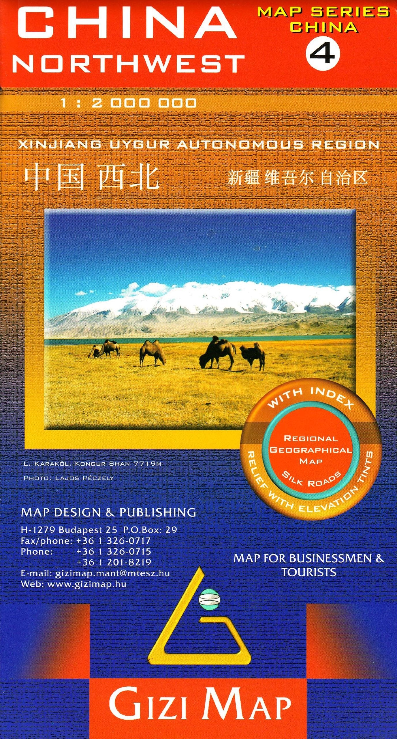
China North West Gizi Maps Folded
High-detail physical and road map | Single-sided | Scale 1:2,000,000 | Size: 1000 mm x 930 mm
Discover the vast deserts, high plateaus, and Silk Road cities of Northwest China with this exceptionally detailed folded map by Gizi Maps. Covering iconic regions such as Xinjiang, Gansu, Qinghai, and western Inner Mongolia, this map offers a panoramic overview of one of China’s most geographically and culturally diverse areas.
Whether you're tracing ancient caravan routes or planning overland travel through remote regions, this map delivers all the clarity and information you need.
🧭 Key Features:
-
Scale 1:2,000,000 – Balanced for both wide-area navigation and regional detail
-
Color relief shading – Highlights elevation, terrain types, and mountainous zones
-
Road network – Includes major highways, regional roads, and desert crossings
-
Distances clearly marked along key routes for easy trip planning
-
Cultural and tourist highlights, including:
-
Pagodas, monasteries, and ancient ruins
-
National parks, scenic areas, and desert oases
-
Nature reserves and ecological zones
-
-
Comprehensive place name index for efficient navigation and reference
-
Clear political boundaries with provinces, cities, and towns accurately labeled
📐 Map Specifications
| Feature | Description |
|---|---|
| Publisher | Gizi Maps |
| Coverage | Northwestern China: Xinjiang, Gansu, Qinghai, and more |
| Scale | 1:2,000,000 |
| Format | Folded, single-sided |
| Size | 1000 mm (W) x 930 mm (H) |
| Material | High-grade printed paper |
| Index | Full place name index included |
📌 Why Choose This Map?
-
✅ Perfect for adventure travellers exploring remote regions of China
-
✅ Essential for Silk Road enthusiasts, historians, and cultural geographers
-
✅ Valuable reference for educators teaching Central Asian geography
-
✅ Easy to fold, lightweight, and portable – ideal for field use
-
✅ A visual tool for understanding terrain, borders, and infrastructure across vast distances
🛠️ Order On Demand
📦 This is a special Order on Demand item.
🕒 Please allow up to 10 working days for delivery to ensure careful handling and dispatch.
Explore ancient trade routes, modern highways, and the breathtaking natural beauty of northwest China with this indispensable travel and reference map. From the Taklamakan Desert to the Tianshan Mountains, every detail has been thoughtfully rendered for clarity and practical use.
👉 Add to Cart Today and take the first step into one of China's most extraordinary landscapes.
Original: $21.43
-65%$21.43
$7.50Product Information
Product Information
Shipping & Returns
Shipping & Returns
Description
High-detail physical and road map | Single-sided | Scale 1:2,000,000 | Size: 1000 mm x 930 mm
Discover the vast deserts, high plateaus, and Silk Road cities of Northwest China with this exceptionally detailed folded map by Gizi Maps. Covering iconic regions such as Xinjiang, Gansu, Qinghai, and western Inner Mongolia, this map offers a panoramic overview of one of China’s most geographically and culturally diverse areas.
Whether you're tracing ancient caravan routes or planning overland travel through remote regions, this map delivers all the clarity and information you need.
🧭 Key Features:
-
Scale 1:2,000,000 – Balanced for both wide-area navigation and regional detail
-
Color relief shading – Highlights elevation, terrain types, and mountainous zones
-
Road network – Includes major highways, regional roads, and desert crossings
-
Distances clearly marked along key routes for easy trip planning
-
Cultural and tourist highlights, including:
-
Pagodas, monasteries, and ancient ruins
-
National parks, scenic areas, and desert oases
-
Nature reserves and ecological zones
-
-
Comprehensive place name index for efficient navigation and reference
-
Clear political boundaries with provinces, cities, and towns accurately labeled
📐 Map Specifications
| Feature | Description |
|---|---|
| Publisher | Gizi Maps |
| Coverage | Northwestern China: Xinjiang, Gansu, Qinghai, and more |
| Scale | 1:2,000,000 |
| Format | Folded, single-sided |
| Size | 1000 mm (W) x 930 mm (H) |
| Material | High-grade printed paper |
| Index | Full place name index included |
📌 Why Choose This Map?
-
✅ Perfect for adventure travellers exploring remote regions of China
-
✅ Essential for Silk Road enthusiasts, historians, and cultural geographers
-
✅ Valuable reference for educators teaching Central Asian geography
-
✅ Easy to fold, lightweight, and portable – ideal for field use
-
✅ A visual tool for understanding terrain, borders, and infrastructure across vast distances
🛠️ Order On Demand
📦 This is a special Order on Demand item.
🕒 Please allow up to 10 working days for delivery to ensure careful handling and dispatch.
Explore ancient trade routes, modern highways, and the breathtaking natural beauty of northwest China with this indispensable travel and reference map. From the Taklamakan Desert to the Tianshan Mountains, every detail has been thoughtfully rendered for clarity and practical use.
👉 Add to Cart Today and take the first step into one of China's most extraordinary landscapes.