East Yarra Electoral Map, Victoria (1939)
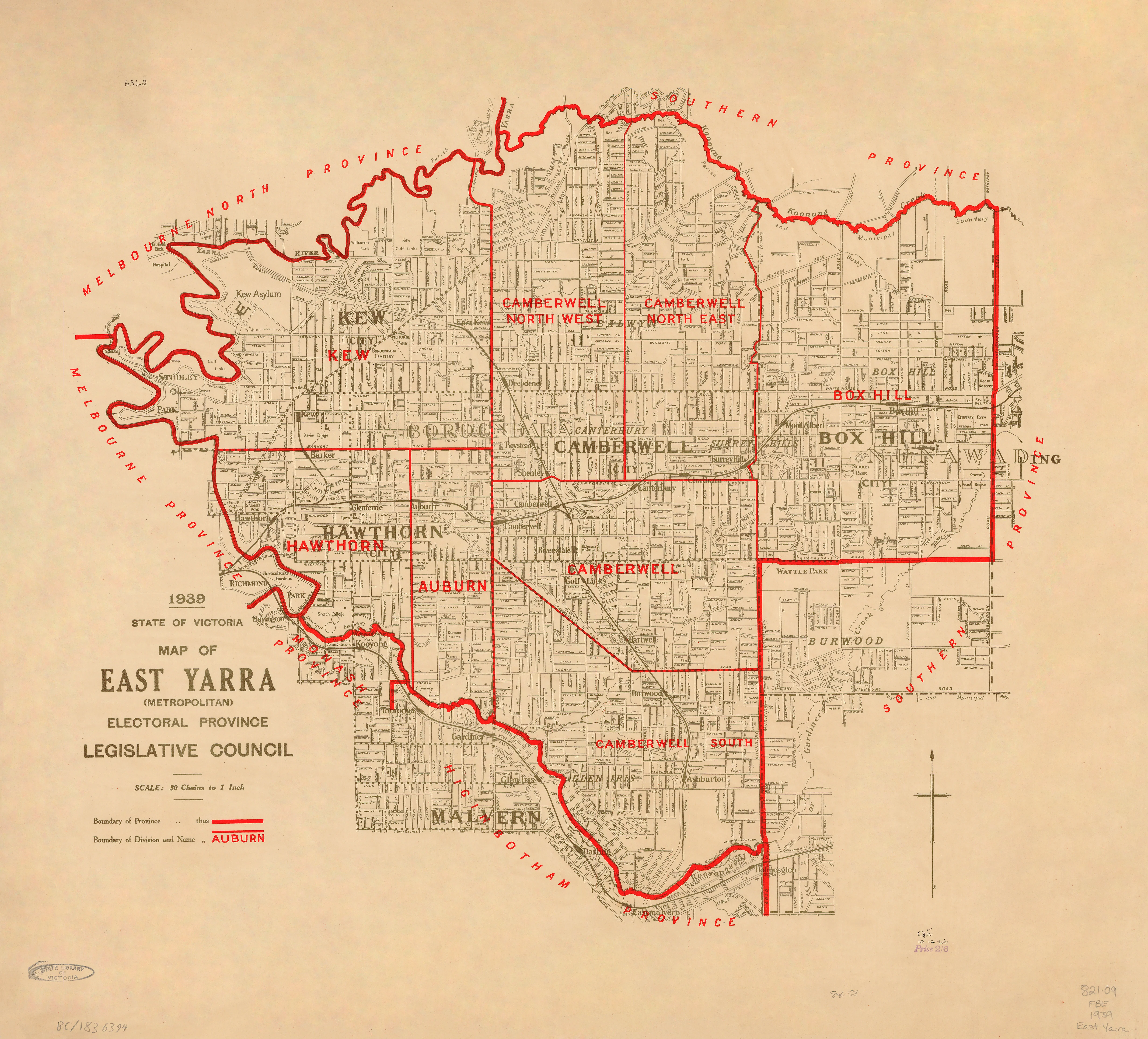
1939 — State of Victoria
East Yarra (Metropolitan) Electoral Province
Legislative Council Electoral Map
This official 1939 electoral map of the East Yarra (Metropolitan) Electoral Province was prepared and issued by the Department of Crown Lands and Survey, documenting Legislative Council boundaries across Melbourne’s inner-eastern suburbs during the late interwar period.
East Yarra encompassed some of Victoria’s most established and politically active metropolitan districts—areas shaped by early suburbanisation, tram and rail corridors, and a dense civic fabric. Produced as a working government document, the map emphasises clarity, accuracy, and administrative purpose, qualities that now give it lasting historical and visual authority.
🗳️ What the Map Shows
-
Legislative Council boundaries for the East Yarra (Metropolitan) Electoral Province
-
Detailed inner-eastern suburban layout and locality naming
-
Clear boundary delineation at large working scale
-
Minimalist, survey-grade cartography typical of late-1930s government mapping
📜 Historical Context
Issued in 1939, this map captures Melbourne’s electoral geography immediately before World War II and prior to the major post-war redistributions that reshaped metropolitan Victoria. It preserves a precise pre-war snapshot of inner-metropolitan political representation, making it a valuable reference for understanding Melbourne’s civic and electoral evolution.
✨ Premium Print & Display Options
Each copy is printed in Australia using archival processes to preserve the original linework and tonal balance.
| Finish | Description |
|---|---|
| 📄 Heavyweight Paper (160 gsm matte) | Archival matte surface with excellent definition. |
| 🔒 Laminated (True Encapsulation) | Sealed between 2 × 80-micron gloss laminate; tear-resistant, wipe-clean, and durable. |
| 🎨 Archival Canvas (395 gsm HP Professional Matte) | Pigment-based, fade-resistant inks with strong visual presence. |
| 🪵 Laminated + Timber Hang Rails | Natural lacquered timber rails, ready to hang (allow up to 10 working days). |
| 🪵 Canvas + Timber Hang Rails | Gallery-ready, frame-free finish (allow up to 10 working days). |
📐 Size (W × H)
1000 mm × 904 mm
Orientation: Landscape
Custom sizing: Available on request.
🎯 Ideal For
-
Victorian electoral and parliamentary history
-
Inner-Melbourne and East Yarra local studies
-
Libraries, universities, and archives
-
Civic offices and institutional interiors
-
Collectors of Australian government and political maps
🤝 Our Commitment
Printed locally in Australia, every map is carefully colour-managed and quality-checked to honour the intent and precision of the original 1939 government issue.
A clear and authoritative record of East Yarra’s metropolitan electorate at a defining moment in Victoria’s political history.
Original: $64.36
-65%$64.36
$22.53Product Information
Product Information
Shipping & Returns
Shipping & Returns
Description
1939 — State of Victoria
East Yarra (Metropolitan) Electoral Province
Legislative Council Electoral Map
This official 1939 electoral map of the East Yarra (Metropolitan) Electoral Province was prepared and issued by the Department of Crown Lands and Survey, documenting Legislative Council boundaries across Melbourne’s inner-eastern suburbs during the late interwar period.
East Yarra encompassed some of Victoria’s most established and politically active metropolitan districts—areas shaped by early suburbanisation, tram and rail corridors, and a dense civic fabric. Produced as a working government document, the map emphasises clarity, accuracy, and administrative purpose, qualities that now give it lasting historical and visual authority.
🗳️ What the Map Shows
-
Legislative Council boundaries for the East Yarra (Metropolitan) Electoral Province
-
Detailed inner-eastern suburban layout and locality naming
-
Clear boundary delineation at large working scale
-
Minimalist, survey-grade cartography typical of late-1930s government mapping
📜 Historical Context
Issued in 1939, this map captures Melbourne’s electoral geography immediately before World War II and prior to the major post-war redistributions that reshaped metropolitan Victoria. It preserves a precise pre-war snapshot of inner-metropolitan political representation, making it a valuable reference for understanding Melbourne’s civic and electoral evolution.
✨ Premium Print & Display Options
Each copy is printed in Australia using archival processes to preserve the original linework and tonal balance.
| Finish | Description |
|---|---|
| 📄 Heavyweight Paper (160 gsm matte) | Archival matte surface with excellent definition. |
| 🔒 Laminated (True Encapsulation) | Sealed between 2 × 80-micron gloss laminate; tear-resistant, wipe-clean, and durable. |
| 🎨 Archival Canvas (395 gsm HP Professional Matte) | Pigment-based, fade-resistant inks with strong visual presence. |
| 🪵 Laminated + Timber Hang Rails | Natural lacquered timber rails, ready to hang (allow up to 10 working days). |
| 🪵 Canvas + Timber Hang Rails | Gallery-ready, frame-free finish (allow up to 10 working days). |
📐 Size (W × H)
1000 mm × 904 mm
Orientation: Landscape
Custom sizing: Available on request.
🎯 Ideal For
-
Victorian electoral and parliamentary history
-
Inner-Melbourne and East Yarra local studies
-
Libraries, universities, and archives
-
Civic offices and institutional interiors
-
Collectors of Australian government and political maps
🤝 Our Commitment
Printed locally in Australia, every map is carefully colour-managed and quality-checked to honour the intent and precision of the original 1939 government issue.
A clear and authoritative record of East Yarra’s metropolitan electorate at a defining moment in Victoria’s political history.


