Eastern Australia with Tasmania, New Guinea & the Western Pacific (c. 1840s–1860s)
The Admiralty’s long-range view of Australia and its Pacific neighbourhood
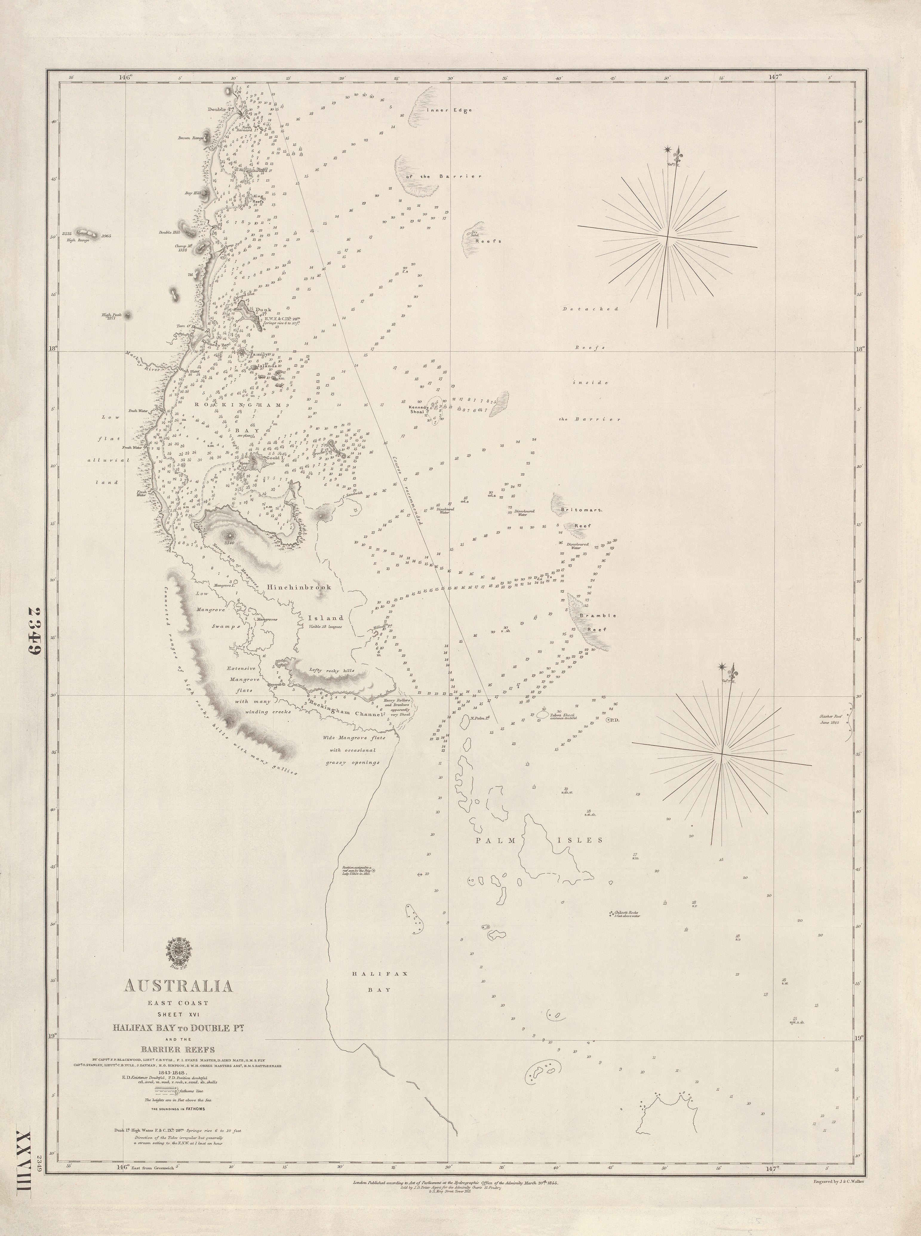
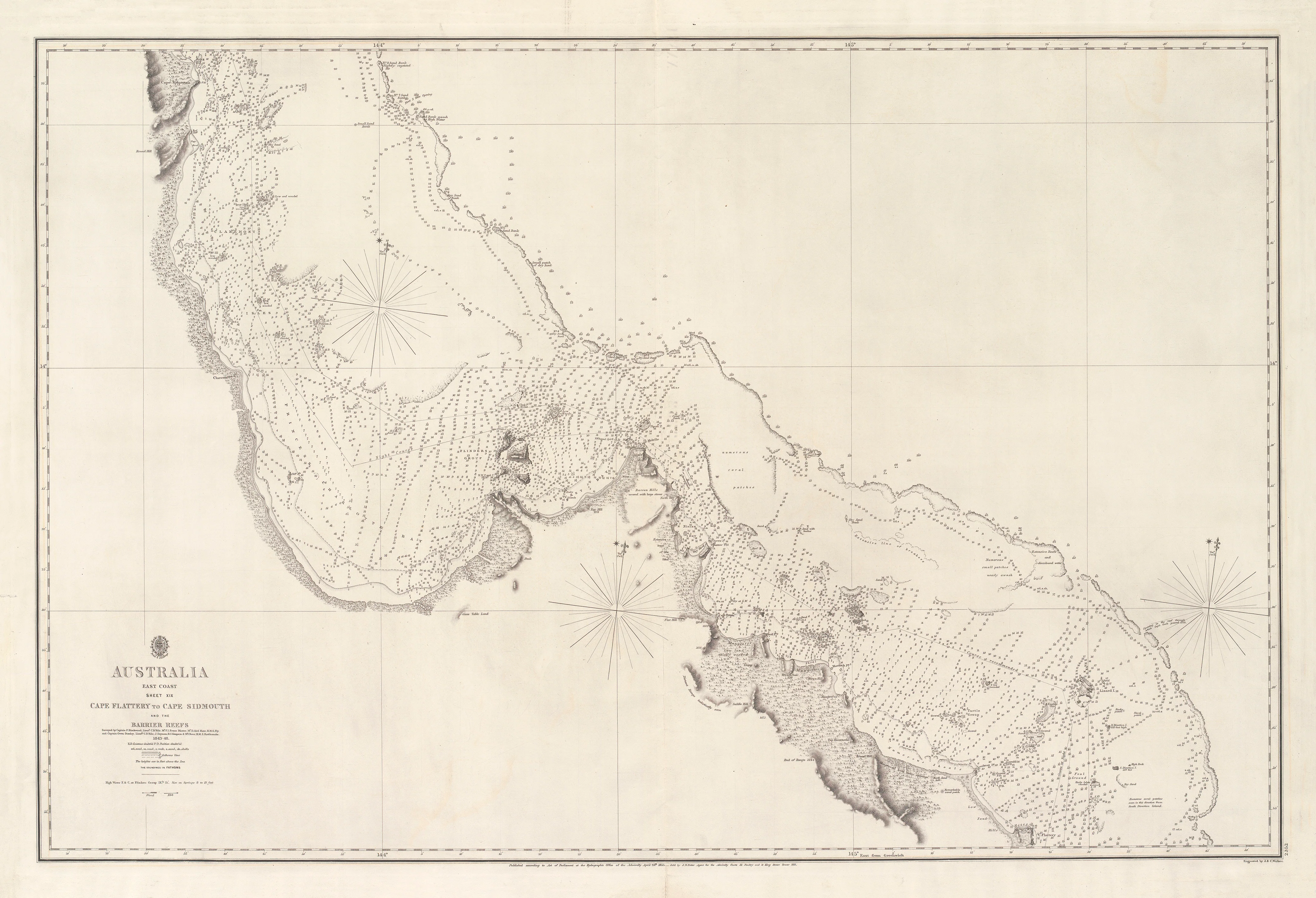
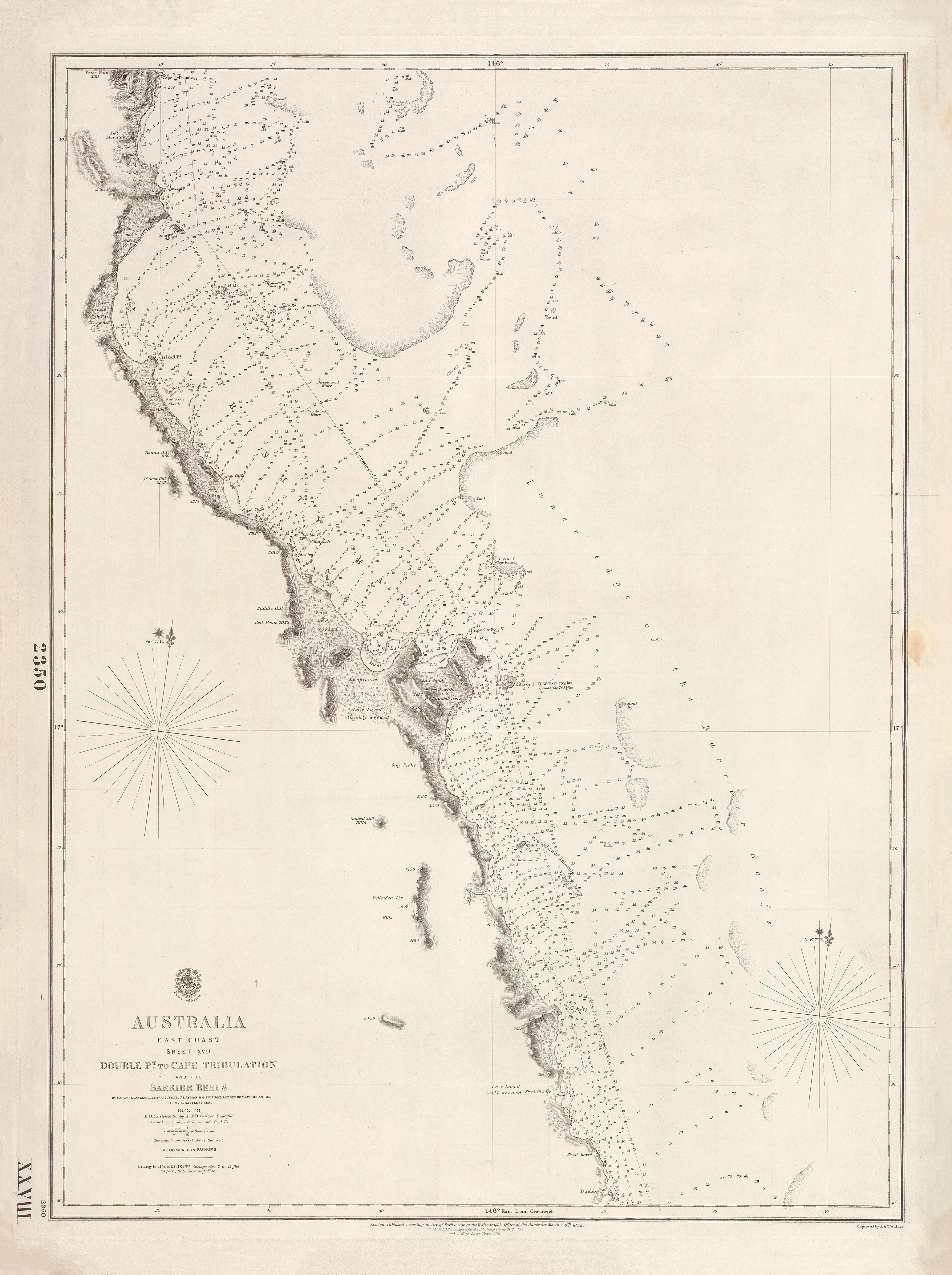
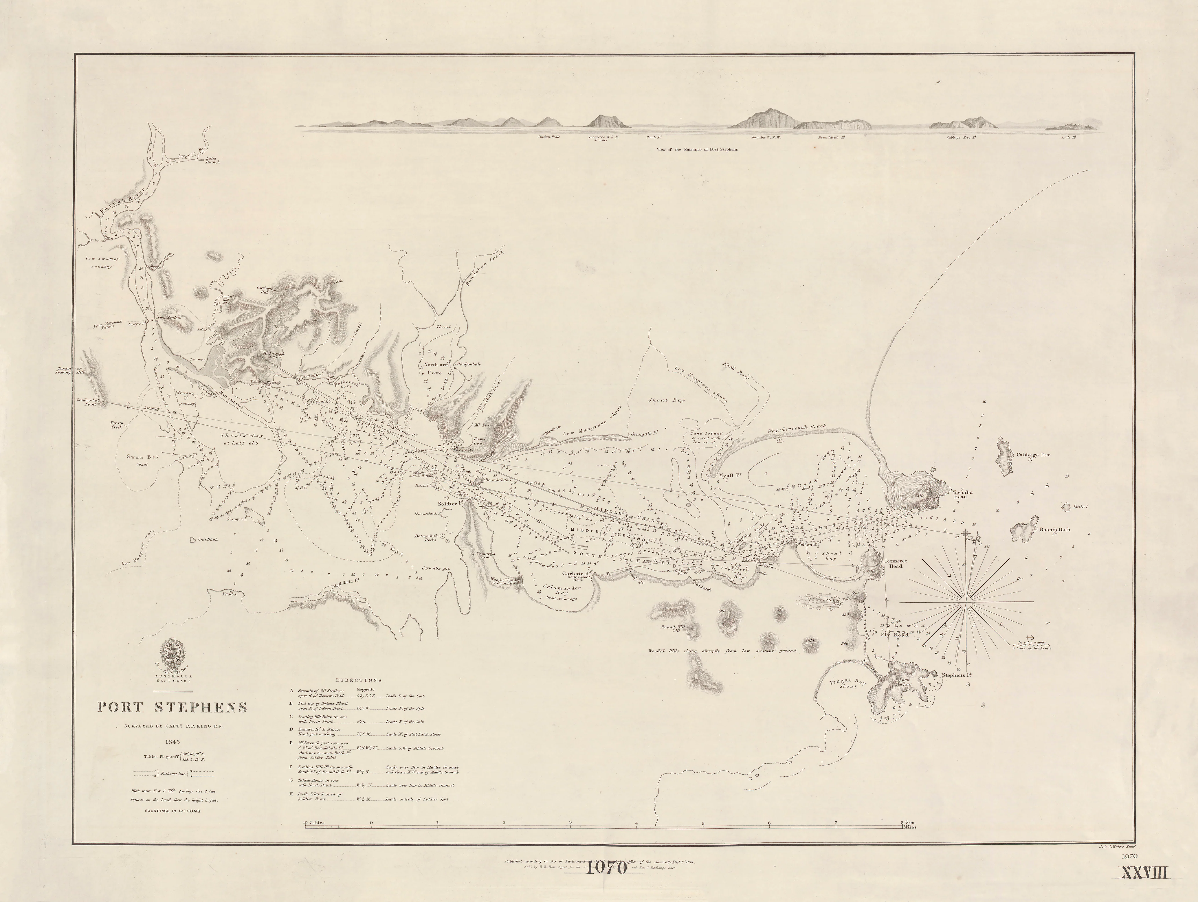
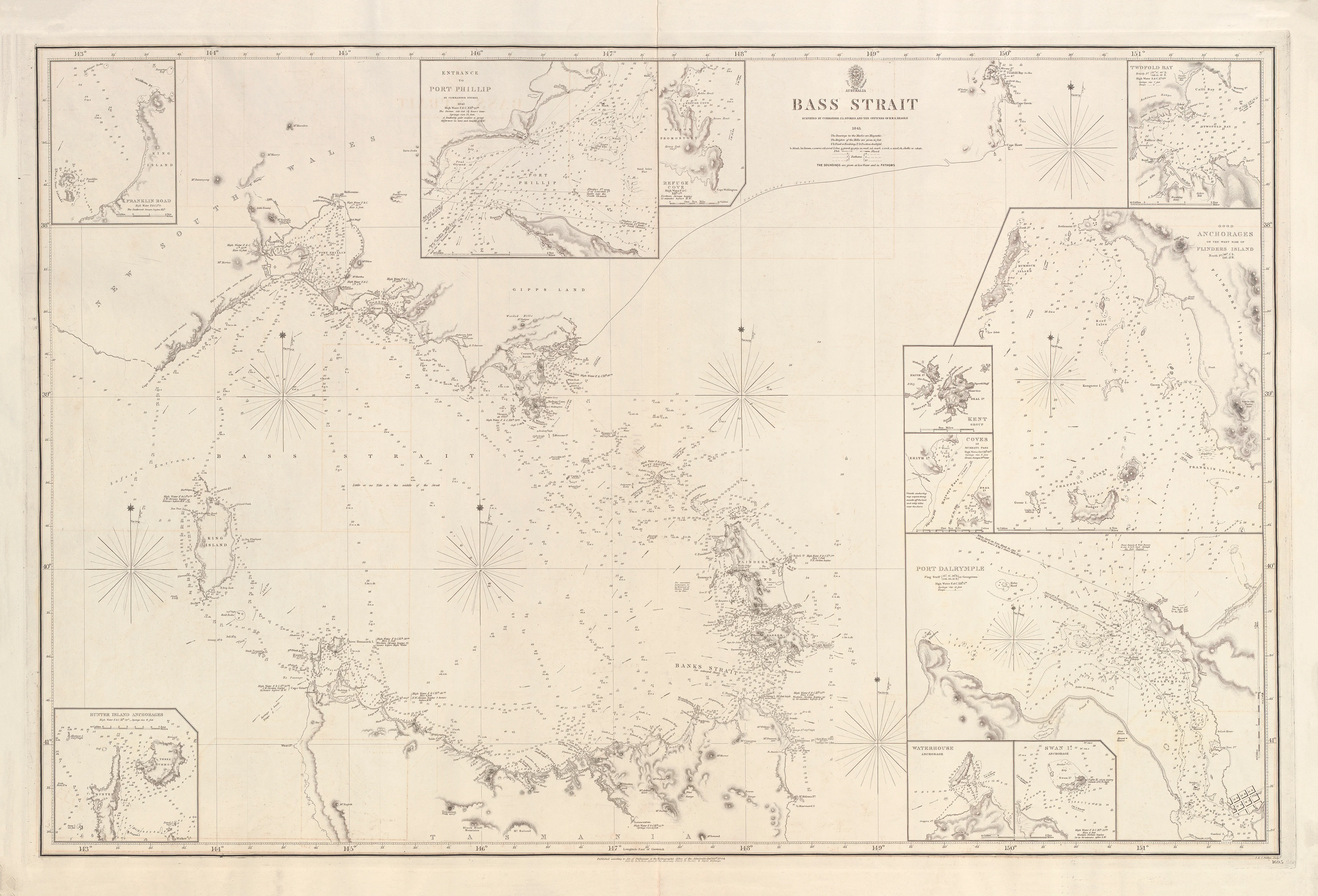
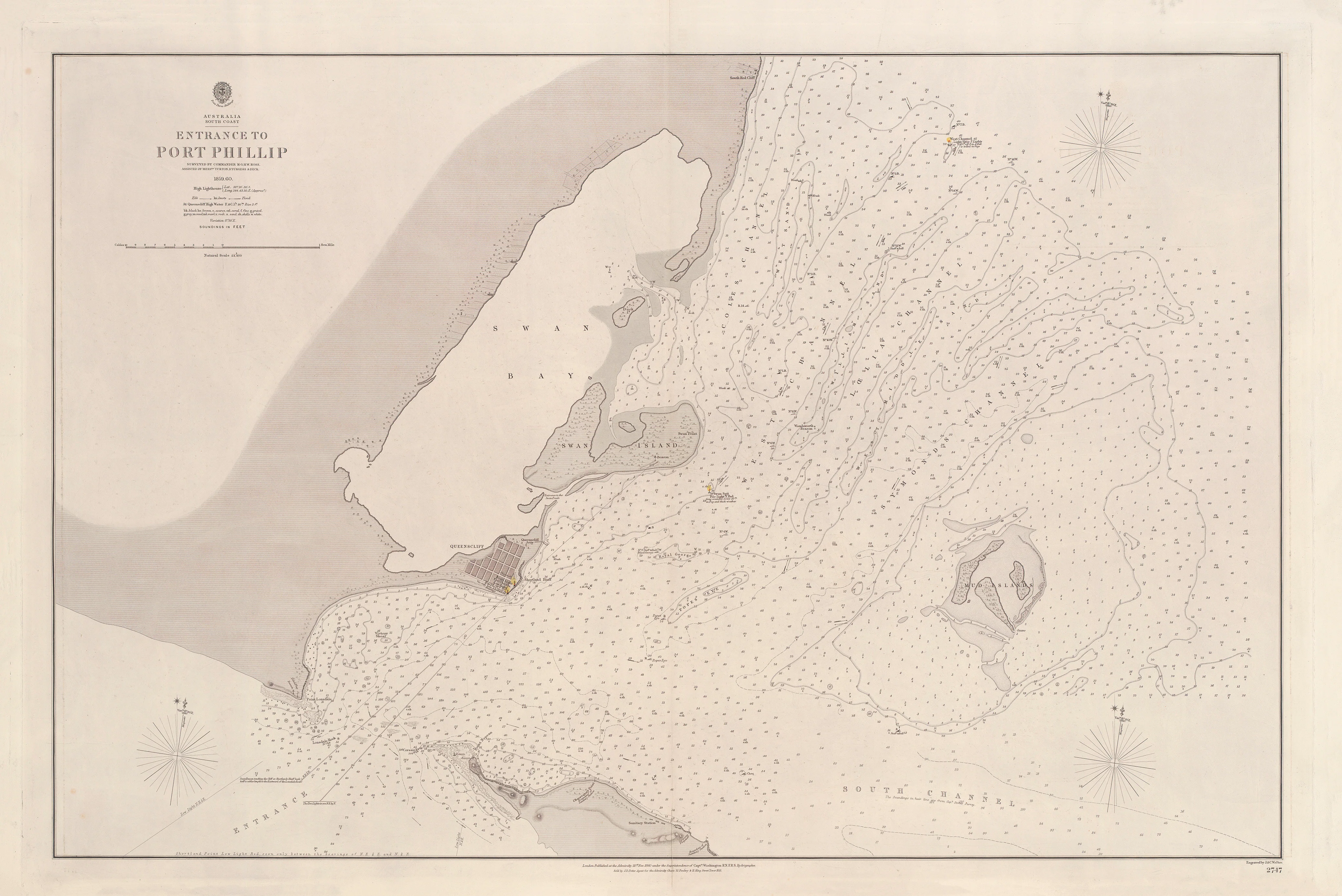
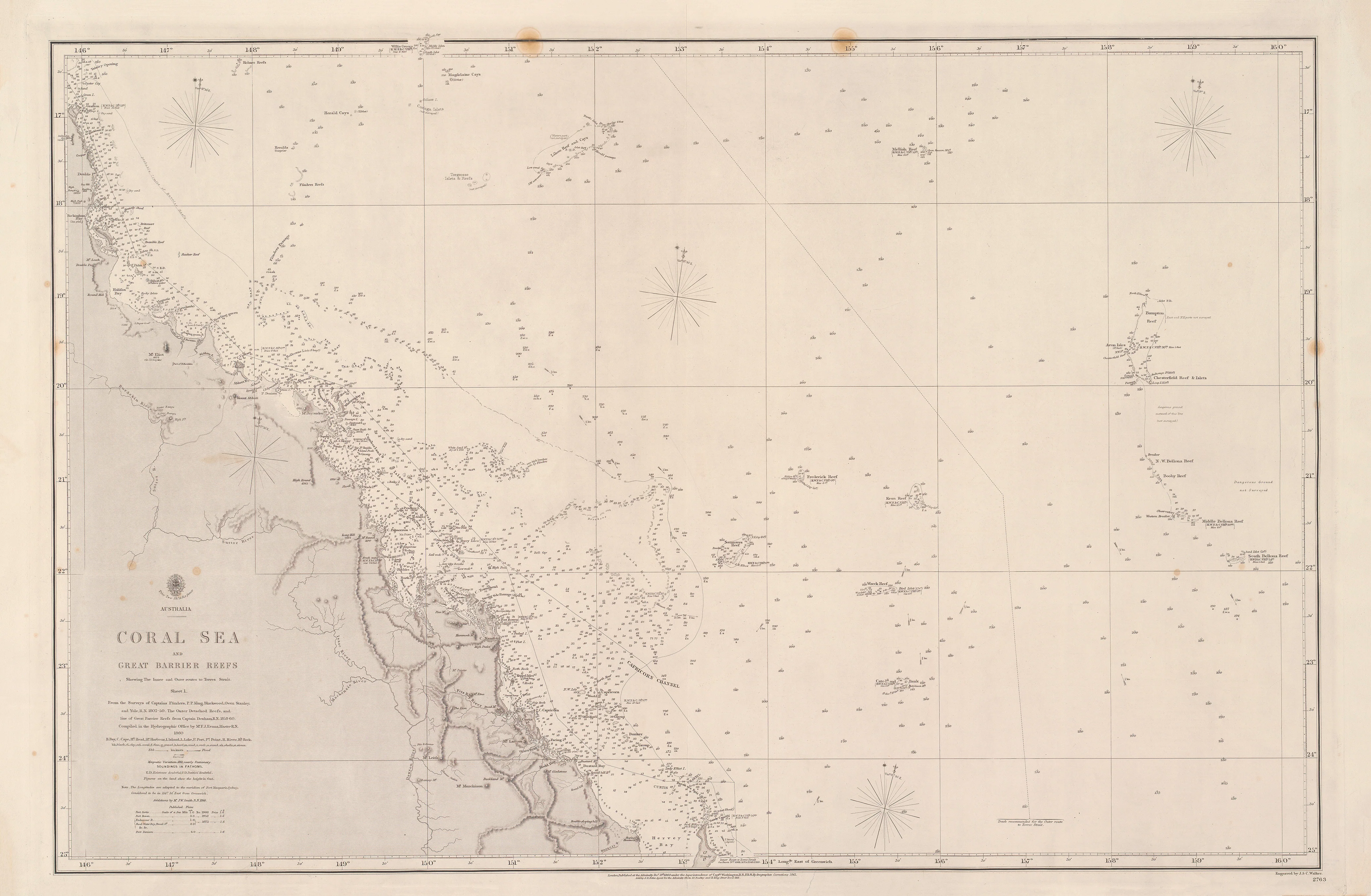
This striking British Admiralty chart presents a rare, panoramic vision of Eastern Australia set within its wider Pacific context. Stretching from Tasmania northward to New Guinea, and eastward across the Caroline and Mariana Islands, it captures the geographic reality faced by 19th-century navigators, traders and imperial planners: Australia was not an island world, but a hub within a vast ocean network.
Compiled and published by the Great Britain Hydrographic Department, this map was designed for big-picture navigation and strategy—a synthesis of coastlines, islands and routes rather than a harbour-by-harbour pilot.
This is not a local chart.
It is Australia seen at oceanic scale.
🌊 What This Map Shows
This long-format Admiralty sheet reveals the eastern half of Australia and the Western Pacific in commanding overview.
-
Eastern Australia from Cape York to Tasmania
-
Tasmania shown in full relation to the mainland
-
New Guinea to the north
-
Caroline Islands & Mariana Islands across the western Pacific
-
Major coastlines and island chains rendered with Admiralty clarity
-
Relief shown by hachures, emphasising landform and prominence
-
Greenwich prime meridian — true Admiralty reference standard
This is the map that let mariners understand distance, direction, and connection across thousands of nautical miles.
🧭 Why This Map Works
Most historical maps focus narrowly on colonies.
This one shows the system they belonged to.
-
True British Admiralty production — authoritative and operational
-
Pacific-wide perspective linking Australia to Asia and Micronesia
-
Rare elongated format ideal for wall display
-
Historic synthesis of exploration-era geography
-
Museum-grade engraving with disciplined, functional design
This is a map for understanding Australia’s place in the Pacific, not just its shoreline.
✨ Premium Finishes
Every Eastern Australia & Western Pacific Admiralty Map is printed in Australia using archival methods to preserve the fine linework and historic tone.
| Format | Description |
|---|---|
| 📜 Paper (160 gsm matte) | Smooth heavyweight archival paper with excellent line clarity. Ideal for framing under glass. |
| 🧼 Laminated (True Encapsulation) | 2 × 80-micron gloss laminate, edge-to-edge protection; tear-resistant and wipe-clean. |
| 🖼️ Canvas (395 gsm HP Professional Matte) | Pigment-based, fade-resistant inks for a warm, gallery-grade presence. |
| 🪵 Laminated + Timber Hang Rails | Natural timber rails with cord; ready to hang. Allow up to 10 working days. |
| 🪵 Canvas + Timber Hang Rails | Elegant frameless presentation with lacquered natural timber rails. Allow up to 10 working days. |
📐 Size
490 mm (W) × 1400 mm (H)
A dramatic vertical panorama that emphasises the north–south sweep from Tasmania to New Guinea and beyond.
🎯 Ideal For
-
Australian and Pacific history collectors
-
Maritime and naval heritage interiors
-
Museums, libraries and universities
-
Strategy rooms and boardrooms
-
Anyone fascinated by Australia’s Pacific connections
🤝 Our Commitment
-
Printed in Australia with professional colour management
-
Archival pigment inks for long-term colour stability
-
Premium laminates and canvas for durability
-
Natural timber hang rails for refined presentation
-
Hand-checked and carefully packed before dispatch
Australia does not end at its shoreline.
Choose your finish and place this rare Admiralty view of the Pacific on your wall.