Eastern Caribbean Imray Chart
Imray Nautical Chart — Eastern Caribbean (Hispaniola to Venezuela)
For bluewater passages, island-hopping routes, and confident navigation across the Caribbean basin
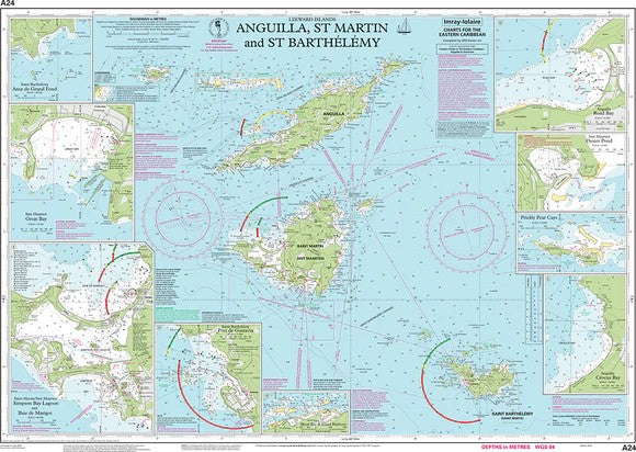
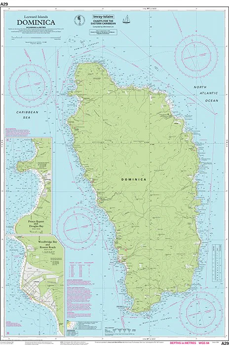
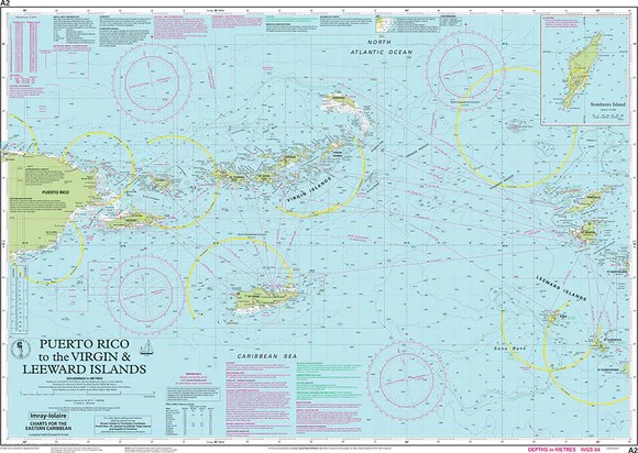
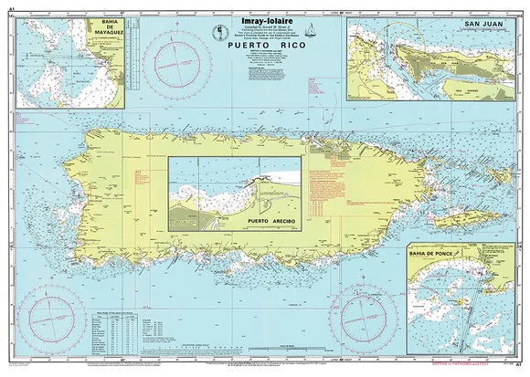
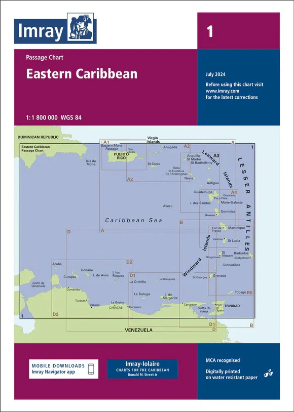
A cornerstone chart for serious cruisers, this Imray Eastern Caribbean General Chart (1:1,800,000) delivers a commanding overview of one of the world’s most celebrated sailing regions. Stretching from Hispaniola in the north to the coast of Venezuela in the south, it captures the full sweep of the Lesser Antilles arc—a region defined by trade winds, volcanic islands, and some of the finest cruising grounds on Earth.
This is the chart you open when planning the big picture—understanding distances between island groups, plotting offshore legs, and visualising the rhythm of the Caribbean. Clear, dependable, and built for life aboard, it’s a trusted companion whether you’re preparing for a passage or already at sea.
🧭 Why skippers trust Imray
- Globally respected standard — widely regarded as one of the most reliable chart series for cruising sailors
- Clarity at scale — a clean, readable layout ideal for long-distance route planning
- Hydrographic accuracy — based on official survey data, enhanced with real-world cruising insight
- Cruiser intelligence built in — includes anchorages, facilities, and local detail often absent from official charts
- Battle-tested heritage — informed by decades of Caribbean sailing knowledge and field research
🌊 What this chart covers
- Primary coverage — Hispaniola (Dominican Republic) to Venezuela
- Island chains — Virgin Islands, Leeward Islands, Windward Islands, Barbados, and Tobago
- Regional context — ideal spacing and positioning of islands for passage planning
- Offshore navigation — key routes across open water between island groups
- Coastal hazards — reefs, shoals, and exposed coastlines clearly defined
- Strategic overview — perfect for understanding seasonal cruising routes and trade-wind passages
🧭 How this chart fits your navigation setup
- Passage planning tool — visualise multi-leg journeys across the Caribbean
- Bridge or chart table reference — quick, reliable overview under pressure
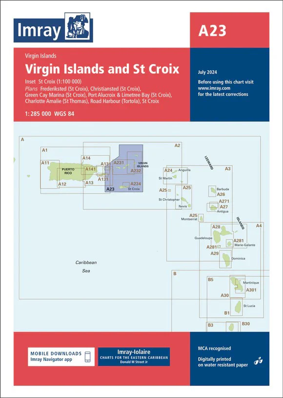
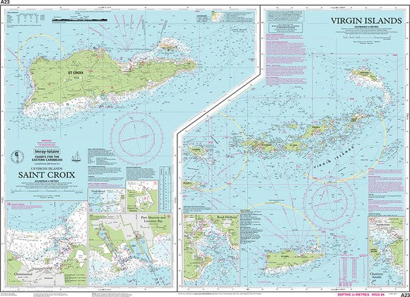
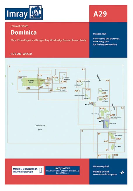
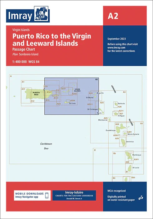
- Companion chart — pairs perfectly with detailed Imray A-Series charts for harbour and approach work
- Training & briefing — ideal for crew briefings and voyage preparation
⚓ Built for real-world sailing
Imray charts are engineered specifically for onboard use:
- Printed on durable, water-resistant Pretex paper for longevity at sea
- Designed for high legibility in variable light conditions
- Includes magnetic variation data and ongoing updates
- Folded or flat formats available depending on use-case
- Proven usability in both coastal and offshore navigation environments
🔄 Chart corrections & live updates
Navigation never stands still—and neither do Imray charts:
- Regular updates issued via Imray Notices to Mariners
- Free downloadable corrections available online
- QR codes printed on the chart for instant smartphone access to updates and supplements
- Ensures your chart remains current and voyage-ready
🎨 Field-Ready Print Options
📄 Paper (120 gsm matte — water-resistant)
- Flexible, lightweight, and ideal for chart tables
- Resistant to splashes and repeated handling
- Best suited for folios and passage planning
🔒 Laminated (soft-matte writeable front / gloss back, edge-sealed)
- Write-on/wipe-off surface for routes, bearings, and notes
- Highly durable and tear-resistant
- Excellent for repeated onboard use
💡 Soft-matte front reduces glare and allows grease pencil or marker use; gloss reverse adds structural strength.
📐 Specifications
| Field | Details |
|---|---|
| Chart Title | Eastern Caribbean |
| Publisher | Imray |
| Scale | 1:1,800,000 |
| Coverage | Hispaniola to Venezuela, including the Lesser Antilles |
| Series | Imray Caribbean Series / Passage Chart |
| Edition | 2024 (updated to latest corrections) |
| Sheet Size | Approx. 640 × 900 mm |
| Format | Flat or folded chart |
| Material | Water-resistant Pretex paper |
| Available Finishes | Paper (120 gsm matte); Laminated (soft-matte writeable front, gloss back, edge-sealed) |
| Inks | Pigment-based, fade-resistant |
| Origin | Printed in Australia |
| Availability | Order on demand — allow up to 10 working days |
🌍 Why this chart matters
The Eastern Caribbean is not just a destination—it’s a network of islands shaped by wind, current, and culture. Distances matter. Routes matter. Timing matters. This chart brings it all together in a single, coherent view—giving you the confidence to move between islands with clarity and intent.
⚠️ Important note (mariner’s guidance)
This chart is intended for planning and reference purposes. For navigation, always use the latest official hydrographic charts, Notices to Mariners, and electronic navigation systems. Conditions at sea can change rapidly.
Ready to plan your Caribbean passage?
Select your finish and add to cart — we’ll print locally, hand-check, and ship with care.
Product Information
Product Information
Shipping & Returns
Shipping & Returns
Description
Imray Nautical Chart — Eastern Caribbean (Hispaniola to Venezuela)
For bluewater passages, island-hopping routes, and confident navigation across the Caribbean basin
A cornerstone chart for serious cruisers, this Imray Eastern Caribbean General Chart (1:1,800,000) delivers a commanding overview of one of the world’s most celebrated sailing regions. Stretching from Hispaniola in the north to the coast of Venezuela in the south, it captures the full sweep of the Lesser Antilles arc—a region defined by trade winds, volcanic islands, and some of the finest cruising grounds on Earth.
This is the chart you open when planning the big picture—understanding distances between island groups, plotting offshore legs, and visualising the rhythm of the Caribbean. Clear, dependable, and built for life aboard, it’s a trusted companion whether you’re preparing for a passage or already at sea.
🧭 Why skippers trust Imray
- Globally respected standard — widely regarded as one of the most reliable chart series for cruising sailors
- Clarity at scale — a clean, readable layout ideal for long-distance route planning
- Hydrographic accuracy — based on official survey data, enhanced with real-world cruising insight
- Cruiser intelligence built in — includes anchorages, facilities, and local detail often absent from official charts
- Battle-tested heritage — informed by decades of Caribbean sailing knowledge and field research
🌊 What this chart covers
- Primary coverage — Hispaniola (Dominican Republic) to Venezuela
- Island chains — Virgin Islands, Leeward Islands, Windward Islands, Barbados, and Tobago
- Regional context — ideal spacing and positioning of islands for passage planning
- Offshore navigation — key routes across open water between island groups
- Coastal hazards — reefs, shoals, and exposed coastlines clearly defined
- Strategic overview — perfect for understanding seasonal cruising routes and trade-wind passages
🧭 How this chart fits your navigation setup
- Passage planning tool — visualise multi-leg journeys across the Caribbean
- Bridge or chart table reference — quick, reliable overview under pressure
- Companion chart — pairs perfectly with detailed Imray A-Series charts for harbour and approach work
- Training & briefing — ideal for crew briefings and voyage preparation
⚓ Built for real-world sailing
Imray charts are engineered specifically for onboard use:
- Printed on durable, water-resistant Pretex paper for longevity at sea
- Designed for high legibility in variable light conditions
- Includes magnetic variation data and ongoing updates
- Folded or flat formats available depending on use-case
- Proven usability in both coastal and offshore navigation environments
🔄 Chart corrections & live updates
Navigation never stands still—and neither do Imray charts:
- Regular updates issued via Imray Notices to Mariners
- Free downloadable corrections available online
- QR codes printed on the chart for instant smartphone access to updates and supplements
- Ensures your chart remains current and voyage-ready
🎨 Field-Ready Print Options
📄 Paper (120 gsm matte — water-resistant)
- Flexible, lightweight, and ideal for chart tables
- Resistant to splashes and repeated handling
- Best suited for folios and passage planning
🔒 Laminated (soft-matte writeable front / gloss back, edge-sealed)
- Write-on/wipe-off surface for routes, bearings, and notes
- Highly durable and tear-resistant
- Excellent for repeated onboard use
💡 Soft-matte front reduces glare and allows grease pencil or marker use; gloss reverse adds structural strength.
📐 Specifications
| Field | Details |
|---|---|
| Chart Title | Eastern Caribbean |
| Publisher | Imray |
| Scale | 1:1,800,000 |
| Coverage | Hispaniola to Venezuela, including the Lesser Antilles |
| Series | Imray Caribbean Series / Passage Chart |
| Edition | 2024 (updated to latest corrections) |
| Sheet Size | Approx. 640 × 900 mm |
| Format | Flat or folded chart |
| Material | Water-resistant Pretex paper |
| Available Finishes | Paper (120 gsm matte); Laminated (soft-matte writeable front, gloss back, edge-sealed) |
| Inks | Pigment-based, fade-resistant |
| Origin | Printed in Australia |
| Availability | Order on demand — allow up to 10 working days |
🌍 Why this chart matters
The Eastern Caribbean is not just a destination—it’s a network of islands shaped by wind, current, and culture. Distances matter. Routes matter. Timing matters. This chart brings it all together in a single, coherent view—giving you the confidence to move between islands with clarity and intent.
⚠️ Important note (mariner’s guidance)
This chart is intended for planning and reference purposes. For navigation, always use the latest official hydrographic charts, Notices to Mariners, and electronic navigation systems. Conditions at sea can change rapidly.
Ready to plan your Caribbean passage?
Select your finish and add to cart — we’ll print locally, hand-check, and ship with care.