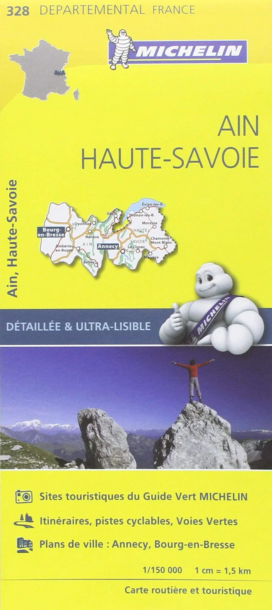
France Ain / Haute-Savoie Michelin Map 328
The Most Detailed Road Map of Eastern France’s Lakes, Mountains & Countryside
Explore the alpine beauty and tranquil backroads of eastern France with Michelin Map 328: Ain / Haute-Savoie. Renowned for its accuracy and clarity, this is Michelin’s most detailed map of the region, offering full coverage of every road, village, and scenic detour at a precision scale of 1:150,000.
Whether you're navigating the shores of Lake Geneva (Lac Léman), touring the pre-Alps, or venturing through remote valleys and charming towns such as Annecy, Chambéry, or Oyonnax, this map ensures you don’t miss a thing—from the obvious highlights to the hidden gems.
🗺️ Map Features
-
Covers the departments of Ain and Haute-Savoie, including major towns such as Annecy, Thonon-les-Bains, Chambéry, and Bourg-en-Bresse
-
Shows all roads, including minor rural routes, mountain passes, and scenic byways
-
Clearly marks villages, hamlets, lakes, rivers, and protected natural areas
-
Ideal for navigating alpine routes, lakeside drives, and countryside escapes
-
Fully indexed for easy reference and route planning
-
Includes a driving distance chart to help you plan efficient day trips and itineraries
-
Produced by Michelin, the trusted name in European travel and cartography
📐 Specifications
| Attribute | Detail |
|---|---|
| Map Title | Michelin Map 328: Ain / Haute-Savoie |
| Scale | 1:150,000 |
| Size (open) | 1200 mm x 1000 mm |
| Format | Folded paper map |
| Index | Yes – full place-name index included |
| Distance Chart | Yes – included on map |
| Publisher | Michelin Maps, France |
🏔️ Perfect For:
-
Mountain drives through the French Alps and Jura foothills
-
Lake tourism around Lake Geneva and Lake Annecy
-
Rural exploration of France’s lesser-known villages and valleys
-
Cycling and walking tours in highland and border regions
-
Cross-border travel near Switzerland with detailed route information
-
Holiday planning, relocation, or business logistics in southeastern France
📦 Order & Delivery Information
📌 Please note: This map is ordered on demand.
🕒 Delivery time: Please allow 7–10 working days.
Each map is carefully sourced and shipped to ensure the most up-to-date edition and a pristine finish.
✅ Why Choose Michelin Map 328?
| Feature | Benefit |
|---|---|
| Exceptional Detail | Ideal for scenic drives and rural navigation |
| Accurate & Reliable | Produced by Michelin, France’s premier mapmaker |
| Indexed & Distance Marked | Easy to use and perfect for itinerary planning |
| Folded Format | Practical for travel – fits neatly into backpacks, car pockets, or map cases |
| Covers Towns & Terrain | Combines urban and natural features for complete regional coverage |
Whether you're following the Route des Grandes Alpes, relaxing in the spa towns of the Jura, or simply seeking to escape the crowds, Michelin Map 328 – Ain & Haute-Savoie is your essential companion for navigating this breathtaking corner of France.
Original: $17.85
-65%$17.85
$6.25Product Information
Product Information
Shipping & Returns
Shipping & Returns
Description
The Most Detailed Road Map of Eastern France’s Lakes, Mountains & Countryside
Explore the alpine beauty and tranquil backroads of eastern France with Michelin Map 328: Ain / Haute-Savoie. Renowned for its accuracy and clarity, this is Michelin’s most detailed map of the region, offering full coverage of every road, village, and scenic detour at a precision scale of 1:150,000.
Whether you're navigating the shores of Lake Geneva (Lac Léman), touring the pre-Alps, or venturing through remote valleys and charming towns such as Annecy, Chambéry, or Oyonnax, this map ensures you don’t miss a thing—from the obvious highlights to the hidden gems.
🗺️ Map Features
-
Covers the departments of Ain and Haute-Savoie, including major towns such as Annecy, Thonon-les-Bains, Chambéry, and Bourg-en-Bresse
-
Shows all roads, including minor rural routes, mountain passes, and scenic byways
-
Clearly marks villages, hamlets, lakes, rivers, and protected natural areas
-
Ideal for navigating alpine routes, lakeside drives, and countryside escapes
-
Fully indexed for easy reference and route planning
-
Includes a driving distance chart to help you plan efficient day trips and itineraries
-
Produced by Michelin, the trusted name in European travel and cartography
📐 Specifications
| Attribute | Detail |
|---|---|
| Map Title | Michelin Map 328: Ain / Haute-Savoie |
| Scale | 1:150,000 |
| Size (open) | 1200 mm x 1000 mm |
| Format | Folded paper map |
| Index | Yes – full place-name index included |
| Distance Chart | Yes – included on map |
| Publisher | Michelin Maps, France |
🏔️ Perfect For:
-
Mountain drives through the French Alps and Jura foothills
-
Lake tourism around Lake Geneva and Lake Annecy
-
Rural exploration of France’s lesser-known villages and valleys
-
Cycling and walking tours in highland and border regions
-
Cross-border travel near Switzerland with detailed route information
-
Holiday planning, relocation, or business logistics in southeastern France
📦 Order & Delivery Information
📌 Please note: This map is ordered on demand.
🕒 Delivery time: Please allow 7–10 working days.
Each map is carefully sourced and shipped to ensure the most up-to-date edition and a pristine finish.
✅ Why Choose Michelin Map 328?
| Feature | Benefit |
|---|---|
| Exceptional Detail | Ideal for scenic drives and rural navigation |
| Accurate & Reliable | Produced by Michelin, France’s premier mapmaker |
| Indexed & Distance Marked | Easy to use and perfect for itinerary planning |
| Folded Format | Practical for travel – fits neatly into backpacks, car pockets, or map cases |
| Covers Towns & Terrain | Combines urban and natural features for complete regional coverage |
Whether you're following the Route des Grandes Alpes, relaxing in the spa towns of the Jura, or simply seeking to escape the crowds, Michelin Map 328 – Ain & Haute-Savoie is your essential companion for navigating this breathtaking corner of France.


