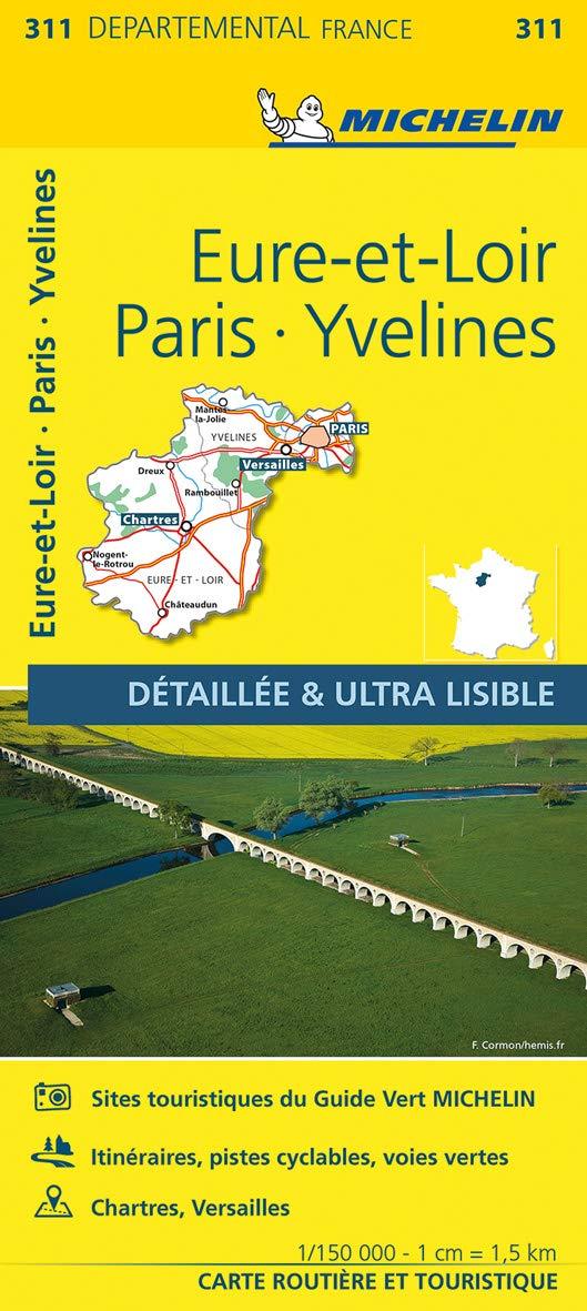
France Eure-et-Loir, Paris & Yvelines Michelin Map 311
Scale 1:150,000 | High-Detail Regional Map for Day Trips & Scenic Exploration
🏰 From City Lights to Countryside Charm – Discover Greater Paris and Beyond
The Michelin Local Map 311 covers one of France’s most diverse and dynamic regions — combining the world-famous cultural capital Paris with the surrounding departments of Yvelines and Eure-et-Loir. This ultra-detailed map offers an unparalleled view of both the urban intricacies of the Paris region and the rural charm of the Île-de-France and Centre-Val de Loire.
With a scale of 1:150,000 (1 cm = 1.5 km), it shows every road, hamlet, and hidden chateau, making it ideal for day-trippers, slow travellers, and history buffs alike.
🔍 Key Features
| Feature Description | Included ✅ |
|---|---|
| 🛣️ Full road network from motorways to backroads | ✅ |
| 🏘️ Minor villages, scenic routes, and rural hamlets | ✅ |
| 🗼 Greater Paris detail and iconic landmarks | ✅ |
| 🏰 Castles, abbeys, natural parks & tourist attractions | ✅ |
| 🧭 Index of towns and villages for quick reference | ✅ |
| 📏 Distance & driving time chart | ✅ |
| 🗺️ Multilingual key (English, French, German, Spanish, Italian, Dutch) | ✅ |
📍 Regional Coverage Includes:
-
Paris & western suburbs: Versailles, Saint-Germain-en-Laye, Rambouillet
-
Yvelines: Home of the Palace of Versailles, forests, and historic châteaux
-
Eure-et-Loir: Including Chartres Cathedral, charming towns, and wheat plains
-
Scenic drives through Chevreuse Valley and Perche Regional Nature Park
-
Country roads ideal for cycling, walking, and slow travel itineraries
📐 Specifications
| Specification | Details |
|---|---|
| Map Title | Michelin Local Map 311 – Eure-et-Loir / Paris / Yvelines |
| Scale | 1:150,000 (1 cm = 1.5 km) |
| Size (Unfolded) | 1200 mm x 1000 mm |
| Format | Folded paper map |
| Language | Local place names with multilingual key |
| Publisher | Michelin Maps, France |
🎯 Perfect For:
-
🏰 Visitors exploring Versailles, Chartres, and Paris's rural hinterlands
-
🚗 Travellers seeking scenic drives and historic routes through Île-de-France
-
🥾 Hikers, cyclists, and countryside explorers
-
📸 Culture lovers mapping out châteaux, cathedrals, and quaint villages
🚚 Delivery Information
-
Order on Demand – Please allow 7–10 working days for delivery
-
Ships from Australia
Michelin Local Map 311 – Eure-et-Loir / Paris / Yvelines
🧭 From Paris’s grandeur to the tranquillity of the countryside, plan your perfect journey with Michelin’s most detailed regional map.
Original: $17.85
-65%$17.85
$6.25Product Information
Product Information
Shipping & Returns
Shipping & Returns
Description
Scale 1:150,000 | High-Detail Regional Map for Day Trips & Scenic Exploration
🏰 From City Lights to Countryside Charm – Discover Greater Paris and Beyond
The Michelin Local Map 311 covers one of France’s most diverse and dynamic regions — combining the world-famous cultural capital Paris with the surrounding departments of Yvelines and Eure-et-Loir. This ultra-detailed map offers an unparalleled view of both the urban intricacies of the Paris region and the rural charm of the Île-de-France and Centre-Val de Loire.
With a scale of 1:150,000 (1 cm = 1.5 km), it shows every road, hamlet, and hidden chateau, making it ideal for day-trippers, slow travellers, and history buffs alike.
🔍 Key Features
| Feature Description | Included ✅ |
|---|---|
| 🛣️ Full road network from motorways to backroads | ✅ |
| 🏘️ Minor villages, scenic routes, and rural hamlets | ✅ |
| 🗼 Greater Paris detail and iconic landmarks | ✅ |
| 🏰 Castles, abbeys, natural parks & tourist attractions | ✅ |
| 🧭 Index of towns and villages for quick reference | ✅ |
| 📏 Distance & driving time chart | ✅ |
| 🗺️ Multilingual key (English, French, German, Spanish, Italian, Dutch) | ✅ |
📍 Regional Coverage Includes:
-
Paris & western suburbs: Versailles, Saint-Germain-en-Laye, Rambouillet
-
Yvelines: Home of the Palace of Versailles, forests, and historic châteaux
-
Eure-et-Loir: Including Chartres Cathedral, charming towns, and wheat plains
-
Scenic drives through Chevreuse Valley and Perche Regional Nature Park
-
Country roads ideal for cycling, walking, and slow travel itineraries
📐 Specifications
| Specification | Details |
|---|---|
| Map Title | Michelin Local Map 311 – Eure-et-Loir / Paris / Yvelines |
| Scale | 1:150,000 (1 cm = 1.5 km) |
| Size (Unfolded) | 1200 mm x 1000 mm |
| Format | Folded paper map |
| Language | Local place names with multilingual key |
| Publisher | Michelin Maps, France |
🎯 Perfect For:
-
🏰 Visitors exploring Versailles, Chartres, and Paris's rural hinterlands
-
🚗 Travellers seeking scenic drives and historic routes through Île-de-France
-
🥾 Hikers, cyclists, and countryside explorers
-
📸 Culture lovers mapping out châteaux, cathedrals, and quaint villages
🚚 Delivery Information
-
Order on Demand – Please allow 7–10 working days for delivery
-
Ships from Australia
Michelin Local Map 311 – Eure-et-Loir / Paris / Yvelines
🧭 From Paris’s grandeur to the tranquillity of the countryside, plan your perfect journey with Michelin’s most detailed regional map.


