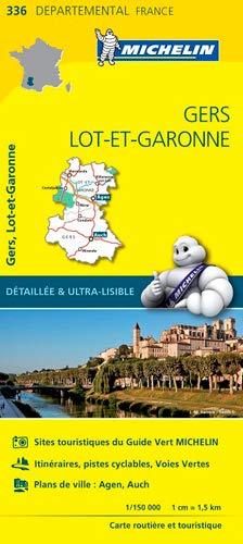
France Gers / Lot-et-Garonne Michelin Map 336
Scale: 1:150,000 | Folded Paper Map | Discover Hidden France in Detail
🌿 The Ultimate Map for Exploring the Heart of Gascony
The Michelin Local Map 336 offers the most detailed and reliable cartographic coverage available for Gers and Lot-et-Garonne, two departments in the southwest of France renowned for their slow-paced charm, sun-drenched villages, Armagnac vineyards, and fortified bastides.
At a large scale of 1:150,000, this map unveils every minor road, back lane, and hamlet—perfect for slow travel, rural adventures, and holidaymakers looking to escape the crowds. Whether you're planning a road trip through rolling countryside or seeking out the region’s best hidden gems, this map is your essential companion.
🌟 Regional Highlights
-
🏰 Auch, Condom & Lectoure — medieval towns with cathedrals, markets, and charm
-
🍇 Armagnac Country — follow winding roads through the home of France’s oldest brandy
-
🛶 Lot & Garonne Rivers — perfect for cycling routes and water-based leisure
-
🏡 Bastide Villages — discover Fourcès, Montréal-du-Gers, and other circular or grid-planned towns
-
🧀 Gastronomy Trails — explore foie gras farms, duck producers, and weekly local food markets
🧭 Map Features at a Glance
| ✔️ | Feature |
|---|---|
| 📌 | Extremely detailed scale — 1 cm = 1.5 km |
| 🛤️ | Shows all roads — from motorways to minor rural tracks |
| 🧭 | Full place name index for quick referencing |
| 🗺️ | Clear cartography with shaded relief and terrain features |
| 🧳 | Tourist sites, scenic routes, historic towns, and natural parks clearly marked |
| ⛽ | Practical info like service stations, rest areas & more |
| 📏 | Includes a distance chart to plan efficient routes & day trips |
📐 Specifications
| Detail | Specification |
|---|---|
| Map Title | Michelin Gers / Lot-et-Garonne Local Map 336 |
| Scale | 1:150,000 |
| Dimensions (unfolded) | 1200 mm x 1000 mm |
| Format | Folded paper map |
| Language | Multilingual legend (EN, FR, DE, ES, IT) |
| Edition | Michelin Local Map Series – France |
🎯 Who Should Use This Map?
-
🚗 Self-Drive Tourists — explore quiet roads, wine routes, and villages at your own pace
-
🥾 Walkers & Cyclists — ideal for planning rural walks, loops, and countryside exploration
-
🧭 Cultural Travellers — discover hidden cathedrals, abbeys, and châteaux not found on basic maps
-
🧺 Gourmands — plan scenic routes to food markets, vineyards, and gourmet towns
-
🏡 Holidaymakers — the perfect companion for your gîte, farmhouse or camping holiday in Gascony
📦 Order & Delivery
-
Format: Folded paper map
-
Ships from Australia
-
Ordered-on-demand — Please allow 7–10 working days for delivery
🇫🇷 Why Choose Michelin?
Michelin maps are synonymous with clarity, precision, and travel confidence. With over a century of mapping excellence, they remain the preferred choice of European travellers, combining rich detail with practical usability.
Original: $17.85
-65%$17.85
$6.25Product Information
Product Information
Shipping & Returns
Shipping & Returns
Description
Scale: 1:150,000 | Folded Paper Map | Discover Hidden France in Detail
🌿 The Ultimate Map for Exploring the Heart of Gascony
The Michelin Local Map 336 offers the most detailed and reliable cartographic coverage available for Gers and Lot-et-Garonne, two departments in the southwest of France renowned for their slow-paced charm, sun-drenched villages, Armagnac vineyards, and fortified bastides.
At a large scale of 1:150,000, this map unveils every minor road, back lane, and hamlet—perfect for slow travel, rural adventures, and holidaymakers looking to escape the crowds. Whether you're planning a road trip through rolling countryside or seeking out the region’s best hidden gems, this map is your essential companion.
🌟 Regional Highlights
-
🏰 Auch, Condom & Lectoure — medieval towns with cathedrals, markets, and charm
-
🍇 Armagnac Country — follow winding roads through the home of France’s oldest brandy
-
🛶 Lot & Garonne Rivers — perfect for cycling routes and water-based leisure
-
🏡 Bastide Villages — discover Fourcès, Montréal-du-Gers, and other circular or grid-planned towns
-
🧀 Gastronomy Trails — explore foie gras farms, duck producers, and weekly local food markets
🧭 Map Features at a Glance
| ✔️ | Feature |
|---|---|
| 📌 | Extremely detailed scale — 1 cm = 1.5 km |
| 🛤️ | Shows all roads — from motorways to minor rural tracks |
| 🧭 | Full place name index for quick referencing |
| 🗺️ | Clear cartography with shaded relief and terrain features |
| 🧳 | Tourist sites, scenic routes, historic towns, and natural parks clearly marked |
| ⛽ | Practical info like service stations, rest areas & more |
| 📏 | Includes a distance chart to plan efficient routes & day trips |
📐 Specifications
| Detail | Specification |
|---|---|
| Map Title | Michelin Gers / Lot-et-Garonne Local Map 336 |
| Scale | 1:150,000 |
| Dimensions (unfolded) | 1200 mm x 1000 mm |
| Format | Folded paper map |
| Language | Multilingual legend (EN, FR, DE, ES, IT) |
| Edition | Michelin Local Map Series – France |
🎯 Who Should Use This Map?
-
🚗 Self-Drive Tourists — explore quiet roads, wine routes, and villages at your own pace
-
🥾 Walkers & Cyclists — ideal for planning rural walks, loops, and countryside exploration
-
🧭 Cultural Travellers — discover hidden cathedrals, abbeys, and châteaux not found on basic maps
-
🧺 Gourmands — plan scenic routes to food markets, vineyards, and gourmet towns
-
🏡 Holidaymakers — the perfect companion for your gîte, farmhouse or camping holiday in Gascony
📦 Order & Delivery
-
Format: Folded paper map
-
Ships from Australia
-
Ordered-on-demand — Please allow 7–10 working days for delivery
🇫🇷 Why Choose Michelin?
Michelin maps are synonymous with clarity, precision, and travel confidence. With over a century of mapping excellence, they remain the preferred choice of European travellers, combining rich detail with practical usability.


