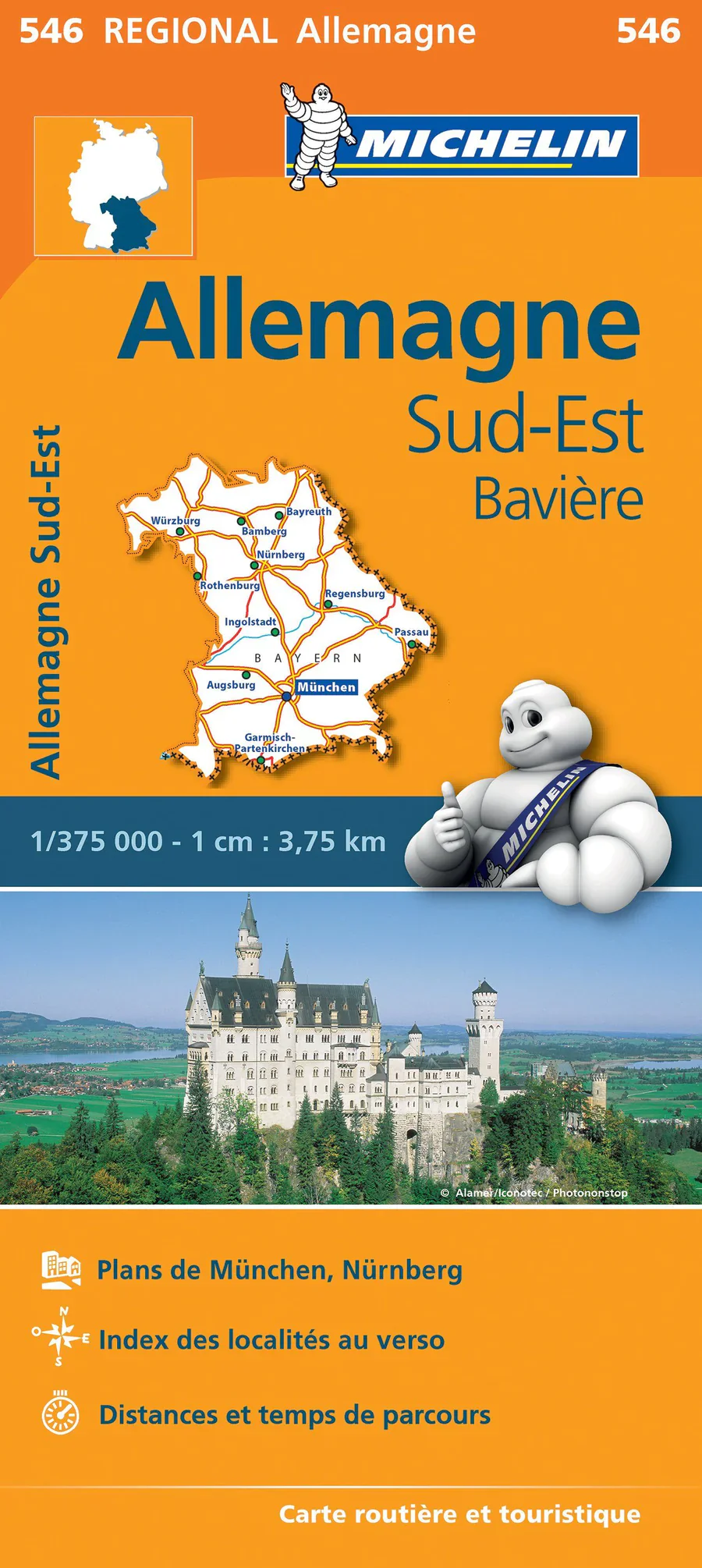
Germany South East & Bavaria Michelin Map 546
Scale: 1:350,000 | Size: 1200 mm (w) x 1000 mm (h)
Edition: Michelin | Format: Folded Paper Map
Order on Demand – Please allow 7–10 working days for delivery
🏔️ Discover the Beauty of Bavaria and Southeastern Germany with Michelin Precision
This one-sided regional map by Michelin, one of Europe's most trusted cartographers, is the most detailed and accurate map available for the south-eastern corner of Germany, including Bavaria, a region renowned for its fairy-tale castles, pristine lakes, and mountain drives.
Whether you're planning a scenic drive through the Alps, exploring charming villages like Rothenburg ob der Tauber, or navigating city streets in Munich, this map provides a richly detailed view of every road, from major highways to minor rural lanes.
🧭 Key Features:
-
Comprehensive Road Network: Shows international, national, regional and local roads — including minor roads and rural routes not found on less detailed maps
-
Clear Cartography: Michelin’s renowned mapping style with colour-coded roads, town symbols, and shaded relief for topography
-
Fully Indexed: Includes an easy-to-use index of principal place names, ideal for route planning and quick referencing
-
Distance Chart: Helpful distance and driving time table allows you to plan your daily itinerary with confidence
-
Ideal Scale: At 1:350,000, it balances high-level detail with broad regional context — perfect for self-drive holidays
-
Border Detail: Shows international boundaries, making it ideal for those exploring nearby Austria or the Czech Republic
-
Tourism-Friendly: Highlights interesting towns, historical monuments, ruins, and scenic routes
🧳 Perfect For:
-
Travellers exploring Bavaria, Saxony, or Thuringia
-
Road trippers venturing into the German Alps or Neuschwanstein Castle
-
Motorcyclists and touring cyclists needing detailed secondary road coverage
-
Planners preparing itineraries through Munich, Nuremberg, Regensburg, or smaller historic towns
-
Armchair travellers and map lovers wanting a clear and accurate regional reference
Product Specifications:
| Feature | Description |
|---|---|
| Scale | 1:350,000 |
| Dimensions | 1200 mm (w) x 1000 mm (h) |
| Edition | Michelin Map 546 |
| Language | Multilingual key, place names in local usage |
| Map Type | Folded, single-sided regional map |
| Printed By | Michelin, France |
| Delivery Time | Made to order – please allow 7–10 working days |
Upgrade your next European road trip with the Germany South East & Bavaria Michelin Map 546—the perfect blend of clarity, accuracy, and travel insight.
Original: $15.70
-65%$15.70
$5.49Product Information
Product Information
Shipping & Returns
Shipping & Returns
Description
Scale: 1:350,000 | Size: 1200 mm (w) x 1000 mm (h)
Edition: Michelin | Format: Folded Paper Map
Order on Demand – Please allow 7–10 working days for delivery
🏔️ Discover the Beauty of Bavaria and Southeastern Germany with Michelin Precision
This one-sided regional map by Michelin, one of Europe's most trusted cartographers, is the most detailed and accurate map available for the south-eastern corner of Germany, including Bavaria, a region renowned for its fairy-tale castles, pristine lakes, and mountain drives.
Whether you're planning a scenic drive through the Alps, exploring charming villages like Rothenburg ob der Tauber, or navigating city streets in Munich, this map provides a richly detailed view of every road, from major highways to minor rural lanes.
🧭 Key Features:
-
Comprehensive Road Network: Shows international, national, regional and local roads — including minor roads and rural routes not found on less detailed maps
-
Clear Cartography: Michelin’s renowned mapping style with colour-coded roads, town symbols, and shaded relief for topography
-
Fully Indexed: Includes an easy-to-use index of principal place names, ideal for route planning and quick referencing
-
Distance Chart: Helpful distance and driving time table allows you to plan your daily itinerary with confidence
-
Ideal Scale: At 1:350,000, it balances high-level detail with broad regional context — perfect for self-drive holidays
-
Border Detail: Shows international boundaries, making it ideal for those exploring nearby Austria or the Czech Republic
-
Tourism-Friendly: Highlights interesting towns, historical monuments, ruins, and scenic routes
🧳 Perfect For:
-
Travellers exploring Bavaria, Saxony, or Thuringia
-
Road trippers venturing into the German Alps or Neuschwanstein Castle
-
Motorcyclists and touring cyclists needing detailed secondary road coverage
-
Planners preparing itineraries through Munich, Nuremberg, Regensburg, or smaller historic towns
-
Armchair travellers and map lovers wanting a clear and accurate regional reference
Product Specifications:
| Feature | Description |
|---|---|
| Scale | 1:350,000 |
| Dimensions | 1200 mm (w) x 1000 mm (h) |
| Edition | Michelin Map 546 |
| Language | Multilingual key, place names in local usage |
| Map Type | Folded, single-sided regional map |
| Printed By | Michelin, France |
| Delivery Time | Made to order – please allow 7–10 working days |
Upgrade your next European road trip with the Germany South East & Bavaria Michelin Map 546—the perfect blend of clarity, accuracy, and travel insight.


