Gibraltar Wall Map 841 x 1189mm
Street-Level Detail | Walking Paths & Land Use | Premium Finishes
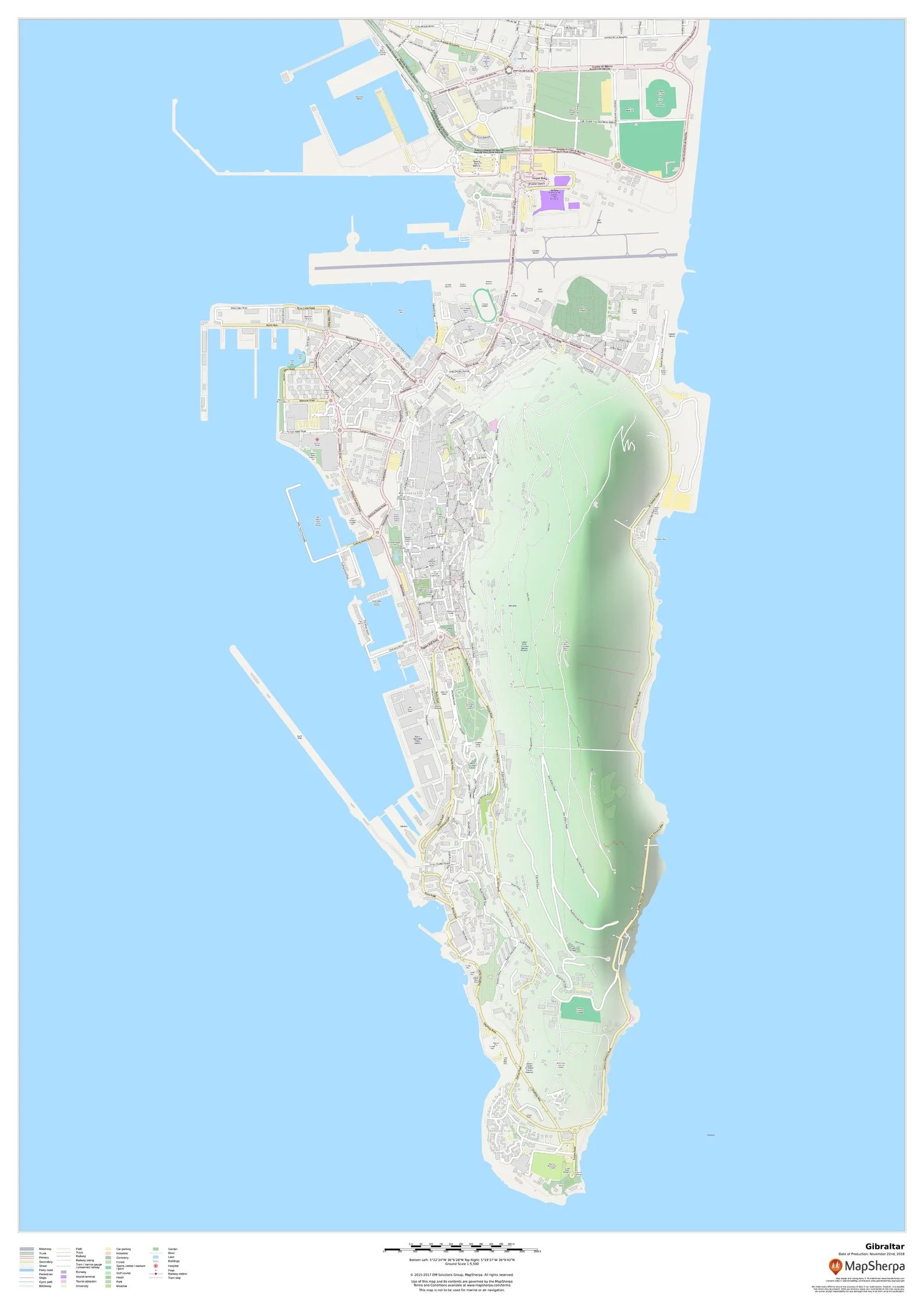
Explore one of Europe’s most iconic locations with this high-resolution wall map of Gibraltar. Designed for clarity and usability, it presents a fully detailed road network, walking paths and steps, land-use areas, points of interest, and near-complete building footprints—perfect for travellers, planners, businesses, or anyone who loves “The Rock.”
🗺️ Map Features
-
Complete Road & Street Network – From main arteries to local lanes, clearly drawn for effortless navigation.
-
Walking Paths & Steps – Pedestrian routes and trails (ideal for exploring the Upper Rock and waterfront promenades).
-
Land Use at a Glance – Parks, reserves, residential and commercial zones, marinas, and waterfront areas.
-
Building Footprints – Extensive building outlines for exceptional urban detail and orientation.
-
Points of Interest – Landmarks, viewpoints, transport hubs, museums, nature areas, beaches, and more.
-
Crisp, Wall-Ready Cartography – Legible at a distance, beautiful up close.
✨ Available Finishes
| Format | Description |
|---|---|
| 📜 Paper (160 gsm) | Heavyweight matte-coated paper—ideal for framing under glass. |
| 🧼 Laminated (Encapsulated) | Fully sealed in 80-micron gloss laminate for a durable, wipe-clean surface. |
| 🪵 Laminated with Wooden Hang Rails | Laminated map mounted with lacquered natural timber rails (top & bottom) and a hanging cord—ready to display. |
| 🖼️ Canvas (395 gsm) | Printed on HP Professional Matte Canvas with archival pigment inks—rich texture, fade-resistant. |
| 🪵 Canvas with Wooden Hang Rails | Canvas finished with lacquered timber rails and hanging cord for a timeless, frame-free presentation. |
🔨 Hang-railed maps are made to order—please allow up to 10 working days for professional mounting.
📐 Specifications
| Feature | Detail |
|---|---|
| Title | Gibraltar Wall Map |
| Scale | 1:5,500 |
| Dimensions | 841 mm (W) × 1189 mm (H) |
| Orientation | Portrait |
| Map Type | Street / Urban Reference |
| Materials | Paper, Laminated, Canvas; optional Timber Hang Rails |
| Printing | Pigment-based inks, fade-resistant |
💡 Why You’ll Love It
-
Ultra-detailed urban coverage—roads, paths, land use, POIs, and buildings
-
Decor meets function—a striking statement piece that’s also highly practical
-
Multiple premium finishes—tailor it to your home, studio, classroom, or office
-
Travel-friendly reference—plan walks, sight-seeing, and urban exploration at a glance
🚚 Delivery
-
Paper, Laminated & Canvas (rolled): Typically ships within 1–2 business days
-
Hang-railed versions: Made to order; please allow up to 10 working days
-
Protective packaging ensures your map arrives in perfect condition
Bring the character and contours of Gibraltar to your wall—order yours today and enjoy a premium map that informs, inspires, and elevates your space.
Original: $42.89
-65%$42.89
$15.01Product Information
Product Information
Shipping & Returns
Shipping & Returns
Description
Street-Level Detail | Walking Paths & Land Use | Premium Finishes
Explore one of Europe’s most iconic locations with this high-resolution wall map of Gibraltar. Designed for clarity and usability, it presents a fully detailed road network, walking paths and steps, land-use areas, points of interest, and near-complete building footprints—perfect for travellers, planners, businesses, or anyone who loves “The Rock.”
🗺️ Map Features
-
Complete Road & Street Network – From main arteries to local lanes, clearly drawn for effortless navigation.
-
Walking Paths & Steps – Pedestrian routes and trails (ideal for exploring the Upper Rock and waterfront promenades).
-
Land Use at a Glance – Parks, reserves, residential and commercial zones, marinas, and waterfront areas.
-
Building Footprints – Extensive building outlines for exceptional urban detail and orientation.
-
Points of Interest – Landmarks, viewpoints, transport hubs, museums, nature areas, beaches, and more.
-
Crisp, Wall-Ready Cartography – Legible at a distance, beautiful up close.
✨ Available Finishes
| Format | Description |
|---|---|
| 📜 Paper (160 gsm) | Heavyweight matte-coated paper—ideal for framing under glass. |
| 🧼 Laminated (Encapsulated) | Fully sealed in 80-micron gloss laminate for a durable, wipe-clean surface. |
| 🪵 Laminated with Wooden Hang Rails | Laminated map mounted with lacquered natural timber rails (top & bottom) and a hanging cord—ready to display. |
| 🖼️ Canvas (395 gsm) | Printed on HP Professional Matte Canvas with archival pigment inks—rich texture, fade-resistant. |
| 🪵 Canvas with Wooden Hang Rails | Canvas finished with lacquered timber rails and hanging cord for a timeless, frame-free presentation. |
🔨 Hang-railed maps are made to order—please allow up to 10 working days for professional mounting.
📐 Specifications
| Feature | Detail |
|---|---|
| Title | Gibraltar Wall Map |
| Scale | 1:5,500 |
| Dimensions | 841 mm (W) × 1189 mm (H) |
| Orientation | Portrait |
| Map Type | Street / Urban Reference |
| Materials | Paper, Laminated, Canvas; optional Timber Hang Rails |
| Printing | Pigment-based inks, fade-resistant |
💡 Why You’ll Love It
-
Ultra-detailed urban coverage—roads, paths, land use, POIs, and buildings
-
Decor meets function—a striking statement piece that’s also highly practical
-
Multiple premium finishes—tailor it to your home, studio, classroom, or office
-
Travel-friendly reference—plan walks, sight-seeing, and urban exploration at a glance
🚚 Delivery
-
Paper, Laminated & Canvas (rolled): Typically ships within 1–2 business days
-
Hang-railed versions: Made to order; please allow up to 10 working days
-
Protective packaging ensures your map arrives in perfect condition
Bring the character and contours of Gibraltar to your wall—order yours today and enjoy a premium map that informs, inspires, and elevates your space.


