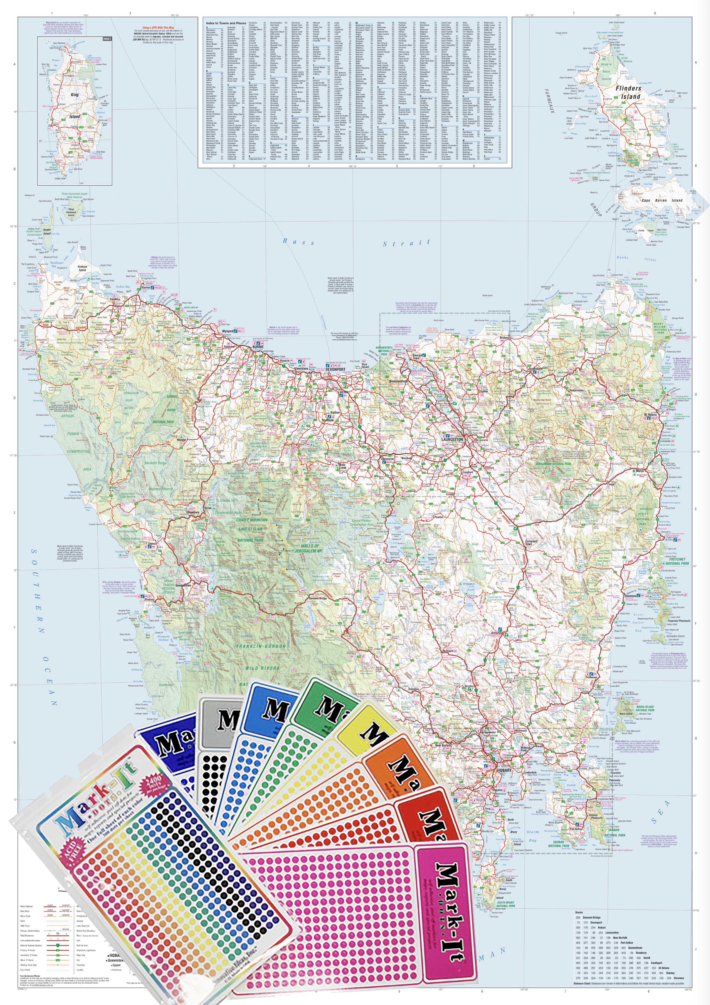
Melbourne & Region Hema 700 x 1000mm Laminated Wall Map
Detailed. Durable. Designed for real-world use across business, education, and everyday navigation in Australia’s fastest-growing city.
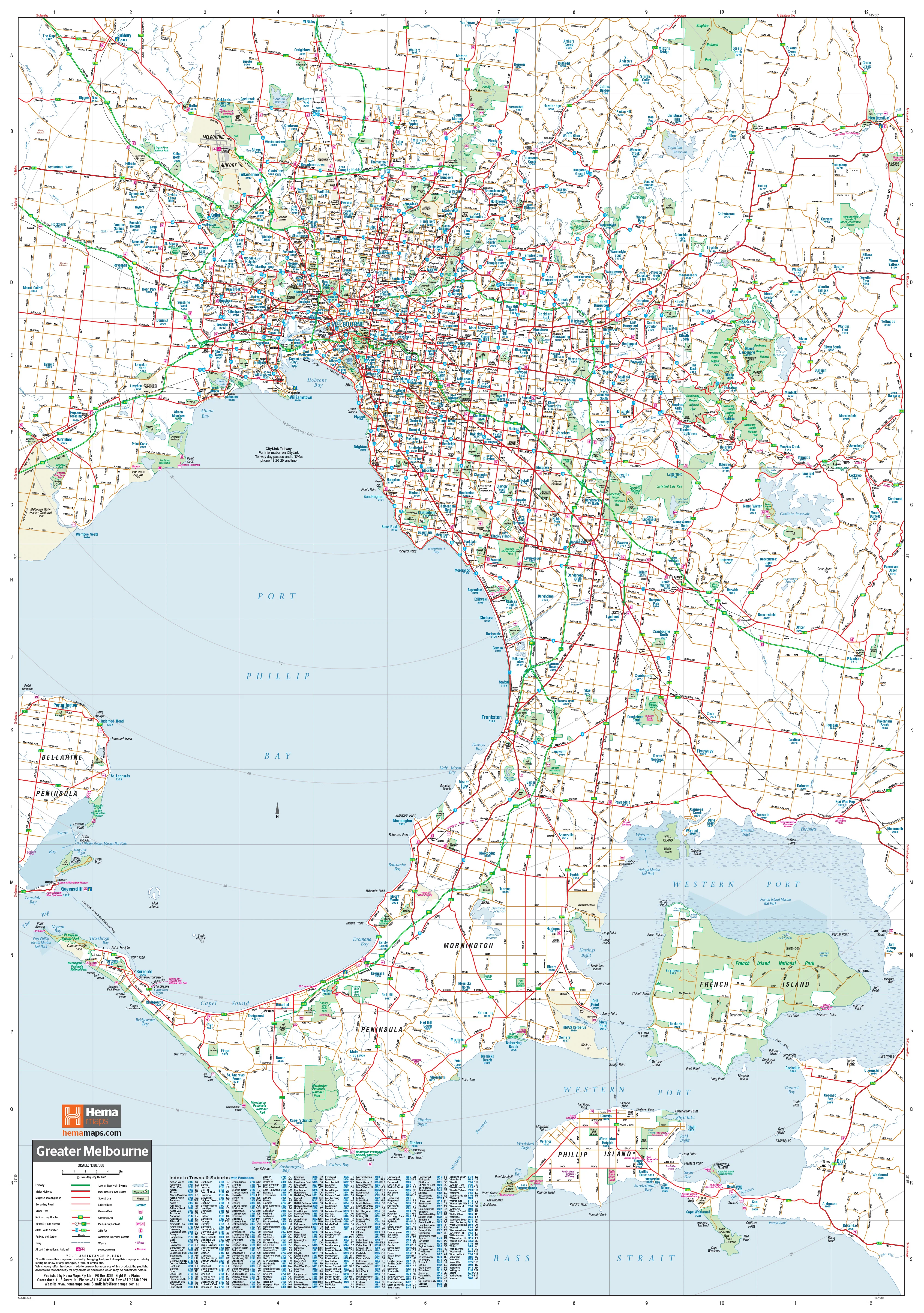
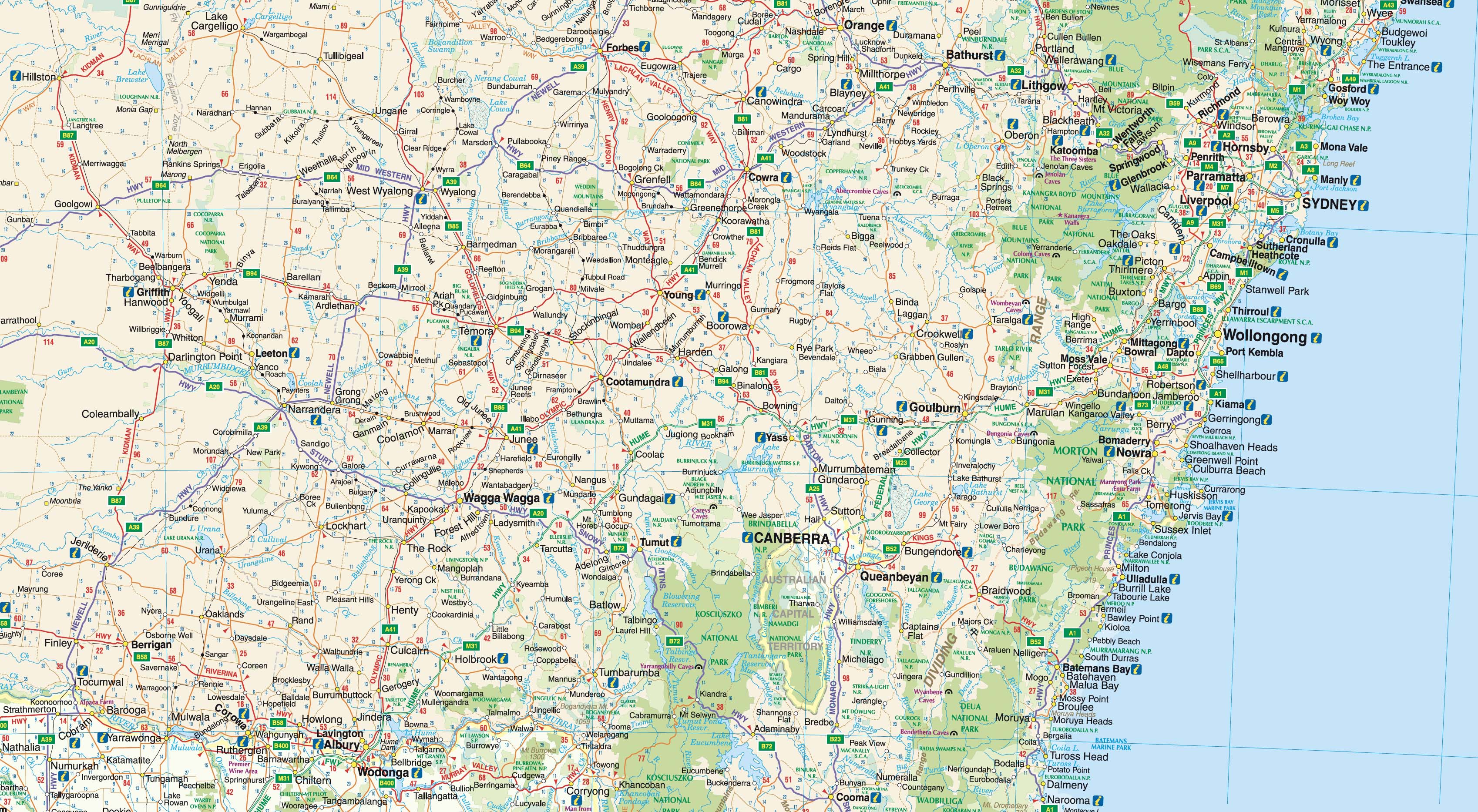
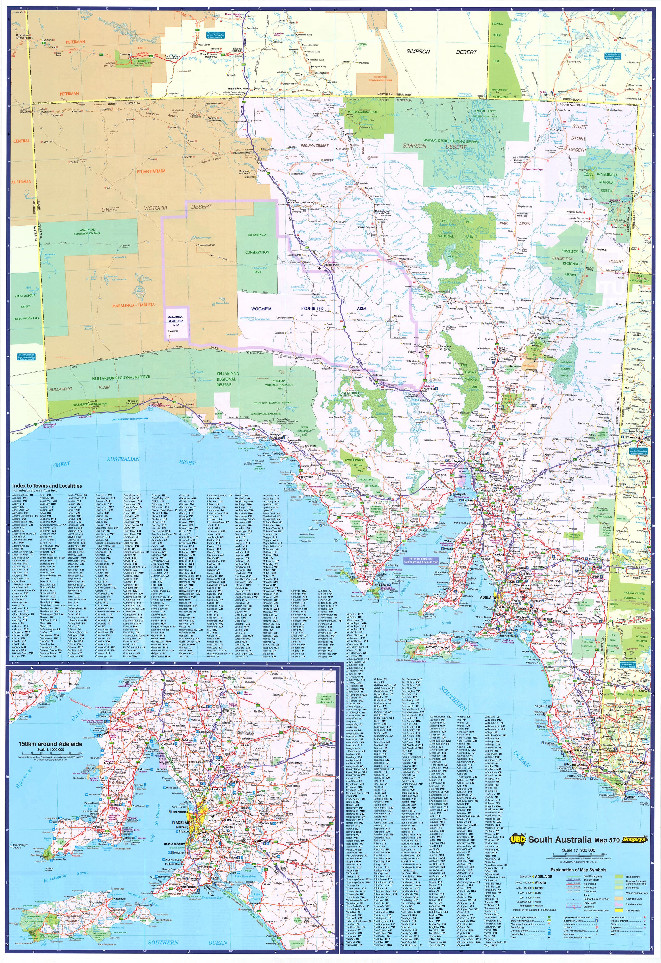
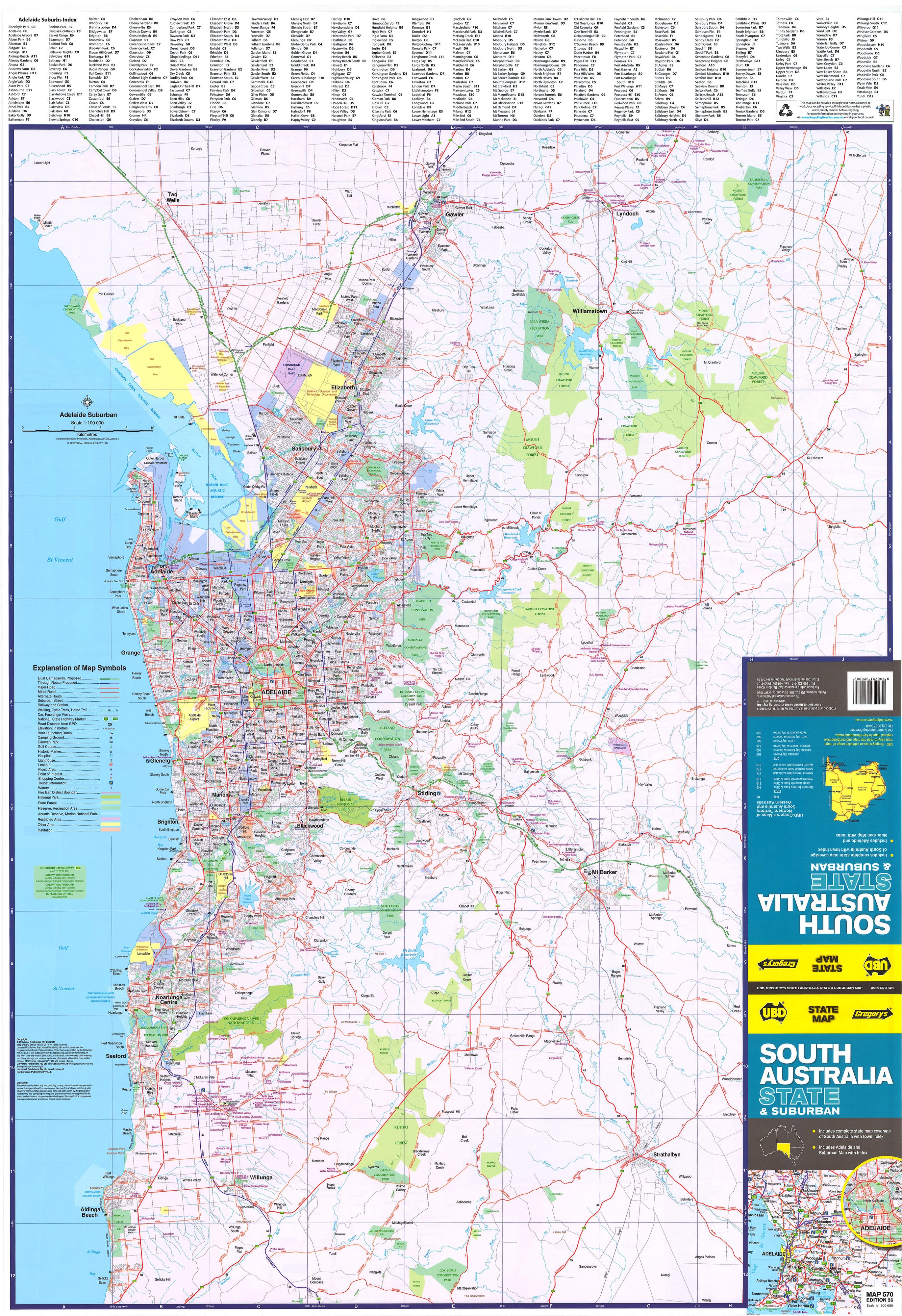
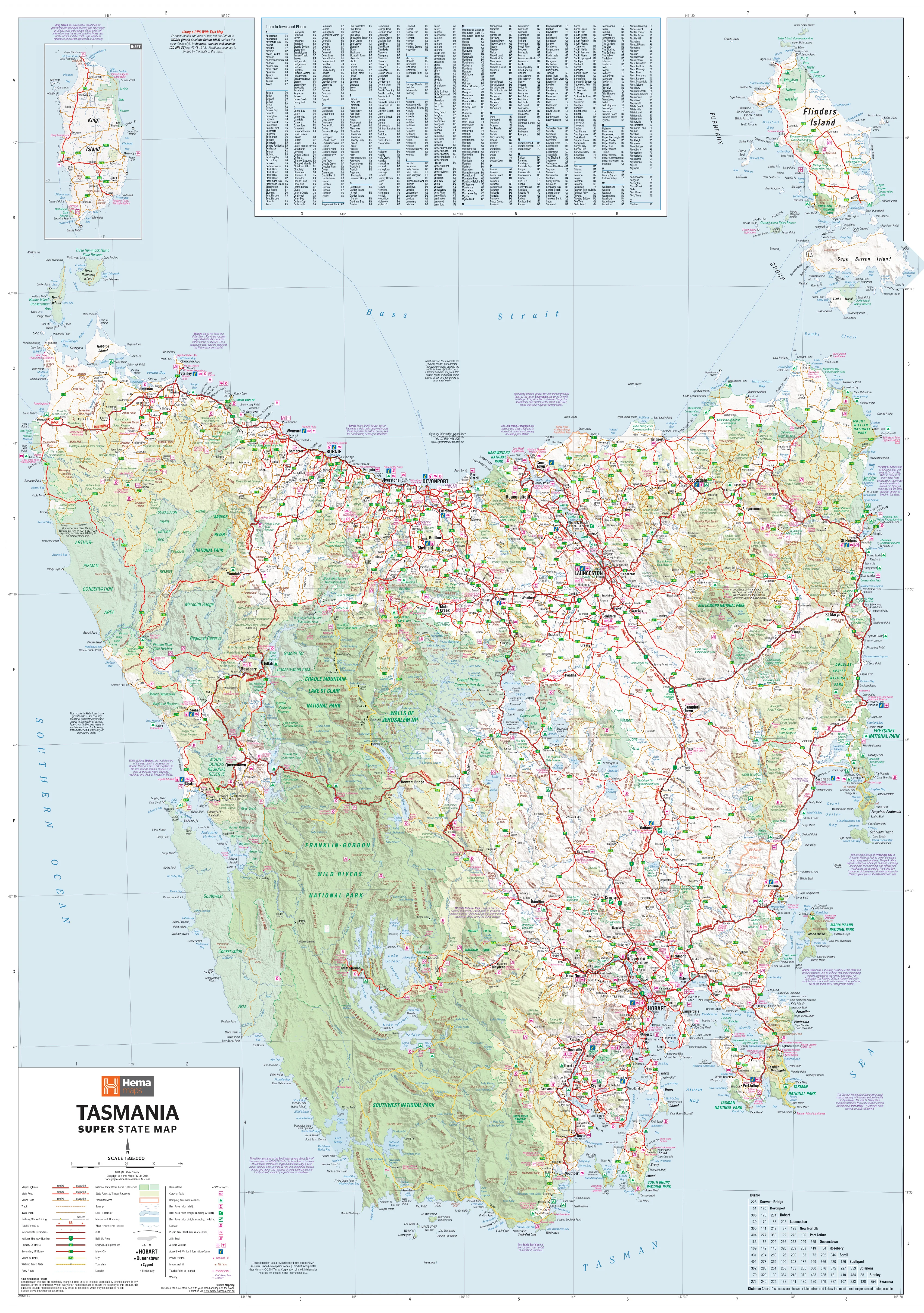
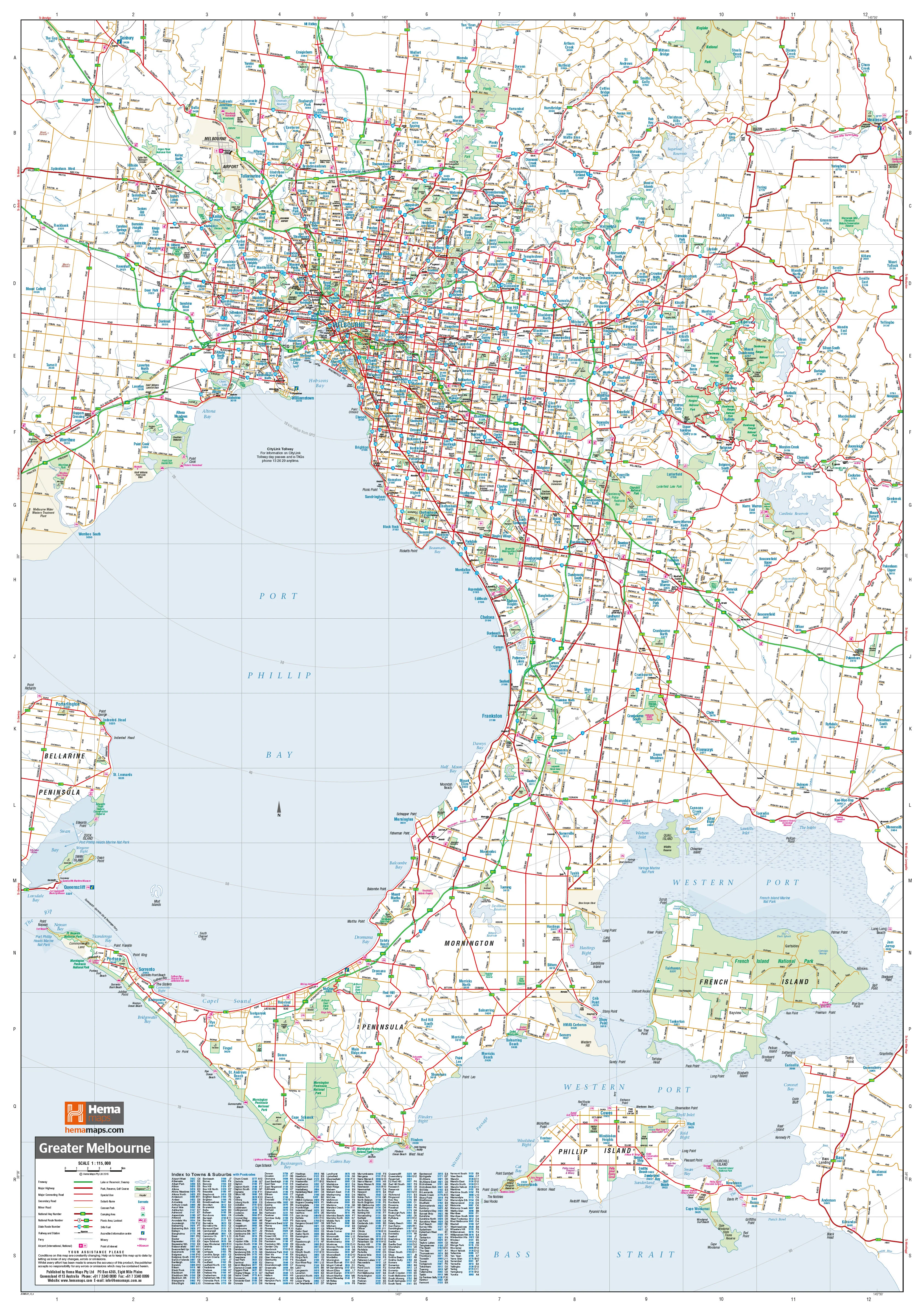
The Greater Melbourne Map by Hema is a professionally designed, large-format wall map that captures the entire metropolitan area of Melbourne in remarkable detail. With coverage stretching from Yan Yean and Whittlesea in the north, down to Phillip Island and the Mornington Peninsula in the south, and from Healesville and the Dandenong Ranges in the east to Werribee and Bacchus Marsh in the west, this map is an indispensable reference tool for anyone working with or within Greater Melbourne.
Developed by Hema Maps, one of Australia’s most trusted names in cartography, this map offers clarity, accuracy, and practical functionality, making it ideal for display in offices, classrooms, warehouses, showrooms, council buildings, or at home.
🗺️ Extensive Map Coverage
This map includes the full spread of Greater Melbourne’s urban and semi-rural zones, such as:
-
CBD & Inner Metro: Melbourne City, Southbank, Carlton, Richmond, Docklands
-
North: Craigieburn, Mickleham, Epping, Whittlesea, Yan Yean
-
South: Frankston, Mornington, Rosebud, Phillip Island
-
East: Lilydale, Healesville, Croydon, Dandenong, Pakenham
-
West: Werribee, Point Cook, Melton, Bacchus Marsh
You’ll also find:
-
Toll roads and proposed freeway extensions (like North East Link and West Gate Tunnel)
-
National and State Route numbers, clearly marked
-
Industrial precincts, green belts, and growth corridor suburbs
-
Public transport lines, including train corridors and major stations
This wide coverage makes the map especially valuable for those involved in logistics, infrastructure development, real estate, and emergency services.
🔍 Map Detail & Features
This map is more than just geographic—it’s packed with actionable and accurate information, including:
-
Major and secondary roads, with clear road hierarchy
-
Met roads, highways, and motorways
-
Suburb names and boundaries
-
Postcode boundaries – ideal for delivery and service area planning
-
Current and proposed freeways, including detailed route lines
-
Local government boundaries
-
Key facilities and infrastructure such as ports, industrial estates, airports, and public transport hubs
-
Parks, rivers, and green spaces clearly shaded for easy visual identification
🖨️ Premium Print & Laminate Quality
-
Printed on 120 gsm FSC-certified matte-coated paper – smooth, low-reflection finish ideal for close-up reading
-
Pigment-based Hewlett-Packard fade-resistant inks – for sharp colour and long-lasting clarity
-
Encapsulated between two 80-micron gloss laminate sheets
-
Waterproof and tear-resistant
-
Write on/wipe off with whiteboard markers
-
Apply and remove Mark-It-Dots without damage
-
Perfect for shared or high-traffic environments
-
📐 Specifications
-
Scale: 1:115,000 – ideal for detailed suburb-level navigation
-
Size: 700 mm (width) × 1000 mm (height)
-
Orientation: Portrait
-
Made in: Australia
-
Publisher: Hema Maps – renowned for their precise, field-checked cartography
🛍️ Purchase Options
-
Flat Laminated Map – $99.00
-
Delivered rolled in a sturdy protective tube
-
Smooth, crease-free surface
-
Ideal for framing or pinning in office or professional spaces
-
-
Laminated Folded Map – $49.95
-
A budget-friendly option
-
Laminated from a previously folded map
-
Some crease lines may remain but does not affect durability or readability
-
🎯 Ideal For
-
Businesses & Logistics:
-
Define delivery or service areas
-
Territory planning and route optimisation
-
Franchises and sales team zoning
-
-
Urban Planners & Government:
-
Local government boundaries
-
Zoning and growth corridor visualisation
-
Public infrastructure reference
-
-
Education & Training:
-
Teaching geography and civic understanding
-
Orientation for students or professionals new to the city
-
-
Real Estate Professionals:
-
Property planning
-
Understanding catchment areas
-
Land development reference
-
-
Residents & Newcomers:
-
Navigate and explore your city
-
Plan commutes or weekend travel
-
Keep track of family and friends across postcodes
-
🧭 See the City Clearly
With Melbourne growing rapidly into outer suburbs and regional corridors, there’s never been a more useful time to display a Greater Melbourne wall map that offers both the overview you need and the detail you rely on.
Clarity. Durability. Precision.
The Hema Greater Melbourne Map is more than just a reference—it’s a powerful visual tool for understanding the structure and scope of one of the world’s most liveable cities.
Order yours today and keep Melbourne within reach.
Original: $35.74
-65%$35.74
$12.51Product Information
Product Information
Shipping & Returns
Shipping & Returns
Description
Detailed. Durable. Designed for real-world use across business, education, and everyday navigation in Australia’s fastest-growing city.
The Greater Melbourne Map by Hema is a professionally designed, large-format wall map that captures the entire metropolitan area of Melbourne in remarkable detail. With coverage stretching from Yan Yean and Whittlesea in the north, down to Phillip Island and the Mornington Peninsula in the south, and from Healesville and the Dandenong Ranges in the east to Werribee and Bacchus Marsh in the west, this map is an indispensable reference tool for anyone working with or within Greater Melbourne.
Developed by Hema Maps, one of Australia’s most trusted names in cartography, this map offers clarity, accuracy, and practical functionality, making it ideal for display in offices, classrooms, warehouses, showrooms, council buildings, or at home.
🗺️ Extensive Map Coverage
This map includes the full spread of Greater Melbourne’s urban and semi-rural zones, such as:
-
CBD & Inner Metro: Melbourne City, Southbank, Carlton, Richmond, Docklands
-
North: Craigieburn, Mickleham, Epping, Whittlesea, Yan Yean
-
South: Frankston, Mornington, Rosebud, Phillip Island
-
East: Lilydale, Healesville, Croydon, Dandenong, Pakenham
-
West: Werribee, Point Cook, Melton, Bacchus Marsh
You’ll also find:
-
Toll roads and proposed freeway extensions (like North East Link and West Gate Tunnel)
-
National and State Route numbers, clearly marked
-
Industrial precincts, green belts, and growth corridor suburbs
-
Public transport lines, including train corridors and major stations
This wide coverage makes the map especially valuable for those involved in logistics, infrastructure development, real estate, and emergency services.
🔍 Map Detail & Features
This map is more than just geographic—it’s packed with actionable and accurate information, including:
-
Major and secondary roads, with clear road hierarchy
-
Met roads, highways, and motorways
-
Suburb names and boundaries
-
Postcode boundaries – ideal for delivery and service area planning
-
Current and proposed freeways, including detailed route lines
-
Local government boundaries
-
Key facilities and infrastructure such as ports, industrial estates, airports, and public transport hubs
-
Parks, rivers, and green spaces clearly shaded for easy visual identification
🖨️ Premium Print & Laminate Quality
-
Printed on 120 gsm FSC-certified matte-coated paper – smooth, low-reflection finish ideal for close-up reading
-
Pigment-based Hewlett-Packard fade-resistant inks – for sharp colour and long-lasting clarity
-
Encapsulated between two 80-micron gloss laminate sheets
-
Waterproof and tear-resistant
-
Write on/wipe off with whiteboard markers
-
Apply and remove Mark-It-Dots without damage
-
Perfect for shared or high-traffic environments
-
📐 Specifications
-
Scale: 1:115,000 – ideal for detailed suburb-level navigation
-
Size: 700 mm (width) × 1000 mm (height)
-
Orientation: Portrait
-
Made in: Australia
-
Publisher: Hema Maps – renowned for their precise, field-checked cartography
🛍️ Purchase Options
-
Flat Laminated Map – $99.00
-
Delivered rolled in a sturdy protective tube
-
Smooth, crease-free surface
-
Ideal for framing or pinning in office or professional spaces
-
-
Laminated Folded Map – $49.95
-
A budget-friendly option
-
Laminated from a previously folded map
-
Some crease lines may remain but does not affect durability or readability
-
🎯 Ideal For
-
Businesses & Logistics:
-
Define delivery or service areas
-
Territory planning and route optimisation
-
Franchises and sales team zoning
-
-
Urban Planners & Government:
-
Local government boundaries
-
Zoning and growth corridor visualisation
-
Public infrastructure reference
-
-
Education & Training:
-
Teaching geography and civic understanding
-
Orientation for students or professionals new to the city
-
-
Real Estate Professionals:
-
Property planning
-
Understanding catchment areas
-
Land development reference
-
-
Residents & Newcomers:
-
Navigate and explore your city
-
Plan commutes or weekend travel
-
Keep track of family and friends across postcodes
-
🧭 See the City Clearly
With Melbourne growing rapidly into outer suburbs and regional corridors, there’s never been a more useful time to display a Greater Melbourne wall map that offers both the overview you need and the detail you rely on.
Clarity. Durability. Precision.
The Hema Greater Melbourne Map is more than just a reference—it’s a powerful visual tool for understanding the structure and scope of one of the world’s most liveable cities.
Order yours today and keep Melbourne within reach.