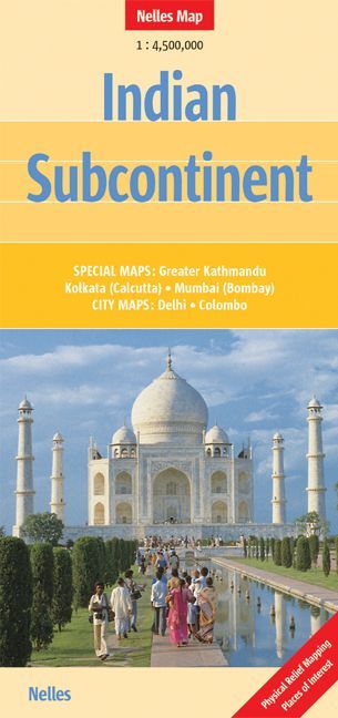
Indian Subcontinent Nelles Map
Folded Map | Scale 1:4,500,000 | Shaded Relief | Major Cities Insets
📏 Map Size: 1000 mm x 500 mm
🌏 Explore the Diversity of the Indian Subcontinent
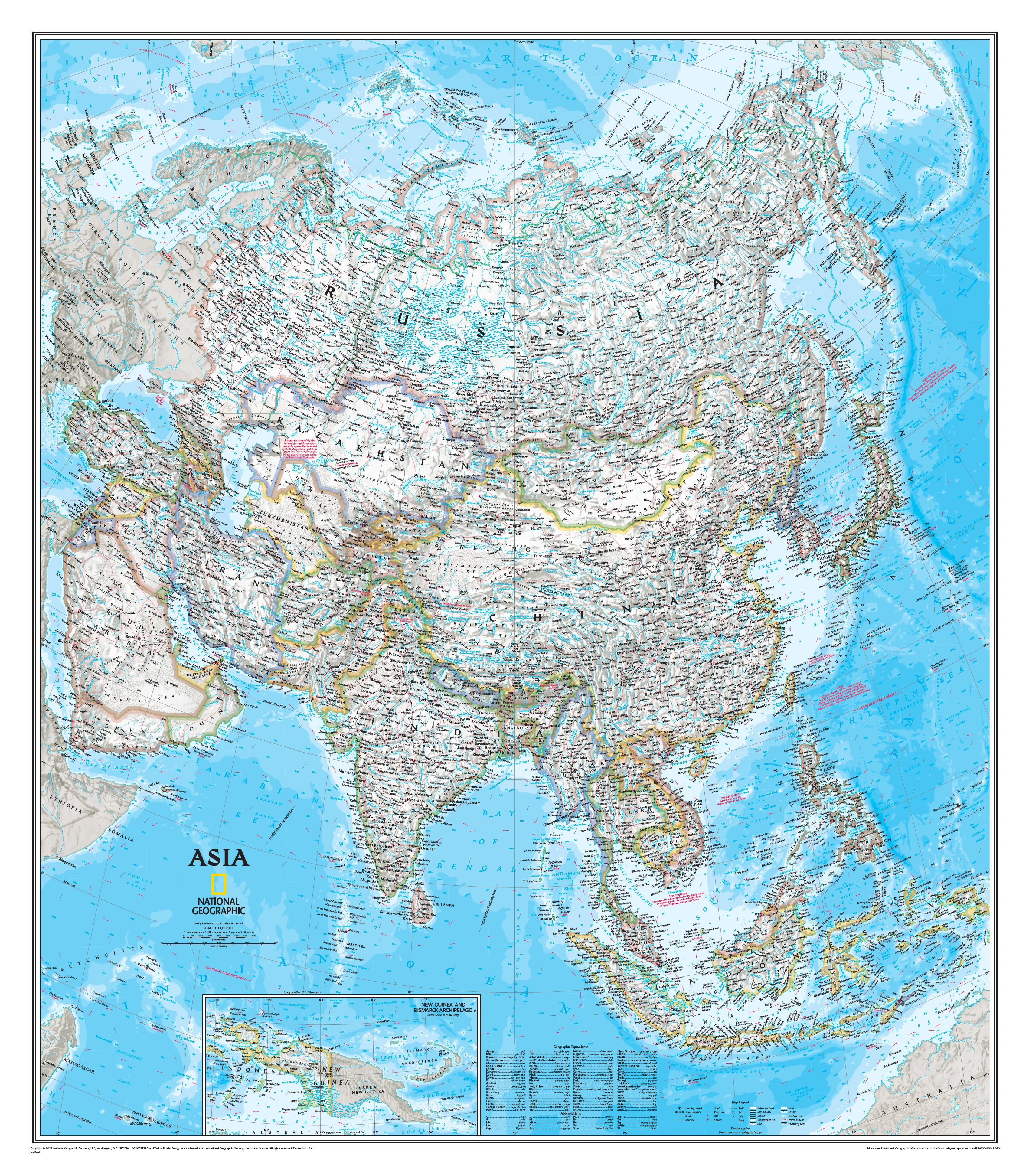
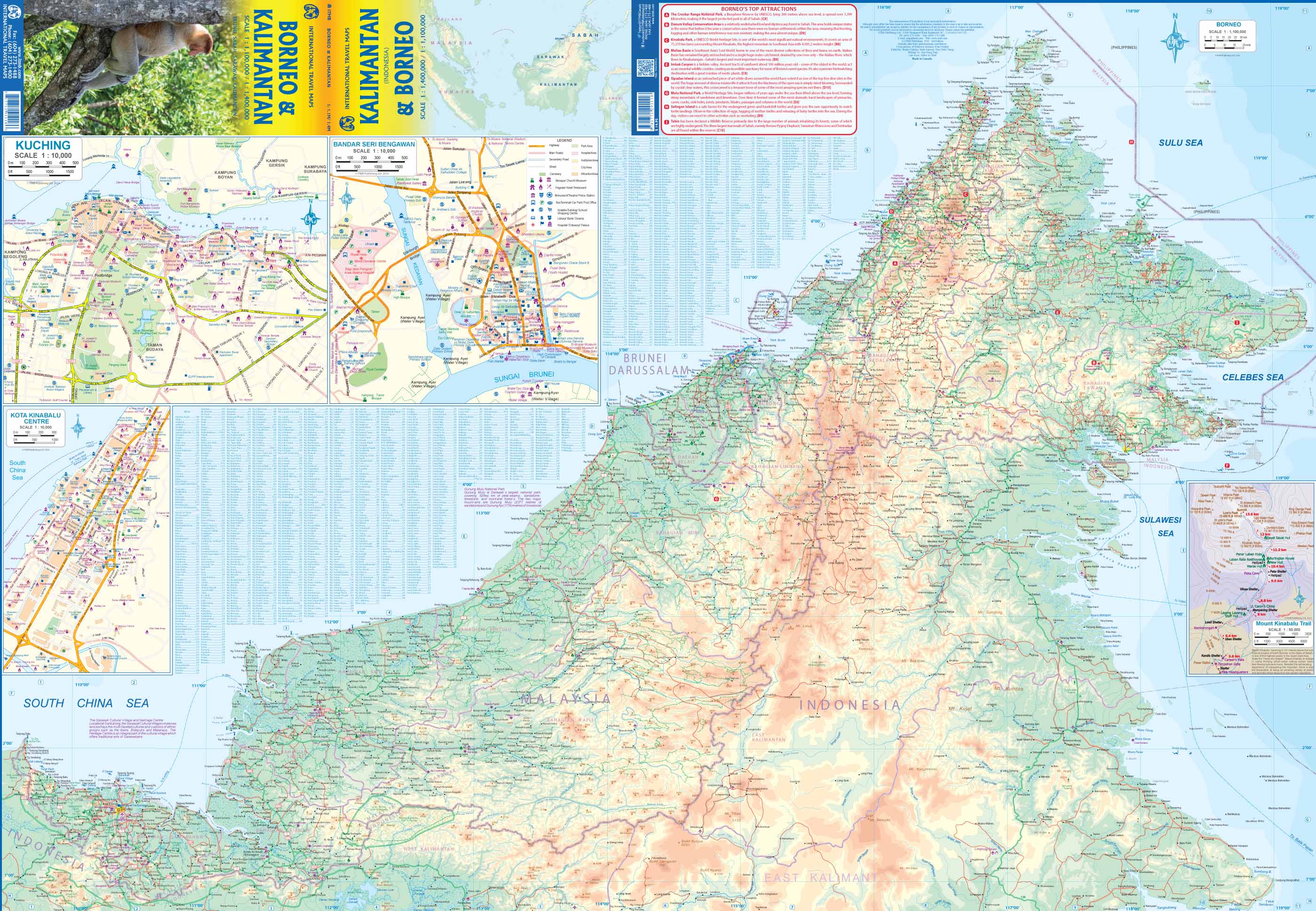
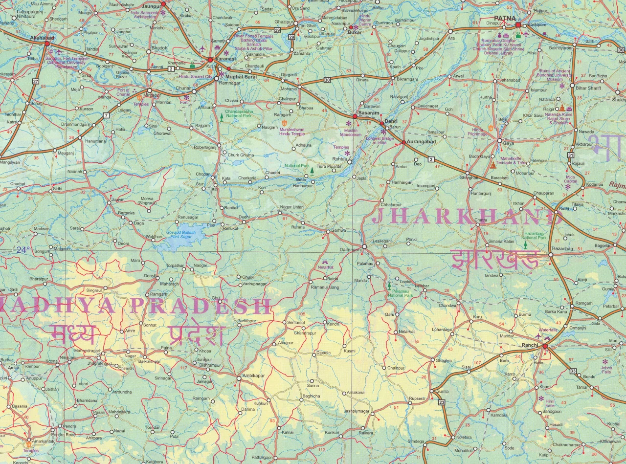
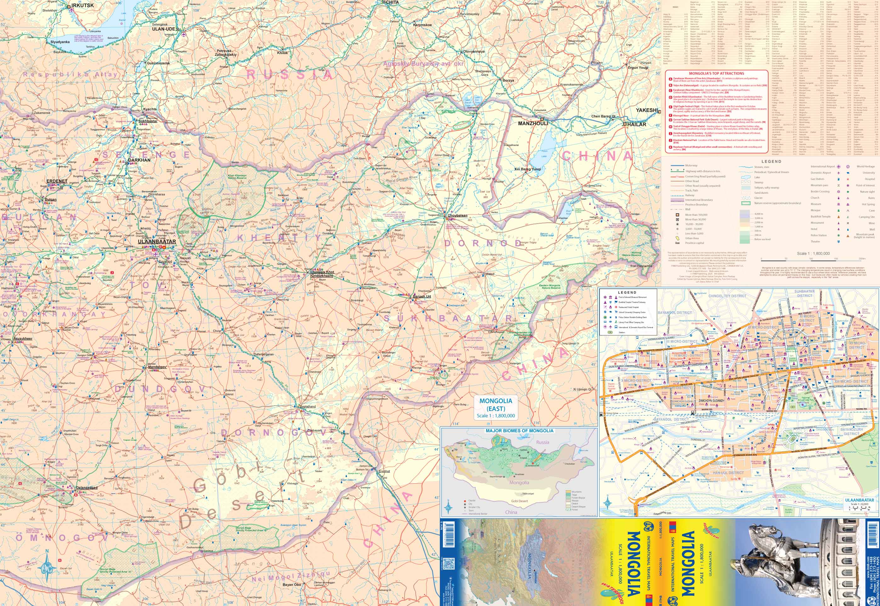
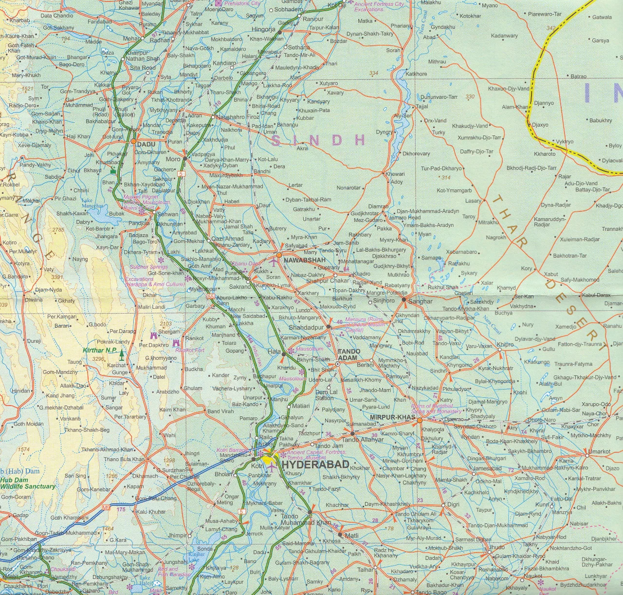
Whether you're planning a journey across borders or exploring the cultural richness of one region, the Nelles Map of the Indian Subcontinent is an essential companion for travelers, students, and geography enthusiasts alike. Covering the entire South Asian region in clear and vibrant detail, this map includes major roads, railway lines, national parks, and points of interest — all presented with beautiful shaded relief topography for a clear sense of the land.
From the Himalayan highlands to the tropical shores of Sri Lanka, this map helps you grasp the geographical breadth and historical complexity of this dynamic part of the world.
🧭 Coverage Includes:
-
India
-
Nepal
-
Bhutan
-
Bangladesh
-
Pakistan
-
Sri Lanka
All major transport routes, national boundaries, and important cities are marked, making this an excellent map for long-range planning or reference.
🔍 Detailed City Insets
For greater navigational clarity, this map features detailed insets of key metropolitan and regional hubs:
| 🏙️ City/Region | 🔎 Scale |
|---|---|
| Greater Kathmandu | 1:100,000 |
| Kolkata (Calcutta) | 1:300,000 |
| Mumbai (Bombay) | 1:300,000 |
| Colombo | 1:12,500 |
| Delhi | 1:50,000 |
These insets provide urban-level detail perfect for locating landmarks, major streets, or planning city tours.
🗂️ Features at a Glance
| 🌟 Feature | 📌 Description |
|---|---|
| Topographic Relief | Shaded elevation and mountain contours across the entire region |
| Major Road Networks | Highways, national roads, and major connecting routes |
| Railways | Key rail lines across borders and regions |
| National Parks | Highlighted green areas for ecological and wildlife reference |
| Points of Interest | Cultural sites, natural landmarks, and tourist destinations |
| Political Boundaries | Clear country borders and internal state lines |
| City Index | Easy-to-use reference for major towns and cities |
🧳 Ideal For:
-
✈️ Travellers planning cross-country trips in South Asia
-
🏞️ Backpackers and overland explorers
-
🎓 Educators and students needing regional reference tools
-
🧭 Cartography collectors and armchair adventurers
-
📍 Display in classrooms, travel agencies, or tour offices
📐 Map Specifications
| Attribute | Details |
|---|---|
| Publisher | Nelles Verlag |
| Map Type | Folded, printed on high-quality paper |
| Scale | 1:4,500,000 |
| Size (unfolded) | 1000 mm x 500 mm |
| Format | Single-sided with city insets |
| Relief | Shaded terrain for clear elevation |
This map is ideal for anyone looking to understand the Indian Subcontinent at a glance — whether for travel planning, academic use, or pure curiosity.
Original: $12.13
-65%$12.13
$4.25Product Information
Product Information
Shipping & Returns
Shipping & Returns
Description
Folded Map | Scale 1:4,500,000 | Shaded Relief | Major Cities Insets
📏 Map Size: 1000 mm x 500 mm
🌏 Explore the Diversity of the Indian Subcontinent
Whether you're planning a journey across borders or exploring the cultural richness of one region, the Nelles Map of the Indian Subcontinent is an essential companion for travelers, students, and geography enthusiasts alike. Covering the entire South Asian region in clear and vibrant detail, this map includes major roads, railway lines, national parks, and points of interest — all presented with beautiful shaded relief topography for a clear sense of the land.
From the Himalayan highlands to the tropical shores of Sri Lanka, this map helps you grasp the geographical breadth and historical complexity of this dynamic part of the world.
🧭 Coverage Includes:
-
India
-
Nepal
-
Bhutan
-
Bangladesh
-
Pakistan
-
Sri Lanka
All major transport routes, national boundaries, and important cities are marked, making this an excellent map for long-range planning or reference.
🔍 Detailed City Insets
For greater navigational clarity, this map features detailed insets of key metropolitan and regional hubs:
| 🏙️ City/Region | 🔎 Scale |
|---|---|
| Greater Kathmandu | 1:100,000 |
| Kolkata (Calcutta) | 1:300,000 |
| Mumbai (Bombay) | 1:300,000 |
| Colombo | 1:12,500 |
| Delhi | 1:50,000 |
These insets provide urban-level detail perfect for locating landmarks, major streets, or planning city tours.
🗂️ Features at a Glance
| 🌟 Feature | 📌 Description |
|---|---|
| Topographic Relief | Shaded elevation and mountain contours across the entire region |
| Major Road Networks | Highways, national roads, and major connecting routes |
| Railways | Key rail lines across borders and regions |
| National Parks | Highlighted green areas for ecological and wildlife reference |
| Points of Interest | Cultural sites, natural landmarks, and tourist destinations |
| Political Boundaries | Clear country borders and internal state lines |
| City Index | Easy-to-use reference for major towns and cities |
🧳 Ideal For:
-
✈️ Travellers planning cross-country trips in South Asia
-
🏞️ Backpackers and overland explorers
-
🎓 Educators and students needing regional reference tools
-
🧭 Cartography collectors and armchair adventurers
-
📍 Display in classrooms, travel agencies, or tour offices
📐 Map Specifications
| Attribute | Details |
|---|---|
| Publisher | Nelles Verlag |
| Map Type | Folded, printed on high-quality paper |
| Scale | 1:4,500,000 |
| Size (unfolded) | 1000 mm x 500 mm |
| Format | Single-sided with city insets |
| Relief | Shaded terrain for clear elevation |
This map is ideal for anyone looking to understand the Indian Subcontinent at a glance — whether for travel planning, academic use, or pure curiosity.