Indonesia ITMB Map
Scale 1:2,400,000 | Folded Map | Optional Lamination
📏 Map Size: 690 mm x 1000 mm
🇮🇩 Discover Indonesia — Island by Island
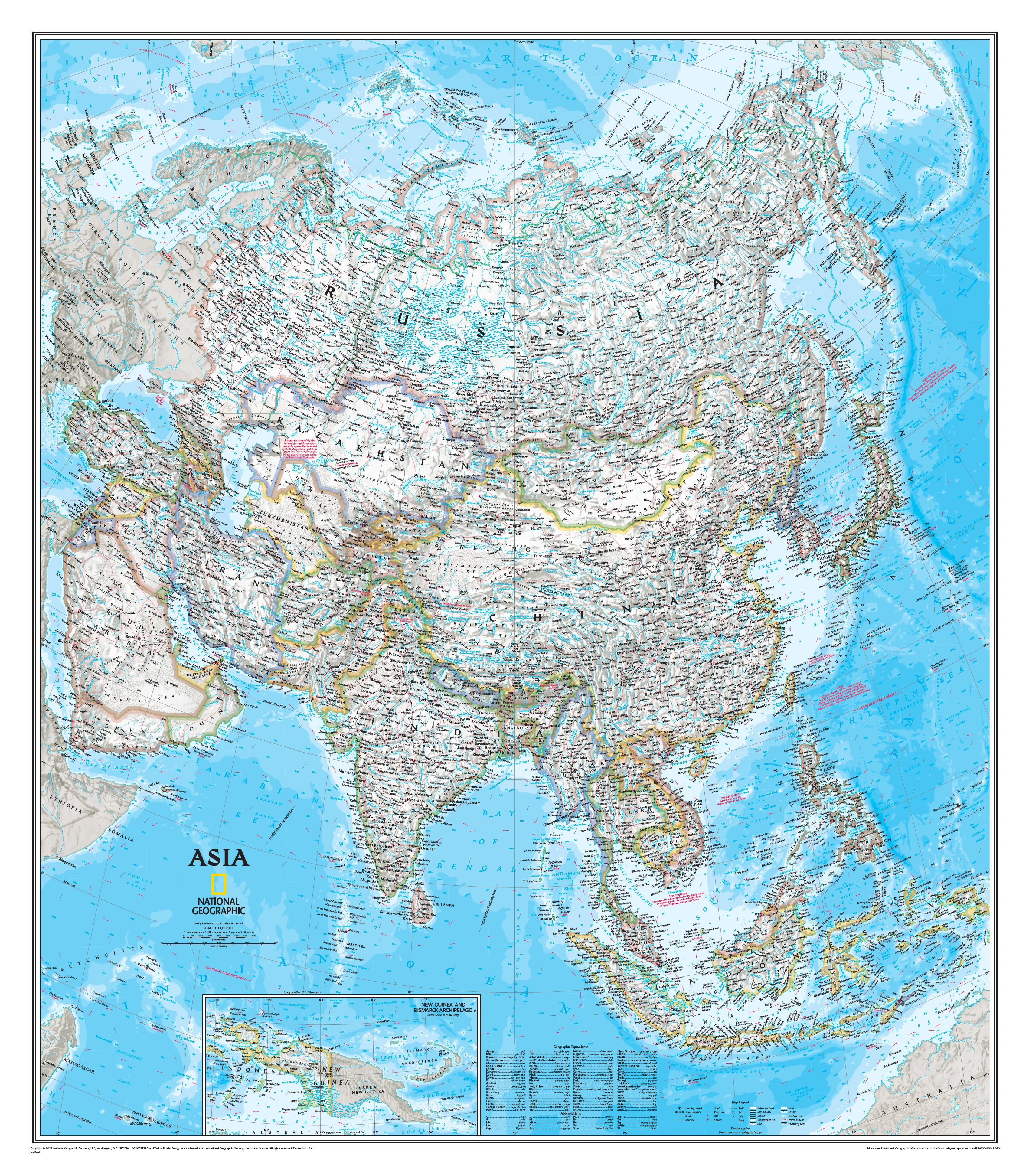
Indonesia, the world’s largest archipelago, spans over 17,000 islands scattered across the Pacific and Indian Oceans — a nation of immense cultural diversity, ecological richness, and historical significance. The Indonesia ITMB Map offers an expansive and highly detailed view of this extraordinary country, making it an essential companion for travellers, educators, and explorers.
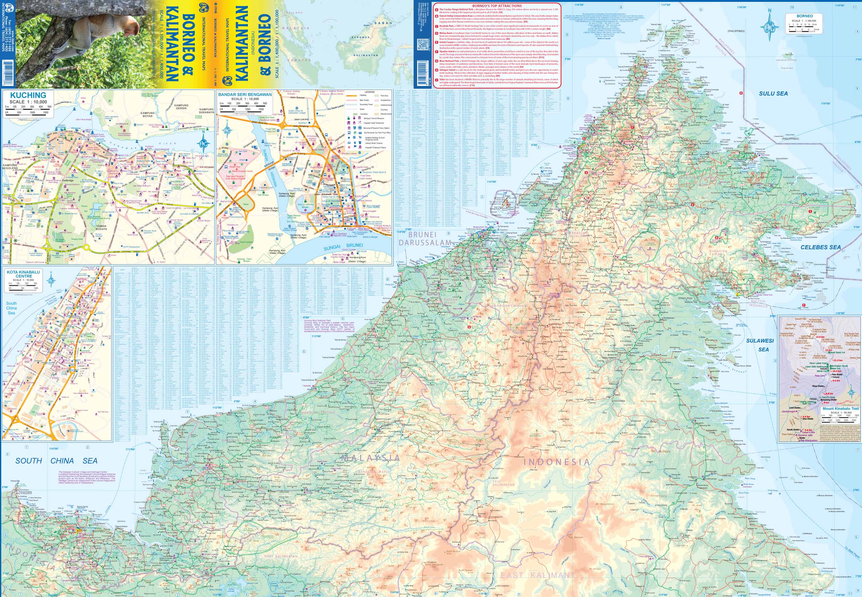
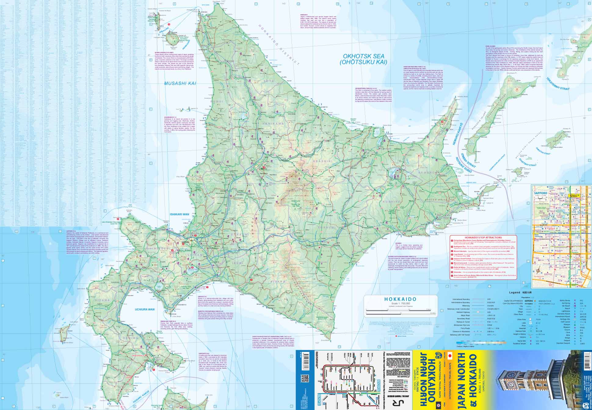
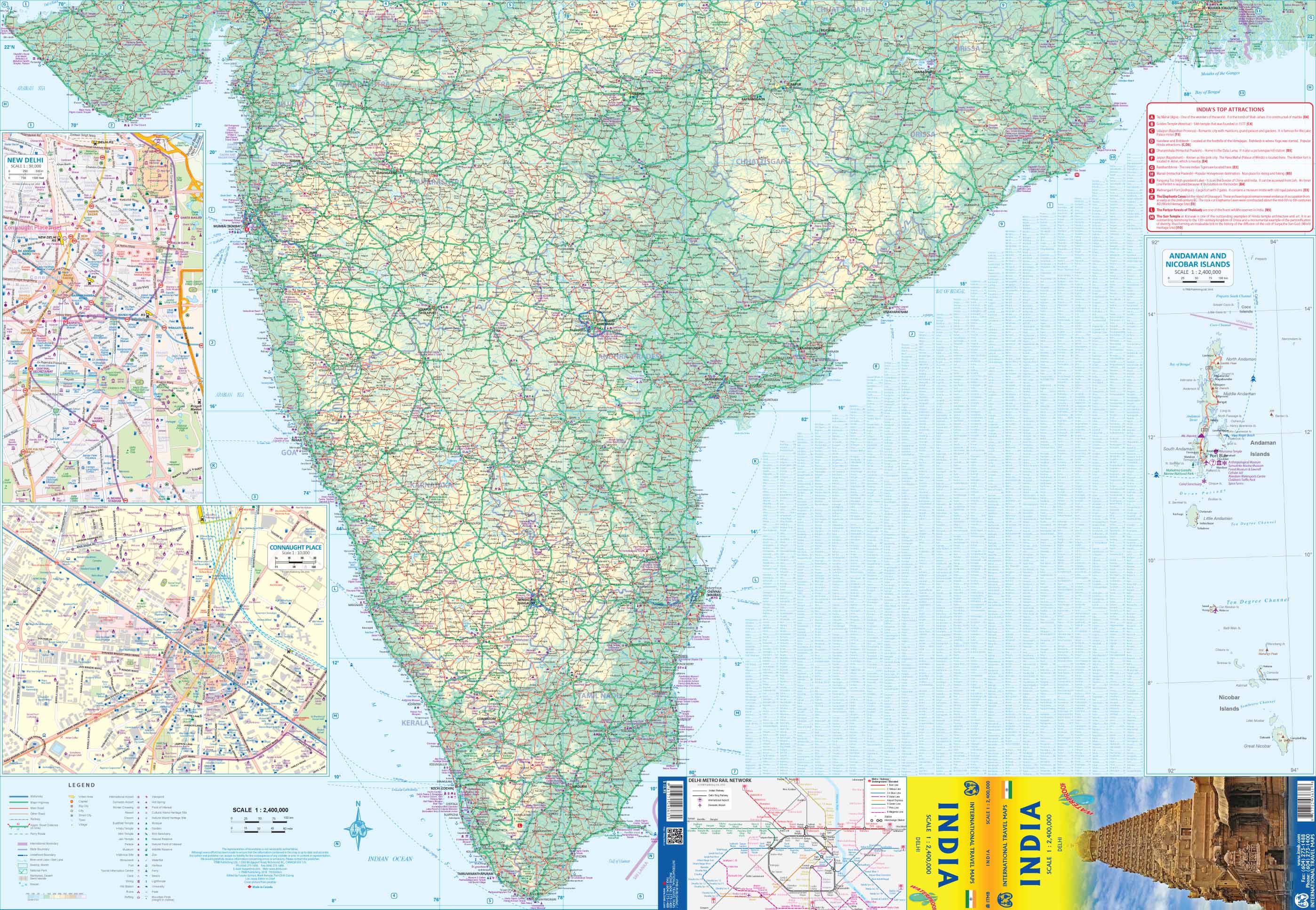
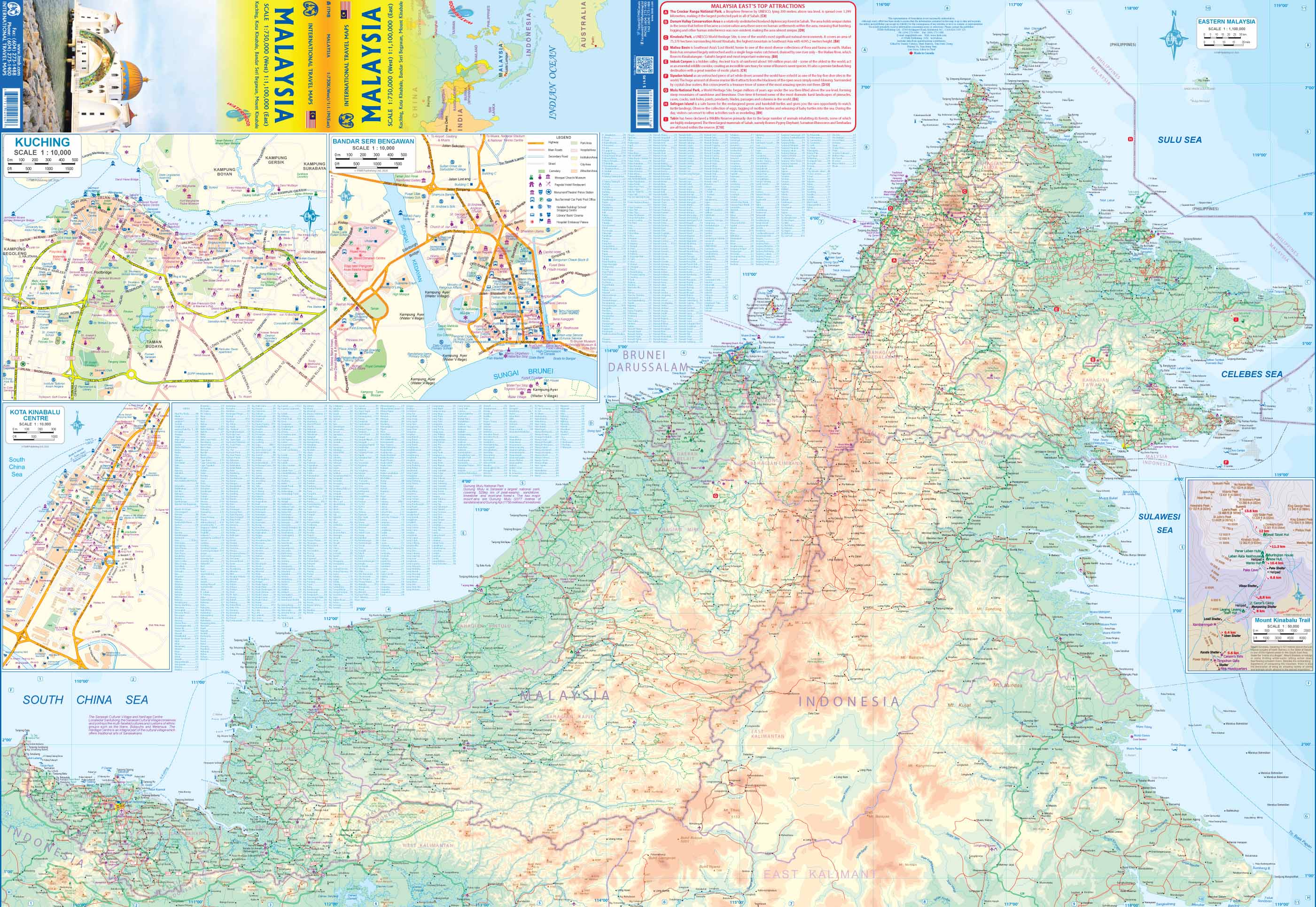
This map provides comprehensive coverage of major islands like Java, Sumatra, Kalimantan (Borneo), Sulawesi, and Papua, as well as hundreds of smaller inhabited and uninhabited isles. Carefully compiled with the support of local cartographers, it reflects up-to-date information and presents it in a user-friendly, readable format.
🧭 Key Features
| 🌟 Feature | 📌 Description |
|---|---|
| Complete Archipelago Coverage | Includes all major and minor islands of Indonesia |
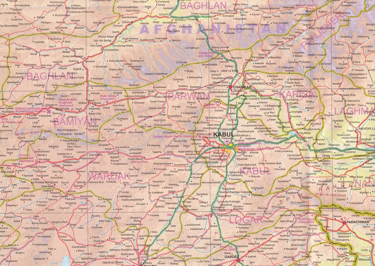
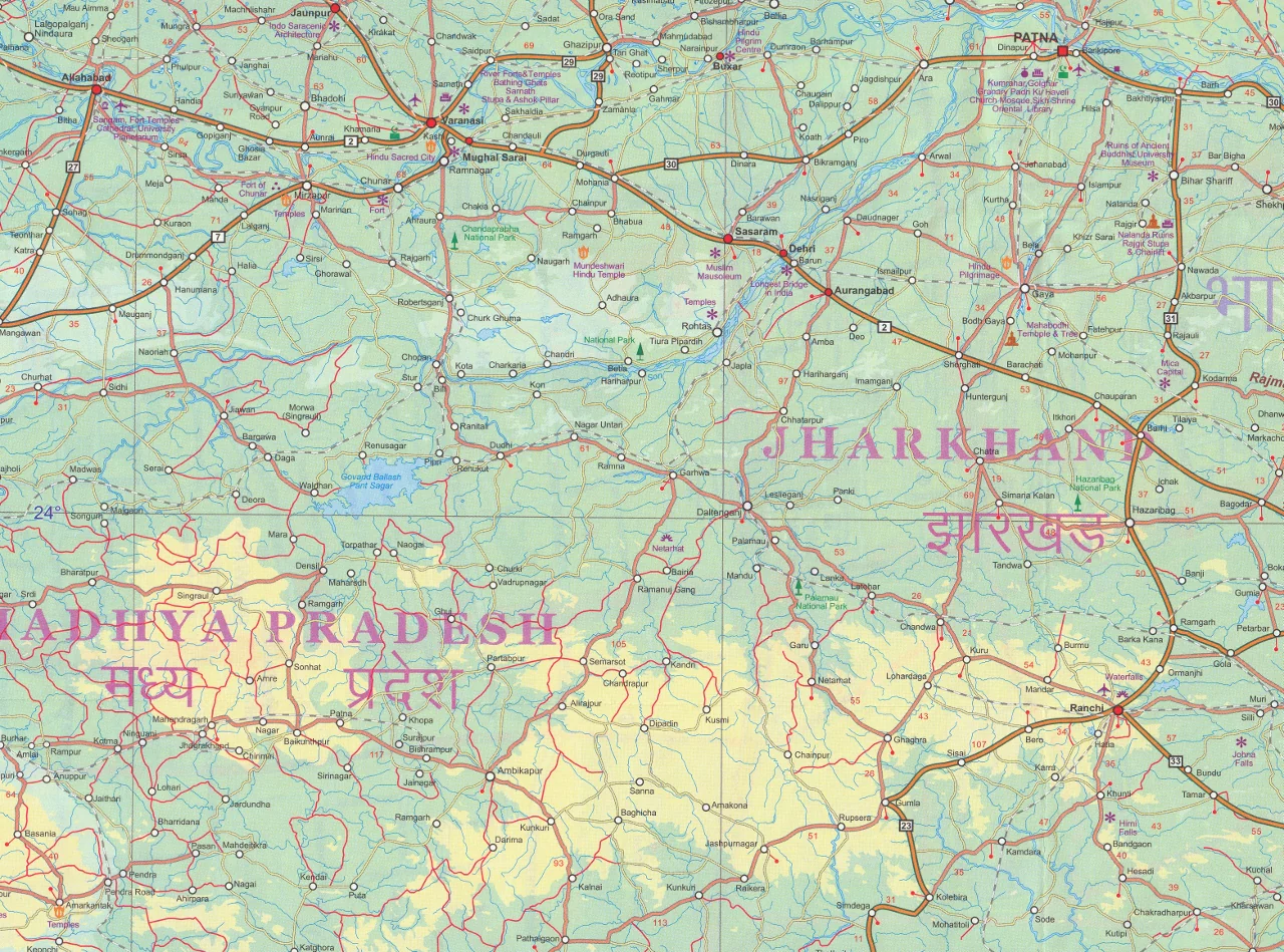
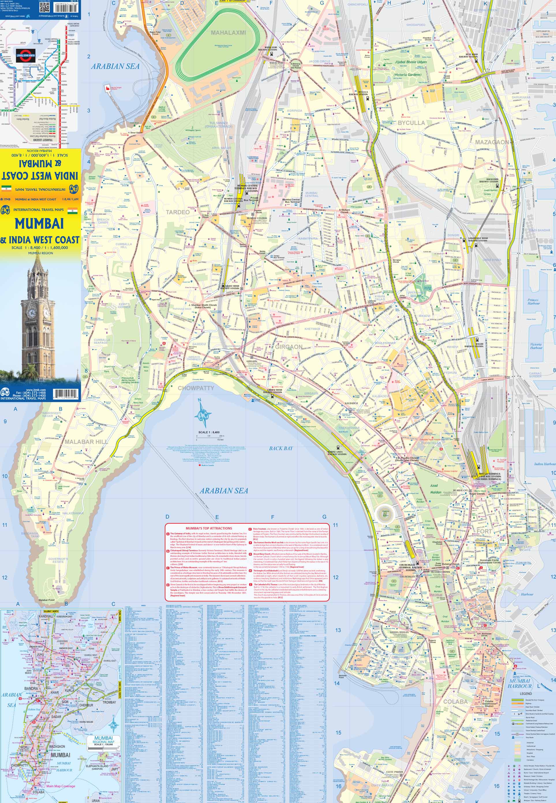
| Road Network | Roads categorized by type: highways, major roads, and regional routes |
| Relief and Terrain | Shaded relief for topography, including mountain ranges and volcanoes |
| Tourist Icons | Landmarks, temples, UNESCO sites, beaches, and waterfalls |
| Travel Infrastructure | Airports, harbours, ferry connections, hospitals, and bus terminals |
| Natural Features | National parks, lakes, hot springs, and conservation zones |
| Outdoor Recreation | Viewpoints, campsites, fishing spots, surfing areas, and golf courses |
| Fully Indexed | Easy-to-navigate city and town index for quick reference |
🏝️ Ideal For:
-
✈️ Travel planning and itinerary mapping across Indonesian islands
-
🌋 Adventure travellers interested in volcanoes, hiking, and national parks
-
🏕️ Backpackers and island-hoppers navigating by road and ferry
-
🧑🏫 Educators and classrooms covering geography or cultural studies
-
🧭 Map enthusiasts building a Southeast Asian collection
🔒 Optional Lamination Upgrade
Upgrade to a laminated version for enhanced durability and interactivity:
✔️ Use whiteboard markers to trace routes
✔️ Apply map dots or sticky flags to highlight destinations
✔️ Wipe clean without damage
✔️ Protects against tears, spills, and wear-and-tear
📌 Note: Laminated versions are made by flattening and encapsulating the folded map in high-quality 80-micron gloss laminate. Slight fold lines may remain visible.
📐 Map Specifications
| Attribute | Details |
|---|---|
| Publisher | ITMB (International Travel Maps) |
| Scale | 1:2,400,000 |
| Size (unfolded) | 690 mm x 1000 mm |
| Map Type | Folded paper map (laminated option available) |
| Edition | Latest edition with updated cartography |
Whether you're tracing the ring of fire, planning a tropical retreat, or studying regional geography, this detailed map is a smart, compact way to explore Indonesia’s vast and varied landscape.
Original: $14.27
-65%$14.27
$4.99Product Information
Product Information
Shipping & Returns
Shipping & Returns
Description
Scale 1:2,400,000 | Folded Map | Optional Lamination
📏 Map Size: 690 mm x 1000 mm
🇮🇩 Discover Indonesia — Island by Island
Indonesia, the world’s largest archipelago, spans over 17,000 islands scattered across the Pacific and Indian Oceans — a nation of immense cultural diversity, ecological richness, and historical significance. The Indonesia ITMB Map offers an expansive and highly detailed view of this extraordinary country, making it an essential companion for travellers, educators, and explorers.
This map provides comprehensive coverage of major islands like Java, Sumatra, Kalimantan (Borneo), Sulawesi, and Papua, as well as hundreds of smaller inhabited and uninhabited isles. Carefully compiled with the support of local cartographers, it reflects up-to-date information and presents it in a user-friendly, readable format.
🧭 Key Features
| 🌟 Feature | 📌 Description |
|---|---|
| Complete Archipelago Coverage | Includes all major and minor islands of Indonesia |
| Road Network | Roads categorized by type: highways, major roads, and regional routes |
| Relief and Terrain | Shaded relief for topography, including mountain ranges and volcanoes |
| Tourist Icons | Landmarks, temples, UNESCO sites, beaches, and waterfalls |
| Travel Infrastructure | Airports, harbours, ferry connections, hospitals, and bus terminals |
| Natural Features | National parks, lakes, hot springs, and conservation zones |
| Outdoor Recreation | Viewpoints, campsites, fishing spots, surfing areas, and golf courses |
| Fully Indexed | Easy-to-navigate city and town index for quick reference |
🏝️ Ideal For:
-
✈️ Travel planning and itinerary mapping across Indonesian islands
-
🌋 Adventure travellers interested in volcanoes, hiking, and national parks
-
🏕️ Backpackers and island-hoppers navigating by road and ferry
-
🧑🏫 Educators and classrooms covering geography or cultural studies
-
🧭 Map enthusiasts building a Southeast Asian collection
🔒 Optional Lamination Upgrade
Upgrade to a laminated version for enhanced durability and interactivity:
✔️ Use whiteboard markers to trace routes
✔️ Apply map dots or sticky flags to highlight destinations
✔️ Wipe clean without damage
✔️ Protects against tears, spills, and wear-and-tear
📌 Note: Laminated versions are made by flattening and encapsulating the folded map in high-quality 80-micron gloss laminate. Slight fold lines may remain visible.
📐 Map Specifications
| Attribute | Details |
|---|---|
| Publisher | ITMB (International Travel Maps) |
| Scale | 1:2,400,000 |
| Size (unfolded) | 690 mm x 1000 mm |
| Map Type | Folded paper map (laminated option available) |
| Edition | Latest edition with updated cartography |
Whether you're tracing the ring of fire, planning a tropical retreat, or studying regional geography, this detailed map is a smart, compact way to explore Indonesia’s vast and varied landscape.