Malawi - Mozambique - Traks4Africa Map
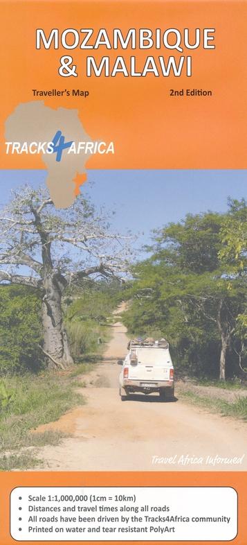
Malawi & Mozambique — Tracks4Africa Overlander Map
GPS-Verified 4×4 Routes | Waterproof PolyArt | Regional Expedition Planning
🌊 Lake Malawi • Indian Ocean Coast • Remote Reserves • Cross-Border Adventure
The Malawi & Mozambique Tracks4Africa Map is designed for serious self-drive travellers and overlanders navigating one of Southern Africa’s most diverse and rewarding regions. Combining detailed geographical mapping with real-world GPS track data, this map is purpose-built for 4×4 exploration across tar, gravel and sand.
This is not a generic road map — it is a practical expedition tool built from the lived experience of the Tracks4Africa community.
🌍 Regional Coverage Highlights
This edition provides comprehensive coverage of:
• Lake Malawi and surrounding highlands
• Mozambique’s Indian Ocean coastline
• Major and minor cross-border routes
• Remote nature reserves and national parks
• Key regional hubs and gateway towns
Separate insets include detailed maps of important National Parks and city plans of the region’s major centres, giving you both wilderness navigation and urban orientation in one folded sheet.
🌟 Why Overlanders Choose This Map
🚙 Comprehensive road & track network — including reserve tracks and lesser-known routes
📏 Travel times & distances printed on the map — plan realistic daily stages
🛰️ GPS-aligned cartography — what you see on paper matches Tracks4Africa GPS Maps
🏕️ Campsites & attractions clearly marked — essential touring detail
🛂 Border crossings indicated — with opening and closing times
🏙️ Up-to-date tourist services in each town — fuel, accommodation and supplies
📍 Place name register included — quick reference for navigation
You’ll understand exactly how long each stretch of road will take — whether on sealed highway, corrugated gravel or deep sand.
🧭 Built for 4×4 & Independent Travel
From the lakeside tracks of Malawi to the coastal routes and wild reserves of Mozambique, conditions vary dramatically. Reliable mapping is essential.
This map helps you:
✔️ Compare route options across borders
✔️ Plan fuel stops and supply points
✔️ Estimate realistic travel times
✔️ Navigate remote park tracks confidently
✔️ Maintain full regional awareness without relying solely on digital devices
It is an ideal companion to GPS navigation — offering the big-picture context that screens often lack.
💪 Printed on Waterproof PolyArt
Unlike standard paper maps, this edition is printed on tear and water-resistant PolyArt, making it suitable for harsh outdoor conditions:
💧 Water resistant
🌞 Sun and heat tolerant
🏕️ Camp-table durable
🚙 Dashboard friendly
The sheet folds easily so you can view only the section you need while travelling.
📐 Format & Specifications
📄 Sheet map — folded
🗺️ Regional national coverage (Malawi & Mozambique)
📏 Travel times & distances indicated
🛰️ GPS-compatible cartography
📘 Place name index included
💧 Printed on waterproof, tear-resistant PolyArt
Built for real expedition conditions.
🎯 Who This Map Is For
🚙 4×4 overlanders
🏕️ Self-drive safari travellers
🌊 Coastal explorers
🌍 Cross-border adventurers
🧭 Travellers who want dependable paper navigation in remote regions
If you’re planning to explore Lake Malawi’s shoreline, Mozambique’s beaches, or venture into lesser-known reserves, this map provides the clarity and reliability you need.
📦 Important Ordering Note
This is an Order-on-Demand map.
🕒 Please allow up to 10 working days for delivery.
⭐ Expedition-Ready Navigation for Malawi & Mozambique
In regions where signal drops and distances stretch long between towns, a trusted paper map remains essential. The Malawi & Mozambique Tracks4Africa Overlander Map brings together practical route data, verified GPS tracks and durable materials — giving you confidence to explore both inland wilderness and coastal frontiers.
Unfold it. Trace your route. And set out with clarity.
Original: $35.74
-65%$35.74
$12.51Product Information
Product Information
Shipping & Returns
Shipping & Returns
Description
Malawi & Mozambique — Tracks4Africa Overlander Map
GPS-Verified 4×4 Routes | Waterproof PolyArt | Regional Expedition Planning
🌊 Lake Malawi • Indian Ocean Coast • Remote Reserves • Cross-Border Adventure
The Malawi & Mozambique Tracks4Africa Map is designed for serious self-drive travellers and overlanders navigating one of Southern Africa’s most diverse and rewarding regions. Combining detailed geographical mapping with real-world GPS track data, this map is purpose-built for 4×4 exploration across tar, gravel and sand.
This is not a generic road map — it is a practical expedition tool built from the lived experience of the Tracks4Africa community.
🌍 Regional Coverage Highlights
This edition provides comprehensive coverage of:
• Lake Malawi and surrounding highlands
• Mozambique’s Indian Ocean coastline
• Major and minor cross-border routes
• Remote nature reserves and national parks
• Key regional hubs and gateway towns
Separate insets include detailed maps of important National Parks and city plans of the region’s major centres, giving you both wilderness navigation and urban orientation in one folded sheet.
🌟 Why Overlanders Choose This Map
🚙 Comprehensive road & track network — including reserve tracks and lesser-known routes
📏 Travel times & distances printed on the map — plan realistic daily stages
🛰️ GPS-aligned cartography — what you see on paper matches Tracks4Africa GPS Maps
🏕️ Campsites & attractions clearly marked — essential touring detail
🛂 Border crossings indicated — with opening and closing times
🏙️ Up-to-date tourist services in each town — fuel, accommodation and supplies
📍 Place name register included — quick reference for navigation
You’ll understand exactly how long each stretch of road will take — whether on sealed highway, corrugated gravel or deep sand.
🧭 Built for 4×4 & Independent Travel
From the lakeside tracks of Malawi to the coastal routes and wild reserves of Mozambique, conditions vary dramatically. Reliable mapping is essential.
This map helps you:
✔️ Compare route options across borders
✔️ Plan fuel stops and supply points
✔️ Estimate realistic travel times
✔️ Navigate remote park tracks confidently
✔️ Maintain full regional awareness without relying solely on digital devices
It is an ideal companion to GPS navigation — offering the big-picture context that screens often lack.
💪 Printed on Waterproof PolyArt
Unlike standard paper maps, this edition is printed on tear and water-resistant PolyArt, making it suitable for harsh outdoor conditions:
💧 Water resistant
🌞 Sun and heat tolerant
🏕️ Camp-table durable
🚙 Dashboard friendly
The sheet folds easily so you can view only the section you need while travelling.
📐 Format & Specifications
📄 Sheet map — folded
🗺️ Regional national coverage (Malawi & Mozambique)
📏 Travel times & distances indicated
🛰️ GPS-compatible cartography
📘 Place name index included
💧 Printed on waterproof, tear-resistant PolyArt
Built for real expedition conditions.
🎯 Who This Map Is For
🚙 4×4 overlanders
🏕️ Self-drive safari travellers
🌊 Coastal explorers
🌍 Cross-border adventurers
🧭 Travellers who want dependable paper navigation in remote regions
If you’re planning to explore Lake Malawi’s shoreline, Mozambique’s beaches, or venture into lesser-known reserves, this map provides the clarity and reliability you need.
📦 Important Ordering Note
This is an Order-on-Demand map.
🕒 Please allow up to 10 working days for delivery.
⭐ Expedition-Ready Navigation for Malawi & Mozambique
In regions where signal drops and distances stretch long between towns, a trusted paper map remains essential. The Malawi & Mozambique Tracks4Africa Overlander Map brings together practical route data, verified GPS tracks and durable materials — giving you confidence to explore both inland wilderness and coastal frontiers.
Unfold it. Trace your route. And set out with clarity.