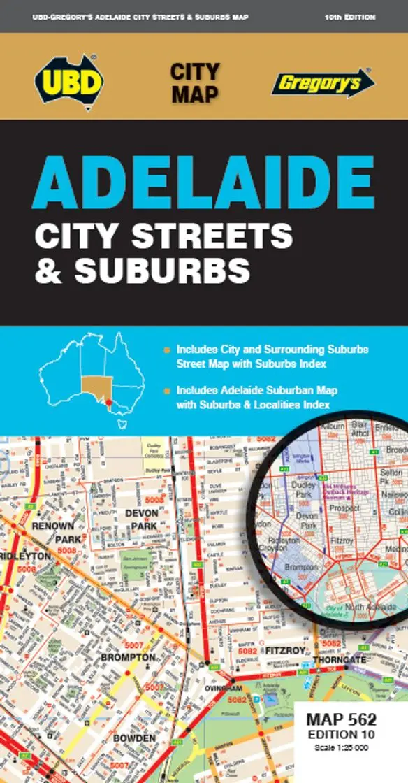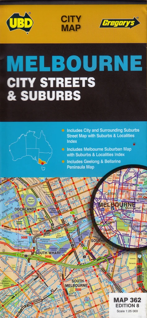
Melbourne City Streets and Suburbs Map UBD 362 8th Edition
An incredibly detailed and versatile wall map of Melbourne – ideal for the home, office, classroom, real estate, logistics, and strategic planning.
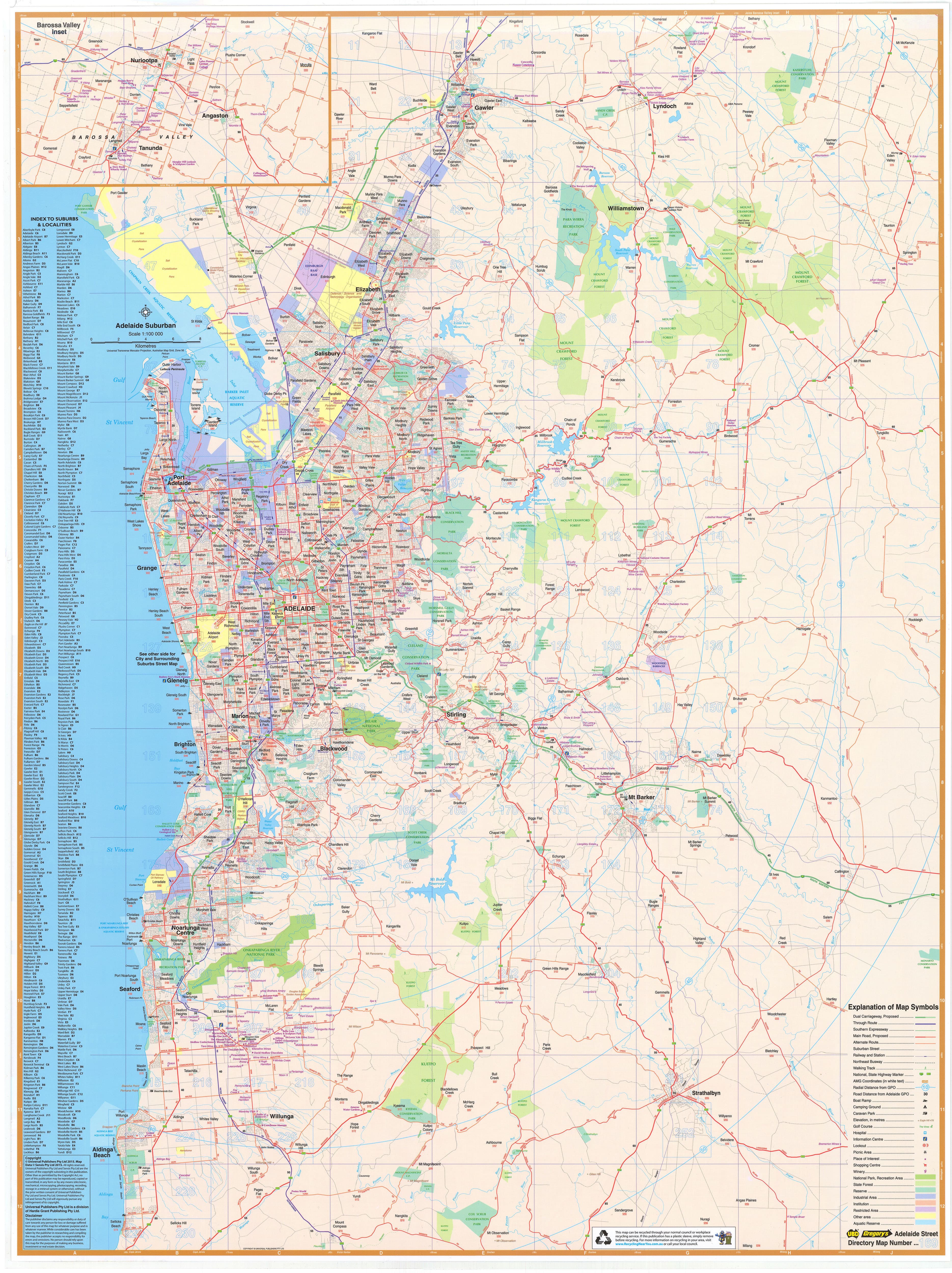
The UBD Melbourne City & Suburbs Wall Map provides a clear, practical, and richly detailed view of Australia’s cultural and commercial capital. Carefully designed with accuracy and usability in mind, this double-sided laminated map delivers two essential perspectives in one product: a fine-grain street-level map of Melbourne’s inner suburbs, and a comprehensive suburban overview of the greater metropolitan area, extending from the northwest growth corridors to the southern coastline.
Whether you're house hunting, planning a development, managing a delivery network, or simply need a reliable map of the city for reference, this updated 2023 edition is your go-to visual tool.
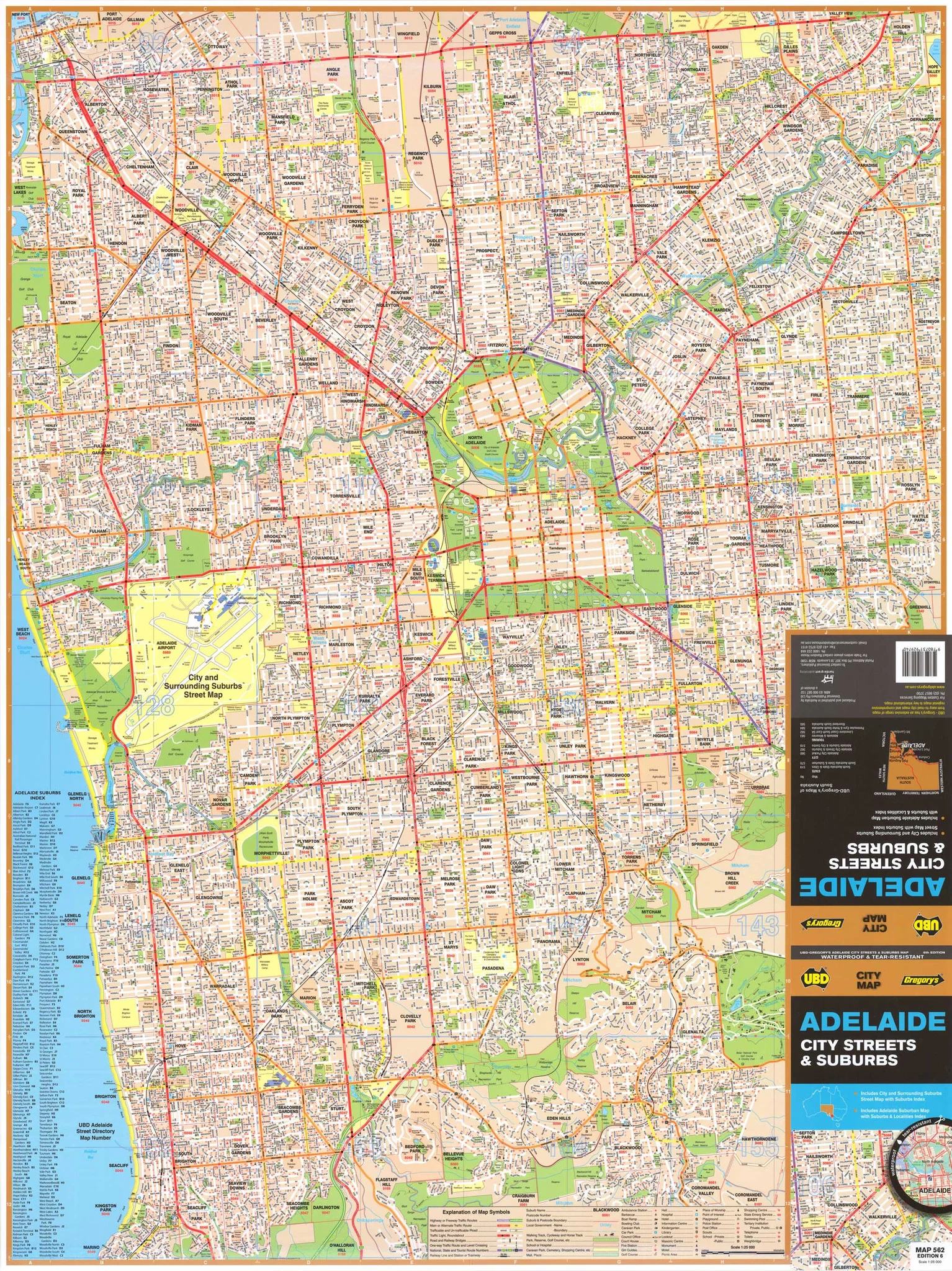
🗺️ SIDE A – Central Melbourne Detailed Map
Scale: 1:25,000
This side focuses on Melbourne’s inner city and central suburbs, offering street-by-street navigation for one of the most dynamic urban areas in the Southern Hemisphere.
Coverage area spans:
-
Northwest to Essendon
-
Northeast to Belfield
-
Southwest to Williamstown
-
Southeast to Sandringham
Features include:
-
Clearly marked streets, laneways, and major intersections
-
Public infrastructure such as train lines, tram routes, hospitals, universities, and government buildings
-
Parks, waterways, and recreational spaces
-
Key tourist attractions, business precincts, and residential zones
This side is perfect for:
-
Real estate professionals needing precise suburb and street boundaries
-
Urban navigation and public service planning
-
Tourism operations and business logistics within the central corridor
🏙️ SIDE B – Greater Melbourne Suburban Overview
Scale: 1:120,000
Flipping the map over reveals a broader view of Melbourne’s metropolitan footprint, showing the full network of suburbs, roads, and key regional connections.
Coverage extends from:
-
Sunbury in the north
-
Cowes and the Mornington Peninsula in the south
-
Geelong and the Bellarine Peninsula (featured in an inset)
Highlights include:
-
Arterial routes, freeways, and main suburban roads
-
Suburb names with clearly marked postcodes
-
Residential zones, green belts, national parks, and industrial areas
-
Rail corridors, rivers, and key transport hubs
-
A complete index of suburb names and corresponding postcodes for quick reference
Ideal for:
-
Franchise territory mapping
-
Public service and emergency planning
-
Family relocation planning, school zoning, or commute route exploration
-
Education and civic engagement — helping locals and newcomers understand the full structure of metropolitan Melbourne
🖨️ PRODUCTION QUALITY
Crafted with durability and clarity in mind, this map is:
-
Printed on premium 120 gsm FSC-certified matte-coated paper
-
Uses fade-resistant pigment-based inks from Hewlett-Packard for long-lasting colour and print quality
-
Encapsulated between two 80-micron gloss laminate sheets, making it:
-
Waterproof and tear-resistant
-
Wipeable with dry-erase markers for notes, planning, or routes
-
Suitable for use with Map Dots or pins to highlight areas of interest
-
📐 MAP DETAILS
-
Published: 2023
-
Publisher: UBD Gregory’s
-
Orientation: Portrait
-
Scales:
-
Central Melbourne: 1:25,000
-
Greater Melbourne: 1:120,000
-
-
Size: 700 mm (W) × 1000 mm (H)
-
Printed in: Australia
🛒 PURCHASE OPTIONS
-
Flat Laminated Map – $99.00
-
Supplied flat, ideal for framing, mounting, or pinning
-
Perfect for professional spaces, council offices, or public display
-
-
Laminated Folded Map – $49.95
-
A previously folded map that has been laminated
-
Some visible crease lines may remain, but full functionality and durability are preserved
-
Ideal for home offices, caravans, or casual use
-
🎯 WHO USES THIS MAP?
-
Real estate offices and property developers seeking accurate suburb layouts and postcode zones
-
Councils, planners, and infrastructure teams managing public services or road networks
-
Logistics companies, technicians, and couriers optimising service zones
-
Schools and educators teaching local geography and urban planning
-
New residents, families, or students learning to navigate the city
-
Businesses expanding operations or visualising customer catchments
✅ WHY CHOOSE THE MELBOURNE CITY & SUBURBS MAP?
-
Trusted cartography by UBD Gregory’s, Australia’s premier map publisher
-
Updated with the latest 2023 urban data
-
Dual-sided versatility — get close-up detail and big-picture context in one product
-
Proudly printed in Australia, with quality production and materials
-
A long-lasting investment in navigation, planning, and education
Explore. Plan. Understand.
The UBD Melbourne City & Suburbs Wall Map delivers the insight and accuracy you need — whether you’re moving across town or managing an entire region.
Built to inform. Designed to last. Made for Melbourne.
Original: $9.98
-65%$9.98
$3.49Product Information
Product Information
Shipping & Returns
Shipping & Returns
Description
An incredibly detailed and versatile wall map of Melbourne – ideal for the home, office, classroom, real estate, logistics, and strategic planning.
The UBD Melbourne City & Suburbs Wall Map provides a clear, practical, and richly detailed view of Australia’s cultural and commercial capital. Carefully designed with accuracy and usability in mind, this double-sided laminated map delivers two essential perspectives in one product: a fine-grain street-level map of Melbourne’s inner suburbs, and a comprehensive suburban overview of the greater metropolitan area, extending from the northwest growth corridors to the southern coastline.
Whether you're house hunting, planning a development, managing a delivery network, or simply need a reliable map of the city for reference, this updated 2023 edition is your go-to visual tool.
🗺️ SIDE A – Central Melbourne Detailed Map
Scale: 1:25,000
This side focuses on Melbourne’s inner city and central suburbs, offering street-by-street navigation for one of the most dynamic urban areas in the Southern Hemisphere.
Coverage area spans:
-
Northwest to Essendon
-
Northeast to Belfield
-
Southwest to Williamstown
-
Southeast to Sandringham
Features include:
-
Clearly marked streets, laneways, and major intersections
-
Public infrastructure such as train lines, tram routes, hospitals, universities, and government buildings
-
Parks, waterways, and recreational spaces
-
Key tourist attractions, business precincts, and residential zones
This side is perfect for:
-
Real estate professionals needing precise suburb and street boundaries
-
Urban navigation and public service planning
-
Tourism operations and business logistics within the central corridor
🏙️ SIDE B – Greater Melbourne Suburban Overview
Scale: 1:120,000
Flipping the map over reveals a broader view of Melbourne’s metropolitan footprint, showing the full network of suburbs, roads, and key regional connections.
Coverage extends from:
-
Sunbury in the north
-
Cowes and the Mornington Peninsula in the south
-
Geelong and the Bellarine Peninsula (featured in an inset)
Highlights include:
-
Arterial routes, freeways, and main suburban roads
-
Suburb names with clearly marked postcodes
-
Residential zones, green belts, national parks, and industrial areas
-
Rail corridors, rivers, and key transport hubs
-
A complete index of suburb names and corresponding postcodes for quick reference
Ideal for:
-
Franchise territory mapping
-
Public service and emergency planning
-
Family relocation planning, school zoning, or commute route exploration
-
Education and civic engagement — helping locals and newcomers understand the full structure of metropolitan Melbourne
🖨️ PRODUCTION QUALITY
Crafted with durability and clarity in mind, this map is:
-
Printed on premium 120 gsm FSC-certified matte-coated paper
-
Uses fade-resistant pigment-based inks from Hewlett-Packard for long-lasting colour and print quality
-
Encapsulated between two 80-micron gloss laminate sheets, making it:
-
Waterproof and tear-resistant
-
Wipeable with dry-erase markers for notes, planning, or routes
-
Suitable for use with Map Dots or pins to highlight areas of interest
-
📐 MAP DETAILS
-
Published: 2023
-
Publisher: UBD Gregory’s
-
Orientation: Portrait
-
Scales:
-
Central Melbourne: 1:25,000
-
Greater Melbourne: 1:120,000
-
-
Size: 700 mm (W) × 1000 mm (H)
-
Printed in: Australia
🛒 PURCHASE OPTIONS
-
Flat Laminated Map – $99.00
-
Supplied flat, ideal for framing, mounting, or pinning
-
Perfect for professional spaces, council offices, or public display
-
-
Laminated Folded Map – $49.95
-
A previously folded map that has been laminated
-
Some visible crease lines may remain, but full functionality and durability are preserved
-
Ideal for home offices, caravans, or casual use
-
🎯 WHO USES THIS MAP?
-
Real estate offices and property developers seeking accurate suburb layouts and postcode zones
-
Councils, planners, and infrastructure teams managing public services or road networks
-
Logistics companies, technicians, and couriers optimising service zones
-
Schools and educators teaching local geography and urban planning
-
New residents, families, or students learning to navigate the city
-
Businesses expanding operations or visualising customer catchments
✅ WHY CHOOSE THE MELBOURNE CITY & SUBURBS MAP?
-
Trusted cartography by UBD Gregory’s, Australia’s premier map publisher
-
Updated with the latest 2023 urban data
-
Dual-sided versatility — get close-up detail and big-picture context in one product
-
Proudly printed in Australia, with quality production and materials
-
A long-lasting investment in navigation, planning, and education
Explore. Plan. Understand.
The UBD Melbourne City & Suburbs Wall Map delivers the insight and accuracy you need — whether you’re moving across town or managing an entire region.
Built to inform. Designed to last. Made for Melbourne.