Monash Electoral Map, Victoria (1939)
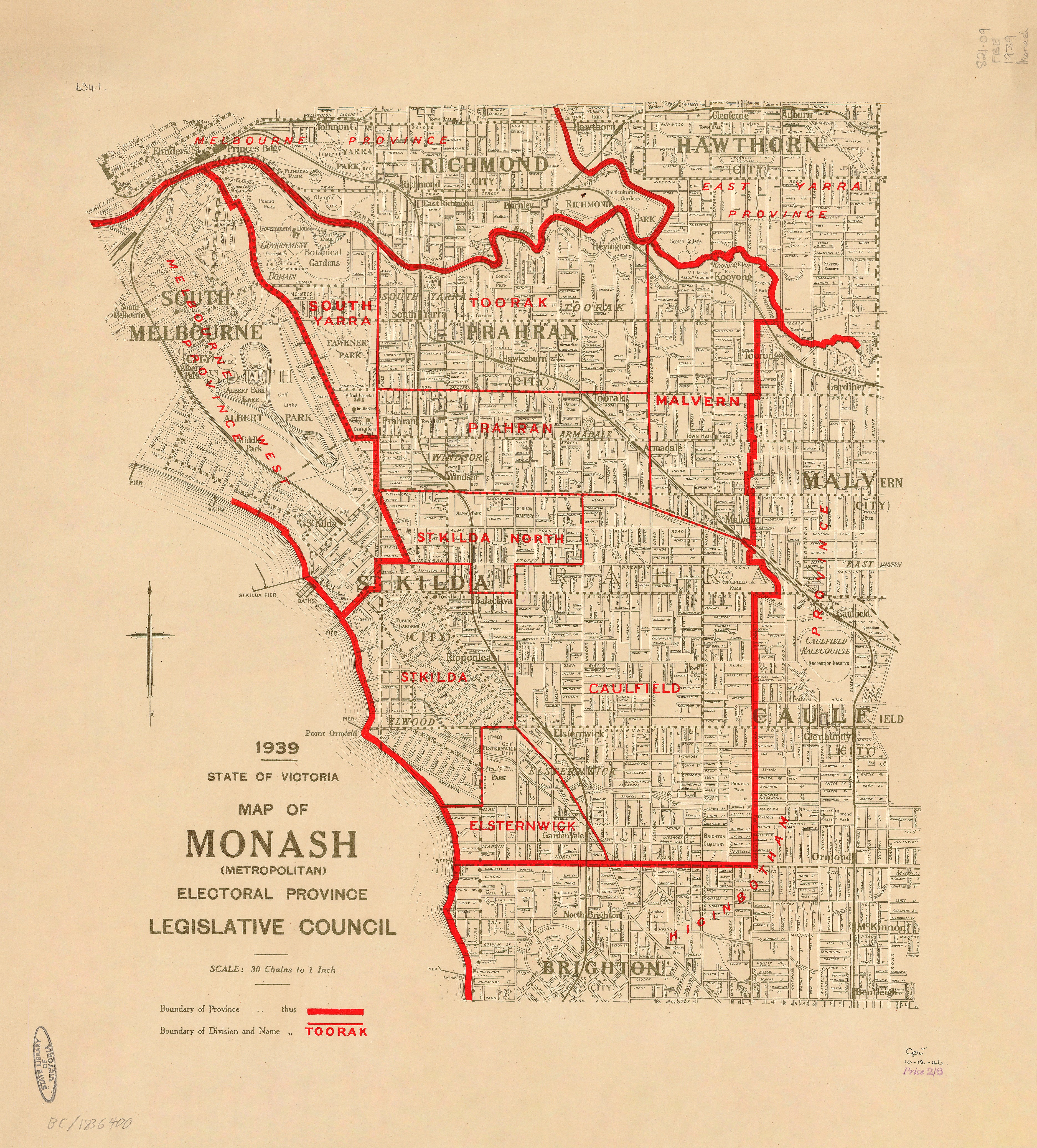
1939 — State of Victoria
Monash (Metropolitan) Electoral Province
Legislative Council Electoral Map
This official 1939 electoral map of the Monash (Metropolitan) Electoral Province was issued by the Department of Crown Lands and Survey as part of Victoria’s formal Legislative Council boundary mapping.
Named in honour of Sir John Monash, the province covered a significant sweep of Melbourne’s inner-to-middle suburbs at a time when metropolitan growth, transport corridors, and population density were reshaping political representation. Produced as a working government document, the map prioritises clarity, accuracy, and administrative purpose, qualities that now make it a valuable historical artefact.
🗳️ What the Map Shows
-
Legislative Council boundaries for the Monash (Metropolitan) Electoral Province
-
Suburban structure and locality layout of metropolitan Melbourne
-
Clean boundary delineation at large working scale
-
Restrained, survey-grade government cartography typical of the late interwar period
📜 Historical Context
Published in 1939, this map captures Melbourne’s electoral geography immediately prior to World War II—before the sweeping post-war suburban expansion and redistribution that would redefine Victorian politics. It provides a precise snapshot of pre-war metropolitan representation, widely used today for electoral, urban, and planning history.
✨ Premium Print & Display Options
Each copy is printed in Australia using archival processes to preserve the original linework and tonal balance.
| Finish | Description |
|---|---|
| 📄 Heavyweight Paper (160 gsm matte) | Archival matte surface with excellent definition. |
| 🔒 Laminated (True Encapsulation) | Sealed between 2 × 80-micron gloss laminate; wipe-clean and durable. |
| 🎨 Archival Canvas (395 gsm HP Professional Matte) | Pigment-based, fade-resistant inks with strong visual presence. |
| 🪵 Laminated + Timber Hang Rails | Natural lacquered timber rails, ready to hang (allow up to 10 working days). |
| 🪵 Canvas + Timber Hang Rails | Gallery-ready, frame-free finish (allow up to 10 working days). |
📐 Size (W × H)
903 mm × 1000 mm
Orientation: Portrait
Custom sizing: Available on request.
🎯 Ideal For
-
Victorian electoral and parliamentary history
-
Melbourne metropolitan studies
-
Libraries, universities, and archives
-
Civic, institutional, and educational spaces
-
Collectors of Australian government maps
🤝 Our Commitment
Printed locally in Australia, every copy is carefully produced to honour the precision and intent of the original 1939 government issue.
A clear and authoritative record of Melbourne’s Monash electorate at a pivotal moment in Victoria’s political history.
Original: $64.36
-65%$64.36
$22.53Product Information
Product Information
Shipping & Returns
Shipping & Returns
Description
1939 — State of Victoria
Monash (Metropolitan) Electoral Province
Legislative Council Electoral Map
This official 1939 electoral map of the Monash (Metropolitan) Electoral Province was issued by the Department of Crown Lands and Survey as part of Victoria’s formal Legislative Council boundary mapping.
Named in honour of Sir John Monash, the province covered a significant sweep of Melbourne’s inner-to-middle suburbs at a time when metropolitan growth, transport corridors, and population density were reshaping political representation. Produced as a working government document, the map prioritises clarity, accuracy, and administrative purpose, qualities that now make it a valuable historical artefact.
🗳️ What the Map Shows
-
Legislative Council boundaries for the Monash (Metropolitan) Electoral Province
-
Suburban structure and locality layout of metropolitan Melbourne
-
Clean boundary delineation at large working scale
-
Restrained, survey-grade government cartography typical of the late interwar period
📜 Historical Context
Published in 1939, this map captures Melbourne’s electoral geography immediately prior to World War II—before the sweeping post-war suburban expansion and redistribution that would redefine Victorian politics. It provides a precise snapshot of pre-war metropolitan representation, widely used today for electoral, urban, and planning history.
✨ Premium Print & Display Options
Each copy is printed in Australia using archival processes to preserve the original linework and tonal balance.
| Finish | Description |
|---|---|
| 📄 Heavyweight Paper (160 gsm matte) | Archival matte surface with excellent definition. |
| 🔒 Laminated (True Encapsulation) | Sealed between 2 × 80-micron gloss laminate; wipe-clean and durable. |
| 🎨 Archival Canvas (395 gsm HP Professional Matte) | Pigment-based, fade-resistant inks with strong visual presence. |
| 🪵 Laminated + Timber Hang Rails | Natural lacquered timber rails, ready to hang (allow up to 10 working days). |
| 🪵 Canvas + Timber Hang Rails | Gallery-ready, frame-free finish (allow up to 10 working days). |
📐 Size (W × H)
903 mm × 1000 mm
Orientation: Portrait
Custom sizing: Available on request.
🎯 Ideal For
-
Victorian electoral and parliamentary history
-
Melbourne metropolitan studies
-
Libraries, universities, and archives
-
Civic, institutional, and educational spaces
-
Collectors of Australian government maps
🤝 Our Commitment
Printed locally in Australia, every copy is carefully produced to honour the precision and intent of the original 1939 government issue.
A clear and authoritative record of Melbourne’s Monash electorate at a pivotal moment in Victoria’s political history.


