Oregon Recreation 903 x 711mm Wall Map
🌲 Oregon Recreation Wall Map – 2022 Edition
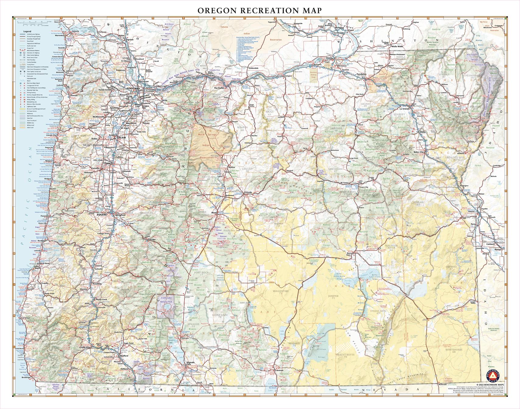
Published: 2022 | Scale: 1:775,000 | Size: 903 mm (W) × 711 mm (H)
From its rugged yet tranquil Pacific coastline to the alpine wonders of Crater Lake, Mount Hood, and the Cascade Range, Oregon is a land of dramatic beauty and endless adventure. This expertly designed wall map showcases The Beaver State’s extensive public lands, scenic roadways, and recreation hotspots — from windswept beaches and towering waterfalls to pristine wilderness and charming small towns.
🗺 Key Features
-
Full State Coverage – From the Pacific Coast to the Idaho border, and from the Columbia River to the California line.
-
Public Lands & Recreation Areas – National and state parks, forests, monuments, and wildlife refuges clearly marked.
-
Road Network Detail – Major highways, secondary roads, and scenic byways for trip planning.
-
Topographic Shaded Relief – Highlights mountain ranges, valleys, and volcanic peaks.
-
Clarity & Readability – Clean, balanced cartography with easy-to-read labels.
📐 Size & Scale
| Dimensions | Scale | Edition |
|---|---|---|
| 903 × 711 mm | 1:775,000 | 2022 |
🖌 Premium Material & Display Options
| Format | Description |
|---|---|
| Paper (160 gsm) | Heavyweight matte-coated stock — ideal for framing under glass. |
| Laminated | Encapsulated in 80-micron gloss laminate — waterproof, durable, and suitable for whiteboard markers. |
| Laminated + Hang Rails | Professionally mounted with natural timber rails and a hanging cord for easy wall display. |
| Canvas (395 gsm) | Museum-grade matte canvas with archival pigment inks — textured, fade-resistant, and built to last. |
| Canvas + Hang Rails | Canvas mounted with lacquered timber rails — a premium ready-to-hang presentation. |
Note: Please allow up to 10 working days for delivery of hang-railed maps due to custom mounting.
🎯 Perfect For
-
Travel Planning – Plan road trips from the coast to the mountains.
-
Outdoor Enthusiasts – Locate hiking trails, fishing spots, campgrounds, and scenic drives.
-
Educators & Visitor Centres – A valuable teaching and display tool.
-
Collectors – Complements the complete U.S. state recreation wall map series.
🌟 Why Choose This Map
-
Comprehensive State Detail – Covers Oregon’s natural diversity in full.
-
Dual Purpose – Practical for navigation and stunning as wall art.
-
Exceptional Print Quality – Crisp lines, vivid colours, and long-lasting durability.
-
Proudly Made in Australia – Crafted to the highest cartographic standards.
The Oregon Recreation Wall Map is more than just a travel reference — it’s an inspiring visual journey across one of America’s most beautiful and adventurous states, perfect for home, office, or educational spaces.
Original: $57.20
-65%$57.20
$20.02Product Information
Product Information
Shipping & Returns
Shipping & Returns
Description
🌲 Oregon Recreation Wall Map – 2022 Edition
Published: 2022 | Scale: 1:775,000 | Size: 903 mm (W) × 711 mm (H)
From its rugged yet tranquil Pacific coastline to the alpine wonders of Crater Lake, Mount Hood, and the Cascade Range, Oregon is a land of dramatic beauty and endless adventure. This expertly designed wall map showcases The Beaver State’s extensive public lands, scenic roadways, and recreation hotspots — from windswept beaches and towering waterfalls to pristine wilderness and charming small towns.
🗺 Key Features
-
Full State Coverage – From the Pacific Coast to the Idaho border, and from the Columbia River to the California line.
-
Public Lands & Recreation Areas – National and state parks, forests, monuments, and wildlife refuges clearly marked.
-
Road Network Detail – Major highways, secondary roads, and scenic byways for trip planning.
-
Topographic Shaded Relief – Highlights mountain ranges, valleys, and volcanic peaks.
-
Clarity & Readability – Clean, balanced cartography with easy-to-read labels.
📐 Size & Scale
| Dimensions | Scale | Edition |
|---|---|---|
| 903 × 711 mm | 1:775,000 | 2022 |
🖌 Premium Material & Display Options
| Format | Description |
|---|---|
| Paper (160 gsm) | Heavyweight matte-coated stock — ideal for framing under glass. |
| Laminated | Encapsulated in 80-micron gloss laminate — waterproof, durable, and suitable for whiteboard markers. |
| Laminated + Hang Rails | Professionally mounted with natural timber rails and a hanging cord for easy wall display. |
| Canvas (395 gsm) | Museum-grade matte canvas with archival pigment inks — textured, fade-resistant, and built to last. |
| Canvas + Hang Rails | Canvas mounted with lacquered timber rails — a premium ready-to-hang presentation. |
Note: Please allow up to 10 working days for delivery of hang-railed maps due to custom mounting.
🎯 Perfect For
-
Travel Planning – Plan road trips from the coast to the mountains.
-
Outdoor Enthusiasts – Locate hiking trails, fishing spots, campgrounds, and scenic drives.
-
Educators & Visitor Centres – A valuable teaching and display tool.
-
Collectors – Complements the complete U.S. state recreation wall map series.
🌟 Why Choose This Map
-
Comprehensive State Detail – Covers Oregon’s natural diversity in full.
-
Dual Purpose – Practical for navigation and stunning as wall art.
-
Exceptional Print Quality – Crisp lines, vivid colours, and long-lasting durability.
-
Proudly Made in Australia – Crafted to the highest cartographic standards.
The Oregon Recreation Wall Map is more than just a travel reference — it’s an inspiring visual journey across one of America’s most beautiful and adventurous states, perfect for home, office, or educational spaces.


