Simpson Desert South G5308 AUSTopo 1:250,000 Map
Simpson Desert South G5308 — AUSTopo 1:250,000 Topographic Map (2025)
Endless dunes, desert corridors, and remote crossings—mapped for precision across vast country
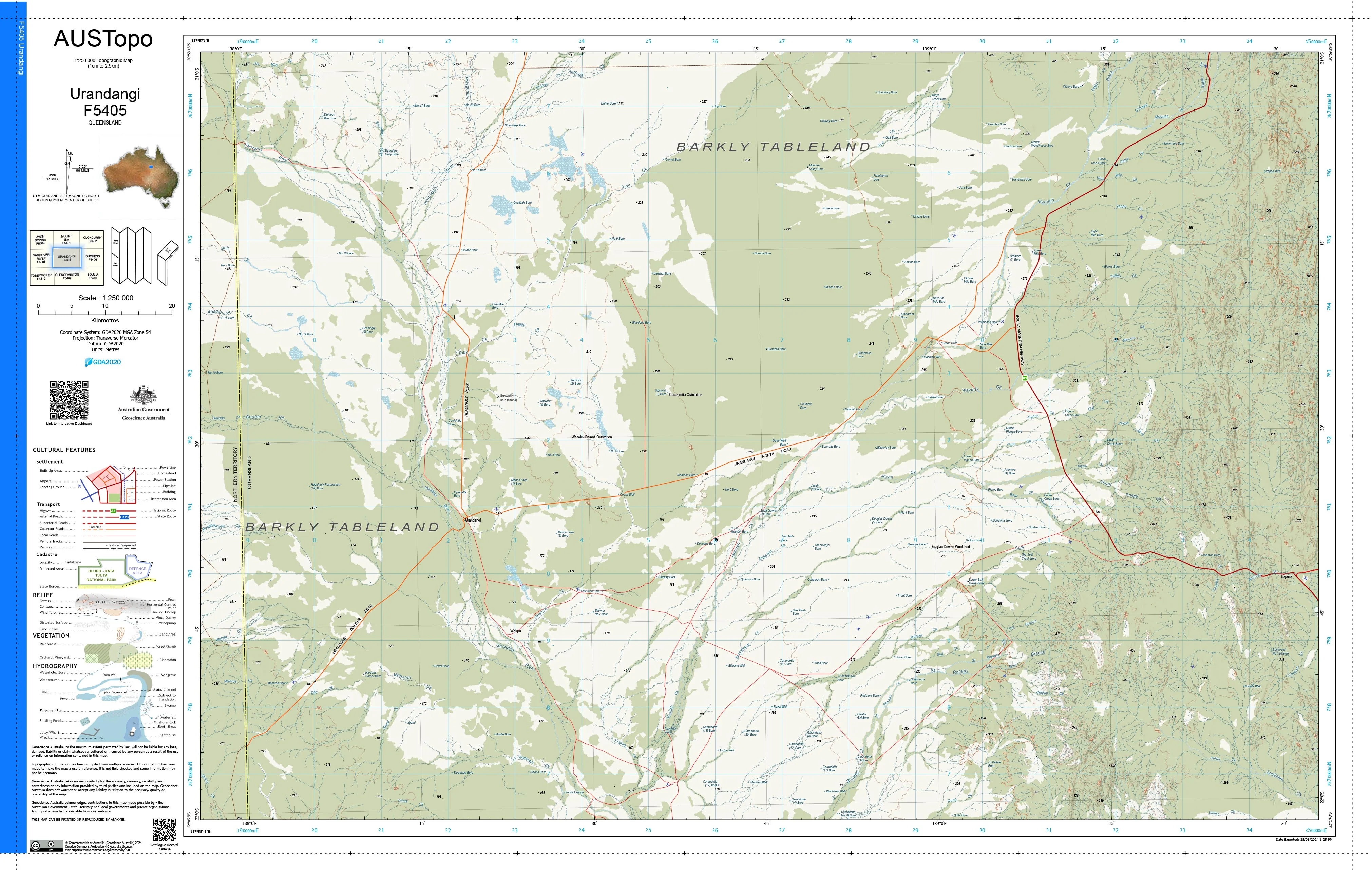
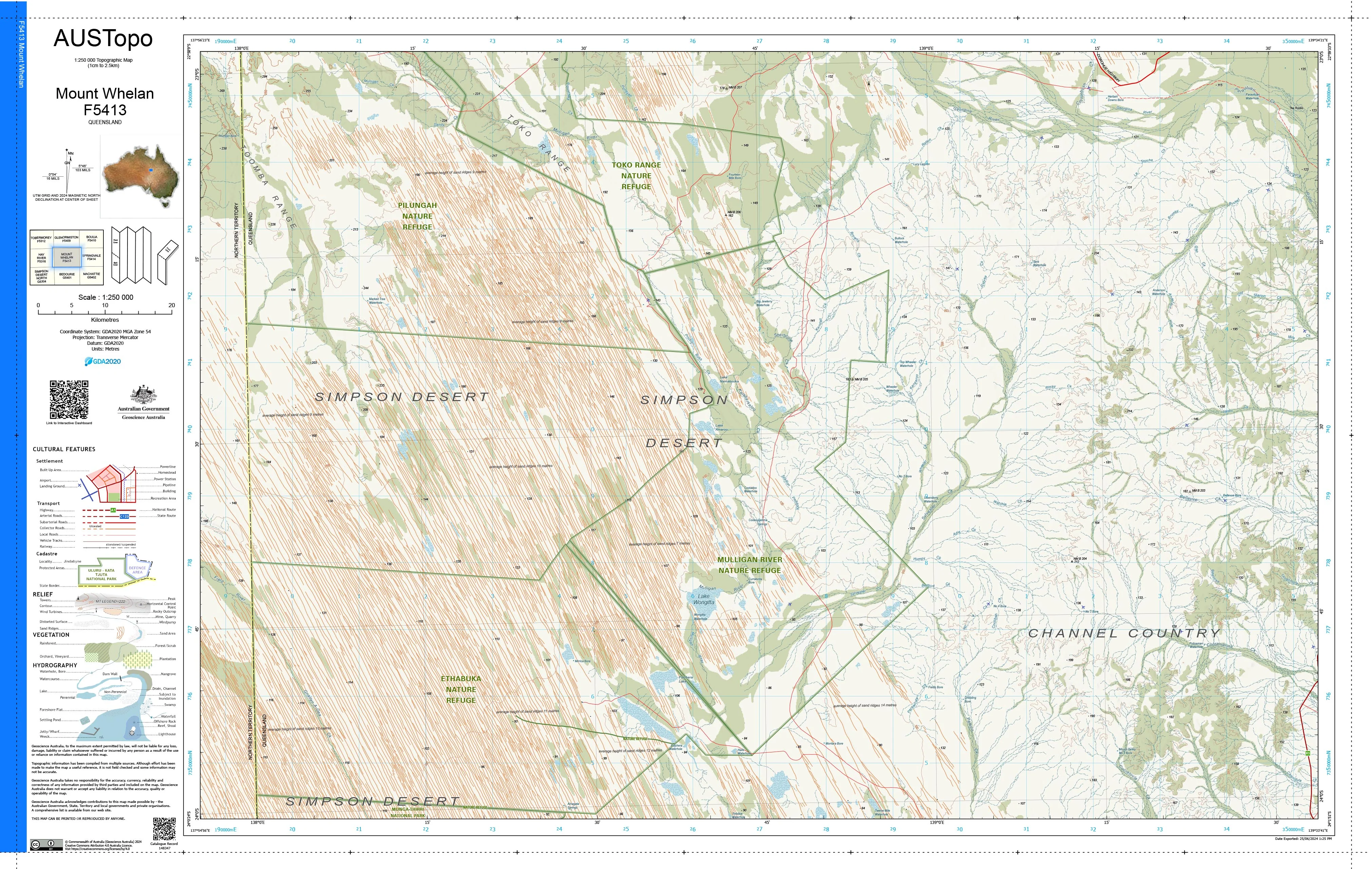
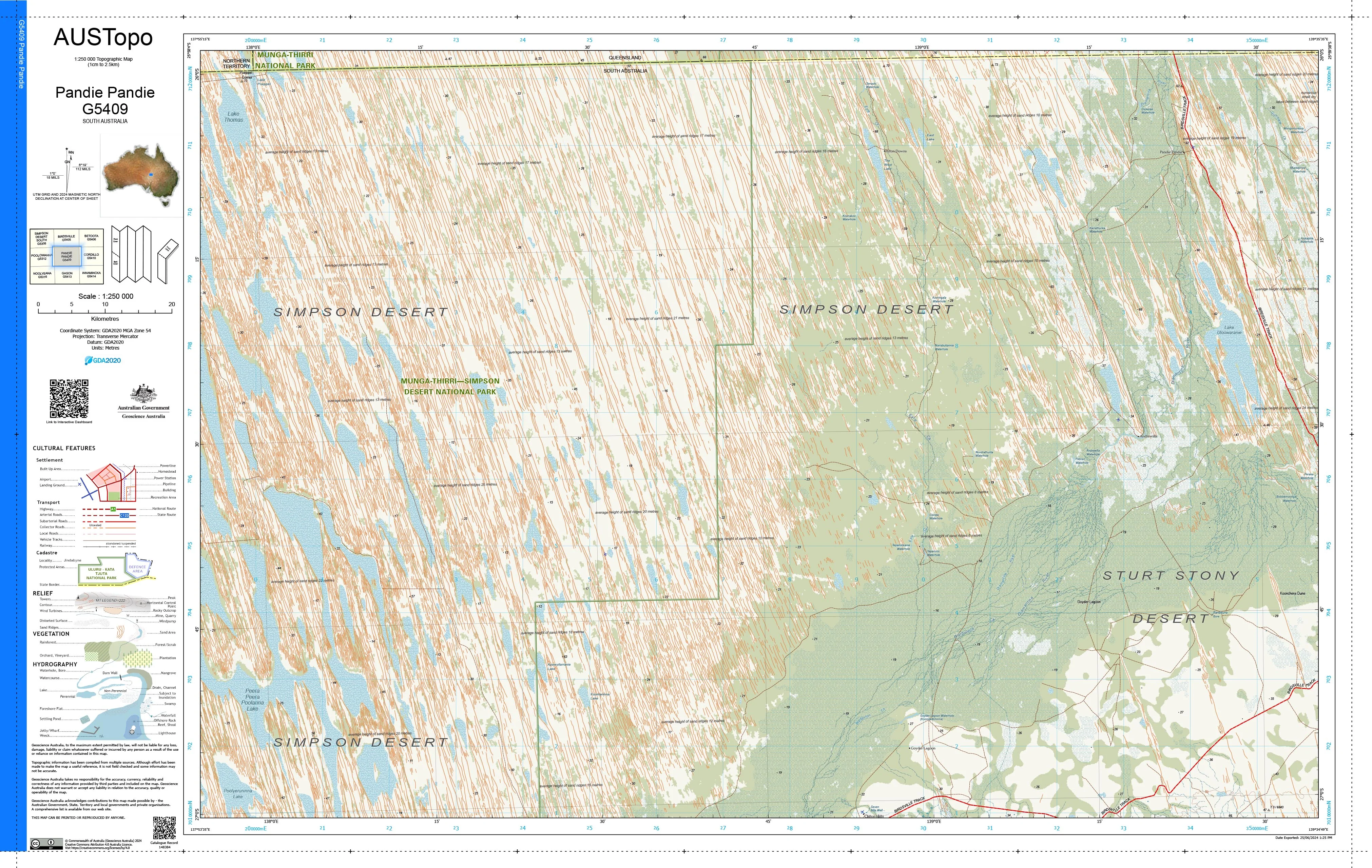
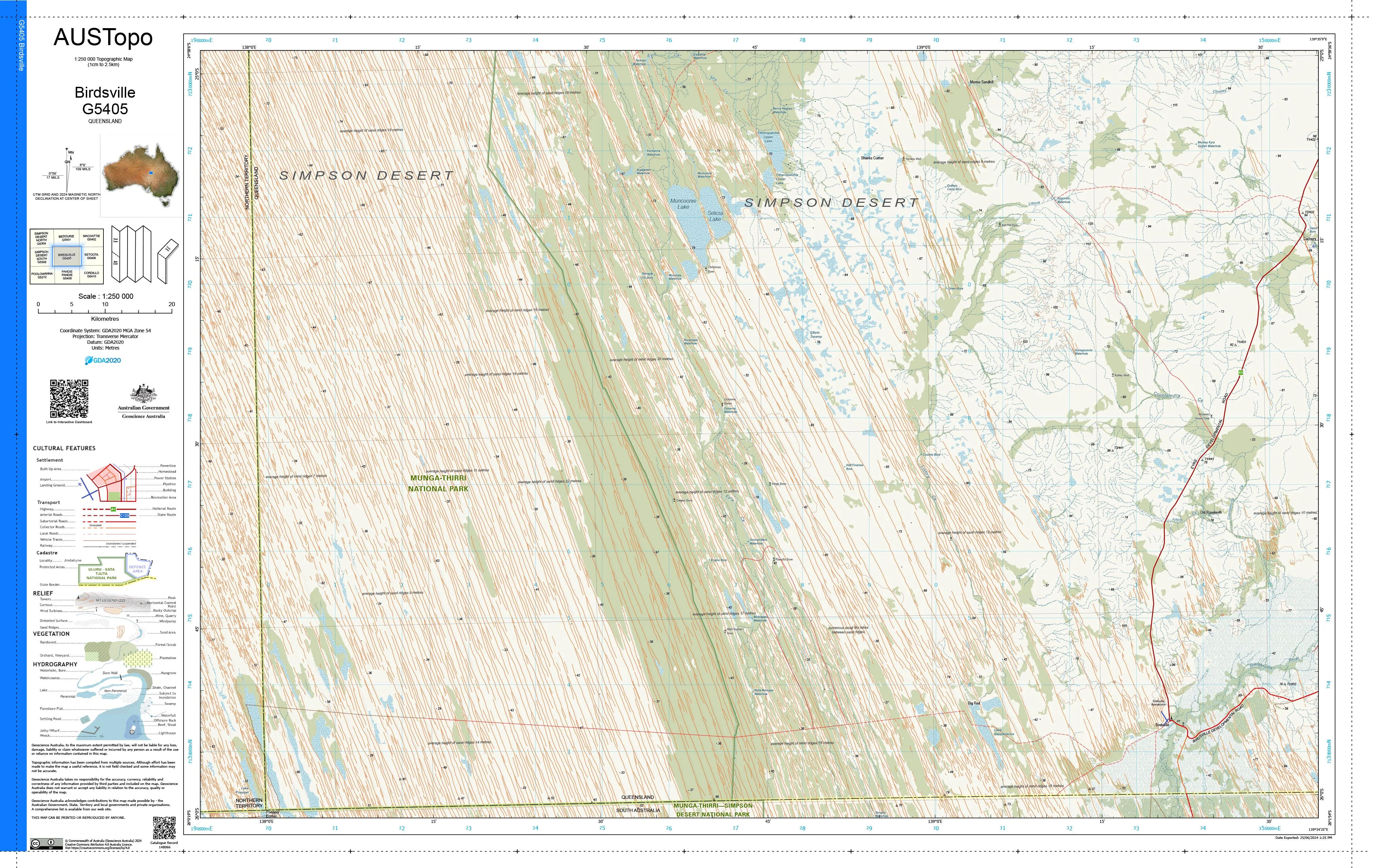
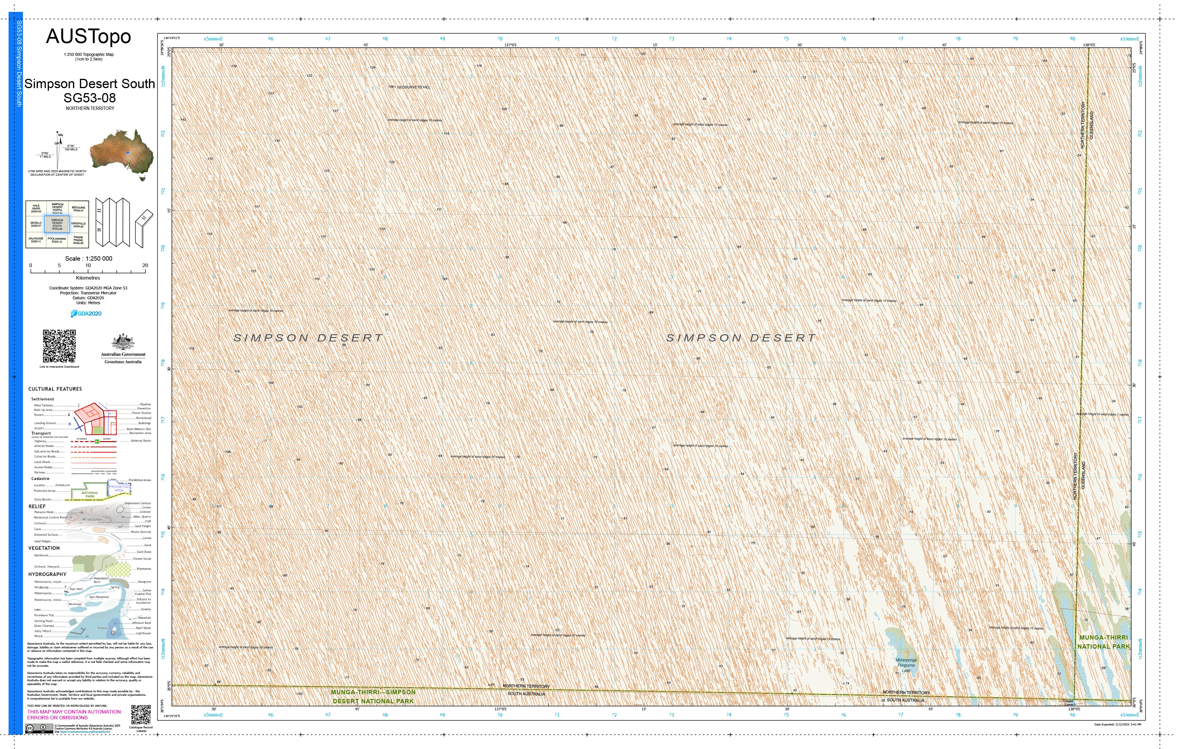
Covering the southern Simpson Desert, this AUSTopo 1:250,000 sheet delivers an authoritative regional overview of one of Australia’s most iconic and demanding landscapes. From parallel dune fields and desert swales to remote tracks and basin-scale drainage, it’s built for professionals and experienced desert travellers who require dependable, large-area context.
At 1:250,000 scale (1 cm = 2.5 km), it is the largest scale at which published topographic maps cover the entire Australian continent—ideal for expedition planning, emergency coordination, environmental research, and serious outback navigation.
🧭 Why this map stands out
-
Updated mapping (2025) — aligned to modern Australian datums for confident decision-making
-
True desert perspective — dune systems, corridors, and access routes shown in one coherent view
-
Professional-grade cartography — relied on by emergency services, scientists, and land managers
-
Dual coordinate systems — seamless use between office planning and field navigation
-
Printed in Australia — precision output, locally finished and quality-checked
🗺️ What you’ll see
-
Contours and spot elevations defining dune crests and desert relief
-
Sand ridges, swales, and arid drainage features
-
Roads, desert tracks, and place names
-
Vegetation patterns and administrative boundaries
-
Clear grid overlays for accurate positioning and route planning
📐 Map details at a glance
-
Scale: 1:250,000
-
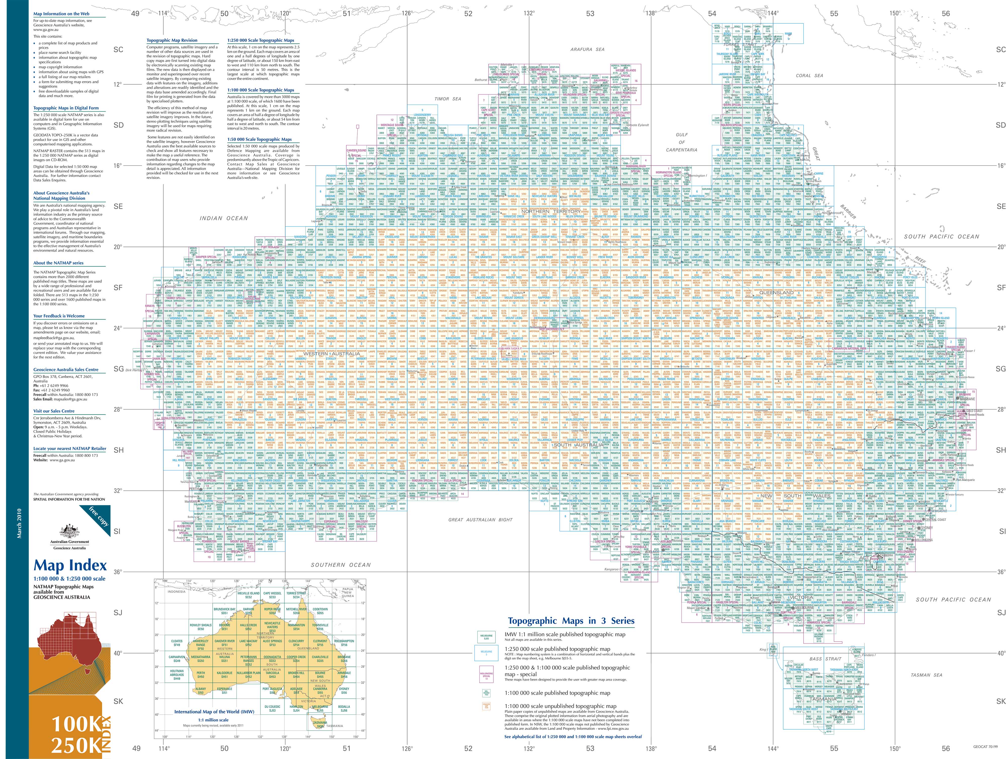
Series: AUSTopo — Australian Digital Topographic Map Series
-
Coverage: Simpson Desert South G5308
-
Map currency: 2025
-
Coordinates: Geographical & MGA
-
Datum: GDA2020, AHD
-
Projection: Universal Transverse Mercator (UTM)
-
Sheet size: 800 mm (W) × 500 mm (H)
🎨 Field-ready print options
All finishes are printed in Australia using high-resolution colour for crisp linework and long-term legibility.
-
📄 Paper (standard)
Ideal for expedition planning, briefing rooms, or framed reference. -
💧 DuPont™ Tyvek® (waterproof & tear-proof)
Foldable, lightweight, and exceptionally durable—perfect for harsh desert conditions and repeated handling. -
🔒 Laminated (write-on / wipe-off)
True encapsulation protects against tears and stains. Mark routes with whiteboard markers or apply map dots—then wipe clean and reuse.
🎯 Who it’s for
-
Emergency services & remote-area coordinators
-
Desert expedition leaders & researchers
-
Environmental and land-use planners
-
Educators and students
-
Outback travellers and serious 4WD adventurers
🇦🇺 Our commitment
Every AUSTopo map we supply is printed and finished in Australia, colour-managed for accuracy, hand-checked, and packed with care—so it arrives ready for real-world use.
Plan, brief, and traverse the Simpson Desert South with confidence. Choose your finish and add this essential 2025 AUSTopo map to your kit today.
Product Information
Product Information
Shipping & Returns
Shipping & Returns
Description
Simpson Desert South G5308 — AUSTopo 1:250,000 Topographic Map (2025)
Endless dunes, desert corridors, and remote crossings—mapped for precision across vast country
Covering the southern Simpson Desert, this AUSTopo 1:250,000 sheet delivers an authoritative regional overview of one of Australia’s most iconic and demanding landscapes. From parallel dune fields and desert swales to remote tracks and basin-scale drainage, it’s built for professionals and experienced desert travellers who require dependable, large-area context.
At 1:250,000 scale (1 cm = 2.5 km), it is the largest scale at which published topographic maps cover the entire Australian continent—ideal for expedition planning, emergency coordination, environmental research, and serious outback navigation.
🧭 Why this map stands out
-
Updated mapping (2025) — aligned to modern Australian datums for confident decision-making
-
True desert perspective — dune systems, corridors, and access routes shown in one coherent view
-
Professional-grade cartography — relied on by emergency services, scientists, and land managers
-
Dual coordinate systems — seamless use between office planning and field navigation
-
Printed in Australia — precision output, locally finished and quality-checked
🗺️ What you’ll see
-
Contours and spot elevations defining dune crests and desert relief
-
Sand ridges, swales, and arid drainage features
-
Roads, desert tracks, and place names
-
Vegetation patterns and administrative boundaries
-
Clear grid overlays for accurate positioning and route planning
📐 Map details at a glance
-
Scale: 1:250,000
-
Series: AUSTopo — Australian Digital Topographic Map Series
-
Coverage: Simpson Desert South G5308
-
Map currency: 2025
-
Coordinates: Geographical & MGA
-
Datum: GDA2020, AHD
-
Projection: Universal Transverse Mercator (UTM)
-
Sheet size: 800 mm (W) × 500 mm (H)
🎨 Field-ready print options
All finishes are printed in Australia using high-resolution colour for crisp linework and long-term legibility.
-
📄 Paper (standard)
Ideal for expedition planning, briefing rooms, or framed reference. -
💧 DuPont™ Tyvek® (waterproof & tear-proof)
Foldable, lightweight, and exceptionally durable—perfect for harsh desert conditions and repeated handling. -
🔒 Laminated (write-on / wipe-off)
True encapsulation protects against tears and stains. Mark routes with whiteboard markers or apply map dots—then wipe clean and reuse.
🎯 Who it’s for
-
Emergency services & remote-area coordinators
-
Desert expedition leaders & researchers
-
Environmental and land-use planners
-
Educators and students
-
Outback travellers and serious 4WD adventurers
🇦🇺 Our commitment
Every AUSTopo map we supply is printed and finished in Australia, colour-managed for accuracy, hand-checked, and packed with care—so it arrives ready for real-world use.
Plan, brief, and traverse the Simpson Desert South with confidence. Choose your finish and add this essential 2025 AUSTopo map to your kit today.