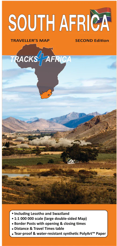
South Africa/Lesotho/Swaziland - Traks4Africa Map
South Africa • Lesotho • Eswatini — Tracks4Africa Overlander Map
GPS-Verified Routes | Comprehensive 4×4 Coverage | Waterproof PolyArt
🦁 Kruger • Drakensberg • Garden Route • Sani Pass • Lowveld & Bushveld
Southern Africa’s southern corridor offers extraordinary diversity — coastal highways, high mountain passes, wildlife reserves and remote gravel backroads. The Tracks4Africa South Africa / Lesotho / Eswatini Map brings all three countries together in one practical, expedition-ready planning tool.
Built from verified GPS travel data and real overland experience, this map is designed for travellers who want more than a tourist overview. It delivers realistic travel times, surface types and route options — across tar highways, gravel roads and 4×4 mountain passes.
🌍 Three Countries — One Connected Journey
This map covers:
-
The full road network of South Africa
-
The mountain kingdom of Lesotho
-
The bushveld and reserves of Eswatini (formerly Swaziland)
Together, they form one of Africa’s most accessible and varied self-drive regions.
From the beaches of the Garden Route to the escarpments of the Drakensberg, from safari plains to high-altitude passes, this map shows how the entire region interlinks.
🧭 What Makes This Map Different
This edition integrates practical travel intelligence with clear cartography:
🛰️ GPS-aligned cartography — matches Tracks4Africa digital mapping
📏 Travel times & distances printed along routes — plan realistic daily stages
🛣️ Comprehensive road & track network — tar, gravel and remote 4×4 tracks
🗺️ National park detail — internal reserve tracks shown
🏙️ City plans for major centres — quick orientation in urban hubs
📍 Place name register included — efficient location lookup
🛂 Border crossings indicated — including opening and closing times
🏕️ Campsites & attractions marked clearly — practical touring insight
It’s designed to answer the critical questions overlanders ask:
-
How far is it really?
-
What surface should I expect?
-
How long will it take?
🐘 Coverage Highlights
This map is ideal for planning routes through:
-
Wildlife corridors in Kruger National Park
-
Mountain crossings like Sani Pass
-
Coastal touring along the Garden Route
-
The highlands and remote gravel roads of Lesotho
-
Nature reserves such as Malolotja Nature Reserve
Whether you’re linking safari regions, navigating mountain passes or planning a loop between all three countries, this map provides full regional awareness.
🚙 Built for 4×4 & Long-Distance Touring
Southern Africa’s southern tier offers:
-
Smooth multi-lane highways
-
Scenic mountain passes
-
Long rural gravel corridors
-
4×4-only highland tracks
-
Cross-border wildlife circuits
Knowing realistic travel times between towns, parks and border posts is essential for:
✔️ Fuel and supply planning
✔️ Managing daylight driving hours
✔️ Comparing alternate routes
✔️ Coordinating multi-country itineraries
This map provides the big-picture view that digital zoom cannot replicate.
💪 Durable PolyArt Construction
Printed on tear- and water-resistant PolyArt, this map is designed for serious use:
💧 Water resistant
🌞 Sun and heat tolerant
🏕️ Camp-table durable
🚙 Easy to use on dashboards
📦 Folds cleanly to display only the section you need
Unlike standard paper maps, it withstands repeated folding and rugged travel conditions.
📐 Specifications
📏 Scale: Regional overview (Tracks4Africa standard large-format country scale)
📄 Format: Folded sheet
💧 Material: Waterproof & tear-resistant PolyArt
🛰️ GPS Compatibility: Matches Tracks4Africa GPS maps
🗺️ Coverage: South Africa, Lesotho & Eswatini
🎯 Who This Map Is For
🚙 4×4 overlanders
🏕️ Self-drive safari travellers
🌍 Cross-border explorers
📍 Touring couples and families
🧭 Travellers who want reliable offline navigation
If you’re driving Cape Town to Kruger, crossing into Lesotho’s highlands, or looping through Eswatini’s bushveld reserves, this map delivers clarity, realism and confidence.
📦 Important Ordering Note
This is an Order-on-Demand map.
🕒 Please allow up to 10 working days for delivery.
⭐ Three Countries. Endless Routes.
The southern African trio of South Africa, Lesotho and Eswatini offers extraordinary variety — coastlines, wildlife, mountains and remote backroads.
The Tracks4Africa Overlander Map brings that diversity into one practical, GPS-verified and expedition-ready format.
Unfold it. Compare your routes. Plan your distances.
And set out across Southern Africa with confidence.
Original: $35.74
-65%$35.74
$12.51Product Information
Product Information
Shipping & Returns
Shipping & Returns
Description
South Africa • Lesotho • Eswatini — Tracks4Africa Overlander Map
GPS-Verified Routes | Comprehensive 4×4 Coverage | Waterproof PolyArt
🦁 Kruger • Drakensberg • Garden Route • Sani Pass • Lowveld & Bushveld
Southern Africa’s southern corridor offers extraordinary diversity — coastal highways, high mountain passes, wildlife reserves and remote gravel backroads. The Tracks4Africa South Africa / Lesotho / Eswatini Map brings all three countries together in one practical, expedition-ready planning tool.
Built from verified GPS travel data and real overland experience, this map is designed for travellers who want more than a tourist overview. It delivers realistic travel times, surface types and route options — across tar highways, gravel roads and 4×4 mountain passes.
🌍 Three Countries — One Connected Journey
This map covers:
-
The full road network of South Africa
-
The mountain kingdom of Lesotho
-
The bushveld and reserves of Eswatini (formerly Swaziland)
Together, they form one of Africa’s most accessible and varied self-drive regions.
From the beaches of the Garden Route to the escarpments of the Drakensberg, from safari plains to high-altitude passes, this map shows how the entire region interlinks.
🧭 What Makes This Map Different
This edition integrates practical travel intelligence with clear cartography:
🛰️ GPS-aligned cartography — matches Tracks4Africa digital mapping
📏 Travel times & distances printed along routes — plan realistic daily stages
🛣️ Comprehensive road & track network — tar, gravel and remote 4×4 tracks
🗺️ National park detail — internal reserve tracks shown
🏙️ City plans for major centres — quick orientation in urban hubs
📍 Place name register included — efficient location lookup
🛂 Border crossings indicated — including opening and closing times
🏕️ Campsites & attractions marked clearly — practical touring insight
It’s designed to answer the critical questions overlanders ask:
-
How far is it really?
-
What surface should I expect?
-
How long will it take?
🐘 Coverage Highlights
This map is ideal for planning routes through:
-
Wildlife corridors in Kruger National Park
-
Mountain crossings like Sani Pass
-
Coastal touring along the Garden Route
-
The highlands and remote gravel roads of Lesotho
-
Nature reserves such as Malolotja Nature Reserve
Whether you’re linking safari regions, navigating mountain passes or planning a loop between all three countries, this map provides full regional awareness.
🚙 Built for 4×4 & Long-Distance Touring
Southern Africa’s southern tier offers:
-
Smooth multi-lane highways
-
Scenic mountain passes
-
Long rural gravel corridors
-
4×4-only highland tracks
-
Cross-border wildlife circuits
Knowing realistic travel times between towns, parks and border posts is essential for:
✔️ Fuel and supply planning
✔️ Managing daylight driving hours
✔️ Comparing alternate routes
✔️ Coordinating multi-country itineraries
This map provides the big-picture view that digital zoom cannot replicate.
💪 Durable PolyArt Construction
Printed on tear- and water-resistant PolyArt, this map is designed for serious use:
💧 Water resistant
🌞 Sun and heat tolerant
🏕️ Camp-table durable
🚙 Easy to use on dashboards
📦 Folds cleanly to display only the section you need
Unlike standard paper maps, it withstands repeated folding and rugged travel conditions.
📐 Specifications
📏 Scale: Regional overview (Tracks4Africa standard large-format country scale)
📄 Format: Folded sheet
💧 Material: Waterproof & tear-resistant PolyArt
🛰️ GPS Compatibility: Matches Tracks4Africa GPS maps
🗺️ Coverage: South Africa, Lesotho & Eswatini
🎯 Who This Map Is For
🚙 4×4 overlanders
🏕️ Self-drive safari travellers
🌍 Cross-border explorers
📍 Touring couples and families
🧭 Travellers who want reliable offline navigation
If you’re driving Cape Town to Kruger, crossing into Lesotho’s highlands, or looping through Eswatini’s bushveld reserves, this map delivers clarity, realism and confidence.
📦 Important Ordering Note
This is an Order-on-Demand map.
🕒 Please allow up to 10 working days for delivery.
⭐ Three Countries. Endless Routes.
The southern African trio of South Africa, Lesotho and Eswatini offers extraordinary variety — coastlines, wildlife, mountains and remote backroads.
The Tracks4Africa Overlander Map brings that diversity into one practical, GPS-verified and expedition-ready format.
Unfold it. Compare your routes. Plan your distances.
And set out across Southern Africa with confidence.