Tasmania Hema 1400 x 2000mm Megamap Laminated Wall Map
Tasmania — Hema Megamap (Laminated Wall Map)
Size: 1400 mm (W) × 2000 mm (H)
Format: Megamap • Laminated
Laminate: 100 micron
Printed in Australia
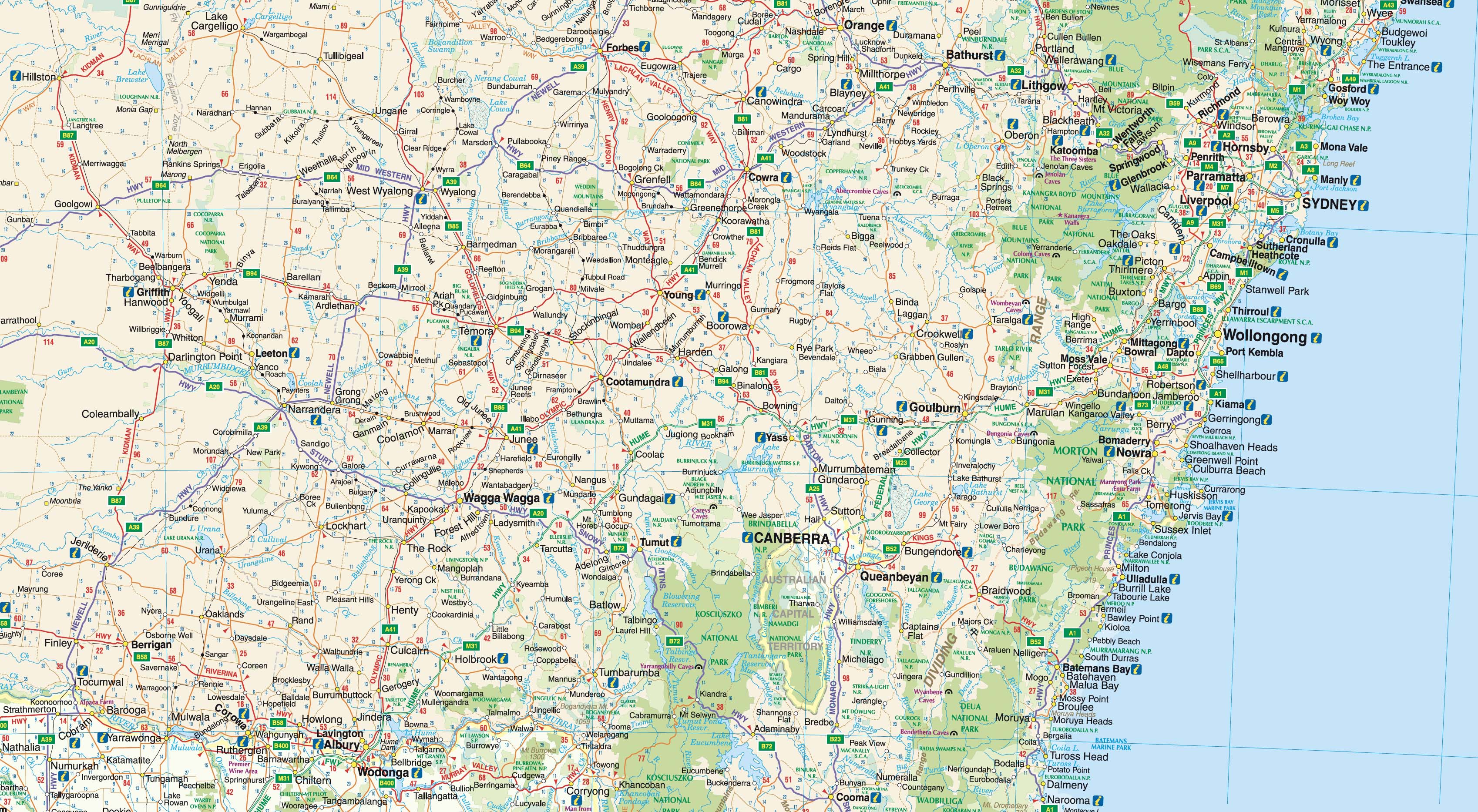
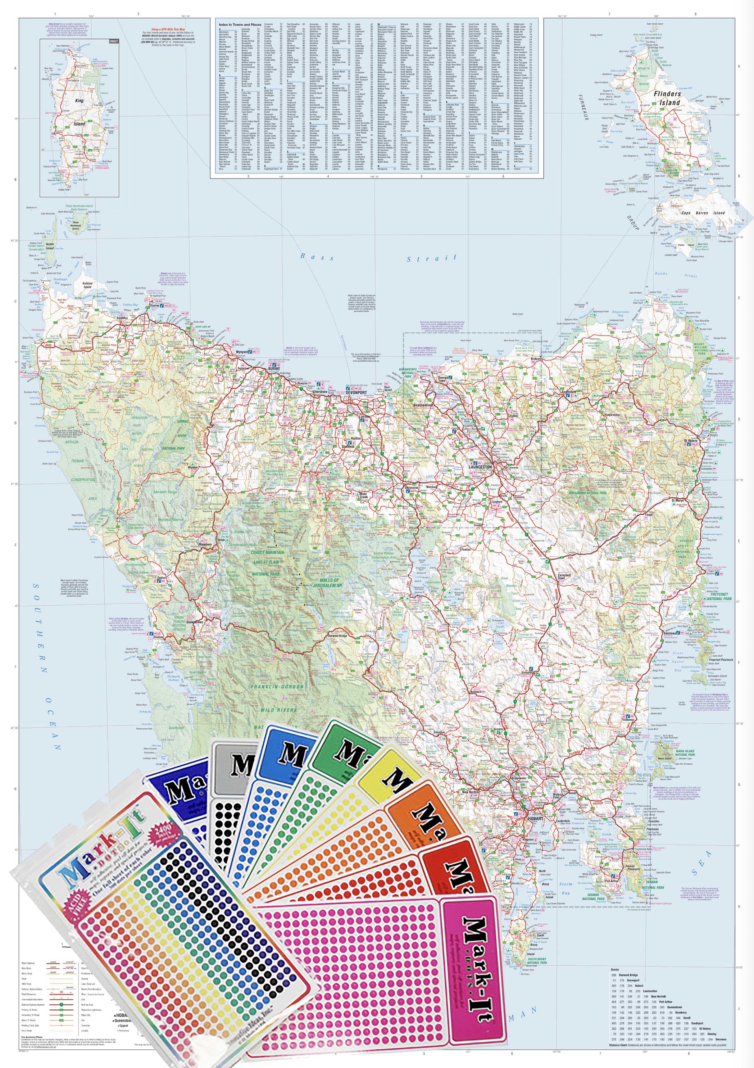
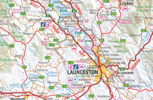
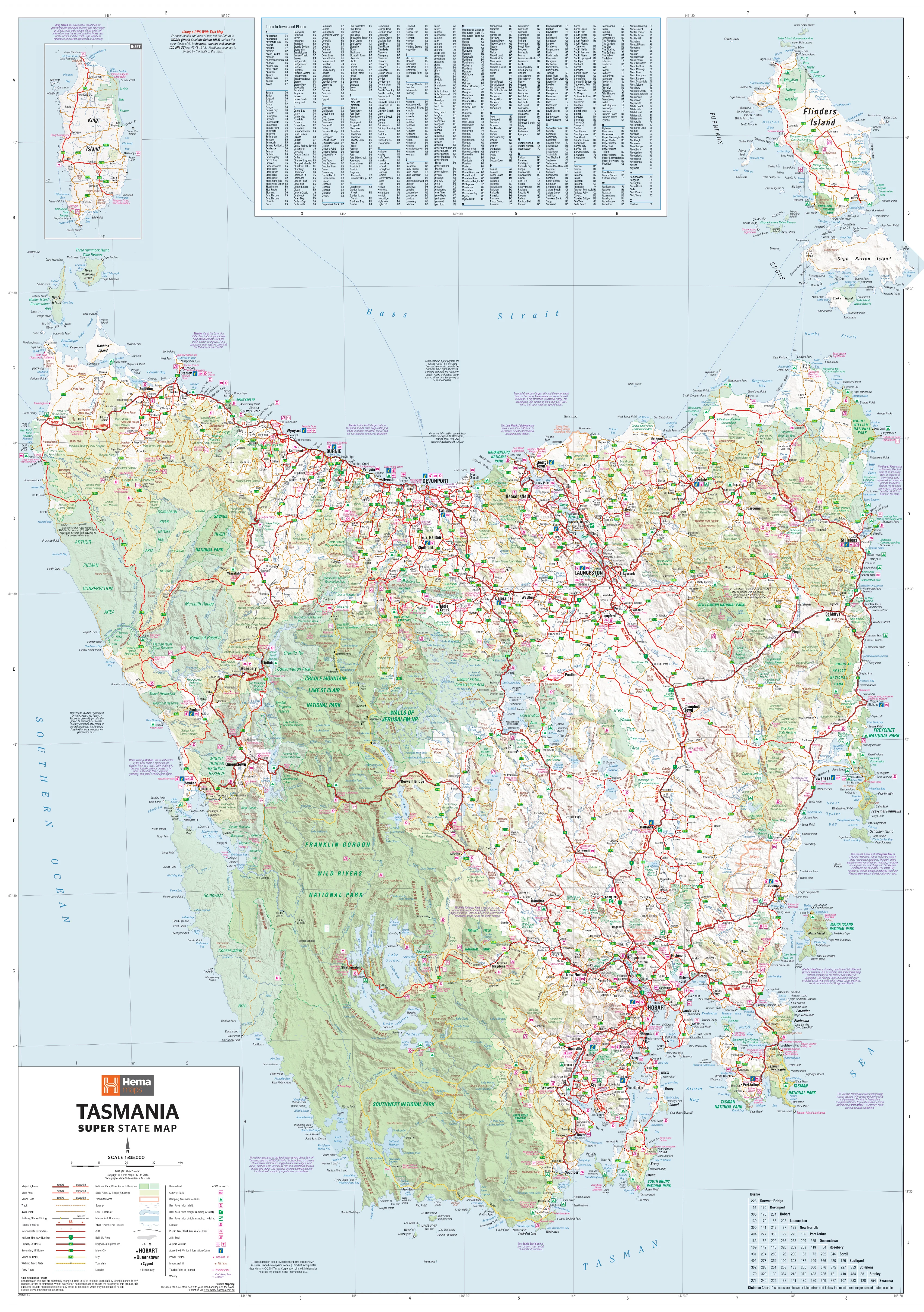
The Tasmania Hema Megamap (Laminated Edition) presents the island state at true wall scale, delivering a clear, durable, and highly practical planning reference. Printed at an impressive 1400 × 2000 mm, this Megamap allows Tasmania’s coastlines, mountain ranges, regional connections, and road networks to be understood instantly from across the room.
Covering all of Tasmania — from the North West Coast and Bass Strait islands, through the Central Highlands, to Hobart, the East Coast, and the far South West — the map clearly shows major and secondary roads, state highways, towns, and key regional centres. Finished with heavy-duty lamination, it’s built for everyday use in offices, planning rooms, classrooms, tourism spaces, and operations environments, where information needs to be marked, updated, and discussed.
Built on trusted Hema cartography, this Megamap turns Tasmania’s diverse geography into a wall-filling tool that is both authoritative and practical.
🗝️ Key Features
-
Complete Tasmania coverage — Coast to highlands, north to south
-
Clear road hierarchy — Major & secondary roads presented with strong visual clarity
-
State highways — Regional travel routes easy to trace
-
Regional context — Cities, towns, and key centres clearly labelled
-
True Megamap scale — Readable across large rooms and shared spaces
-
Trusted Hema cartography — Renowned for accuracy, consistency, and clean design
🎨 Materials & Finish
-
Premium base paper — Printed on 120 gsm matte-coated FSC-certified paper, selected for strength, flatness, and colour consistency
-
Archival print quality — Produced using Hewlett-Packard archival, fade-resistant pigment inks for crisp detail and long-term colour stability
-
Heavy-duty lamination — Finished with a 100-micron protective laminate
-
Write-on / wipe-off surface — Compatible with whiteboard markers and map dots
-
Low-maintenance finish — Ideal for busy planning walls and shared environments
📐 Size & Orientation
-
1400 mm × 2000 mm (Megamap)
-
Orientation: Portrait
📊 Specifications
| Attribute | Details |
|---|---|
| Title | Tasmania — Hema Megamap (Laminated) |
| Coverage | Entire state of Tasmania |
| Features | Major & secondary roads, state highways, cities, towns, regional centres |
| Print Size | 1400 mm × 2000 mm |
| Paper | 120 gsm matte-coated FSC-certified |
| Inks | Hewlett-Packard archival, fade-resistant pigment inks |
| Laminate | 100-micron protective laminate |
| Surface | Write-on / wipe-off |
| Origin | Printed in Australia |
🎯 Who it’s for
-
🏢 Businesses & offices — Regional planning and spatial overview
-
🚐 Tourism & travel operators — Route planning and destination context
-
🧭 Operations & planning rooms — Big-picture coordination across Tasmania
-
🎓 Education & community spaces — Durable, interactive Tasmanian geography
-
🏠 Home offices — A bold, practical Tasmania reference
🤝 Our Commitment
Every laminated Hema Megamap is printed locally in Australia using FSC-certified paper, Hewlett-Packard archival pigment inks, and professional-grade 100-micron lamination. Each map is carefully checked and packed to ensure it arrives ready to deliver years of clarity, durability, and everyday usability.
🛒 Order your Tasmania Hema Megamap (Laminated) today — a wall-filling, write-on planning map designed to make Tasmania’s geography clear, usable, and actionable.
Product Information
Product Information
Shipping & Returns
Shipping & Returns
Description
Tasmania — Hema Megamap (Laminated Wall Map)
Size: 1400 mm (W) × 2000 mm (H)
Format: Megamap • Laminated
Laminate: 100 micron
Printed in Australia
The Tasmania Hema Megamap (Laminated Edition) presents the island state at true wall scale, delivering a clear, durable, and highly practical planning reference. Printed at an impressive 1400 × 2000 mm, this Megamap allows Tasmania’s coastlines, mountain ranges, regional connections, and road networks to be understood instantly from across the room.
Covering all of Tasmania — from the North West Coast and Bass Strait islands, through the Central Highlands, to Hobart, the East Coast, and the far South West — the map clearly shows major and secondary roads, state highways, towns, and key regional centres. Finished with heavy-duty lamination, it’s built for everyday use in offices, planning rooms, classrooms, tourism spaces, and operations environments, where information needs to be marked, updated, and discussed.
Built on trusted Hema cartography, this Megamap turns Tasmania’s diverse geography into a wall-filling tool that is both authoritative and practical.
🗝️ Key Features
-
Complete Tasmania coverage — Coast to highlands, north to south
-
Clear road hierarchy — Major & secondary roads presented with strong visual clarity
-
State highways — Regional travel routes easy to trace
-
Regional context — Cities, towns, and key centres clearly labelled
-
True Megamap scale — Readable across large rooms and shared spaces
-
Trusted Hema cartography — Renowned for accuracy, consistency, and clean design
🎨 Materials & Finish
-
Premium base paper — Printed on 120 gsm matte-coated FSC-certified paper, selected for strength, flatness, and colour consistency
-
Archival print quality — Produced using Hewlett-Packard archival, fade-resistant pigment inks for crisp detail and long-term colour stability
-
Heavy-duty lamination — Finished with a 100-micron protective laminate
-
Write-on / wipe-off surface — Compatible with whiteboard markers and map dots
-
Low-maintenance finish — Ideal for busy planning walls and shared environments
📐 Size & Orientation
-
1400 mm × 2000 mm (Megamap)
-
Orientation: Portrait
📊 Specifications
| Attribute | Details |
|---|---|
| Title | Tasmania — Hema Megamap (Laminated) |
| Coverage | Entire state of Tasmania |
| Features | Major & secondary roads, state highways, cities, towns, regional centres |
| Print Size | 1400 mm × 2000 mm |
| Paper | 120 gsm matte-coated FSC-certified |
| Inks | Hewlett-Packard archival, fade-resistant pigment inks |
| Laminate | 100-micron protective laminate |
| Surface | Write-on / wipe-off |
| Origin | Printed in Australia |
🎯 Who it’s for
-
🏢 Businesses & offices — Regional planning and spatial overview
-
🚐 Tourism & travel operators — Route planning and destination context
-
🧭 Operations & planning rooms — Big-picture coordination across Tasmania
-
🎓 Education & community spaces — Durable, interactive Tasmanian geography
-
🏠 Home offices — A bold, practical Tasmania reference
🤝 Our Commitment
Every laminated Hema Megamap is printed locally in Australia using FSC-certified paper, Hewlett-Packard archival pigment inks, and professional-grade 100-micron lamination. Each map is carefully checked and packed to ensure it arrives ready to deliver years of clarity, durability, and everyday usability.
🛒 Order your Tasmania Hema Megamap (Laminated) today — a wall-filling, write-on planning map designed to make Tasmania’s geography clear, usable, and actionable.