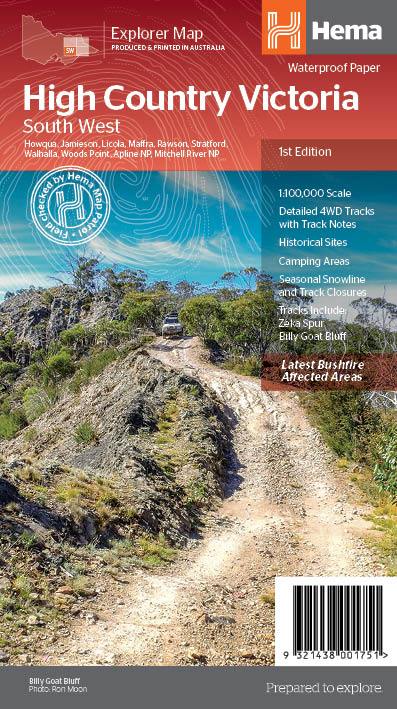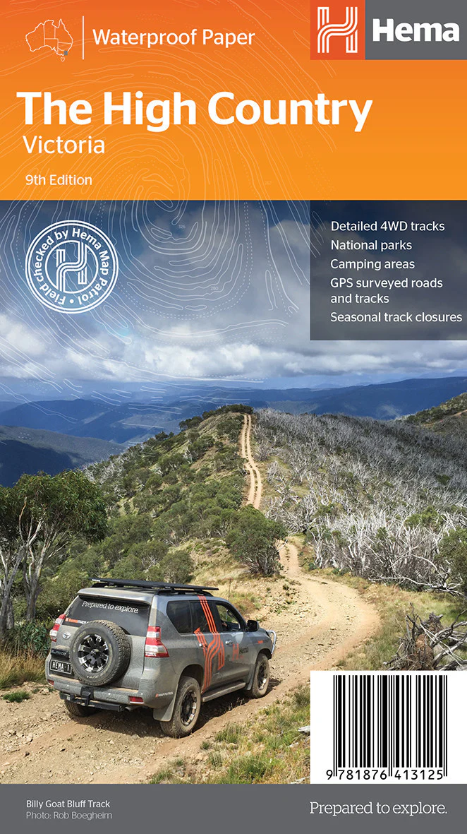
The High Country Victoria Map Hema
The ultimate touring map for 4WD adventures, alpine escapes, and remote highland exploration.
The High Country Victoria Map by Hema is a must-have for anyone planning to explore the iconic alpine and subalpine regions of Victoria. From the rugged peaks of the Great Dividing Range to the twisting forest trails of the Alpine National Park, this map is your trusted guide through some of Australia’s most breathtaking—and remote—terrain.
Created by Hema Maps, Australia’s leading authority in off-road cartography, this double-sided map has been field-checked by Hema’s own Map Patrol to ensure the highest level of accuracy and detail for recreational use.
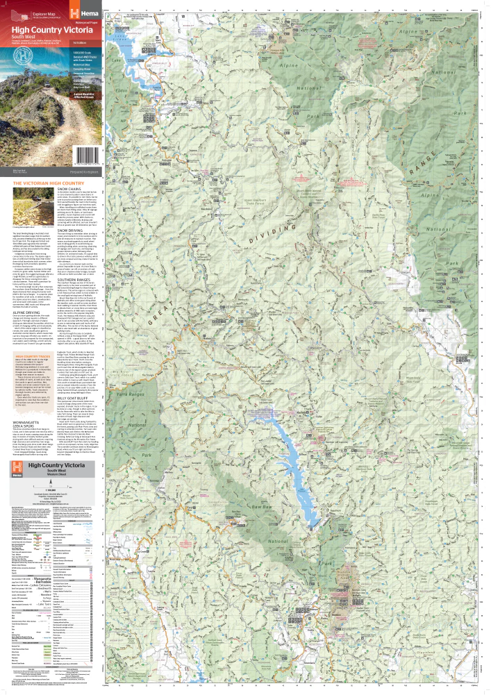
🌄 Discover Victoria’s Alpine Heartland
This map covers one of the most popular and diverse touring destinations in Australia, encompassing key regions and towns including:
-
Mansfield
-
Bright
-
Omeo
-
Dargo
-
Mount Beauty
-
Wangaratta
-
Licola
-
Benambra
-
Buckland Valley
-
Craig’s Hut
-
Wonnangatta Valley
-
Bogong High Plains
The map highlights main touring routes, challenging 4WD tracks, seasonal road closures, and points of interest—perfect for trip planning or on-the-go navigation.
🗺️ Key Features
✅ 1:150,000 Touring Map
Large-scale detail makes it easy to follow minor roads, fire trails, and 4WD routes through mountainous and forested regions.
✅ 4WD Tracks & Ratings
Clearly marked 4WD tracks include difficulty gradings, access notes, and seasonal closures—ideal for adventure travellers and overlanders.
✅ Camping & Accommodation
All known campsites, huts, and caravan parks are marked, along with fuel stops, picnic areas, and lookouts.
✅ Topographical Shading
Elevation is shown through shaded relief, giving an instant sense of the terrain’s complexity and the grandeur of the High Country landscape.
✅ Detailed Insets
Includes zoomed-in town maps and recreation-focused insets for high-use areas like Mt. Hotham, Falls Creek, and Lake Eildon.
✅ Touring Symbols
Symbols mark out fishing spots, wineries, historical sites, alpine resorts, and walking trails.
✅ GPS Compatibility
Fully GPS-referenced and compatible with most mapping apps and GPS devices.
🧭 Adventure-Proof Construction
-
Printed on tear-resistant, waterproof paper
-
Durable enough to withstand heavy folding, rough weather, and repeated use
-
Ideal for gloveboxes, backpacks, and touring folders
Whether you’re plotting a multi-day 4WD trek across remote high plains or a scenic weekend getaway through alpine villages, the Hema High Country Victoria Map is built to last the journey.
📐 Map Specifications
| Attribute | Detail |
|---|---|
| Publisher | Hema Maps |
| Scale | 1:150,000 |
| Map Dimensions | Approx. 1000 mm (W) × 700 mm (H) (unfolded) |
| Map Type | Double-sided touring map |
| Material | Waterproof, tear-resistant synthetic paper |
| Edition | Latest edition (check cover for year) |
| ISBN | 9781865009824 (subject to change) |
| Weight | Approx. 120g |
| Folded Size | 140 mm × 250 mm |
| Coverage | Mansfield to Omeo, Bright to Licola, and everywhere in between |
🎒 Perfect For:
-
4WD adventurers & overlanders
-
Bushwalkers & hikers
-
Caravanners & grey nomads
-
Tour planners & travel agents
-
Anyone exploring the Great Alpine Road or Alpine National Park
🚗 Why Choose Hema?
Hema’s Map Patrol team has been mapping Australia’s backroads since 1996. Every trail, track, and town is meticulously researched and regularly updated using real GPS data collected in the field—giving you confidence in the most remote regions.
🛒 Ordering Info
-
In stock and ready to ship
-
Fast delivery available across Australia and internationally
Take the high road—and know exactly where it leads. With the High Country Victoria Map by Hema, you’re not just navigating terrain, you’re unlocking adventure.
Original: $10.70
-65%$10.70
$3.74Product Information
Product Information
Shipping & Returns
Shipping & Returns
Description
The ultimate touring map for 4WD adventures, alpine escapes, and remote highland exploration.
The High Country Victoria Map by Hema is a must-have for anyone planning to explore the iconic alpine and subalpine regions of Victoria. From the rugged peaks of the Great Dividing Range to the twisting forest trails of the Alpine National Park, this map is your trusted guide through some of Australia’s most breathtaking—and remote—terrain.
Created by Hema Maps, Australia’s leading authority in off-road cartography, this double-sided map has been field-checked by Hema’s own Map Patrol to ensure the highest level of accuracy and detail for recreational use.
🌄 Discover Victoria’s Alpine Heartland
This map covers one of the most popular and diverse touring destinations in Australia, encompassing key regions and towns including:
-
Mansfield
-
Bright
-
Omeo
-
Dargo
-
Mount Beauty
-
Wangaratta
-
Licola
-
Benambra
-
Buckland Valley
-
Craig’s Hut
-
Wonnangatta Valley
-
Bogong High Plains
The map highlights main touring routes, challenging 4WD tracks, seasonal road closures, and points of interest—perfect for trip planning or on-the-go navigation.
🗺️ Key Features
✅ 1:150,000 Touring Map
Large-scale detail makes it easy to follow minor roads, fire trails, and 4WD routes through mountainous and forested regions.
✅ 4WD Tracks & Ratings
Clearly marked 4WD tracks include difficulty gradings, access notes, and seasonal closures—ideal for adventure travellers and overlanders.
✅ Camping & Accommodation
All known campsites, huts, and caravan parks are marked, along with fuel stops, picnic areas, and lookouts.
✅ Topographical Shading
Elevation is shown through shaded relief, giving an instant sense of the terrain’s complexity and the grandeur of the High Country landscape.
✅ Detailed Insets
Includes zoomed-in town maps and recreation-focused insets for high-use areas like Mt. Hotham, Falls Creek, and Lake Eildon.
✅ Touring Symbols
Symbols mark out fishing spots, wineries, historical sites, alpine resorts, and walking trails.
✅ GPS Compatibility
Fully GPS-referenced and compatible with most mapping apps and GPS devices.
🧭 Adventure-Proof Construction
-
Printed on tear-resistant, waterproof paper
-
Durable enough to withstand heavy folding, rough weather, and repeated use
-
Ideal for gloveboxes, backpacks, and touring folders
Whether you’re plotting a multi-day 4WD trek across remote high plains or a scenic weekend getaway through alpine villages, the Hema High Country Victoria Map is built to last the journey.
📐 Map Specifications
| Attribute | Detail |
|---|---|
| Publisher | Hema Maps |
| Scale | 1:150,000 |
| Map Dimensions | Approx. 1000 mm (W) × 700 mm (H) (unfolded) |
| Map Type | Double-sided touring map |
| Material | Waterproof, tear-resistant synthetic paper |
| Edition | Latest edition (check cover for year) |
| ISBN | 9781865009824 (subject to change) |
| Weight | Approx. 120g |
| Folded Size | 140 mm × 250 mm |
| Coverage | Mansfield to Omeo, Bright to Licola, and everywhere in between |
🎒 Perfect For:
-
4WD adventurers & overlanders
-
Bushwalkers & hikers
-
Caravanners & grey nomads
-
Tour planners & travel agents
-
Anyone exploring the Great Alpine Road or Alpine National Park
🚗 Why Choose Hema?
Hema’s Map Patrol team has been mapping Australia’s backroads since 1996. Every trail, track, and town is meticulously researched and regularly updated using real GPS data collected in the field—giving you confidence in the most remote regions.
🛒 Ordering Info
-
In stock and ready to ship
-
Fast delivery available across Australia and internationally
Take the high road—and know exactly where it leads. With the High Country Victoria Map by Hema, you’re not just navigating terrain, you’re unlocking adventure.