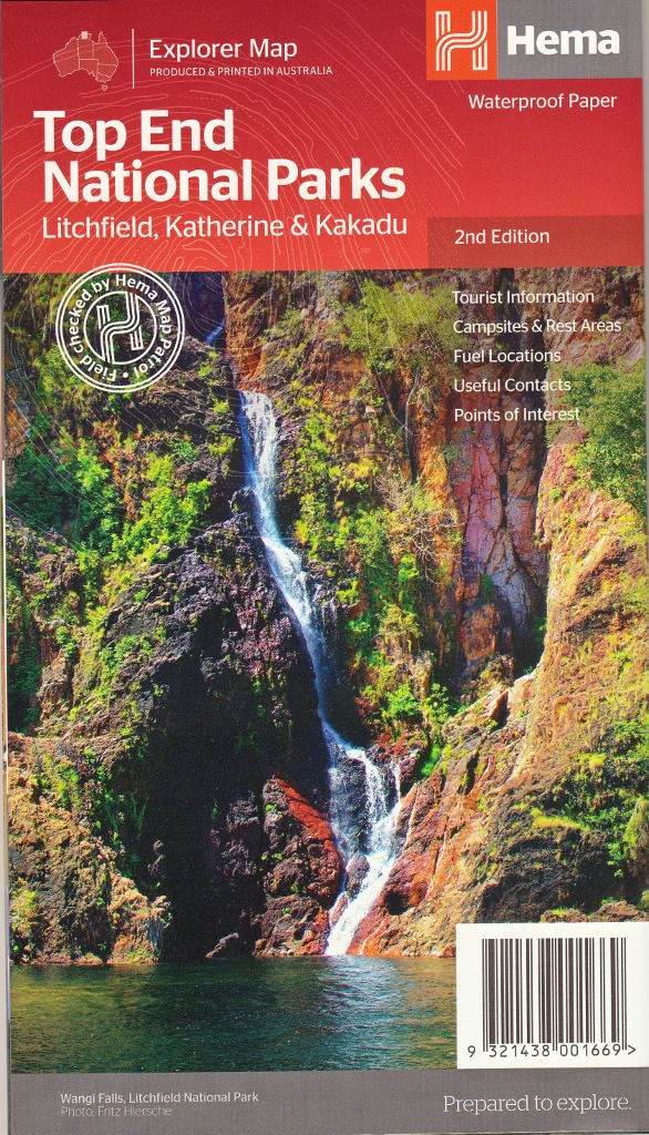
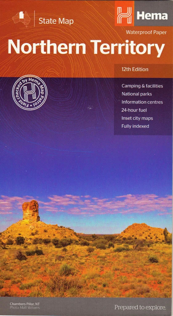
Top End & Gulf Hema Map 7th Edition
Your essential map for exploring the tropical north and remote wilderness of Australia’s Top End and Gulf Country.
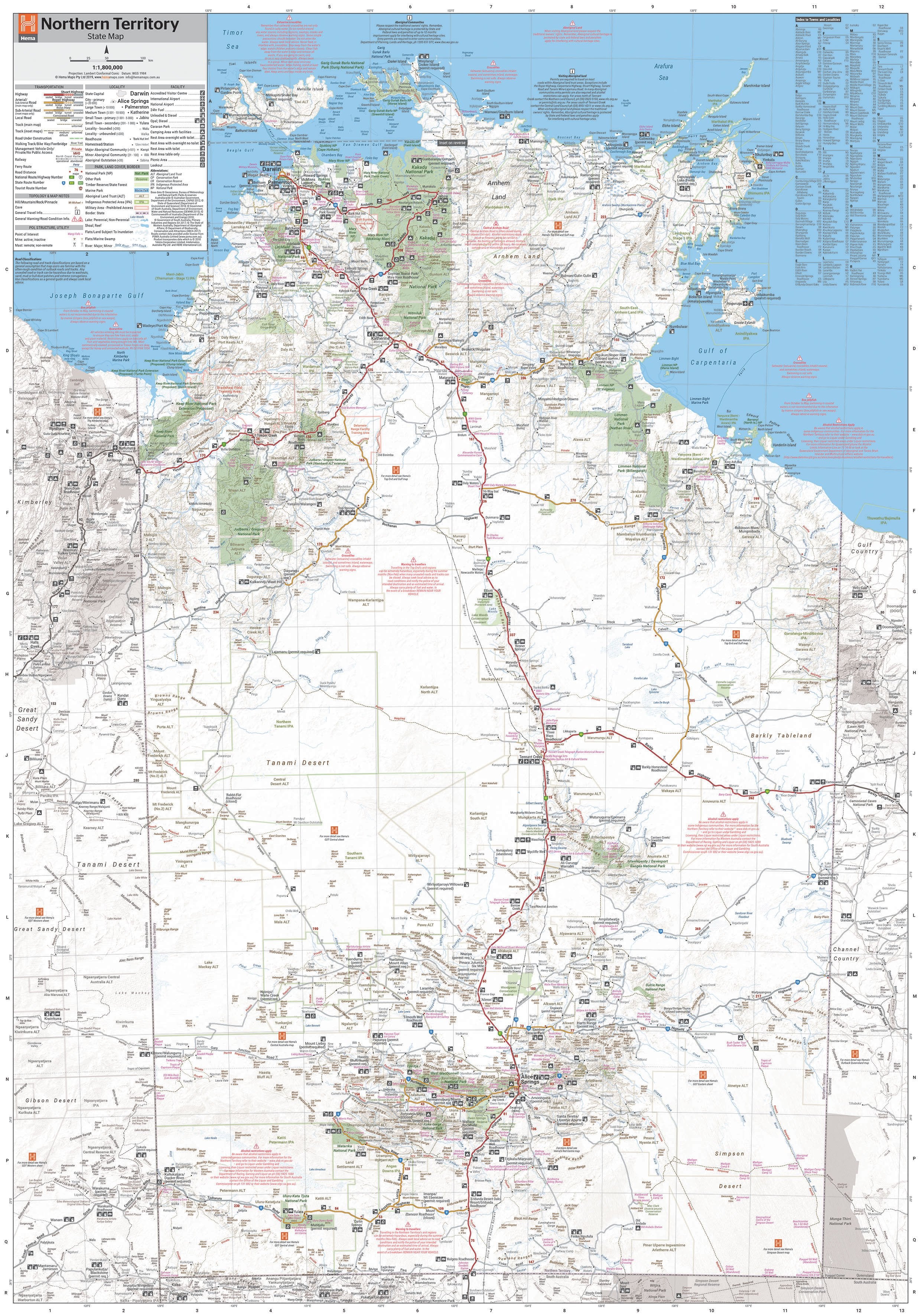
The Top End & Gulf Hema Map – 7th Edition is a meticulously researched and field-verified map covering the stunning and often remote regions of northern Northern Territory and Gulf Country Queensland. Whether you’re planning an overland expedition, self-drive adventure, cultural journey, or just looking to understand the layout of one of Australia's most unique environments, this map is packed with the detail, durability, and accuracy you’d expect from Hema Maps, Australia’s leading outback cartographers.
Tailored specifically for 4WD travellers, campers, grey nomads, and remote area explorers, it brings together road and topographic detail, tourist highlights, and practical travel information, making it a vital tool for trip planning and navigation.
🗺️ Coverage Area
This large-format, waterproof touring map provides comprehensive coverage of:
-
Darwin & Surrounds
-
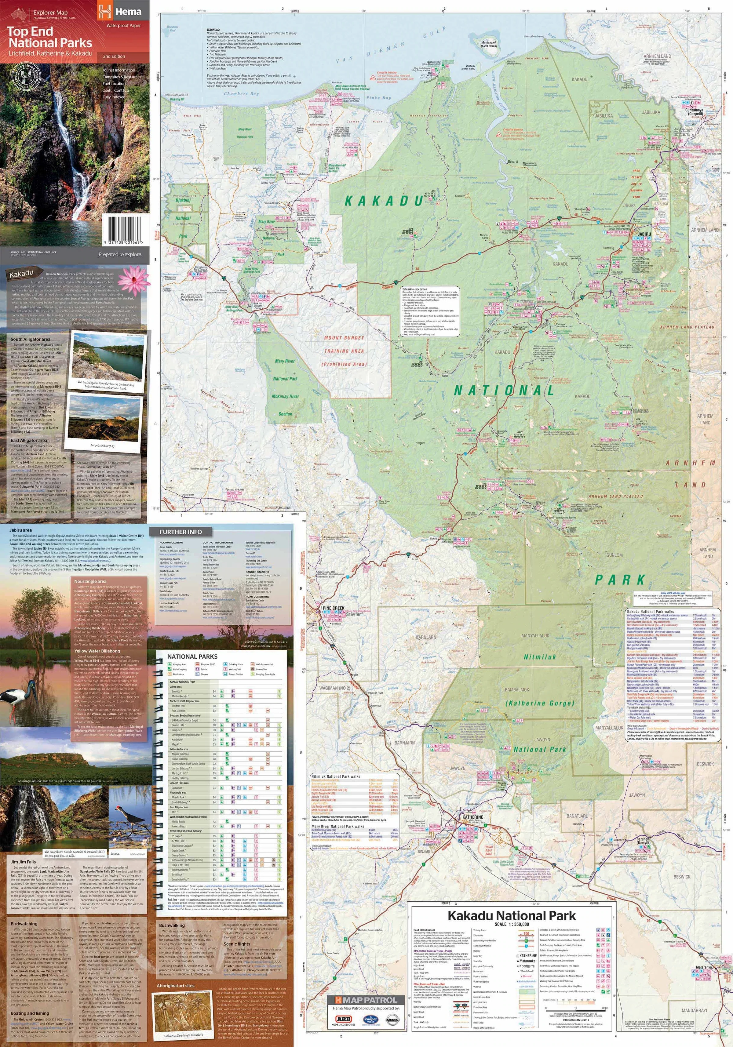
Katherine, Batchelor, Pine Creek, and Litchfield National Park
-
Arnhem Land (access and permit zones indicated)
-
Nhulunbuy / Gove Peninsula
-
Roper River region and Limmen National Park
-
Judbarra / Gregory National Park and Keep River National Park
-
Savannah Way route, from the NT to Queensland’s Gulf Country
-
Boodjamulla (Lawn Hill) National Park, Burketown, Normanton, and Karumba
This map gives you a bird's-eye view of vast wilderness areas, allowing you to plan your trip safely, efficiently, and with the confidence of Hema’s GPS-verified data.
🧭 Key Map Features
-
Scale: 1:1,650,000 — perfect for large-area travel planning
-
GPS-surveyed roads and 4WD tracks verified by Hema Map Patrol field teams
-
Detailed inset maps for key national parks including:
-
Judbarra / Gregory NP
-
Keep River NP
-
Boodjamulla (Lawn Hill) NP
-
-
Touring routes and adventure drives including the Savannah Way, Roper River Track, and Nature’s Way
-
Camping and caravan sites, remote fuel stops, and accommodation markers
-
Points of interest, including waterfalls, gorges, Aboriginal cultural sites, and hot springs
-
Permit zones and access notes for Arnhem Land and Aboriginal freehold lands
-
Emergency services locations and local airstrips
-
Road surface types clearly indicated (sealed, unsealed, 4WD only)
🌧️ Built for the Outback
Printed on high-quality waterproof and tear-resistant synthetic paper, this map is made for harsh environments:
-
Won’t rip, crumple, or smudge
-
Resists rain, dust, and moisture
-
Folded format fits into glove boxes, map cases, or seat pouches
-
Lightweight and flexible enough to use on the go or in the field
Whether you're navigating by the bonnet, checking your route around the campfire, or referencing it mid-drive, this map holds up to rugged Australian conditions.
📐 Product Specifications
-
Edition: 7th Edition
-
Release Date: July 2019
-
Unfolded Size: 700 mm (W) x 1000 mm (H)
-
Folded Size: 140 mm x 250 mm x 3 mm
-
Weight: Approx. 90 g
-
Material: Waterproof and tearproof synthetic stock
-
Publisher: Hema Maps
-
Printed in: Australia
🎯 Who This Map Is For
-
4WD enthusiasts heading into remote NT and QLD terrain
-
Caravanners and campers exploring the Top End and Gulf
-
Savannah Way travellers crossing from Cairns to Broome
-
Nature lovers and hikers visiting Kakadu, Litchfield, or Limmen NP
-
Geography educators and researchers needing an overview of Australia’s north
-
Tour operators and remote accommodation providers
-
Anyone seeking to travel beyond the bitumen
✅ Why Choose This Map?
-
Designed and tested by Hema’s Map Patrol
-
Combines touring insight with practical navigation
-
Includes topographic detail and cultural access information
-
Compact, waterproof, and field-ready
-
One of the only maps to truly focus on the Top End + Gulf regions in a single view
From the red cliffs of Arnhem Land to the tidal flats of the Gulf of Carpentaria, the Top End & Gulf Hema Map connects you with one of Australia’s last true frontiers.
Trust it to guide your journey — confidently, safely, and with unforgettable views along the way.
This map is also available as a laminated map encapsulated in high-quality plastic.
Original: $10.70
-65%$10.70
$3.74Product Information
Product Information
Shipping & Returns
Shipping & Returns
Description
Your essential map for exploring the tropical north and remote wilderness of Australia’s Top End and Gulf Country.
The Top End & Gulf Hema Map – 7th Edition is a meticulously researched and field-verified map covering the stunning and often remote regions of northern Northern Territory and Gulf Country Queensland. Whether you’re planning an overland expedition, self-drive adventure, cultural journey, or just looking to understand the layout of one of Australia's most unique environments, this map is packed with the detail, durability, and accuracy you’d expect from Hema Maps, Australia’s leading outback cartographers.
Tailored specifically for 4WD travellers, campers, grey nomads, and remote area explorers, it brings together road and topographic detail, tourist highlights, and practical travel information, making it a vital tool for trip planning and navigation.
🗺️ Coverage Area
This large-format, waterproof touring map provides comprehensive coverage of:
-
Darwin & Surrounds
-
Katherine, Batchelor, Pine Creek, and Litchfield National Park
-
Arnhem Land (access and permit zones indicated)
-
Nhulunbuy / Gove Peninsula
-
Roper River region and Limmen National Park
-
Judbarra / Gregory National Park and Keep River National Park
-
Savannah Way route, from the NT to Queensland’s Gulf Country
-
Boodjamulla (Lawn Hill) National Park, Burketown, Normanton, and Karumba
This map gives you a bird's-eye view of vast wilderness areas, allowing you to plan your trip safely, efficiently, and with the confidence of Hema’s GPS-verified data.
🧭 Key Map Features
-
Scale: 1:1,650,000 — perfect for large-area travel planning
-
GPS-surveyed roads and 4WD tracks verified by Hema Map Patrol field teams
-
Detailed inset maps for key national parks including:
-
Judbarra / Gregory NP
-
Keep River NP
-
Boodjamulla (Lawn Hill) NP
-
-
Touring routes and adventure drives including the Savannah Way, Roper River Track, and Nature’s Way
-
Camping and caravan sites, remote fuel stops, and accommodation markers
-
Points of interest, including waterfalls, gorges, Aboriginal cultural sites, and hot springs
-
Permit zones and access notes for Arnhem Land and Aboriginal freehold lands
-
Emergency services locations and local airstrips
-
Road surface types clearly indicated (sealed, unsealed, 4WD only)
🌧️ Built for the Outback
Printed on high-quality waterproof and tear-resistant synthetic paper, this map is made for harsh environments:
-
Won’t rip, crumple, or smudge
-
Resists rain, dust, and moisture
-
Folded format fits into glove boxes, map cases, or seat pouches
-
Lightweight and flexible enough to use on the go or in the field
Whether you're navigating by the bonnet, checking your route around the campfire, or referencing it mid-drive, this map holds up to rugged Australian conditions.
📐 Product Specifications
-
Edition: 7th Edition
-
Release Date: July 2019
-
Unfolded Size: 700 mm (W) x 1000 mm (H)
-
Folded Size: 140 mm x 250 mm x 3 mm
-
Weight: Approx. 90 g
-
Material: Waterproof and tearproof synthetic stock
-
Publisher: Hema Maps
-
Printed in: Australia
🎯 Who This Map Is For
-
4WD enthusiasts heading into remote NT and QLD terrain
-
Caravanners and campers exploring the Top End and Gulf
-
Savannah Way travellers crossing from Cairns to Broome
-
Nature lovers and hikers visiting Kakadu, Litchfield, or Limmen NP
-
Geography educators and researchers needing an overview of Australia’s north
-
Tour operators and remote accommodation providers
-
Anyone seeking to travel beyond the bitumen
✅ Why Choose This Map?
-
Designed and tested by Hema’s Map Patrol
-
Combines touring insight with practical navigation
-
Includes topographic detail and cultural access information
-
Compact, waterproof, and field-ready
-
One of the only maps to truly focus on the Top End + Gulf regions in a single view
From the red cliffs of Arnhem Land to the tidal flats of the Gulf of Carpentaria, the Top End & Gulf Hema Map connects you with one of Australia’s last true frontiers.
Trust it to guide your journey — confidently, safely, and with unforgettable views along the way.
This map is also available as a laminated map encapsulated in high-quality plastic.