TRAVEL POSTER - Imperial Airways Map of the World
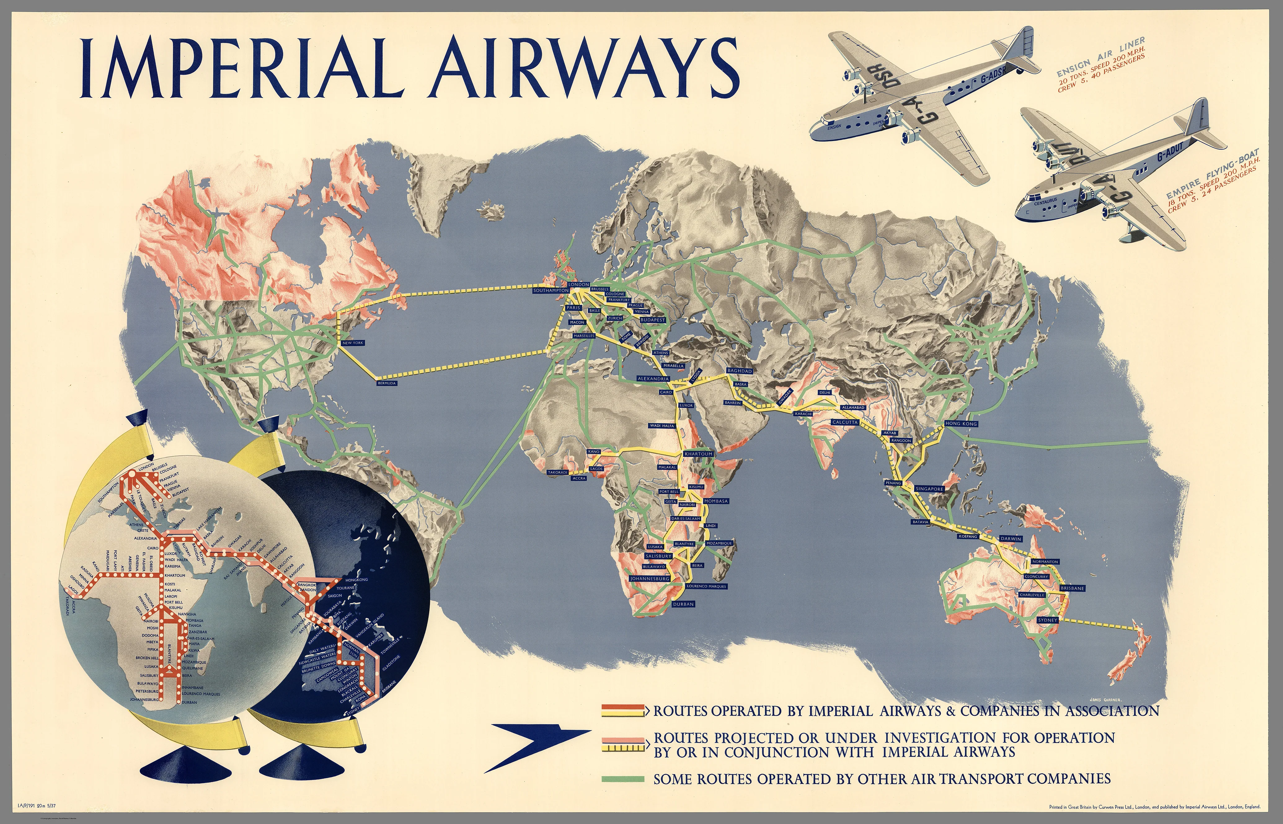
✈️ Imperial Airways Map of the World (1937)
Illustrated by James Gardner | Commissioned by Imperial Airways Ltd | Printed by Curwen Press, London
“A Glorious Celebration of Empire, Flight, and the Dawn of Global Travel”
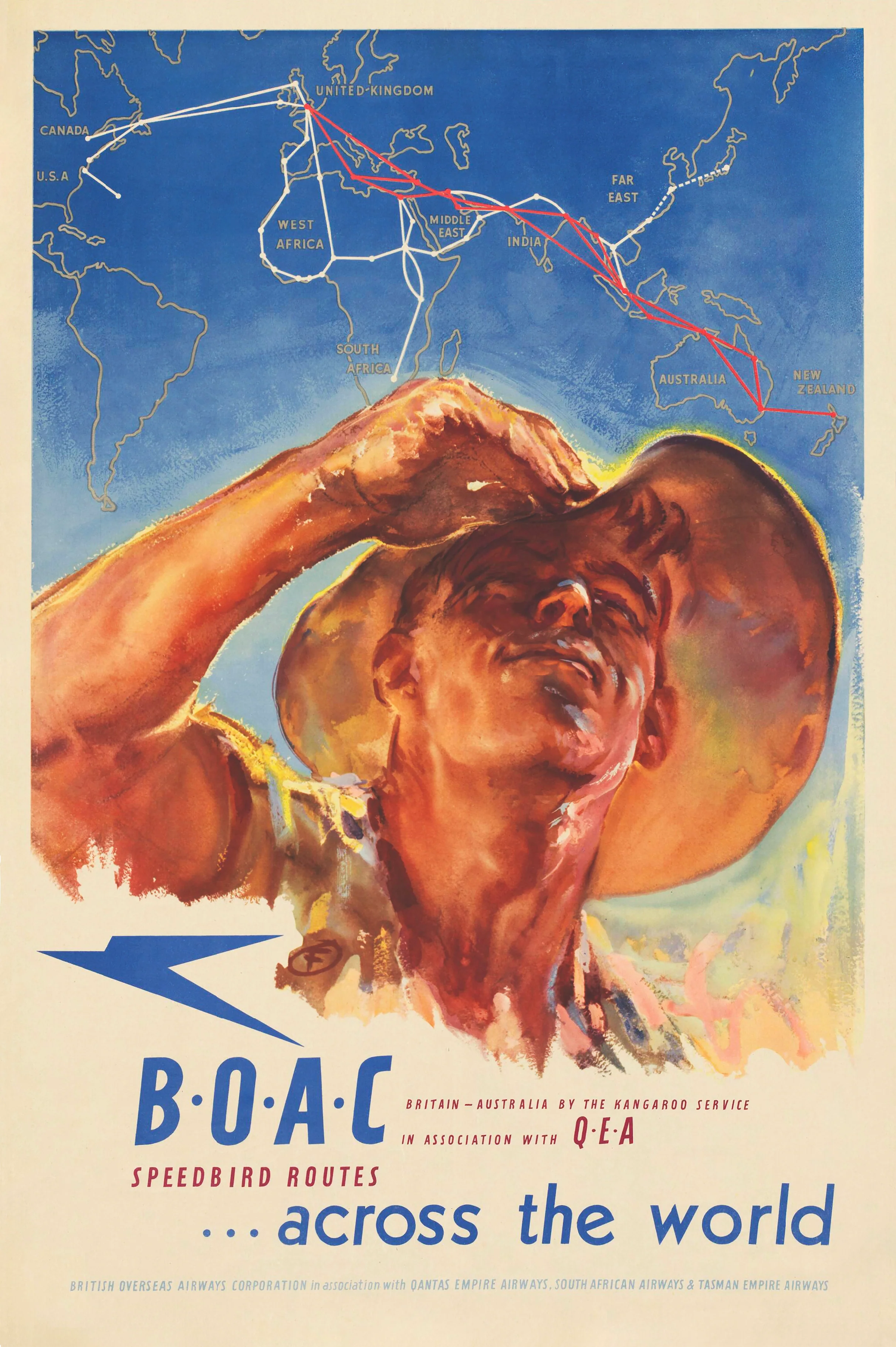
Step into the golden age of aviation with this breathtaking 1937 reproduction of the Imperial Airways Map of the World. Designed by acclaimed British artist James Gardner, this remarkable work blends cartographic precision with the romantic grandeur of early air travel. Originally issued by Imperial Airways, the British Empire’s pioneering intercontinental airline, this map was far more than a route chart—it was a statement of power, innovation, and global connection.
This is a map that doesn’t just show where you can go—it makes you want to go.
🌍 A Map Rich with Story and Detail
Exquisitely illustrated in vibrant colour lithography, the map showcases:
-
Imperial Airways’ official routes crisscrossing Africa, the Middle East, India, Southeast Asia, and Australia.
-
A stylised Ensign Air Liner and Empire Flying-Boat, representing the engineering marvels of the skies.
-
Inset panels detailing distances from London, flight frequencies, and timetables—offering a glimpse into the logistics of 1930s global travel.
-
Colour-coded route networks:
-
🔴 Red Lines – Routes operated by Imperial Airways and its affiliates
-
🟡 Yellow Lines – Projected or under-development routes
-
🟢 Green Lines – Connecting services by other carriers
-
The design reflects not only the physical scale of the British Empire but also the ambition and optimism of an era when aviation was reshaping the world.
🇬🇧 Historical and Cultural Significance
Issued just two years before WWII, this map captures a pivotal moment in history. The British Empire stretched from Canada to Australia, and Imperial Airways was the connective tissue, delivering diplomats, adventurers, and correspondence across oceans and deserts.
It’s a compelling visual record of:
-
British geopolitical influence
-
The expansion of commercial aviation
-
Technological elegance—each aircraft depicted as a marvel of modern design
The map stands as a love letter to the skies, embodying the promise and prestige of flying before it became commonplace.
🖼️ Two Grand Display Sizes
Available in two impressive sizes to suit home, office, or gallery wall:
| Format | Dimensions (W x H) |
|---|---|
| Small | 1000 mm x 640 mm |
| Large | 1400 mm x 900 mm |
Both options are proportionally faithful to Gardner’s original lithograph.
🖨️ Premium Format Options
Each reproduction is professionally printed in Australia using archival-grade materials, ensuring both clarity and longevity:
-
📄 Paper
Printed on heavyweight 160 gsm coated paper—ideal for framing under glass. Crisp, smooth, and perfect for collectors. -
🧽 Laminated
Gloss encapsulation using two sheets of 80-micron laminate. Durable, wipeable, and perfect for workspaces, education, or public display. -
🪵 Laminated with Wooden Hang Rails
Adds instant charm with a natural timber finish and a top hanging cord—easy to display, no framing required. -
🖼️ Canvas
Printed on 395 gsm HP Matte Professional Canvas using pigment-based inks. Rich texture, museum-quality reproduction, and fade-resistant for decades of enjoyment. -
🪵 Canvas with Wooden Hang Rails
A timeless presentation. Lacquered natural timber rails top and bottom with a cotton hanging cord. Elegant, gallery-ready, and completely frameless.
⏳ Note: Please allow 10 working days for delivery of hang-railed maps, as each is hand-finished by our professional framer.
🎁 A Gift with Wings
This map is a remarkable gift for:
-
Aviation enthusiasts and vintage travel collectors
-
Historians, educators, and cartographers
-
Anglophiles and lovers of British Imperial heritage
-
Anyone seeking a striking centrepiece for a study, hallway, library, or creative workspace
✨ Display a Moment in Time
The Imperial Airways Map of the World (1937) is more than a cartographic document—it’s a window into a world defined by airborne aspiration, British diplomacy, and the excitement of long-distance flight. Every detail—from the stylised aircraft to the intricate route networks—echoes the glamour and pride of a bygone era.
This is not just a reproduction. It’s a revival of the dream that first united continents by air. And now, it’s ready to find a place on your wall.
Original: $50.05
-65%$50.05
$17.52Product Information
Product Information
Shipping & Returns
Shipping & Returns
Description
✈️ Imperial Airways Map of the World (1937)
Illustrated by James Gardner | Commissioned by Imperial Airways Ltd | Printed by Curwen Press, London
“A Glorious Celebration of Empire, Flight, and the Dawn of Global Travel”
Step into the golden age of aviation with this breathtaking 1937 reproduction of the Imperial Airways Map of the World. Designed by acclaimed British artist James Gardner, this remarkable work blends cartographic precision with the romantic grandeur of early air travel. Originally issued by Imperial Airways, the British Empire’s pioneering intercontinental airline, this map was far more than a route chart—it was a statement of power, innovation, and global connection.
This is a map that doesn’t just show where you can go—it makes you want to go.
🌍 A Map Rich with Story and Detail
Exquisitely illustrated in vibrant colour lithography, the map showcases:
-
Imperial Airways’ official routes crisscrossing Africa, the Middle East, India, Southeast Asia, and Australia.
-
A stylised Ensign Air Liner and Empire Flying-Boat, representing the engineering marvels of the skies.
-
Inset panels detailing distances from London, flight frequencies, and timetables—offering a glimpse into the logistics of 1930s global travel.
-
Colour-coded route networks:
-
🔴 Red Lines – Routes operated by Imperial Airways and its affiliates
-
🟡 Yellow Lines – Projected or under-development routes
-
🟢 Green Lines – Connecting services by other carriers
-
The design reflects not only the physical scale of the British Empire but also the ambition and optimism of an era when aviation was reshaping the world.
🇬🇧 Historical and Cultural Significance
Issued just two years before WWII, this map captures a pivotal moment in history. The British Empire stretched from Canada to Australia, and Imperial Airways was the connective tissue, delivering diplomats, adventurers, and correspondence across oceans and deserts.
It’s a compelling visual record of:
-
British geopolitical influence
-
The expansion of commercial aviation
-
Technological elegance—each aircraft depicted as a marvel of modern design
The map stands as a love letter to the skies, embodying the promise and prestige of flying before it became commonplace.
🖼️ Two Grand Display Sizes
Available in two impressive sizes to suit home, office, or gallery wall:
| Format | Dimensions (W x H) |
|---|---|
| Small | 1000 mm x 640 mm |
| Large | 1400 mm x 900 mm |
Both options are proportionally faithful to Gardner’s original lithograph.
🖨️ Premium Format Options
Each reproduction is professionally printed in Australia using archival-grade materials, ensuring both clarity and longevity:
-
📄 Paper
Printed on heavyweight 160 gsm coated paper—ideal for framing under glass. Crisp, smooth, and perfect for collectors. -
🧽 Laminated
Gloss encapsulation using two sheets of 80-micron laminate. Durable, wipeable, and perfect for workspaces, education, or public display. -
🪵 Laminated with Wooden Hang Rails
Adds instant charm with a natural timber finish and a top hanging cord—easy to display, no framing required. -
🖼️ Canvas
Printed on 395 gsm HP Matte Professional Canvas using pigment-based inks. Rich texture, museum-quality reproduction, and fade-resistant for decades of enjoyment. -
🪵 Canvas with Wooden Hang Rails
A timeless presentation. Lacquered natural timber rails top and bottom with a cotton hanging cord. Elegant, gallery-ready, and completely frameless.
⏳ Note: Please allow 10 working days for delivery of hang-railed maps, as each is hand-finished by our professional framer.
🎁 A Gift with Wings
This map is a remarkable gift for:
-
Aviation enthusiasts and vintage travel collectors
-
Historians, educators, and cartographers
-
Anglophiles and lovers of British Imperial heritage
-
Anyone seeking a striking centrepiece for a study, hallway, library, or creative workspace
✨ Display a Moment in Time
The Imperial Airways Map of the World (1937) is more than a cartographic document—it’s a window into a world defined by airborne aspiration, British diplomacy, and the excitement of long-distance flight. Every detail—from the stylised aircraft to the intricate route networks—echoes the glamour and pride of a bygone era.
This is not just a reproduction. It’s a revival of the dream that first united continents by air. And now, it’s ready to find a place on your wall.