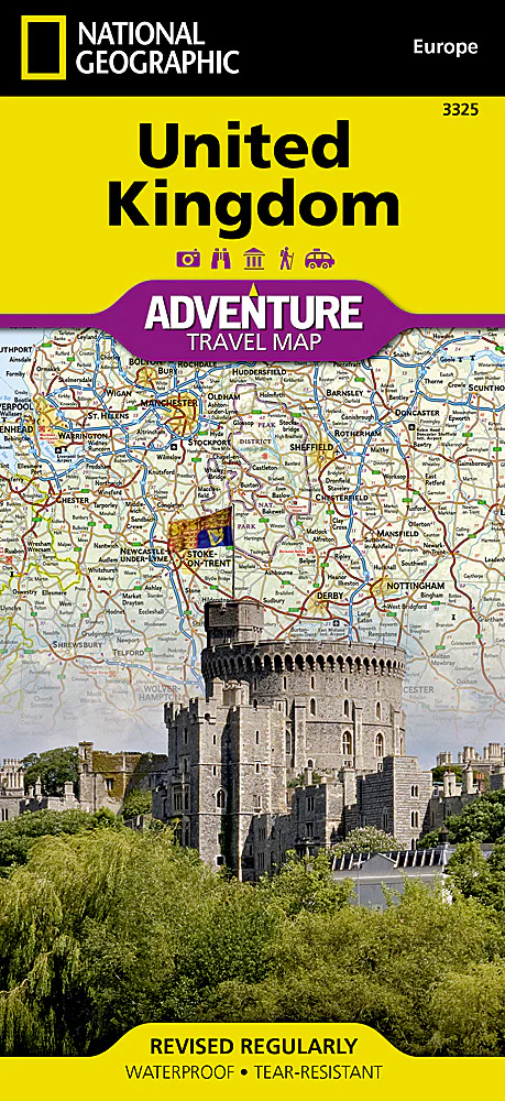
United Kingdom National Geographic Folded Map
Double-Sided Folded Travel Map | Waterproof & Tear-Resistant Synthetic Paper
Scale: 1:825,000 | Sheet Size: 959 mm x 648 mm | Folded Size: 235 mm x 108 mm
🇬🇧 Discover the Full Beauty of the United Kingdom with National Geographic Precision
From rolling English countryside and dramatic Scottish Highlands to the windswept coasts of Wales and the cultural richness of Northern Ireland, the United Kingdom Adventure Map by National Geographic offers an exceptional blend of accuracy, detail, and durability. Whether you're planning a road trip through England, a trek across Snowdonia, or an exploration of historic sites from Edinburgh to Belfast, this map is the perfect companion for adventure travellers and culturally curious explorers alike.
Carefully designed with motorists, hikers, and explorers in mind, the map highlights hundreds of recreational, ecological, and historical points of interest, helping you go beyond the typical guidebook.
🧭 Regional Coverage – Two Maps in One
🗺 Side 1 – Southern UK & Ireland
-
Covers Southern England, Wales, the Isle of Man, and Southern Ireland, extending from the English Channel to the Irish Sea
-
Shows key cities and destinations including London, Oxford, Bath, Cardiff, Dublin, and Belfast
-
Perfect for planning scenic drives, coastal walks, or castle tours
🗺 Side 2 – Northern UK & Scottish Isles
-
Extends north from Belfast and Edinburgh to cover:
-
The Scottish Highlands, Loch Ness, Aberdeen, Inverness
-
Island regions including the Outer Hebrides, Orkney Islands, and Shetland Islands
-
-
Excellent for rugged, remote adventures and island-hopping itineraries
🧳 Key Features
✅ Comprehensive Road Network
-
Clearly marked motorways, primary roads, secondary routes, and scenic byways
-
Includes kilometre-based distances to support road trip and itinerary planning
-
Ferry routes and channel crossings also included
✅ Topographic and Geographic Detail
-
Highlights major bodies of water such as Lough Neagh, Loch Ness, and coastal inlets
-
Depicts key physical boundaries like Scotland’s Highland Fault Line
-
Elevation shading and geographic contours provide a clear sense of terrain
✅ Cultural, Historical & Recreational Sites
-
Hundreds of points of interest marked, including:
-
🏰 Castles, ruins, cathedrals, and battlefields
-
🌲 National parks, walking paths, and ecological reserves
-
🎭 Museums, heritage towns, and scenic lookouts
-
✅ Built to Last
-
Printed on tear-resistant, waterproof synthetic paper
-
Ideal for frequent folding, outdoor use, and wet-weather travel
-
Lightweight and compact – folds to a convenient, pocketable size
✅ User-Friendly Design
-
Includes comprehensive place name index for quick reference
-
Features clear legend with intuitive map symbols and categories
-
Designed in English with a global traveler in mind
📐 Specifications at a Glance
| Feature | Details |
|---|---|
| Map Type | Folded, double-sided adventure map |
| Publisher | National Geographic Maps |
| Scale | 1:825,000 |
| Sheet Size (Unfolded) | 959 mm x 648 mm (approx. 37.7" x 25.5") |
| Folded Size | 235 mm x 108 mm (approx. 9.25" x 4.25") |
| Material | Waterproof, tear-resistant synthetic paper |
| Language | English (place names, symbols, and index) |
| Topographic Detail | Elevation shading, terrain markers, natural features |
| Index | Includes cities, towns, islands, and major physical features |
👥 Who Is This Map For?
-
🚗 Road trippers and self-guided travellers exploring the UK by car or campervan
-
🧭 Hikers and nature lovers planning routes across the Lake District, Snowdonia, or the Highlands
-
📚 Cultural tourists and history buffs visiting castles, battlefields, and heritage sites
-
🗺️ Map collectors and National Geographic fans looking for beautiful, functional cartography
-
🧳 International visitors seeking a durable, all-in-one guide to British geography
🛒 Add the United Kingdom Adventure Map to Your Cart Today
Perfectly suited for international travel, regional exploration, or educational planning, this rugged yet elegant National Geographic map is your gateway to experiencing the UK in full detail.
Original: $20.00
-65%$20.00
$7.00Product Information
Product Information
Shipping & Returns
Shipping & Returns
Description
Double-Sided Folded Travel Map | Waterproof & Tear-Resistant Synthetic Paper
Scale: 1:825,000 | Sheet Size: 959 mm x 648 mm | Folded Size: 235 mm x 108 mm
🇬🇧 Discover the Full Beauty of the United Kingdom with National Geographic Precision
From rolling English countryside and dramatic Scottish Highlands to the windswept coasts of Wales and the cultural richness of Northern Ireland, the United Kingdom Adventure Map by National Geographic offers an exceptional blend of accuracy, detail, and durability. Whether you're planning a road trip through England, a trek across Snowdonia, or an exploration of historic sites from Edinburgh to Belfast, this map is the perfect companion for adventure travellers and culturally curious explorers alike.
Carefully designed with motorists, hikers, and explorers in mind, the map highlights hundreds of recreational, ecological, and historical points of interest, helping you go beyond the typical guidebook.
🧭 Regional Coverage – Two Maps in One
🗺 Side 1 – Southern UK & Ireland
-
Covers Southern England, Wales, the Isle of Man, and Southern Ireland, extending from the English Channel to the Irish Sea
-
Shows key cities and destinations including London, Oxford, Bath, Cardiff, Dublin, and Belfast
-
Perfect for planning scenic drives, coastal walks, or castle tours
🗺 Side 2 – Northern UK & Scottish Isles
-
Extends north from Belfast and Edinburgh to cover:
-
The Scottish Highlands, Loch Ness, Aberdeen, Inverness
-
Island regions including the Outer Hebrides, Orkney Islands, and Shetland Islands
-
-
Excellent for rugged, remote adventures and island-hopping itineraries
🧳 Key Features
✅ Comprehensive Road Network
-
Clearly marked motorways, primary roads, secondary routes, and scenic byways
-
Includes kilometre-based distances to support road trip and itinerary planning
-
Ferry routes and channel crossings also included
✅ Topographic and Geographic Detail
-
Highlights major bodies of water such as Lough Neagh, Loch Ness, and coastal inlets
-
Depicts key physical boundaries like Scotland’s Highland Fault Line
-
Elevation shading and geographic contours provide a clear sense of terrain
✅ Cultural, Historical & Recreational Sites
-
Hundreds of points of interest marked, including:
-
🏰 Castles, ruins, cathedrals, and battlefields
-
🌲 National parks, walking paths, and ecological reserves
-
🎭 Museums, heritage towns, and scenic lookouts
-
✅ Built to Last
-
Printed on tear-resistant, waterproof synthetic paper
-
Ideal for frequent folding, outdoor use, and wet-weather travel
-
Lightweight and compact – folds to a convenient, pocketable size
✅ User-Friendly Design
-
Includes comprehensive place name index for quick reference
-
Features clear legend with intuitive map symbols and categories
-
Designed in English with a global traveler in mind
📐 Specifications at a Glance
| Feature | Details |
|---|---|
| Map Type | Folded, double-sided adventure map |
| Publisher | National Geographic Maps |
| Scale | 1:825,000 |
| Sheet Size (Unfolded) | 959 mm x 648 mm (approx. 37.7" x 25.5") |
| Folded Size | 235 mm x 108 mm (approx. 9.25" x 4.25") |
| Material | Waterproof, tear-resistant synthetic paper |
| Language | English (place names, symbols, and index) |
| Topographic Detail | Elevation shading, terrain markers, natural features |
| Index | Includes cities, towns, islands, and major physical features |
👥 Who Is This Map For?
-
🚗 Road trippers and self-guided travellers exploring the UK by car or campervan
-
🧭 Hikers and nature lovers planning routes across the Lake District, Snowdonia, or the Highlands
-
📚 Cultural tourists and history buffs visiting castles, battlefields, and heritage sites
-
🗺️ Map collectors and National Geographic fans looking for beautiful, functional cartography
-
🧳 International visitors seeking a durable, all-in-one guide to British geography
🛒 Add the United Kingdom Adventure Map to Your Cart Today
Perfectly suited for international travel, regional exploration, or educational planning, this rugged yet elegant National Geographic map is your gateway to experiencing the UK in full detail.


