North America Road Atlas Michelin
The Most Comprehensive Road Atlas for Cross-Country Travel Through the USA, Canada & Mexico
If you're preparing for a coast-to-coast adventure across the United States, a scenic drive through the Canadian Rockies, or a sun-drenched journey into Mexico’s Baja Peninsula, there is one essential tool that should be riding shotgun: the Michelin North America Road Atlas.
Unlike any other road atlas on the market, this spiralbound edition covers three countries—USA, Canada, and Mexico—in high-resolution, multi-scale detail, making it a true all-in-one reference for serious travellers, campers, roadtrippers, and RV explorers. This is not just a book of maps—this is a travel-planning powerhouse, a trip-saver, and a visual roadmap to your best adventures yet.
🌎 Unrivalled Continental Coverage
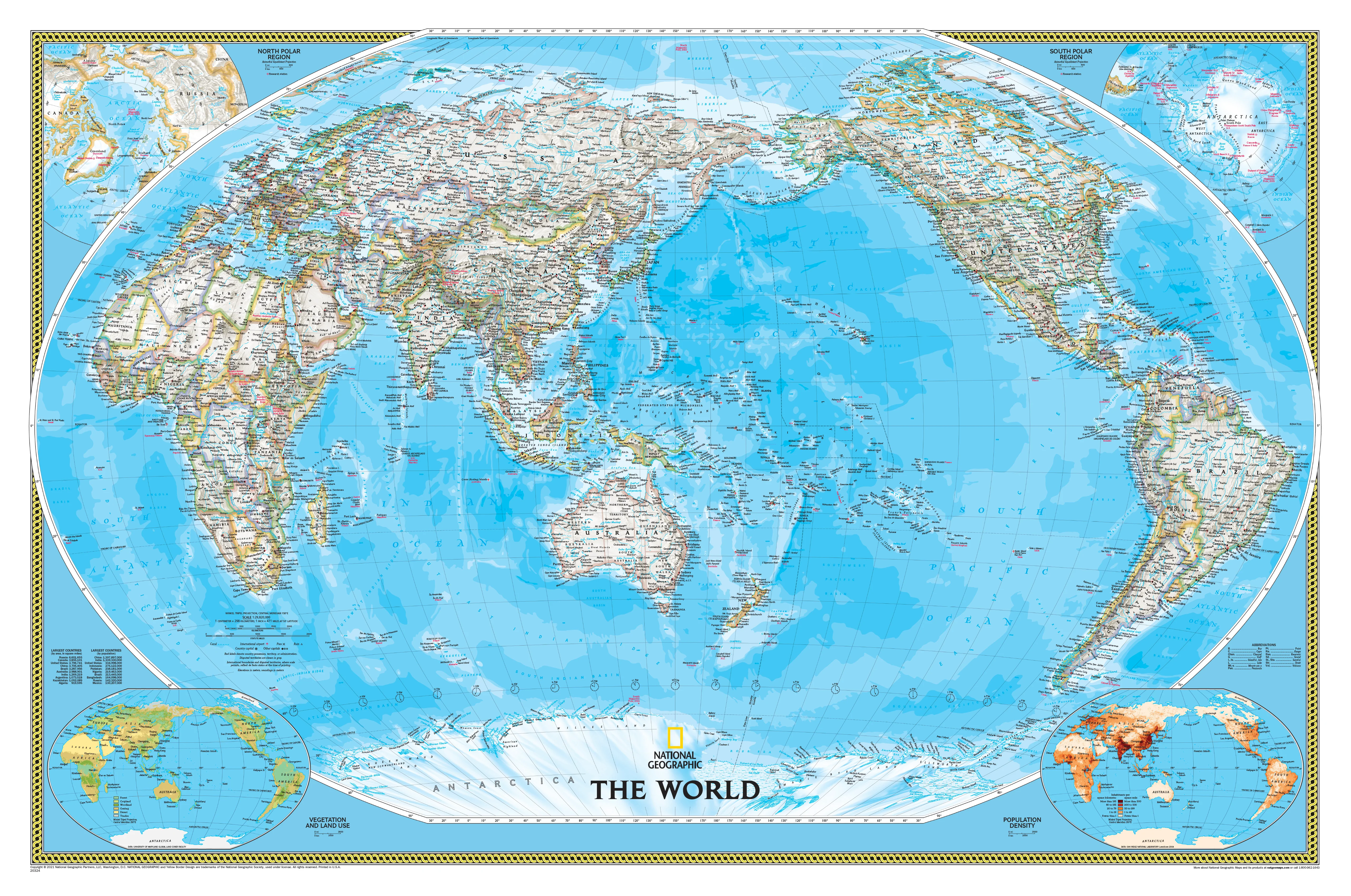
Michelin is one of the world’s most respected map publishers—and this edition of the North America Road Atlas showcases exactly why. Designed to help you plan and navigate with precision across national borders, mountain ranges, urban jungles, and wilderness corridors, this is the only atlas on the market that covers the entirety of the United States, Canada, and Mexico in such usable detail.
-
Covers all 50 U.S. states, Canadian provinces and territories, and major regions of Mexico
-
Features multiple map scales, inset maps, and region-specific details
-
Ideal for transcontinental journeys, border-hopping, and multi-country road trips
🔍 What’s Inside – A Deep Dive into Features
🗺️ Multi-Scale Road Mapping
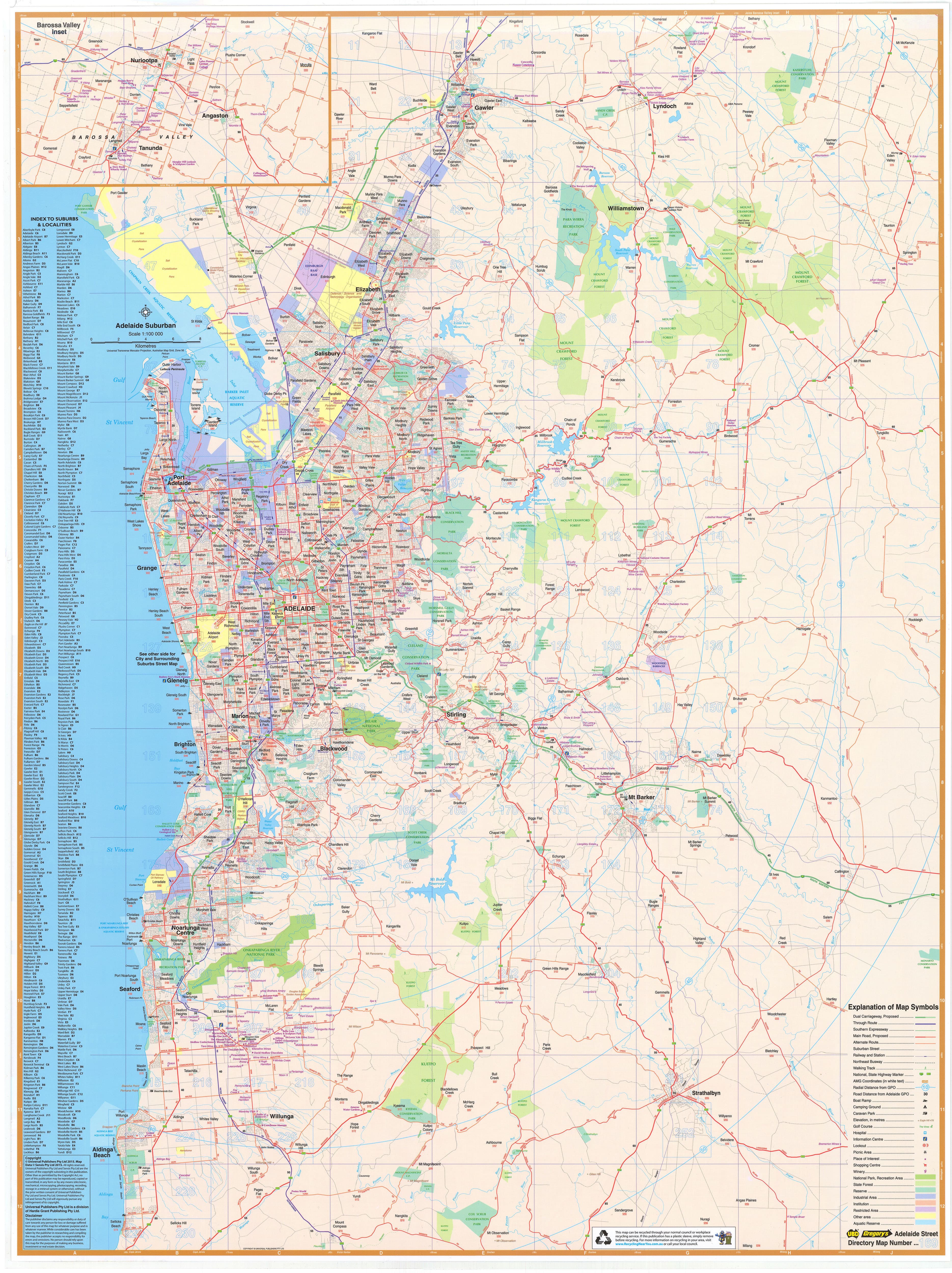
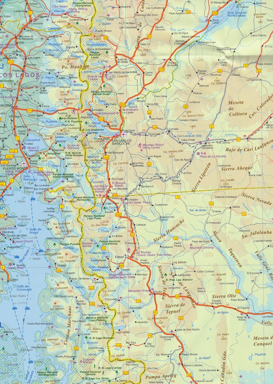
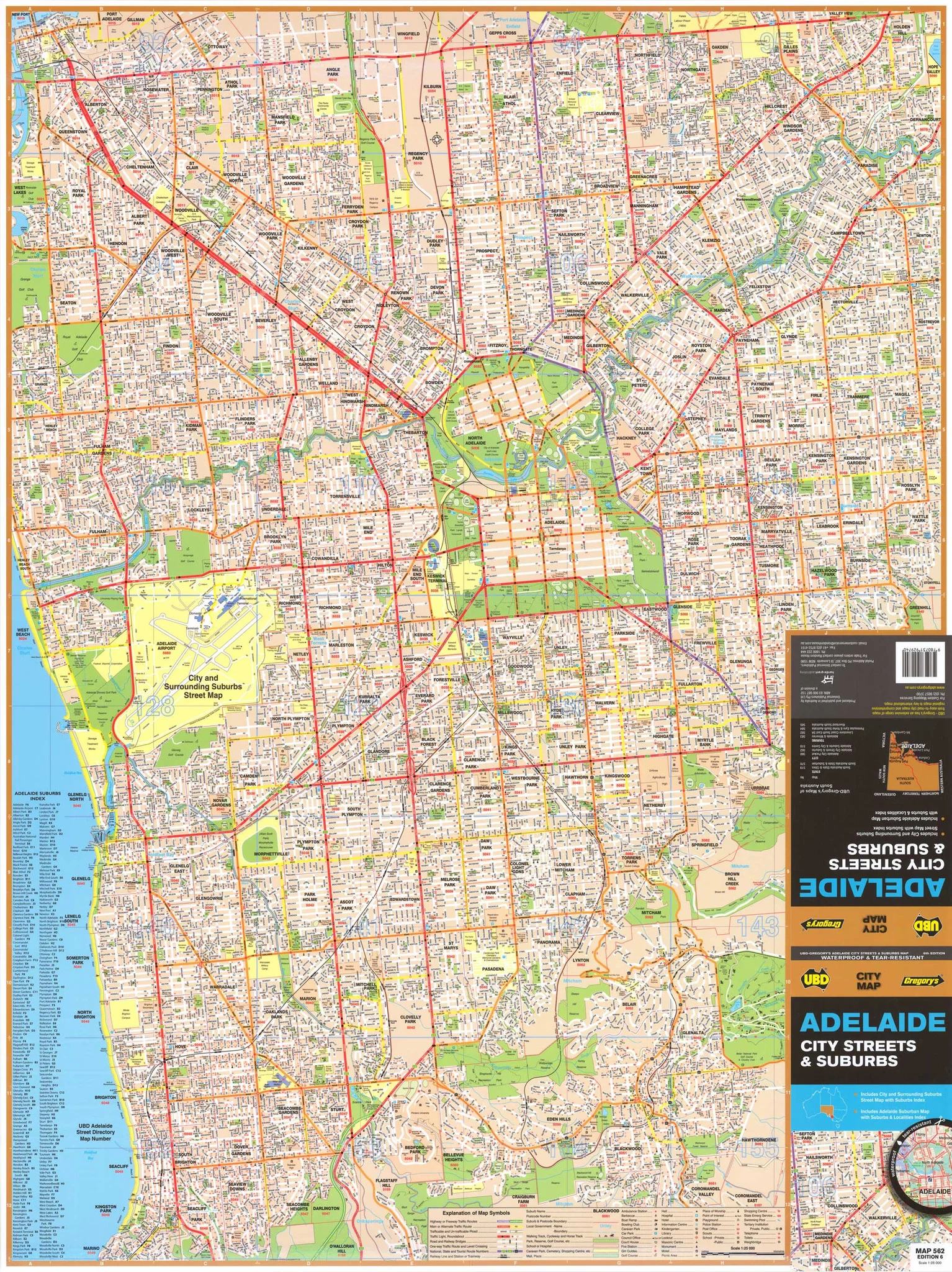
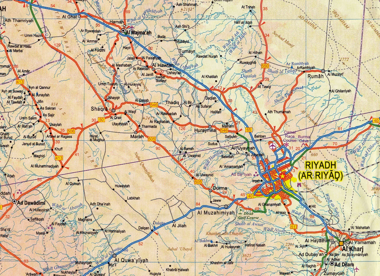
Each map is rendered with Michelin’s signature clarity. Whether you're looking at interstates, regional highways, or smaller state and provincial routes, the information is clear, well-labelled, and easy to follow.
-
Includes road numbers, route designations, rest areas, service centres, national highways, and scenic byways
-
Identifies toll roads, ferry connections, border crossings, and limited-access expressways
-
Map scales vary by region to maximise legibility and detail
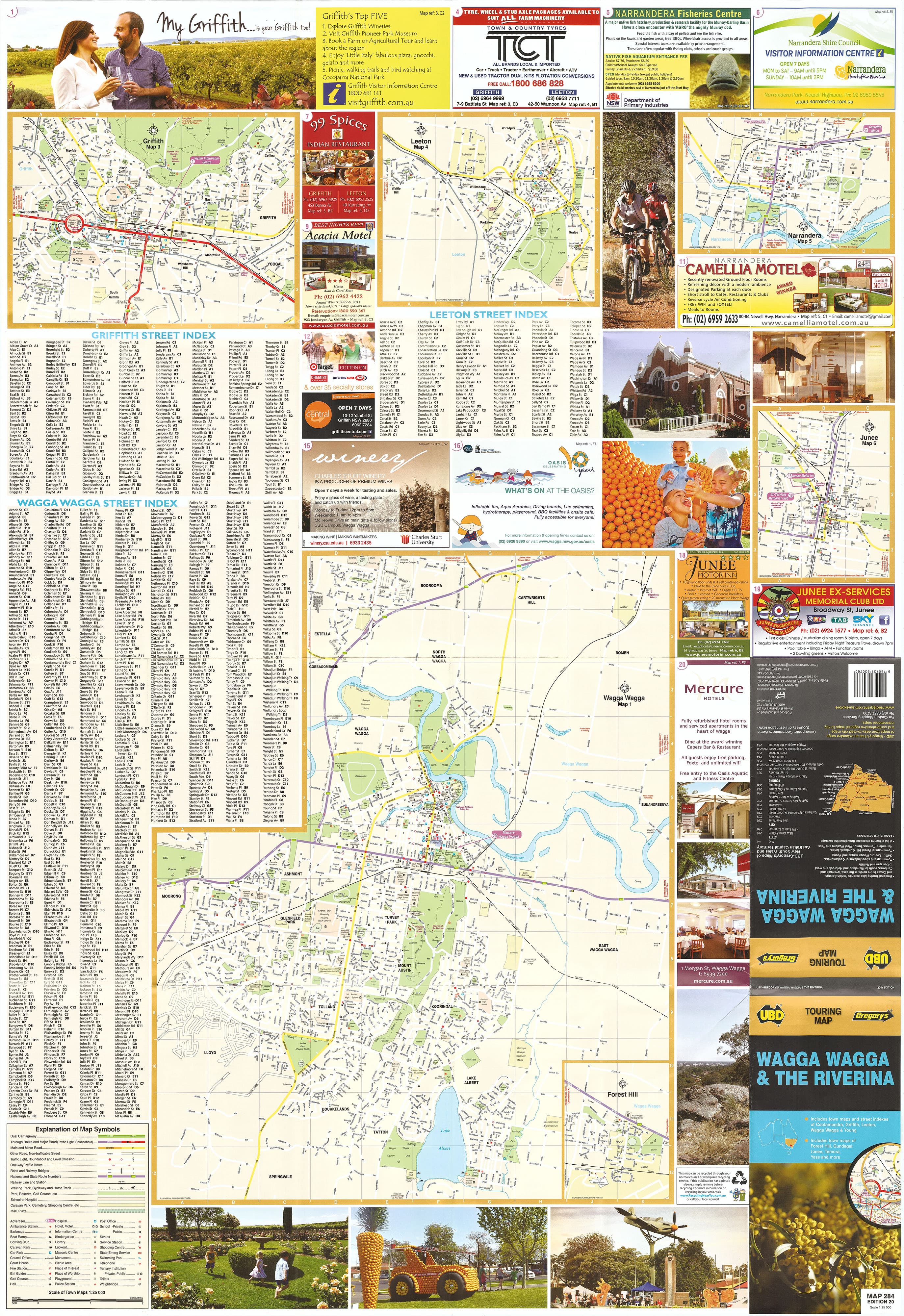
🏙️ City & Regional Maps
Urban driving can be overwhelming—especially in megacities like Los Angeles, Chicago, Toronto, and Mexico City. That’s why Michelin includes an extensive section of city-specific maps to help you approach, enter, and exit complex areas with confidence.
-
Large-scale urban maps for major metropolitan centres
-
Highlighted city centres, ring roads, major junctions and freeway systems
-
Essential for tourists, delivery drivers, and RV travellers avoiding congestion zones
📏 Distance Tools & Drive Time Estimators
Route planning is made easy with:
-
City-to-city distance tables, showing mileage and estimated drive times
-
Regional distance charts, perfect for estimating daily stops and fuel costs
-
Optimised for those who prefer the confidence of analogue tools over digital guesswork
🏞️ National & Provincial Parks Index
Planning a visit to Yellowstone, Banff, Yosemite, Zion, or Copper Canyon? The atlas includes a comprehensive park directory covering over 2,500 national, state, and provincial parks, with:
-
Descriptions of scenic highlights and recreational features
-
Icons for park entrances, campgrounds, picnic areas and visitor centres
-
Bonus: GPS coordinates included for every park—perfect for offline navigation using a GPS device or app
🛣️ Travel Centre Listings
Long-distance drivers and RV enthusiasts will appreciate a curated directory of 1,000+ travel centres, including:
-
Rest stops, refuelling stations, overnight truck-friendly parking, and full-service locations
-
Key routes for cross-country trucking and camper travel
-
Well-marked service corridors for stress-free planning on extended trips
📐 Product Specifications
| Specification | Details |
|---|---|
| Format | Spiralbound (opens flat for easy use) |
| Dimensions | 220 mm (W) × 280 mm (H) × 15 mm (D) |
| Weight | 650 grams |
| Pages | 302 full-colour pages |
| Map Scale | Varies by region (high resolution where needed) |
| Publisher | Michelin Travel Publications |
| Extras | GPS coordinates for 2,500+ parks, national park index, city distance charts |
🎯 Who Is This Atlas Designed For?
Road Trippers & Holidaymakers
Plan epic drives, scenic routes, and cross-country tours with confidence. Track your progress with physical maps that never run out of battery.
RV & Campervan Travellers
Navigate from national parks to fuel stations to campsites with the park index, GPS listings, and travel centre guides.
Cross-Border Adventurers
Easily navigate three countries without switching between multiple maps or apps. One book, three nations.
Digital Minimalists
Avoid data charges, battery drain, or poor signal in remote areas. This atlas works wherever your wheels take you.
Families & Educators
Teach kids to read real maps. Involve them in trip planning. Turn every road trip into an engaging geography lesson.
Professional Drivers & Logistics Planners
Rely on consistent mapping of fuel stops, interstates, key urban networks, and practical routing tools.
💬 What Real Travellers Say
“It’s the best atlas I’ve ever owned. Detailed, clear, and incredibly helpful for trip planning. A must-have for our motorhome.”
— ⭐⭐⭐⭐⭐ Sandra, Oregon
“We crossed from the U.S. into Canada and then into Mexico with this book. Everything we needed was right there. No flipping between apps. No dead zones.”
— ⭐⭐⭐⭐⭐ Luis & Marcy, Arizona
“So helpful for finding national parks and knowing how long the drive really takes. GPS coordinates were a bonus.”
— ⭐⭐⭐⭐⭐ Dave, Alberta
🌟 Why Michelin?
Michelin has been producing premium road atlases and travel guides for over a century. Known for precision cartography, intuitive layout, and traveller-first innovation, every product is designed with real-world utility in mind. This isn’t just a map—it’s Michelin’s legacy of excellence in your glovebox.
Durable. Reliable. Fully updated. The Michelin North America Road Atlas is your trusted co-pilot for the long road ahead—whether you’re crossing borders, camping under the stars, or just seeking the quiet thrill of the open highway.
Original: $39.31
-65%$39.31
$13.76Product Information
Product Information
Shipping & Returns
Shipping & Returns
Description
The Most Comprehensive Road Atlas for Cross-Country Travel Through the USA, Canada & Mexico
If you're preparing for a coast-to-coast adventure across the United States, a scenic drive through the Canadian Rockies, or a sun-drenched journey into Mexico’s Baja Peninsula, there is one essential tool that should be riding shotgun: the Michelin North America Road Atlas.
Unlike any other road atlas on the market, this spiralbound edition covers three countries—USA, Canada, and Mexico—in high-resolution, multi-scale detail, making it a true all-in-one reference for serious travellers, campers, roadtrippers, and RV explorers. This is not just a book of maps—this is a travel-planning powerhouse, a trip-saver, and a visual roadmap to your best adventures yet.
🌎 Unrivalled Continental Coverage
Michelin is one of the world’s most respected map publishers—and this edition of the North America Road Atlas showcases exactly why. Designed to help you plan and navigate with precision across national borders, mountain ranges, urban jungles, and wilderness corridors, this is the only atlas on the market that covers the entirety of the United States, Canada, and Mexico in such usable detail.
-
Covers all 50 U.S. states, Canadian provinces and territories, and major regions of Mexico
-
Features multiple map scales, inset maps, and region-specific details
-
Ideal for transcontinental journeys, border-hopping, and multi-country road trips
🔍 What’s Inside – A Deep Dive into Features
🗺️ Multi-Scale Road Mapping
Each map is rendered with Michelin’s signature clarity. Whether you're looking at interstates, regional highways, or smaller state and provincial routes, the information is clear, well-labelled, and easy to follow.
-
Includes road numbers, route designations, rest areas, service centres, national highways, and scenic byways
-
Identifies toll roads, ferry connections, border crossings, and limited-access expressways
-
Map scales vary by region to maximise legibility and detail
🏙️ City & Regional Maps
Urban driving can be overwhelming—especially in megacities like Los Angeles, Chicago, Toronto, and Mexico City. That’s why Michelin includes an extensive section of city-specific maps to help you approach, enter, and exit complex areas with confidence.
-
Large-scale urban maps for major metropolitan centres
-
Highlighted city centres, ring roads, major junctions and freeway systems
-
Essential for tourists, delivery drivers, and RV travellers avoiding congestion zones
📏 Distance Tools & Drive Time Estimators
Route planning is made easy with:
-
City-to-city distance tables, showing mileage and estimated drive times
-
Regional distance charts, perfect for estimating daily stops and fuel costs
-
Optimised for those who prefer the confidence of analogue tools over digital guesswork
🏞️ National & Provincial Parks Index
Planning a visit to Yellowstone, Banff, Yosemite, Zion, or Copper Canyon? The atlas includes a comprehensive park directory covering over 2,500 national, state, and provincial parks, with:
-
Descriptions of scenic highlights and recreational features
-
Icons for park entrances, campgrounds, picnic areas and visitor centres
-
Bonus: GPS coordinates included for every park—perfect for offline navigation using a GPS device or app
🛣️ Travel Centre Listings
Long-distance drivers and RV enthusiasts will appreciate a curated directory of 1,000+ travel centres, including:
-
Rest stops, refuelling stations, overnight truck-friendly parking, and full-service locations
-
Key routes for cross-country trucking and camper travel
-
Well-marked service corridors for stress-free planning on extended trips
📐 Product Specifications
| Specification | Details |
|---|---|
| Format | Spiralbound (opens flat for easy use) |
| Dimensions | 220 mm (W) × 280 mm (H) × 15 mm (D) |
| Weight | 650 grams |
| Pages | 302 full-colour pages |
| Map Scale | Varies by region (high resolution where needed) |
| Publisher | Michelin Travel Publications |
| Extras | GPS coordinates for 2,500+ parks, national park index, city distance charts |
🎯 Who Is This Atlas Designed For?
Road Trippers & Holidaymakers
Plan epic drives, scenic routes, and cross-country tours with confidence. Track your progress with physical maps that never run out of battery.
RV & Campervan Travellers
Navigate from national parks to fuel stations to campsites with the park index, GPS listings, and travel centre guides.
Cross-Border Adventurers
Easily navigate three countries without switching between multiple maps or apps. One book, three nations.
Digital Minimalists
Avoid data charges, battery drain, or poor signal in remote areas. This atlas works wherever your wheels take you.
Families & Educators
Teach kids to read real maps. Involve them in trip planning. Turn every road trip into an engaging geography lesson.
Professional Drivers & Logistics Planners
Rely on consistent mapping of fuel stops, interstates, key urban networks, and practical routing tools.
💬 What Real Travellers Say
“It’s the best atlas I’ve ever owned. Detailed, clear, and incredibly helpful for trip planning. A must-have for our motorhome.”
— ⭐⭐⭐⭐⭐ Sandra, Oregon
“We crossed from the U.S. into Canada and then into Mexico with this book. Everything we needed was right there. No flipping between apps. No dead zones.”
— ⭐⭐⭐⭐⭐ Luis & Marcy, Arizona
“So helpful for finding national parks and knowing how long the drive really takes. GPS coordinates were a bonus.”
— ⭐⭐⭐⭐⭐ Dave, Alberta
🌟 Why Michelin?
Michelin has been producing premium road atlases and travel guides for over a century. Known for precision cartography, intuitive layout, and traveller-first innovation, every product is designed with real-world utility in mind. This isn’t just a map—it’s Michelin’s legacy of excellence in your glovebox.
Durable. Reliable. Fully updated. The Michelin North America Road Atlas is your trusted co-pilot for the long road ahead—whether you’re crossing borders, camping under the stars, or just seeking the quiet thrill of the open highway.