Victoria & Melbourne Postcode Laminated Wall Map 1036 x 788mm
Victoria & Melbourne Postcode Laminated Wall Map · 1036 × 788 mm
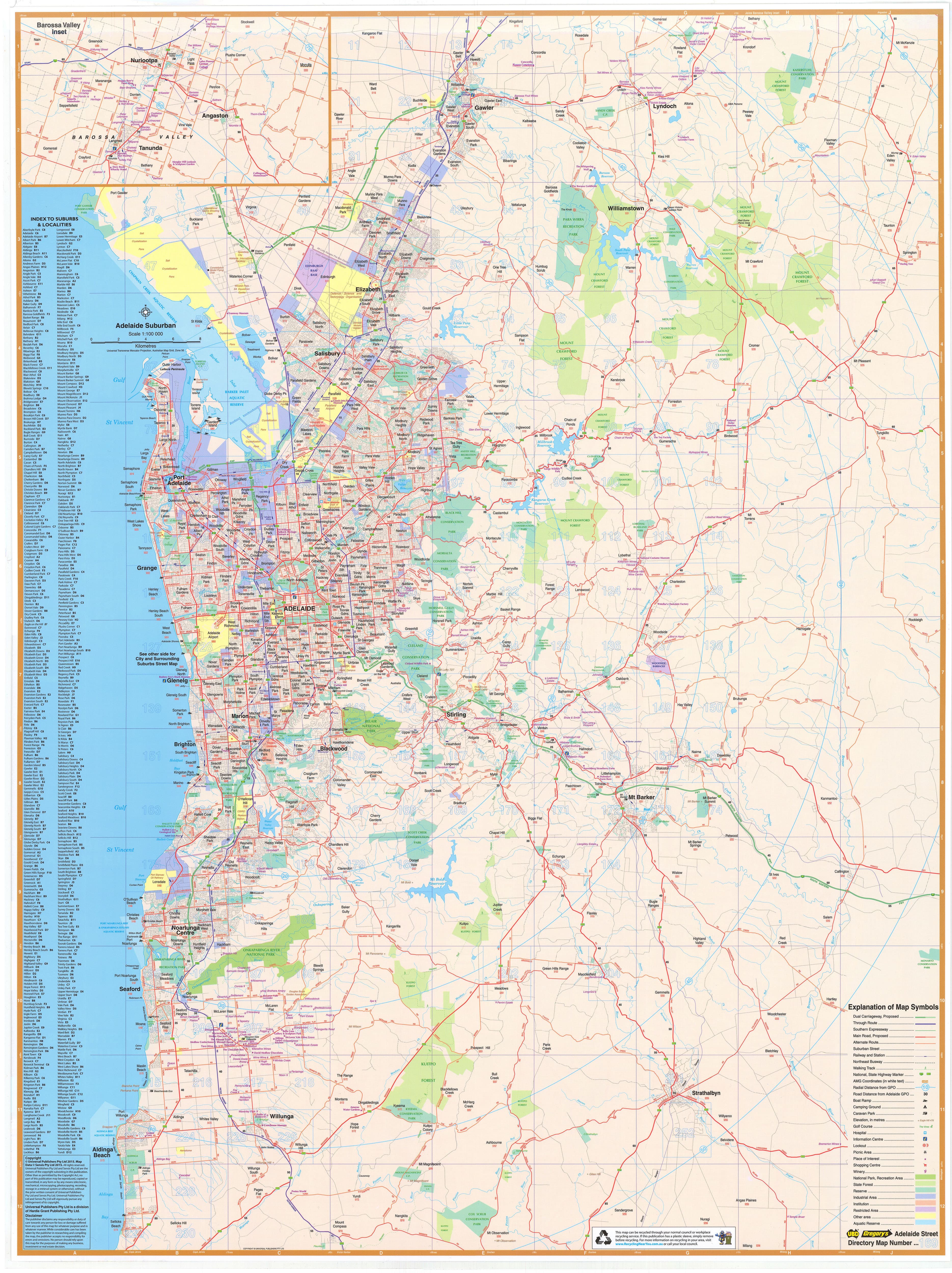
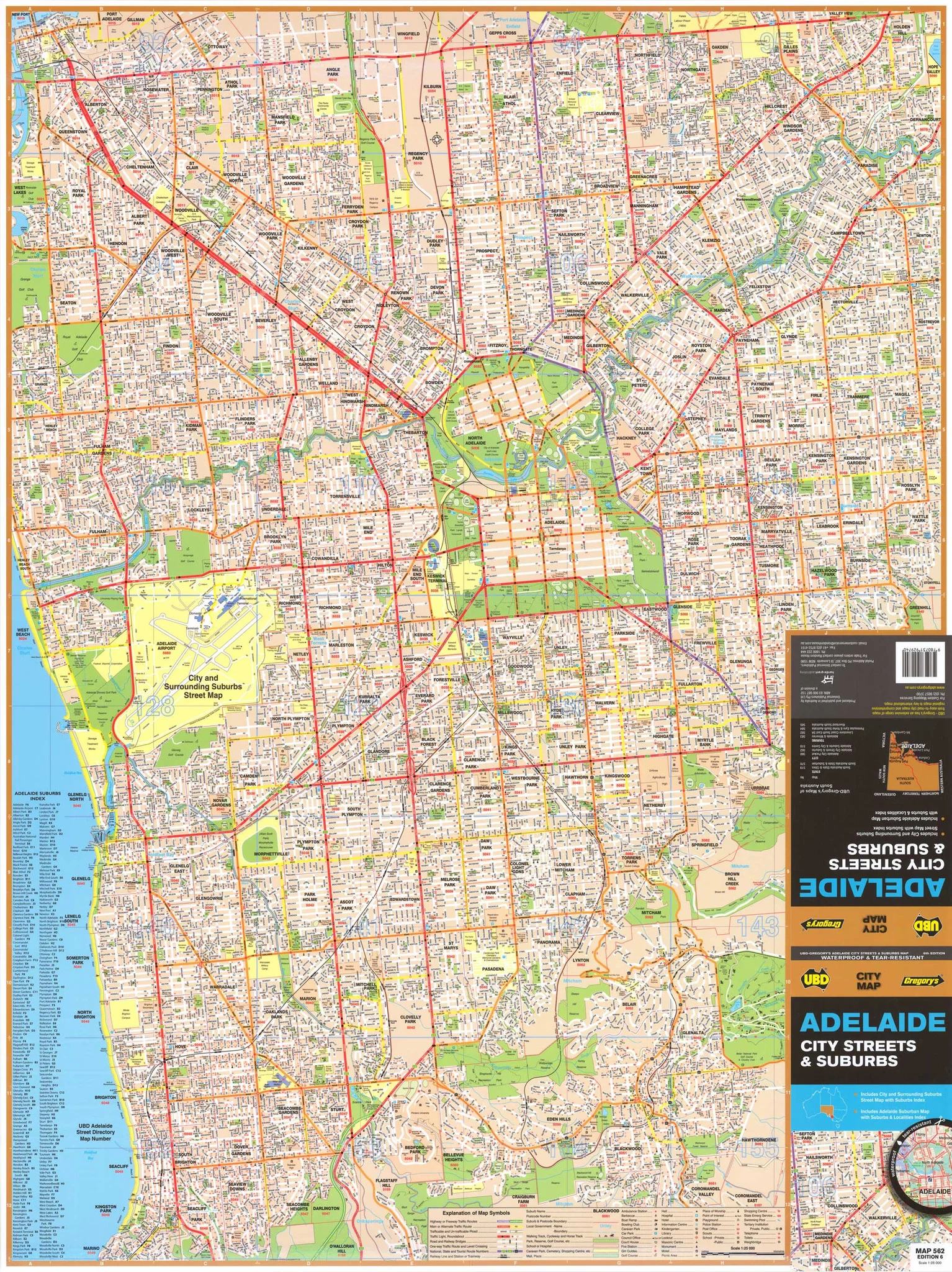
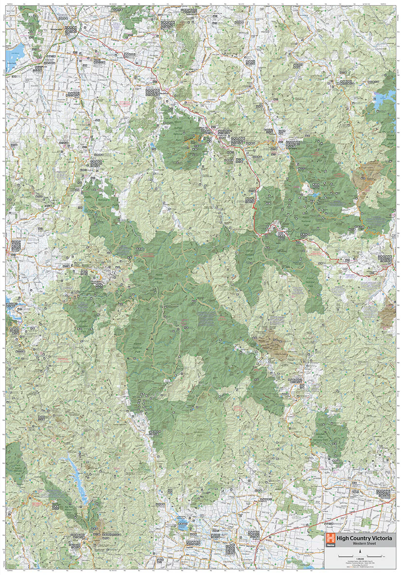
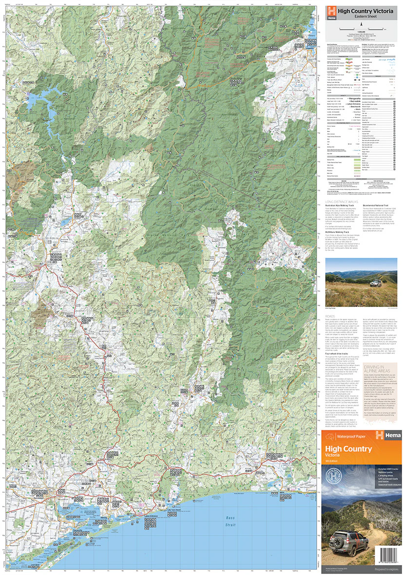
The definitive postcode planning map for Victoria and its capital, Melbourne. Cartodraft’s Victoria & Melbourne Postcode Map shows every postcode boundary and number across the state—zooming from metropolitan Melbourne’s dense suburbs to regional towns, coastal hubs, and rural communities. Finished in a robust write-on/wipe-off laminate, this map is built for logistics, sales, service planning, government, and education.
✅ Why this map works
-
Complete statewide coverage — from central Melbourne through Geelong, Bendigo, Ballarat, Mildura, Gippsland, and beyond
-
Dual focus — detailed Melbourne metro paired with full Victoria postcode clarity
-
Comprehensive suburb & town index — quick postcode confirmation at a glance
-
True write & wipe surface — annotate with whiteboard markers; erase cleanly with no ghosting
-
Mark-It-Dots compatible — highlight depots, service areas, or hotspots without damaging the laminate
-
Professional-grade tool — trusted by sales teams, logistics managers, planners, government agencies, and educators
🪵 Premium materials (made to last)
-
Heavy base stock — stable, smooth paper ensures crisp lines and vibrant colour
-
True encapsulation lamination — sealed in 2 × 80-micron gloss film, waterproof and tear-resistant
-
Reusable write-on/wipe-off finish — designed for daily use with standard whiteboard markers
-
Edge-sealed protection — resists fraying and moisture in high-use settings
-
Colour-managed printing — high contrast for wall-distance readability
✨ Optional upgrade: Laminated + Timber Hang Rails — natural lacquered rails fitted top & bottom with a hanging cord for a polished, ready-to-hang display.
⏱️ Please allow up to 10 working days for hang-railed maps.
🧾 What’s on the map
-
Victoria postcode boundaries & numbers statewide
-
Detailed Melbourne metro coverage for dense suburban areas
-
Comprehensive suburb & town index for fast reference
-
Major highways, transport corridors, and features (as supplied by Cartodraft)
📐 Size & display
-
1036 × 788 mm (landscape) — wide format for readability and balance on office or classroom walls
-
Mount directly with 3M picture strips, screws, or upgrade to timber hang rails for a professional finish
📦 Practical uses
-
Sales & franchise planning — allocate and adjust postcode-based territories
-
Logistics & courier services — manage metro delivery runs and regional freight networks
-
Government & administration — reference tool for service planning, outreach, and compliance
-
Education & training — ideal for geography, planning, and business studies
-
Office & boardroom display — functional, clear, and impressive as a wall feature
🧽 Care & maintenance
-
Wipe gently with a soft dry or slightly damp cloth
-
Use only whiteboard markers (avoid permanent/ethanol-based pens)
-
Remove dots or tape carefully to protect the laminate seal
📊 Specifications
| Field | Detail |
|---|---|
| Title | Victoria & Melbourne Postcode Laminated Wall Map |
| Publisher | Cartodraft |
| Coverage | Statewide Victoria with detailed Melbourne metro |
| Index | Suburb & town index with postcodes |
| Colour-managed, high-contrast cartography | |
| Lamination | 2 × 80-micron gloss film, fully encapsulated, edge-sealed |
| Surface | Write-on/wipe-off (whiteboard-marker compatible) |
| Orientation & Size | Landscape — 1036 × 788 mm |
| Optional Display | Laminated + Timber Hang Rails (natural lacquered; allow up to 10 working days) |
| Best for | Sales, logistics, franchise planning, service coverage, education |
🇦🇺 Our commitment
-
Made & printed in Australia — supporting local production and expertise
-
Hand-finished lamination — carefully sealed edges for strength and long life
-
Colour-managed workflow — ensures consistent clarity and accuracy in every print run
-
Packed with care — shipped in heavy-duty tubes or flat-packed for safe delivery
-
Family-run expertise — decades of cartographic knowledge built into every map
Plan Victoria and Melbourne with confidence. Select your finish, add accessories, and bring postcode clarity to your wall today.
Product Information
Product Information
Shipping & Returns
Shipping & Returns
Description
Victoria & Melbourne Postcode Laminated Wall Map · 1036 × 788 mm
The definitive postcode planning map for Victoria and its capital, Melbourne. Cartodraft’s Victoria & Melbourne Postcode Map shows every postcode boundary and number across the state—zooming from metropolitan Melbourne’s dense suburbs to regional towns, coastal hubs, and rural communities. Finished in a robust write-on/wipe-off laminate, this map is built for logistics, sales, service planning, government, and education.
✅ Why this map works
-
Complete statewide coverage — from central Melbourne through Geelong, Bendigo, Ballarat, Mildura, Gippsland, and beyond
-
Dual focus — detailed Melbourne metro paired with full Victoria postcode clarity
-
Comprehensive suburb & town index — quick postcode confirmation at a glance
-
True write & wipe surface — annotate with whiteboard markers; erase cleanly with no ghosting
-
Mark-It-Dots compatible — highlight depots, service areas, or hotspots without damaging the laminate
-
Professional-grade tool — trusted by sales teams, logistics managers, planners, government agencies, and educators
🪵 Premium materials (made to last)
-
Heavy base stock — stable, smooth paper ensures crisp lines and vibrant colour
-
True encapsulation lamination — sealed in 2 × 80-micron gloss film, waterproof and tear-resistant
-
Reusable write-on/wipe-off finish — designed for daily use with standard whiteboard markers
-
Edge-sealed protection — resists fraying and moisture in high-use settings
-
Colour-managed printing — high contrast for wall-distance readability
✨ Optional upgrade: Laminated + Timber Hang Rails — natural lacquered rails fitted top & bottom with a hanging cord for a polished, ready-to-hang display.
⏱️ Please allow up to 10 working days for hang-railed maps.
🧾 What’s on the map
-
Victoria postcode boundaries & numbers statewide
-
Detailed Melbourne metro coverage for dense suburban areas
-
Comprehensive suburb & town index for fast reference
-
Major highways, transport corridors, and features (as supplied by Cartodraft)
📐 Size & display
-
1036 × 788 mm (landscape) — wide format for readability and balance on office or classroom walls
-
Mount directly with 3M picture strips, screws, or upgrade to timber hang rails for a professional finish
📦 Practical uses
-
Sales & franchise planning — allocate and adjust postcode-based territories
-
Logistics & courier services — manage metro delivery runs and regional freight networks
-
Government & administration — reference tool for service planning, outreach, and compliance
-
Education & training — ideal for geography, planning, and business studies
-
Office & boardroom display — functional, clear, and impressive as a wall feature
🧽 Care & maintenance
-
Wipe gently with a soft dry or slightly damp cloth
-
Use only whiteboard markers (avoid permanent/ethanol-based pens)
-
Remove dots or tape carefully to protect the laminate seal
📊 Specifications
| Field | Detail |
|---|---|
| Title | Victoria & Melbourne Postcode Laminated Wall Map |
| Publisher | Cartodraft |
| Coverage | Statewide Victoria with detailed Melbourne metro |
| Index | Suburb & town index with postcodes |
| Colour-managed, high-contrast cartography | |
| Lamination | 2 × 80-micron gloss film, fully encapsulated, edge-sealed |
| Surface | Write-on/wipe-off (whiteboard-marker compatible) |
| Orientation & Size | Landscape — 1036 × 788 mm |
| Optional Display | Laminated + Timber Hang Rails (natural lacquered; allow up to 10 working days) |
| Best for | Sales, logistics, franchise planning, service coverage, education |
🇦🇺 Our commitment
-
Made & printed in Australia — supporting local production and expertise
-
Hand-finished lamination — carefully sealed edges for strength and long life
-
Colour-managed workflow — ensures consistent clarity and accuracy in every print run
-
Packed with care — shipped in heavy-duty tubes or flat-packed for safe delivery
-
Family-run expertise — decades of cartographic knowledge built into every map
Plan Victoria and Melbourne with confidence. Select your finish, add accessories, and bring postcode clarity to your wall today.