Zimbabwe - Traks4Africa Map
Zimbabwe — Tracks4Africa Overlander Map
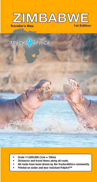
Scale 1 : 1,000,000 | GPS-Verified Routes | Waterproof PolyArt
🦓 Victoria Falls • Hwange • Great Zimbabwe • Gonarezhou • Lake Kariba
Zimbabwe is one of Southern Africa’s most rewarding self-drive destinations — vast wildlife estates, legendary safari parks, dramatic escarpments and ancient stone cities. The Tracks4Africa Zimbabwe Map is built specifically for overlanders and independent travellers who want more than a tourist overview.
By combining accurate geographic detail with real-world GPS track data, this map provides the clarity needed to plan routes across sealed highways, gravel corridors and remote 4×4 park tracks.
At 1:1,000,000 scale (1 cm ≈ 10 km), it delivers excellent country-wide coverage while remaining readable and practical for field use.
🌍 What Sets This Map Apart
This is not a simplified road atlas. It integrates:
🛰️ GPS-aligned cartography — what appears on paper corresponds with Tracks4Africa GPS data
📏 Travel times & distances printed along routes — critical for realistic day-by-day planning
🛣️ Complete road and track network — tar, gravel and remote reserve routes
🏕️ Campsites & attractions clearly marked — practical touring intelligence
🗺️ Detailed national park insets — internal tracks shown inside key reserves
🏙️ City plans for major centres — including Harare and Bulawayo
📍 Place name register included — quick reference navigation
🛂 Border crossings marked — with opening and closing times
This means you can see not just where a road goes — but how long it takes, and what surface to expect.
🐘 Explore Zimbabwe’s Iconic Regions
Plan confidently across:
-
The thunder of Victoria Falls
-
Wildlife corridors in Hwange National Park
-
The remote wilderness of Gonarezhou National Park
-
The shores of Lake Kariba
-
The ancient stone city of Great Zimbabwe
Zimbabwe’s road network links these diverse landscapes through changing terrain — highveld plateaus, savannah plains, river valleys and rugged conservation areas. This map reveals how those destinations connect.
🚙 Built for 4×4 & Remote Safari Travel
Zimbabwe’s infrastructure varies significantly:
-
Smooth national highways between cities
-
Long rural gravel stretches
-
Sandy and corrugated park access roads
-
Seasonal river crossings
Accurate travel times are invaluable for:
✔️ Planning fuel stops between remote settlements
✔️ Managing daylight driving inside wildlife areas
✔️ Estimating park gate arrival times
✔️ Coordinating cross-border itineraries
✔️ Planning multi-week overland loops
Paper mapping gives you full national awareness at once — something digital zoom often fragments.
💪 Expedition-Ready PolyArt Construction
Printed on tear- and water-resistant PolyArt, this map is designed for rugged use:
💧 Water resistant
🌞 Heat and sun tolerant
🏕️ Durable at camp tables
🚙 Easy to use on dashboards
📦 Folds cleanly to show only the section you need
Unlike standard paper, PolyArt withstands repeated folding and outdoor handling — ideal for serious travel.
📐 Specifications
📏 Scale: 1 : 1,000,000
📄 Format: Folded national sheet
💧 Material: Waterproof & tear-resistant PolyArt
🛰️ GPS Compatibility: Matches Tracks4Africa GPS mapping
🗺️ Coverage: Entire Zimbabwe with national parks and urban insets
🎯 Who This Map Is For
🚙 4×4 overlanders
🏕️ Self-drive safari travellers
🌍 Cross-border expedition planners
📍 Independent road trippers
🧭 Travellers who want reliable offline navigation
If you’re linking Victoria Falls with Hwange, circling Lake Kariba, or planning a trans-Southern Africa overland route, this map gives you confidence at every stage.
📦 Important Ordering Note
This is an Order-on-Demand map.
🕒 Please allow up to 10 working days for delivery.
⭐ Big Landscapes. Real Distances. Smart Planning.
Zimbabwe rewards travellers who plan carefully. Distances are long, wildlife regions are vast, and conditions can change quickly.
The Tracks4Africa Zimbabwe Overlander Map brings together GPS-verified routes, printed travel times and durable field-ready materials — making it one of the most dependable paper navigation tools available for exploring Zimbabwe.
Unfold it. Trace your route across savannah and river valley. And head into Zimbabwe prepared.
Original: $35.74
-65%$35.74
$12.51Product Information
Product Information
Shipping & Returns
Shipping & Returns
Description
Zimbabwe — Tracks4Africa Overlander Map
Scale 1 : 1,000,000 | GPS-Verified Routes | Waterproof PolyArt
🦓 Victoria Falls • Hwange • Great Zimbabwe • Gonarezhou • Lake Kariba
Zimbabwe is one of Southern Africa’s most rewarding self-drive destinations — vast wildlife estates, legendary safari parks, dramatic escarpments and ancient stone cities. The Tracks4Africa Zimbabwe Map is built specifically for overlanders and independent travellers who want more than a tourist overview.
By combining accurate geographic detail with real-world GPS track data, this map provides the clarity needed to plan routes across sealed highways, gravel corridors and remote 4×4 park tracks.
At 1:1,000,000 scale (1 cm ≈ 10 km), it delivers excellent country-wide coverage while remaining readable and practical for field use.
🌍 What Sets This Map Apart
This is not a simplified road atlas. It integrates:
🛰️ GPS-aligned cartography — what appears on paper corresponds with Tracks4Africa GPS data
📏 Travel times & distances printed along routes — critical for realistic day-by-day planning
🛣️ Complete road and track network — tar, gravel and remote reserve routes
🏕️ Campsites & attractions clearly marked — practical touring intelligence
🗺️ Detailed national park insets — internal tracks shown inside key reserves
🏙️ City plans for major centres — including Harare and Bulawayo
📍 Place name register included — quick reference navigation
🛂 Border crossings marked — with opening and closing times
This means you can see not just where a road goes — but how long it takes, and what surface to expect.
🐘 Explore Zimbabwe’s Iconic Regions
Plan confidently across:
-
The thunder of Victoria Falls
-
Wildlife corridors in Hwange National Park
-
The remote wilderness of Gonarezhou National Park
-
The shores of Lake Kariba
-
The ancient stone city of Great Zimbabwe
Zimbabwe’s road network links these diverse landscapes through changing terrain — highveld plateaus, savannah plains, river valleys and rugged conservation areas. This map reveals how those destinations connect.
🚙 Built for 4×4 & Remote Safari Travel
Zimbabwe’s infrastructure varies significantly:
-
Smooth national highways between cities
-
Long rural gravel stretches
-
Sandy and corrugated park access roads
-
Seasonal river crossings
Accurate travel times are invaluable for:
✔️ Planning fuel stops between remote settlements
✔️ Managing daylight driving inside wildlife areas
✔️ Estimating park gate arrival times
✔️ Coordinating cross-border itineraries
✔️ Planning multi-week overland loops
Paper mapping gives you full national awareness at once — something digital zoom often fragments.
💪 Expedition-Ready PolyArt Construction
Printed on tear- and water-resistant PolyArt, this map is designed for rugged use:
💧 Water resistant
🌞 Heat and sun tolerant
🏕️ Durable at camp tables
🚙 Easy to use on dashboards
📦 Folds cleanly to show only the section you need
Unlike standard paper, PolyArt withstands repeated folding and outdoor handling — ideal for serious travel.
📐 Specifications
📏 Scale: 1 : 1,000,000
📄 Format: Folded national sheet
💧 Material: Waterproof & tear-resistant PolyArt
🛰️ GPS Compatibility: Matches Tracks4Africa GPS mapping
🗺️ Coverage: Entire Zimbabwe with national parks and urban insets
🎯 Who This Map Is For
🚙 4×4 overlanders
🏕️ Self-drive safari travellers
🌍 Cross-border expedition planners
📍 Independent road trippers
🧭 Travellers who want reliable offline navigation
If you’re linking Victoria Falls with Hwange, circling Lake Kariba, or planning a trans-Southern Africa overland route, this map gives you confidence at every stage.
📦 Important Ordering Note
This is an Order-on-Demand map.
🕒 Please allow up to 10 working days for delivery.
⭐ Big Landscapes. Real Distances. Smart Planning.
Zimbabwe rewards travellers who plan carefully. Distances are long, wildlife regions are vast, and conditions can change quickly.
The Tracks4Africa Zimbabwe Overlander Map brings together GPS-verified routes, printed travel times and durable field-ready materials — making it one of the most dependable paper navigation tools available for exploring Zimbabwe.
Unfold it. Trace your route across savannah and river valley. And head into Zimbabwe prepared.