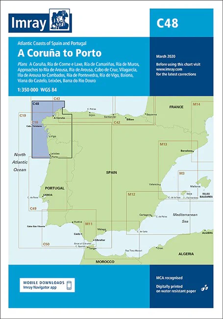
A Coruña to Porto Imray Chart
Coruña to Porto imray 1:350 000 Detailed plans or insets include:
A Coruña (1:50 000) Ría de Corme e Laxe (1:75 000) Ría de Camariñas (1:50 000) Ría de Muros (1:75 000) Approaches to Ría de Arousa (1:150 000 Ría de Arousa (1:150 000) Cabo de Cruz (1:40 000) Vilagarcía (1:35 000) Illa de Arousa to Cambados (1:40 000) Ría de Pontevedra (1:150 000) Ría de Vigo (1:150 000) Baiona (1:85 000) Viana do Castelo (1:30 000) Leixões (1:20 000) Barra do Rio Douro (1:20 000)
Imray C Series charts cover sailing areas in northwestern Europe. These series form the most comprehensive range of yachtsmen’s charts available. Suitable for passage planning and larger scale charts for navigating the coastal waters even close to shore.
The information shown on charts is liable to constant change. Corrections are made available on the Imray website: https://store.imray.com/collections/imray-charts-1 Visit the website to obtain the latest correction notices which are available as free downloads and are continually updated. Imray is now adding smart phone readable QR codes on their charts.
These will provide a fast link to chart corrections and book supplements which are available at the Imray website.
THIS CHART IS ORDER ON-DEMAND PLEASE ALLOW 10 WORKING DAYS FOR DELIVERY
Original: $53.66
-65%$53.66
$18.78Product Information
Product Information
Shipping & Returns
Shipping & Returns
Description
Coruña to Porto imray 1:350 000 Detailed plans or insets include:
A Coruña (1:50 000) Ría de Corme e Laxe (1:75 000) Ría de Camariñas (1:50 000) Ría de Muros (1:75 000) Approaches to Ría de Arousa (1:150 000 Ría de Arousa (1:150 000) Cabo de Cruz (1:40 000) Vilagarcía (1:35 000) Illa de Arousa to Cambados (1:40 000) Ría de Pontevedra (1:150 000) Ría de Vigo (1:150 000) Baiona (1:85 000) Viana do Castelo (1:30 000) Leixões (1:20 000) Barra do Rio Douro (1:20 000)
Imray C Series charts cover sailing areas in northwestern Europe. These series form the most comprehensive range of yachtsmen’s charts available. Suitable for passage planning and larger scale charts for navigating the coastal waters even close to shore.
The information shown on charts is liable to constant change. Corrections are made available on the Imray website: https://store.imray.com/collections/imray-charts-1 Visit the website to obtain the latest correction notices which are available as free downloads and are continually updated. Imray is now adding smart phone readable QR codes on their charts.
These will provide a fast link to chart corrections and book supplements which are available at the Imray website.
THIS CHART IS ORDER ON-DEMAND PLEASE ALLOW 10 WORKING DAYS FOR DELIVERY