Britain Collins Folded Map 2026
A comprehensive, fully updated road map of England, Scotland & Wales — ideal for planning, touring, and discovering the best of Britain by road
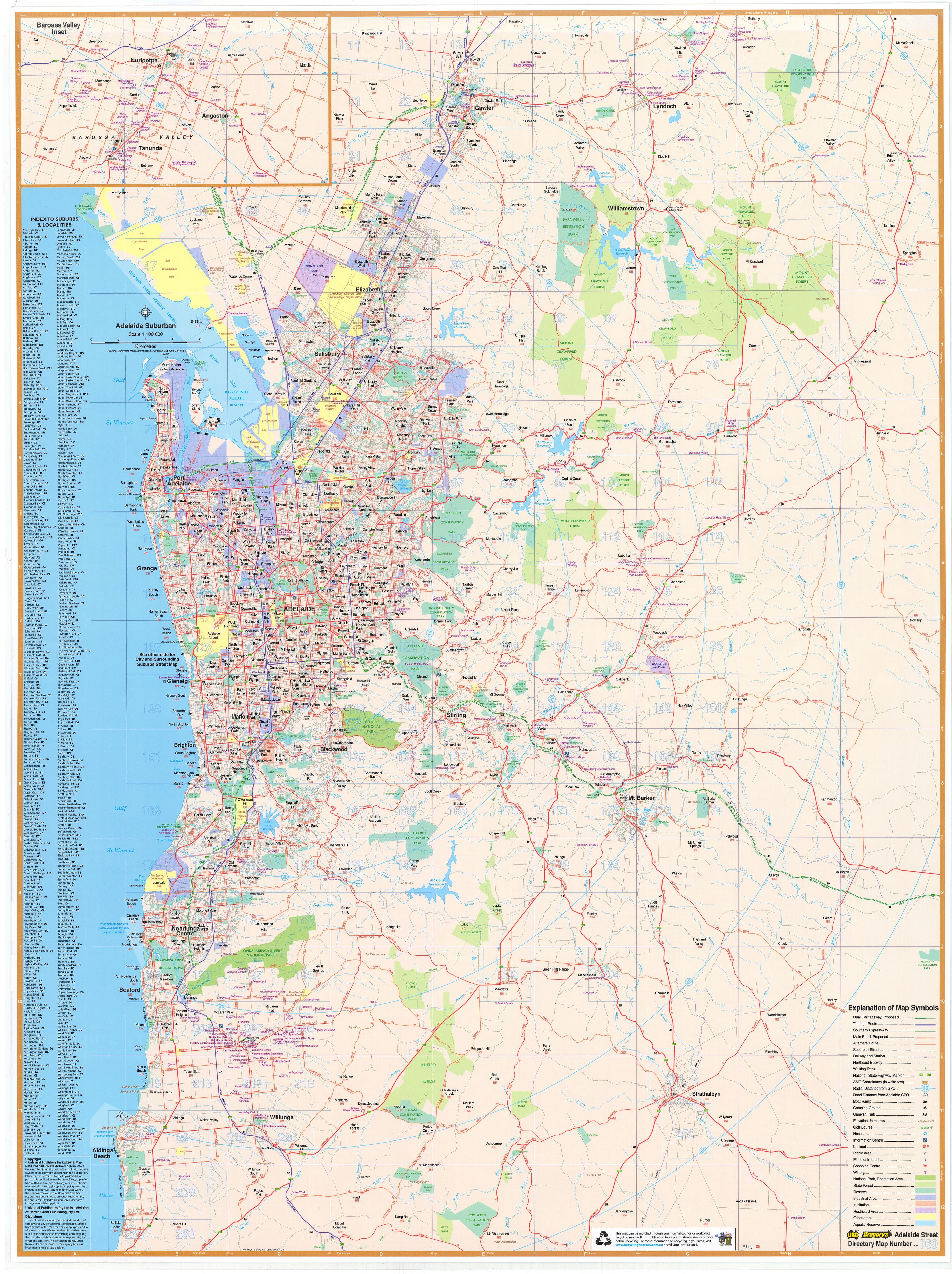
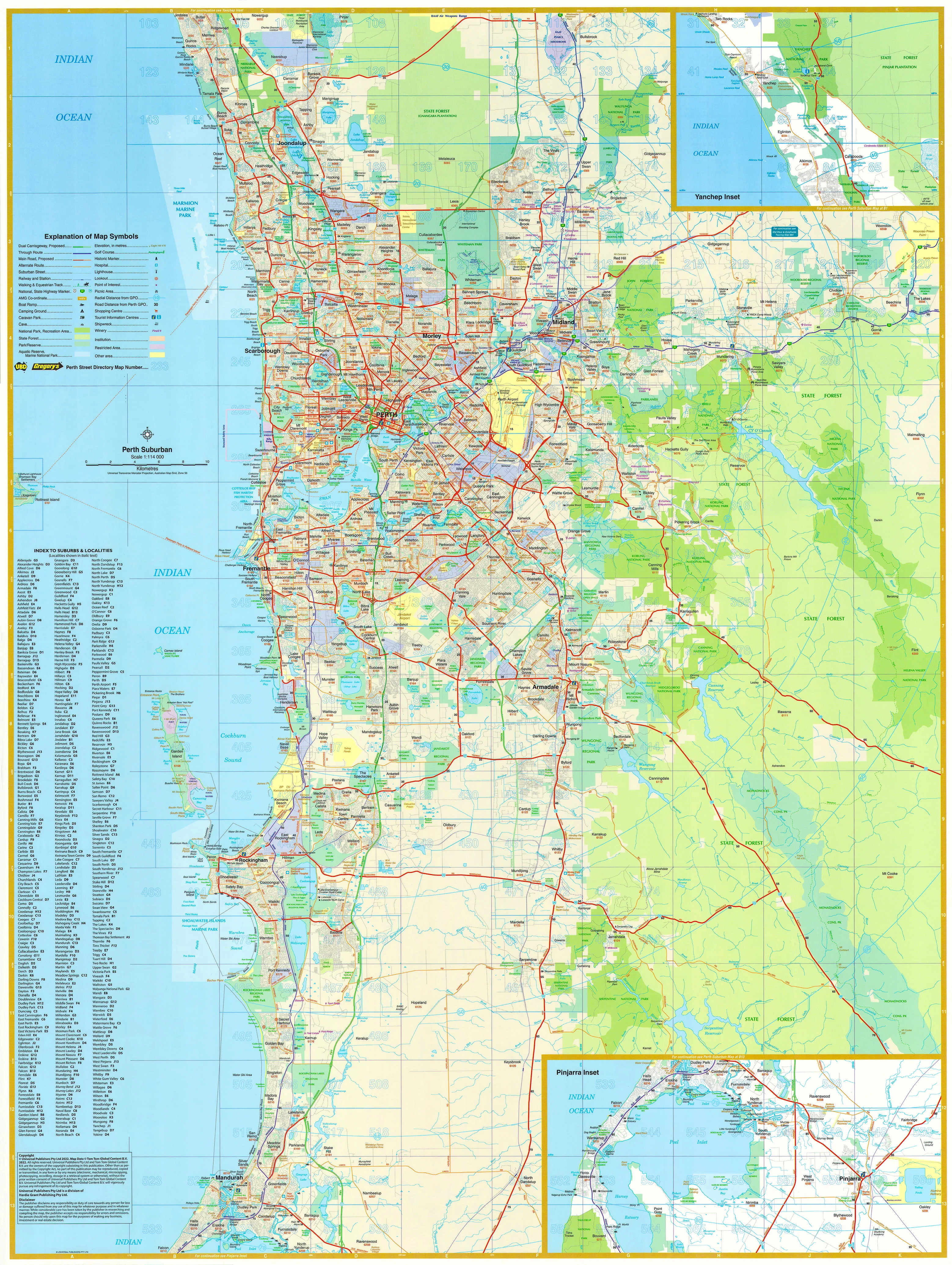
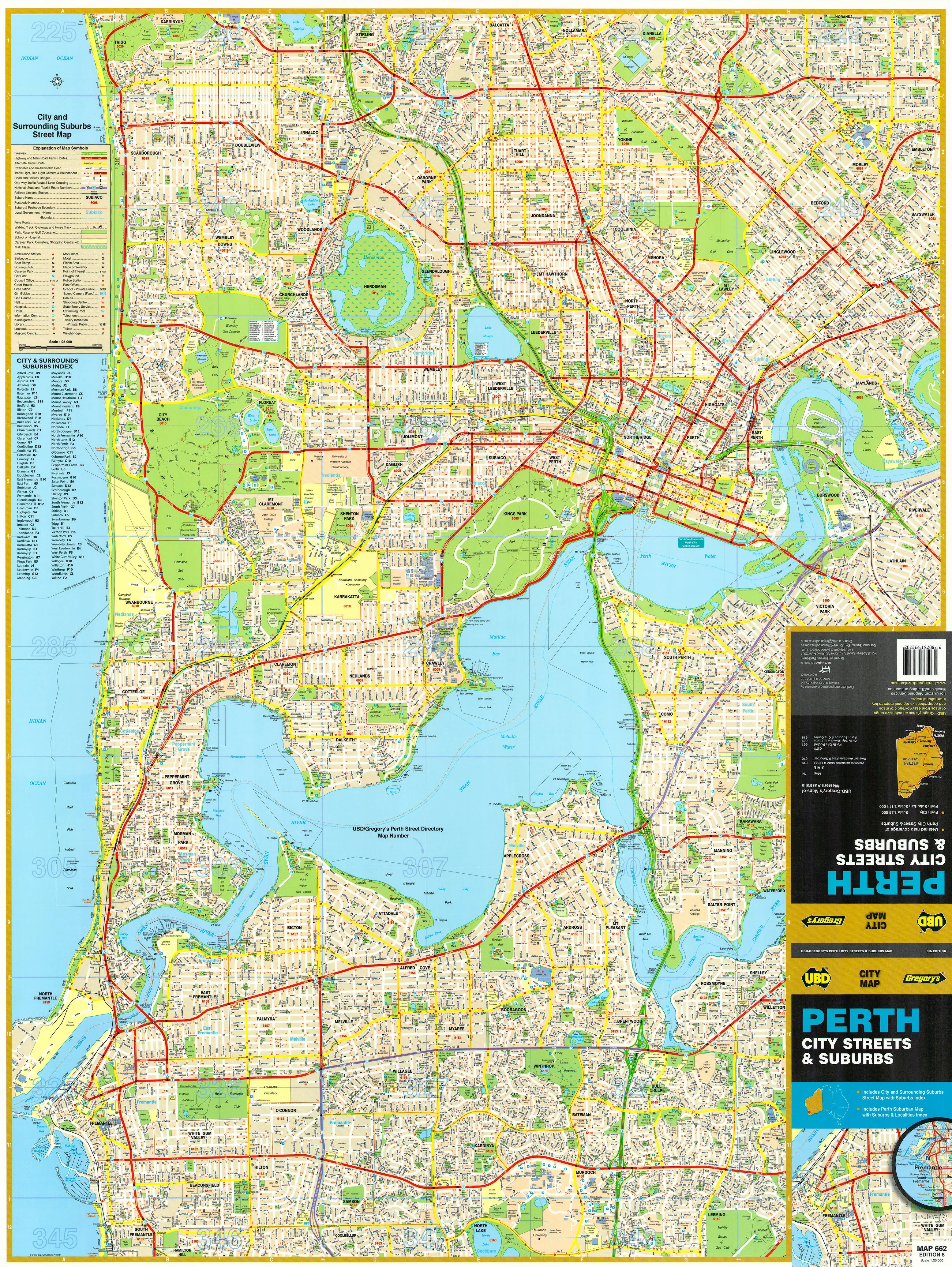
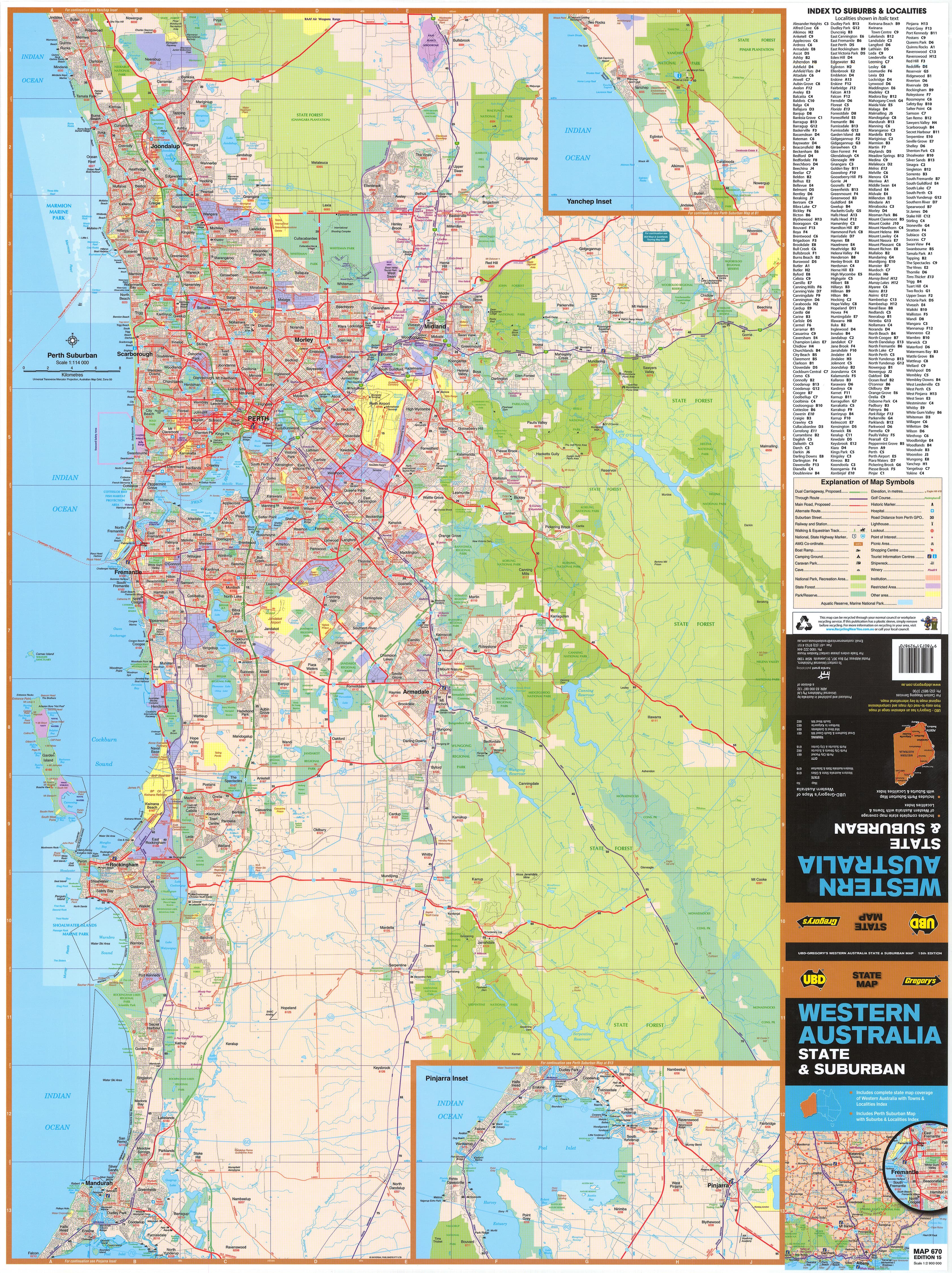
The Collins Britain Folded Map 2026 is your all-in-one road companion for navigating the length and breadth of Great Britain. Covering England, Scotland, and Wales in clear, easy-to-read detail, this trusted map offers an unbeatable combination of accuracy, practicality, and convenience. Whether you’re plotting a scenic countryside escape, preparing for a long-haul drive, or simply want a dependable map as backup to digital navigation, this updated edition is the smart traveller’s choice.
Crafted with Collins’ renowned cartographic clarity, the 2026 edition has been updated with the latest road changes, infrastructure upgrades, and route information, ensuring you're always a step ahead, wherever the road takes you.
🗺️ Key Features:
-
Comprehensive road coverage of England, Scotland, and Wales — from remote highland roads to major motorway routes
-
Clearly marked motorways, A and B roads, and minor routes, colour-coded for quick identification
-
Distances between major towns and cities shown to help estimate travel times and fuel stops
-
Highlights national parks, scenic routes, historic sites, and major tourist attractions throughout Britain
-
Easy-to-locate airports, ferry terminals, and major rail lines for multi-modal travel planning
-
Includes city bypasses, key junctions, and service stations for efficient driving
-
Fully indexed with an alphabetical list of towns, cities, and key landmarks
-
Features relief shading and topographical detail to give a better sense of terrain
-
Updated for 2026, incorporating new roads, road closures, reclassified routes, and urban changes
📏 Scale & Size:
-
Scale: 1:550,000 — approximately 1 inch = 8.7 miles (1 cm = 5.5 km)
This scale strikes the perfect balance between broad national coverage and detailed navigation -
Unfolded map size: approx. 992 mm x 890 mm
Large enough to view the whole country at once -
Folded size: approx. 240 mm x 135 mm
Compact and portable — fits neatly into a glovebox, backpack, or door pocket
📄 Format & Durability:
-
Traditional folded map format — easy to unfold for use and refold for storage
-
Printed on high-quality, durable paper designed to withstand repeated handling
-
Lightweight and portable, ideal for use on the road, at home, or in a classroom
-
Crisp, colour-coded design ensures excellent readability in both natural and low light
🚗 Ideal For:
-
UK road trippers, holidaymakers, and caravan travellers mapping their route across the country
-
Professional drivers, delivery services, and logistics planners needing a reliable offline resource
-
Students, teachers, and geography enthusiasts looking for a current large-format map of Britain
-
Cyclists and motorcyclists navigating scenic routes and rural backroads
-
Emergency or GPS-free backup navigation in remote or low-signal areas
From the rugged coastlines of Cornwall, to the scenic roads of the Lake District, the vibrant cities of London and Manchester, and the majestic Highlands of Scotland, the Collins Britain Folded Map 2026 Edition gives you the tools to navigate confidently and discover every corner of the UK.
Whether you're driving, teaching, exploring, or just dreaming, this map brings the whole of Britain to your fingertips — with accuracy, elegance, and ease.
Let the journey unfold.
The only map of Britain we have that shows the counties in different colours, making it much easier to identify locations.
It includes a distance calculator and city centre maps of:
- Aberdeen
- Dundee
- Edinburgh
- Glasgow
- Inverness
- Perth
- Newcastle
- Birmingham
- Leeds
- Liverpool
- Manchester
- Nottingham
- Sheffield
- Bristol
- Cardiff
- Southampton
- Greater London (Overview)
SHIPS FROM AUSTRALIA, NEXT DAY SHIPPING
Original: $16.42
-65%$16.42
$5.75Product Information
Product Information
Shipping & Returns
Shipping & Returns
Description
A comprehensive, fully updated road map of England, Scotland & Wales — ideal for planning, touring, and discovering the best of Britain by road
The Collins Britain Folded Map 2026 is your all-in-one road companion for navigating the length and breadth of Great Britain. Covering England, Scotland, and Wales in clear, easy-to-read detail, this trusted map offers an unbeatable combination of accuracy, practicality, and convenience. Whether you’re plotting a scenic countryside escape, preparing for a long-haul drive, or simply want a dependable map as backup to digital navigation, this updated edition is the smart traveller’s choice.
Crafted with Collins’ renowned cartographic clarity, the 2026 edition has been updated with the latest road changes, infrastructure upgrades, and route information, ensuring you're always a step ahead, wherever the road takes you.
🗺️ Key Features:
-
Comprehensive road coverage of England, Scotland, and Wales — from remote highland roads to major motorway routes
-
Clearly marked motorways, A and B roads, and minor routes, colour-coded for quick identification
-
Distances between major towns and cities shown to help estimate travel times and fuel stops
-
Highlights national parks, scenic routes, historic sites, and major tourist attractions throughout Britain
-
Easy-to-locate airports, ferry terminals, and major rail lines for multi-modal travel planning
-
Includes city bypasses, key junctions, and service stations for efficient driving
-
Fully indexed with an alphabetical list of towns, cities, and key landmarks
-
Features relief shading and topographical detail to give a better sense of terrain
-
Updated for 2026, incorporating new roads, road closures, reclassified routes, and urban changes
📏 Scale & Size:
-
Scale: 1:550,000 — approximately 1 inch = 8.7 miles (1 cm = 5.5 km)
This scale strikes the perfect balance between broad national coverage and detailed navigation -
Unfolded map size: approx. 992 mm x 890 mm
Large enough to view the whole country at once -
Folded size: approx. 240 mm x 135 mm
Compact and portable — fits neatly into a glovebox, backpack, or door pocket
📄 Format & Durability:
-
Traditional folded map format — easy to unfold for use and refold for storage
-
Printed on high-quality, durable paper designed to withstand repeated handling
-
Lightweight and portable, ideal for use on the road, at home, or in a classroom
-
Crisp, colour-coded design ensures excellent readability in both natural and low light
🚗 Ideal For:
-
UK road trippers, holidaymakers, and caravan travellers mapping their route across the country
-
Professional drivers, delivery services, and logistics planners needing a reliable offline resource
-
Students, teachers, and geography enthusiasts looking for a current large-format map of Britain
-
Cyclists and motorcyclists navigating scenic routes and rural backroads
-
Emergency or GPS-free backup navigation in remote or low-signal areas
From the rugged coastlines of Cornwall, to the scenic roads of the Lake District, the vibrant cities of London and Manchester, and the majestic Highlands of Scotland, the Collins Britain Folded Map 2026 Edition gives you the tools to navigate confidently and discover every corner of the UK.
Whether you're driving, teaching, exploring, or just dreaming, this map brings the whole of Britain to your fingertips — with accuracy, elegance, and ease.
Let the journey unfold.
The only map of Britain we have that shows the counties in different colours, making it much easier to identify locations.
It includes a distance calculator and city centre maps of:
- Aberdeen
- Dundee
- Edinburgh
- Glasgow
- Inverness
- Perth
- Newcastle
- Birmingham
- Leeds
- Liverpool
- Manchester
- Nottingham
- Sheffield
- Bristol
- Cardiff
- Southampton
- Greater London (Overview)
SHIPS FROM AUSTRALIA, NEXT DAY SHIPPING