California Borch Folded Laminated Map
Scale: 1:1,200,000
ISBN-13: 978-3-86609-345-4
Map Size (Unfolded): 660 mm x 494 mm (26 in x 19.5 in)
Folded Size: 243 mm (H) x 110 mm (W) x 8 mm (D)
Weight: 60 g (2.1 oz)
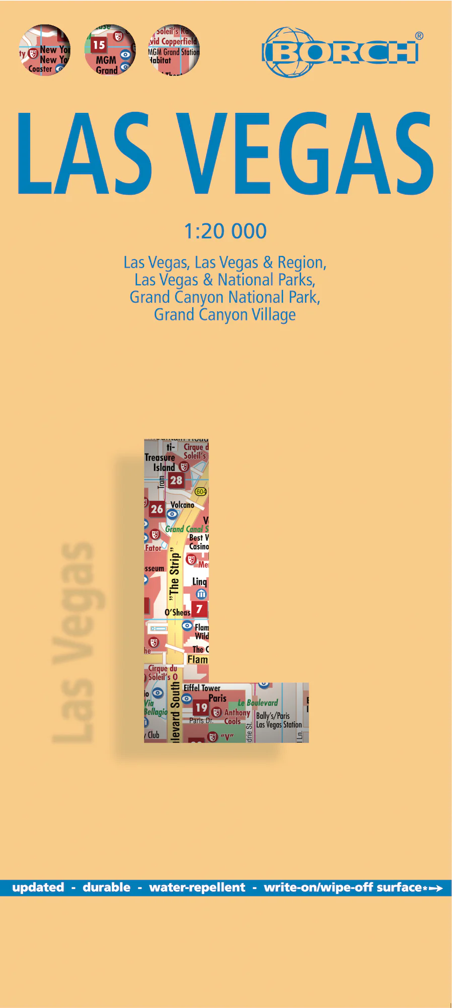
Edition: 12th Edition (2022)
Format: Folded, soft-laminated (wipeable & water-resistant)
Publisher: BORCH
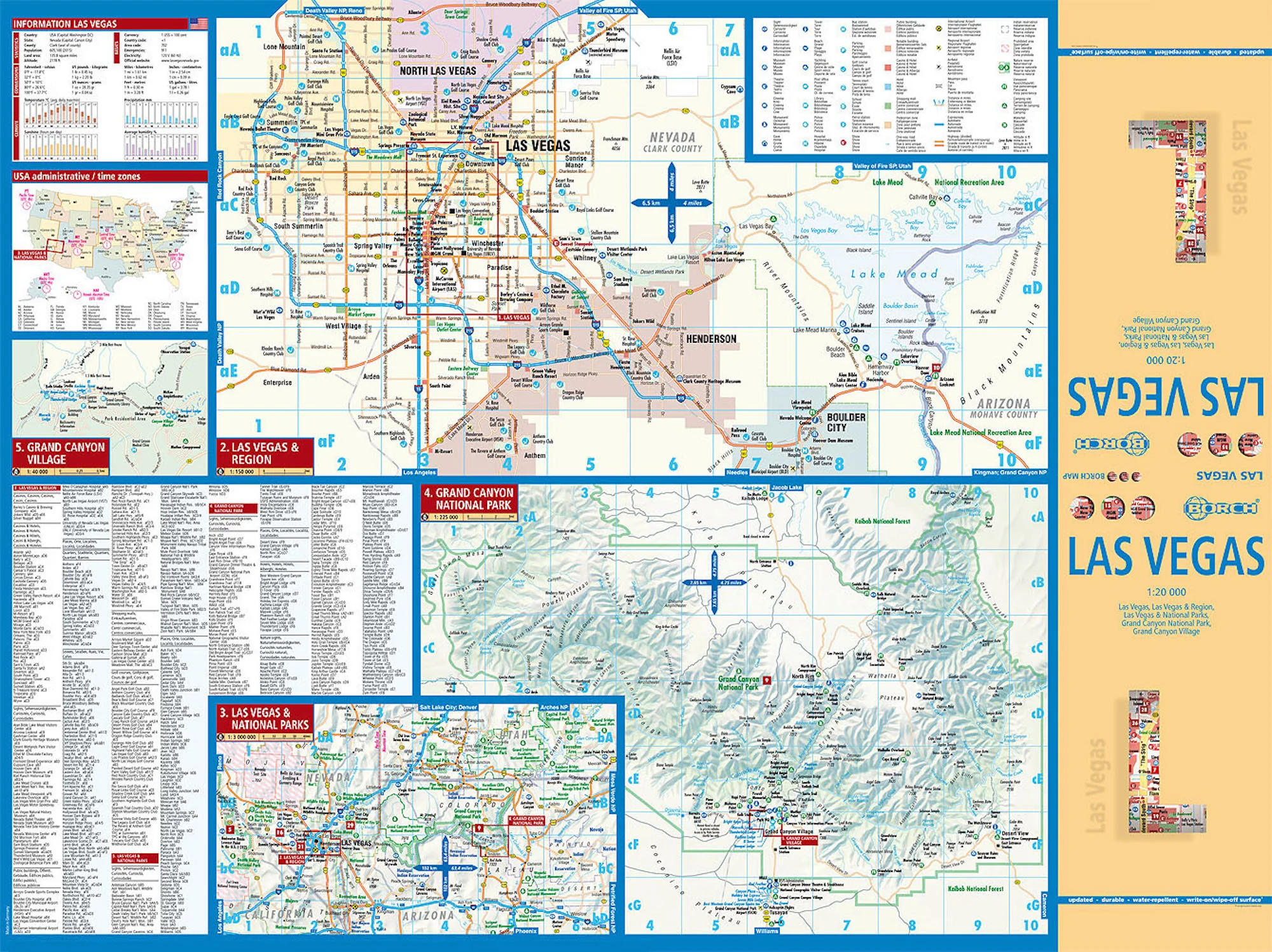
🧭 Map Details & Insets
This professionally designed map includes detailed, colour-coded regional breakdowns of the Golden State:
-
California North – 1:1,200,000
-
California South – 1:1,200,000
-
Yosemite National Park – 1:675,000
-
USA Administrative Divisions & Time Zones
Each section is easy to read, practical to navigate, and updated with current topographic and travel information.
🧳 Travel Features & Highlights
✔️ Durable Lamination – waterproof, tear-resistant, and reusable
✔️ Wipe-Clean Surface – mark and re-mark your routes with a whiteboard pen
✔️ Accurate Road & Highway Details – from interstates to scenic backroads
✔️ Public Transport & Regional Rail – includes networks around major urban centres
✔️ Climate Charts – monthly averages for temperature, rainfall, humidity, and sunshine
✔️ Distance Tables – travel time and road distance estimations
✔️ Top Tourist Sites – natural wonders, city landmarks, museums, markets, and attractions
✔️ Easy Folding – compact and portable for daily travel use
✔️ Conversion Tables – helpful charts for metric/imperial users
🌄 Discover California’s Iconic Landscapes
From the windswept cliffs of Big Sur to the stark dunes of Death Valley, this map is your passport to California’s rich diversity of experiences. Explore:
-
🌁 San Francisco: Golden Gate Bridge, Alcatraz, and buzzing neighbourhoods
-
🌴 Los Angeles: Home of Hollywood, Venice Beach, Griffith Park, and endless glamour
-
🏞️ Yosemite & Sequoia: Hike glacier-carved valleys and meet the tallest trees on Earth
-
🏖️ San Diego: Surf, tacos, and the laid-back vibe of SoCal living
-
🌅 Palm Springs & Joshua Tree: Desert serenity, rock formations, and stargazing
-
🎡 Anaheim & Disneyland: The magic of childhood and thrills of adventure parks
-
🛷 Lake Tahoe & the Sierra Nevada: Ideal for skiing, snowboarding, hiking, and lakeside retreats
-
🏜️ Death Valley: Explore the hottest, driest place in North America
California offers it all — whether you're chasing sunsets down Pacific Coast Highway, trekking through alpine forests, or weaving through vineyards in Napa.
💡 Why Choose This Map?
| 🧾 Feature | 💬 Benefit |
|---|---|
| Soft-Laminated & Folded | Travel-ready, resilient to weather and wear |
| Multi-Scale Coverage | Navigate large regions and local parks with ease |
| Tourism-Ready | Ideal for planning road trips, sightseeing, and detours |
| No Batteries Needed | Reliable when phone signals drop — a must for remote areas |
| Wipeable Surface | Use again and again — perfect for plotting multi-day routes |
| Compact | Fits in glove boxes, daypacks, or carry-on luggage |
🛍️ Perfect For:
-
🚐 Vanlife Explorers planning off-grid detours
-
🧳 International Travellers on their dream California trip
-
🧭 Roadtrippers mapping out the West Coast highways
-
🌄 Outdoor Adventurers seeking national parks and wild spaces
-
📸 Photographers & Creatives chasing the golden light of the West
-
🎓 Students & Educators needing a clear visual of California’s geography
🔍 Map Specs at a Glance
| Specification | Detail |
|---|---|
| Edition | 12th Edition (2022) |
| Publisher | BORCH |
| Scale | 1:1,200,000 |
| Unfolded Size | 660 mm x 494 mm (26 in x 19.5) |
| Folded Size | 243 mm x 110 mm x 8 mm |
| Weight | 60 g (2.1 oz) |
| Language | English, multilingual legend |
📌 Explore smarter. Travel farther. Discover California with BORCH — a map you’ll love using again and again.
Product Information
Product Information
Shipping & Returns
Shipping & Returns
Description
Scale: 1:1,200,000
ISBN-13: 978-3-86609-345-4
Map Size (Unfolded): 660 mm x 494 mm (26 in x 19.5 in)
Folded Size: 243 mm (H) x 110 mm (W) x 8 mm (D)
Weight: 60 g (2.1 oz)
Edition: 12th Edition (2022)
Format: Folded, soft-laminated (wipeable & water-resistant)
Publisher: BORCH
🧭 Map Details & Insets
This professionally designed map includes detailed, colour-coded regional breakdowns of the Golden State:
-
California North – 1:1,200,000
-
California South – 1:1,200,000
-
Yosemite National Park – 1:675,000
-
USA Administrative Divisions & Time Zones
Each section is easy to read, practical to navigate, and updated with current topographic and travel information.
🧳 Travel Features & Highlights
✔️ Durable Lamination – waterproof, tear-resistant, and reusable
✔️ Wipe-Clean Surface – mark and re-mark your routes with a whiteboard pen
✔️ Accurate Road & Highway Details – from interstates to scenic backroads
✔️ Public Transport & Regional Rail – includes networks around major urban centres
✔️ Climate Charts – monthly averages for temperature, rainfall, humidity, and sunshine
✔️ Distance Tables – travel time and road distance estimations
✔️ Top Tourist Sites – natural wonders, city landmarks, museums, markets, and attractions
✔️ Easy Folding – compact and portable for daily travel use
✔️ Conversion Tables – helpful charts for metric/imperial users
🌄 Discover California’s Iconic Landscapes
From the windswept cliffs of Big Sur to the stark dunes of Death Valley, this map is your passport to California’s rich diversity of experiences. Explore:
-
🌁 San Francisco: Golden Gate Bridge, Alcatraz, and buzzing neighbourhoods
-
🌴 Los Angeles: Home of Hollywood, Venice Beach, Griffith Park, and endless glamour
-
🏞️ Yosemite & Sequoia: Hike glacier-carved valleys and meet the tallest trees on Earth
-
🏖️ San Diego: Surf, tacos, and the laid-back vibe of SoCal living
-
🌅 Palm Springs & Joshua Tree: Desert serenity, rock formations, and stargazing
-
🎡 Anaheim & Disneyland: The magic of childhood and thrills of adventure parks
-
🛷 Lake Tahoe & the Sierra Nevada: Ideal for skiing, snowboarding, hiking, and lakeside retreats
-
🏜️ Death Valley: Explore the hottest, driest place in North America
California offers it all — whether you're chasing sunsets down Pacific Coast Highway, trekking through alpine forests, or weaving through vineyards in Napa.
💡 Why Choose This Map?
| 🧾 Feature | 💬 Benefit |
|---|---|
| Soft-Laminated & Folded | Travel-ready, resilient to weather and wear |
| Multi-Scale Coverage | Navigate large regions and local parks with ease |
| Tourism-Ready | Ideal for planning road trips, sightseeing, and detours |
| No Batteries Needed | Reliable when phone signals drop — a must for remote areas |
| Wipeable Surface | Use again and again — perfect for plotting multi-day routes |
| Compact | Fits in glove boxes, daypacks, or carry-on luggage |
🛍️ Perfect For:
-
🚐 Vanlife Explorers planning off-grid detours
-
🧳 International Travellers on their dream California trip
-
🧭 Roadtrippers mapping out the West Coast highways
-
🌄 Outdoor Adventurers seeking national parks and wild spaces
-
📸 Photographers & Creatives chasing the golden light of the West
-
🎓 Students & Educators needing a clear visual of California’s geography
🔍 Map Specs at a Glance
| Specification | Detail |
|---|---|
| Edition | 12th Edition (2022) |
| Publisher | BORCH |
| Scale | 1:1,200,000 |
| Unfolded Size | 660 mm x 494 mm (26 in x 19.5) |
| Folded Size | 243 mm x 110 mm x 8 mm |
| Weight | 60 g (2.1 oz) |
| Language | English, multilingual legend |
📌 Explore smarter. Travel farther. Discover California with BORCH — a map you’ll love using again and again.