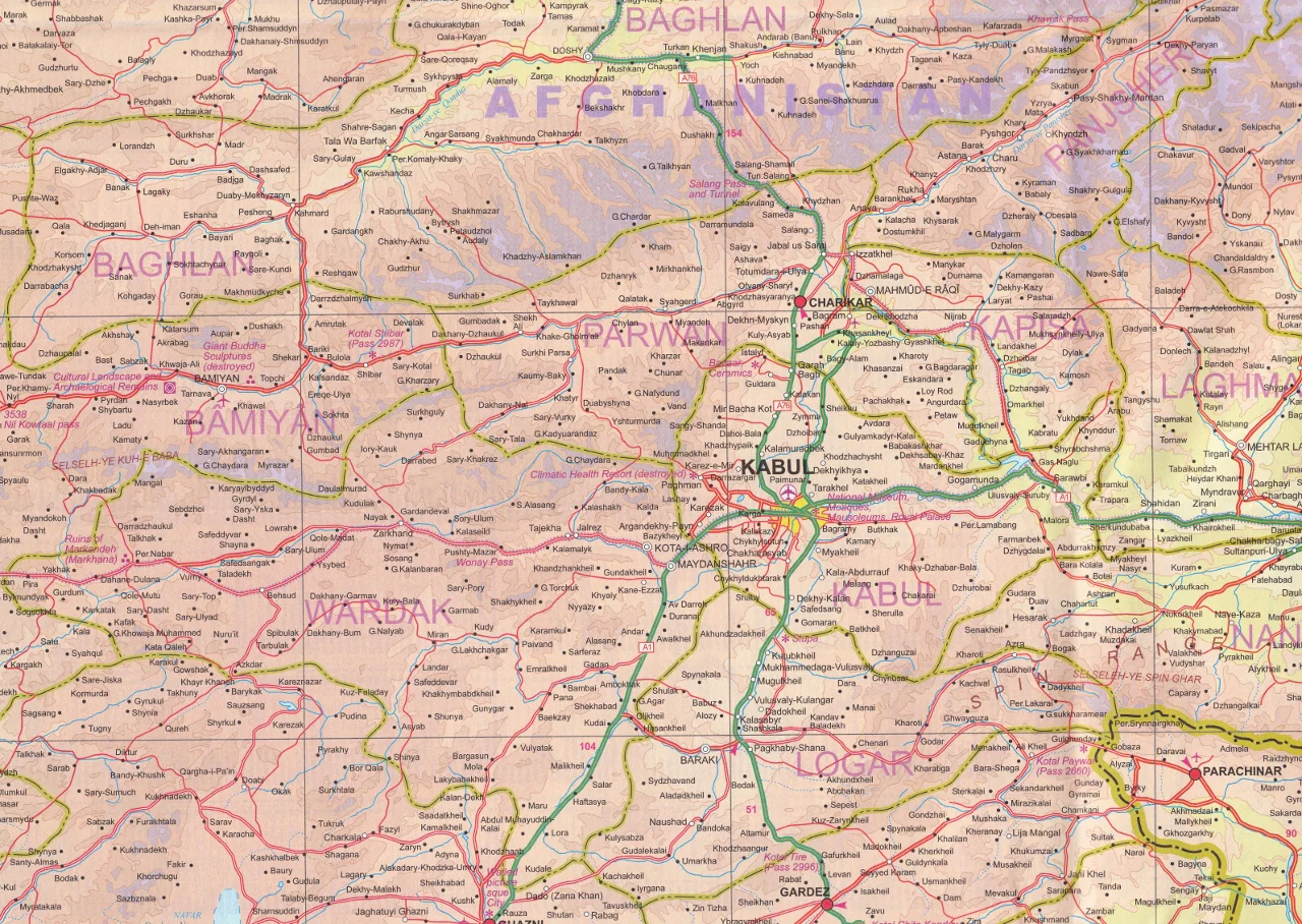
Energy Map of the World 2010
Energy Map of the World 2010 Map features Major oil & gas fields, Major oil & gas pipelines, LNG export plants & import terminals, Major tanker terminals, Major oil refineries, and Major coal basins.
A series of world inset maps highlighting Hydroelectric and Nuclear consumption (including the top 10 largest power stations) and Alternative Energy power capacity (Wind, Solar & Geothermal). Charts & graphics showing Energy Mix by Region, Primary Energy Consumption by Country, & Proved Reserves of Hydrocarbons by Region Scale: 1:23 million.
Size: 1,260mm x 891mm
Published: July 2010 Folded Paper
Product Information
Product Information
Shipping & Returns
Shipping & Returns
Description
Energy Map of the World 2010 Map features Major oil & gas fields, Major oil & gas pipelines, LNG export plants & import terminals, Major tanker terminals, Major oil refineries, and Major coal basins.
A series of world inset maps highlighting Hydroelectric and Nuclear consumption (including the top 10 largest power stations) and Alternative Energy power capacity (Wind, Solar & Geothermal). Charts & graphics showing Energy Mix by Region, Primary Energy Consumption by Country, & Proved Reserves of Hydrocarbons by Region Scale: 1:23 million.
Size: 1,260mm x 891mm
Published: July 2010 Folded Paper