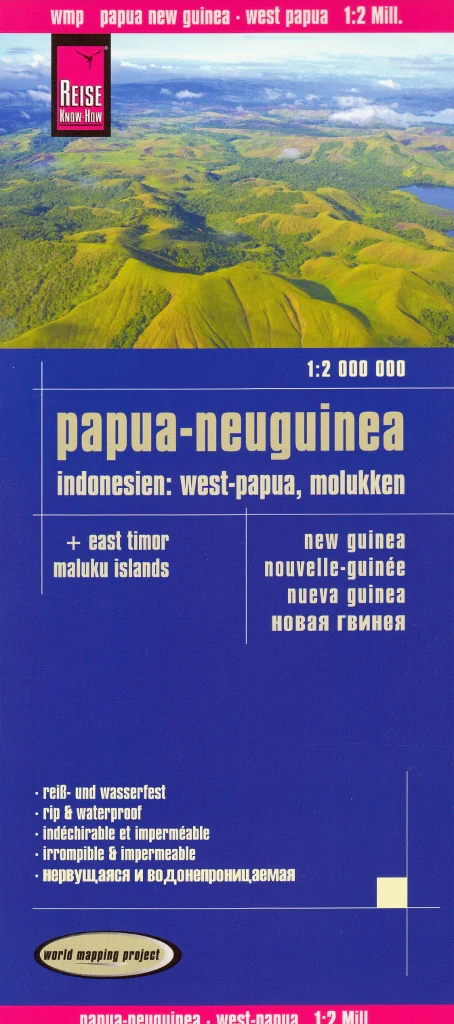
New Guinea, East Timor & Maluku Islands – Reise Know-How Folded Travel Map
Waterproof • Tear-Resistant • Double-Sided
Scale: 1:2,000,000 | Size: 1000 mm x 700 mm | Edition: World Mapping Project Series
🌍 A Comprehensive Map of a Culturally Rich and Geographically Diverse Region
This expertly detailed, double-sided travel map from Reise Know-How covers one of the most rugged and fascinating regions in the world—New Guinea, West Papua, Papua New Guinea, East Timor, and the Maluku Islands. Whether you're a traveller, researcher, overlander, or adventurer, this map provides a clear and practical overview of this vast and often under-mapped area.
🧭 Coverage Includes:
-
West Papua & Papua New Guinea – from Jayapura to Port Moresby, including the Sepik and Highlands regions
-
East Timor (Timor-Leste) – showing Dili, Baucau, and key regional roads
-
Maluku Islands (Moluccas) – including Ambon, Ternate, Halmahera, and Seram
-
Surrounding Indonesian Islands – with connecting ferry and air routes
🌟 Map Features
| ✔ Feature | ✅ Description |
|---|---|
| 🗺️ Double-sided cartography | Separates regions clearly while maintaining scale consistency |
| 🔍 Place name index | Extensive and easy-to-use |
| 🚙 Road network & tracks | Primary roads, unsealed routes, and 4WD tracks shown |
| 🏞️ Topography | Hypsometric tinting, contour lines & shaded relief for terrain clarity |
| 🧭 GPS-compatible | Ideal for navigation with coordinates & elevation cues |
| ✏️ Writeable surface | Can be written on with pencil despite being waterproof |
| 🧳 Detachable sleeve | Protects your map and makes folding easier on the move |
🛡️ Built for Real-World Travel
Part of Reise Know-How’s World Mapping Project, this map is:
-
✅ Printed on rip-proof, waterproof synthetic paper – perfect for humid, tropical, and wet climates
-
✅ Durable and flexible – made to withstand folding, packing, and daily use
-
✅ Weatherproof and field-tested – trusted by independent travellers and researchers alike
📐 Specifications
| Attribute | Detail |
|---|---|
| Publisher | Reise Know-How |
| Title | New Guinea, East Timor & Maluku Islands |
| Series | World Mapping Project |
| Format | Folded Map with detachable cover |
| Material | Synthetic waterproof paper |
| Scale | 1:2,000,000 |
| Sheet Size | 1000 mm x 700 mm |
| Sidedness | Double-sided |
🧭 Ideal For:
-
🌿 Independent travellers and adventurers in New Guinea and the Moluccas
-
🏕️ Backpackers, overlanders, and cultural explorers
-
🎒 Field researchers, NGOs, and development agencies
-
🗺️ Map collectors and geography educators
Explore one of the world’s last frontiers with a map designed to go wherever you do.
Original: $17.85
-65%$17.85
$6.25Product Information
Product Information
Shipping & Returns
Shipping & Returns
Description
Waterproof • Tear-Resistant • Double-Sided
Scale: 1:2,000,000 | Size: 1000 mm x 700 mm | Edition: World Mapping Project Series
🌍 A Comprehensive Map of a Culturally Rich and Geographically Diverse Region
This expertly detailed, double-sided travel map from Reise Know-How covers one of the most rugged and fascinating regions in the world—New Guinea, West Papua, Papua New Guinea, East Timor, and the Maluku Islands. Whether you're a traveller, researcher, overlander, or adventurer, this map provides a clear and practical overview of this vast and often under-mapped area.
🧭 Coverage Includes:
-
West Papua & Papua New Guinea – from Jayapura to Port Moresby, including the Sepik and Highlands regions
-
East Timor (Timor-Leste) – showing Dili, Baucau, and key regional roads
-
Maluku Islands (Moluccas) – including Ambon, Ternate, Halmahera, and Seram
-
Surrounding Indonesian Islands – with connecting ferry and air routes
🌟 Map Features
| ✔ Feature | ✅ Description |
|---|---|
| 🗺️ Double-sided cartography | Separates regions clearly while maintaining scale consistency |
| 🔍 Place name index | Extensive and easy-to-use |
| 🚙 Road network & tracks | Primary roads, unsealed routes, and 4WD tracks shown |
| 🏞️ Topography | Hypsometric tinting, contour lines & shaded relief for terrain clarity |
| 🧭 GPS-compatible | Ideal for navigation with coordinates & elevation cues |
| ✏️ Writeable surface | Can be written on with pencil despite being waterproof |
| 🧳 Detachable sleeve | Protects your map and makes folding easier on the move |
🛡️ Built for Real-World Travel
Part of Reise Know-How’s World Mapping Project, this map is:
-
✅ Printed on rip-proof, waterproof synthetic paper – perfect for humid, tropical, and wet climates
-
✅ Durable and flexible – made to withstand folding, packing, and daily use
-
✅ Weatherproof and field-tested – trusted by independent travellers and researchers alike
📐 Specifications
| Attribute | Detail |
|---|---|
| Publisher | Reise Know-How |
| Title | New Guinea, East Timor & Maluku Islands |
| Series | World Mapping Project |
| Format | Folded Map with detachable cover |
| Material | Synthetic waterproof paper |
| Scale | 1:2,000,000 |
| Sheet Size | 1000 mm x 700 mm |
| Sidedness | Double-sided |
🧭 Ideal For:
-
🌿 Independent travellers and adventurers in New Guinea and the Moluccas
-
🏕️ Backpackers, overlanders, and cultural explorers
-
🎒 Field researchers, NGOs, and development agencies
-
🗺️ Map collectors and geography educators
Explore one of the world’s last frontiers with a map designed to go wherever you do.