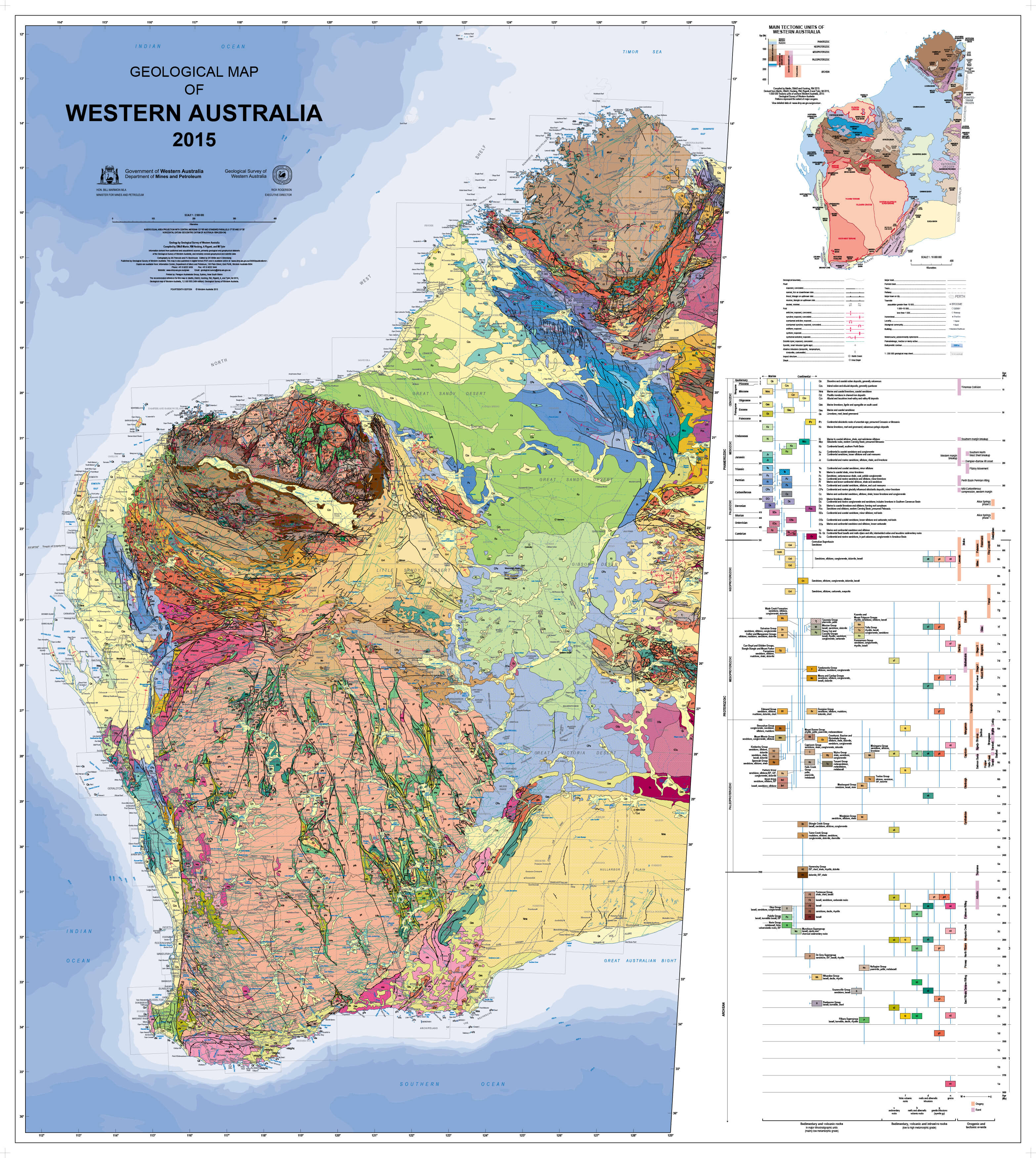
WA Operating and Under Development Mines (2025) 1415 x 2000mm Wall Map
MEGA Wall Map • 1415 × 2000 mm • Portrait • Statewide Mining Coverage • Paper / Laminated / Laminated + Hang Rails / Canvas / Canvas + Hang Rails • Made in Australia
🔥 A TRUE 2-METRE WALL MAP — BUILT FOR SERIOUS WORKSPACES
This is a full-scale operational map—engineered for rooms where decisions are made.
At 2000 mm high (2 metres), it delivers a level of visibility that smaller maps simply can’t match:
- 1415 mm wide × 2000 mm tall — commanding vertical presence
- Designed to be read from 3–5 metres away
- Multiple users can engage at the same time
- Perfect for boardrooms, site offices, EOCs, and planning environments
👉 This isn’t a reference tucked in a corner—it becomes the visual centre of the room.
⛏️ Western Australia’s Mining Network — In One View
The Operating & Under Development Mines (2025) map provides a clear, statewide snapshot of WA’s mining activity—both current operations and the next wave of development.
From the Pilbara’s iron ore giants to the Goldfields’ gold and nickel belts, and the fast-expanding lithium and battery minerals sector, this map connects it all.
No dashboards. No switching screens.
Just one cohesive, wall-scale intelligence tool.
🔍 What’s on the Map
⚒️ Operating Mines
- Active sites across major commodities:
- Iron ore
- Gold
- Nickel
- Lithium
- Copper
- Cobalt & critical minerals
- Clearly symbolised for immediate recognition
🚧 Under Development Projects
- Pipeline of future operations and expansions
- Identified separately from operating sites
- Essential for forward planning and investment insight
🧭 Regional Structure
- Pilbara
- Kimberley
- Mid West
- Goldfields–Esperance
- South West
Each region is visually structured to help teams orient instantly.
🏙️ Infrastructure & Key Hubs
- Strategic towns and service centres
- Logistics and workforce anchors
- Context for supply chains and regional access
🏷️ Clarity at Scale
- Clean icons and colour hierarchy
- Labels engineered for distance readability
- Detailed when viewed up close, simple when viewed across the room
🎯 Why Teams Choose This Map
✔ Operational Awareness
See where everything is—active sites and future developments in one glance
✔ Strategic Planning
Support:
- Expansion planning
- Investment decisions
- Joint venture discussions
- Infrastructure alignment
✔ Boardroom Ready
Turn complex datasets into a shared visual language
✔ Built for Collaboration
- Teams gather around it
- Ideas happen in front of it
- Decisions are made with it
📐 Size & Format — Why It Matters
1415 mm (W) × 2000 mm (H)
Portrait | MEGA FORMAT
This size changes how the map functions:
- ✔ Readable without stepping forward
- ✔ Ideal for group briefings
- ✔ Supports live discussion and annotation
- ✔ Reduces reliance on screens and slides
💡 This isn’t just larger—it’s more effective.
🎨 Premium Finishes & Display Options
📄 Paper (Heavyweight 160 gsm Matte)
Classic. Refined. Frame-ready.
- Smooth, low-glare surface
- Crisp detail across large format
- Ideal for framing or mounting boards
💡 Best for: permanent installations
💧 Laminated (True Encapsulation — 2 × 80 Micron Gloss)
Durable. Practical. Built to last.
- Fully sealed and edge-protected
- Wipe-clean for markers and map dots
- Handles high-use environments
💡 Best for: planning rooms and operations teams
🪵 Laminated + Timber Hang Rails (Ready to Hang)
Clean. Professional. Immediate impact.
- Natural timber rails (top & bottom)
- Keeps large map flat and tensioned
- Hang from a single point
⏱️ Allow up to 10 working days
💡 Best for: offices needing fast installation
🖼️ Canvas (HP 395 gsm Professional Matte)
Textured. Executive. Gallery-quality.
- Rich colour depth with low glare
- Subtle texture enhances presentation
- Premium finish for client-facing spaces
💡 Best for: executive offices and reception areas
🪵 Canvas + Timber Hang Rails
Statement. Architectural. Ready-to-hang.
- Combines gallery canvas with timber rails
- Clean, balanced presentation
⏱️ Allow up to 10 working days
💡 Best for: high-impact feature walls
👥 Who Uses It
🏢 Mining & Resource Companies
- Portfolio visibility
- Competitor landscape
- Site and JV briefings
🏛️ Government & Planning Bodies
- Regional development
- Infrastructure alignment
- Stakeholder engagement
💼 Investors & Analysts
- Pipeline visibility
- Market positioning
- Due diligence
🚛 Logistics & Infrastructure Teams
- Corridor planning
- Service coverage
- Regional connectivity
🎓 Universities & Training
- Teaching WA’s resource geography
- Understanding commodities and distribution
🌱 Environmental & GIS Teams
- High-level spatial reference
- Context alongside technical datasets
📊 Specifications
| Attribute | Specification |
|---|---|
| Title | Western Australia — Operating & Under Development Mines |
| Edition | 2025 |
| Size | 1415 × 2000 mm (MEGA FORMAT) |
| Orientation | Portrait |
| Coverage | Entire Western Australia |
| Focus | Operating mines & development projects |
| Projection | Custom regional cartography |
| Formats | Paper • Laminated • Laminated + Hang Rails • Canvas • Canvas + Hang Rails |
| Paper | 160 gsm matte |
| Canvas | 395 gsm HP Professional Matte |
| Inks | Archival HP pigment (fade-resistant) |
| Origin | Printed in Australia |
| Lead Time | Hang-railed finishes: up to 10 working days |
🤝 Our Commitment
- Designed & printed in Australia
- Built specifically for large-format clarity
- Premium archival materials for durability
- Colour-managed for accuracy
- Every map hand-checked and packed with care
Need custom overlays, branding, or alternate sizing?
We can tailor this map to your operational needs.
🛒 Go Big. Work Smarter.
When your team needs clarity—not clutter—this is the map that delivers.
It’s more than a reference.
It’s a tool for thinking, planning, and deciding.
Choose your finish and put Western Australia’s mining network on the wall—at full scale.
Original: $321.92
-65%$321.92
$112.67Product Information
Product Information
Shipping & Returns
Shipping & Returns
Description
MEGA Wall Map • 1415 × 2000 mm • Portrait • Statewide Mining Coverage • Paper / Laminated / Laminated + Hang Rails / Canvas / Canvas + Hang Rails • Made in Australia
🔥 A TRUE 2-METRE WALL MAP — BUILT FOR SERIOUS WORKSPACES
This is a full-scale operational map—engineered for rooms where decisions are made.
At 2000 mm high (2 metres), it delivers a level of visibility that smaller maps simply can’t match:
- 1415 mm wide × 2000 mm tall — commanding vertical presence
- Designed to be read from 3–5 metres away
- Multiple users can engage at the same time
- Perfect for boardrooms, site offices, EOCs, and planning environments
👉 This isn’t a reference tucked in a corner—it becomes the visual centre of the room.
⛏️ Western Australia’s Mining Network — In One View
The Operating & Under Development Mines (2025) map provides a clear, statewide snapshot of WA’s mining activity—both current operations and the next wave of development.
From the Pilbara’s iron ore giants to the Goldfields’ gold and nickel belts, and the fast-expanding lithium and battery minerals sector, this map connects it all.
No dashboards. No switching screens.
Just one cohesive, wall-scale intelligence tool.
🔍 What’s on the Map
⚒️ Operating Mines
- Active sites across major commodities:
- Iron ore
- Gold
- Nickel
- Lithium
- Copper
- Cobalt & critical minerals
- Clearly symbolised for immediate recognition
🚧 Under Development Projects
- Pipeline of future operations and expansions
- Identified separately from operating sites
- Essential for forward planning and investment insight
🧭 Regional Structure
- Pilbara
- Kimberley
- Mid West
- Goldfields–Esperance
- South West
Each region is visually structured to help teams orient instantly.
🏙️ Infrastructure & Key Hubs
- Strategic towns and service centres
- Logistics and workforce anchors
- Context for supply chains and regional access
🏷️ Clarity at Scale
- Clean icons and colour hierarchy
- Labels engineered for distance readability
- Detailed when viewed up close, simple when viewed across the room
🎯 Why Teams Choose This Map
✔ Operational Awareness
See where everything is—active sites and future developments in one glance
✔ Strategic Planning
Support:
- Expansion planning
- Investment decisions
- Joint venture discussions
- Infrastructure alignment
✔ Boardroom Ready
Turn complex datasets into a shared visual language
✔ Built for Collaboration
- Teams gather around it
- Ideas happen in front of it
- Decisions are made with it
📐 Size & Format — Why It Matters
1415 mm (W) × 2000 mm (H)
Portrait | MEGA FORMAT
This size changes how the map functions:
- ✔ Readable without stepping forward
- ✔ Ideal for group briefings
- ✔ Supports live discussion and annotation
- ✔ Reduces reliance on screens and slides
💡 This isn’t just larger—it’s more effective.
🎨 Premium Finishes & Display Options
📄 Paper (Heavyweight 160 gsm Matte)
Classic. Refined. Frame-ready.
- Smooth, low-glare surface
- Crisp detail across large format
- Ideal for framing or mounting boards
💡 Best for: permanent installations
💧 Laminated (True Encapsulation — 2 × 80 Micron Gloss)
Durable. Practical. Built to last.
- Fully sealed and edge-protected
- Wipe-clean for markers and map dots
- Handles high-use environments
💡 Best for: planning rooms and operations teams
🪵 Laminated + Timber Hang Rails (Ready to Hang)
Clean. Professional. Immediate impact.
- Natural timber rails (top & bottom)
- Keeps large map flat and tensioned
- Hang from a single point
⏱️ Allow up to 10 working days
💡 Best for: offices needing fast installation
🖼️ Canvas (HP 395 gsm Professional Matte)
Textured. Executive. Gallery-quality.
- Rich colour depth with low glare
- Subtle texture enhances presentation
- Premium finish for client-facing spaces
💡 Best for: executive offices and reception areas
🪵 Canvas + Timber Hang Rails
Statement. Architectural. Ready-to-hang.
- Combines gallery canvas with timber rails
- Clean, balanced presentation
⏱️ Allow up to 10 working days
💡 Best for: high-impact feature walls
👥 Who Uses It
🏢 Mining & Resource Companies
- Portfolio visibility
- Competitor landscape
- Site and JV briefings
🏛️ Government & Planning Bodies
- Regional development
- Infrastructure alignment
- Stakeholder engagement
💼 Investors & Analysts
- Pipeline visibility
- Market positioning
- Due diligence
🚛 Logistics & Infrastructure Teams
- Corridor planning
- Service coverage
- Regional connectivity
🎓 Universities & Training
- Teaching WA’s resource geography
- Understanding commodities and distribution
🌱 Environmental & GIS Teams
- High-level spatial reference
- Context alongside technical datasets
📊 Specifications
| Attribute | Specification |
|---|---|
| Title | Western Australia — Operating & Under Development Mines |
| Edition | 2025 |
| Size | 1415 × 2000 mm (MEGA FORMAT) |
| Orientation | Portrait |
| Coverage | Entire Western Australia |
| Focus | Operating mines & development projects |
| Projection | Custom regional cartography |
| Formats | Paper • Laminated • Laminated + Hang Rails • Canvas • Canvas + Hang Rails |
| Paper | 160 gsm matte |
| Canvas | 395 gsm HP Professional Matte |
| Inks | Archival HP pigment (fade-resistant) |
| Origin | Printed in Australia |
| Lead Time | Hang-railed finishes: up to 10 working days |
🤝 Our Commitment
- Designed & printed in Australia
- Built specifically for large-format clarity
- Premium archival materials for durability
- Colour-managed for accuracy
- Every map hand-checked and packed with care
Need custom overlays, branding, or alternate sizing?
We can tailor this map to your operational needs.
🛒 Go Big. Work Smarter.
When your team needs clarity—not clutter—this is the map that delivers.
It’s more than a reference.
It’s a tool for thinking, planning, and deciding.
Choose your finish and put Western Australia’s mining network on the wall—at full scale.