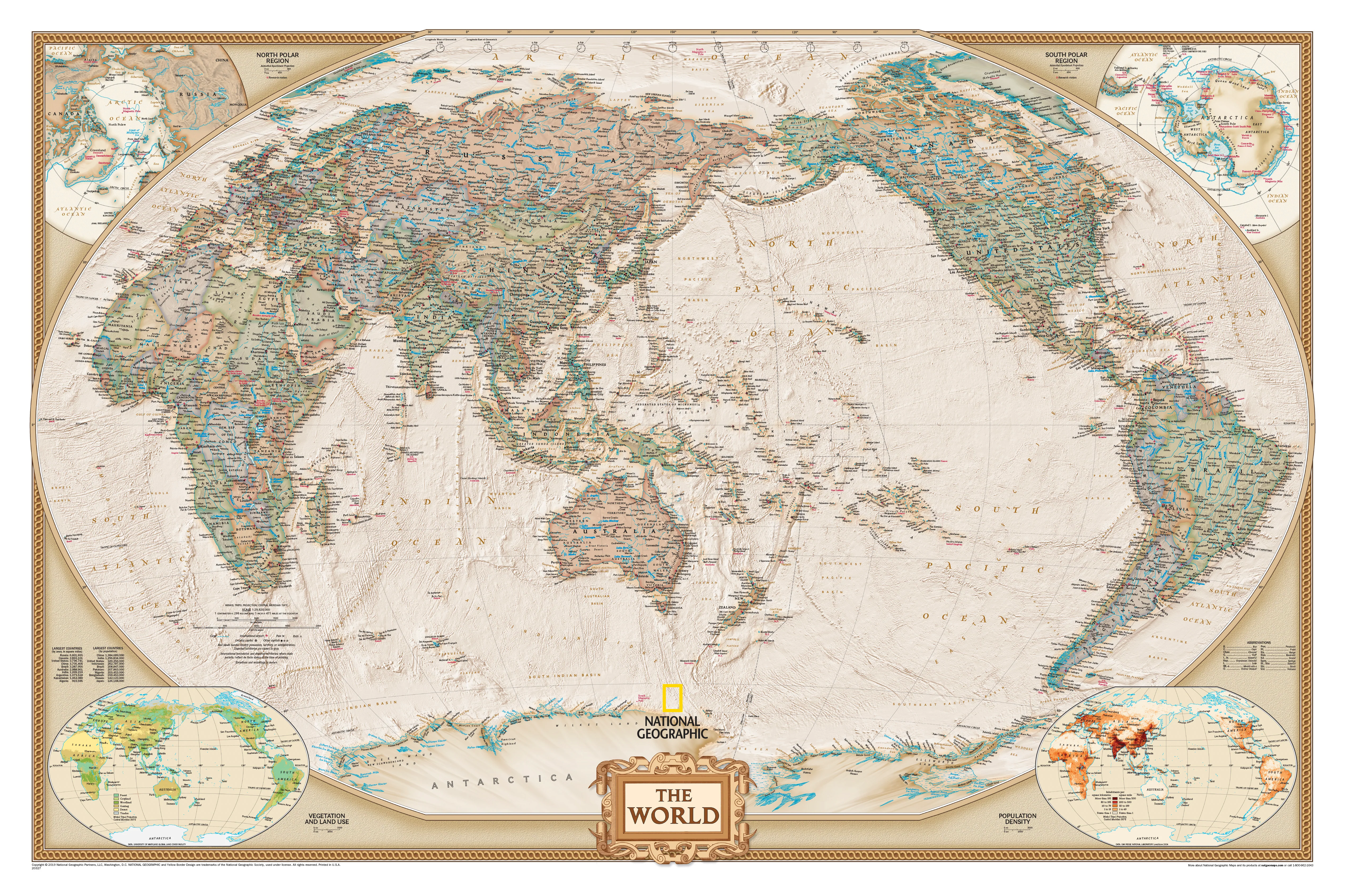
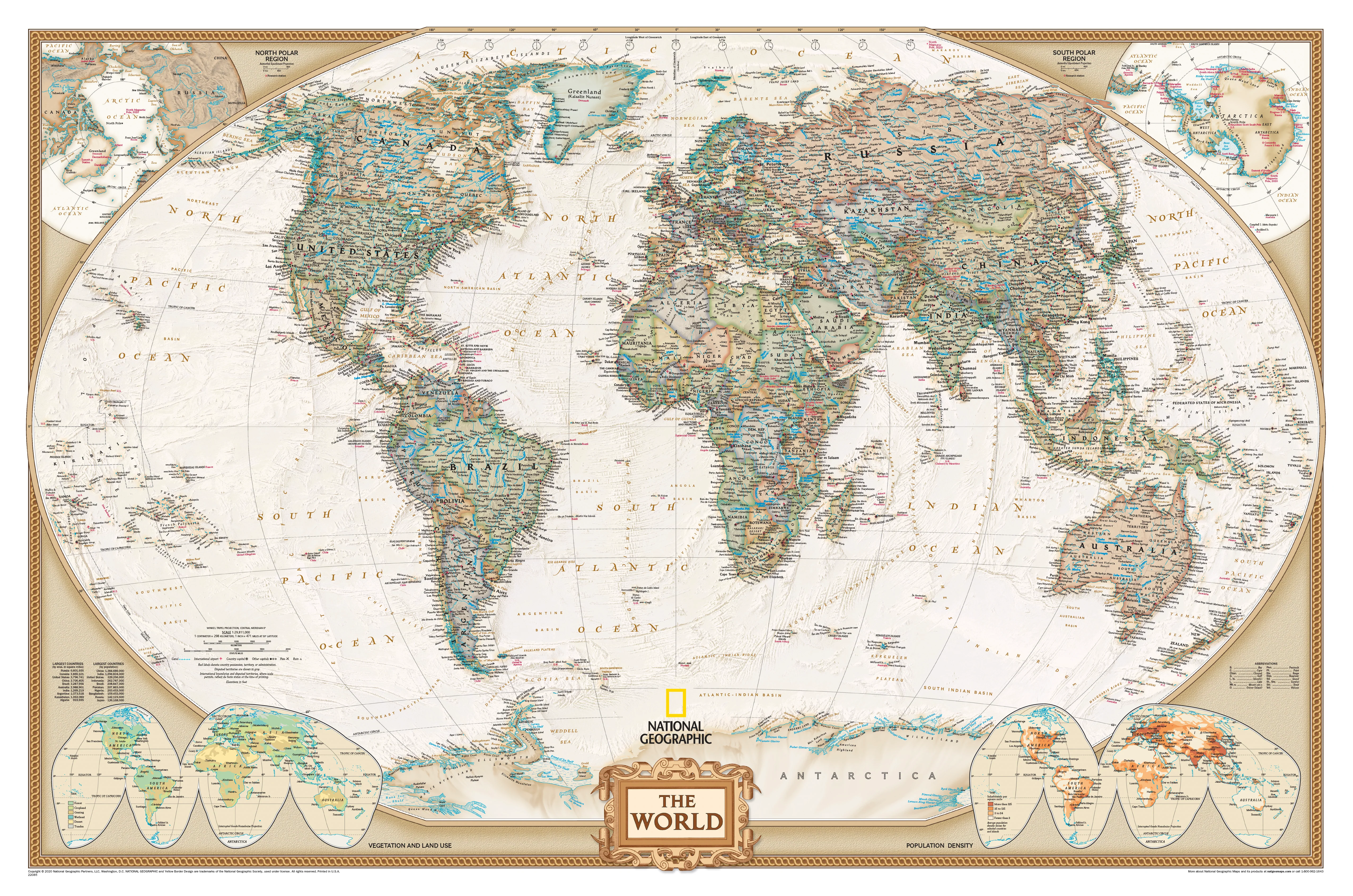
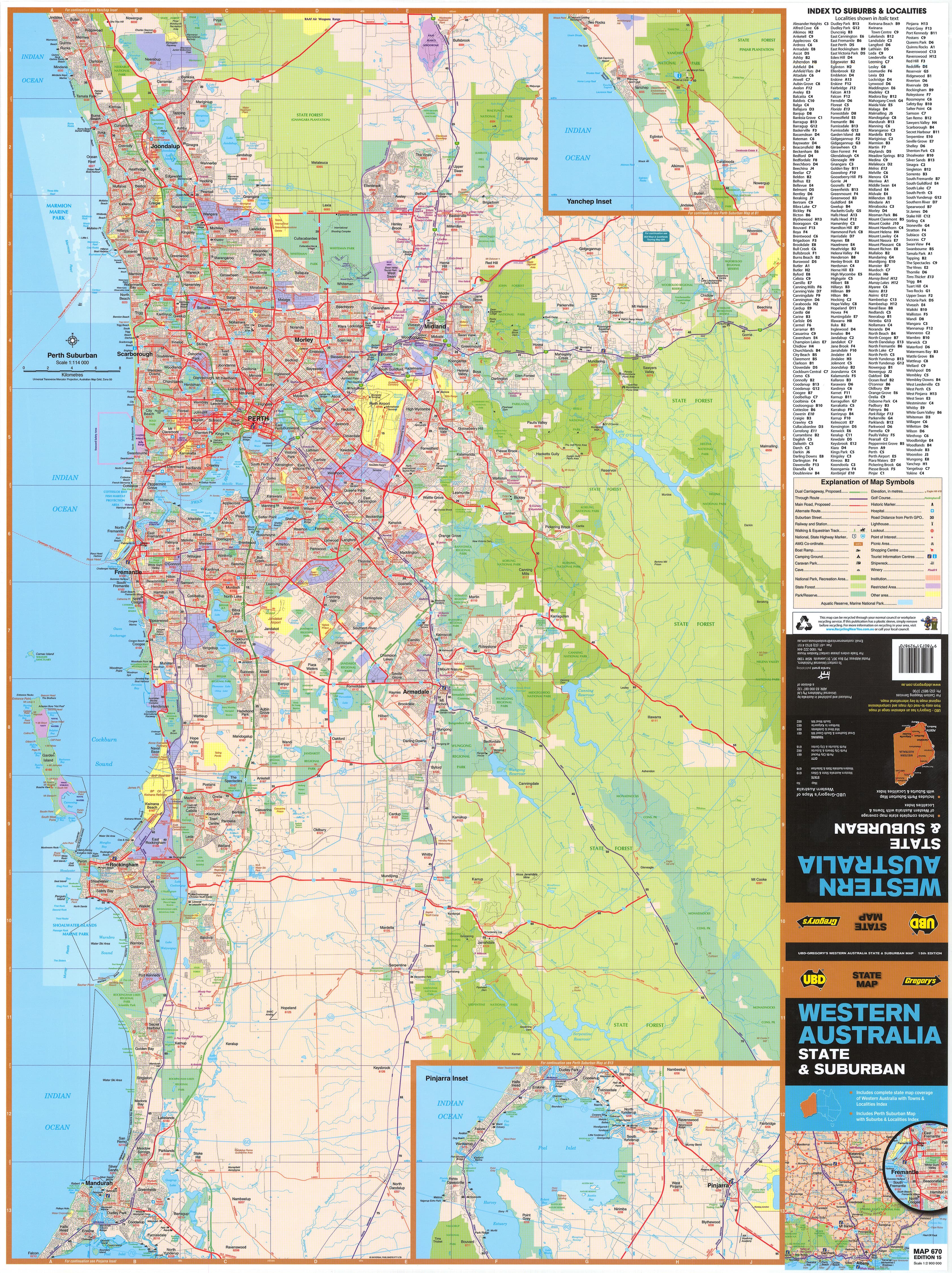
World Political Supermap with Flags 1440 x 960mm (Pacific Centred) Cosmographics 2026
Pacific-Centred World Map | Flags, Countries & Global Detail | Supermap 1440 × 960 mm | Premium Finishes
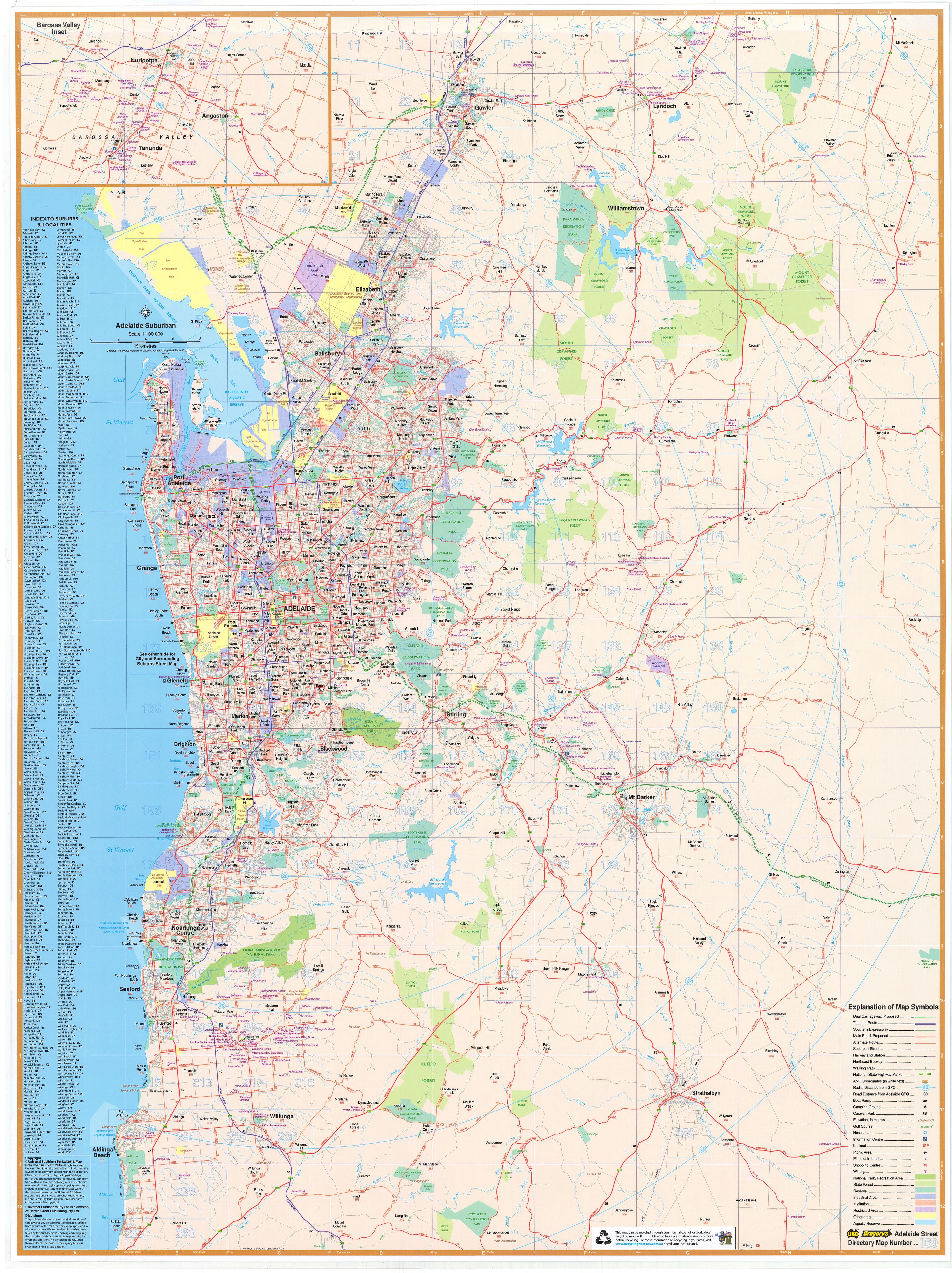
A bold, wall-dominating view of the modern world, the World Political Supermap with Flags by Cosmographics delivers clarity, scale, and visual impact in one expansive format. Centred on the Pacific, it reorients your perspective—placing Australia and the Asia-Pacific at the heart of the world.
With every country clearly defined and accompanied by its national flag, this is a map designed for learning, reference, and standout display.
Why This Map Stands Out
Supermap scale for real impact
Large 1440 × 960 mm format—easy to read from across the room.
Pacific-centred perspective
A modern layout ideal for Australian and Asia-Pacific audiences.
Flags for every nation
Quick visual identification of countries and their symbols.
Clear political mapping
Countries, capitals, and major cities presented with precision.
A versatile wall map
Perfect for education, business, and home display.
🌍 What the Map Shows
🗺️ Global Political Detail
- All countries clearly defined with borders and names
- Capital cities prominently marked
- Major towns and geographic reference points included
🚩 World Flags
- National flags displayed alongside their respective countries
- A visual and educational reference for global identity
- Ideal for classrooms and quick recognition
🌏 Pacific-Centred World View
- The Pacific Ocean positioned centrally
- Seamless view from the Americas across to Asia and Oceania
- A more intuitive perspective for Southern Hemisphere users
⛰️ Physical Features
- Major mountain ranges, rivers, and landforms
- Ocean features and seabed relief for added depth
- A balanced blend of political and physical geography
🌐 A World Map That Works
This is more than a reference—it’s a tool:
- Understand global relationships at a glance
- Identify countries and capitals instantly
- Teach geography with clarity and engagement
- Create a strong visual centrepiece in any space
📐 Size & Format
1440 mm (W) × 960 mm (H)
Supermap | Landscape orientation
A large-format map designed for:
- Classrooms and lecture spaces
- Offices and planning environments
- Boardrooms and presentations
- Feature walls and home studies
✨ Premium Finishes & Display Options
Every World Political Supermap with Flags (2026) is produced using archival-grade materials and precision colour management, ensuring sharp detail and long-lasting colour.
📜 Heavyweight Paper (160 gsm Matte)
Classic. Refined. Frame-ready.
- Premium 160 gsm matte-coated archival paper
- Smooth, low-glare finish for easy reading
- Ideal for framing under glass
💡 Best for: traditional display and detailed study.
🧼 Laminated (True Encapsulation — 2 × 80 Micron Gloss)
Durable. Practical. Built to last.
- Fully sealed with 2 × 80-micron laminate
- Edge-to-edge protection against wear and moisture
- Wipe-clean surface for notes and markers
💡 Best for: classrooms and active use.
🪵 Laminated + Timber Hang Rails
Ready to hang. Clean lines. Contemporary feel.
- Natural timber rails (top & bottom), lacquered finish
- Includes hanging cord
- Keeps map flat without framing
🔨 Please allow up to 10 working days.
💡 Best for: offices and ready-to-hang display.
🖼️ Archival Canvas (395 gsm HP Professional Matte)
Textured. Elegant. Gallery-quality.
- Printed on 395 gsm HP Professional Matte Canvas
- Pigment-based inks for long-term colour stability
- Subtle texture enhances visual depth
💡 Best for: feature walls and premium interiors.
🪵 Canvas + Timber Hang Rails
Gallery-ready. Warm. Architectural.
- Canvas paired with natural timber rails
- Clean, balanced presentation
🔨 Please allow up to 10 working days.
💡 Best for: statement display spaces.
Original: $71.51
-65%$71.51
$25.03Product Information
Product Information
Shipping & Returns
Shipping & Returns
Description
Pacific-Centred World Map | Flags, Countries & Global Detail | Supermap 1440 × 960 mm | Premium Finishes
A bold, wall-dominating view of the modern world, the World Political Supermap with Flags by Cosmographics delivers clarity, scale, and visual impact in one expansive format. Centred on the Pacific, it reorients your perspective—placing Australia and the Asia-Pacific at the heart of the world.
With every country clearly defined and accompanied by its national flag, this is a map designed for learning, reference, and standout display.
Why This Map Stands Out
Supermap scale for real impact
Large 1440 × 960 mm format—easy to read from across the room.
Pacific-centred perspective
A modern layout ideal for Australian and Asia-Pacific audiences.
Flags for every nation
Quick visual identification of countries and their symbols.
Clear political mapping
Countries, capitals, and major cities presented with precision.
A versatile wall map
Perfect for education, business, and home display.
🌍 What the Map Shows
🗺️ Global Political Detail
- All countries clearly defined with borders and names
- Capital cities prominently marked
- Major towns and geographic reference points included
🚩 World Flags
- National flags displayed alongside their respective countries
- A visual and educational reference for global identity
- Ideal for classrooms and quick recognition
🌏 Pacific-Centred World View
- The Pacific Ocean positioned centrally
- Seamless view from the Americas across to Asia and Oceania
- A more intuitive perspective for Southern Hemisphere users
⛰️ Physical Features
- Major mountain ranges, rivers, and landforms
- Ocean features and seabed relief for added depth
- A balanced blend of political and physical geography
🌐 A World Map That Works
This is more than a reference—it’s a tool:
- Understand global relationships at a glance
- Identify countries and capitals instantly
- Teach geography with clarity and engagement
- Create a strong visual centrepiece in any space
📐 Size & Format
1440 mm (W) × 960 mm (H)
Supermap | Landscape orientation
A large-format map designed for:
- Classrooms and lecture spaces
- Offices and planning environments
- Boardrooms and presentations
- Feature walls and home studies
✨ Premium Finishes & Display Options
Every World Political Supermap with Flags (2026) is produced using archival-grade materials and precision colour management, ensuring sharp detail and long-lasting colour.
📜 Heavyweight Paper (160 gsm Matte)
Classic. Refined. Frame-ready.
- Premium 160 gsm matte-coated archival paper
- Smooth, low-glare finish for easy reading
- Ideal for framing under glass
💡 Best for: traditional display and detailed study.
🧼 Laminated (True Encapsulation — 2 × 80 Micron Gloss)
Durable. Practical. Built to last.
- Fully sealed with 2 × 80-micron laminate
- Edge-to-edge protection against wear and moisture
- Wipe-clean surface for notes and markers
💡 Best for: classrooms and active use.
🪵 Laminated + Timber Hang Rails
Ready to hang. Clean lines. Contemporary feel.
- Natural timber rails (top & bottom), lacquered finish
- Includes hanging cord
- Keeps map flat without framing
🔨 Please allow up to 10 working days.
💡 Best for: offices and ready-to-hang display.
🖼️ Archival Canvas (395 gsm HP Professional Matte)
Textured. Elegant. Gallery-quality.
- Printed on 395 gsm HP Professional Matte Canvas
- Pigment-based inks for long-term colour stability
- Subtle texture enhances visual depth
💡 Best for: feature walls and premium interiors.
🪵 Canvas + Timber Hang Rails
Gallery-ready. Warm. Architectural.
- Canvas paired with natural timber rails
- Clean, balanced presentation
🔨 Please allow up to 10 working days.
💡 Best for: statement display spaces.