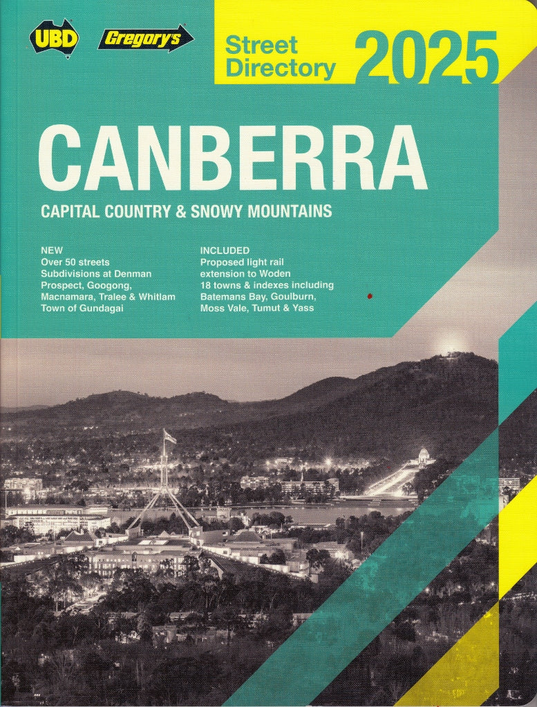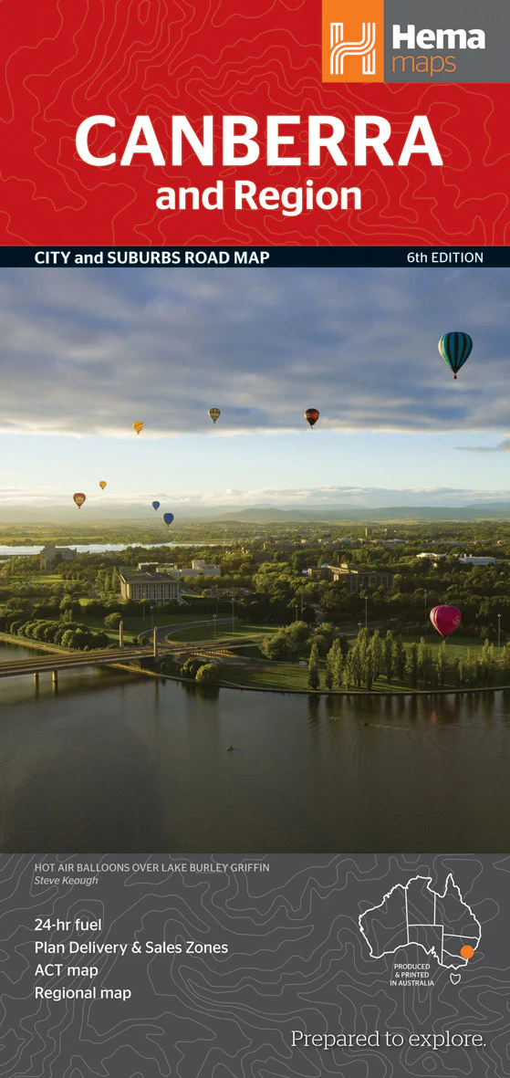
Canberra & Region Hema Map
🏛️ Canberra & Region Folded Map – Hema Maps (6th Edition)
Your ultimate navigation companion to Australia’s capital and surrounding countryside.
Whether you're a first-time visitor exploring Parliament House, a local resident tracing new developments, or a courier plotting efficient delivery routes — the Canberra & Region Map by Hema Maps delivers trusted, clear, and easy-to-read navigation across the Australian Capital Territory (ACT) and beyond. This compact, double-sided map features a blend of city, suburb, and regional mapping, all backed by Hema’s field-verified cartography.
Covering everything from the political heart of Canberra to the rural charm of southern New South Wales, this map is ideal for tourism, logistics, and everyday navigation.
📍 What’s Covered?
The map features three distinct mapping zones, tailored to different navigation needs:
🗺️ 1. Canberra Suburbs Map – Scale: 1:53,715
-
Full suburban layout with residential zones, industrial areas, major roads, and suburb names.
-
Postcode boundaries and town indexing, perfect for deliveries, real estate planning, and navigation.
🏙️ 2. Canberra City Centre Map – Scale: 1:37,500
-
Zoomed-in street-level detail of the CBD and inner suburbs.
-
Government buildings, cultural landmarks, parks, embassies, shopping precincts, and transport hubs clearly marked.
🌄 3. Canberra Regional Map – Scale: 1:850,000
-
Spans the ACT and its surrounding areas in southern NSW.
-
Extends north to Canowindra and Sydney, south to the Victorian border, and west to Wagga Wagga.
-
Ideal for planning road trips, touring the Snowy Mountains region, and accessing nearby towns like Yass, Goulburn, Cooma, and Batemans Bay.
🌟 Map Features at a Glance
| ✅ Feature | 💬 Description |
|---|---|
| 🛣️ Road Network | Major roads, highways, suburban routes, and scenic drives |
| 🧭 Tourist Attractions | Cultural sites, museums, lookout points, gardens, national institutions |
| ⛽ 24-Hour Fuel Locations | Vital for road trips and late-night travel |
| 🛌 Accommodation | Hotels, motels, caravan parks, and camping grounds |
| 🛍️ Shopping Centres | Regional malls and retail hubs |
| 🚉 Railway Stations | Including Canberra Railway Station and regional connections |
| 📮 Postcode Index | Useful for postal services, deliveries, and sales route planning |
| 🧭 Legend and Scale Bars | Make reading and measuring simple and precise |
🧾 Additional Highlights
-
✔️ Designed and printed in Australia
-
✔️ Ideal for tourists, residents, educators, and professionals
-
✔️ Offers a helpful town and suburb index, including postcode numbers
-
✔️ Serves as a functional and educational reference for classroom, office, or vehicle use
-
✔️ Used by travel agencies, couriers, real estate agents, and local councils
📐 Map Specifications
| Specification | Details |
|---|---|
| Edition | 6th Edition |
| Publication Date | July 2013 |
| Scale(s) | 1:53,715 (Suburbs) 1:37,500 (City) 1:850,000 (Region) |
| Folded Size | 116 mm (W) × 250 mm (H) × 3 mm (D) |
| Flat Size | 700 mm (W) × 1000 mm (H) |
| Weight | Approx. 70 g |
| Publisher | Hema Maps |
| ISBN | 9781865006772 |
🧳 Who This Map Is For
-
🧭 Visitors exploring Canberra and surrounding regions
-
🏠 Locals navigating new suburbs or scenic backroads
-
🚚 Delivery drivers needing postcode accuracy and efficient routing
-
🧱 Developers & real estate professionals needing suburb boundaries
-
🧳 Trip planners organising routes through the ACT and beyond
-
🧒 Teachers and students studying geography or political history
-
🏕️ Holidaymakers heading to the Snowy Mountains or coastal towns
🔒 Optional Lamination Upgrade
Want more durability? Choose the laminated version, which is:
-
💧 Waterproof and tear-resistant
-
✏️ Whiteboard-compatible – draw and wipe as needed
-
🧼 Stain-resistant – ideal for fieldwork or classrooms
We laminate by flattening the folded map and sealing it between two high-quality 80-micron gloss layers. Please note that light fold lines may still be visible.
🏛️ Discover the Capital Like Never Before
From the bustling boulevards of Civic to the winding trails of Tidbinbilla, from Parliament House to rural hamlets like Bungendore — the Hema Canberra & Region Map helps you see, understand, and explore it all.
Whether you’re delivering parcels, visiting national landmarks, planning your next outback escape, or simply learning more about the region, trust Hema Maps — the cartographic standard in Australian mapping.
🗺️ Navigate with clarity. Travel with confidence. Explore with purpose.
Original: $8.55
-65%$8.55
$2.99Product Information
Product Information
Shipping & Returns
Shipping & Returns
Description
🏛️ Canberra & Region Folded Map – Hema Maps (6th Edition)
Your ultimate navigation companion to Australia’s capital and surrounding countryside.
Whether you're a first-time visitor exploring Parliament House, a local resident tracing new developments, or a courier plotting efficient delivery routes — the Canberra & Region Map by Hema Maps delivers trusted, clear, and easy-to-read navigation across the Australian Capital Territory (ACT) and beyond. This compact, double-sided map features a blend of city, suburb, and regional mapping, all backed by Hema’s field-verified cartography.
Covering everything from the political heart of Canberra to the rural charm of southern New South Wales, this map is ideal for tourism, logistics, and everyday navigation.
📍 What’s Covered?
The map features three distinct mapping zones, tailored to different navigation needs:
🗺️ 1. Canberra Suburbs Map – Scale: 1:53,715
-
Full suburban layout with residential zones, industrial areas, major roads, and suburb names.
-
Postcode boundaries and town indexing, perfect for deliveries, real estate planning, and navigation.
🏙️ 2. Canberra City Centre Map – Scale: 1:37,500
-
Zoomed-in street-level detail of the CBD and inner suburbs.
-
Government buildings, cultural landmarks, parks, embassies, shopping precincts, and transport hubs clearly marked.
🌄 3. Canberra Regional Map – Scale: 1:850,000
-
Spans the ACT and its surrounding areas in southern NSW.
-
Extends north to Canowindra and Sydney, south to the Victorian border, and west to Wagga Wagga.
-
Ideal for planning road trips, touring the Snowy Mountains region, and accessing nearby towns like Yass, Goulburn, Cooma, and Batemans Bay.
🌟 Map Features at a Glance
| ✅ Feature | 💬 Description |
|---|---|
| 🛣️ Road Network | Major roads, highways, suburban routes, and scenic drives |
| 🧭 Tourist Attractions | Cultural sites, museums, lookout points, gardens, national institutions |
| ⛽ 24-Hour Fuel Locations | Vital for road trips and late-night travel |
| 🛌 Accommodation | Hotels, motels, caravan parks, and camping grounds |
| 🛍️ Shopping Centres | Regional malls and retail hubs |
| 🚉 Railway Stations | Including Canberra Railway Station and regional connections |
| 📮 Postcode Index | Useful for postal services, deliveries, and sales route planning |
| 🧭 Legend and Scale Bars | Make reading and measuring simple and precise |
🧾 Additional Highlights
-
✔️ Designed and printed in Australia
-
✔️ Ideal for tourists, residents, educators, and professionals
-
✔️ Offers a helpful town and suburb index, including postcode numbers
-
✔️ Serves as a functional and educational reference for classroom, office, or vehicle use
-
✔️ Used by travel agencies, couriers, real estate agents, and local councils
📐 Map Specifications
| Specification | Details |
|---|---|
| Edition | 6th Edition |
| Publication Date | July 2013 |
| Scale(s) | 1:53,715 (Suburbs) 1:37,500 (City) 1:850,000 (Region) |
| Folded Size | 116 mm (W) × 250 mm (H) × 3 mm (D) |
| Flat Size | 700 mm (W) × 1000 mm (H) |
| Weight | Approx. 70 g |
| Publisher | Hema Maps |
| ISBN | 9781865006772 |
🧳 Who This Map Is For
-
🧭 Visitors exploring Canberra and surrounding regions
-
🏠 Locals navigating new suburbs or scenic backroads
-
🚚 Delivery drivers needing postcode accuracy and efficient routing
-
🧱 Developers & real estate professionals needing suburb boundaries
-
🧳 Trip planners organising routes through the ACT and beyond
-
🧒 Teachers and students studying geography or political history
-
🏕️ Holidaymakers heading to the Snowy Mountains or coastal towns
🔒 Optional Lamination Upgrade
Want more durability? Choose the laminated version, which is:
-
💧 Waterproof and tear-resistant
-
✏️ Whiteboard-compatible – draw and wipe as needed
-
🧼 Stain-resistant – ideal for fieldwork or classrooms
We laminate by flattening the folded map and sealing it between two high-quality 80-micron gloss layers. Please note that light fold lines may still be visible.
🏛️ Discover the Capital Like Never Before
From the bustling boulevards of Civic to the winding trails of Tidbinbilla, from Parliament House to rural hamlets like Bungendore — the Hema Canberra & Region Map helps you see, understand, and explore it all.
Whether you’re delivering parcels, visiting national landmarks, planning your next outback escape, or simply learning more about the region, trust Hema Maps — the cartographic standard in Australian mapping.
🗺️ Navigate with clarity. Travel with confidence. Explore with purpose.