New South Wales Federal Electoral Divisions and Local Government Areas Map - Wollongong & Area
New South Wales Federal Electoral Divisions and Local Government Areas Map - Wollongong & Area
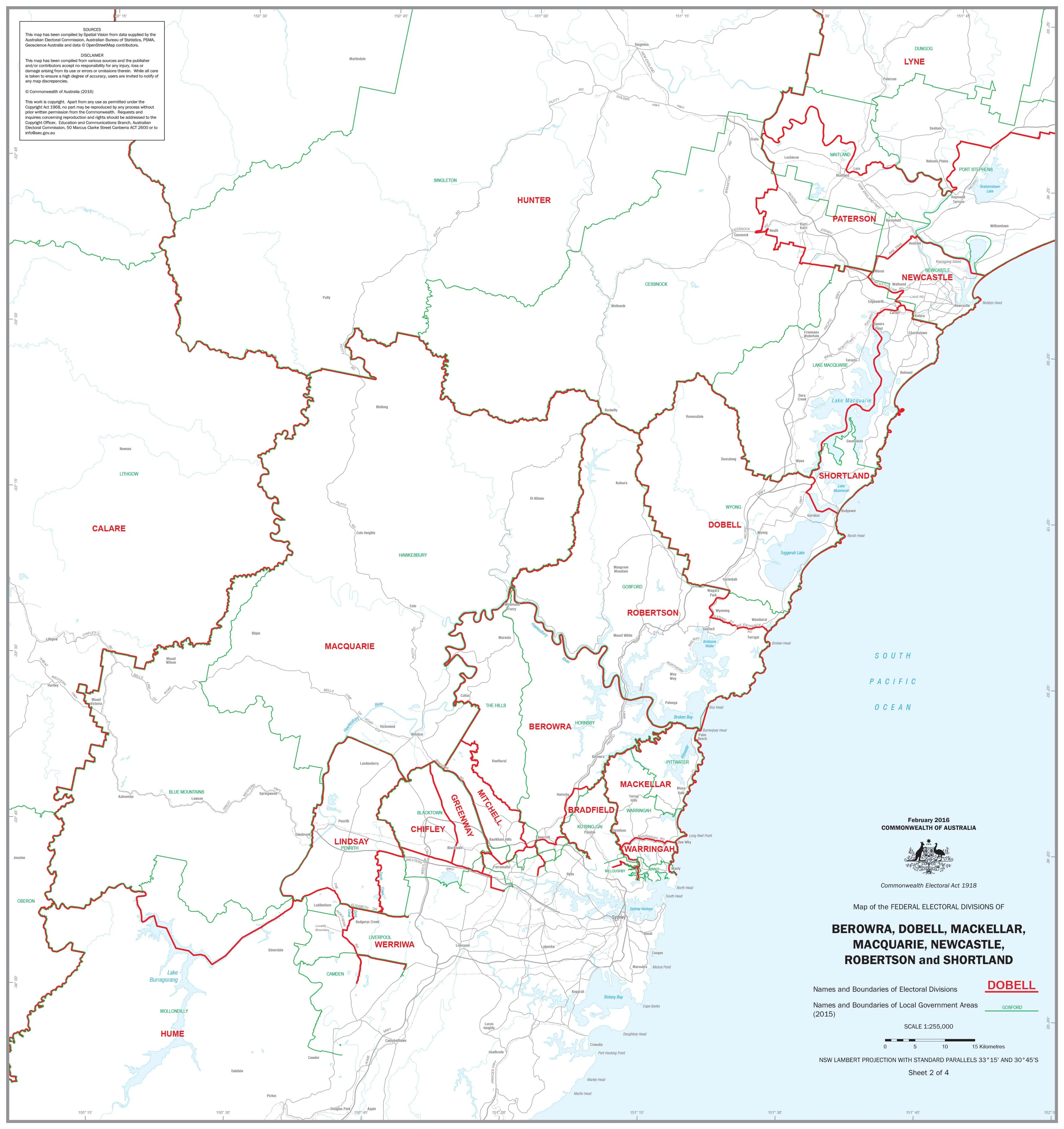
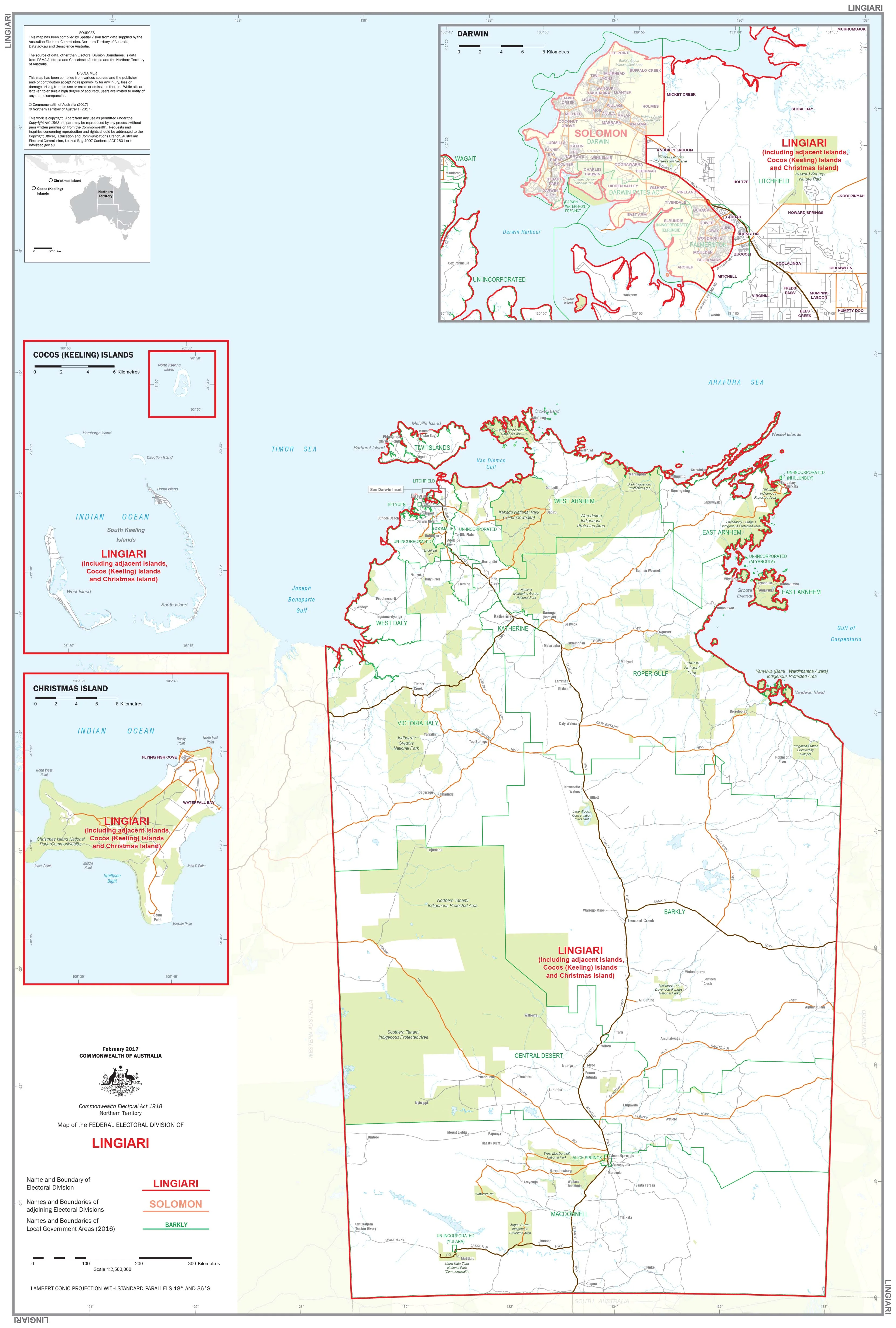
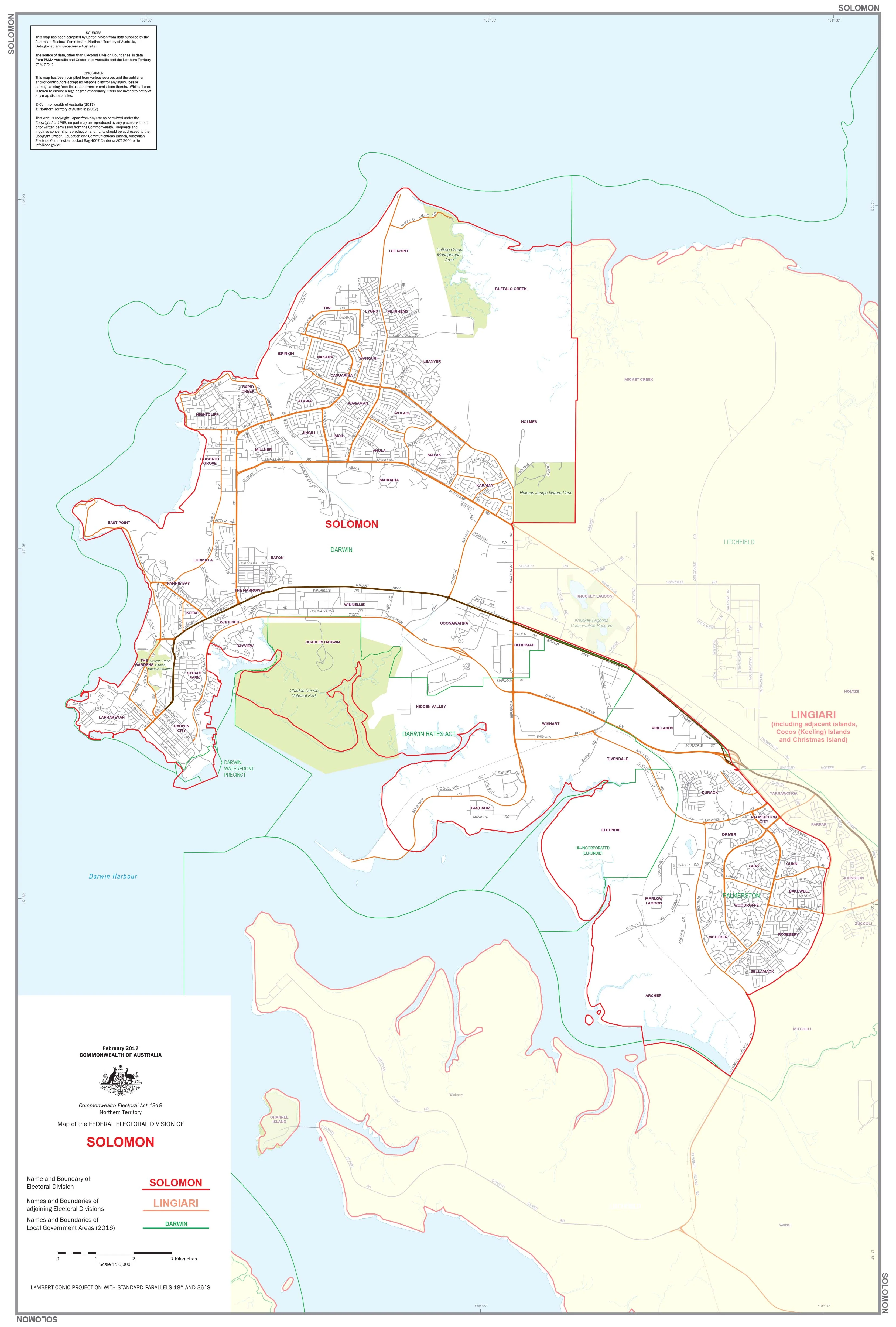
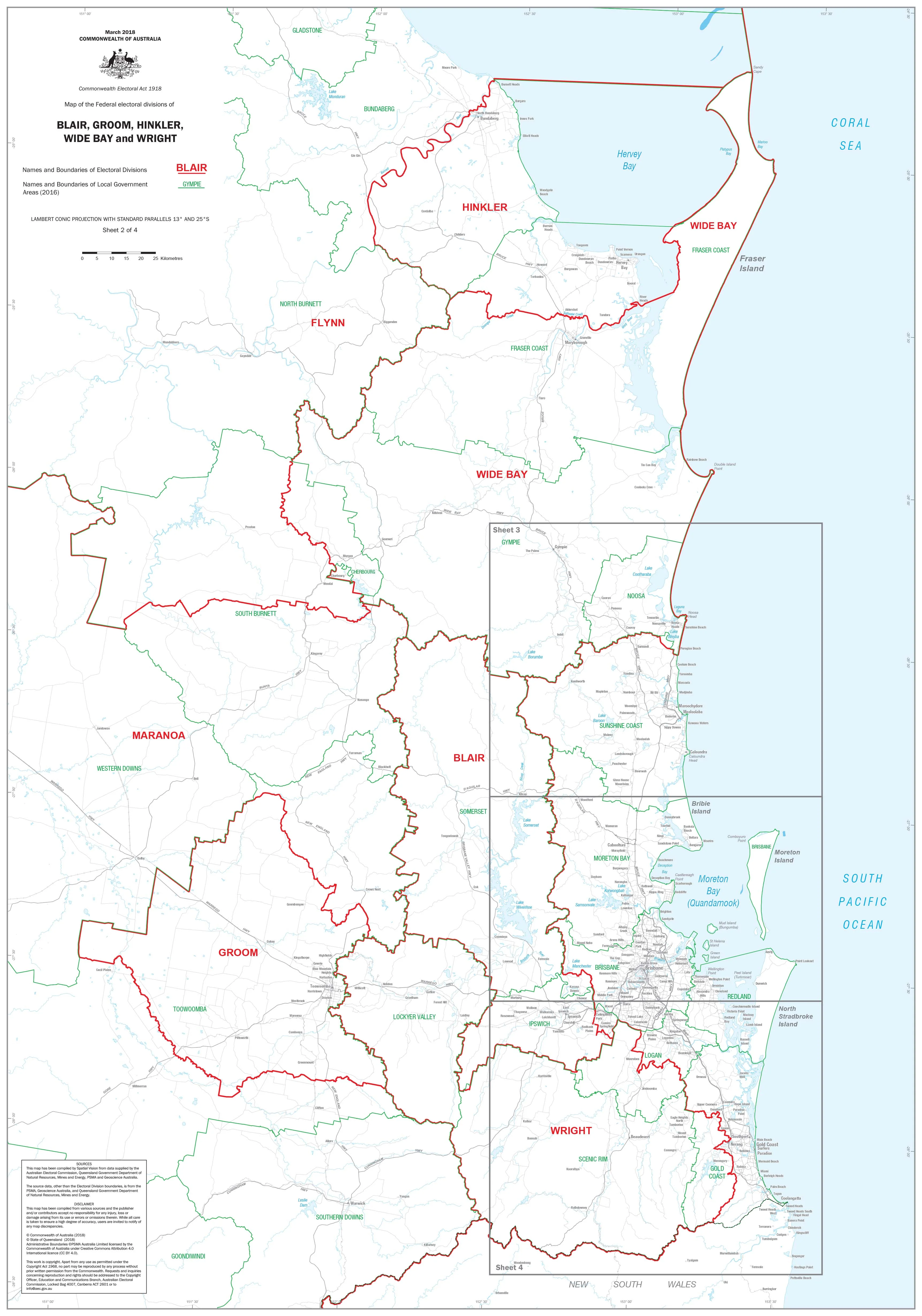
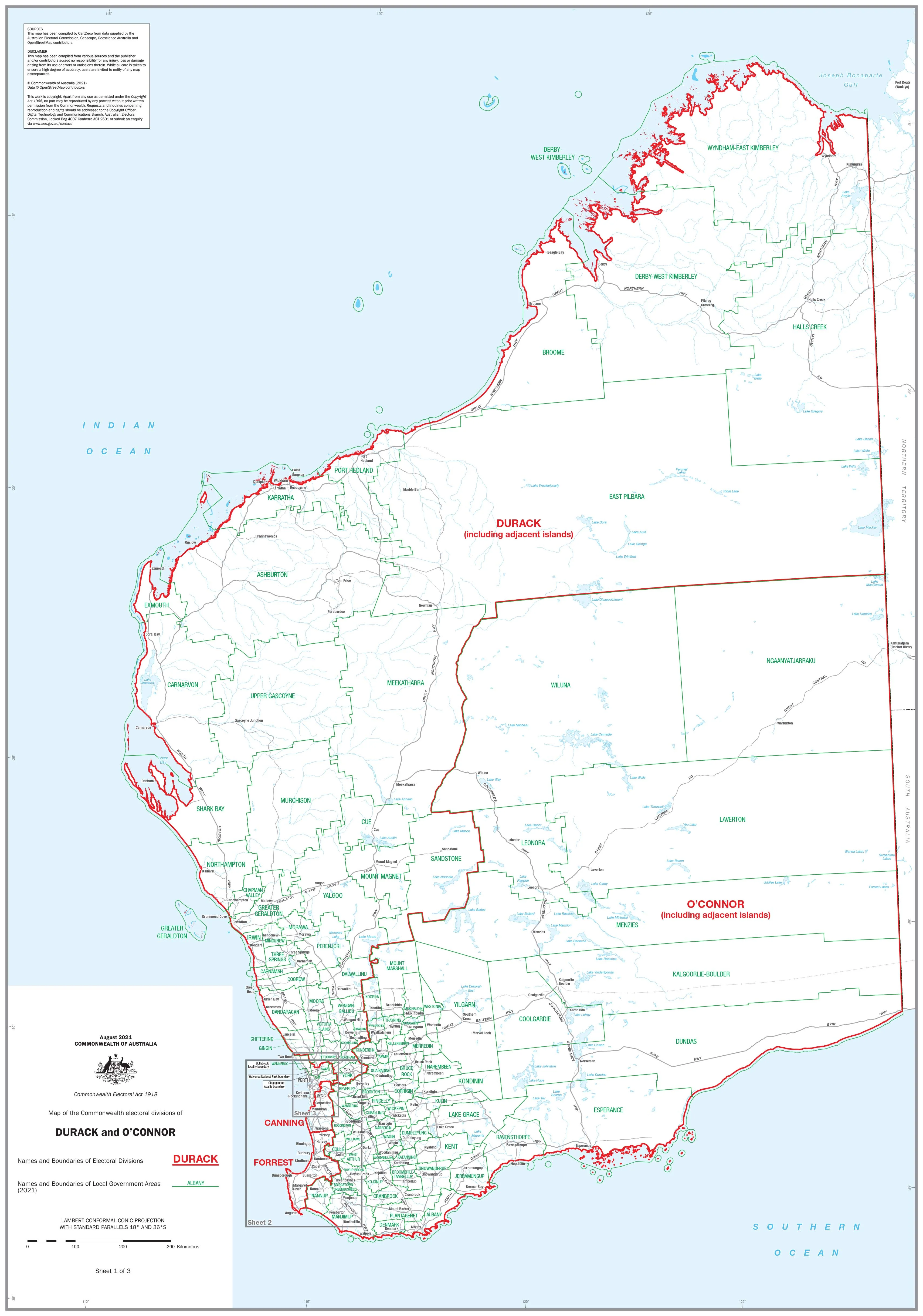
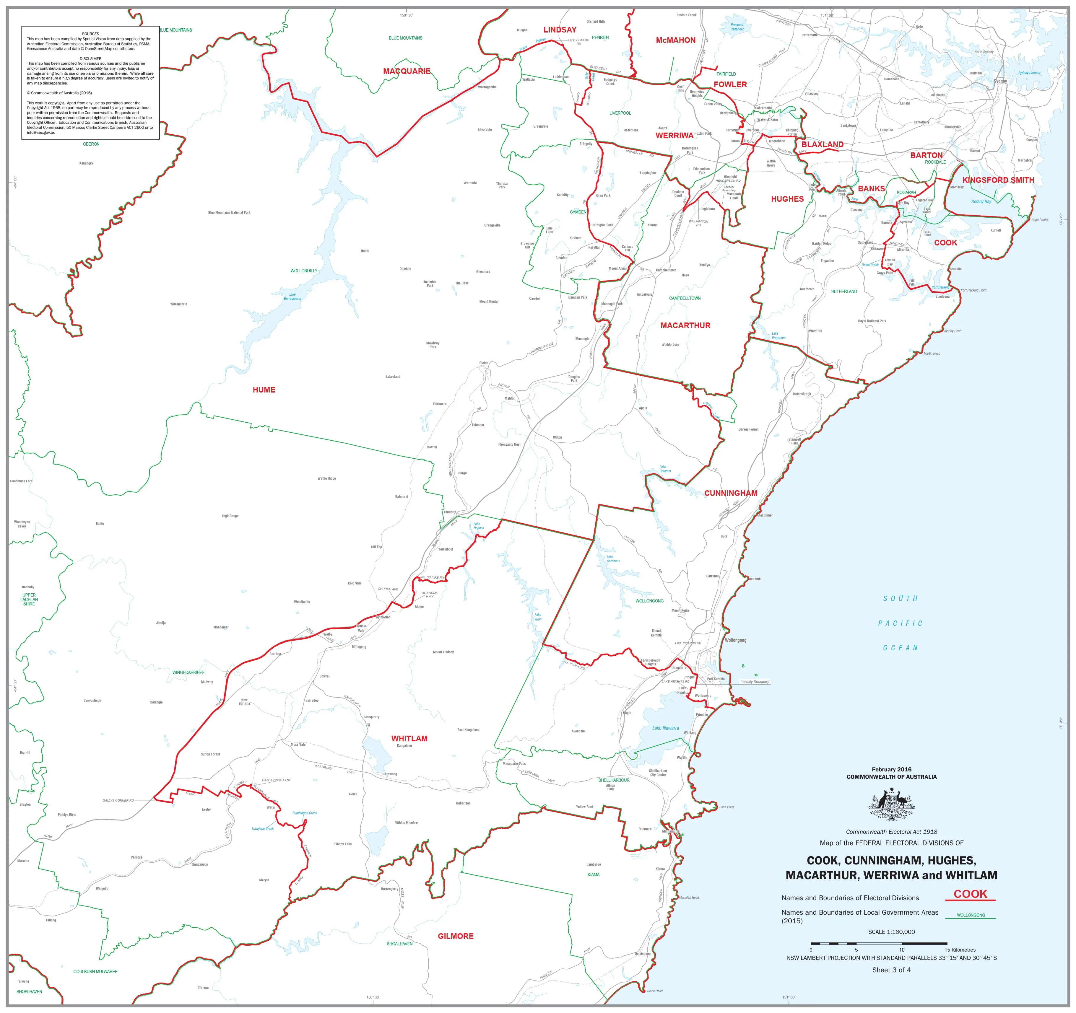
New South Wales — Federal Electoral Divisions & Local Government Areas Map (Wollongong & Surrounds)
This detailed wall map covers the Wollongong region and adjoining districts, clearly showing both federal electoral division boundaries and local government area (LGA) boundaries. Designed for clarity and accuracy, it’s a valuable reference for government offices, schools, businesses, and community organisations.
Electoral divisions featured on this map include:
Cook, Cunningham, Hughes, Macarthur, Werriwa, and Whitlam.
🗝️ Key Features
-
Electoral boundaries — Names and borders of six federal divisions clearly marked
-
Local government areas — All LGAs within the region clearly identified
-
Regional coverage — Wollongong & surrounds, extending across multiple divisions
-
Practical design — Large-format layout for easy readability in offices and classrooms
-
Custom availability — Individual division maps can be produced on request — please contact us
🎨 Materials & Finish
-
📄 Paper (160 gsm matte): Archival-quality paper, ideal for framing under glass.
-
💧 Laminated (True Encapsulation): Fully encapsulated in 2 × 80-micron gloss laminate — waterproof, tear-resistant, and wipe-clean.
-
🪵 Laminated + Timber Hang Rails: Laminated map mounted with natural lacquered timber rails and top hanging cord for easy wall display.
-
🎨 Canvas (395 gsm HP Professional Matte): Printed on museum-grade canvas with pigment-based inks for exceptional durability and clarity.
-
🪵 Canvas + Timber Hang Rails: Canvas version fitted with natural timber rails, lacquered finish, and hanging cord — a gallery-ready display.
⚠️ Please allow up to 10 working days for delivery of hang-railed maps, as these are custom-finished by our framer.
📐 Size
-
1000 mm × 700 mm (39.3" × 27.5")
-
Orientation: Landscape
📊 Specifications
| Attribute | Details |
|---|---|
| Title | NSW Federal Electoral Divisions & Local Government Areas — Wollongong & Area |
| Coverage | Federal divisions: Cook, Cunningham, Hughes, Macarthur, Werriwa, Whitlam |
| Features | Electoral division boundaries, local government area boundaries, clear labelling |
| Print Size | 1000 mm × 700 mm |
| Format Options | Paper, Laminated, Laminated + Timber Hang Rails, Canvas, Canvas + Timber Hang Rails |
| Paper Weight | 160 gsm archival matte |
| Laminate | 2 × 80-micron gloss (true encapsulation) |
| Canvas | 395 gsm HP Professional Matte |
| Inks | Pigment-based, fade-resistant |
| Optional Hang Rails | Natural timber, lacquered; top cord included; allow 10 working days |
| Origin | Printed in Australia |
🎯 Who it’s for
-
🏛️ Government & electoral offices — Electoral planning and regional administration
-
🏢 Businesses & service providers — Useful for defining territories and service areas
-
🎓 Schools & universities — Ideal for civics, political studies, and geography teaching
-
📍 Community groups & NGOs — Clear, accessible reference for regional boundaries
🤝 Our Commitment
Each map is printed and finished locally in Australia with archival-quality materials and fade-resistant inks. Every copy is colour-managed, hand-checked, and professionally packed, ensuring it arrives accurate, durable, and ready to display.
🛒 Order your NSW Federal Electoral Divisions & Local Government Areas Map (Wollongong & Area) today — the clearest and most detailed view of boundaries across this key region.
Original: $42.89
-65%$42.89
$15.01Product Information
Product Information
Shipping & Returns
Shipping & Returns
Description
New South Wales — Federal Electoral Divisions & Local Government Areas Map (Wollongong & Surrounds)
This detailed wall map covers the Wollongong region and adjoining districts, clearly showing both federal electoral division boundaries and local government area (LGA) boundaries. Designed for clarity and accuracy, it’s a valuable reference for government offices, schools, businesses, and community organisations.
Electoral divisions featured on this map include:
Cook, Cunningham, Hughes, Macarthur, Werriwa, and Whitlam.
🗝️ Key Features
-
Electoral boundaries — Names and borders of six federal divisions clearly marked
-
Local government areas — All LGAs within the region clearly identified
-
Regional coverage — Wollongong & surrounds, extending across multiple divisions
-
Practical design — Large-format layout for easy readability in offices and classrooms
-
Custom availability — Individual division maps can be produced on request — please contact us
🎨 Materials & Finish
-
📄 Paper (160 gsm matte): Archival-quality paper, ideal for framing under glass.
-
💧 Laminated (True Encapsulation): Fully encapsulated in 2 × 80-micron gloss laminate — waterproof, tear-resistant, and wipe-clean.
-
🪵 Laminated + Timber Hang Rails: Laminated map mounted with natural lacquered timber rails and top hanging cord for easy wall display.
-
🎨 Canvas (395 gsm HP Professional Matte): Printed on museum-grade canvas with pigment-based inks for exceptional durability and clarity.
-
🪵 Canvas + Timber Hang Rails: Canvas version fitted with natural timber rails, lacquered finish, and hanging cord — a gallery-ready display.
⚠️ Please allow up to 10 working days for delivery of hang-railed maps, as these are custom-finished by our framer.
📐 Size
-
1000 mm × 700 mm (39.3" × 27.5")
-
Orientation: Landscape
📊 Specifications
| Attribute | Details |
|---|---|
| Title | NSW Federal Electoral Divisions & Local Government Areas — Wollongong & Area |
| Coverage | Federal divisions: Cook, Cunningham, Hughes, Macarthur, Werriwa, Whitlam |
| Features | Electoral division boundaries, local government area boundaries, clear labelling |
| Print Size | 1000 mm × 700 mm |
| Format Options | Paper, Laminated, Laminated + Timber Hang Rails, Canvas, Canvas + Timber Hang Rails |
| Paper Weight | 160 gsm archival matte |
| Laminate | 2 × 80-micron gloss (true encapsulation) |
| Canvas | 395 gsm HP Professional Matte |
| Inks | Pigment-based, fade-resistant |
| Optional Hang Rails | Natural timber, lacquered; top cord included; allow 10 working days |
| Origin | Printed in Australia |
🎯 Who it’s for
-
🏛️ Government & electoral offices — Electoral planning and regional administration
-
🏢 Businesses & service providers — Useful for defining territories and service areas
-
🎓 Schools & universities — Ideal for civics, political studies, and geography teaching
-
📍 Community groups & NGOs — Clear, accessible reference for regional boundaries
🤝 Our Commitment
Each map is printed and finished locally in Australia with archival-quality materials and fade-resistant inks. Every copy is colour-managed, hand-checked, and professionally packed, ensuring it arrives accurate, durable, and ready to display.
🛒 Order your NSW Federal Electoral Divisions & Local Government Areas Map (Wollongong & Area) today — the clearest and most detailed view of boundaries across this key region.