New South Wales Health & Hospitals Map 1190 x 870mm Wall Map
Detailed Planning Map | 1190 x 870 mm | Laminated Finish Available
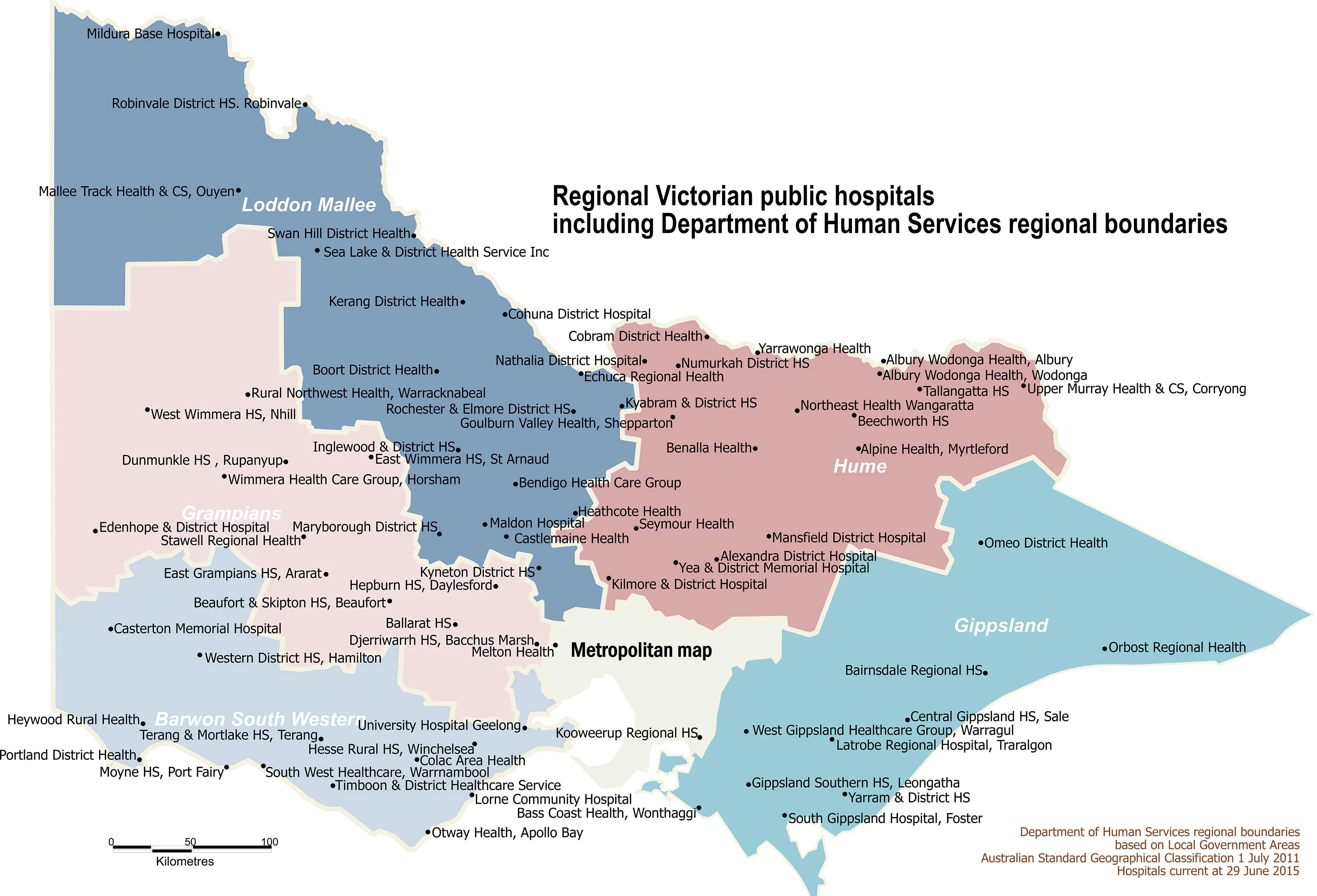
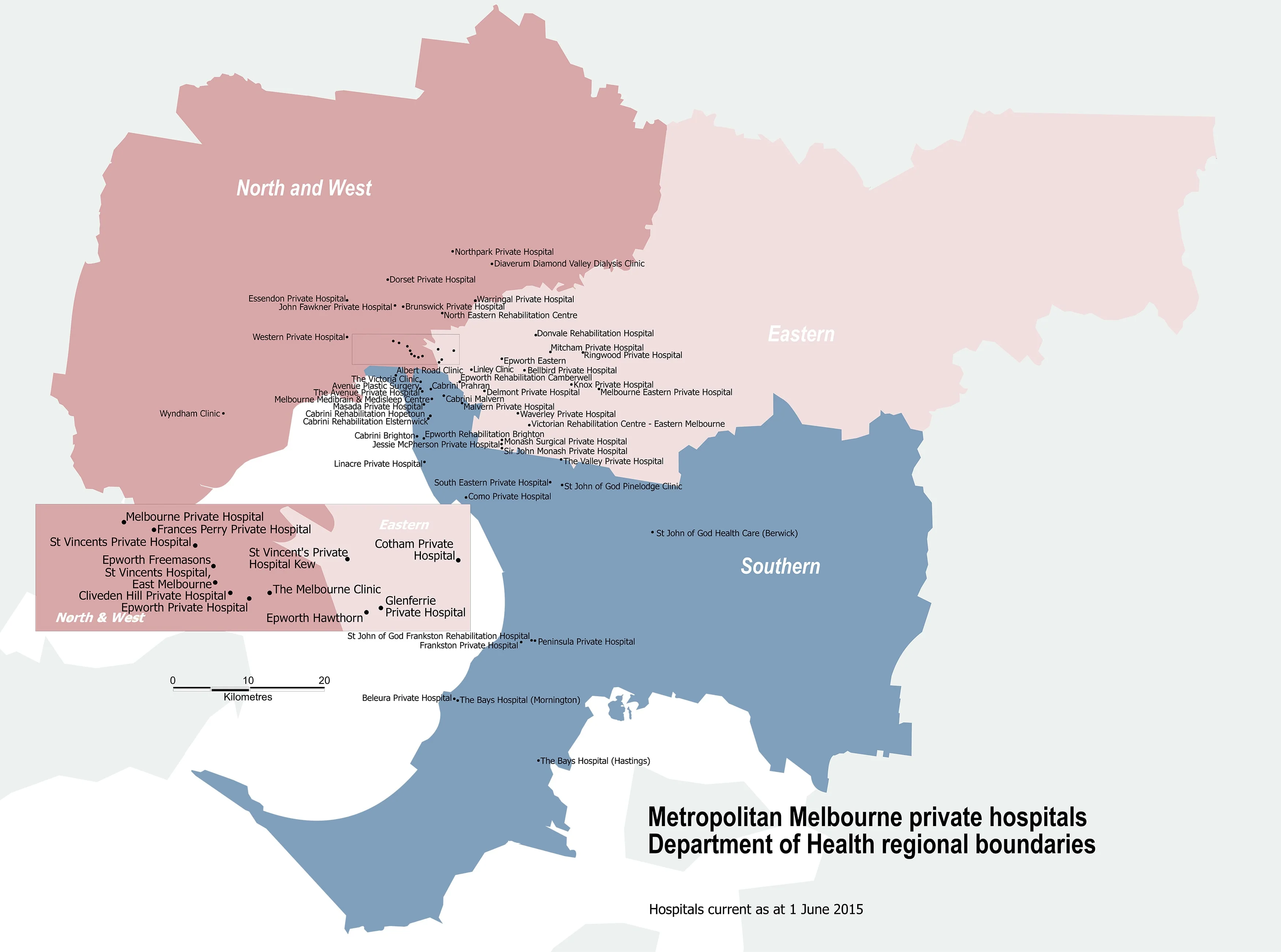
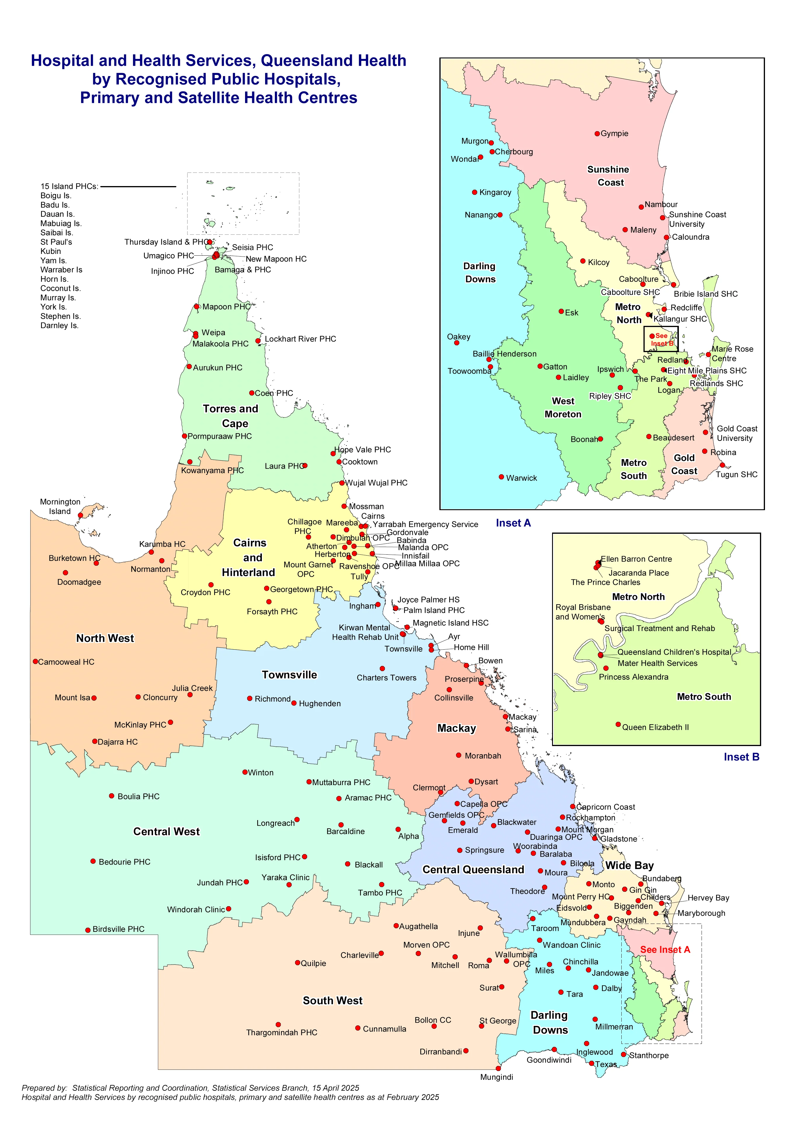
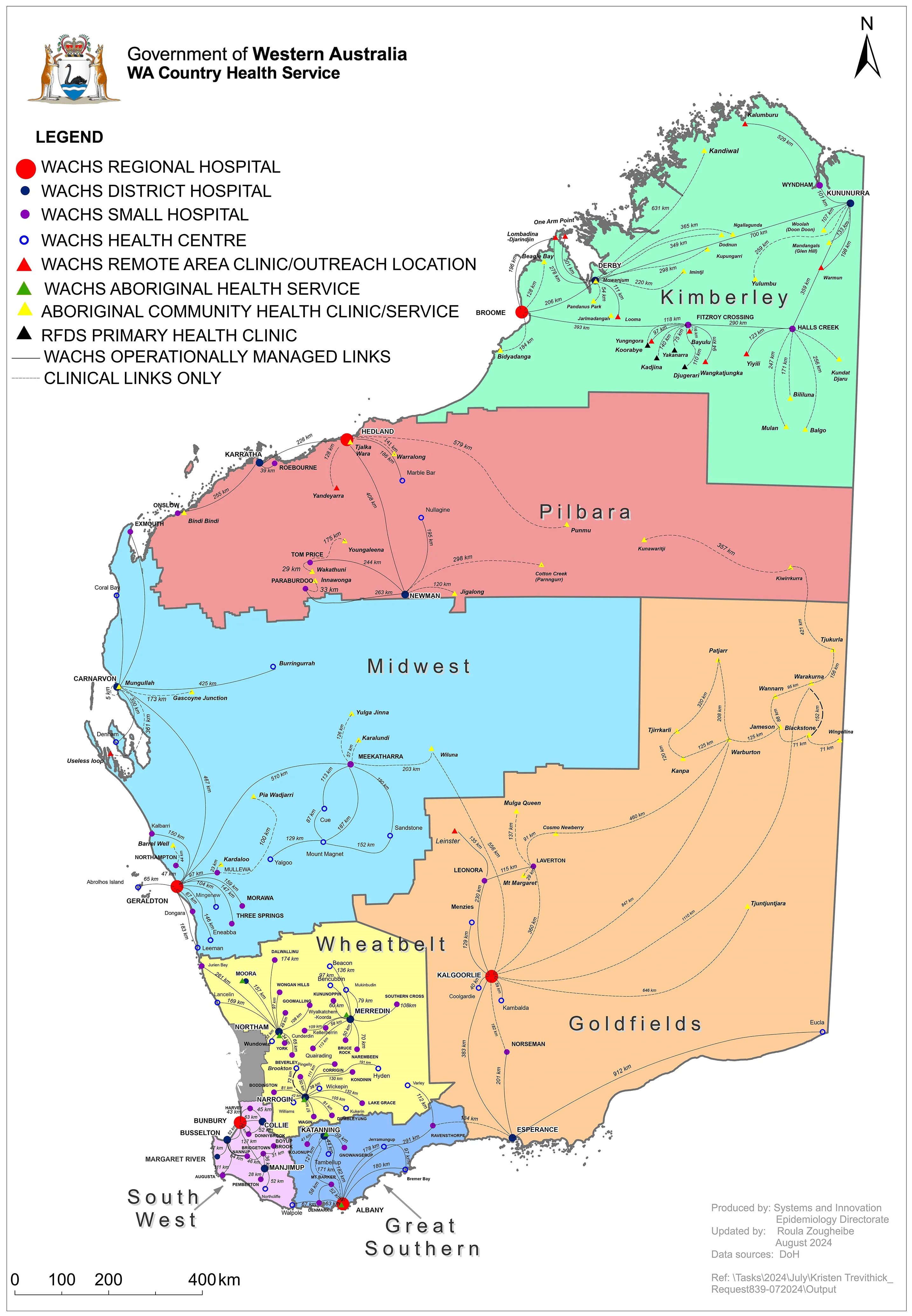
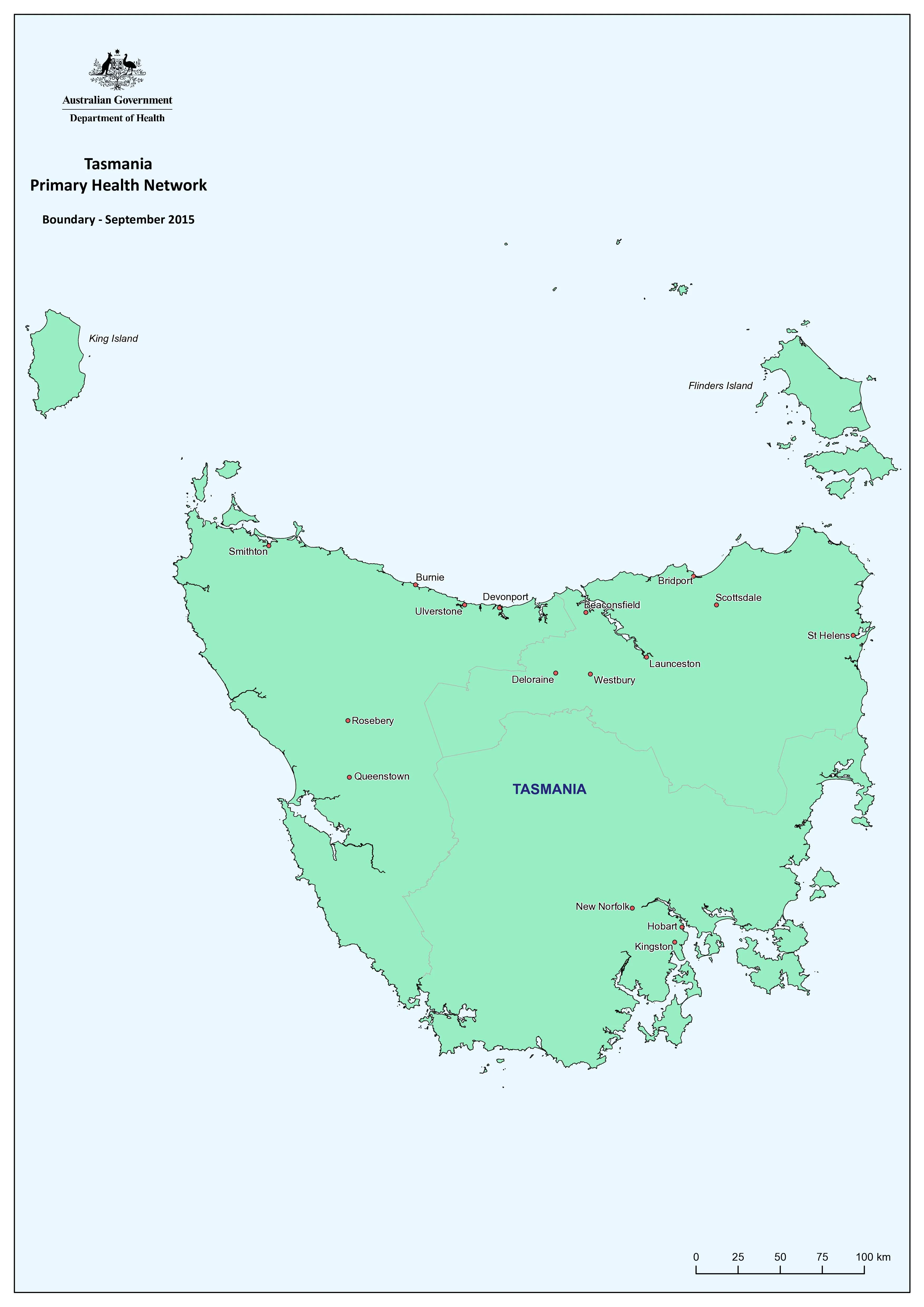
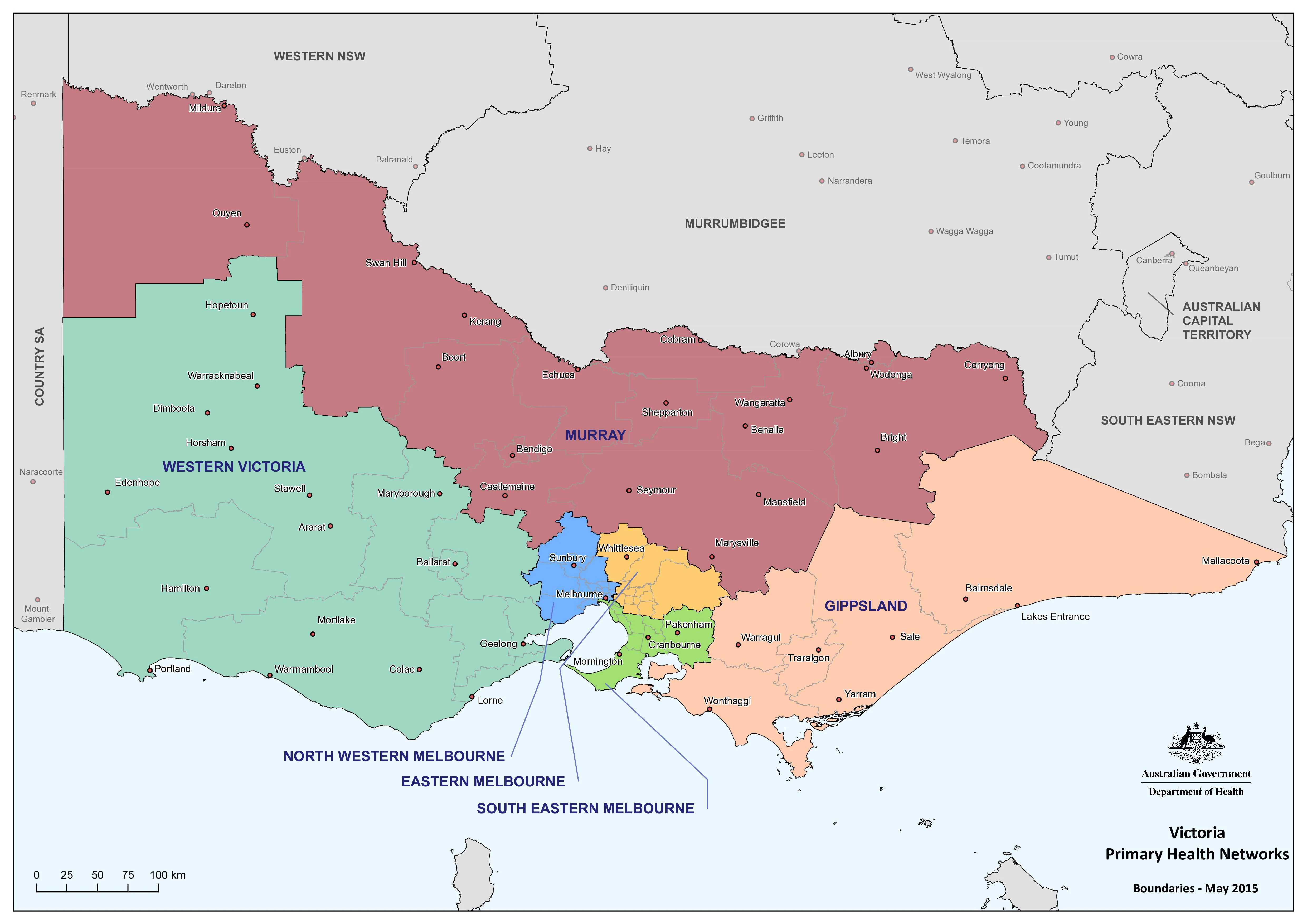
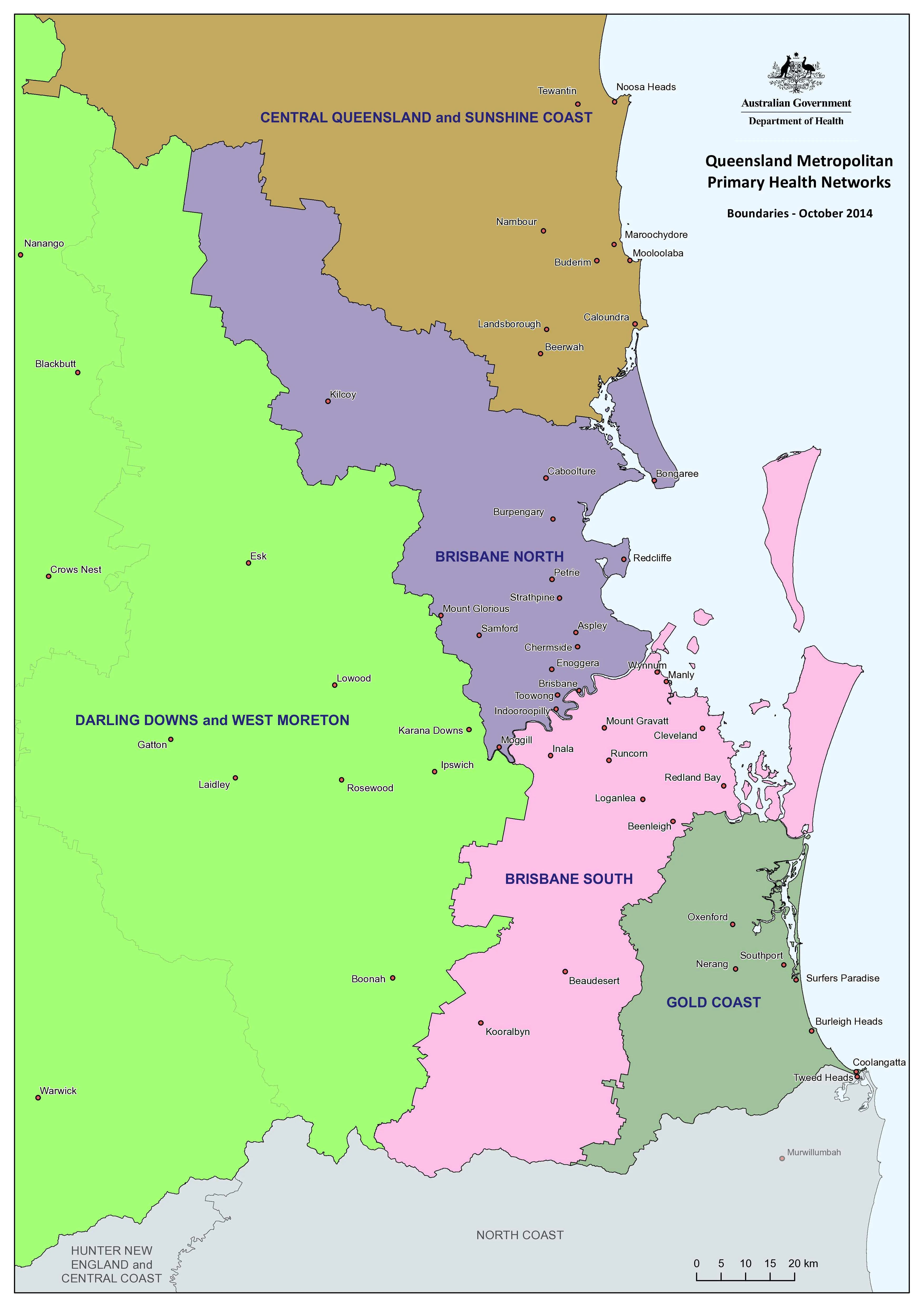
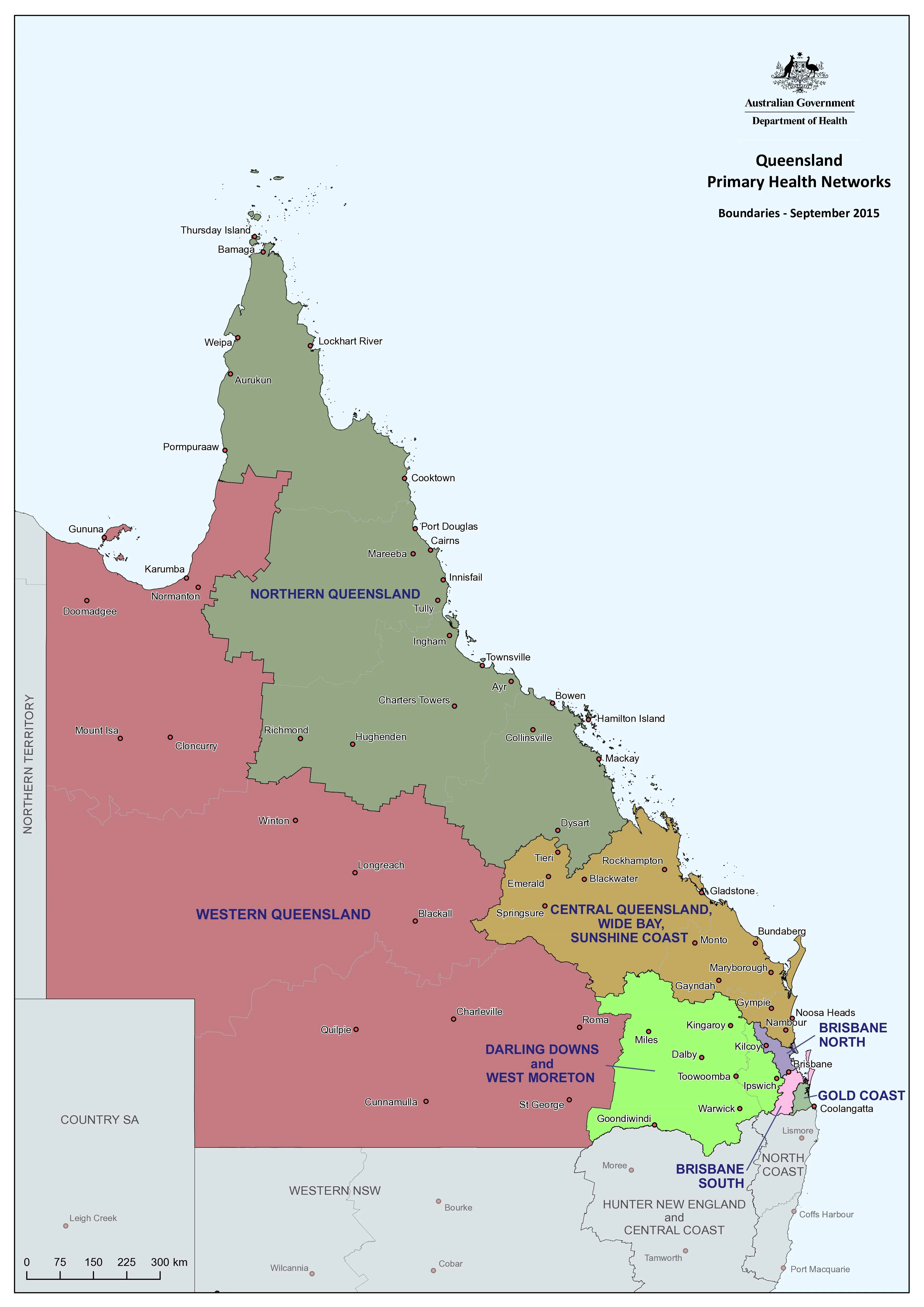
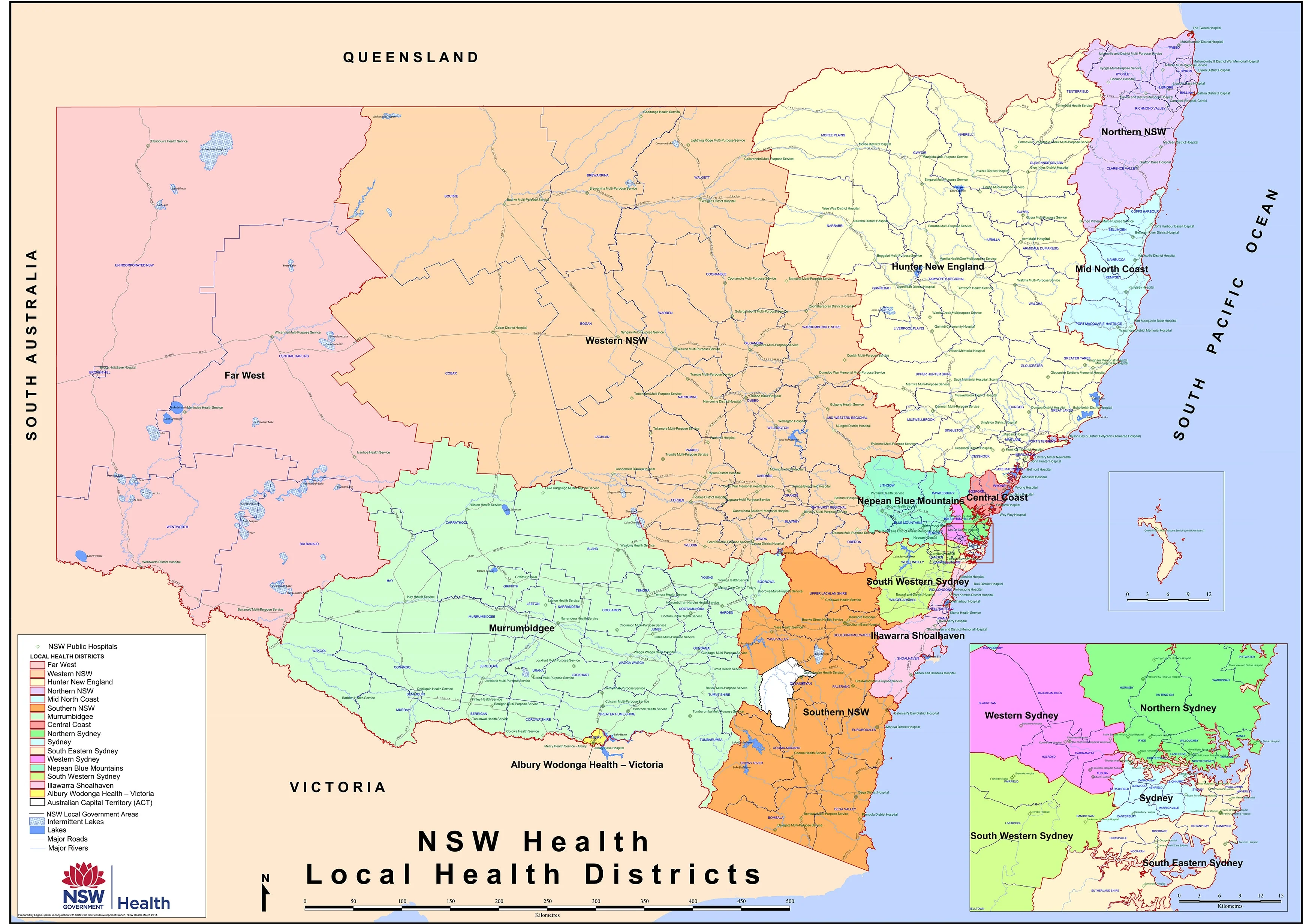
An essential reference for health professionals, administrators, government agencies, and emergency planners, the New South Wales Health & Hospitals Map provides a clear and comprehensive overview of the state’s public health infrastructure.
This large-format wall map presents critical administrative and geographical data, making it ideal for strategic planning, resource allocation, and operational logistics across NSW’s health network.
🔍 Key Features
| Category | Details |
|---|---|
| Map Focus | Health Districts, Public Hospitals, LGAs, Roads |
| Coverage | Entire state of New South Wales |
| Map Format | Wall Map (Flat) |
| Finish Options | Laminated or Paper |
| Size | 1190 mm (w) × 870 mm (h) |
🏨 What This Map Shows
-
NSW Local Health District Boundaries: Clearly delineated to help visualise catchment areas and jurisdictions.
-
Public Hospital Locations: Every NSW public hospital is accurately marked, enabling rapid identification of facilities.
-
Local Government Areas (LGAs): LGA boundaries provide important administrative context for healthcare governance.
-
Major Roads & Highways: An essential inclusion for logistics, travel-time assessments, and emergency access routes.
🖊️ Laminated for Utility
This map is available in a high-quality gloss laminate, allowing for practical use in dynamic settings:
-
Write and wipe with whiteboard markers
-
Apply map dots or pins for planning, training, or coordination
-
Easy to clean and resistant to tears, creases, and spills
Whether you're in a hospital boardroom, local health office, ambulance command centre, or state department, this map is built for daily use.
🧭 Ideal For:
-
Health Planners & Administrators
-
Emergency Services & Crisis Management Teams
-
Hospital Management & Regional Health Boards
-
Public Health Policy and Research
-
Educational Institutions in Health & Urban Planning
✅ Practical and Professional
Designed to meet the needs of busy professionals, this map combines clarity with accuracy. It’s perfect for wall mounting in offices, operations centres, or classrooms where having a clear view of NSW’s health geography is critical.
Plan smarter. Act faster. See the whole picture.
This is the definitive NSW health and hospital reference map.
Original: $50.05
-65%$50.05
$17.52Product Information
Product Information
Shipping & Returns
Shipping & Returns
Description
Detailed Planning Map | 1190 x 870 mm | Laminated Finish Available
An essential reference for health professionals, administrators, government agencies, and emergency planners, the New South Wales Health & Hospitals Map provides a clear and comprehensive overview of the state’s public health infrastructure.
This large-format wall map presents critical administrative and geographical data, making it ideal for strategic planning, resource allocation, and operational logistics across NSW’s health network.
🔍 Key Features
| Category | Details |
|---|---|
| Map Focus | Health Districts, Public Hospitals, LGAs, Roads |
| Coverage | Entire state of New South Wales |
| Map Format | Wall Map (Flat) |
| Finish Options | Laminated or Paper |
| Size | 1190 mm (w) × 870 mm (h) |
🏨 What This Map Shows
-
NSW Local Health District Boundaries: Clearly delineated to help visualise catchment areas and jurisdictions.
-
Public Hospital Locations: Every NSW public hospital is accurately marked, enabling rapid identification of facilities.
-
Local Government Areas (LGAs): LGA boundaries provide important administrative context for healthcare governance.
-
Major Roads & Highways: An essential inclusion for logistics, travel-time assessments, and emergency access routes.
🖊️ Laminated for Utility
This map is available in a high-quality gloss laminate, allowing for practical use in dynamic settings:
-
Write and wipe with whiteboard markers
-
Apply map dots or pins for planning, training, or coordination
-
Easy to clean and resistant to tears, creases, and spills
Whether you're in a hospital boardroom, local health office, ambulance command centre, or state department, this map is built for daily use.
🧭 Ideal For:
-
Health Planners & Administrators
-
Emergency Services & Crisis Management Teams
-
Hospital Management & Regional Health Boards
-
Public Health Policy and Research
-
Educational Institutions in Health & Urban Planning
✅ Practical and Professional
Designed to meet the needs of busy professionals, this map combines clarity with accuracy. It’s perfect for wall mounting in offices, operations centres, or classrooms where having a clear view of NSW’s health geography is critical.
Plan smarter. Act faster. See the whole picture.
This is the definitive NSW health and hospital reference map.