Northern Territory Primary Health Care Network Wall Map
Northern Territory Primary Health Care Network — Wall Map
A clear, region-wide view of primary health care delivery across the Northern Territory
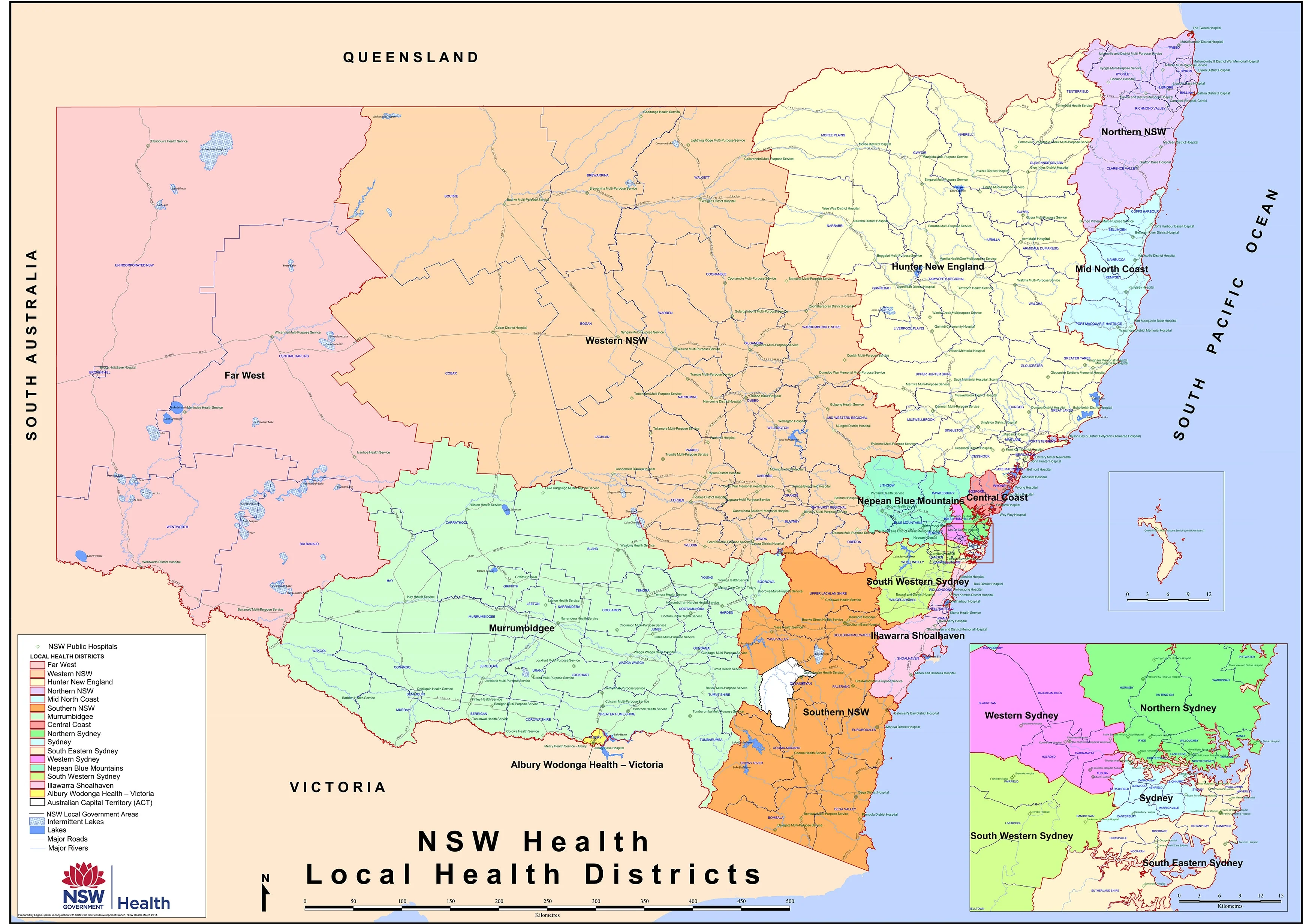
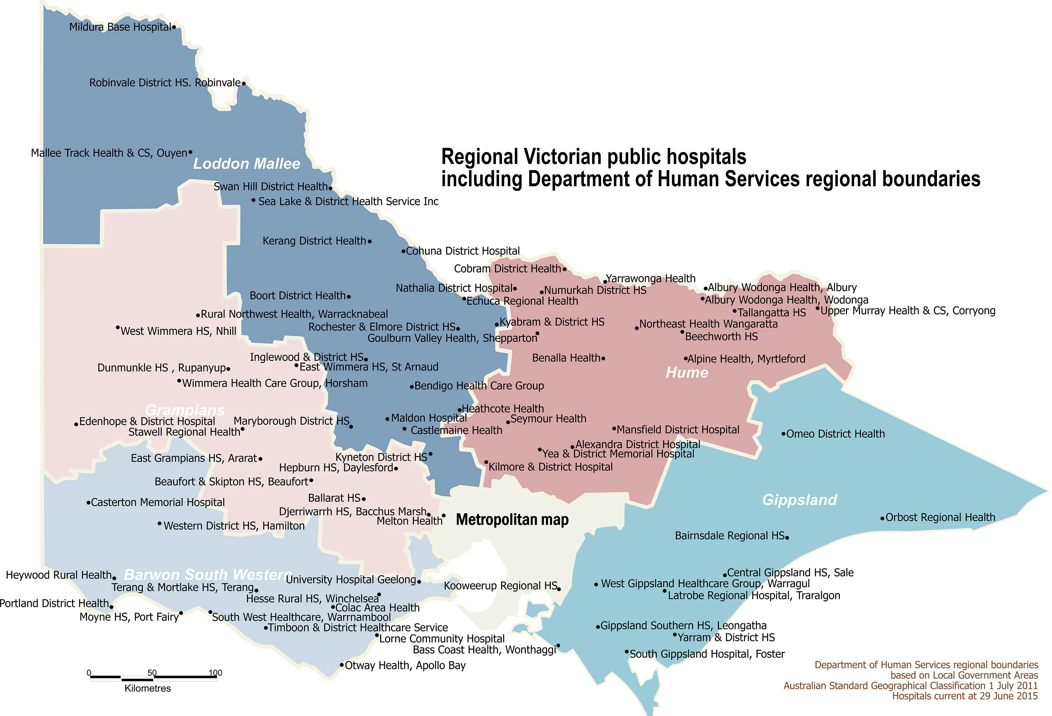
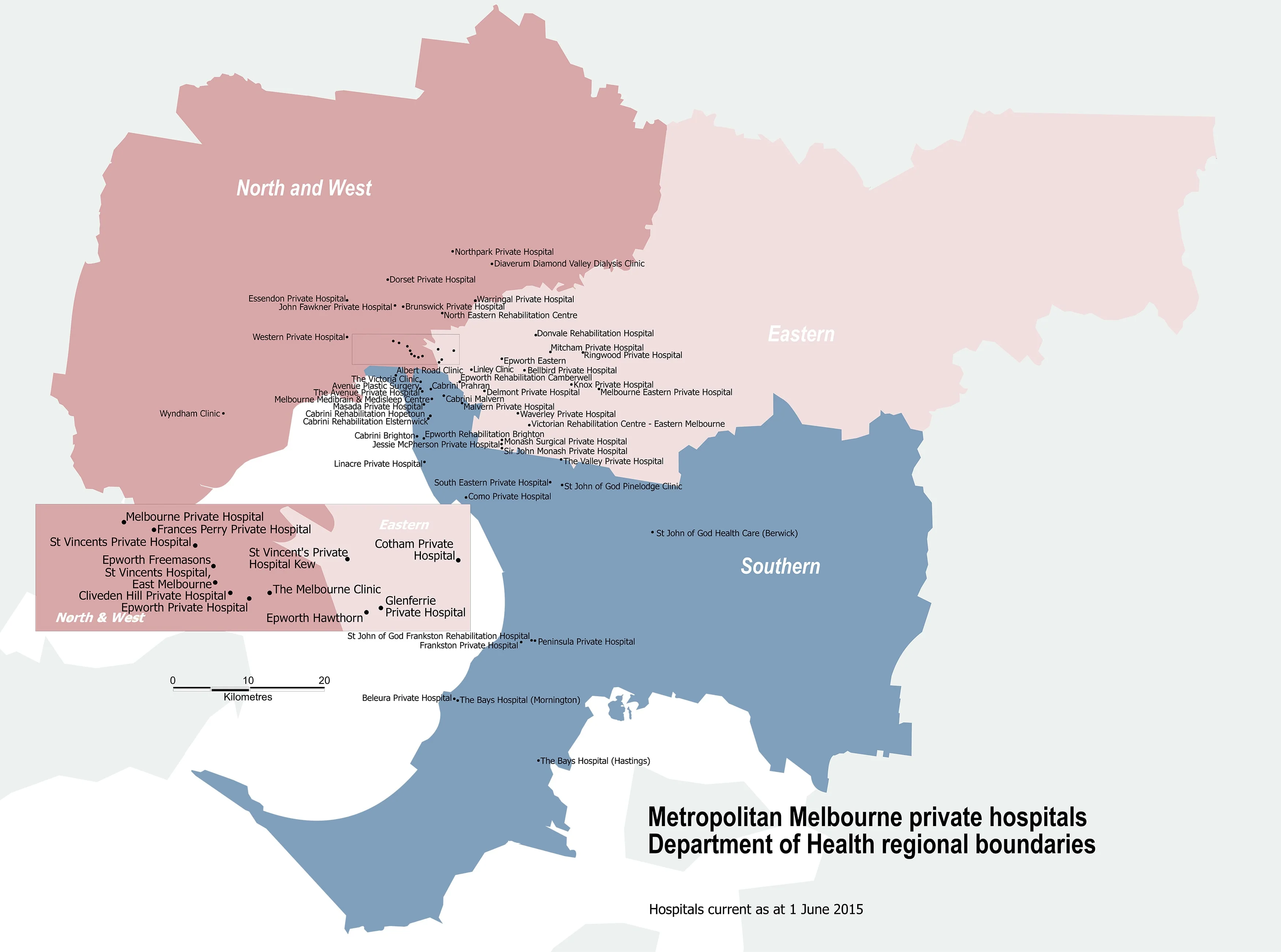
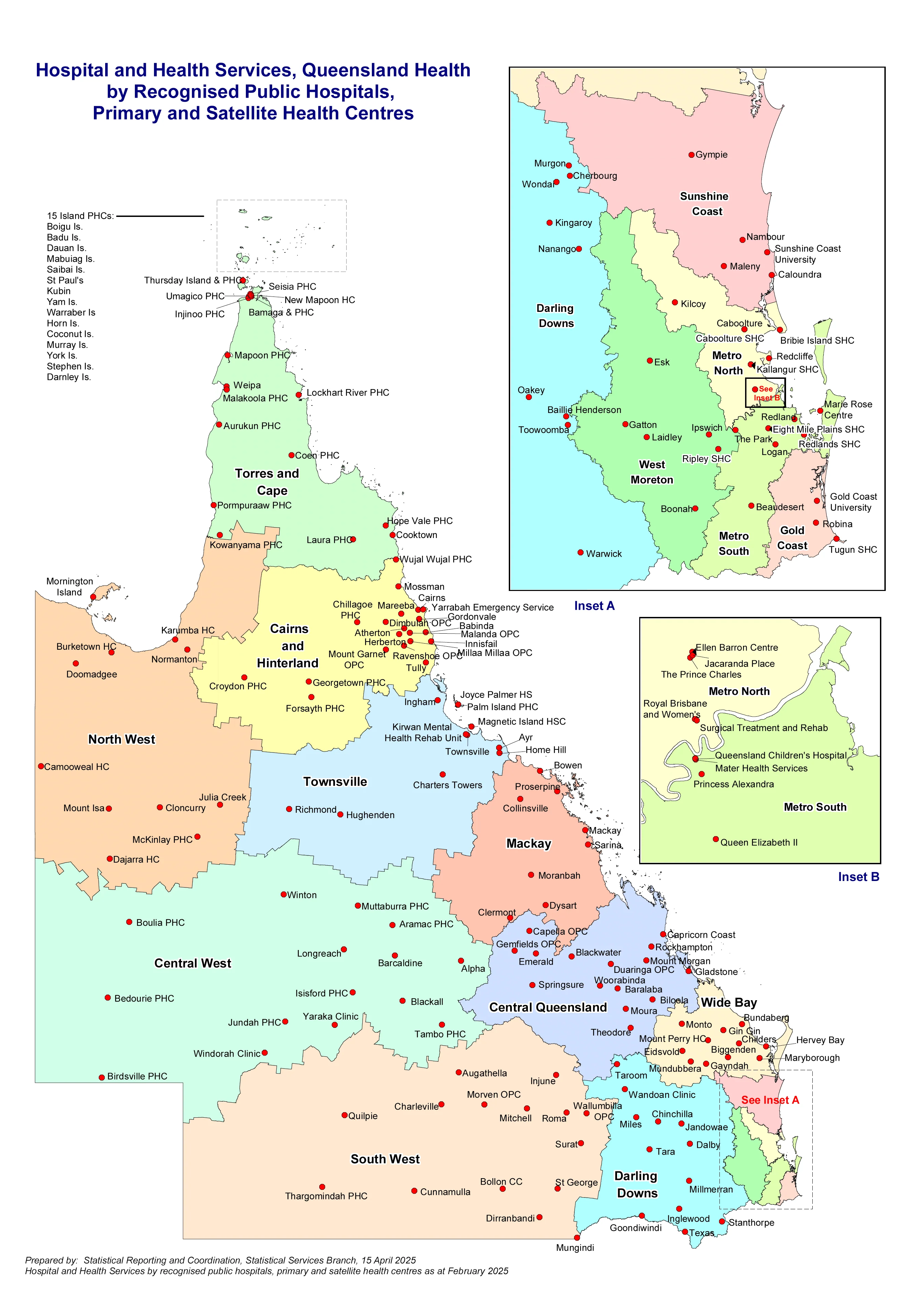
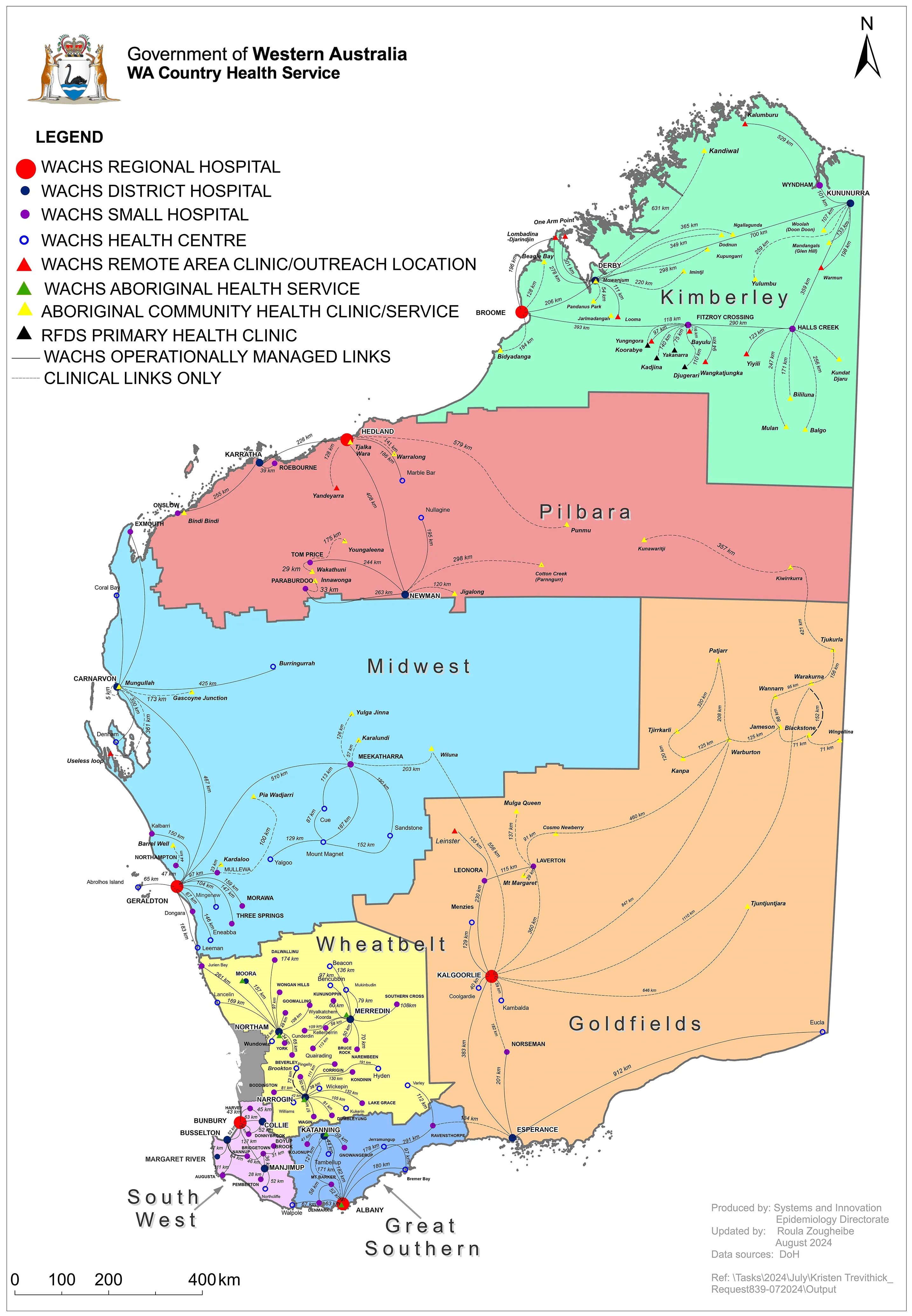
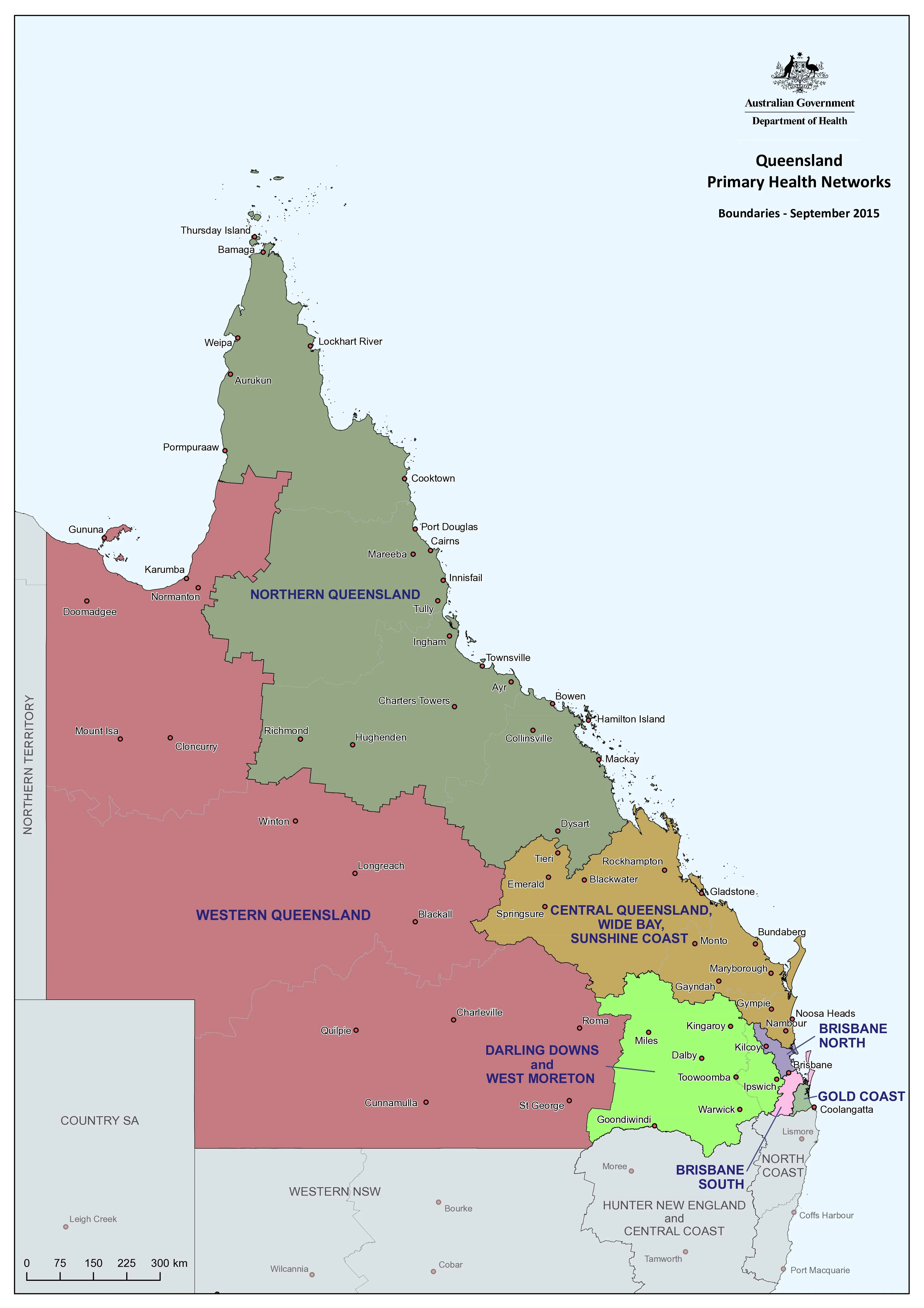
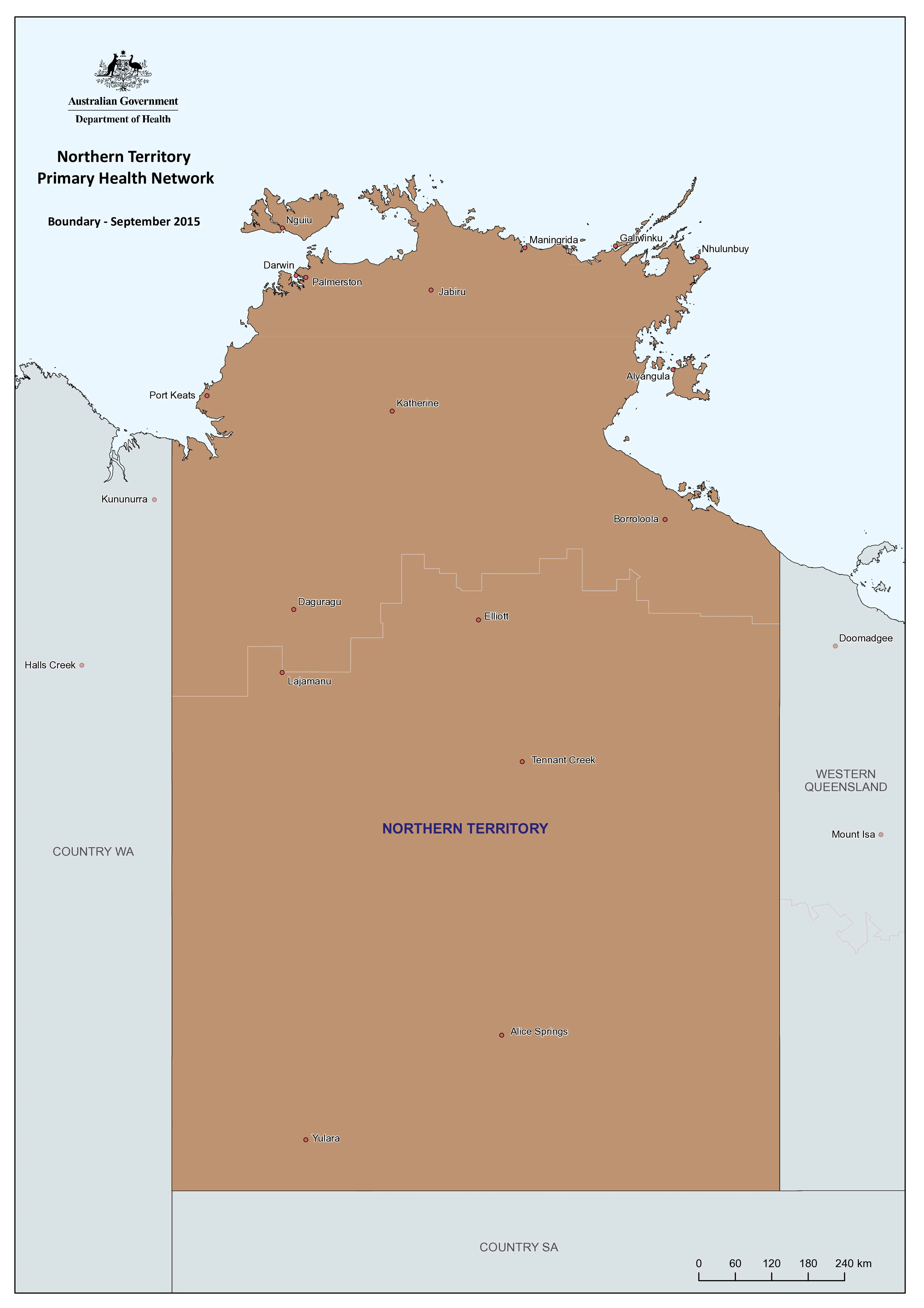
This Northern Territory Primary Health Care Network (PHN) Wall Map provides a practical, wall-ready overview of how primary health care is organised and delivered across one of Australia’s most geographically complex jurisdictions. Designed to support planning, commissioning, and coordination, it translates system-level health delivery into a clear geographic reference for everyday use.
Funded by the Australian Government, Primary Health Networks play a central role in improving access, equity, and outcomes in primary health care. In the Northern Territory—where remoteness, distance, and dispersed populations shape service delivery—this map brings essential spatial clarity to decision-making.
🩺 The Three Core Functions of PHNs
This wall map supports and reflects the three core PHN responsibilities:
-
Coordinate & integrate care
Working in partnership with Local Hospital Networks (LHNs) and regional services to improve quality of care, patient experience, and efficient use of resources. -
Commission services
Planning and funding primary care and mental health services to address population health needs, service gaps, access challenges, and equity—particularly in remote and very remote communities. -
Capacity-build & support providers
Strengthening general practice, Aboriginal Community Controlled Health Services, allied health, and mental health providers through practice support and system coordination.
🗺️ Why a PHN Wall Map Matters in the Northern Territory
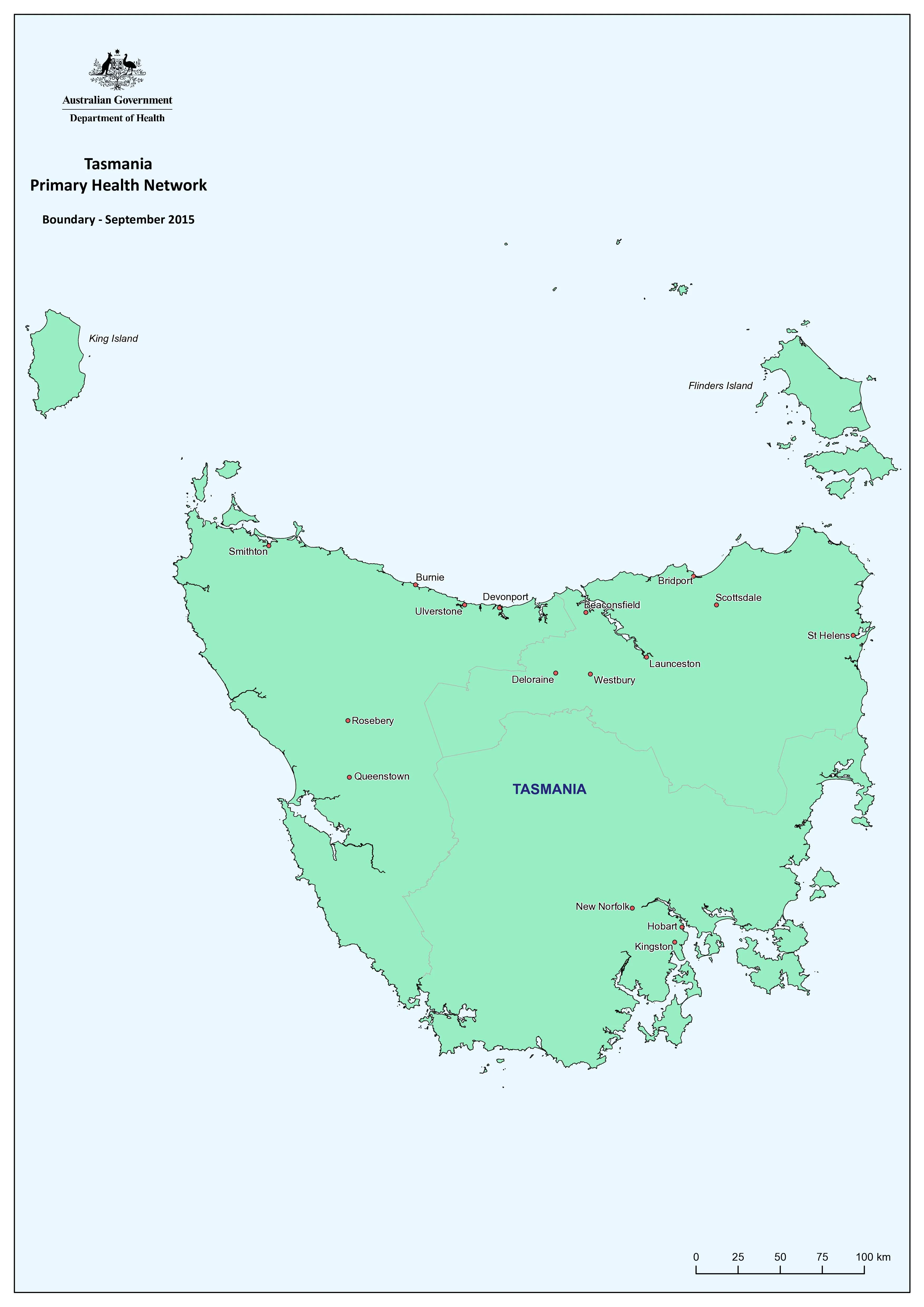
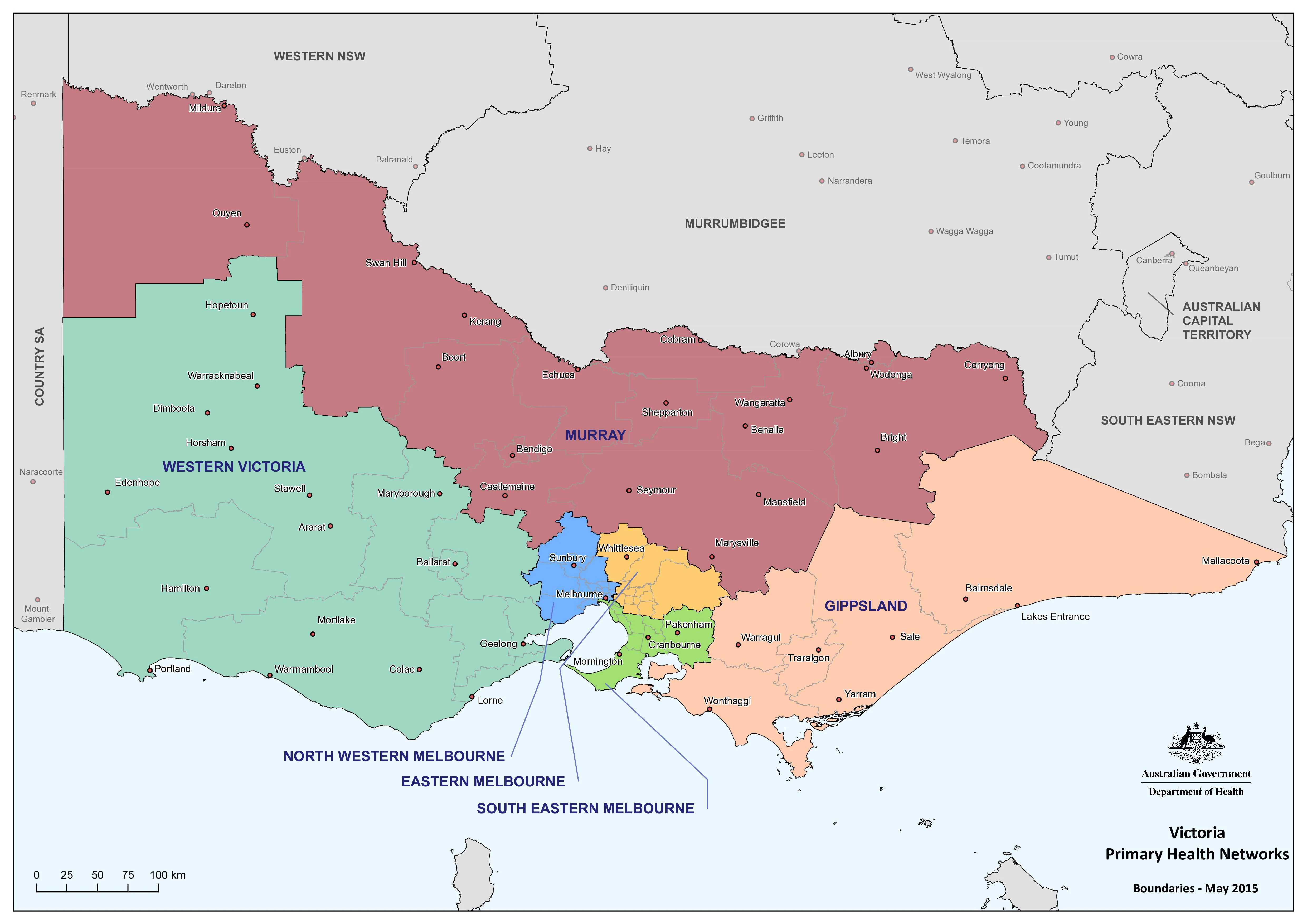
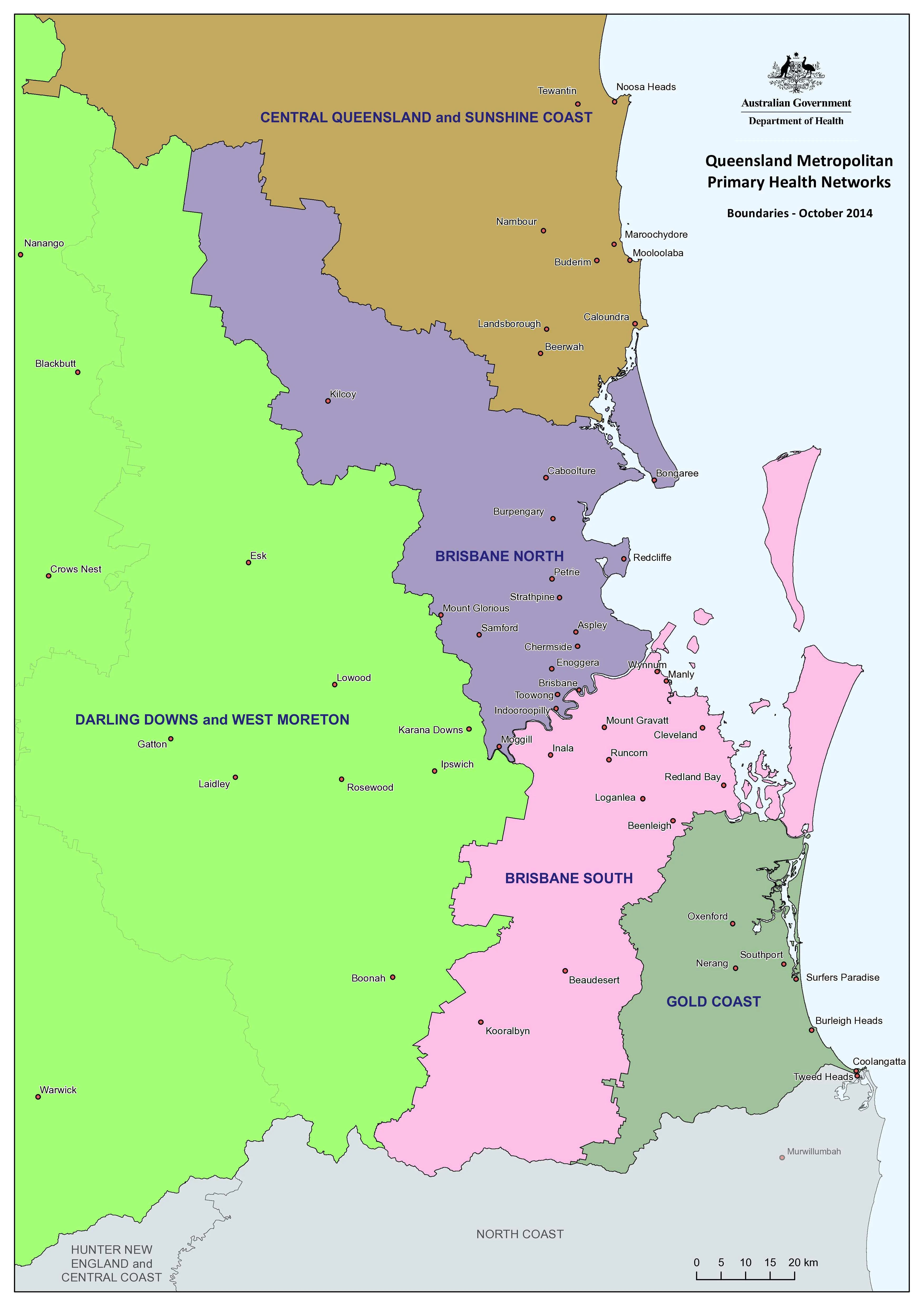
Government primary health care wall maps are powerful visual planning and communication tools. In the NT context, this map helps users to:
-
Visualise PHN coverage across vast and remote regions
-
Support commissioning, outreach, and service-planning discussions
-
Understand distances, regional relationships, and access constraints
-
Brief staff, partners, and stakeholders quickly and consistently
-
Improve transparency and shared understanding of health service delivery
By grounding policy and planning in geography, this map supports more informed decisions and more equitable health outcomes.
🎯 Why This Map Works
-
Territory-wide perspective with clearly defined PHN coverage
-
Clean, professional cartography designed for rapid interpretation
-
Purpose-built for planning, commissioning, and coordination
-
Suitable for offices, clinics, training rooms, and meeting spaces
✨ Premium Print & Display Options
Each map is printed in Australia using archival processes to preserve fine linework, colour accuracy, and long-term durability.
Available finishes:
-
📄 Heavyweight Paper (160 gsm matte)
Archival matte surface with excellent definition; ideal for framing under glass. -
🔒 Laminated (True Encapsulation)
Sealed edge-to-edge between 2 × 80-micron gloss laminate; tear-resistant, wipe-clean, and highly durable. -
🪵 Laminated + Timber Hang Rails
Laminated map fitted with natural lacquered timber hang rails (top & bottom), supplied with hanging cord.
Please allow up to 10 working days. -
🎨 Archival Canvas (395 gsm HP Professional Matte)
Pigment-based, fade-resistant inks on heavyweight canvas for a refined, gallery-style presentation. -
🪵 Canvas + Timber Hang Rails
Canvas finished with natural timber rails for a frame-free, ready-to-hang display.
Please allow up to 10 working days.
📐 Size & Orientation
-
700 mm (w) × 1000 mm (h)
-
Orientation: Portrait
-
Ideal for wall display in offices, boardrooms, clinics, and health hubs
🏥 Ideal For
🏢 Northern Territory PHNs & health departments
🏥 Local Hospital Networks & regional health services
📊 Planning, commissioning & policy teams
🎓 Universities & health training providers
🤝 Community health organisations & NGOs
🇦🇺 Our Commitment
Printed locally in Australia, every map is colour-managed, hand-checked, and carefully packed to ensure clarity, durability, and professional presentation.
A practical, authoritative wall map supporting coordination, commissioning, and stronger primary health care delivery across the Northern Territory.
Original: $50.05
-65%$50.05
$17.52Product Information
Product Information
Shipping & Returns
Shipping & Returns
Description
Northern Territory Primary Health Care Network — Wall Map
A clear, region-wide view of primary health care delivery across the Northern Territory
This Northern Territory Primary Health Care Network (PHN) Wall Map provides a practical, wall-ready overview of how primary health care is organised and delivered across one of Australia’s most geographically complex jurisdictions. Designed to support planning, commissioning, and coordination, it translates system-level health delivery into a clear geographic reference for everyday use.
Funded by the Australian Government, Primary Health Networks play a central role in improving access, equity, and outcomes in primary health care. In the Northern Territory—where remoteness, distance, and dispersed populations shape service delivery—this map brings essential spatial clarity to decision-making.
🩺 The Three Core Functions of PHNs
This wall map supports and reflects the three core PHN responsibilities:
-
Coordinate & integrate care
Working in partnership with Local Hospital Networks (LHNs) and regional services to improve quality of care, patient experience, and efficient use of resources. -
Commission services
Planning and funding primary care and mental health services to address population health needs, service gaps, access challenges, and equity—particularly in remote and very remote communities. -
Capacity-build & support providers
Strengthening general practice, Aboriginal Community Controlled Health Services, allied health, and mental health providers through practice support and system coordination.
🗺️ Why a PHN Wall Map Matters in the Northern Territory
Government primary health care wall maps are powerful visual planning and communication tools. In the NT context, this map helps users to:
-
Visualise PHN coverage across vast and remote regions
-
Support commissioning, outreach, and service-planning discussions
-
Understand distances, regional relationships, and access constraints
-
Brief staff, partners, and stakeholders quickly and consistently
-
Improve transparency and shared understanding of health service delivery
By grounding policy and planning in geography, this map supports more informed decisions and more equitable health outcomes.
🎯 Why This Map Works
-
Territory-wide perspective with clearly defined PHN coverage
-
Clean, professional cartography designed for rapid interpretation
-
Purpose-built for planning, commissioning, and coordination
-
Suitable for offices, clinics, training rooms, and meeting spaces
✨ Premium Print & Display Options
Each map is printed in Australia using archival processes to preserve fine linework, colour accuracy, and long-term durability.
Available finishes:
-
📄 Heavyweight Paper (160 gsm matte)
Archival matte surface with excellent definition; ideal for framing under glass. -
🔒 Laminated (True Encapsulation)
Sealed edge-to-edge between 2 × 80-micron gloss laminate; tear-resistant, wipe-clean, and highly durable. -
🪵 Laminated + Timber Hang Rails
Laminated map fitted with natural lacquered timber hang rails (top & bottom), supplied with hanging cord.
Please allow up to 10 working days. -
🎨 Archival Canvas (395 gsm HP Professional Matte)
Pigment-based, fade-resistant inks on heavyweight canvas for a refined, gallery-style presentation. -
🪵 Canvas + Timber Hang Rails
Canvas finished with natural timber rails for a frame-free, ready-to-hang display.
Please allow up to 10 working days.
📐 Size & Orientation
-
700 mm (w) × 1000 mm (h)
-
Orientation: Portrait
-
Ideal for wall display in offices, boardrooms, clinics, and health hubs
🏥 Ideal For
🏢 Northern Territory PHNs & health departments
🏥 Local Hospital Networks & regional health services
📊 Planning, commissioning & policy teams
🎓 Universities & health training providers
🤝 Community health organisations & NGOs
🇦🇺 Our Commitment
Printed locally in Australia, every map is colour-managed, hand-checked, and carefully packed to ensure clarity, durability, and professional presentation.
A practical, authoritative wall map supporting coordination, commissioning, and stronger primary health care delivery across the Northern Territory.