Western Australia Country Health Service Map
Western Australia Country Health Service Map — 2024 Edition
Statewide Coverage • 690 × 1000 mm or 1040 × 1500 mm
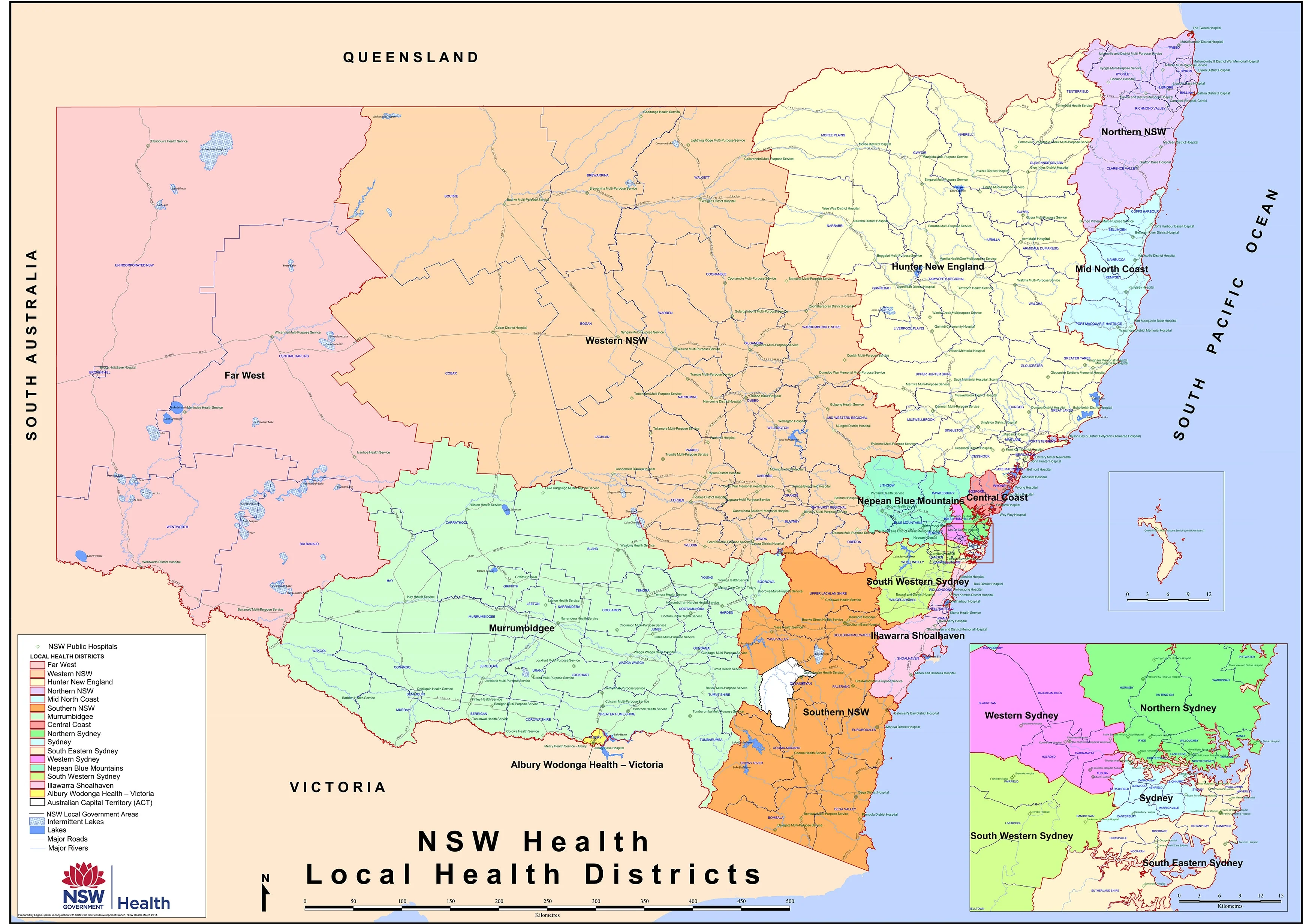
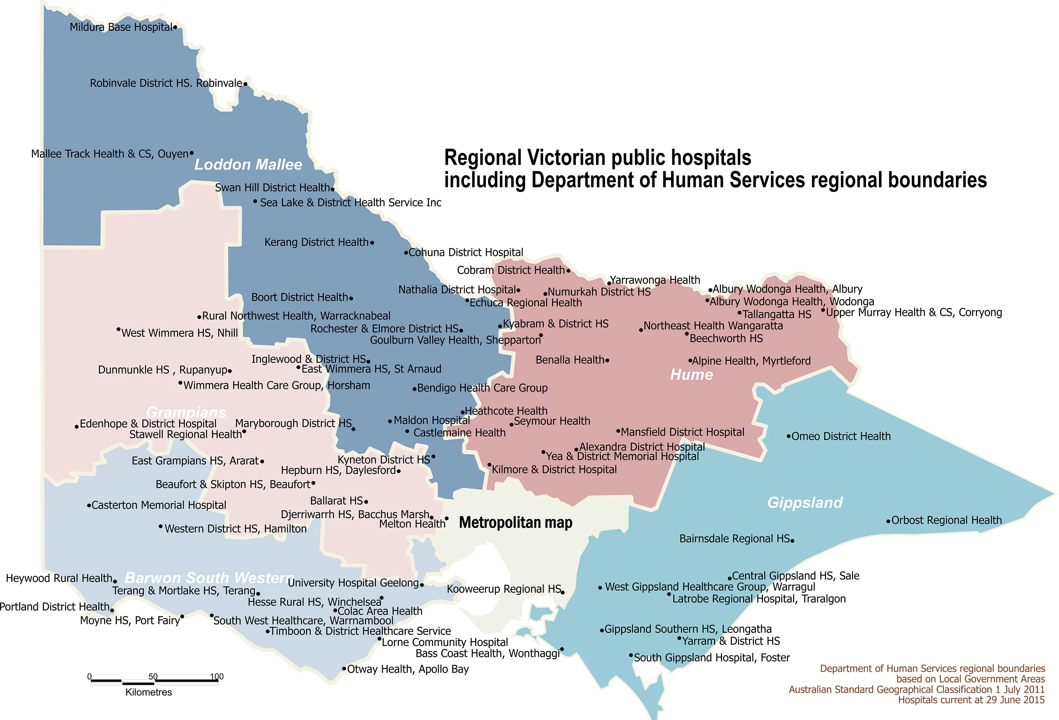
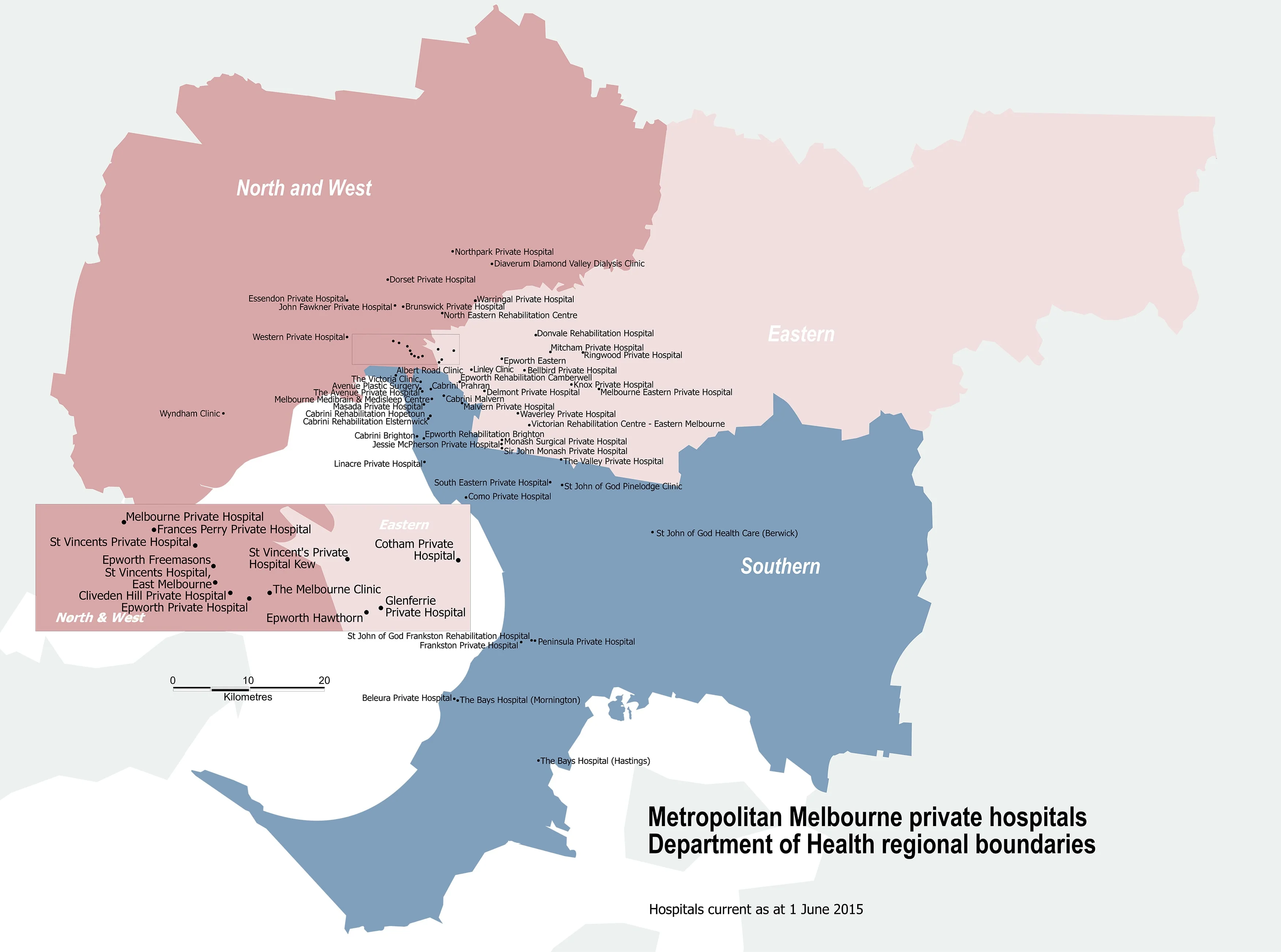
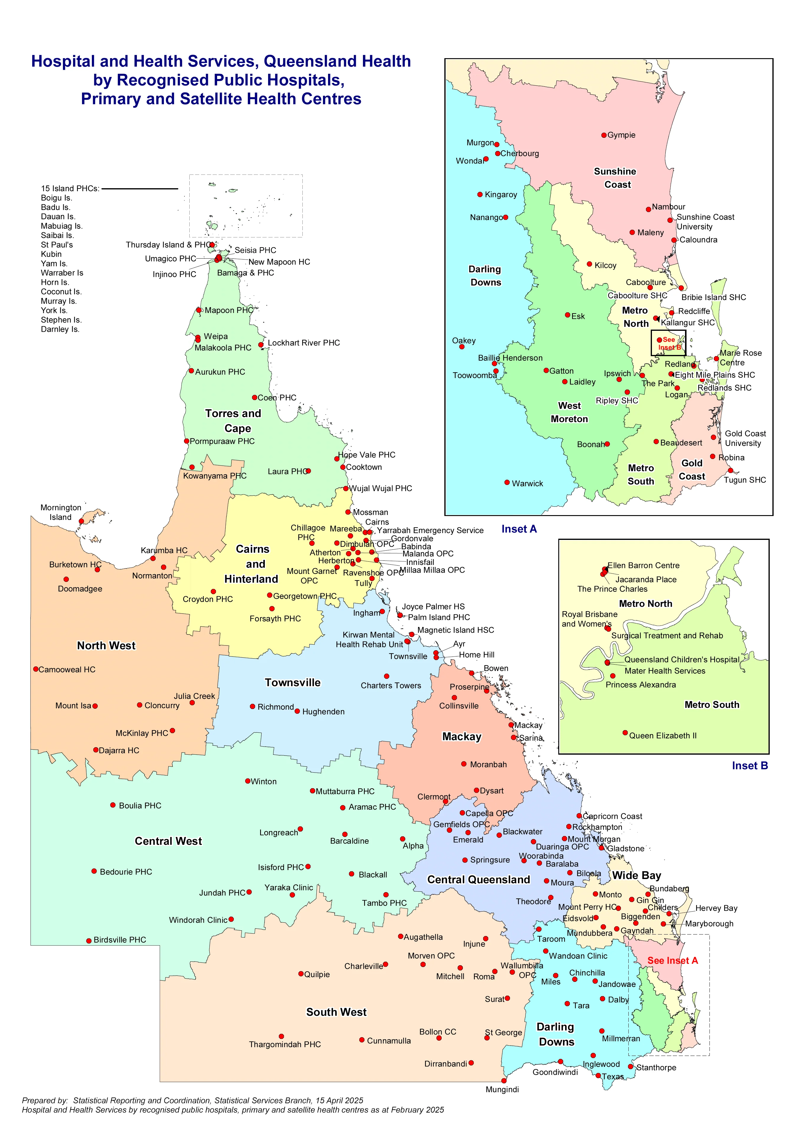
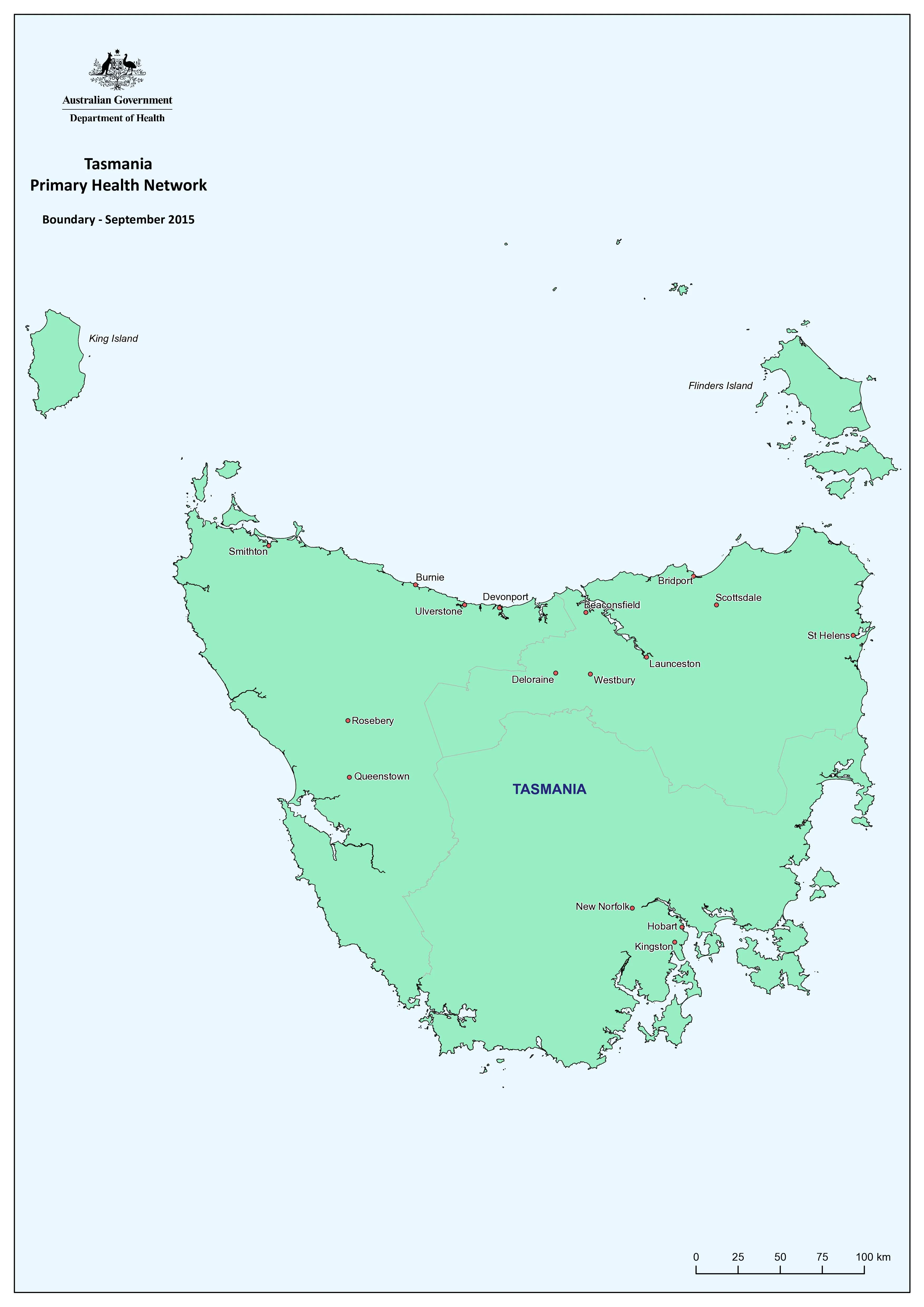
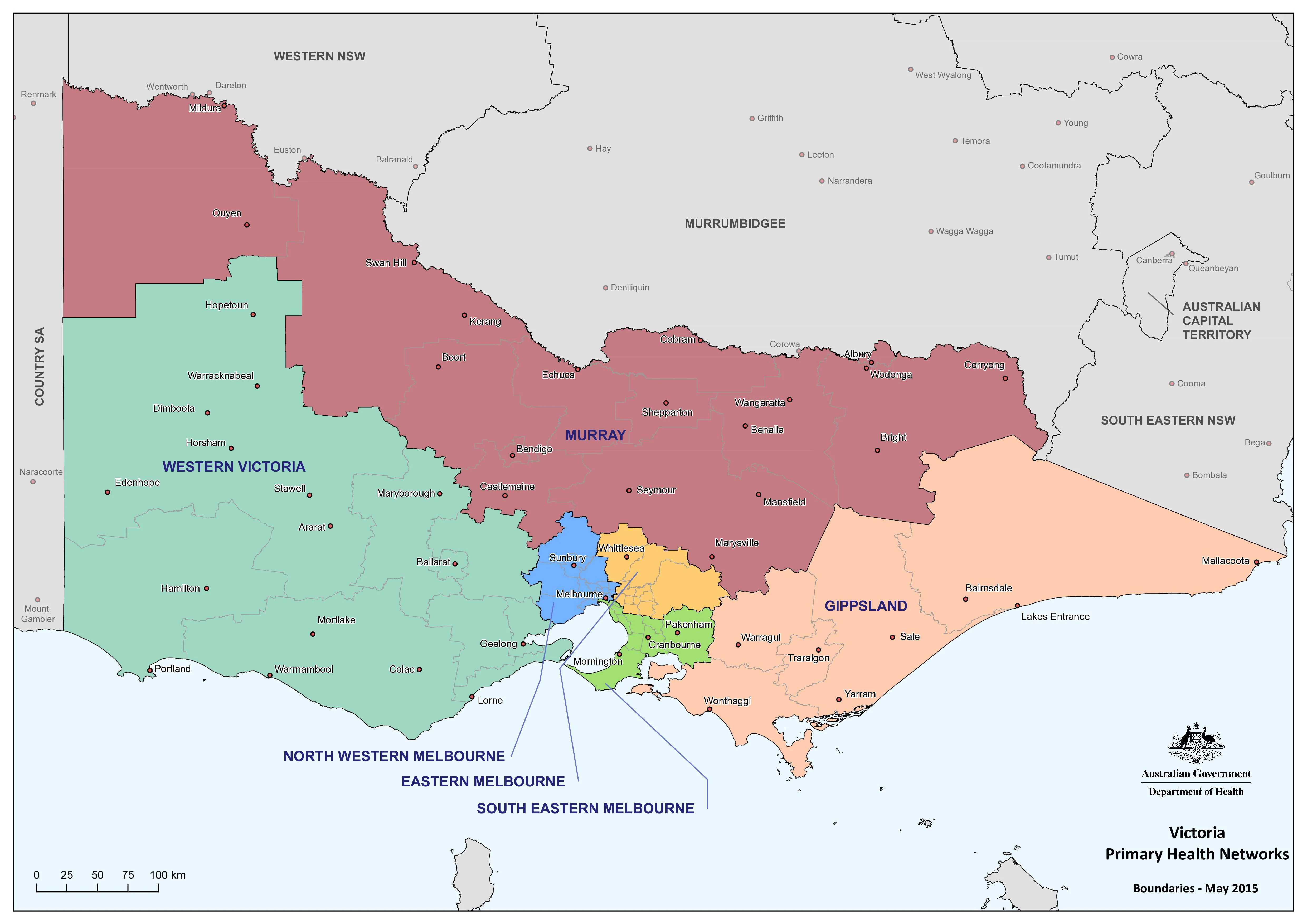
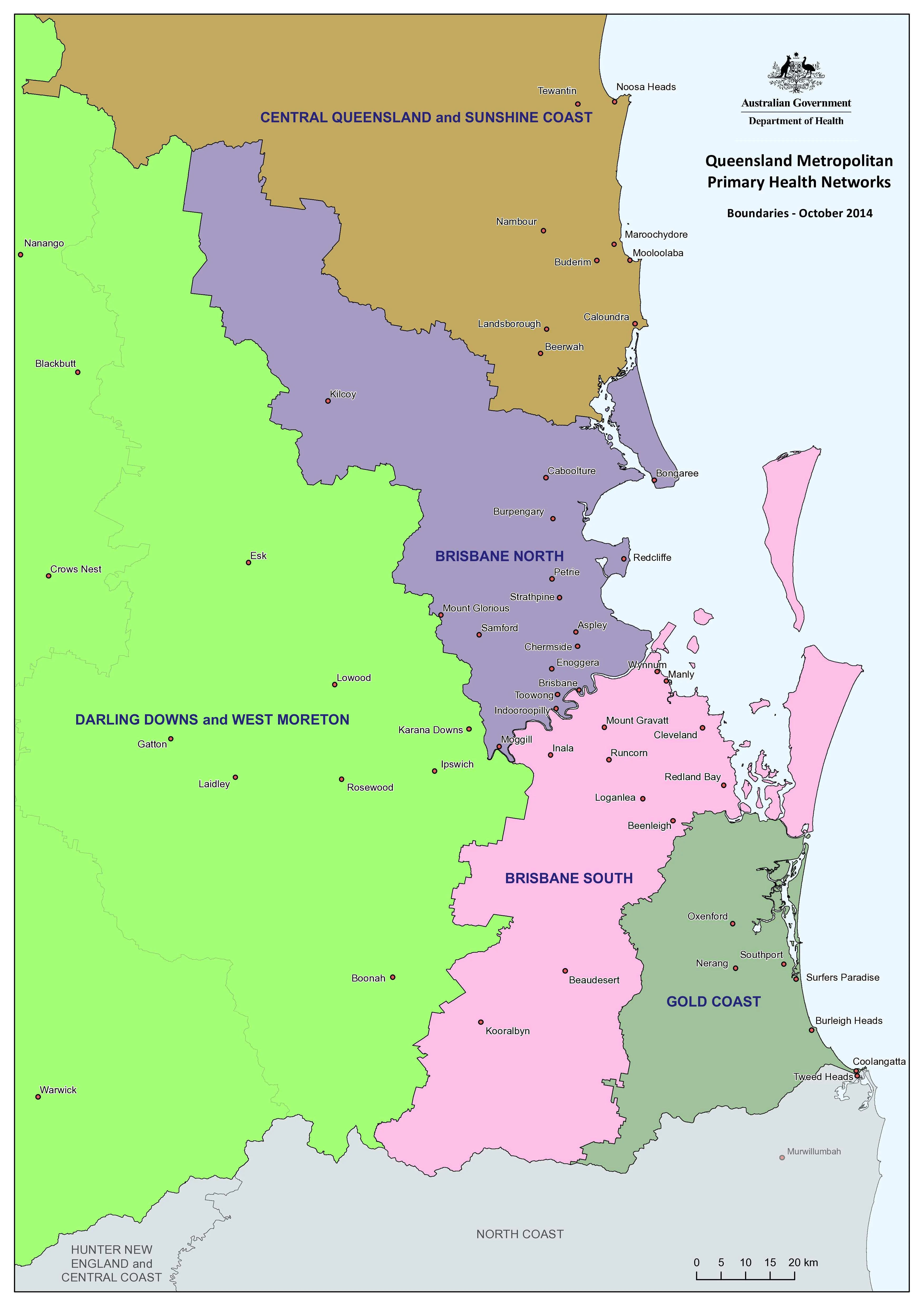
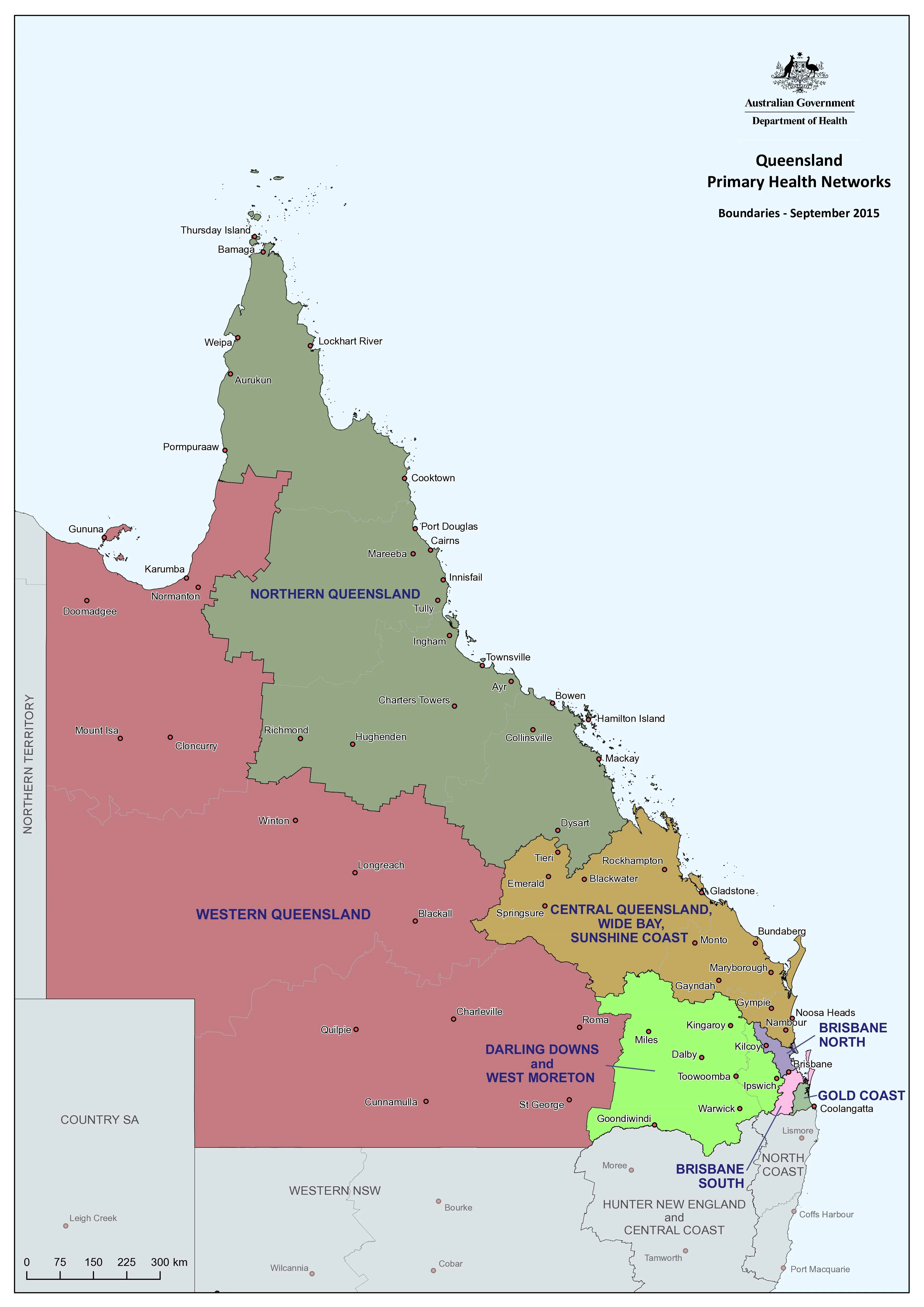
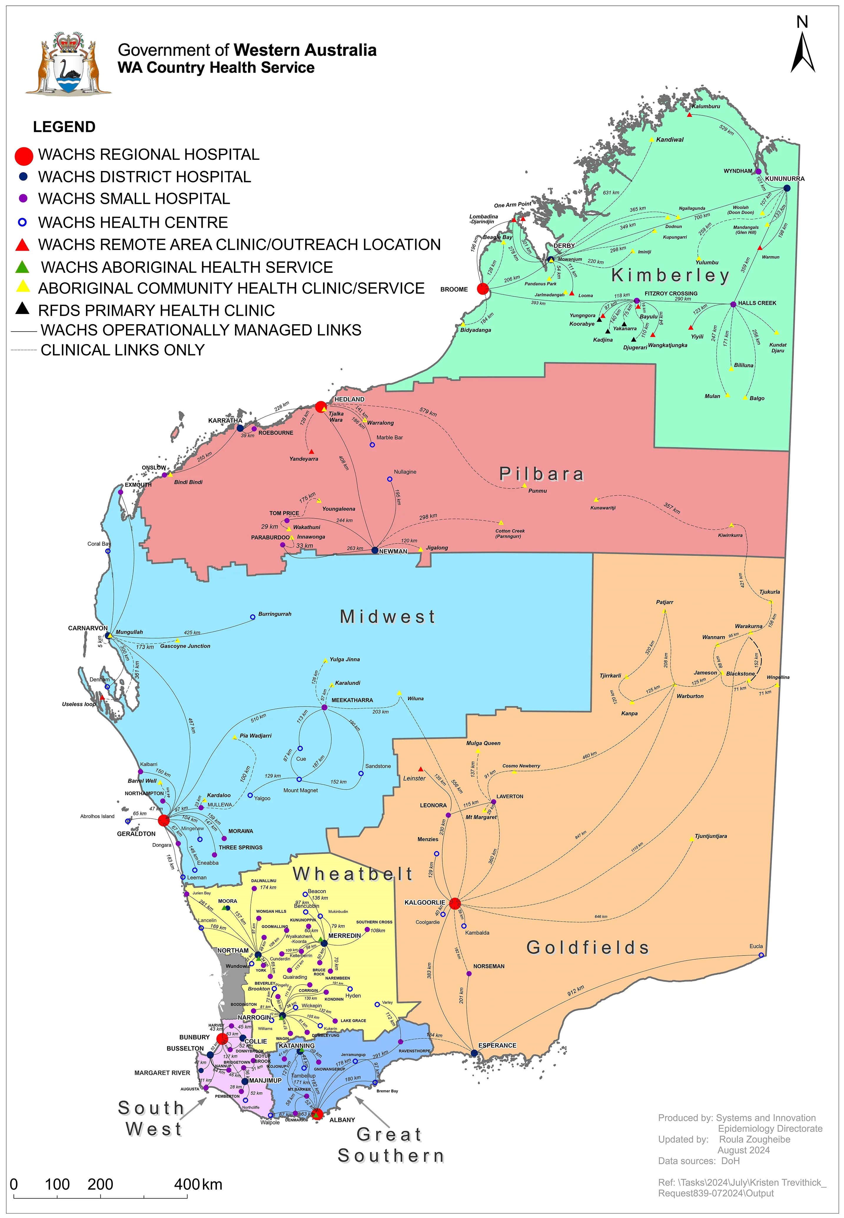
A definitive, wall-ready reference to the Western Australia Country Health Service (WACHS) network — 2024 Edition. This large-format map visualises one of the largest and most geographically complex public health systems in the world, spanning the Kimberley, Pilbara, Gascoyne, Midwest, Wheatbelt, Goldfields, Great Southern, and South West.
Designed for planning, operations, orientation, and education, the map clearly identifies regional health campuses, district hospitals, small hospitals, nursing posts, and health centres, supported by major towns, transport corridors, and regional context essential for real-world decision-making across rural and remote WA.
🗺️ At a Glance
-
Statewide WACHS network (2024) — regional hospitals, district and small hospitals, nursing posts, and health centres clearly symbolised and labelled
-
Regional clarity at scale — vast distances, service distribution, and isolation made immediately legible on a single wall map
-
Operational context — major towns, highways, and transport routes support referral, retrieval, and outreach planning
-
Wall-optimised design — balanced symbology and hierarchy for easy reading from across a room
🎯 Built for Real-World Use
-
Health system planning & coordination — coverage, service distribution, and regional dependencies
-
Emergency & surge response — escalation pathways, retrieval planning, and regional support
-
Operations & logistics — transport routes, workforce deployment, and outreach services
-
Workforce orientation & training — onboarding clinicians, allied health staff, students, and visiting specialists
-
Inter-agency coordination — shared visual reference for emergency services, NGOs, and regional partners
👥 Who It’s For
-
WACHS regional offices & health campuses — day-to-day reference, planning, and staff orientation
-
Hospitals, clinics & nursing posts — understanding service context, catchments, and referral pathways
-
Emergency Operations Centres (EOCs) — incident coordination, surge planning, and briefings
-
Universities & training providers — public health, nursing, paramedicine, and rural health education
-
NGOs & community health organisations — outreach planning and service navigation
-
Government & local authorities — strategic planning, infrastructure discussions, and policy support
📐 Sizes (Portrait)
-
Standard (S): 690 × 1000 mm — ideal for offices, clinics, staff rooms, and noticeboards
-
Large (L): 1040 × 1500 mm — maximum legibility for boardrooms, EOCs, and training environments
🎨 Materials, Print & Finishes
Every map is printed in Australia using professional equipment and Hewlett-Packard archival pigment inks for long-term clarity and durability.
📄 Paper — FSC 170 gsm matte-coated
-
Premium, glare-reduced stock
-
Ideal for framing under glass
-
Excellent line definition and colour accuracy
💧 Laminated — 120 gsm coated base + true encapsulation
-
Printed on 120 gsm coated paper with HP archival pigment inks
-
Fully encapsulated in 2 × 80-micron gloss laminate (edge-sealed)
-
Waterproof • Tear-resistant • Wipe-clean
-
Compatible with whiteboard markers and planning dots
🪵 Laminated + Timber Hang Rails (Ready to Hang)
-
Laminated map fitted with natural lacquered timber rails (top & bottom)
-
Supplied with top hanging cord — no framing required
-
Ideal for EOCs, planning rooms, and shared spaces
-
Please allow up to 10 working days for rail fitting
🎨 Canvas — HP 395 gsm Professional Matte Canvas
-
Gallery-grade canvas with refined, non-glare finish
-
Printed with HP archival pigment inks for excellent colour stability
🪵 Canvas + Timber Hang Rails
-
Canvas finished with lacquered timber rails (top & bottom) and hanging cord
-
Gallery-quality, ready-to-hang presentation
-
Please allow up to 10 working days for rail fitting
🧽 Use & Care
-
Laminated / Laminated + Rails — Use non-permanent whiteboard markers only. Wipe clean with a soft, dry cloth; for stubborn marks use a lightly damp microfiber cloth. Avoid alcohol or ammonia cleaners.
-
Paper — Frame under glass to protect the matte surface and archival inks.
-
Canvas — Dust gently with a dry microfiber cloth; avoid liquids and prolonged direct sunlight.
📊 Specifications
| Attribute | Details |
|---|---|
| Title | Western Australia Country Health Service Map |
| Edition | 2024 Edition |
| Coverage | Western Australia statewide |
| Content Layers | Regional Health Campuses; District Hospitals; Small Hospitals; Nursing Posts; Health Centres; major towns and transport corridors |
| Orientation | Portrait |
| Available Sizes | 690 × 1000 mm • 1040 × 1500 mm |
| Formats | Paper / Laminated / Laminated + Timber Hang Rails / Canvas / Canvas + Timber Hang Rails |
| Paper (Unlaminated) | FSC 170 gsm matte-coated |
| Laminated Base Paper | 120 gsm coated |
| Canvas | HP 395 gsm Professional Matte Canvas |
| Inks (All Formats) | Hewlett-Packard archival-grade pigment inks (fade-resistant) |
| Laminate | 2 × 80-micron gloss (true encapsulation) |
| Hang Rails | Natural timber, lacquered; top hanging cord |
🤝 Our Commitment
We produce every wall map with professional users and demanding environments in mind.
-
Printed in Australia — consistent quality, reliable supply, and local turnaround
-
Archival materials & pigment inks — long-term colour stability and clarity
-
Purpose-built finishes — from framable paper to write-on/wipe-off planning maps
-
Careful quality control & packing — each map is checked, protected, and shipped with care
🛒 Choose your size and finish — 2024 Edition
Available in 690 × 1000 mm or 1040 × 1500 mm, across Paper, Laminated, Laminated + Hang Rails, Canvas, or Canvas + Hang Rails — a trusted, professional reference for Western Australia’s country health network.
Original: $57.20
-65%$57.20
$20.02Product Information
Product Information
Shipping & Returns
Shipping & Returns
Description
Western Australia Country Health Service Map — 2024 Edition
Statewide Coverage • 690 × 1000 mm or 1040 × 1500 mm
A definitive, wall-ready reference to the Western Australia Country Health Service (WACHS) network — 2024 Edition. This large-format map visualises one of the largest and most geographically complex public health systems in the world, spanning the Kimberley, Pilbara, Gascoyne, Midwest, Wheatbelt, Goldfields, Great Southern, and South West.
Designed for planning, operations, orientation, and education, the map clearly identifies regional health campuses, district hospitals, small hospitals, nursing posts, and health centres, supported by major towns, transport corridors, and regional context essential for real-world decision-making across rural and remote WA.
🗺️ At a Glance
-
Statewide WACHS network (2024) — regional hospitals, district and small hospitals, nursing posts, and health centres clearly symbolised and labelled
-
Regional clarity at scale — vast distances, service distribution, and isolation made immediately legible on a single wall map
-
Operational context — major towns, highways, and transport routes support referral, retrieval, and outreach planning
-
Wall-optimised design — balanced symbology and hierarchy for easy reading from across a room
🎯 Built for Real-World Use
-
Health system planning & coordination — coverage, service distribution, and regional dependencies
-
Emergency & surge response — escalation pathways, retrieval planning, and regional support
-
Operations & logistics — transport routes, workforce deployment, and outreach services
-
Workforce orientation & training — onboarding clinicians, allied health staff, students, and visiting specialists
-
Inter-agency coordination — shared visual reference for emergency services, NGOs, and regional partners
👥 Who It’s For
-
WACHS regional offices & health campuses — day-to-day reference, planning, and staff orientation
-
Hospitals, clinics & nursing posts — understanding service context, catchments, and referral pathways
-
Emergency Operations Centres (EOCs) — incident coordination, surge planning, and briefings
-
Universities & training providers — public health, nursing, paramedicine, and rural health education
-
NGOs & community health organisations — outreach planning and service navigation
-
Government & local authorities — strategic planning, infrastructure discussions, and policy support
📐 Sizes (Portrait)
-
Standard (S): 690 × 1000 mm — ideal for offices, clinics, staff rooms, and noticeboards
-
Large (L): 1040 × 1500 mm — maximum legibility for boardrooms, EOCs, and training environments
🎨 Materials, Print & Finishes
Every map is printed in Australia using professional equipment and Hewlett-Packard archival pigment inks for long-term clarity and durability.
📄 Paper — FSC 170 gsm matte-coated
-
Premium, glare-reduced stock
-
Ideal for framing under glass
-
Excellent line definition and colour accuracy
💧 Laminated — 120 gsm coated base + true encapsulation
-
Printed on 120 gsm coated paper with HP archival pigment inks
-
Fully encapsulated in 2 × 80-micron gloss laminate (edge-sealed)
-
Waterproof • Tear-resistant • Wipe-clean
-
Compatible with whiteboard markers and planning dots
🪵 Laminated + Timber Hang Rails (Ready to Hang)
-
Laminated map fitted with natural lacquered timber rails (top & bottom)
-
Supplied with top hanging cord — no framing required
-
Ideal for EOCs, planning rooms, and shared spaces
-
Please allow up to 10 working days for rail fitting
🎨 Canvas — HP 395 gsm Professional Matte Canvas
-
Gallery-grade canvas with refined, non-glare finish
-
Printed with HP archival pigment inks for excellent colour stability
🪵 Canvas + Timber Hang Rails
-
Canvas finished with lacquered timber rails (top & bottom) and hanging cord
-
Gallery-quality, ready-to-hang presentation
-
Please allow up to 10 working days for rail fitting
🧽 Use & Care
-
Laminated / Laminated + Rails — Use non-permanent whiteboard markers only. Wipe clean with a soft, dry cloth; for stubborn marks use a lightly damp microfiber cloth. Avoid alcohol or ammonia cleaners.
-
Paper — Frame under glass to protect the matte surface and archival inks.
-
Canvas — Dust gently with a dry microfiber cloth; avoid liquids and prolonged direct sunlight.
📊 Specifications
| Attribute | Details |
|---|---|
| Title | Western Australia Country Health Service Map |
| Edition | 2024 Edition |
| Coverage | Western Australia statewide |
| Content Layers | Regional Health Campuses; District Hospitals; Small Hospitals; Nursing Posts; Health Centres; major towns and transport corridors |
| Orientation | Portrait |
| Available Sizes | 690 × 1000 mm • 1040 × 1500 mm |
| Formats | Paper / Laminated / Laminated + Timber Hang Rails / Canvas / Canvas + Timber Hang Rails |
| Paper (Unlaminated) | FSC 170 gsm matte-coated |
| Laminated Base Paper | 120 gsm coated |
| Canvas | HP 395 gsm Professional Matte Canvas |
| Inks (All Formats) | Hewlett-Packard archival-grade pigment inks (fade-resistant) |
| Laminate | 2 × 80-micron gloss (true encapsulation) |
| Hang Rails | Natural timber, lacquered; top hanging cord |
🤝 Our Commitment
We produce every wall map with professional users and demanding environments in mind.
-
Printed in Australia — consistent quality, reliable supply, and local turnaround
-
Archival materials & pigment inks — long-term colour stability and clarity
-
Purpose-built finishes — from framable paper to write-on/wipe-off planning maps
-
Careful quality control & packing — each map is checked, protected, and shipped with care
🛒 Choose your size and finish — 2024 Edition
Available in 690 × 1000 mm or 1040 × 1500 mm, across Paper, Laminated, Laminated + Hang Rails, Canvas, or Canvas + Hang Rails — a trusted, professional reference for Western Australia’s country health network.