Southern South America Atlas of the World, 11th Edition, National Geographic Wall Map
🌍 Southern South America – Atlas of the World, 11th Edition
Published: 2019 | Made in Australia
Available Formats: Paper • Laminated • Laminated with Hang Rails • Canvas • Canvas with Hang Rails
🗺 A Comprehensive View of Southern South America
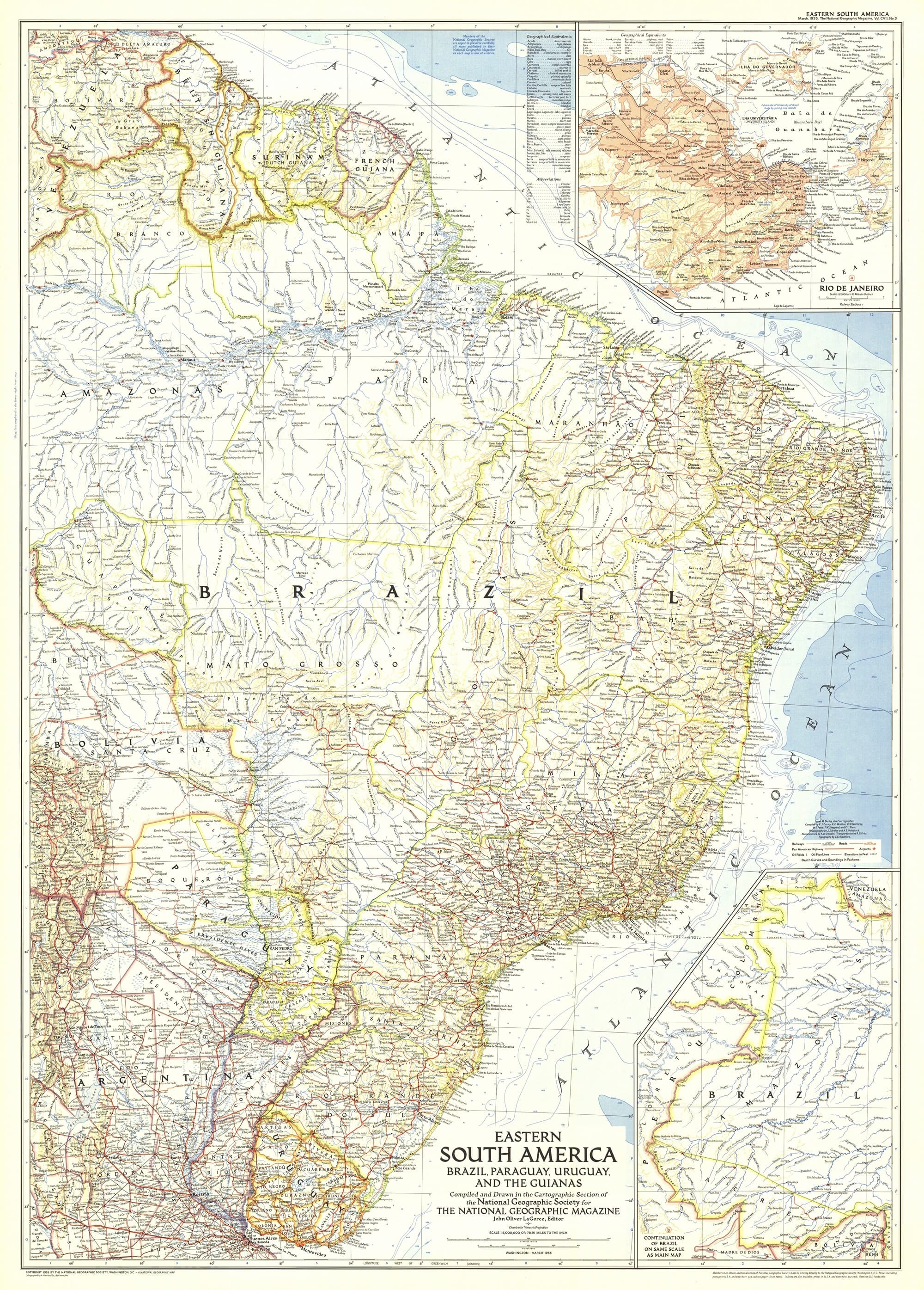
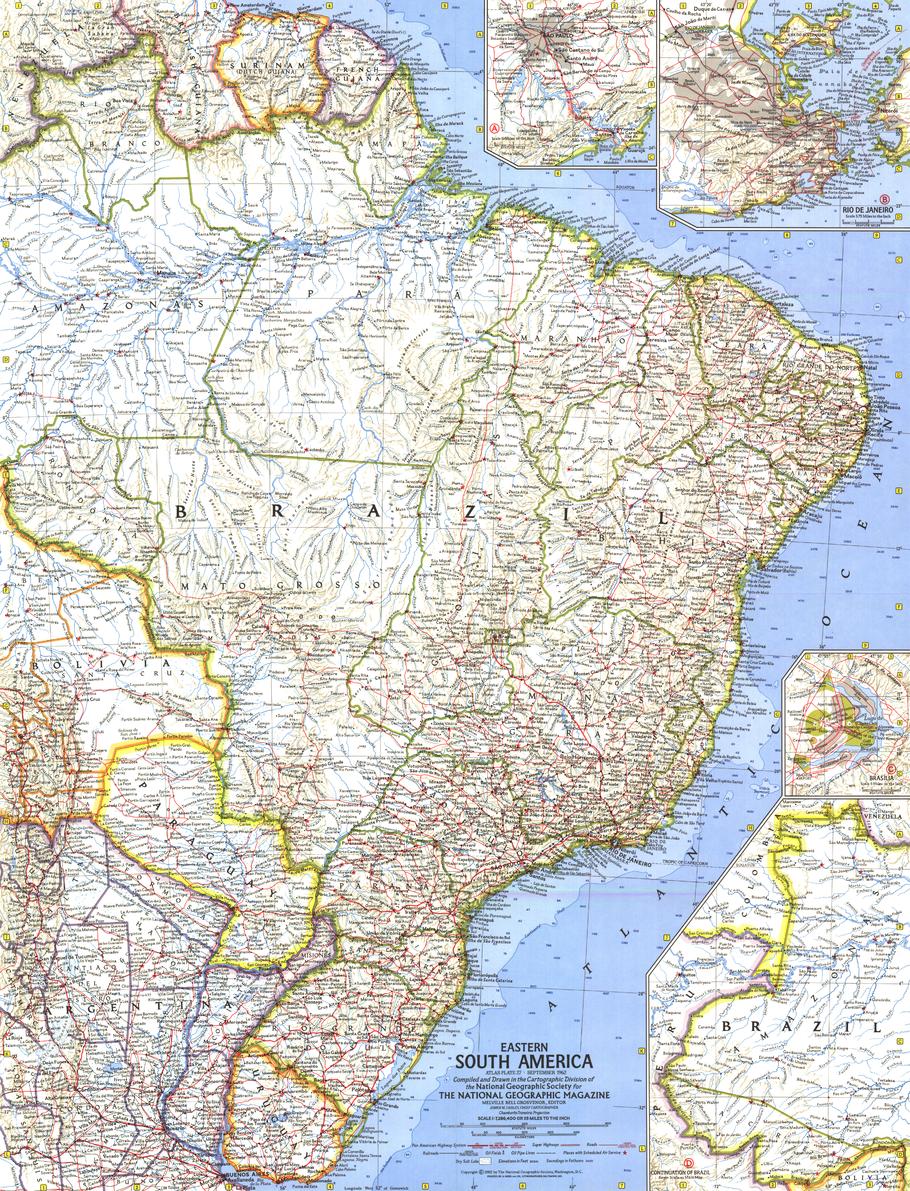
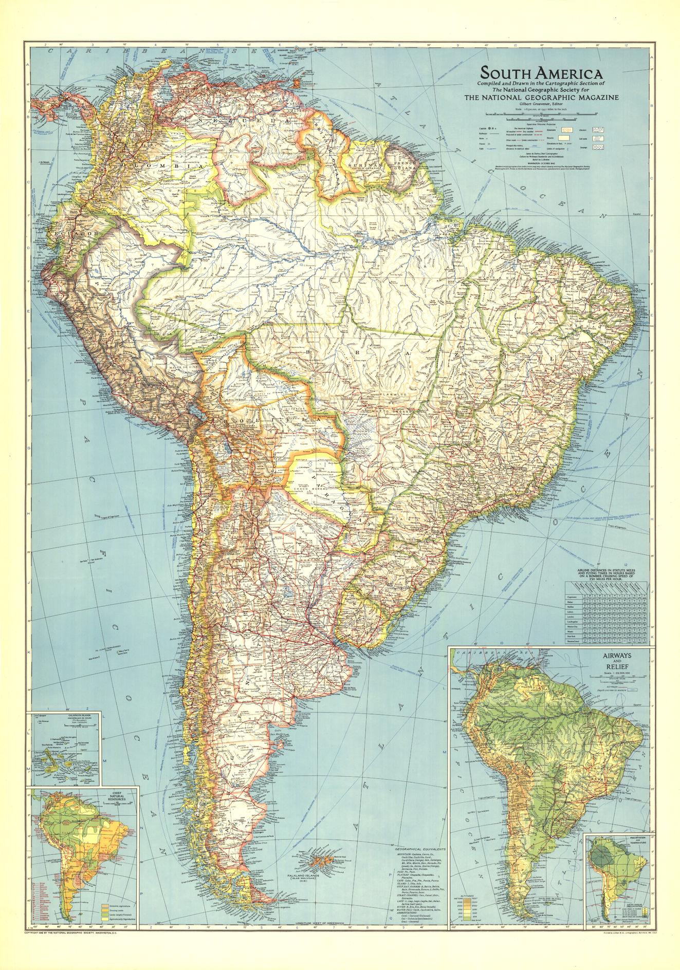
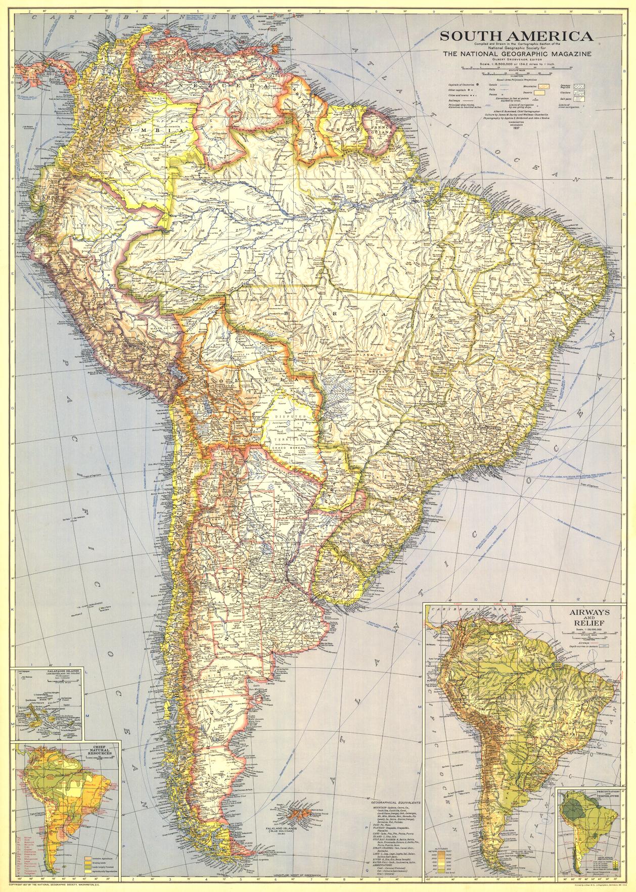
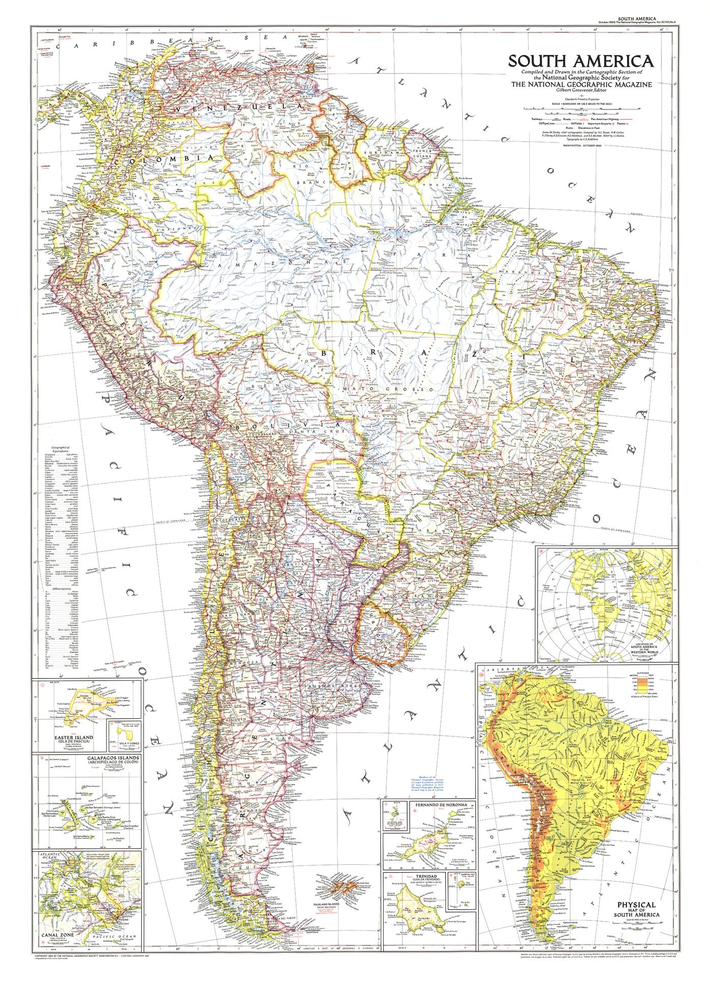
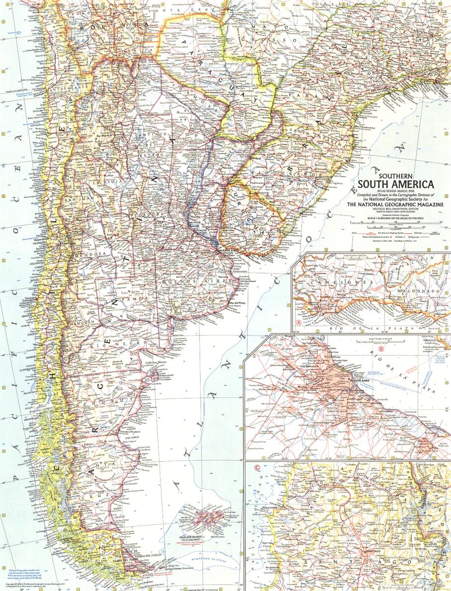
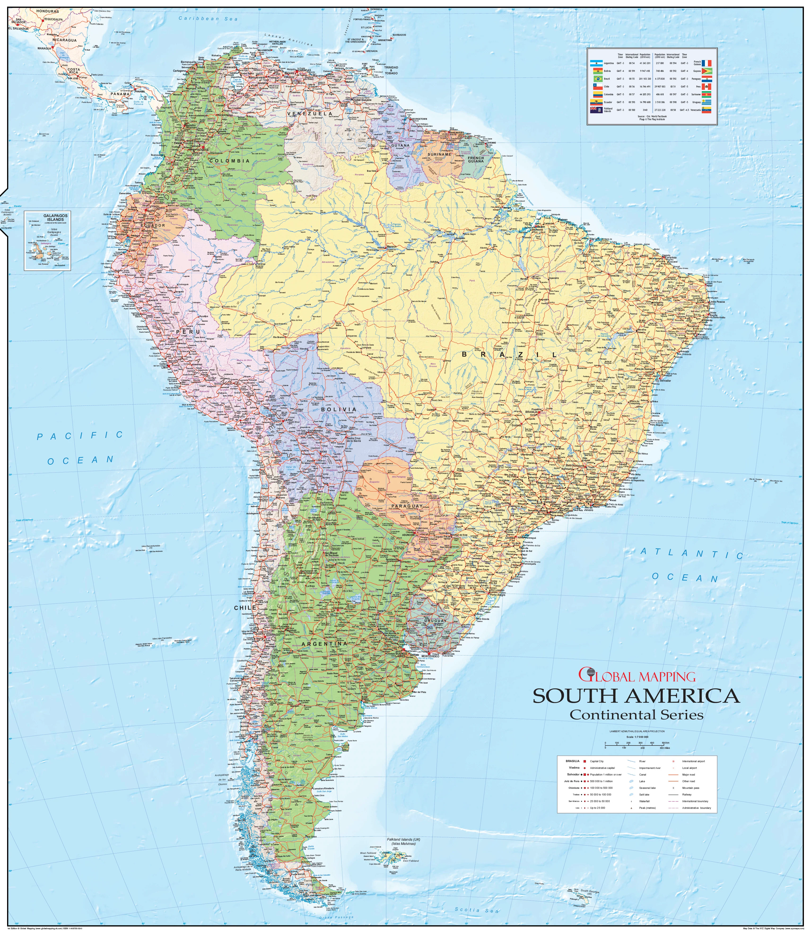
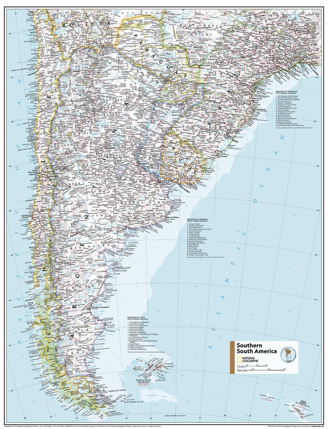
From the snow-capped Andes stretching along Chile’s spine to the fertile pampas of Argentina and the rugged coastlines of Uruguay, National Geographic’s Southern South America Wall Map captures the southern tip of the continent in meticulous political and physical detail.
Originally featured in the 11th Edition National Geographic World Atlas, this map is now available as a stand-alone wall map, making it perfect for classrooms, libraries, offices, and home study spaces.
📐 Cartographic Excellence
This map blends political boundaries with physical features, allowing viewers to understand the region’s geography in context:
-
Country Borders & Capitals – Clearly marked for Argentina, Chile, Paraguay, and Uruguay.
-
Regional Lists with Capitals – Includes a detailed list of each region within Chile, Paraguay, and Uruguay, with their administrative capitals.
-
Physical Features in Context – Major rivers, mountain ranges, and coastal features are accurately placed.
-
Bright, Accessible Colour Palette – Blue oceans, green lowlands, and shaded relief for mountains—maintaining National Geographic’s trademark style.
-
Azimuthal Equidistant Projection – Ensures all points are shown at proportionally correct distances from the map’s centre.
-
Thoughtful Label Placement – Names and boundaries positioned for maximum legibility without clutter.
🖌 Premium Printing & Display Options
Choose the finish that best suits your purpose and style:
| Format | Best For | Details |
|---|---|---|
| Paper (160 gsm) | Framing | Heavyweight matte-coated stock for sharp, detailed printing. |
| Laminated | Frequent Use | Fully encapsulated in 80-micron gloss laminate for durability. |
| Laminated + Hang Rails | Ready-to-Hang | Lamination plus natural timber hang rails and hanging cord. |
| Canvas (395 gsm) | Premium Display | Museum-grade matte canvas with archival pigment inks for rich, fade-resistant colour. |
| Canvas + Hang Rails | Statement Piece | Canvas with natural timber hang rails for effortless installation. |
Note: Please allow 10 working days for delivery of hang-railed maps, as each is custom-mounted by our professional framer.
📏 Available Sizes
| Size Name | Dimensions (mm) | Dimensions (inches) | Best For |
|---|---|---|---|
| Standard | 798 × 610 mm | 31.4 × 24.0 in | Compact spaces, smaller classrooms, home offices. |
| Supermap | 915 × 1197 mm | 36.0 × 47.1 in | Large teaching spaces, libraries, boardrooms, feature walls. |
🎯 Ideal For
-
Educators – Visual aid for teaching both political and physical geography.
-
Students & Researchers – Reliable, detailed reference.
-
Geography Enthusiasts – A premium National Geographic collectible.
-
Interior Spaces – Adds sophistication and substance to offices, studies, or libraries.
✨ Why This Map Stands Out
-
Combines political clarity with physical depth for a richer understanding of the region.
-
Features regional capital listings for Chile, Paraguay, and Uruguay—ideal for academic use.
-
Printed with fade-resistant archival inks on premium materials.
-
Proudly made in Australia with meticulous attention to detail.
📍 Bring the southern tip of South America into focus with a map that is as beautiful as it is informative—crafted to last, ready to inspire, and designed to be enjoyed for years to come.
Original: $50.05
-65%$50.05
$17.52Product Information
Product Information
Shipping & Returns
Shipping & Returns
Description
🌍 Southern South America – Atlas of the World, 11th Edition
Published: 2019 | Made in Australia
Available Formats: Paper • Laminated • Laminated with Hang Rails • Canvas • Canvas with Hang Rails
🗺 A Comprehensive View of Southern South America
From the snow-capped Andes stretching along Chile’s spine to the fertile pampas of Argentina and the rugged coastlines of Uruguay, National Geographic’s Southern South America Wall Map captures the southern tip of the continent in meticulous political and physical detail.
Originally featured in the 11th Edition National Geographic World Atlas, this map is now available as a stand-alone wall map, making it perfect for classrooms, libraries, offices, and home study spaces.
📐 Cartographic Excellence
This map blends political boundaries with physical features, allowing viewers to understand the region’s geography in context:
-
Country Borders & Capitals – Clearly marked for Argentina, Chile, Paraguay, and Uruguay.
-
Regional Lists with Capitals – Includes a detailed list of each region within Chile, Paraguay, and Uruguay, with their administrative capitals.
-
Physical Features in Context – Major rivers, mountain ranges, and coastal features are accurately placed.
-
Bright, Accessible Colour Palette – Blue oceans, green lowlands, and shaded relief for mountains—maintaining National Geographic’s trademark style.
-
Azimuthal Equidistant Projection – Ensures all points are shown at proportionally correct distances from the map’s centre.
-
Thoughtful Label Placement – Names and boundaries positioned for maximum legibility without clutter.
🖌 Premium Printing & Display Options
Choose the finish that best suits your purpose and style:
| Format | Best For | Details |
|---|---|---|
| Paper (160 gsm) | Framing | Heavyweight matte-coated stock for sharp, detailed printing. |
| Laminated | Frequent Use | Fully encapsulated in 80-micron gloss laminate for durability. |
| Laminated + Hang Rails | Ready-to-Hang | Lamination plus natural timber hang rails and hanging cord. |
| Canvas (395 gsm) | Premium Display | Museum-grade matte canvas with archival pigment inks for rich, fade-resistant colour. |
| Canvas + Hang Rails | Statement Piece | Canvas with natural timber hang rails for effortless installation. |
Note: Please allow 10 working days for delivery of hang-railed maps, as each is custom-mounted by our professional framer.
📏 Available Sizes
| Size Name | Dimensions (mm) | Dimensions (inches) | Best For |
|---|---|---|---|
| Standard | 798 × 610 mm | 31.4 × 24.0 in | Compact spaces, smaller classrooms, home offices. |
| Supermap | 915 × 1197 mm | 36.0 × 47.1 in | Large teaching spaces, libraries, boardrooms, feature walls. |
🎯 Ideal For
-
Educators – Visual aid for teaching both political and physical geography.
-
Students & Researchers – Reliable, detailed reference.
-
Geography Enthusiasts – A premium National Geographic collectible.
-
Interior Spaces – Adds sophistication and substance to offices, studies, or libraries.
✨ Why This Map Stands Out
-
Combines political clarity with physical depth for a richer understanding of the region.
-
Features regional capital listings for Chile, Paraguay, and Uruguay—ideal for academic use.
-
Printed with fade-resistant archival inks on premium materials.
-
Proudly made in Australia with meticulous attention to detail.
📍 Bring the southern tip of South America into focus with a map that is as beautiful as it is informative—crafted to last, ready to inspire, and designed to be enjoyed for years to come.