50 Miles around Manchester 1228 x 871mm Wall Map
Plan, Explore, and Navigate the North with Confidence
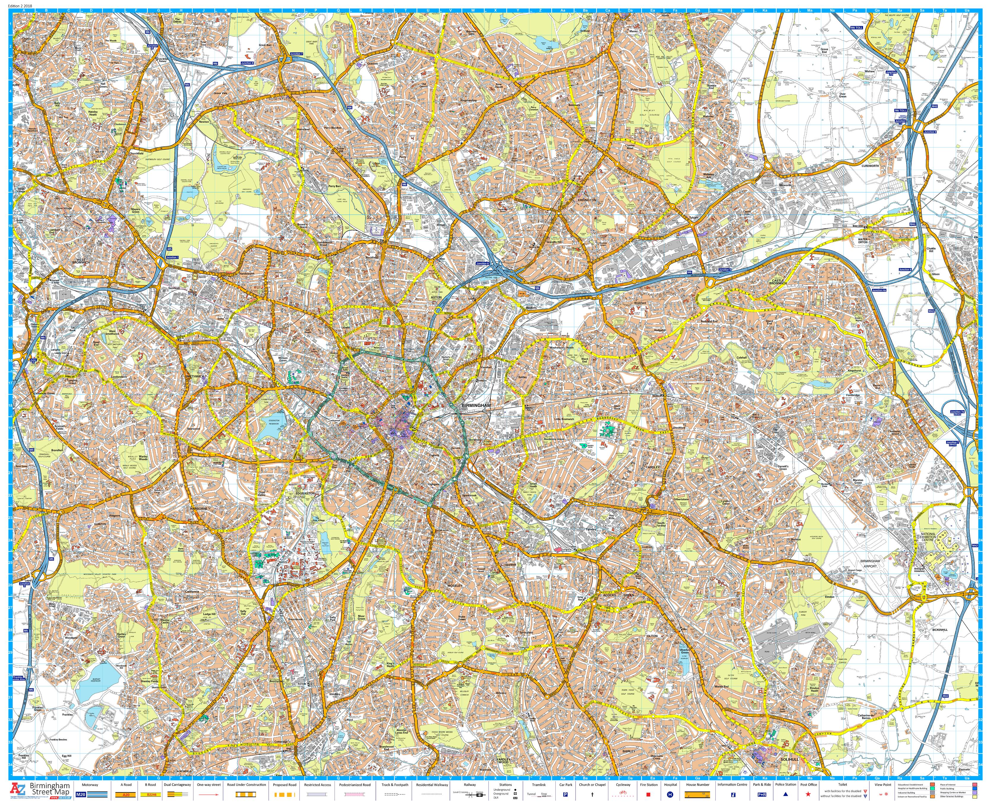
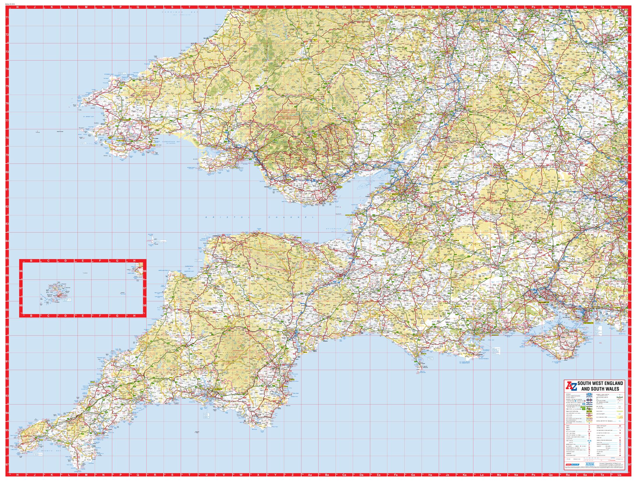
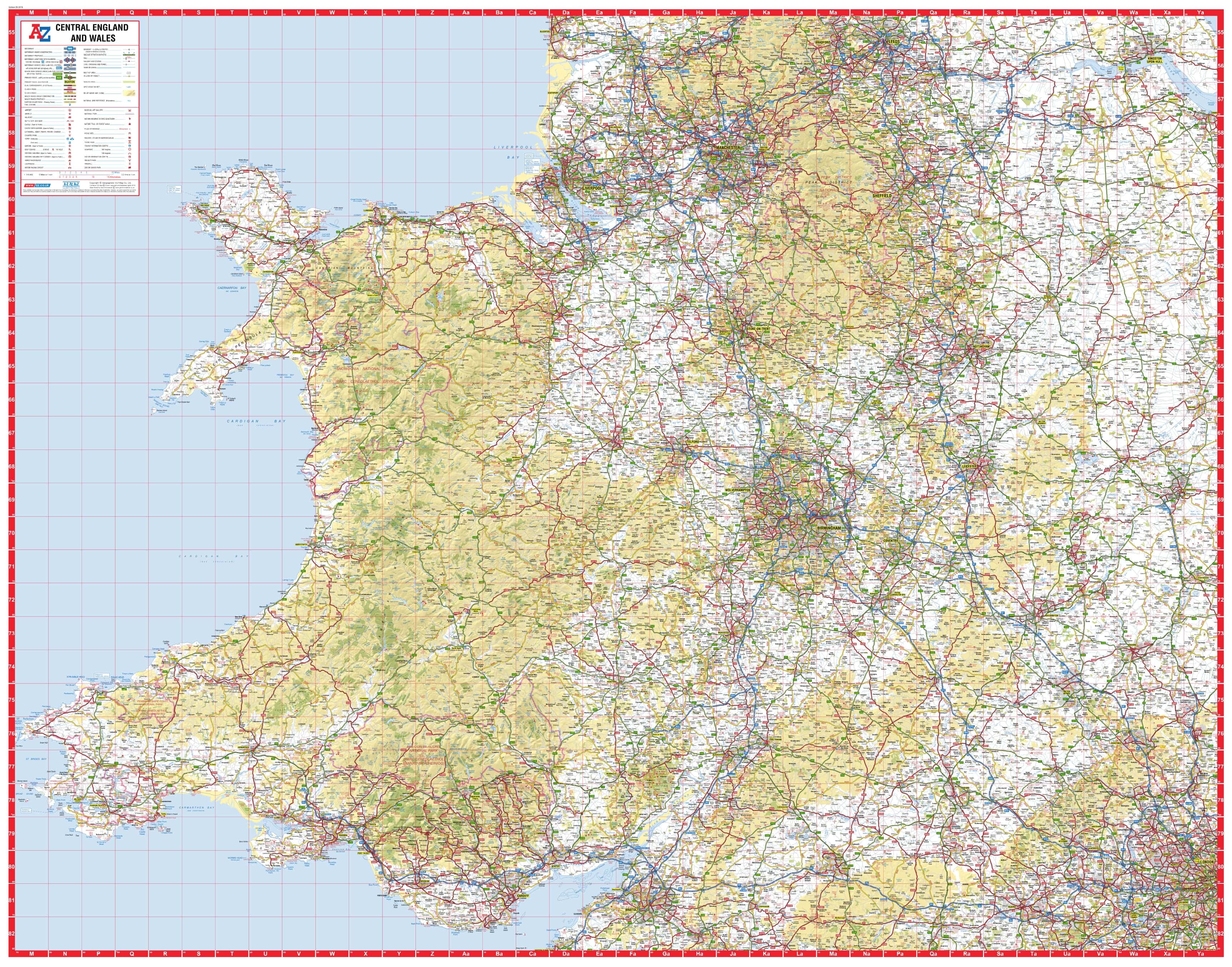
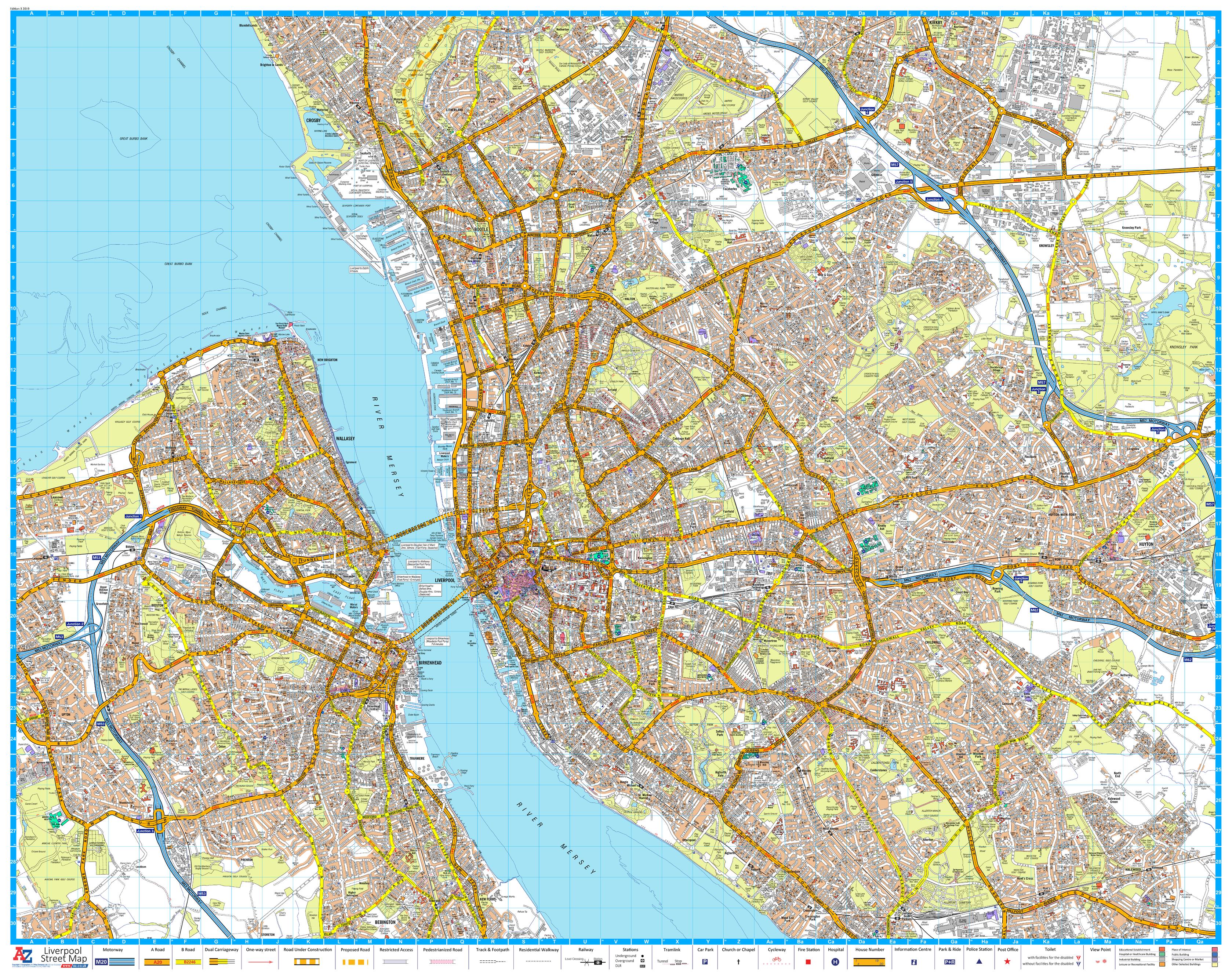
Capture the full scope of Northern England with the 50 Miles Around Manchester Wall Map by A-Z — a highly detailed road map designed to bring the Greater Manchester region and its surrounding counties into full perspective. Whether you're planning routes, analysing coverage zones, or simply appreciating the geography of the North, this striking wall map is a powerful visual tool for home, office, or classroom use.
With coverage extending in all directions—across coastlines, national parks, and major cities—this large-format map provides unrivalled clarity and scale for business, travel, or education.
🧭 Coverage Highlights
This map spans an impressive circular area centred on Manchester and includes dozens of key destinations across the North and Midlands, such as:
-
🏙️ Northwest & Coastal – Liverpool, Birkenhead, Southport, Blackpool, Fleetwood, Barrow-in-Furness
-
🏞️ North & Northeast – Kirby Lonsdale, Ripon, York, Selby
-
🛤️ East Midlands – Doncaster, Worksop, Mansfield, Nottingham, Loughborough
-
🌳 West & Southwest – Cannock, Telford, Shrewsbury, Llangadfan
-
🎯 Core Focus – Manchester and the full Greater Manchester region
Ideal for logistics planning, educational reference, or simply appreciating the geography of northern England, this map offers unmatched detail in a single sheet.
🗺️ Map Features at a Glance
| ✅ Feature | 📋 Description |
|---|---|
| Full Road Network | Clearly marked motorways, A-roads, B-roads, and smaller connecting routes |
| Settlements & Cities | Towns, villages, and urban areas clearly labelled |
| Topographical Detail | Rivers, coastline, hills, and landscape features for regional context |
| Administrative Boundaries | County lines and major local authority borders |
| Radius | Covers approximately 50 miles in every direction from Manchester |
📐 Specifications
| 🔧 Specification | 📍 Details |
|---|---|
| Title | 50 Miles Around Manchester Wall Map |
| Publisher | A-Z Maps (Geographers' A–Z) |
| Edition | 2019 |
| Scale | 1:202,752 |
| Map Size | 1228 mm (W) × 871 mm (H) |
🖨️ Available Format Options
| 📄 Format | 📋 Description |
|---|---|
| Paper | Printed on heavyweight 160 gsm coated paper — suitable for pinning or framing |
| Laminated | Fully encapsulated with 80-micron gloss laminate — durable, wipe-clean surface |
| Laminated with Hang Rails | Supplied with elegant timber rails and hanging cord — ready for immediate display |
| Canvas | Printed on 395 gsm HP Matte Canvas with pigment inks — rich, fade-resistant finish |
| Canvas with Hang Rails | A luxurious hanging version with wooden rails — ideal for offices or public spaces |
👤 Perfect For:
| 🏢 Use Case | ✅ Ideal For |
|---|---|
| Business & Transport Teams | Route planning, delivery zones, regional strategy |
| Educators & Institutions | Teaching northern England geography, urban development |
| Home or Office Display | Add visual interest and regional knowledge to any wall |
| Local Government & Planning | Catchment areas, infrastructure projects, public display |
Whether you're managing a team, planning a journey, or decorating with a geographic touch, the 50 Miles Around Manchester A-Z Wall Map offers precision, elegance, and extraordinary coverage in one stunning view.
Please allow up to 10 working days for delivery of hang-railed maps, as they are custom-mounted by our professional framer.
📌 Bring the North into sharp focus — and elevate your planning or décor today.
Original: $50.05
-65%$50.05
$17.52Product Information
Product Information
Shipping & Returns
Shipping & Returns
Description
Plan, Explore, and Navigate the North with Confidence
Capture the full scope of Northern England with the 50 Miles Around Manchester Wall Map by A-Z — a highly detailed road map designed to bring the Greater Manchester region and its surrounding counties into full perspective. Whether you're planning routes, analysing coverage zones, or simply appreciating the geography of the North, this striking wall map is a powerful visual tool for home, office, or classroom use.
With coverage extending in all directions—across coastlines, national parks, and major cities—this large-format map provides unrivalled clarity and scale for business, travel, or education.
🧭 Coverage Highlights
This map spans an impressive circular area centred on Manchester and includes dozens of key destinations across the North and Midlands, such as:
-
🏙️ Northwest & Coastal – Liverpool, Birkenhead, Southport, Blackpool, Fleetwood, Barrow-in-Furness
-
🏞️ North & Northeast – Kirby Lonsdale, Ripon, York, Selby
-
🛤️ East Midlands – Doncaster, Worksop, Mansfield, Nottingham, Loughborough
-
🌳 West & Southwest – Cannock, Telford, Shrewsbury, Llangadfan
-
🎯 Core Focus – Manchester and the full Greater Manchester region
Ideal for logistics planning, educational reference, or simply appreciating the geography of northern England, this map offers unmatched detail in a single sheet.
🗺️ Map Features at a Glance
| ✅ Feature | 📋 Description |
|---|---|
| Full Road Network | Clearly marked motorways, A-roads, B-roads, and smaller connecting routes |
| Settlements & Cities | Towns, villages, and urban areas clearly labelled |
| Topographical Detail | Rivers, coastline, hills, and landscape features for regional context |
| Administrative Boundaries | County lines and major local authority borders |
| Radius | Covers approximately 50 miles in every direction from Manchester |
📐 Specifications
| 🔧 Specification | 📍 Details |
|---|---|
| Title | 50 Miles Around Manchester Wall Map |
| Publisher | A-Z Maps (Geographers' A–Z) |
| Edition | 2019 |
| Scale | 1:202,752 |
| Map Size | 1228 mm (W) × 871 mm (H) |
🖨️ Available Format Options
| 📄 Format | 📋 Description |
|---|---|
| Paper | Printed on heavyweight 160 gsm coated paper — suitable for pinning or framing |
| Laminated | Fully encapsulated with 80-micron gloss laminate — durable, wipe-clean surface |
| Laminated with Hang Rails | Supplied with elegant timber rails and hanging cord — ready for immediate display |
| Canvas | Printed on 395 gsm HP Matte Canvas with pigment inks — rich, fade-resistant finish |
| Canvas with Hang Rails | A luxurious hanging version with wooden rails — ideal for offices or public spaces |
👤 Perfect For:
| 🏢 Use Case | ✅ Ideal For |
|---|---|
| Business & Transport Teams | Route planning, delivery zones, regional strategy |
| Educators & Institutions | Teaching northern England geography, urban development |
| Home or Office Display | Add visual interest and regional knowledge to any wall |
| Local Government & Planning | Catchment areas, infrastructure projects, public display |
Whether you're managing a team, planning a journey, or decorating with a geographic touch, the 50 Miles Around Manchester A-Z Wall Map offers precision, elegance, and extraordinary coverage in one stunning view.
Please allow up to 10 working days for delivery of hang-railed maps, as they are custom-mounted by our professional framer.
📌 Bring the North into sharp focus — and elevate your planning or décor today.