Jamaica & Cayman Islands ITMB - West Indies Map
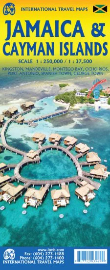
🇯🇲 Jamaica & 🇰🇾 Cayman Islands Travel Map by ITMB
Explore Two Caribbean Jewels in One Practical, Double-Sided Map
Scale: 1:37,500 / 1:250,000 | Size: 690 mm x 990 mm | Double-Sided Map
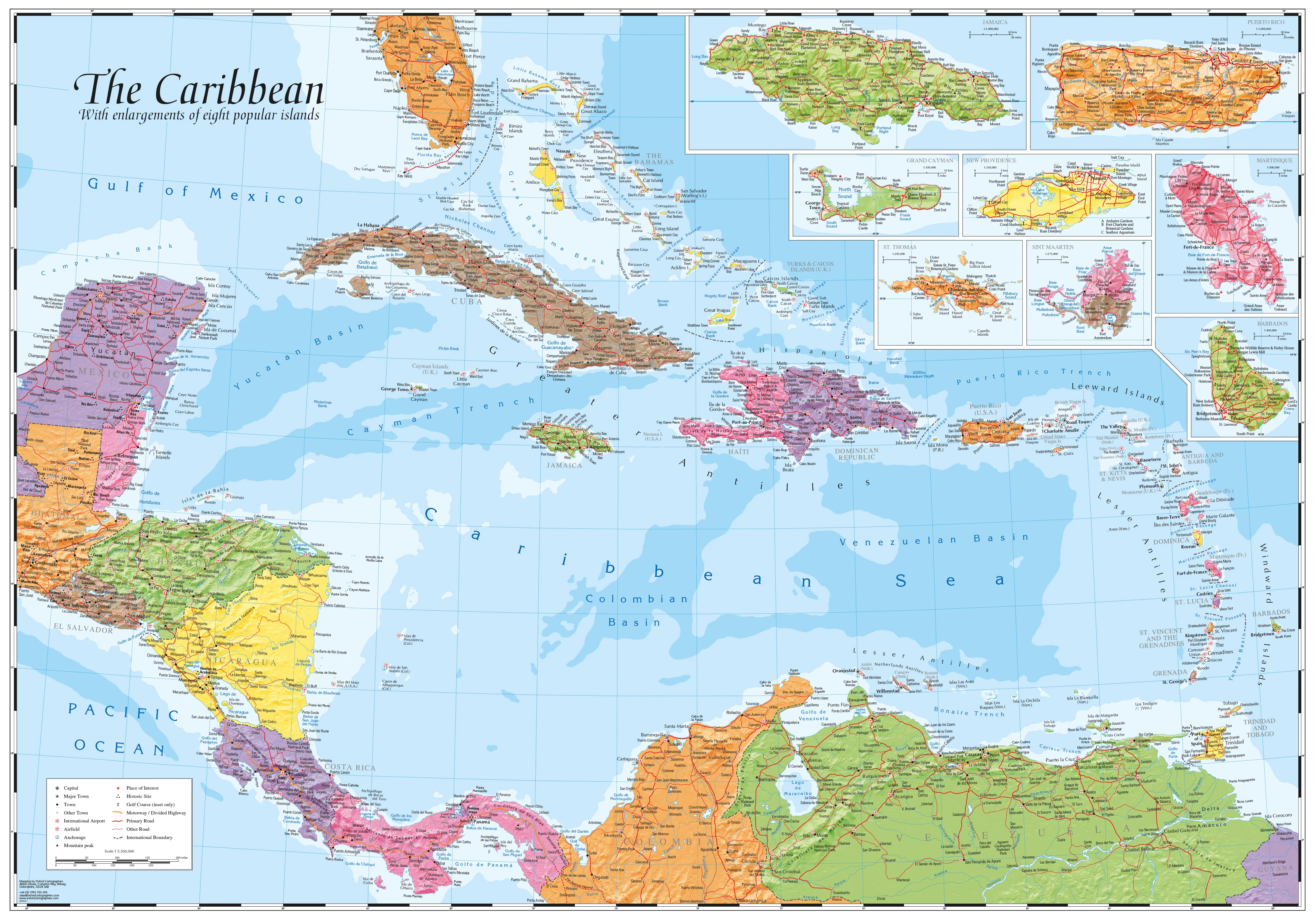
Discover the tropical allure of the Caribbean with this detailed, double-sided ITMB travel map featuring both the Cayman Islands and Jamaica. Whether you’re diving into the crystal-clear waters of Grand Cayman or tracing the reggae rhythms of Kingston, this map is an essential tool for adventurers, island hoppers, and travel planners alike.
🗺️ Map Coverage & Features
Side A – Cayman Islands (Scale 1:37,500):
-
Covers Grand Cayman, Cayman Brac, and Little Cayman, along with key cayes and islets
-
Detailed street maps of George Town, major resorts, and residential areas
-
Dive sites and marine attractions clearly marked – over 100 locations ideal for snorkelling and scuba diving
-
Local highlights such as:
-
The quirky geological formation known as Hell
-
Seven Mile Beach, one of the Caribbean’s most famous stretches of sand
-
Gas stations, hotels, shopping areas, and every named street
-
Side B – Jamaica (Scale 1:250,000):
-
Full island map of Jamaica with terrain and topography shading
-
City detail for Kingston, Montego Bay, Negril, and Ocho Rios
-
Road network including highways, secondary roads, and rural tracks
-
Points of interest including:
-
Cultural and historical sites
-
Waterfalls and beaches
-
National parks and eco-tourism areas
-
🌴 Why Choose This Map?
| Feature | Benefit |
|---|---|
| Double-Sided Format | Get two destinations in one compact map |
| Diving & Marine Detail | Perfect for scuba divers and snorkelers |
| Full Road Network | Navigate urban centres and rural regions with confidence |
| Durable Paper Format | Lightweight and ideal for packing into your day bag or travel pouch |
| Local Insight | Shows lesser-known spots like Hell and hidden beaches |
| British Territories Info | Useful for understanding administrative divisions and colonial history |
🧭 Map Specifications
| Attribute | Detail |
|---|---|
| Title | Jamaica & Cayman Islands – ITMB Map |
| Publisher | ITMB (International Travel Maps) |
| Map Type | Folded Travel Map |
| Scale | 1:37,500 (Cayman Islands) / 1:250,000 (Jamaica) |
| Sheet Size | 690 mm x 990 mm |
| Printing | Double-sided, full-colour |
🧳 Ideal For:
-
🚗 Self-drive holidays and island tours
-
🏝️ Beach and resort planning
-
🤿 Diving trips in Grand Cayman
-
🎵 Cultural exploration in Jamaica
-
🗺️ Travel agents and tour operators planning Caribbean itineraries
✨ Optional Upgrade – Laminated Version Available
Upgrade to a laminated edition for enhanced durability:
-
Mark routes with whiteboard markers
-
Use map dots or pins
-
Resistant to water, stains, and tears
(Note: Laminated maps may show faint original fold lines due to the flattening process.)
Original: $17.85
-65%$17.85
$6.25Product Information
Product Information
Shipping & Returns
Shipping & Returns
Description
🇯🇲 Jamaica & 🇰🇾 Cayman Islands Travel Map by ITMB
Explore Two Caribbean Jewels in One Practical, Double-Sided Map
Scale: 1:37,500 / 1:250,000 | Size: 690 mm x 990 mm | Double-Sided Map
Discover the tropical allure of the Caribbean with this detailed, double-sided ITMB travel map featuring both the Cayman Islands and Jamaica. Whether you’re diving into the crystal-clear waters of Grand Cayman or tracing the reggae rhythms of Kingston, this map is an essential tool for adventurers, island hoppers, and travel planners alike.
🗺️ Map Coverage & Features
Side A – Cayman Islands (Scale 1:37,500):
-
Covers Grand Cayman, Cayman Brac, and Little Cayman, along with key cayes and islets
-
Detailed street maps of George Town, major resorts, and residential areas
-
Dive sites and marine attractions clearly marked – over 100 locations ideal for snorkelling and scuba diving
-
Local highlights such as:
-
The quirky geological formation known as Hell
-
Seven Mile Beach, one of the Caribbean’s most famous stretches of sand
-
Gas stations, hotels, shopping areas, and every named street
-
Side B – Jamaica (Scale 1:250,000):
-
Full island map of Jamaica with terrain and topography shading
-
City detail for Kingston, Montego Bay, Negril, and Ocho Rios
-
Road network including highways, secondary roads, and rural tracks
-
Points of interest including:
-
Cultural and historical sites
-
Waterfalls and beaches
-
National parks and eco-tourism areas
-
🌴 Why Choose This Map?
| Feature | Benefit |
|---|---|
| Double-Sided Format | Get two destinations in one compact map |
| Diving & Marine Detail | Perfect for scuba divers and snorkelers |
| Full Road Network | Navigate urban centres and rural regions with confidence |
| Durable Paper Format | Lightweight and ideal for packing into your day bag or travel pouch |
| Local Insight | Shows lesser-known spots like Hell and hidden beaches |
| British Territories Info | Useful for understanding administrative divisions and colonial history |
🧭 Map Specifications
| Attribute | Detail |
|---|---|
| Title | Jamaica & Cayman Islands – ITMB Map |
| Publisher | ITMB (International Travel Maps) |
| Map Type | Folded Travel Map |
| Scale | 1:37,500 (Cayman Islands) / 1:250,000 (Jamaica) |
| Sheet Size | 690 mm x 990 mm |
| Printing | Double-sided, full-colour |
🧳 Ideal For:
-
🚗 Self-drive holidays and island tours
-
🏝️ Beach and resort planning
-
🤿 Diving trips in Grand Cayman
-
🎵 Cultural exploration in Jamaica
-
🗺️ Travel agents and tour operators planning Caribbean itineraries
✨ Optional Upgrade – Laminated Version Available
Upgrade to a laminated edition for enhanced durability:
-
Mark routes with whiteboard markers
-
Use map dots or pins
-
Resistant to water, stains, and tears
(Note: Laminated maps may show faint original fold lines due to the flattening process.)