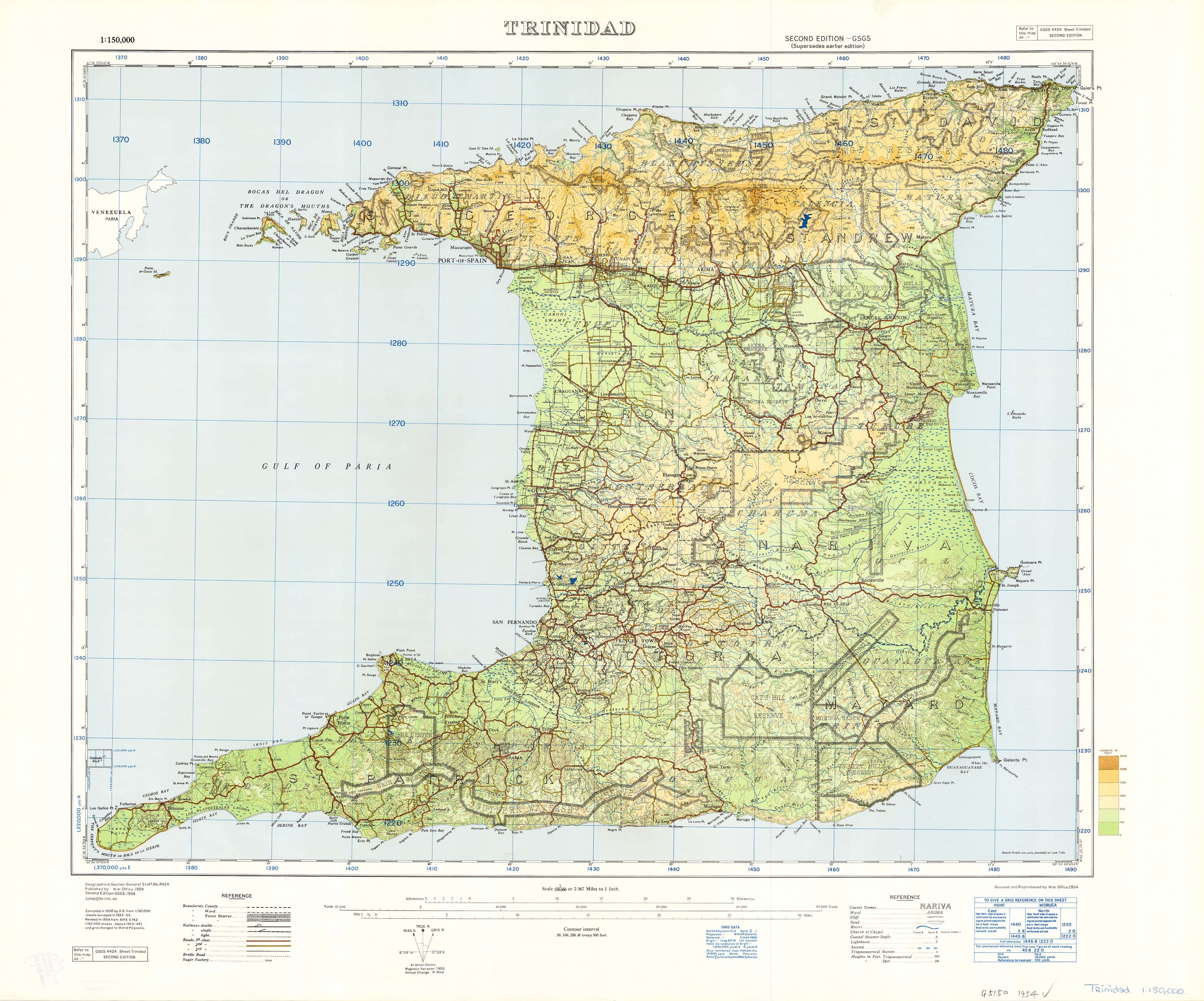
Trinidad, West Indies Ordinance Survey 1923 - Land of Calypso
Historical War Office Map | Exceptional Detail | Beautiful Heritage Piece
Size: 780 mm (W) x 630 mm (H)
Available in Paper, Laminated, Canvas, and Canvas with Timber Hang Rails
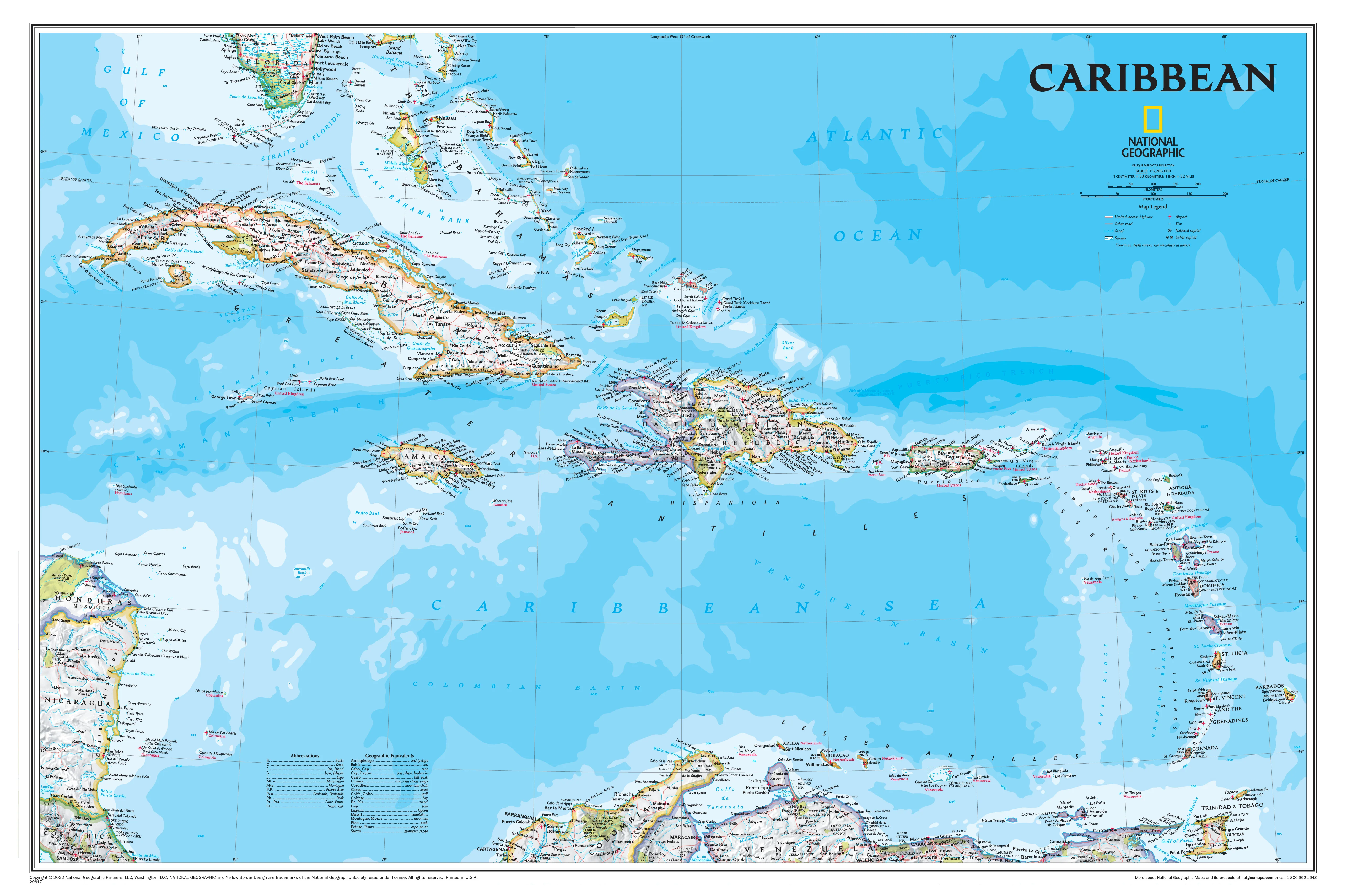
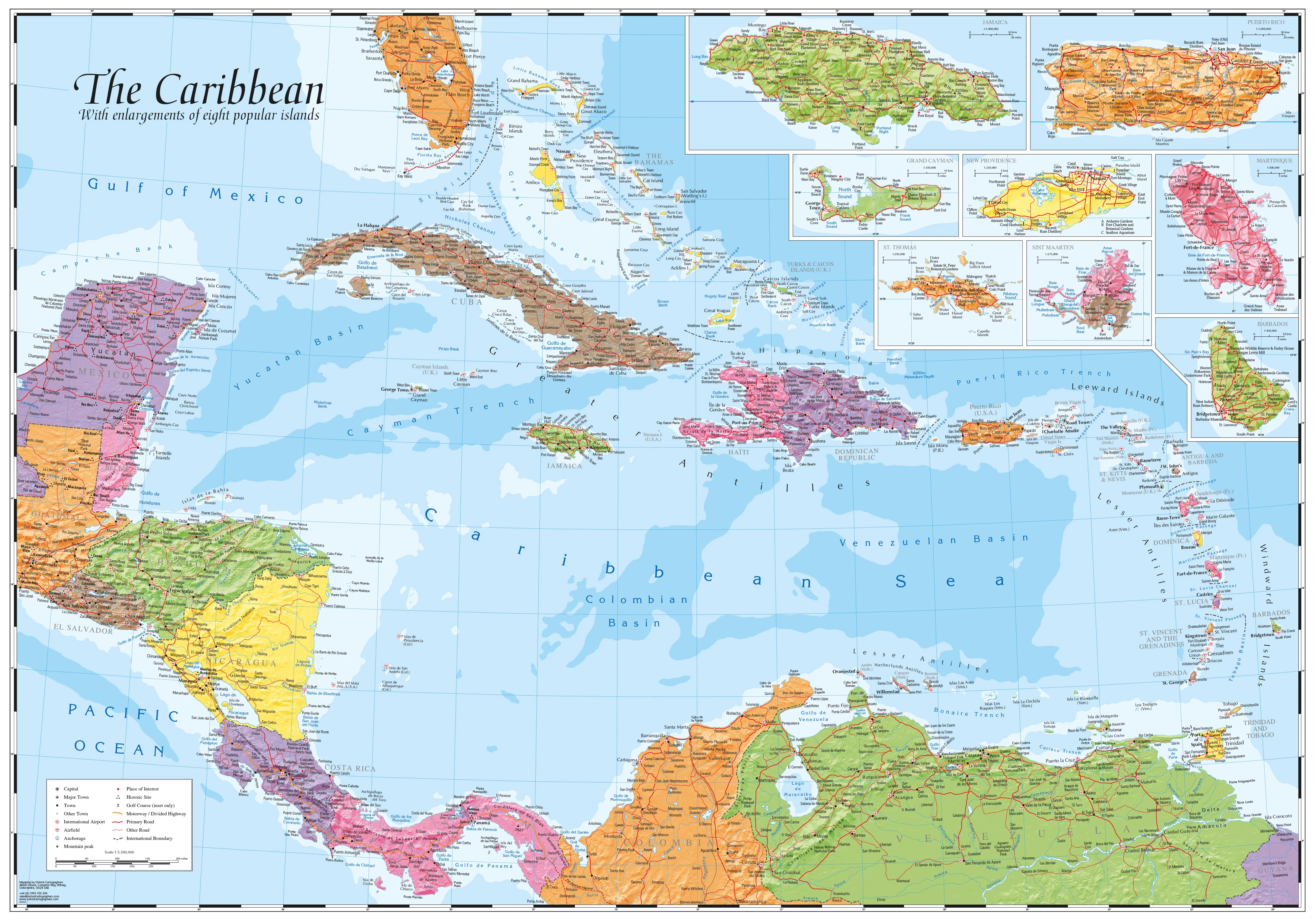
Step into the past with one of the most detailed and captivating maps ever produced of Trinidad. Commissioned by the British War Office and compiled from data collected between 1923 and 1925, this map was published in 1954, long before Piarco International Airport existed or modern development transformed the island.
Whether you're a proud Trini wanting to honour your roots, a history buff exploring colonial cartography, or someone discovering the real Trinidad beyond the postcards—this map is a masterpiece of place names, coastal markers, and cultural memory.
🧭 Why This Map Is So Special
-
🔍 Incredible Place Name Density – Towns, rivers, bays, estates, and rural villages all named with unrivalled detail
-
🌊 Detailed Coastline Mapping – Dozens of minor coastal features labeled and preserved
-
🕰️ Pre-Modern Trinidad – Offers a rare view of the island before airports, motorways, and modern expansion
-
🎨 Aesthetically Beautiful – Vintage typography, fine linework, and natural terrain rendering
❤️ Who Is It For?
-
🇹🇹 Every Trini, near or far – reconnect with the land, the language, and the legacy
-
👨👩👧👦 Families & educators – teach the next generation about their heritage and geography
-
📚 Researchers & historians – examine colonial and pre-modern land use and settlement patterns
-
🏡 Interior decorators – add timeless vintage charm to any study, hallway, or lounge
-
🗺️ Collectors & map lovers – own a rare and beautiful piece of Caribbean cartographic history
🗨️ "To remember home. To teach the kids. To discover the Trinidad you thought you already knew."
📌 Format Options
| Format | Description |
|---|---|
| 📄 Paper (160gsm) | Archival-quality matte paper – ideal for framing under glass |
| 🛡️ Laminated | Encapsulated in 80-micron gloss laminate – wipeable, tear- and stain-resistant |
| 🖼️ Canvas (395gsm) | Printed on premium HP Professional Matte Canvas – fade-resistant and richly textured |
| 🪵 Canvas + Hang Rails | Canvas version with natural timber hang rails and hanging cord – ready to hang on the wall |
🪵 Canvas & Laminated Versions with Timber Rails
For a gallery-style display, choose a canvas or laminated map with wooden hang rails:
-
🪵 Top and bottom hang rails, lacquered in natural timber
-
🧵 Pre-attached cord on the top rail for easy, elegant hanging
-
✅ No additional framing required
-
🖼️ Perfect for home offices, libraries, schools, or cultural spaces
📦 Please allow up to 10 working days for delivery of hang-railed maps, as each is professionally hand-finished.
📐 Product Specifications
| Attribute | Detail |
|---|---|
| Title | Trinidad, West Indies Ordnance Survey Map (1923–1954) |
| Publisher | War Office / Ordnance Survey |
| Map Type | Historical reproduction |
| Size | 780 mm (W) x 630 mm (H) |
| Formats Available | Paper, Laminated, Canvas, Canvas + Hang Rails |
| Print Quality | Full-colour, high-resolution facsimile reproduction |
| Made In | Australia |
🛒 Add to Cart – A Tribute to the Land of Calypso
This is more than just a map—it’s a window into Trinidad’s past, beautifully restored and available in archival formats to cherish for years to come. Whether you hang it proudly in your home, gift it to family overseas, or use it to teach and inspire, the 1923 Trinidad Ordnance Survey Map is a timeless piece of Caribbean heritage.
Original: $42.89
-65%$42.89
$15.01Product Information
Product Information
Shipping & Returns
Shipping & Returns
Description
Historical War Office Map | Exceptional Detail | Beautiful Heritage Piece
Size: 780 mm (W) x 630 mm (H)
Available in Paper, Laminated, Canvas, and Canvas with Timber Hang Rails
Step into the past with one of the most detailed and captivating maps ever produced of Trinidad. Commissioned by the British War Office and compiled from data collected between 1923 and 1925, this map was published in 1954, long before Piarco International Airport existed or modern development transformed the island.
Whether you're a proud Trini wanting to honour your roots, a history buff exploring colonial cartography, or someone discovering the real Trinidad beyond the postcards—this map is a masterpiece of place names, coastal markers, and cultural memory.
🧭 Why This Map Is So Special
-
🔍 Incredible Place Name Density – Towns, rivers, bays, estates, and rural villages all named with unrivalled detail
-
🌊 Detailed Coastline Mapping – Dozens of minor coastal features labeled and preserved
-
🕰️ Pre-Modern Trinidad – Offers a rare view of the island before airports, motorways, and modern expansion
-
🎨 Aesthetically Beautiful – Vintage typography, fine linework, and natural terrain rendering
❤️ Who Is It For?
-
🇹🇹 Every Trini, near or far – reconnect with the land, the language, and the legacy
-
👨👩👧👦 Families & educators – teach the next generation about their heritage and geography
-
📚 Researchers & historians – examine colonial and pre-modern land use and settlement patterns
-
🏡 Interior decorators – add timeless vintage charm to any study, hallway, or lounge
-
🗺️ Collectors & map lovers – own a rare and beautiful piece of Caribbean cartographic history
🗨️ "To remember home. To teach the kids. To discover the Trinidad you thought you already knew."
📌 Format Options
| Format | Description |
|---|---|
| 📄 Paper (160gsm) | Archival-quality matte paper – ideal for framing under glass |
| 🛡️ Laminated | Encapsulated in 80-micron gloss laminate – wipeable, tear- and stain-resistant |
| 🖼️ Canvas (395gsm) | Printed on premium HP Professional Matte Canvas – fade-resistant and richly textured |
| 🪵 Canvas + Hang Rails | Canvas version with natural timber hang rails and hanging cord – ready to hang on the wall |
🪵 Canvas & Laminated Versions with Timber Rails
For a gallery-style display, choose a canvas or laminated map with wooden hang rails:
-
🪵 Top and bottom hang rails, lacquered in natural timber
-
🧵 Pre-attached cord on the top rail for easy, elegant hanging
-
✅ No additional framing required
-
🖼️ Perfect for home offices, libraries, schools, or cultural spaces
📦 Please allow up to 10 working days for delivery of hang-railed maps, as each is professionally hand-finished.
📐 Product Specifications
| Attribute | Detail |
|---|---|
| Title | Trinidad, West Indies Ordnance Survey Map (1923–1954) |
| Publisher | War Office / Ordnance Survey |
| Map Type | Historical reproduction |
| Size | 780 mm (W) x 630 mm (H) |
| Formats Available | Paper, Laminated, Canvas, Canvas + Hang Rails |
| Print Quality | Full-colour, high-resolution facsimile reproduction |
| Made In | Australia |
🛒 Add to Cart – A Tribute to the Land of Calypso
This is more than just a map—it’s a window into Trinidad’s past, beautifully restored and available in archival formats to cherish for years to come. Whether you hang it proudly in your home, gift it to family overseas, or use it to teach and inspire, the 1923 Trinidad Ordnance Survey Map is a timeless piece of Caribbean heritage.